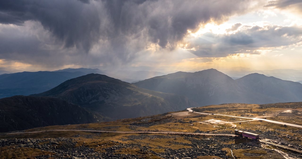
Mount Washington is the highest peak in the Northeast at 6,288 feet, and it is the thing guests most often add to a trip at the last minute, usually the night before, with a map open on the table. It rewards planning and punishes improvisation. There are three ways to stand on that summit without being a mountaineer: ride the Cog Railway up the west side, drive or be driven up the Auto Road on the east side, or walk up on your own two feet. From where we sit in Lincoln, all three are on the far side of the range, and all three answer to the same boss, which is the weather. Here is the shape of each one, what it actually involves, and how to keep the day from going sideways.
It takes a full day from Lincoln
The first thing to understand is geography. Mount Washington is not our mountain. It stands in the Presidential Range on the eastern side of the White Mountains, well across the region from the lodge, and the two mechanized ways up start on opposite flanks of it. Neither is a quick hop from Lincoln, and there is no road up and over the top, so whichever one you pick, you drive around the range to reach it.
The Cog Railway base, on the northwest side at Bretton Woods, is the closer of the two. Figure roughly 35 miles and about an hour: north on I-93, then Route 3 to Twin Mountain and Route 302 east to Bretton Woods, where Base Station Road climbs to the Cog's Marshfield Station. The Auto Road is the farther of the two, on the mountain's east side in Pinkham Notch off Route 16, closer to an hour and a half of driving because it sits well around the range from us. A common mistake is to assume the Kancamagus Highway is a shortcut toward the mountain. It isn't. The Kanc runs east to Conway, not up to Mount Washington, so it doesn't save you anything on this trip.
Budget the whole day, leave early, and don't stack anything else on top of it. Mornings are also your best odds for a clear summit, since cloud tends to build over the course of the day. On a fine summer or foliage weekend the access roads, the parking, and the summit itself all get busy. It's worth remembering, too, that with Cannon's aerial tramway out of service while it is replaced, with no reopening date announced, Mount Washington is the peak in this region you can currently ride to the top of, which is part of why it draws the crowds it does. If you want to eyeball the drive times before you commit, our area map lays out where these trailheads sit relative to the lodge.
The Cog Railway
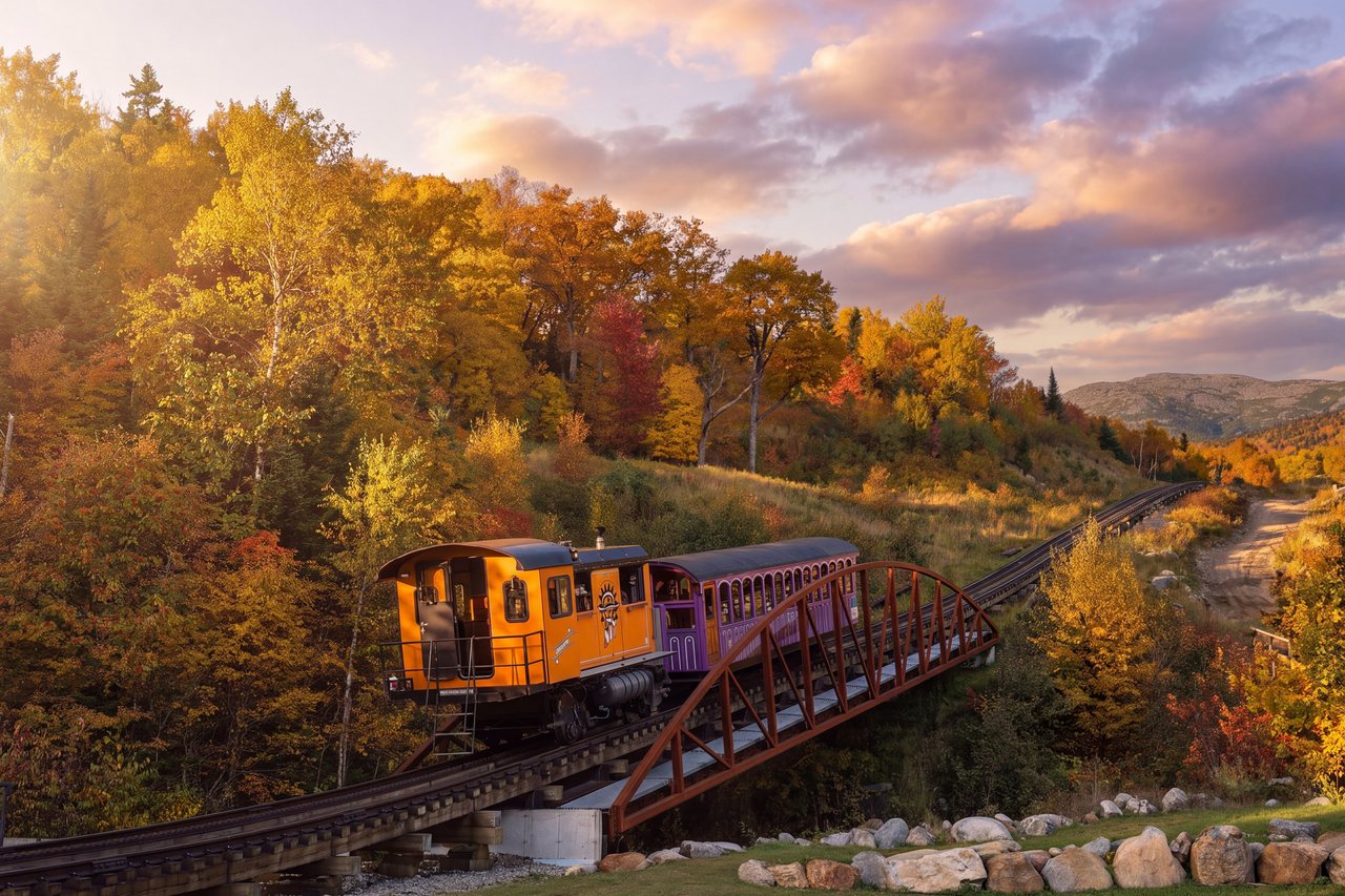
The Mount Washington Cog Railway climbs the western shoulder on a rack-and-pinion line about three miles long, running from Marshfield Base Station in Bretton Woods, off Route 302. It has been hauling passengers up this mountain since 1869, when it opened as the first mountain-climbing cog railway in the world, the design later copied in the Alps. It is still one of the steepest rack railways anywhere, second only to Switzerland's Pilatus line, with an average grade above 25 percent. The famous stretch, a trestle called Jacob's Ladder, tips to roughly 37 percent, steep enough that the passengers at the front of the car sit noticeably higher than the ones at the back. A full round trip to the summit runs just under three hours, including about an hour at the top for the Sherman Adams visitor center and the observation deck.
Most departures are pulled by biodiesel locomotives, introduced in 2008 and now the workhorses of the line, which make the climb in roughly 45 min. Summit trips run from spring into late fall. The railway also keeps a pair of coal-fired steam engines, well over a century old, with boilers set on a slant so they sit close to level on the steep grade. Steam runs on a separate, limited schedule, only certain days and only in the warmer months, and those seats sell out first. The steam calendar is published closer to the season, so check it directly and confirm you are booking a steam departure rather than a biodiesel one, because the two are easy to mix up.
The railway asks passengers to arrive at least 45 min before departure, and trains sell out routinely once the leaves turn, so book well ahead if you are coming in September or October. Foliage weekends are the busiest of the year on this mountain, and a same-week seat is rarely there when you want it.
The ride itself is slow and deliberate by design, a comfortable way to gain roughly 3,600 feet of elevation without lifting a boot, and the trains stop for photos on the way up. Marshfield Station at the base has a museum, a gift shop, and a place to eat, which is useful because you'll want to arrive well ahead of your departure anyway. Steam is the more atmospheric option and the one railway enthusiasts come for, though it's slower and a bit sootier than the biodiesel trains; both get you to the same view.
Of the three routes, the Cog asks the least of you. You park once, sit down, and let someone else worry about the weather and the grade. For anyone uneasy about steep mountain driving, or traveling with someone who is, it's the calmest way up, and the easiest to lock in as a fixed departure time so the rest of the day plans around it.
The Auto Road
The Mount Washington Auto Road runs 7.6 miles from Route 16 in Pinkham Notch to the summit, on the mountain's east side, south of Gorham. It opened in 1861 and bills itself as the country's oldest man-made tourist attraction, which gives you a sense of how long people have been finding a way up this peak. You can drive your own vehicle, or buy a seat in a guided tour, where a driver takes a small group up and back over about two hours and narrates the way. The guided tours run from late spring through the end of the season, with departures spread across the day. The tour is the choice to make if the idea of the descent bothers you at all.
The road typically operates from mid-May into late October, weather permitting; it does not run in winter. On a normal day the first car goes up in the morning, around eight or eight-thirty, and the last car up is in the afternoon, with every vehicle required to be off the summit within roughly 45 min of closing and headed straight down. Hours shift with the season, and the road can close quickly in bad weather, so check its status the morning you go.
The vehicle restrictions are strict and enforced, and they're worth reading before you drive an hour and a half to the gate only to be turned around:
- No trailers, RVs or motorhomes, and no dual-wheeled vehicles. No mopeds, scooters or bicycles.
- Automatic transmissions must be able to lock into a low gear, shown as an L, a 1, or an S on the shifter. The descent is done in low gear, using the engine to hold the car back rather than riding the brakes.
- There are size and weight limits, and oversized or very heavily loaded vehicles are turned away for the same braking reasons, so check the Auto Road's current vehicle rules before you go if you're driving anything large.
The road is paved for most of its length, with a shorter gravel section near the top, and it averages just under a 12 percent grade the whole way, so it climbs steadily rather than in one lung-busting pitch. There are a few places to pull off for the view on the way up, and the higher you get, the more the trees shrink and fall away until you're driving through open alpine terrain. Allow about half an hour to drive up and 30 to 45 min to come down, longer if you stop to let the brakes cool, which you should. This is a real mountain road with drop-offs and no guardrail in places, and overheated brakes on the descent are what actually get people into trouble, which is why low gear is not optional. Confident drivers enjoy it. Nervous ones should take the guided tour and spend the ride looking out the window instead of white-knuckling the wheel. Dress for the top either way, because you can leave a warm parking lot and step out into a hard, cold wind 20 min later. And yes, you earn the bumper sticker at the bottom.
Hiking to the summit
Walking up Mount Washington is a serious undertaking and not a beginner's day out. The summit is known for some of the worst weather recorded anywhere, conditions above treeline change fast, and people get into trouble on this mountain every year, including experienced and fit hikers. If you go up on foot, go early, carry full layers no matter what the forecast says in the valley, and read the higher summits forecast before you commit to going above treeline. A day that looks fine at the trailhead can be a different mountain entirely two thousand feet higher.
From the east, the most popular and direct route is the Tuckerman Ravine Trail from Pinkham Notch, about 4.2 miles one way with roughly 4,250 feet of elevation gain. It's steep, especially up through the ravine, and in summer most hikers avoid the headwall itself by taking the Lion Head Trail to the summit cone. From the west, the Ammonoosuc Ravine Trail climbs roughly three miles to the Appalachian Mountain Club's Lakes of the Clouds Hut just below the summit, from where the Crawford Path finishes the last mile and a half to the top. Many people loop the west side, going up the Ammonoosuc and down the Jewell Trail, for a full day of around nine miles and roughly 3,800 to 4,000 feet of gain, commonly eight to ten hours moving.
Whichever line you take, long stretches sit fully exposed above treeline with no shelter, so a forecast that turns is a reason to turn around rather than push on. Sturdy footwear, real layers, food, water, and a headlamp are the baseline for this hike, worth carrying even when the valley is warm. If you want to break the day in two, Lakes of the Clouds is one of the Appalachian Mountain Club's high huts and can be booked for an overnight in season, which turns a punishing single push into a more manageable two days. Winter is a different animal altogether: an ascent between roughly November and April is a technical mountaineering objective that calls for crampons, an ice axe, and real experience, plus avalanche awareness in Tuckerman Ravine, and it should not be attempted on the strength of a summer hike. Our piece on hiking safety in the White Mountains covers the timing and the judgment calls in more depth than we can here. One practical note on the west-side trailheads: the Ammonoosuc and Jewell parking on Base Station Road is White Mountain National Forest land and needs a recreation pass, currently $5 a day or $30 for the year. Buy it ahead of time or come prepared to pay at the lot.
What is at the summit
All three routes deliver you to the same small, weather-beaten plateau, and it helps to know what's actually up there so the top doesn't surprise you. The main building is the Sherman Adams visitor center, which holds a cafeteria, restrooms, a gift shop, and the Mount Washington Observatory along with its museum. Summit-building services generally run from about mid-June to mid-October, roughly nine to five; outside that window the summit is unstaffed, so plan to be fully self-sufficient.
The true high point is a pile of rock with the summit sign on it, a short walk from the building, and on a clear day you'll see a line of people waiting their turn for a photo beside it. The historic Tip Top House, built in 1853, is the oldest surviving building on the summit; it stands near the visitor center and opens seasonally, roughly early May to early October, as a small state historic site with exhibits on the mountain's history and a modest fee to go inside. There's no lodging for casual visitors up here; the Observatory staff and the hut guests below are the only ones who stay.
The Mount Washington Observatory is a private nonprofit that has kept a crew on the summit through the winter since the 1930s, and it is the source of the wind and cold records the mountain is known for. Its small museum inside the Sherman Adams building is worth the few minutes if the weather has you pinned indoors.
On a rare clear day the view is enormous, reaching across several states and, on the cleanest ones, all the way to the Atlantic. Those days are the exception. The summit is wrapped in cloud more often than not, and on a fine summer or foliage weekend, when the train, the cars, and the hikers all arrive at once, the top can feel surprisingly crowded for a place this remote. None of that should keep you home. Go with the right expectations, and treat a clear summit as the bonus it is.
The weather that governs every route
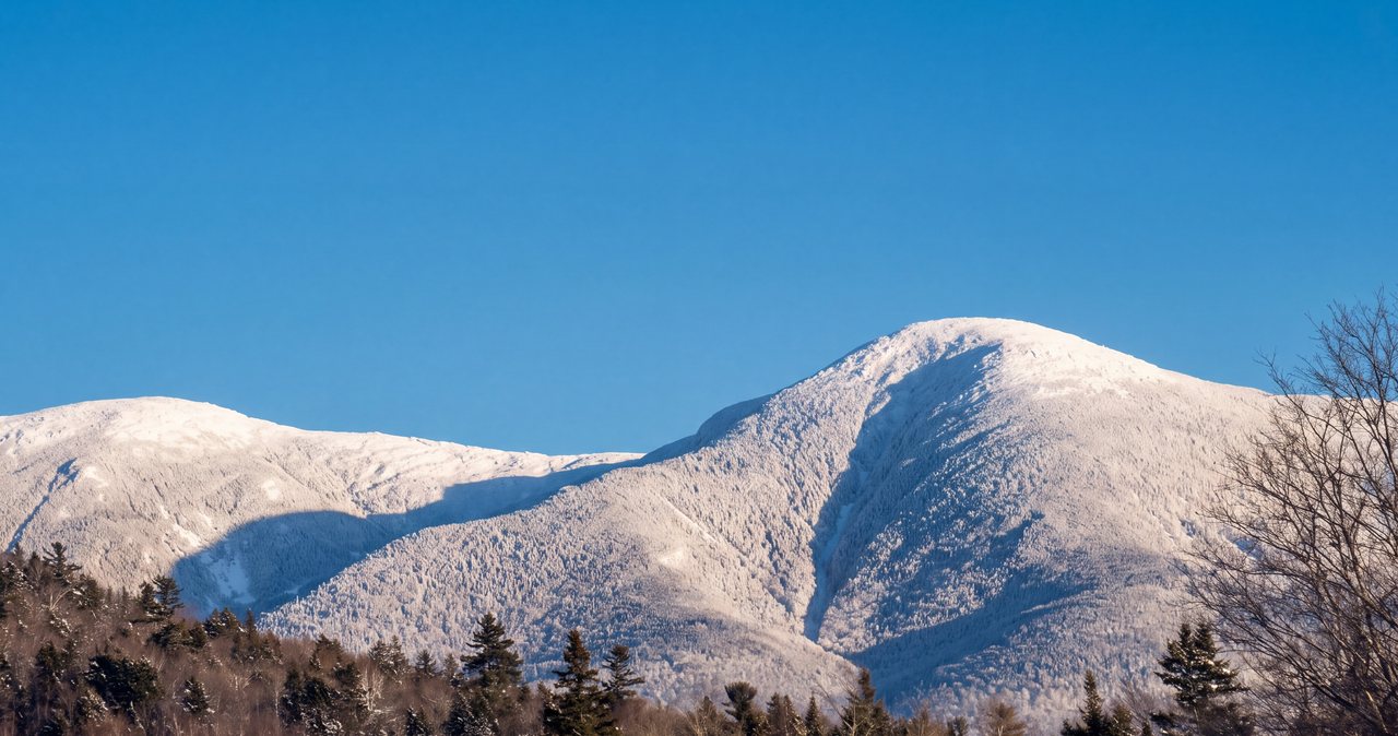
Here is the rule that sits over the Cog, the Auto Road, and the trail alike: the summit makes its own weather, and the day you booked weeks ago may be a whiteout with a fifty-foot view. This is not a mountain where a nice morning in town guarantees anything at the top. Mount Washington is famous for having some of the worst weather recorded anywhere on the planet, and the numbers back it up.
The Mount Washington Observatory, which staffs the summit year-round, recorded a wind gust of 231 miles per hour on April 12, 1934. That stood as the fastest surface wind ever measured anywhere on earth until an automated station at Barrow Island, Australia, logged 254 during a tropical cyclone in 1996, and it remains the fastest ever recorded by a staffed weather station. The summit sees hurricane-force winds on a hundred or more days a year, stays cool even at the height of summer, and can produce a whiteout in any season. Above treeline it can be near freezing with a hard wind in July, which catches unprepared visitors off guard every summer.
The reasons are geographic. Major storm tracks converge over this part of New England, and the peak stands high and alone across the prevailing wind, so air gets funneled and squeezed as it rises over the summit and speeds up on the way through. That's also why the town forecast and the summit forecast so often disagree: they're describing conditions thousands of feet apart, and the top writes its own rules.
Both the Cog and the Auto Road run in cloud. You can pay, ascend, and see nothing at all but the inside of a gray whiteout. That's the deal with this mountain, and it's worth making peace with before you go.
The move is to watch the forecast in the days before, keep the plan flexible if you can, and read the higher summits forecast rather than the town forecast, since they are often two different worlds. Our guide to trail conditions and mountain weather points you to the right forecast and explains how to read it. If the mountain is socked in on the one day you'd set aside, go do something at fifteen hundred feet and try again another trip. The mountain isn't going anywhere.
Which one to choose
All three get you to the same summit sign. The right one depends on what you want out of the day and who you're traveling with.
- Least logistics, most comfort: the Cog. You park once, sit down, and let the railway handle the weather and the grade. It's the gentlest option and the easiest to book as a fixed time.
- You like driving and stopping for the views: the Auto Road, if your vehicle qualifies. Give yourself time on the descent and let the brakes cool. If the drop-offs would rattle you, take the guided tour up the same road instead.
- You'd rather hike than ride: walk something on our side of the range instead. Franconia Ridge is the finer walk and about 15 min from the lodge rather than a full day away. It runs 8.9 miles with some 3,900 feet of gain, a long and fully exposed effort that is only worth attempting in good weather.
- You want the height without the effort or the driving: the Cog or a guided Auto Road tour both get you up and down hands-free, which is the right call for anyone with bad knees, vertigo, or no interest in a mountain descent behind the wheel.
Planning it from the lodge
A few plain logistics keep the day pleasant. Leave early, both because it's a long drive around the range and because the summit tends to be clearest in the morning before cloud builds. Fill the tank before you go. Download your maps and directions at the lodge, where the Wi-Fi is fast, because cell service drops out on stretches of the drive and at the summit itself; our note on cell service and what to download covers what to grab before you lose signal.
Pack layers even in summer. A fleece and a wind shell weigh almost nothing in a daypack and make the difference between enjoying the top and cutting it short, since it can run thirty or forty degrees colder up there than in Lincoln, with a wind on top of that. If you're taking the Cog or the Auto Road, book your tickets ahead, especially in foliage season when they sell out, and check the road or rail status the morning of in case the weather has shut things down. There's a cafeteria at the summit if you don't want to carry food, but a packed lunch is never a mistake up here.
Most of all, hold the day loosely. Pick your Mount Washington day off the forecast, not off your itinerary, and keep a backup in your pocket for when the summit is buried in cloud. The guests who come home with the big view are usually the ones who stayed flexible and grabbed the clear morning when it came. We're always happy to say how the summit has been looking lately and help you time it. When you're ready to pick dates, book direct with us for the best rate, and we'll help you build the rest of the trip around whichever way up you choose.
— Launchpoint Lodge, From the lodge