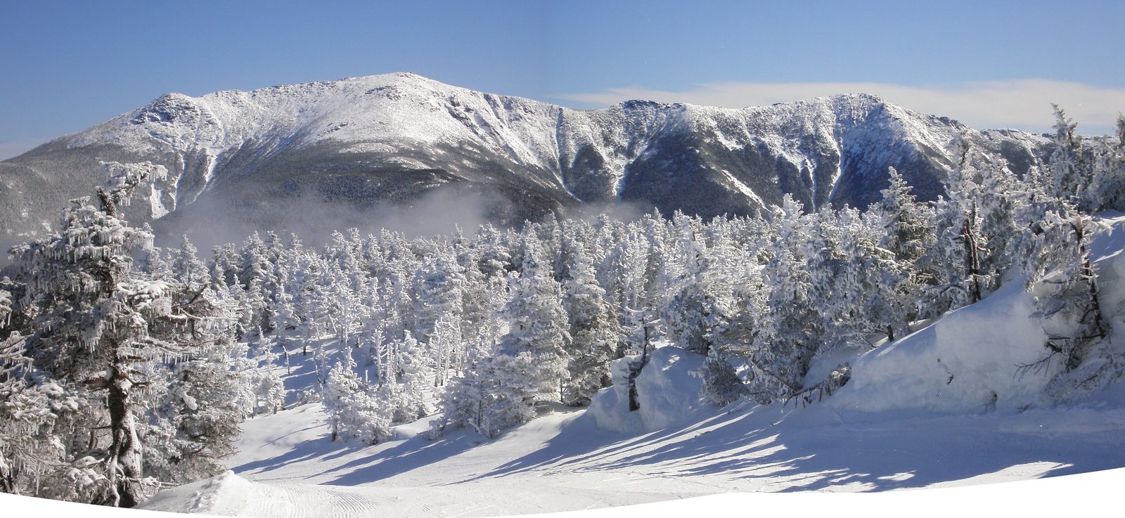
The weather in Lincoln and the weather on Franconia Ridge are two different things, and the gap between them is how most bad days in these mountains start. A warm, still morning at 1,400 feet in town can be forty degrees with sixty-mile-an-hour wind and no visibility at 5,000 feet, twelve miles away. The trails have their own news too: a bridge out, a road gated for the season, a brook running too high to cross, a trailhead closed for a summer of repairs. None of it is hard to find out, but you have to know where to look, and you have to look before you leave the lodge, because the notch and the Kancamagus have almost no signal.
This guide is the morning check we run for guests, laid out source by source: the forecast for the high summits and why it is the one to read, the Forest Service's closure and road-status page, the state park's parking and shuttle notes, the two river gauges that tell you about the crossings, the road-conditions service for the drive, the sites where hikers post trip reports from yesterday, and the hikeSafe code that ties it together. Then a calendar of what the mountains do to hikers month by month, from mud season to early dark.
It takes 10 min, and it changes plans more often than you would think. Our hike guides each carry the specific warnings for their trail; this is the general habit that makes those warnings useful.
The higher-summits forecast, and why the town forecast lies to you
The single most useful thing to read before a big hike is the Mount Washington Observatory's Higher Summits Forecast, published every morning for the peaks above about 4,000 feet. It gives the summit temperature, the wind speed and direction, the wind chill, the chance of precipitation and, crucially, whether the summits will be in the clouds. It is written by the meteorologists who live on top of Mount Washington and it applies, with a little judgment, to Lafayette, Lincoln, Moosilauke, the Bonds and every other summit near treeline in this range.
The town forecast for Lincoln is for the valley, and the valley is a different climate. Temperature drops roughly three to five degrees Fahrenheit for every thousand feet you climb, so a summit 3,500 feet above town starts fifteen degrees colder before the wind is counted, and the wind above treeline is routinely two or three times what the valley feels. When the higher-summits forecast says winds of 50 to 70 miles per hour and summits in the clouds, the Franconia Ridge is not a place to be, whatever the sky over Main Street looks like. On those days we send guests to the waterfalls, the ponds and the wooded summits.
For the valleys and the lower trails, the National Weather Service office in Gray, Maine covers the White Mountains, and its point forecasts let you click a spot on the map, including a summit, and read a forecast for that elevation. Use it for the day's rain timing and the thunderstorm risk; use the Observatory for anything above the trees.
Closures and road gates: the Forest Service alerts page
The White Mountain National Forest keeps an alerts and notices page that lists every trail closure, bridge removal, fire restriction and seasonal road gate on the forest. It is dull reading and it saves whole days. In 2026 the big item is the Lincoln Woods Trail, closed from June to November between the Kancamagus and the Osseo Trail junction for repairs to an eroding riverbank, which cuts off the usual approaches to the Pemi Loop, Owl's Head, the Bonds and Franconia Falls and sends them on long detours from Zealand Road and the Gale River and North Twin trails.
The seasonal roads matter as much. Tripoli Road behind Loon, Zealand Road in Bethlehem and Bear Notch Road between the Kancamagus and Route 302 are gated for the winter and reopen only when the mud firms up, usually sometime in May, and the alerts page is where the dates appear. A trailhead at the end of a gated road becomes a road walk of several miles; our East Pond and Zealand Falls guides explain what that does to those hikes. The page also carries the peregrine falcon closures on the Franconia Notch cliffs, roughly May to mid-July each year, which matter to climbers.

The state park: parking, shuttles and the Flume
Franconia Notch State Park runs its own show inside the notch. Its pages carry the trailhead parking situation, the weekend hiker shuttle between Lafayette Place and the Falling Waters trailhead, which in 2026 runs Saturdays, Sundays and holidays from May 23 to October 18 for five dollars a round trip, the Cannon Mountain tram lot as overflow, and the standing rule that parking on the Franconia Notch Parkway is illegal at any time. They also carry the Flume Gorge's season and its timed-entry tickets, and Echo Lake beach's hours. Check them the night before a notch day; the Lafayette Place lots are full by eight on any fine summer or foliage weekend.
River gauges: whether the crossings go
Several of the best hikes around Lincoln involve unbridged brook crossings that are easy in normal water and best avoided after rain: the Pemi Trail's brooks, the approaches into the Pemigewasset Wilderness, the Kinsman trails. The United States Geological Survey runs two real-time stream gauges that tell you, in numbers, how much water is moving: the Pemigewasset River at Woodstock, station 01075000, for the main river, and the East Branch of the Pemigewasset at Lincoln, station 01074520, for the Lincoln Woods side and the wilderness brooks that feed it.
You do not need to know what a cubic foot per second is. Each gauge page plots the current flow against the long-term median for the date. If today's line sits far above the median, the brooks are high and the crossings are a problem; if it is at or below, they are normal. A hard rain shows up within hours and the rivers here fall almost as fast as they rise, so the gauge is worth checking again the morning after a storm. When in doubt, pick a hike that stays on one side of the water.
Roads: the Kancamagus, the notches and New England 511
The Kancamagus Highway is a plowed, year-round through road, but it closes for storms and accidents, its overlook lots are not always cleared in winter, and it has no services or signal for 34 miles. The Franconia Notch Parkway and Route 302 through Crawford Notch are mountain roads with weather of their own. New England 511, the regional road-conditions service, reports closures, crashes and winter conditions for all of them, and the state's traffic cameras show the notch in real time. Check it before a winter drive and before any drive on a foliage weekend, when Route 302 and the Kancamagus slow to a crawl by late morning.
Trip reports: what the trail was like yesterday
Forecasts and alerts tell you the official state of things. For the unofficial state, the ice on the upper trail, the blowdowns, whether the bog bridges are floating, hikers write it down. New England Trail Conditions collects dated trip reports by trail and is the best single place to see what someone found on Lafayette or Osceola two days ago; the big trail apps carry recent reviews too, though their mileage should never be trusted over a paper map. Read the last few reports for your trail the night before. In shoulder season the phrase to look for is microspikes, and if the reports mention them, carry them.
The hikeSafe code
New Hampshire Fish and Game and the Forest Service publish the hikeSafe Hiker Responsibility Code, six plain points: be prepared with knowledge and gear; leave your plans with someone; stay together; turn back when the weather or the group says so; know how to handle an emergency; and share the code with others. The code is the standard the state uses when it decides whether a rescued hiker was negligent and can be billed for the rescue under RSA 206:26-bb. The voluntary hikeSafe card, twenty-five dollars for a person or thirty-five for a family in 2026, protects cardholders from that bill unless they were reckless, and its sales fund the volunteer rescue teams.
The point about plans is the one people skip. Tell someone which trail, which trailhead and when you expect to be back, and tell them what to do if you are not. Leave your plan with someone at home.
The hazard calendar: what each month does
Mud season runs from the first thaw in late March through mid-May. The valleys are bare while the trails above 3,000 feet hold deep, rotten snow and ice that lasts into late May or June on the north sides, so a hike that starts in shorts ends on a frozen staircase; carry microspikes and expect gates on the seasonal roads. The Squam Lakes Association closes its trails in April to protect them. Late April to early June is peak water in every waterfall and every crossing.
Black flies emerge in mid-May in the valleys and are fierce through late June, lingering into July at the ponds and the higher trails; a head net is the answer. Blacklegged tick nymphs are most active from May through August, roughly six in ten New Hampshire blacklegged ticks carry Lyme disease, and the risk is highest in the lower, brushier country south and west of town; check yourself after every hike. July and August bring afternoon thunderstorms that build over the ridges after noon, the reason every alpine hike starts at dawn, and the summer crowds that fill the notch lots by eight.
September is the best hiking month, dry and clear with the bugs gone. Foliage peaks in the first two weeks of October and brings the year's worst traffic and fullest lots; the first snow dusts the high summits in October and ice returns to the upper trails by Columbus Day, so microspikes go back in the pack. November is dark, cold and empty, with sunset before 4:30 by the end of the month, hunting season in the woods, so wear bright colors, and full winter conditions above treeline. December through March is winter hiking, a different sport with its own gear, and the Mount Washington Avalanche Center's advisories matter to anyone bound for the Presidentials.
The morning check, in order
Over coffee: the higher-summits forecast for the day, then the Gray point forecast for your trailhead, then the Forest Service alerts page for closures and gates, then the trailhead's parking rules, then the river gauge if the route has a crossing, then last night's trip reports. Decide the hike, decide the turnaround time, tell someone the plan, download the map, fill the bottles. It sounds like a lot; it is 10 min, and it is the difference between a good day and a story.
Where to stay
We run this check every morning in hiking season and are glad to talk it through; message us the night before with the hike you have in mind and we will tell you what the forecast and the alerts say about it. The digital guidebook every guest receives carries the links on this page so they are on your phone before you lose signal in the notch.
When the summits are out, the lodge is in the right place for a plan B: the waterfalls, the ponds, the Pemi Trail and the wooded summits like Tecumseh and Hale are all within 40 min and all below the weather. Our rainy-day guide and the shorter hikes on the hikes hub are built for exactly those mornings.
Useful links
- Mount Washington Observatory: Higher Summits Forecast
The morning forecast for every peak above about 4,000 feet. Read it before any ridge or summit day. - National Weather Service, Gray, Maine
Valley forecasts and point forecasts by elevation for the White Mountains. - White Mountain National Forest: alerts and notices
Trail closures, seasonal road gates, fire restrictions and the Lincoln Woods closure status. - Franconia Notch State Park
Parking rules, the weekend hiker shuttle, Flume Gorge tickets and Echo Lake hours. - USGS gauge: Pemigewasset River at Woodstock (01075000)
Real-time flow against the median for the date; high means hard crossings. - USGS gauge: East Branch Pemigewasset River at Lincoln (01074520)
The gauge for the Lincoln Woods side and the wilderness brooks. - New England 511 road conditions
Closures, crashes, winter conditions and cameras for the Kancamagus, the notches and I-93. - New England Trail Conditions
Dated hiker trip reports by trail; the place to learn about ice, blowdowns and bog bridges. - Mount Washington Avalanche Center
Winter avalanche advisories for the Presidential Range ravines. - hikeSafe: the code and the card
The six-point Hiker Responsibility Code and the $25 / $35 voluntary card.
Sources & official info: mountwashington.org · fs.usda.gov · outdoors.org · waterdata.usgs.gov · cannonmt.com · hikesafe.com
— Launchpoint Lodge, From the lodge