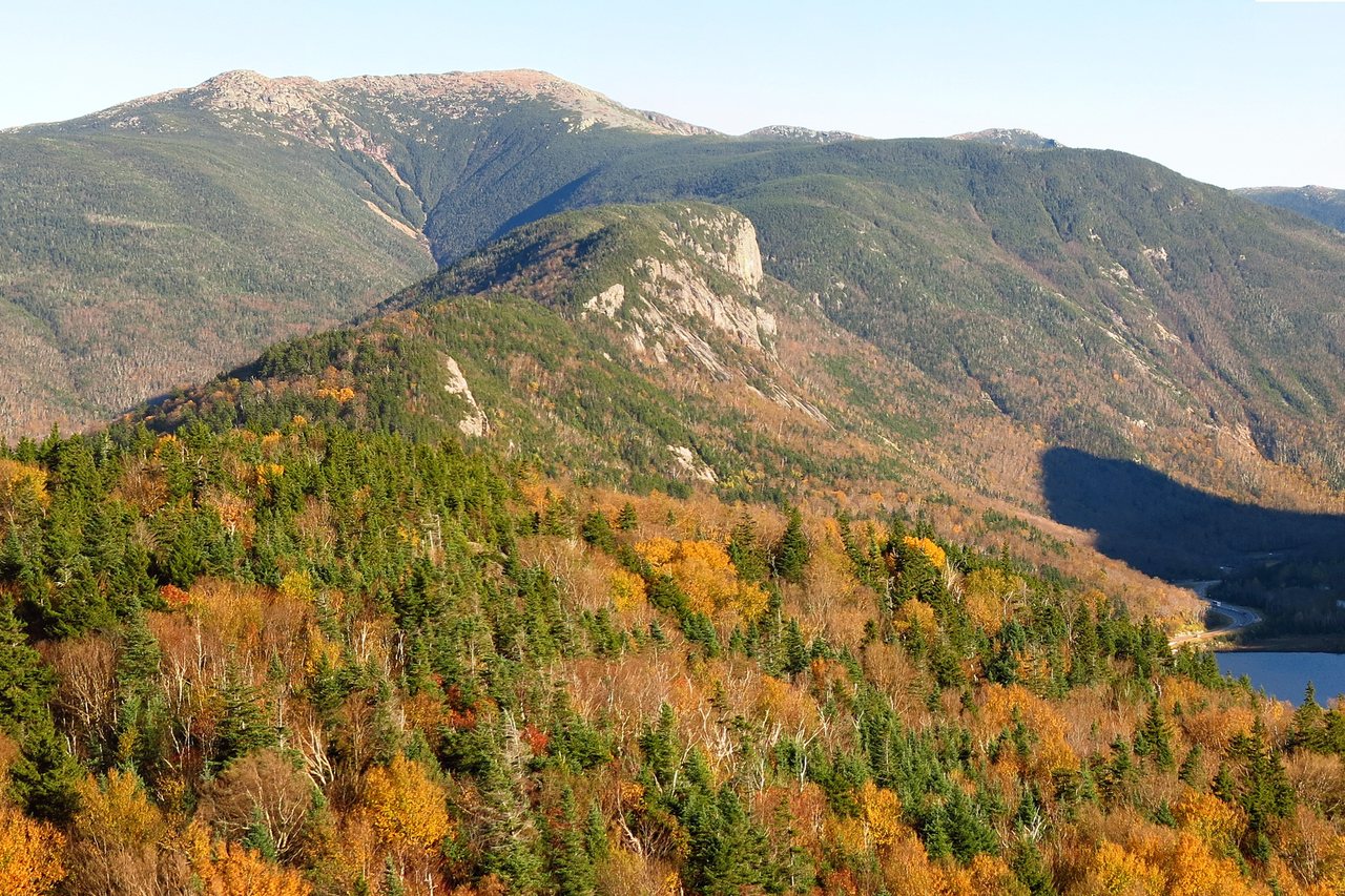
Mount Moosilauke is 4,802 feet, the tenth-highest of New Hampshire's 4,000-footers and the great bald mountain that anchors the southwestern corner of the White Mountains. It sits off by itself, west of Franconia Notch and south of Kinsman Notch, and because so much of it belongs to Dartmouth College and is looked after by the Dartmouth Outing Club, people around here call it Dartmouth's mountain. It has an old nickname too, the Gentle Giant, and that nickname is the reason this guide exists. Moosilauke is one of the most rewarding first big summits in the Whites, and it is also a mountain whose broad, open, treeless top is fully alpine - a place where the weather can turn hard and there is nowhere to hide. Both of those things are true at once, and a good guide has to say so.
The standard way up, and the one almost every lodge guest should plan for, is the Gorge Brook Trail from the Moosilauke Ravine Lodge, Dartmouth's rustic base at the eastern foot of the mountain. It runs about 7.4 miles round trip, climbing steadily through the woods along Gorge Brook and then up onto the open summit ridge - a well-graded, well-maintained trail that earns its reputation as the friendly route to the top. The reward at the end is unusual for these mountains: not a rock knob you scramble onto, but a wide grassy-and-rock dome above the trees, with a 360-degree view that takes in the Kinsmans, Franconia Ridge, the Presidentials, Lake Winnipesaukee, and on a clear day the Green Mountains of Vermont and the Adirondacks beyond. It is a big, generous summit, and it is completely exposed.
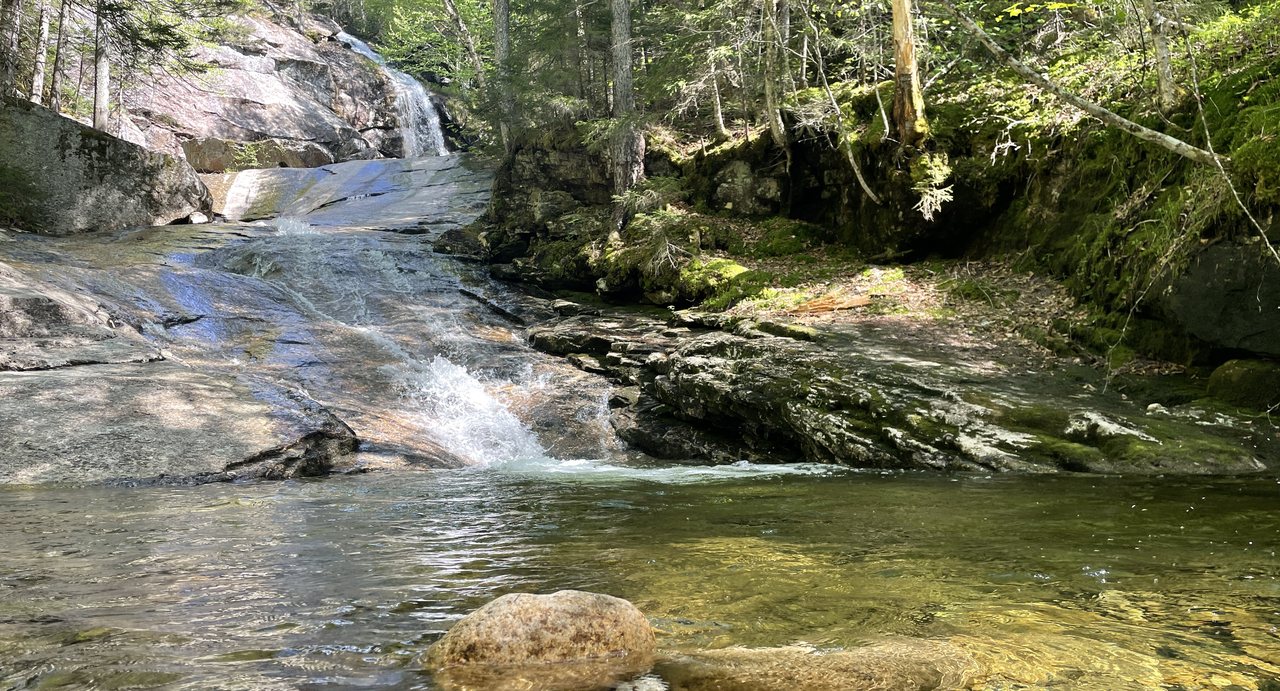
Two things make Moosilauke worth a careful guide rather than a cheerful one, and both get their own section below. The first is that summit plateau. It is above tree line, which in these mountains means real alpine weather - wind, cold, fast-moving cloud, and fragile plants that took centuries to grow. The second is the far side of the mountain. Moosilauke is crossed by the Appalachian Trail, and the AT drops off the northeast shoulder down the Beaver Brook Trail, a beautiful, very steep staircase beside a chain of cascades that is one of the toughest descents in the region when it is wet or iced. People who climb the easy Gorge Brook side sometimes decide to go down Beaver Brook for variety and get themselves in trouble. This guide will send you up Gorge Brook and back down Gorge Brook, and tell you when the far side is a bad idea. The trailhead is about 30 min from our door. Here is the real 2026 rundown.
The numbers
Start with the standard route, because it is the one to plan around: Mount Moosilauke by the Gorge Brook Trail, out and back from the Moosilauke Ravine Lodge. From the Dartmouth trailhead the Gorge Brook Trail climbs about 3.7 miles to the summit, so the round trip is roughly 7.4 miles. That is the widely published figure; a few sources round it to 7.5, and if you add the short spur to the actual high point or wander the summit a little, you will log a touch more. Call it a solid two-thirds of a day on your feet for most people.
The climbing works out to somewhere around 2,500 to 2,600 feet of elevation gain. I want to be straight with you about that number: the 4,802-foot summit and the roughly 7.4-mile distance are well established, and there is no 2026 closure on this route, but the exact gain figure wanders a little from source to source and from one GPS track to the next, as it always does in these mountains. If you want the precise number your map uses, check the current AMC White Mountain Guide or the Dartmouth Outing Club trail description before you go, and treat any single figure as approximate. What is not in doubt is the shape of the day: a long, steady, practical climb, not a wall.
Time is where people should be realistic. Most fit parties spend five to seven hours on Moosilauke car to car, and a strong, experienced hiker moving well can do it in around four and a half. A first-time 4,000-footer, or a family group having a careful day, can easily be out for seven or eight hours with breaks and a long lunch on the summit. The Gorge Brook Trail is graded kindly, so the pace is better than on the rougher Whites peaks, but 7.4 miles and 2,500-plus feet is still a real mountain day. Plan for the long end, not the short one, and start early enough that a relaxed descent still leaves you daylight.
One more realistic note before you commit. The Gorge Brook Trail is out-and-back as described here, but there is a well-known loop option: up Gorge Brook, then down the Carriage Road and the Snapper Trail back to the lodge, which makes a circuit of roughly 7.7 miles. It is a fine way to see more of the mountain and it keeps you well away from the Beaver Brook descent. It also adds a little distance and a couple of trail junctions to get right. For a first trip up Moosilauke, the plain out-and-back on Gorge Brook is the simplest, safest plan, and that is what most of this guide describes.
The Gentle Giant, and why that name gets people hurt
Moosilauke has a real and deserved reputation as one of the best beginner 4,000-footers in New Hampshire, and I am not going to talk you out of it, because it is true. The Gorge Brook Trail is beautifully graded, the footing is good by White Mountain standards, the mountain is well signed and heavily maintained by the Dartmouth Outing Club, and the summit view is out of proportion to the effort. If you are working up to your first big peak, this is a superb choice - arguably the best in the western Whites. The nickname Gentle Giant fits the climb.
It does not fit the summit, and that is the trap. Because the trail is friendly and the mountain is called gentle, people arrive dressed for a walk in the woods and are shocked by what the top is like. Moosilauke's summit is above tree line - a broad, open, treeless dome where the wind has a clear run at you and the temperature can be twenty or thirty degrees colder than the parking lot, with cloud that blows in and swallows the view in minutes. The gentleness is all in the trail. The summit behaves like the high alpine country it is, and the mountain does not care that the guidebook called it easy.
So hold both ideas at once, because that is the real picture. Moosilauke is an approachable climb and a serious summit. Treat the trail as the friendly thing it is - a great day for a fit beginner - and treat the top as full alpine terrain that demands warm layers, a wind shell, a real weather check, and the willingness to turn back below the trees if the summit is socked in or blown out. The people who get in trouble here are almost always the ones who believed the nickname all the way to the top and packed accordingly. Believe it for the trail. Do not believe it for the summit.
The Gorge Brook Trail: the standard climb, step by step
From the Ravine Lodge parking area the route drops a short way to cross the Baker River - here near its source, a mountain stream rather than the river it becomes downcountry - on a footbridge, then picks up the Gorge Brook Trail on the far bank. For the first stretch the trail is nearly flat, running through Dartmouth's woods and following the brook upstream on easy ground. It is a gentle, pretty start that lulls you a little, and that is fine - enjoy it, settle into a rhythm, and do not burn your legs early.
After the easy opening the trail turns to climb in earnest, working up the flank of the mountain along and above Gorge Brook. This is the meat of the ascent: a long, steady, well-built grade through birch and then spruce and fir, with a few marked outlooks along the way where the trees open and you can see back across the ravine. The Dartmouth Outing Club has graded and maintained this trail for a long time, and it shows - the footing is good, the switchbacks are sensible, and the climb is the kind of sustained uphill where you make clear, satisfying progress rather than fighting a boulder scramble. Most of your elevation gets earned in this middle section.
Higher up, the forest begins to shrink and thin, the firs get stunted and wind-flagged, and the trail swings onto the upper south ridge to join the old Carriage Road, the historic route that once carried guests to a hotel on the summit. This is the transition zone, and it is your signal that everything is about to change. The trees are about to run out. It is the right place to stop, drink, eat something, pull on the warm layer and the wind shell you have been carrying, and take a plain look at the sky and the summit before you step out of shelter. Everything above here is open, alpine, and exposed to whatever the weather is doing.
The final stretch follows cairns and scree up the open ridge to the broad summit. It is a walk, not a scramble - no hands-on rock, no ledges to haul up - but it is a walk across fully exposed alpine ground, and in wind or cloud it can feel a lot longer and wilder than the mellow woods below suggested. Follow the cairns, stay on the worn footway and the rock, keep the group together, and keep your eye on the weather the whole way up. The summit dome is big enough that in thick fog the top itself can be surprisingly disorienting, which is a navigation problem covered in its own section below.
Dartmouth's mountain: the Ravine Lodge, the trailhead, and free parking
This is the trailhead fact that sets Moosilauke apart from almost every other hike we send guests on, and it is good news: the Gorge Brook Trail starts on Dartmouth College land, not in the White Mountain National Forest, so the usual Forest Service parking pass does not apply here and parking at the Ravine Lodge trailhead is free. On most Whites trailheads you feed a $5 self-service machine or display an annual pass. At the Ravine Lodge you do not. It is a rare no-fee 4,000-footer trailhead, and worth knowing before you spend money you do not need to.
Free does not mean lawless, though, and the etiquette here matters because you are a guest on someone else's ground. The Moosilauke Ravine Lodge is a working Dartmouth facility - rustic, hostel-style lodging and family-style meals, open to students, staff, and the general public - and it runs buses and vans in and out. Dartmouth's own directions ask day hikers to park on the downhill side of the road past the turnaround, to leave the turnaround itself clear, and to leave room for those buses to get by. So park where you are directed, tuck in tight, do not block the loop, and treat the lodge grounds as the private property they are. The Dartmouth Outing Club maintains this mountain out of goodwill and a lot of volunteer labor; the least a visitor can do is park considerately and pack out every scrap.
The address to put in your phone is the Moosilauke Ravine Lodge, 1 Ravine Road, Woodstock, NH, reached from NH Route 118. Turn off Route 118 onto Ravine Road and follow it to the end, a narrow, winding lane that drops toward the lodge. The lot is not enormous and it fills on clear summer and fall weekends, so the same early-start discipline that works everywhere in the Whites works here: be one of the first cars in, not the twentieth. An early start also puts you on that exposed summit in the calm of the morning and gets you down before the afternoon, which is when the weather in these mountains tends to turn.
A note for winter and the shoulder seasons, because access changes with the calendar. The lodge operates seasonally, and Ravine Road - the last narrow stretch in to the lodge - is not reliably maintained or plowed once the snow comes. In winter, hikers typically park where the plowing ends up on Route 118 or the upper road and walk the extra distance in to the trailhead, adding a mile or so to the day. If you are thinking about Moosilauke outside the warm months, confirm the current road and lodge status with the Dartmouth Outing Club before you drive out, rather than assuming you can reach the summer trailhead.
Water crossings: the Baker River and Gorge Brook after rain and snowmelt
The Gorge Brook Trail is not a trail defined by big river fords the way some Pemigewasset routes are, but it does start by crossing water, and that crossing is worth knowing about in a wet season. Right out of the Ravine Lodge the trail crosses the Baker River near its headwaters on a footbridge. In normal summer flow this is a non-event - you walk across dry-footed and never think about it. After heavy rain, or during the spring snowmelt when the whole mountain is draining, that gentle stream can come up fast and loud, and if a bridge is ever out for repair the crossing becomes a real rock-hop across cold, pushy water.
Bridges in these mountains do get damaged by floods and ice, so a footbridge that was there last year is not guaranteed to be there this year. The Dartmouth Outing Club generally keeps the Ravine Lodge crossings bridged because so much traffic uses them, but if you are coming in a wet spring or right after a big storm, it is worth a call to the lodge to confirm the bridges are in. Never wade a fast, thigh-deep mountain stream to save a hike; moving water is far stronger than it looks, especially in a swollen White Mountain brook after a downpour.
Higher up, the trail climbs alongside Gorge Brook and crosses it as well, and the same rule applies in miniature: easy and pretty in normal flow, slick and worth caution when the water is up. The rocks beside a fast stream are wet and mossy, and a rolled ankle or a cold dunking is no small thing two miles up the mountain. The simple discipline is to hike this one in settled conditions when you can, give the mountain a day or two to drain after heavy rain, and if you do hit high water at the first crossing, take that as information about what the upper brook will be doing and adjust your plans accordingly.
The bald summit and the alpine zone: walk on the rock
Moosilauke's summit is the payoff and the reason people fall in love with this mountain: a wide, open, treeless dome with a true 360-degree view. Stand up there on a clear day and you can pick out the Kinsmans close by, Franconia Ridge and the higher Presidentials to the northeast, Lake Winnipesaukee shining to the south, and the long blue lines of the Green Mountains and the Adirondacks far off to the west. There is room to spread out, room to sit, and, unusually for a Whites summit, a real sense of standing on top of a broad alpine world rather than perched on a rock knob. The remains of old summit structures and the historic Carriage Road are up there too, reminders that a hotel once stood on this bald top and guests were carried up to it.
That open summit is above tree line, and everything above tree line in these mountains is a fragile alpine zone that took centuries to establish and that a careless boot can undo in a season. The low, tough, wind-pruned plants growing in the thin soil between the rocks are alpine species living at the very edge of what they can survive, and they do not bounce back from being trampled. The rule is simple and it is not optional: walk on the rock and the bare, worn footway, follow the cairns, and keep off the vegetation. If you step off the path to find a wind-sheltered lunch spot or a photo angle, step from rock to rock, not onto the green.
The same care extends to how you treat the top generally. Keep dogs leashed and on the rock with you, so they are not crashing through the alpine plants. Pack out everything, including food scraps and peels, which do not belong in an alpine ecosystem and draw wildlife. Do not build new cairns or knock the existing ones apart - those rock piles are the navigation system for the next person caught up here in fog. Moosilauke's summit is a heavily loved place, close to a college that has cared for it for over a century, and it stays beautiful only because most people who climb it tread lightly. Be one of them.
Weather and exposure on the summit plateau: read the higher-summits forecast
This is the most important section in the guide, so here it is without hedging: Moosilauke's summit is a broad, fully exposed alpine plateau, and the weather up there is a different and more serious thing than the weather at the trailhead. The mountain earns its friendly reputation on the way up through the trees and then hands you, all at once, a treeless dome with nothing to break the wind and nowhere to shelter. A pleasant 70-degree morning in the valley can be a raw, wind-driven 45 degrees in cloud on top, and that swing catches underdressed hikers on this mountain more than on almost any other in the region precisely because they were told it was gentle.
The specific hazards on that plateau are wind, cold, and whiteout cloud, and in summer, thunderstorms. Wind on an open summit that is merely brisk in the parking lot can be hard to stand up in on the dome, and combined with wet and cold it drives body heat away fast, which is why a warm layer earns its place even in summer. Cloud can roll over the top in minutes and cut visibility to a few dozen feet, which is both disorienting on the broad summit and demoralizing when the view you climbed for vanishes. And in the warm months, thunderstorms build over these mountains on summer afternoons; a wide-open alpine summit with nothing taller around is exactly what lightning finds, and there is no shelter up there. If you can hear thunder, the storm is already close enough to strike you - that first distant rumble is your signal to get down off the open ground into the trees, not to take one more photo.
The single best tool for judging all of this before you go is the Mount Washington Observatory Higher Summits Forecast at mountwashington.org. It is written by meteorologists who live in this weather, and while it speaks for the highest peaks, Moosilauke's bald top behaves like the high country and the forecast is the best read you will get on what the summit will feel like - wind, temperature, cloud, and storm risk. Pair it with an ordinary valley forecast for the Lincoln or Warren area and note the spread; the summit will be colder, windier, and more exposed than the number in town, often dramatically so. If the higher-summits forecast is calling for high winds, thick cloud, or storms, the sane move is to enjoy the wooded climb and turn around at tree line, or to pick a sheltered lower hike for the day. The summit will still be there next week.
Carry the layers to back up that judgment, every time, no matter how warm the parking lot is. A warm insulating layer, a wind-and-rain shell, a hat and gloves, and more food and water than you think you need belong in the pack on Moosilauke in any season, because the summit can be wintry when the valley is not. Put the wind shell on before you step out of the trees, not after you are cold on the dome, and if the group is losing heat or morale up top, do not linger for the view - drop back below tree line where it is warmer and calmer and regroup there. The trees are your shelter on this mountain, and getting back down into them is always the right answer when the summit turns hostile.
Do not descend Beaver Brook in bad conditions
Here is the mistake that turns a good day on Moosilauke into a bad one, and it is common enough that it needs saying: do not climb the easy Gorge Brook side and then decide to go down the far side by the Beaver Brook Trail unless conditions are good and you know what you are getting into. The Appalachian Trail crosses Moosilauke and drops off the northeast toward Kinsman Notch down Beaver Brook, and on the map it looks like a tidy way to make a through-hike or a change of scenery. On the ground it is one of the steepest, most relentless descents in the White Mountains, a long staircase of rock and wooden steps that plunges down right beside a chain of cascades.
That closeness to the cascades is exactly the problem. The Beaver Brook Trail descends on steep, often wet rock slabs immediately alongside falling water, with stone steps and, in places, wooden blocks and iron rungs bolted to the ledge to give you something to stand on. Dry, on a good day, going up, it is a spectacular and demanding climb. Wet, or iced, or going down on tired legs at the end of a long day, it is another matter - the slabs are slick, the drop beside the water is real, and every step deserves care. The Dartmouth Outing Club has long posted a warning sign near the top of the descent telling hikers that this trail is unusually steep and rough and that this is not the way to go in bad weather or when you are tired. Take that sign at its word.
For a lodge guest doing Moosilauke as a day hike, the answer is simple: go up Gorge Brook and come back down Gorge Brook. It is the easy grade in both directions, it returns you to your own car at the Ravine Lodge, and it keeps you entirely off the Beaver Brook staircase. If you want to vary the descent, use the Carriage Road and Snapper Trail loop back to the lodge instead - a longer but far safer alternative that stays on Dartmouth's graded trails. Save Beaver Brook for a dedicated dry-weather trip when you have deliberately chosen to climb it, ideally as an ascent rather than a descent. Our separate Beaver Brook Cascades guide covers that route and its hazards on its own terms; read it before you ever set foot on that trail, and do not wander onto it off the summit on a whim because the weather looked fine on top. The weather on the summit is not the weather down in the cascades, and by the time you learn the difference you are committed to the descent.
Winter and the shoulder seasons: a full alpine climb
Moosilauke is a popular and rewarding winter mountain, but winter turns the Gentle Giant into a serious undertaking, and the gentleness of the summer trail does nothing to soften the alpine summit under snow and ice. The exposed dome that is merely windy in July is a full winter-alpine environment in the cold months - deep cold, high wind, blowing snow, rime ice, and the very real potential for frostbite and whiteout navigation on open ground. This is terrain for hikers who already have real winter experience, the right gear, and the training to use it, not a first winter summit and not a place to learn as you go.
The access itself changes first. As covered above, Ravine Road is not reliably plowed to the lodge in winter, so you will likely park where the road is last cleared on Route 118 and walk in, adding distance and time to an already short-daylight day. Confirm the current road status with the Dartmouth Outing Club before you go. On the trail, snowshoes and then, higher up, full crampons and an ice axe with the skills to use them become the right tools as you move from packed snow to the wind-scoured, iced upper ridge. Light traction that handles a packed lower trail is not enough for the frozen summit dome, and the Carriage Road section above tree line can be a sheet of wind-blown ice.
The shoulder seasons are the sneaky ones, and they surprise hikers who expect winter conditions only in deep winter. From roughly October into late spring, the summit can be glazed with ice and raked by winter-strength wind while the trailhead still looks like fall or spring - a hiker in a fleece who was comfortable in the woods can walk out onto a summit that is frankly wintry. Carry microspikes and real layers any time from mid-fall through late spring even on a mild-looking day, watch the higher-summits forecast rather than the season, and be ready to turn around at tree line if the open ridge is iced or blown out. On this mountain in the cold months, the trees are the last safe place, and the discipline is to make your go-or-turn decision before you leave them.
Navigation on the open summit, and choosing the right trail down
Navigation on Moosilauke is easy in the trees and tricky in two specific places, and both deserve attention because the mistakes here are common and consequential. The first is the broad summit dome in fog. Because the top is wide and open with several trails and old roads meeting on it, a thick cloud can leave you standing on a featureless plateau unsure which way is down, following cairns that all look alike. In clear weather this is a non-issue. In a whiteout it is exactly how people wander off the wrong side of the mountain. If cloud closes over the top, slow down, find the next cairn before you leave the last one, and do not freelance across the open ground.
The second and more serious trap is choosing the wrong trail down, because the summit is a junction of routes that head to trailheads miles apart on opposite sides of the mountain. The friendly Gorge Brook Trail you came up shares the summit with the Carriage Road, the Benton Trail, the Glencliff and Appalachian routes, and - the steep one - the Beaver Brook Trail dropping toward Kinsman Notch. Every so often a hiker who came up from the Ravine Lodge starts down the wrong trail off the summit and ends up far from their car, or on the rugged Beaver Brook descent they never meant to take. Before you take a single step off the top, confirm by the signs that you are on the Gorge Brook Trail heading back the way you came, toward the Ravine Lodge and the east.
Carry the tools to get this right and know how to use them. Download the trail map to your phone before you leave town, because cell coverage is unreliable out here and you cannot count on loading it at the trailhead. Carry a paper map and compass as a backup that does not run out of battery, and a GPS track of your ascent is the simplest insurance of all - if you can see the line you climbed, you can follow it back down through fog or fatigue. On a clear day none of this is hard. It is the socked-in summit and the tired late-afternoon descent that catch people, and those are exactly the moments the map earns its place in your pack.
Water, food, and provisioning before you drive out
Plan Moosilauke as a carry-your-own-water hike. The Gorge Brook Trail follows water for much of the climb, so there is a stream near you on the way up, but the upper mountain and the whole exposed summit are dry, and you do not want to be rationing on a windy alpine dome two miles from the nearest reliable water. Bring 2 to 3 liters per person in summer heat, more if the forecast is hot, and do not drink it all on the way up so hard that you are empty for the descent. If you do draw from Gorge Brook, filter, purify, or boil it as you would any backcountry water in the Whites - but the better plan is simply to carry what you need from the car.
Bring more food than you think you need, too, and real food, not just a snack. A long climb to a cold summit burns through calories fast, and being warm on an exposed top is partly a matter of having fuel in the tank. Pack a proper lunch, some extra energy for the descent, and something warm to look forward to. The summit, on a good day, is one of the finest lunch spots in the White Mountains - a wide-open dome with the whole range spread around you - and it is worth arriving with enough food and enough warm clothing to sit and enjoy it rather than shivering through a hurried handful of trail mix.
The practical point is that you provision in Lincoln or North Woodstock before you drive out, because there is essentially nothing along the way once you turn toward the mountain. Route 118 and the small towns beyond it have few to no services, and the Ravine Lodge is a rustic backcountry facility, not a store. The grocery and the gas stations back in Lincoln and North Woodstock are your last certain stop for sandwiches, extra water, and a full tank. Do it the evening before if you are chasing an early start, arrive at the trailhead with everything you need, and download your map while you still have a signal in town.
Who this hike is for, the hikeSafe card, and turnaround judgment
Mount Moosilauke is for a hiker in reasonable shape who wants a big, rewarding summit on a friendly trail and is real about alpine weather. It is one of the best first 4,000-footers in New Hampshire - the grade is kind, the trail is well built and well signed, and the reward is a true alpine summit with a giant view. A fit beginner having a good, careful day can absolutely do it, and it is a wonderful mountain to do it on. What it is not is a casual walk in shorts to a sheltered viewpoint; the trail is gentle, the top is not, and the hikers who get in trouble are the ones who packed for the trail and not for the summit. Come dressed for the alpine and it is a superb day.
Two New Hampshire specifics belong in your pocket on any Whites 4,000-footer, and Moosilauke is no exception. First, under RSA 206:26-bb, New Hampshire can bill a hiker whom Fish and Game judges negligent for the cost of a search and rescue. The voluntary hikeSafe card waives that cost short of true recklessness and helps fund the rescue teams directly - it is 25 dollars for an individual or 35 dollars for a family for 2026, sold through New Hampshire Fish and Game, valid January through December, the same price for residents and visitors. On an exposed alpine summit where the weather changes fast, it is a sensible thing to buy the night before.
Second, do not let your phone be your safety plan. Cell coverage is patchy to nonexistent out at the Ravine Lodge and on the mountain, so anything that depends on a signal - live maps, a weather check, a call for help - may simply not work when you need it. Download your maps before you leave the driveway, carry a real map and compass or a GPS unit you know how to use, and leave your route and your expected out-time with a person who will notice if you do not come back. We ask our hiking guests to do exactly this, and we mean it: someone at home who knows you went up the Gorge Brook Trail and expected to be down by a certain hour is worth more than anything in your pack if something goes sideways.
Turnaround judgment is the whole discipline on this mountain, and Moosilauke gives you a clean, natural decision point built right in - the edge of the trees, where the graded woods-walk gives way to the open alpine ridge. That is the spot to make a clear-eyed call before you commit to the exposed summit: is the weather holding, is everyone warm and steady, is there time to go up and get down with a margin, and does the higher-summits forecast agree? If the answer to any of those is no, stopping at tree line and turning back is a sound decision, not a failure. Turning around is free, and the summit is not going anywhere - it runs on the same schedule every year, and it will be there, big and bald and generous, on the next clear morning. There is no view on that dome worth getting hurt for.
Safety & conditions
- The summit is a broad, fully exposed alpine plateau, and its weather is far more serious than the trailhead's - a warm valley morning can be a raw, wind-driven, socked-in summit twenty or thirty degrees colder. The gentle trail fools people into underpacking. Carry a warm layer, a wind-and-rain shell, hat and gloves, and extra food and water in every season, and put the wind shell on before you step out of the trees, not after you are cold on the dome.
- Read the Mount Washington Observatory Higher Summits Forecast (mountwashington.org) before you go, not just the valley forecast. Moosilauke's bald top behaves like the high country, and the forecast is the best read on wind, cold, cloud, and storm risk up on the open ridge. If it calls for high wind, thick cloud, or thunderstorms, turn around at tree line and enjoy the wooded climb, or choose a sheltered hike. In summer, afternoon thunderstorms build fast on an open alpine summit - if you hear thunder, get down off the exposed ground into the trees immediately.
- Do not descend the Beaver Brook Trail off the far side of the mountain in bad conditions. It is one of the steepest, roughest descents in the White Mountains, dropping beside a chain of cascades on slick rock slabs with stone steps and iron rungs, and it is best avoided when wet, iced, or taken on tired legs - the Dartmouth Outing Club posts a sign at the top saying as much. For a day hike, go up Gorge Brook and back down Gorge Brook, or use the Carriage Road and Snapper Trail loop. Read our Beaver Brook Cascades guide before ever using that route.
- Do not descend the wrong trail off the summit. The broad top is a junction of several routes that head to trailheads miles apart on opposite sides of the mountain - Carriage Road, Benton, Glencliff, the Appalachian Trail, and the steep Beaver Brook descent. Before you take a step off the summit, confirm by the signs that you are on the Gorge Brook Trail heading back toward the Ravine Lodge and the east. Carry a downloaded map, a paper map and compass, and ideally a GPS track of your ascent.
- The wide, open summit dome is disorienting in fog. Several trails and old roads meet on featureless alpine ground, and a thick cloud can leave you unsure which way is down, following cairns that all look alike. If cloud closes over the top, slow down, find the next cairn before you leave the last one, and do not freelance across the open ground. This is exactly when a downloaded map or GPS track earns its place in the pack.
- Respect the water crossings after rain and snowmelt. The trail crosses the Baker River near the lodge and Gorge Brook higher up; easy in normal flow, but fast and pushy when the water is up, and a real rock-hop if a bridge is out. Never wade a swollen, fast mountain stream to save a hike - it is far stronger than it looks. Give the mountain a day or two to drain after a big storm, and confirm the bridges are in with the lodge if you are coming in a wet spring.
- Carry your own water - 2 to 3 liters per person in summer - and more food than you think you need. There is a stream alongside much of the climb, but the upper mountain and the exposed summit are dry, and being warm on a windy alpine dome depends partly on having calories in the tank. The Ravine Lodge is a rustic facility, not a store, and Route 118 has few services, so provision in Lincoln or North Woodstock before you drive out.
- Pick up the voluntary hikeSafe card from New Hampshire Fish and Game ($25 individual, $35 family for 2026); New Hampshire can bill negligent hikers for rescue costs under RSA 206:26-bb, and the card waives that cost short of recklessness while funding the rescue teams. Cell coverage is patchy to nonexistent at the Ravine Lodge and on the mountain, so download maps in advance, carry map and compass, and leave your route and out-time with someone who will notice if you are late.
Where to stay for it
This is one of the shorter trailhead drives we send guests on, and one of the prettier ones. From 191 Pollard Road you head out through Lincoln to North Woodstock and pick up NH Route 118, the winding mountain highway that climbs southwest over the height-of-land toward Warren. A few miles up Route 118, turn onto Ravine Road and follow it to its end at the Moosilauke Ravine Lodge - roughly 14 miles and about 30 min from our door, most of it a slow, curving climb, so give it a little more time than the mileage suggests. There is really only one turn that matters, from Route 118 onto Ravine Road, so watch for it. Confirm current road conditions with the Dartmouth Outing Club if you are coming outside the warm months, since the last stretch in to the lodge is not reliably plowed in winter.
Provision before you leave town, because there is essentially nothing to buy once you turn toward the mountain. Lincoln and North Woodstock have the grocery store and the gas stations that are your last certain stop for sandwiches, extra water, and a full tank; Route 118 and the small towns beyond have few to no services, and the Ravine Lodge is a rustic backcountry facility rather than a shop. Do your shopping the evening before if you are chasing an early start, which helps at this trailhead on a clear weekend, download your trail map while you still have a signal in town, and leave your route and your out-time with someone at home. On a mountain with a fully exposed alpine summit and fast-changing weather, someone knowing your plan is worth more than anything you can carry.
Sources & official info: outdoors.dartmouth.edu · outdoors.dartmouth.edu · outdoors.org · fs.usda.gov · mountwashington.org
— Launchpoint Lodge, From the lodge