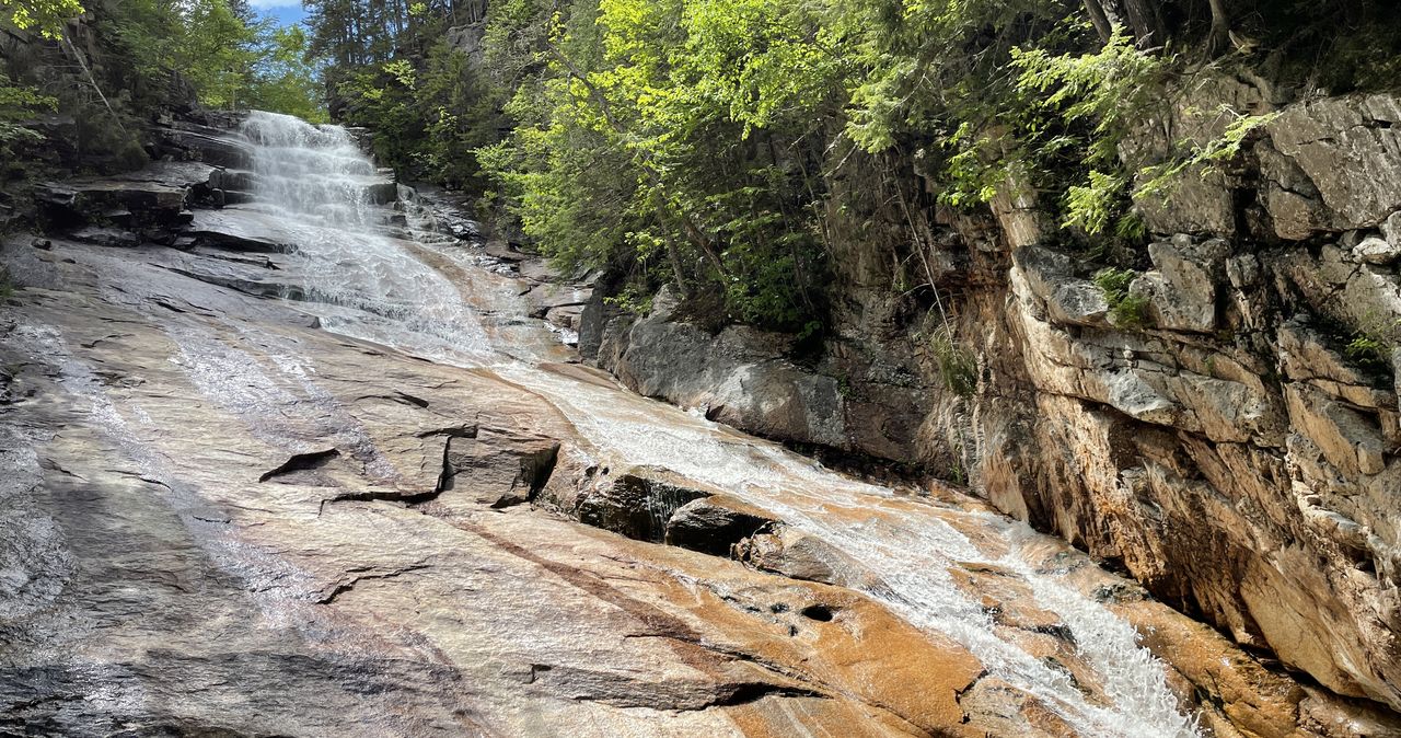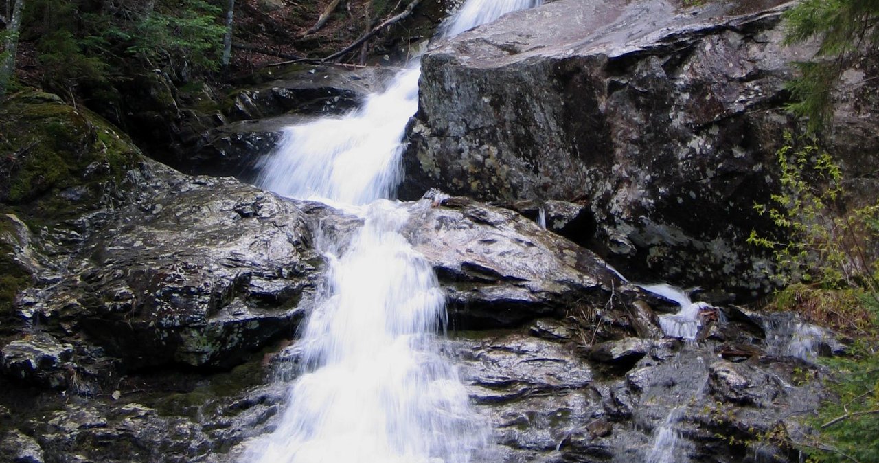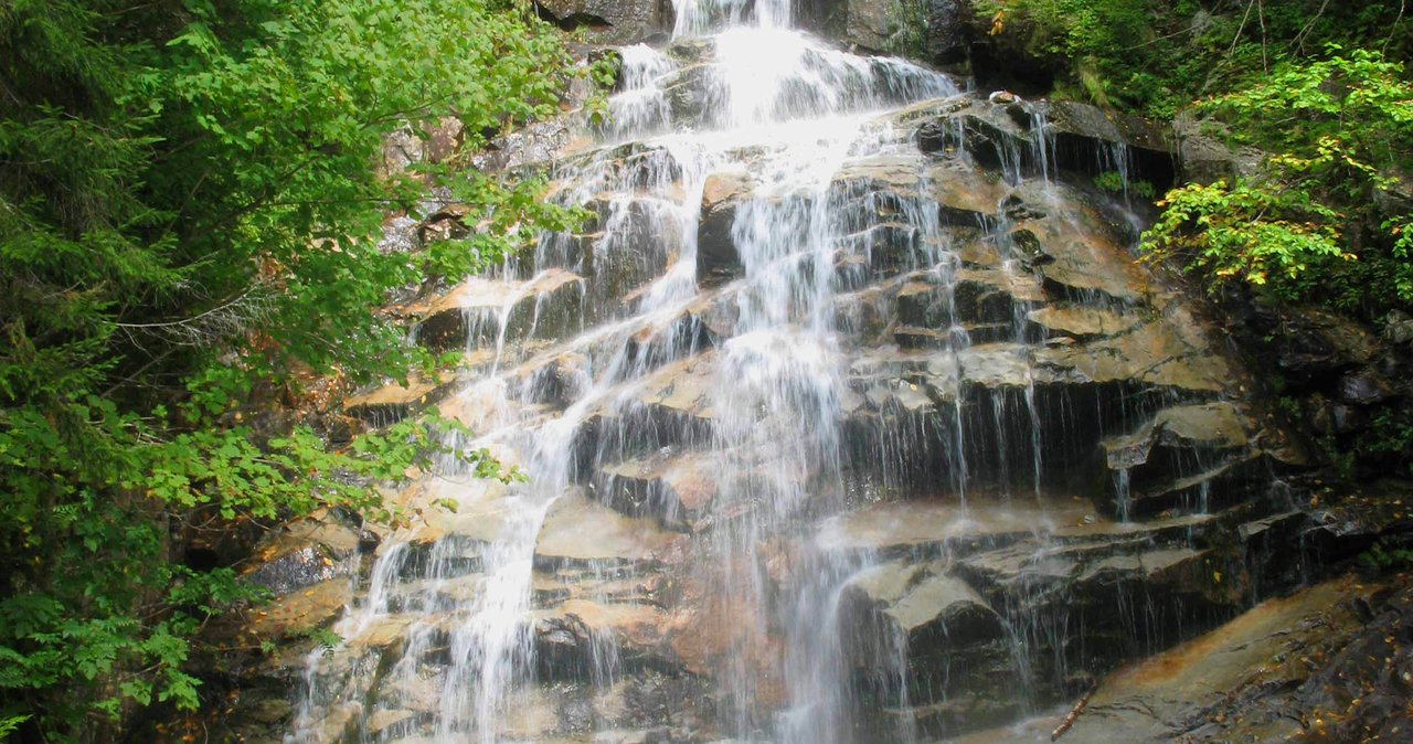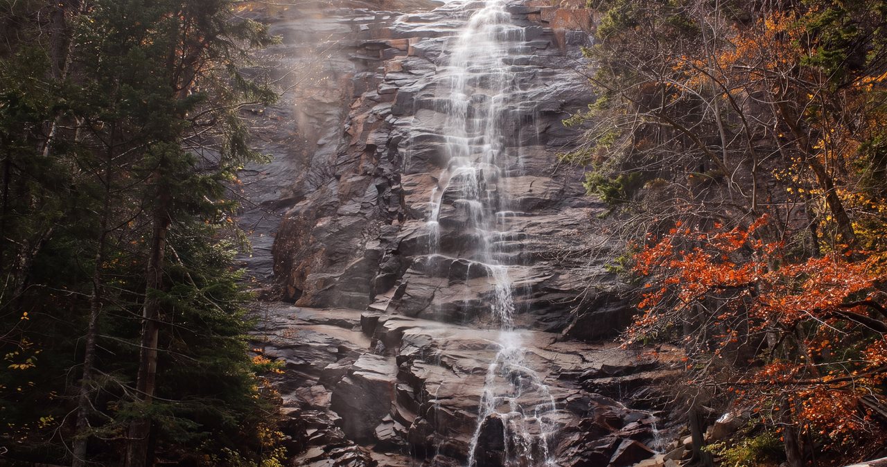
Arethusa Falls is the one White Mountains waterfall that looks like the picture. Bemis Brook slides off a granite shelf on the western wall of Crawford Notch and free-falls in a single, uninterrupted sheet that is usually cited at around 140 feet, which makes it the tallest single-drop waterfall in New Hampshire. You do not need to be a mountaineer to stand at the bottom of it. You do need a couple of hours, sturdy shoes, a few dollars for the fee box, and a clear head about wet rock and rising water. This guide is written to be more useful than the trailhead sign, and more candid than the average five-star review.
The hike is a moderate out-and-back on the Arethusa Falls Trail, roughly 1.4 to 1.5 miles each way, so figure about 2.8 to 3.0 miles round trip with somewhere near 850 to 900 feet of climbing. It is the kind of trail a reasonably fit adult, and plenty of kids, can do in a morning, but it is not a paved path or a gentle stroll. Expect roots, rock steps, and a trail surface that turns slick near the falls where the spray never really lets the granite dry out. Ambitious hikers can turn it into a bigger day by looping over Frankenstein Cliff, or by connecting through to Ripley Falls, and we cover both of those candidly below, including the parts the guidebooks gloss over.
We are a six-suite lodge at Exit 32 in Lincoln, roughly 40 min from the Arethusa Falls trailhead, and this is one of the drives our guests take most often. What follows is the version we share with our guests: the parking, which lot to aim for, when the falls are thundering versus trickling, why winter makes this a completely different hike, and the few simple habits that keep a visit here a good one. Waterfalls in these mountains are not scenery you climb on. Read the safety section before you go.
The short version, if you only read one paragraph
Drive about 40 min from the lodge up through Crawford Notch on US Route 302. Turn onto Arethusa Falls Road (a short paved spur on the west side of the highway, roughly a mile south of the Willey House). Park in one of the two dirt lots, drop $5 in the self-serve fee box (or display your annual pass), and start walking. The Arethusa Falls Trail climbs steadily for about a mile and a half through the woods, with roots and rock underfoot the whole way, and delivers you to a wide, cold plunge pool beneath a tall ribbon of falling water. Turn around and come back the way you came. Plan on two to three hours car-to-car at a relaxed pace.
That is the whole hike in one paragraph. Everything else in this guide is about doing it well: picking the right lot, reading the water, deciding whether to add the loop, staying upright on the slick stuff, and knowing when the mountain is telling you to go home. The falls are worth the drive in every season. They are also hazardous in a few specific ways that are easy to underestimate on a sunny day.
How tall is Arethusa Falls?
Here is the answer: nobody agrees, and the number you see depends on who measured it and where they started and stopped. Modern sources put it at about 140 feet. When the falls were first surveyed in 1875, they were measured at 176 feet. The AMC White Mountain Guide, the closest thing hikers have to a bible up here, describes it as 'nearly 200 feet.' New England Waterfalls, a careful regional catalog, estimates around 160 feet. So the practical range is roughly 140 to 200 feet depending on the source and the water level.
Why the spread? A tall waterfall is hard to measure. The top lip, the main free-fall, and the lower run-out of tumbling water over broken rock all blur together, and where you put your tape changes the total by dozens of feet. What is not in dispute is the distinction: Arethusa is the tallest single-drop waterfall in New Hampshire. A few high-angle cascades in the state technically fall farther in total, but they slide and step down the rock rather than dropping in one clean sheet. Arethusa drops.
The falls are named for a spring nymph out of Greek mythology, a fitting bit of nineteenth-century romance for a place that looks like it was designed to be painted. Practically speaking, the number matters less than the flow. A 140-foot waterfall running thin in a dry August is a pretty trickle down a big rock face. The same falls in full snowmelt is a roaring, spray-throwing wall of water you can feel from the trail. When you go matters more than the exact height, and we cover timing in its own section below.
The trail, step by step
The Arethusa Falls Trail leaves from the upper edge of the parking area and climbs almost immediately. Within the first tenth of a mile you cross near the old railroad grade and reach the junction with the Bemis Brook Trail, which splits left (more on that detour in a moment). Stay on the main Arethusa Falls Trail and it keeps climbing at a steady, moderate grade, roughly paralleling Bemis Brook off to your left, sometimes close enough to hear it, sometimes not.
The footing is the defining feature of this trail. It is wide and well-worn, so you will not lose your way, but the surface is a near-constant carpet of exposed tree roots and embedded rock, with sections of log steps and rock steps built into the steeper pitches, especially in the last stretch. It is the kind of trail that rewards looking down. Most of the injuries here are not dramatic falls off cliffs; they are turned ankles and stubbed toes from catching a root while gawking at the scenery. Trail runners and low sneakers get people through it, but a shoe with a real sole and some ankle support makes the descent noticeably kinder.
The climb eases as you approach the falls, and then the trees open and there it is: a tall granite face with water pouring down it into a broad, shallow pool ringed with boulders. There is room to spread out on the rocks at the base, and on a summer weekend you will share that space with a couple dozen other people eating snacks and taking photos. The rock closest to the water is perpetually damp from spray and is far more slippery than it looks. Enjoy the view from a stable, dry perch. The wet rock beside the falls is better admired than climbed, so take your photos from the base and keep the morning a lovely one.
To return, you simply reverse the trail. The descent is where tired legs and slick roots combine, so take it at a controlled pace, especially the rocky steps near the top. Most people are back at the car about an hour to an hour and a half after leaving the falls.
The Bemis Brook Trail detour: two bonus waterfalls
About a tenth of a mile up from the parking lot, the Bemis Brook Trail branches off to the left. It is a roughly half-mile alternate that runs lower and closer to the brook before climbing steeply to rejoin the main Arethusa Falls Trail higher up. The payoff is two smaller cascades that most people never see: Coliseum Falls, a wide, tiered slide of water over a broad rock apron, and Bemis Brook Falls, a shorter drop nearby. Both are pretty, and on a low-water day when Arethusa itself is running thin, this detour can be the highlight.
The detour does ask a bit more of you. The Bemis Brook Trail is narrower, rootier, and steeper than the main trail, particularly on the pitch where it climbs back up to reconnect. In wet or icy conditions it becomes a scramble with some slick, hands-on sections. Our standard advice: take the Bemis Brook detour on the way in, when your legs are fresh and the steep bit is a climb rather than a descent, then come back down the main trail, which is gentler underfoot. That loops in the bonus falls without asking your knees to negotiate the steepest, most slippery ground on the way down.
In winter or after heavy rain, skip the Bemis Brook Trail unless you are confident and well-equipped. The section between Bemis Brook Falls and the main trail is reportedly the first place to glaze over with ice, and it is steep enough that a slide there is not trivial. The main trail gets you to Arethusa just fine on its own.
Parking: the lower lot, the upper lot, and the $5 fee
Turn off US Route 302 onto Arethusa Falls Road and you will find two dirt lots. The lower lot sits right where you leave the highway. The upper lot is a short distance farther up the road, closer to the old railroad tracks and noticeably closer to the actual trailhead, which saves you a few minutes of walking on the road. Between them they hold on the order of 75 vehicles. If you can get a spot in the upper lot, take it; if the upper lot is full, the lower lot is a perfectly fine fallback and only adds a brief walk.
There is a fee, and it is worth understanding. This is a fee-collection site tied to the White Mountain National Forest, and payment is self-serve: you fill out an envelope, drop your $5 daily fee in the iron ranger (the metal fee tube), and display the stub on your dashboard. Bring cash or a check; do not count on a card reader or a cell signal to bail you out. If you already hold a White Mountain National Forest annual pass, or the roughly $80 America the Beautiful interagency annual pass, that covers your parking here at no extra charge. Senior (formerly Golden Age) and Access passes are honored as well. If you are hiking the Whites for more than a handful of days across a season, the annual pass pays for itself quickly.
A word on timing the lot: this is one of the more popular waterfall hikes in the region, and on peak fall-foliage weekends and warm summer Saturdays both lots can fill by mid-morning. Arrive before 9 a.m. if you want your pick of spots and a quieter trail, or come later in the afternoon after the morning crowd has cleared out. Do not park along Route 302 itself or block the road; it is a fast highway through the notch and the shoulders are not a safe place to leave a car.
Difficulty and footing: who this hike is really for
We would call Arethusa Falls a moderate hike, and we would push back on anyone who calls it either 'easy' or 'hard.' It is easy in the sense that the grade is steady rather than steep, the trail is obvious, and it is short enough to do in a morning. It is not easy in the sense that you are climbing roughly 850 to 900 feet over uneven, rooty, rocky ground, and that adds up if you are not used to trail walking. Sedentary visitors and older kids do it all the time; they also frequently underestimate it and arrive at the falls more winded than they expected.
For families, it is a good introductory mountain hike with a spectacular reward, and dogs on leash are welcome on the trail. That said, clear framing matters: this is a real trail with real hazards, not a boardwalk. Keep small children close on the rock steps and especially at the falls, where the boulders stay wet and the pool is cold. If you have a toddler in a carrier, the roots and steps make for slow, careful going in both directions.
It is not stroller-accessible or wheelchair-accessible; the surface rules that out. If you or someone in your group needs a smooth, level path to a waterfall, that is a different trip. Sabbaday Falls off the Kancamagus is a short, mostly gentle gravel walk to a dramatic flume, and it is a far better match for limited mobility than Arethusa. We are happy to point you there instead.
The single most useful thing you can do to make this hike safer and more pleasant is wear appropriate footwear. Trail shoes or light hiking boots with real tread, laced properly, prevent the great majority of the twisted ankles this trail hands out. Trekking poles help on the descent if your knees appreciate the assist.
Making it a bigger day: the Frankenstein Cliff loop
If the out-and-back is not enough mountain for you, the classic upgrade is the Frankenstein Cliff loop, which turns the day into roughly a 5.0 to 5.2 mile circuit with something in the neighborhood of 1,600 to 2,000 feet of elevation gain, depending on whose track you trust. This is a strenuous half-day, not an easy add-on, and it earns you big open views from the cliff top out over Crawford Notch and Mount Washington on a clear day.
The usual way to do it is to hike up to Arethusa Falls first, then continue on the Arethusa Falls Trail and pick up the Frankenstein Cliff Trail, following it over the cliffs and back down to the parking area, closing the loop. You can also run it in reverse, hitting the cliffs first and saving the falls for the end. Reversing it front-loads the steepest climbing while your legs are fresh, which some hikers prefer; doing the falls first gets the marquee attraction done early if the forecast looks iffy. Either way you are committing to a real hike with sustained climbing and rougher, steeper trail than the falls out-and-back.
The name, for the record, has nothing to do with the monster. Frankenstein Cliff and the striking steel railroad trestle below it are named for Godfrey Frankenstein, a nineteenth-century landscape painter who worked in the notch. That trestle sits on the Conway Scenic Railroad line, and the tracks are active. The loop crosses and travels near the railroad grade, and tourist trains do run through the notch in season. Treat the tracks like the live railroad they are: look both ways, cross quickly, never walk out onto the trestle, and never assume you will hear a train in time. This is a real, if easily managed, hazard that casual hikers underestimate.
The cliff itself is the other thing to respect. The viewpoints are open ledges with unguarded drop-offs. The footing near the edges can be loose, and it calls for extra care in wind, wet, or ice. Enjoy the view from well back from the lip, keep dogs leashed and children within arm's reach, and do not go out to the edge for a photo. The view is every bit as good from a few steps back, and that small margin is what keeps a ledge day relaxed.
Reaching Ripley Falls, and the real logistics
You will see Arethusa and Ripley Falls mentioned together, and it is worth clearing up how they relate, because the marketing sometimes oversells it as a tidy loop. Ripley Falls is a separate waterfall, a roughly 100-foot sheet of water sliding down a smooth granite slab a little north up the notch. It is beautiful in a different way than Arethusa: less of a free-fall, more of a long polished ramp of water.
Ripley Falls has its own, much shorter trailhead. From the Ethan Pond Trail parking area off Route 302, it is only about a 1.2-mile round trip with maybe 400 feet of gain to reach the base, following the Ethan Pond Trail a couple tenths of a mile to the junction, then the Arethusa-Ripley Falls Trail the rest of the way. If Ripley is all you want, drive to that trailhead and do the short hike; it is one of the easiest big-payoff waterfalls in the notch.
The Arethusa-Ripley Falls Trail is the connector that links the two falls directly through the woods and up over the height of land between them. Hiking both falls in one continuous traverse via that trail makes a full day, about 5.8 miles with close to 2,000 feet of gain, and it is worth knowing up front that it is a point-to-point, not a loop. You either arrange a second car or a shuttle between the two trailheads, or you tack on a road walk along a fast highway, which we do not recommend. For most guests, the cleaner plan is to do the Arethusa Falls out-and-back one day and drive to Ripley Falls separately, treating them as two good short hikes rather than forcing them into one grind.
When the falls run biggest
A tall waterfall is only as dramatic as its water level, and Arethusa varies more than most because Bemis Brook is a modest mountain stream, not a river. The single best time for raw power is spring snowmelt, roughly mid-April into May, when the winter's snowpack is running off the western slope of the notch and the falls become a loud, spray-throwing spectacle. That window also brings mud, lingering ice on the trail, cold water, and higher, faster brook crossings, so you are choosing between the biggest flow and the easiest footing.
The next reliable time for big water is simply after heavy rain, any time from spring through fall. Give it a day. A soaking rain overnight will have the falls booming the following morning, and the drive up the notch after a storm, with every seasonal cascade running, is a show in itself. The flip side is that the same rain that fattens the falls also makes the rocks slicker and the brook higher, so gorgeous and hazardous arrive together. Read the water before you get close to it.
By high summer, especially in a dry stretch, the falls thin out considerably. They are still tall and still worth the hike, but you are looking at a graceful ribbon rather than a wall of water, and the base pool shrinks and warms slightly (only slightly; this is snowmelt-fed mountain water). Late September into mid-October brings the foliage, and this is arguably the prettiest overall time to go: the flow is usually moderate, the hardwoods framing the falls turn gold and crimson, and the light in the notch is spectacular. It is also the most crowded window, so go early. Winter is its own animal, and it gets its own section below.
Winter: ice, traction, and the climbers
In winter, Arethusa Falls becomes one of the more dramatic sights in the White Mountains, and a very different hike that asks you to come prepared. The falls partially or fully freeze into a towering blue-white column of ice, and the trail transforms from a rooty summer path into a packed, glazed, and often icy corridor through snow. Ice climbers use the frozen falls as a route, and you may well see them working up the ice with ropes and tools. Give them plenty of room and keep clear of the area directly beneath the climbers or the ice itself, which can shed chunks at any time.
Traction is not optional in winter here; it is the price of admission. At minimum, carry and use microspikes over good winter boots. After fresh snow, snowshoes may be the better tool, and the steep Bemis Brook section ices up early and hard, so many winter hikers leave it for summer and stick to the main trail. Bare boots on this trail in February are how people slide, fall, and get hurt far from help.
The rest of the winter kit matters too, because the notch is cold and the days are short. Layers, insulated gloves, a warm hat, extra food, a headlamp, and enough water that it does not freeze. Cell service in the notch is unreliable at best; plan to be self-sufficient. Start early enough that you are back at the car well before dark, and remember that the drive itself, on Route 302 through the notch, can be snow-covered and slow. Winter here is beautiful and very much a real-mountains endeavor; treat it with the respect a below-freezing, remote trail deserves.
Swimming, wading, and reading the water
Let us be straight about this, because water is where these mountains hurt people. Arethusa Falls is not a swimming hole. The pool at the base is shallow, rock-bottomed, and shockingly cold; it is fed by snowmelt and stays frigid even in July. There are no lifeguards, no rangers standing by, and no quick help if something goes wrong. In low, calm, summer conditions, people do wade at the edges of the pool, and if you choose to, keep it to shallow, careful wading on stable footing, never near the base of the falling water, and never with the intent to swim laps or dunk your head.
Two things turn this from a cold dip into a real emergency. The first is cold-water shock: sudden immersion in water this cold triggers an involuntary gasp and can incapacitate even strong adults in seconds. The second is the rock. Everything within reach of the spray is slick, and the temptation to scramble up the wet granite beside the falls, or to stand on rocks right at the base of the drop, is exactly where slips become falls. Do not climb the falls. Do not let kids climb the falls. This is the single most important sentence in this guide.
After rain or during snowmelt, drop the wading idea entirely. The flow rises fast, the spray zone widens, and the current at the base gets pushy, quite unlike the gentle scene of a dry day. If the brook is high, loud, and running brown or cloudy, admire the falls from a stable, dry vantage well back from the water and keep your hands in your pockets. If you want a place where wading is part of the plan, the Swift River holes off the Kancamagus are a better bet in low water; just note that Rocky Gorge, farther east, is a no-swimming spot, so keep that one for the view.
Turnaround judgment and staying safe
The most important hiking skill is not fitness or gear; it is the willingness to turn around. Arethusa is short and forgiving enough that most people never have to make that call, but the same short trail lulls visitors into ignoring the signs. Turn around, without ego, if the brook is high and fast and the crossings or the base of the falls look sketchy, if the light is fading and you are not confident of getting back before dark, if the trail is iced beyond the traction you brought, or if anyone in your group is cold, exhausted, or hurting. The falls will be there next time.
Plan for the notch being remote. Cell coverage is spotty to nonexistent, so tell someone your plan and expected return, carry a paper sense of the route or a downloaded map, and do not rely on your phone to navigate or call for help. Pack more than you think you need for a two-hour hike: water, a snack, a warm layer, and a headlamp, because a twisted ankle at the falls can turn a quick morning into a slow, cold afternoon. New Hampshire promotes the Hike Safe program and sells a Hike Safe card; it is inexpensive peace of mind and worth looking into if you hike here regularly.
Finally, respect the specific hazards this spot concentrates: wet, slick granite near the falls; unguarded ledge drop-offs if you add the Frankenstein Cliff loop; an active railroad line on that loop; cold water year-round; and ice all winter. None of these should keep a prepared, sensible adult away. All of them have hurt people who were neither. Go, stand under one of the tallest waterfalls in the state, and come home to tell us about it over a nightcap.
Getting there from the lodge
The drive from Launchpoint Lodge to the Arethusa Falls trailhead runs about 40 min and roughly 30 to 35 miles, almost all of it scenic. From Exit 32 in Lincoln, head north on Interstate 93 through Franconia Notch, where the parkway narrows and the Old Man's cliff, the Basin, and the Flume all slide past your windows. Continue to Exit 35 and follow US Route 3 north toward Twin Mountain, then pick up US Route 302 east and follow it as it climbs toward Bretton Woods and drops into Crawford Notch.
Inside the notch, watch for the Willey House historic site on the valley floor; the Arethusa Falls Road turnoff is a short, easy-to-miss paved spur on the west (right, if you are heading south into the notch) side of Route 302, roughly a mile south of the Willey House. Turn in, park, and pay the fee. If you reach the Dry River area or start climbing back out the far side of the notch, you have gone a bit too far. The drive itself, especially in foliage season, is one of the best in New England, so leave a little margin to pull over at the notch overlooks on the way.
Safety & conditions
- Wet granite is the main thing to watch: the rock within reach of the spray at the base of the falls stays slick year-round. Watch your footing, keep to dry stable perches, and never scramble up the wet rock beside or above the falls for a photo. This is the most common way visitors get seriously hurt here.
- Cold-water shock is real: Bemis Brook is snowmelt-fed and frigid even in summer. Sudden immersion can trigger an involuntary gasp and incapacitate strong swimmers in seconds. This is not a swimming hole; wade only shallow and calm, never near the base of the drop, and never after rain.
- Flash and high water after rain or snowmelt: the falls, the spray zone, and the brook rise fast. That is when the falls are at their most impressive. If the water is high, loud, or running cloudy, admire it from well back and skip the Bemis Brook spur, whose crossings and steep pitch get sketchy when wet.
- Roots and rock steps cause most injuries: the trail is a near-constant carpet of exposed roots and embedded rock with log steps near the top. Twisted ankles are the number-one problem. Wear real trail shoes or boots with tread, and take the descent at a controlled pace.
- Winter demands traction: the whole trail glazes over and the steep Bemis Brook section ices first. Microspikes are the minimum; snowshoes after fresh snow. Ice climbers use the frozen falls, so enjoy the ice column from off to the side rather than directly beneath it, since it can shed chunks at any time.
- Frankenstein Cliff has open drop-offs: if you add the loop, the ledge viewpoints have no railings and loose footing near the edges, so take extra care in wind, wet, or ice. Stay well back from the lip, keep dogs leashed and kids within arm's reach, and do not step out for a photo.
- The loop crosses an active railroad: the Conway Scenic Railroad line runs through the notch in season. Look both ways, cross the tracks quickly, never walk out onto the Frankenstein trestle, and do not assume you will hear a train in time.
- Plan for remoteness and turnaround judgment: cell service in the notch is unreliable, and there is no on-site help. Tell someone your plan, carry water, a warm layer, a snack, and a headlamp, and turn around without hesitation if the water is high, the light is fading, or the ice is beyond your traction.
Where to stay for it
Launchpoint Lodge sits at Exit 32 in Lincoln, at the western mouth of the Kancamagus, about 40 min from the Arethusa Falls trailhead by way of Franconia Notch and Route 302 through Crawford Notch. It is an easy morning trip: coffee here, on the trail by nine, back for lunch or an afternoon by the fireplace. Send us a message and we are glad to tell you which lot to aim for, whether the falls are running big that week, and how the trail is holding up in the current conditions.
Because we are adults-only, with a virtual innkeeper a message away, guests tend to treat this place as a quiet base camp: pull your boots off on the back deck, warm up in front of the fireplace, and let your photos of the falls be your screensaver. If you are chaining together a few waterfalls or a bigger hiking weekend, ask us and we will help you sequence Arethusa with Sabbaday, Georgiana, or the Flume so you are not doubling back across the notches.
Sources & official info: nhstateparks.org · fs.usda.gov · northeasthikes.com · alltrails.com · nhstateparks.org
— Launchpoint Lodge, From the lodge