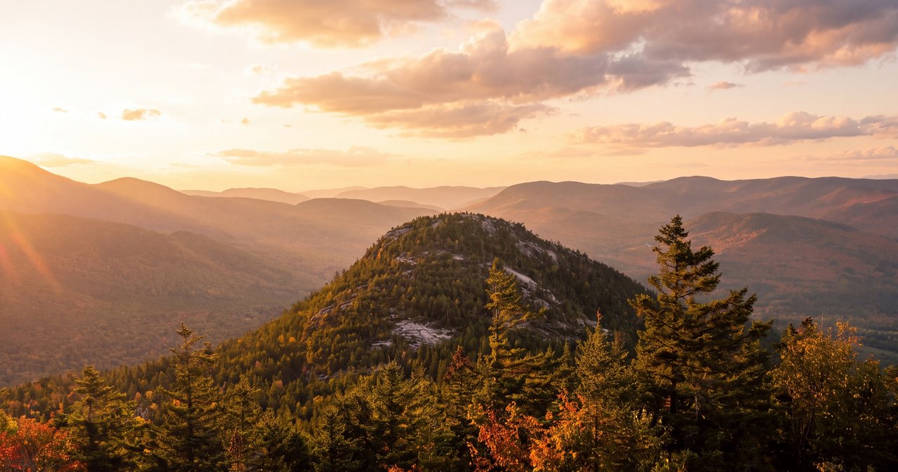
The Welch-Dickey Loop is the hike we point first-timers toward when they want to feel like they climbed a real White Mountains peak without committing to a whole day above treeline. It runs roughly 4.4 miles around and over two low summits, Welch at 2,605 feet and Dickey at 2,734 feet, but the numbers undersell it. Much of the loop is open granite ledge with views that stretch across the Sandwich Range, down the Mad River valley, and out toward Franconia Notch. For the effort involved, there is little that matches its view-per-mile within a half hour of the lodge.
That draw also shapes how you plan the day. The lot fills early on any decent summer or foliage weekend, and those same open slabs that make the hike so good turn slick when the granite is wet, iced, or fogged in. This guide walks the loop the way we hike it, in the smart direction, with plain notes on where it gets hard, what the parking situation really looks like, and when to turn around. We would rather you have a good morning and come back for dinner than push a slick ledge because you drove all this way.
The route, segment by segment
From the Orris Road trailhead, the trail runs a short distance to a junction where the loop splits. This is the one decision that shapes your whole hike. Go right here to climb Welch first and save Dickey for the way back. This is the standard direction, hiked counterclockwise, and nearly everyone does it this way for reasons I will get to in the common-mistakes section. Take the left fork only if you specifically want to reverse it.
The first stretch toward Welch is the gentlest part of the whole loop. You cross a small brook early on, which is your last reliable water and not one to count on in a dry August, then the trail traverses the lower slopes and climbs at an easy grade through hardwood forest. This is the part that lulls people. It is shaded, soft underfoot, and unremarkable in the best way. Around the one-mile mark the trees thin and you step out onto the first big open ledge on the shoulder of Welch, looking down the Mad River valley toward the Sandwich Range. Most people stop here whether they meant to or not. It is the first payoff and it is a good one.
From that lower ledge the character of the hike changes. The trail climbs the open granite toward Welch's summit with several steeper pitches where you will use your hands on the rock, short scrambles rather than true climbing, but enough that wet stone matters. You reach the summit of Welch at 2,605 feet with a wide, nearly all-around view. Dickey sits just to the north, close enough that you can trace the trail line running across its ledges.
Between the two summits the loop drops briefly into a wooded col, a cool pocket of conifers that feels like a different mountain, then climbs steeply back up to Dickey at 2,734 feet. Dickey is the higher of the two and, to many hikers, has the better ledges on its far side. From here the loop turns and begins its long descent along Dickey's ledges, and this back half is the reason to hike it Welch-first: you get an extended, gradual walk down open slab with views much of the way, rather than grinding up it. Eventually the ledges give way to a mature hardwood forest that carries you back down to the junction and out to the lot. Total distance is about 4.4 miles with roughly 1,800 feet of elevation gain.
The open slabs and the rare jack pine
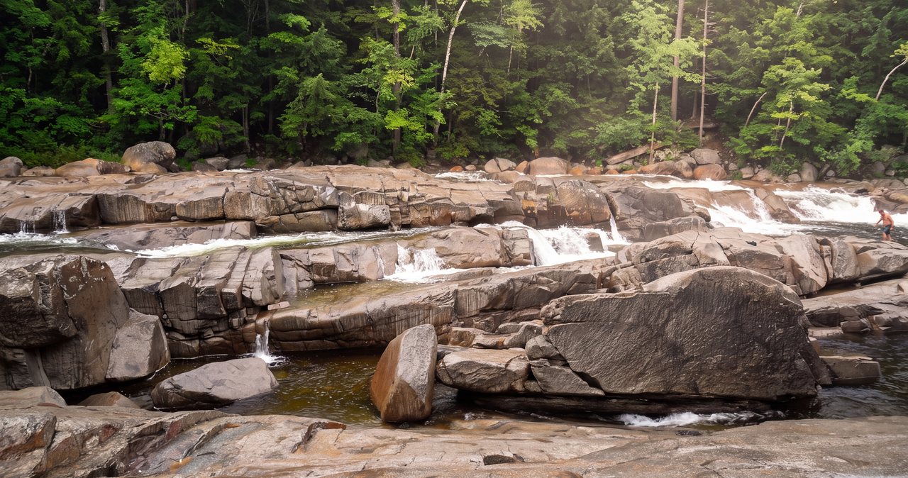
What makes Welch-Dickey stand out is the sheer amount of open rock. Unlike most White Mountains hikes, where the view is a reward at the top, here you spend a large fraction of the loop out on bare granite with the sky over you. That is the whole point of the hike on a clear day. It is also the source of nearly every problem people have out here, so it is worth understanding what you are walking on.
The slabs are smooth, exposed granite, tilted at angles that are easy going up and surprisingly committing coming down. Dry, they offer plenty of grip and you will barely think about it. Wet, they turn to something close to a slide, and morning dew, an afternoon shower, or lingering seep can leave stretches slick when the rest of the trail looks fine. Take the descent off Dickey seriously in anything but dry conditions, and if a section looks doubtful, come down on your backside rather than your boots. There is no shame in it and it beats a fall.
Look closely at the trees clinging to those ledges and you will see stunted, scrubby pines growing right out of cracks in the rock. That is jack pine, and this is one of only a handful of places in New Hampshire where it grows. Jack pine is a fire-adapted species; many of its cones need the heat of a fire to open and release seed, and it colonizes harsh, thin-soil sites where little else survives. The stand on Welch and Dickey is a genuine botanical rarity, not just scenery. Stay on the marked rock and the worn path across the ledges, don't cut across the vegetated islands, and let those trees and the fragile plants around them be. They are living in barely any soil, and a boot print sets them back years.
How hard it is
On paper Welch-Dickey is a moderate hike, and for a fit adult who hikes occasionally, that is fair. The distance is short, the elevation gain is manageable, and there is nothing technical in the mountaineering sense. But moderate is not the same as easy, and this loop trips up two kinds of people: those who read four-and-a-half miles and expect a walk in the park, and those who assume a short hike must be safe in any weather.
The real picture is that there are several steep, scrambly pitches on the way up Welch and again on the climb up Dickey, where you will use your hands and your quads will notice. The open ledges demand steady footing and a little nerve if you are uneasy with heights or exposure, because there are places where the ground falls away beside you. Kids who are comfortable scrambling do well here and it is a popular family hike, but it is not a stroller or a toddler hike, and it is not the right pick for someone with balance issues or brand-new to hiking who wants something flat.
For time, plan on roughly three to four hours car to car, and toward the longer end if you want to enjoy the views, eat lunch on top, and take photos, which most people do. A strong, unencumbered hiker can do the loop in around two and a half hours. A family with kids, or anyone stopping at every ledge, should budget four hours or more and not feel slow about it. The views are the reason you came, so give yourself the time to take them in.
Trailhead, parking, and the fee
The trailhead is on Orris Road in Thornton, on the edge of the Waterville Valley region. From Exit 28 off I-93 you follow Route 49 toward Waterville Valley, turn onto Upper Mad River Road, then onto Orris Road, and the lot is at the end. It is a good-sized Forest Service day-use lot, holding on the order of seventy to eighty vehicles, with a privy, but good-sized does not mean adequate for how popular this hike has become.
This is a White Mountain National Forest fee site. The cost is $5 per vehicle per day, paid at the self-service envelope station at the trailhead during the maintained season. If you already hold a WMNF annual pass (currently $30 for an individual or $40 for a household) or an America the Beautiful interagency pass, that covers it; just display it on your dash. Bring a few singles if you are paying the day fee, because it is a fill-out-the-envelope-and-drop-it system rather than a card machine, so you want the cash on you before you arrive. Note that the trailhead is not maintained in winter and the fee is not collected then, but that also means no plowing and no guarantees on the access road or lot.
Now the reality on parking. On any clear Saturday or Sunday from late June through foliage, and on holiday weekdays, this lot fills early, often by 8 or 8:30 in the morning and sometimes sooner during peak foliage. When it fills, people park along the road, which the Forest Service discourages and which can get you ticketed or towed in the worst spots, and it makes the last stretch of your drive a slow crawl. The fix is simple and it is the single best piece of advice in this guide: start early. If your car is in that lot by 7:30, you get a spot, you get the ledges to yourself for the first stretch, and you are often heading down as the crowds are heading up. That early-start advantage is a big part of why staying central in Lincoln pays off, which I cover below.
Exposure and weather: the part people underestimate
Welch-Dickey is not a high peak and it does not reach the alpine zone above treeline, so it does not get the same respect as, say, Franconia Ridge or the Presidentials. That is a mistake. The very thing that makes this hike good, all that open granite, is also what makes it hazardous in bad weather, and the White Mountains generate bad weather fast and out of a clear morning.
Two specific dangers. First, whiteout. When fog or low cloud settles on those broad open slabs, the painted blazes and worn rock path can be hard to follow, and people do lose the route on the ledges in poor visibility. The open rock that felt so obvious in sun becomes a featureless gray tilt with no trees to guide you. If cloud rolls in while you are up high, slow down, find the next blaze before you leave the last one, and if you cannot, wait it out or retreat the way you came. Second, wet or icy rock. As covered above, the slabs turn treacherous when wet, and shoulder-season ice on Dickey's ledges has put people in trouble. Lightning is the third: those open summits are among the worst places in the region to be caught in a thunderstorm, and summer storms here often build in the early afternoon. Aim to be up and down before they do.
Build two habits before you drive over. Check the Mount Washington Observatory Higher Summits Forecast the night before and again that morning; it is the best read on what the exposed high ground across this region is doing, and if it is calling for storms, fog, or high wind, believe it. And read the hikeSafe Hiker Responsibility Code at hikeSafe.com, which every trailhead here posts: come prepared, tell someone your plan, stay together, turn back when you should, and be self-sufficient for an emergency. Consider a NH hikeSafe Card, $25 per person or $35 per family for the year; it supports search and rescue and waives the cost of a rescue for card holders, short of recklessness. Most people never need it. It is inexpensive and the money does good work.
Seasons: what changes through the year
Summer, roughly late June through August, is prime time and also peak crowd. The forest sections are shaded and cool but the open ledges bake in full sun with no relief, so this hike drinks water faster than its length suggests. Start early both to get parking and to be off the exposed rock before afternoon heat and thunderstorms. This is also the season the jack pine and the ledge vegetation are at their most fragile underfoot, so stay on rock and trail.
Foliage is the marquee time, and around here that usually means late September into the first two weeks of October, with the exact peak shifting a few days year to year and by elevation. The views from those open ledges over the valley are as good as fall color gets in New Hampshire, and everyone knows it. Expect the lot to be full extremely early, expect company on the summits, and expect it to be worth it anyway if you start at dawn. This is the one time of year I would tell you to be in the lot before 7.
Winter and the shoulder seasons change the hike from moderate to serious. Those open slabs ice over, and Dickey's descent ledges in particular become a place people get hurt without traction. Microspikes are the minimum from roughly November into April, sometimes crampons and an axe depending on conditions, and route-finding on snow-covered ledges is a real difficulty. The trailhead is not maintained in winter, so the access road and lot may not be plowed. Spring brings mud season, typically April into May, when trails are soft and easily damaged and the brook runs high; the Forest Service asks hikers to stay off saturated high trails during the worst of it. If you are not experienced on winter ledges, save Welch-Dickey for firm, dry ground, and there is plenty of that from June through October.
Gear, water, and footwear
This is a short hike, which fools people into underpacking. Bring more than you think you need for the length, because the exposure and the sun stretch it out. Carry at least two liters of water per person in summer, more on a hot day; there is no reliable water on the loop beyond that early brook, and you should not count on treating from it. Pack real food or snacks, sun protection, and a light layer even on a warm morning, because wind on the open summits can be a good deal cooler than the parking lot suggested.
Footwear matters here more than on a typical trail of this size, specifically because of the slabs. Wear shoes or boots with genuine grippy tread and be realistic about whether yours are worn smooth; bald soles on tilted granite are how people slide. Trail runners with good rubber are fine for fit hikers in dry conditions; a light hiking boot gives more ankle support on the scrambly bits. Trekking poles help some people on the steep descent off Dickey and get in the way of others on the hand-over-hand pitches, so bring the collapsible kind you can stow.
The rest is standard White Mountains kit: a headlamp in case you are slower than planned, a small first-aid kit, a paper map or a downloaded offline map since cell service is spotty, and a rain shell. On Leave No Trace, this is a heavily used trail and it shows the wear, so it matters here: pack out everything including food scraps and orange peels, keep to the rock and the worn path across the ledges to protect the thin-soil vegetation and the jack pine, and don't build cairns or move rocks. Leave the ledges the way you would want to find them at 7 a.m. with no one else around.
Common mistakes and the smarter play
The first mistake is direction, and it is easy to avoid. Hike the loop by going right at the split to climb Welch first, the standard counterclockwise direction. This gives you a shaded, forgiving ascent, saves the long ledge descent off Dickey for the way down with views much of the way, and puts the steepest open slab where you are descending it in good light rather than grinding up it in the heat. Hiking it the other way is not wrong, but the standard direction is standard for a reason.
The second mistake is timing, and it costs people their whole morning. Showing up at 10 on a summer or foliage weekend means circling a full lot, parking illegally along the road, or driving away. The smarter play is a dawn or near-dawn start. You get the spot, you get the quiet, and you are descending as the crowd is climbing. Staying nearby, rather than driving up from the seacoast or Boston that morning, is what makes an early start happen.
The third is pushing bad conditions. Because it is short, people talk themselves into hiking it in rain or when fog is sitting on the ridge, then find the wet slabs and lost blazes the hard way. The smarter play is to have a plan B. If the Higher Summits Forecast looks ugly or you arrive to find the ledges socked in, this is a good hike to swap for a lower-stakes day: the Basin and the easy Franconia Notch paths, Flume Gorge, or a drive on the Kancamagus all deliver on a gray day without asking you to trust wet granite. Welch-Dickey will still be there next clear morning, and the trailhead is close, so coming back is easy.
One more, for the dog owners, because it deserves its own note below: this is not the casual dog hike its length implies. Read the next section before you decide to bring yours.
Bringing a dog
Dogs are allowed and plenty of people bring them, but Welch-Dickey is harder on a dog than its mileage suggests, and it is candidly not the right hike for every dog. The reason is the same slabs that make it good for us. The steep, tilted granite that we scramble up on hands and feet can be difficult for a dog to get up and, worse, back down, and there are pitches where you may need to spot or lift your dog. A big, athletic dog with good confidence on rock does fine; a small dog, an older dog, or one that is nervous on smooth surfaces can get stuck or hurt.
The second issue is heat on the exposed rock. On a sunny summer day that open granite gets hot enough to be hard on paw pads, and there is no shade and no water for most of the loop. If you bring a dog, bring water for it too, plan on plenty of it, and consider skipping the hike in real heat. Keep your dog leashed and on the rock and trail across the ledges, both for the fragile vegetation and because a dog off-leash near those drop-offs is a bad idea. If any of this gives you pause, it should; there are gentler hikes nearby better suited to a mellow dog day.
Nearby add-ons and how it connects
Welch-Dickey is a loop that stands on its own and does not connect into the big trail network the way a Franconia Notch hike does, which is part of its appeal: you get a complete mountain experience in a self-contained half day. That leaves your afternoon open, and there is a lot within easy reach. Waterville Valley itself is right up the road, with a walkable town square, easy flat paths along the Mad River, and food if you skipped a proper lunch on the summit.
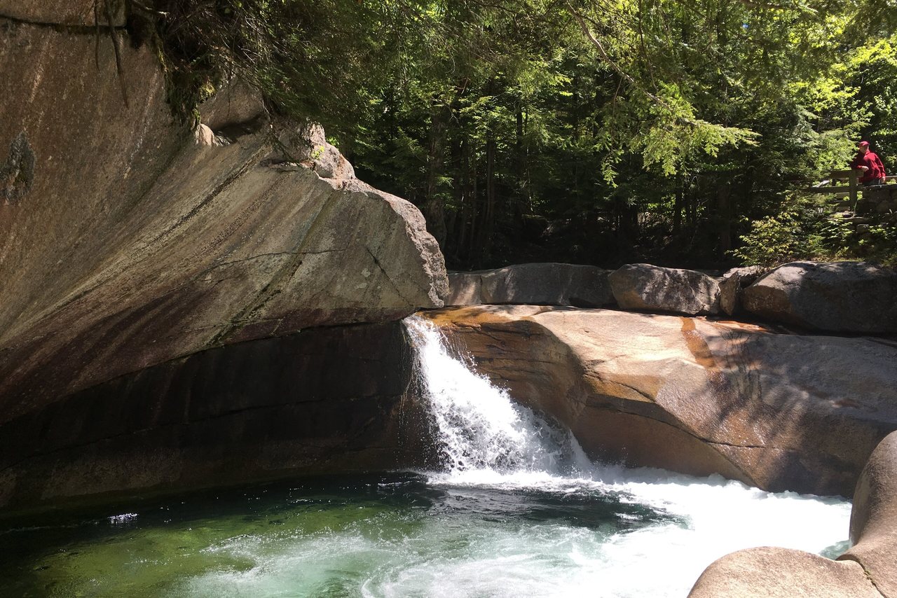
Because the loop is a morning hike for most people, it pairs naturally with a second, lower-key stop on the way back toward Lincoln. The Basin in Franconia Notch is a short, worthwhile walk to a granite pothole carved by the Pemigewasset and takes almost no time. Flume Gorge is a longer, ticketed boardwalk walk through a dramatic slot in the rock, ideal for tired legs that still want to see something; buy timed tickets ahead in the busy season. And the Kancamagus Highway, which starts in Lincoln, is the classic slow drive with pull-offs, swimming holes, and short walks if you would rather sit than climb again. For hikers who catch the bug and want the next step up, Lonesome Lake and the AMC hut above it is a natural progression from Welch-Dickey: a bit longer, a real high-mountain pond, and a taste of the hut system without the full commitment of the ridgeline.
Safety & conditions
- The open granite slabs turn slick when wet or icy, especially on the descent off Dickey. In anything but dry conditions, slow down and come down steep pitches on your backside rather than risking a fall.
- In fog or low cloud the painted blazes on the open ledges are hard to follow, and hikers lose the route. If cloud rolls in up high, find the next blaze before leaving the last one, and retreat the way you came if you cannot.
- These exposed summits are among the worst places to be in a thunderstorm, and summer storms often build in the early afternoon. Check the Mount Washington Observatory Higher Summits Forecast, start early, and be down before storms develop.
- From roughly November into April the slabs ice over; microspikes are the minimum, and Dickey's ledges have injured people without traction. The trailhead is also unmaintained in winter. If you are not experienced on winter ledges, save this hike for firm, dry ground.
- Read the hikeSafe Hiker Responsibility Code before you go: come prepared, leave your plans with someone, stay together, and turn back when conditions or the group say so. Consider a NH hikeSafe Card ($25/person, $35/family).
Where to stay for it
The Welch-Dickey trailhead is about a 30 min drive from the lodge here at 191 Pollard Road, straight out of Lincoln toward Waterville Valley. That short drive is the whole game with this hike, because the single biggest factor in a good Welch-Dickey morning is being in that lot early before it fills. Staying here means you can be up, coffee in hand, and parked by 7:30 without a pre-dawn haul from Boston or the seacoast. Guests who drive up the morning of routinely find a full lot; guests who sleep here don't.
For a hike that works your legs on all that open granite, it is worth thinking about which suite you come home to. If your knees will have earned it on Dickey's long ledge descent, the Basin suite has the deep soaking tub that our hiking guests keep thanking us for. If stairs after a day on the rock sound like one flight too many, ask about a first-floor suite when you book. Our suites are named for the landmarks around here, and after a day on the ledges you will recognize the names.
Check the current Higher Summits Forecast the night before; it tells you whether it is a Welch-Dickey day or a save-it-for-tomorrow day. If the ledges are socked in, we will point you at something better suited to the weather, and since the trailhead is close, coming back on your next clear morning is easy.
Sources & official info: fs.usda.gov · fs.usda.gov · waterville.com · hikesafe.com · mountwashington.org · wildlife.nh.gov
— Launchpoint Lodge, From the lodge