Mount Washington is the biggest thing you can do on foot from the lodge, and it is the hike we talk people out of more than any other when the forecast is wrong. At 6,288 feet it is the highest summit in the Northeast, with weather to match: the observatory on top recorded a surface wind gust of 231 miles per hour in April 1934, a world record for more than sixty years, and the summit still sees hurricane-force wind, whiteout, and bitter cold in every month of the year. The route this guide covers is the west-side loop that a lot of experienced White Mountain hikers consider the best way up the mountain on foot without ropes: up the Ammonoosuc Ravine Trail to the Lakes of the Clouds Hut, up the Crawford Path to the summit, and down the gentler Jewell Trail. Figure about 9.5 miles round trip and roughly 3,800 feet of climbing, starting from the Cog Railway Base Station about 55 min from our front door.
Read this next part before you read the rest. This is not a harder version of the other hikes in this section - it is a different category of day. You will walk a long way, gain nearly 4,000 feet, and spend roughly two miles of the loop above treeline on open ground that has no shelter and no fast way off. The summit deserves the same respect in July as in January, from seasoned hikers as much as from first-timers. The trail is not technical and there is no scrambling worth the name, but the mountain does not grade on effort, and a warm blue morning in Lincoln can be a whiteout with 60-mile-an-hour wind at the hut two hours later. Everything friendly about the drive and the first mile is real, and none of it lowers the ceiling on how bad the top can get. That gap is the whole point of this page.
What follows covers the whole day: the numbers and how the loop breaks down; what the summit is like, because it is not a wild and lonely peak but a place with a road, a cog railway, a big state-park building, and a crowd on a fair day; the Ammonoosuc Ravine Trail with its waterfalls, Gem Pool, and the steep slabs that call for the most care when wet; the Lakes of the Clouds Hut and why it is your go or no-go decision point; the final climb up the summit cone on the Crawford Path; the long, open Jewell Trail descent and the spot at the top of it where navigation gets tricky; the weather, which is the section that matters most; whether you can ride down when your legs are spent and why not to count on it; winter, which is mountaineering, not hiking; and the fees, the hikeSafe card, and the turnaround judgment this mountain asks of everyone. The trailhead is about 55 min away, up the west side of the range near Bretton Woods.
The numbers
The standard west-side loop goes up the Ammonoosuc Ravine Trail from the hiker parking near the Cog Railway Base Station, reaches the Lakes of the Clouds Hut in about 3 miles, climbs the Crawford Path about 1.4 miles up the summit cone to the top, then descends by way of the Gulfside Trail and the Jewell Trail back to the trailhead. Round trip it runs about 9.5 miles by the count on the reference site 4000footers.com, which is the working number to plan around. It is a lollipop rather than a pure out-and-back, so you see different ground going up and coming down, which is a big part of why people like it.
The climb is roughly 3,800 feet. The trailhead sits near 2,500 feet and the summit is 6,288, so the net gain is a little under 3,800; because the Ammonoosuc dips a few times, the col at the hut sits below the summit, and the Jewell descends off a high point on the Gulfside Trail, GPS tracks that count every rise and fall on the loop often read higher, in the 3,900 to 4,100 range. Published figures vary, which is normal - if you want an exact number, check a current map or the AMC White Mountain Guide, but plan your legs, your food, and your water around roughly 3,800 feet of up.
On time, this is a full day for fit hikers, not a half day. Most parties are moving 7 to 9 hours car to car, and slower groups, bad footing, or a long stop on top push it past that. The Ammonoosuc is steep and slow in its upper half, and the Jewell, though gentler in grade, is long and rocky on tired knees, so plan on taking your time coming down. Build the day so you are standing on the summit by early afternoon at the latest, with real hours of daylight left for the descent.
One frame before you go: what makes this serious is not the trail, it is the address. By raw numbers it is a moderate-mileage loop with no scrambling, but you are climbing to the highest, most weather-beaten summit in the East, with roughly two miles of the loop on fully exposed alpine ground and the Lakes of the Clouds Hut as the only shelter between treeline and the top. The distance and grade are manageable; the exposure and the speed the weather turns are not.
What the summit is - a practical picture
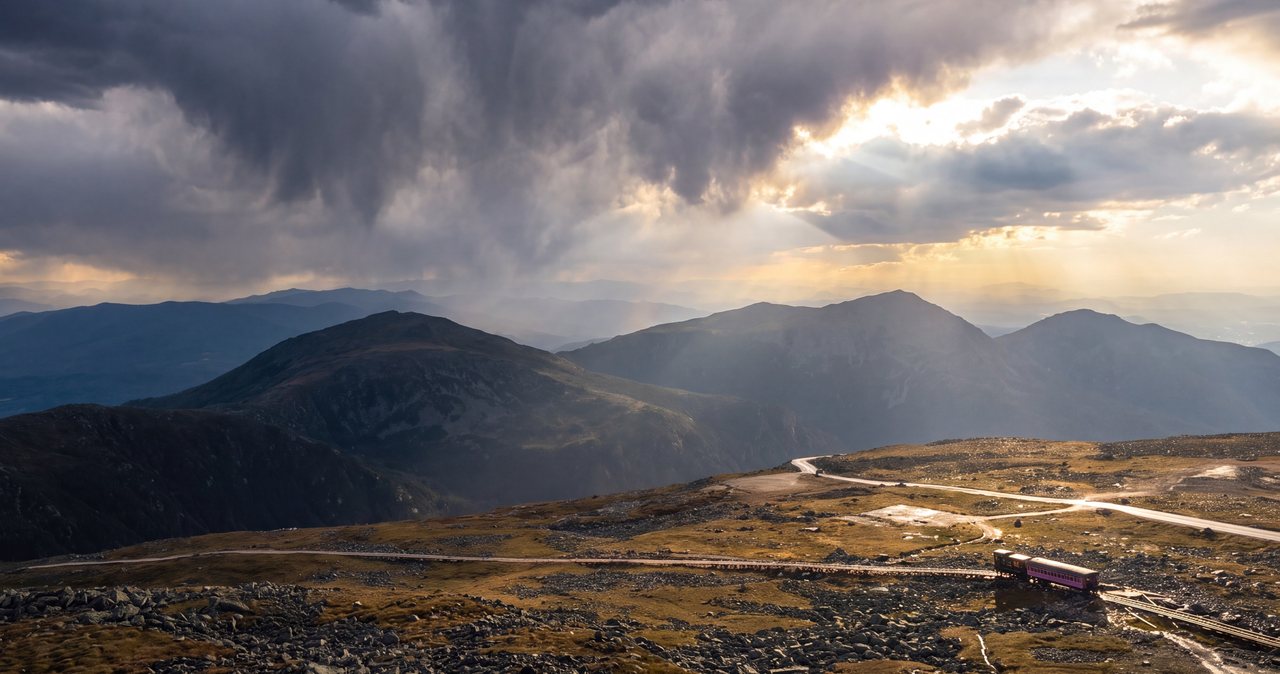
People are sometimes surprised by the top, so here is the straight version. Mount Washington's summit is not a wild, lonely alpine peak - it is a small, busy hilltop settlement. There is a paved auto road that climbs the east side, a cog railway that grinds up the west side hauling tourists, a large state-park building called the Sherman Adams Visitor Center with restrooms, a snack bar, and a gift shop, the Mount Washington Observatory and its museum, and the old stone Tip-Top House. On a clear summer weekend the summit is crowded, with a line of people from the parking lot waiting to photograph the summit sign while you stand there having walked every foot of it. It is a strange and slightly comic reward after a hard climb, and you should know it is coming so it does not sour the day.
The practical upside of all that development is real. In season, the summit building gives you a warm place to sit, a bathroom, water, and hot food, which is a genuine safety asset on a mountain this exposed - a wrecked, cold hiker can get inside and warm up. But it comes with a catch worth stating: the building keeps its own hours and closes for the season, and it is not a guaranteed shelter. Do not build your safety plan around the snack bar being open. The state park operates seasonally and around the weather, so treat any indoor comfort at the top as a bonus you might get, not a refuge you can count on.
The other thing the crowds and the buildings can hide is that this is still high, exposed alpine ground. The auto road and the cog do not make the weather any softer, and every year some of the people in trouble up there arrived by their own two feet in shorts because it was warm at the bottom. The summit sign, the gift shop, and the tour buses sit in the same wind and cold that experienced mountaineers plan carefully around. Enjoy the oddity of the place, use the shelter if it is open, and do not let the tourist-attraction feel talk you out of respecting the mountain you climbed.
For what it is worth, the view on a clear day earns the trip - the whole Presidential Range dropping away to the south, the Great Gulf falling off to the north, and, when the air is very clear, a reach into Vermont, Maine, and Canada. Clear days are the minority up here, though, which is the recurring theme of this entire guide.
Why Ammonoosuc up, Jewell down - and the other classic
There are many ways up Mount Washington, and this loop is a deliberate choice. The Ammonoosuc Ravine Trail is the most direct hiking line to the Lakes of the Clouds Hut and the summit from the west, and it is the more scenic and more interesting climb - a river, waterfalls, and steep granite slabs. The Jewell Trail is longer but graded more kindly, with switchbacks instead of slab, which makes it the better line for tired legs on the way down. Going up the steep, scenic trail and down the moderate one is the pattern most experienced hikers settle on, and it is the one we point guests to.
The order matters for a specific reason: the Ammonoosuc's upper slabs are far more dangerous to descend than to climb, especially when wet. Coming down steep, greasy granite on tired legs is exactly how people get hurt on this mountain, and the Jewell's switchbacks avoid that trap. Do the loop in this direction - Ammonoosuc up, Jewell down - and resist the temptation to reverse it just to end on the shorter trail.
You will hear about the other classic on-foot route, and it deserves a mention even though this guide does not cover it. The Tuckerman Ravine Trail climbs the east side from the Pinkham Notch Visitor Center on Route 16 - about 4.1 miles to the summit - up through the enormous glacial bowl of Tuckerman Ravine, famous for its spring backcountry skiing, and it finishes with a steep, rocky climb out of the ravine and up the cone. It is a magnificent and much busier route, but it starts on the far side of the mountain, a long drive around from the lodge, and the headwall is no place to be in bad weather. If you specifically want Tuckerman, plan it as its own trip from Pinkham; for a west-side loop close to Lincoln, the Ammonoosuc and Jewell are the answer.
A word on ambition: some strong parties string Mount Washington together with its neighbors into a multi-peak Presidential traverse, or add nearby Mount Monroe, which sits right above the hut and costs only about 0.8 mile extra by the 4000footers.com count. Monroe is a reasonable add-on in good weather from the hut, but the full traverse is a serious, committing, all-above-treeline undertaking that is a different and much bigger day. Come for the loop first, and respect the forecast before you tack anything onto it.
The Ammonoosuc Ravine Trail: waterfalls, Gem Pool, and the slabs
From the hiker lot the Ammonoosuc Ravine Trail starts gently, an easy walk on old grade through spruce and fir that follows the Ammonoosuc River up its ravine. For the first couple of miles it is a pleasant, straightforward woods climb alongside moving water, and it lulls you a little - the grade is friendly and the forest is cool and green. This is the part of the day to settle into a steady rhythm and drink and eat before the trail turns serious, because it is about to.
The landmark that marks the change is Gem Pool, a small, clear pool at the foot of the steep section, roughly two miles up. From Gem Pool the trail rears up and climbs hard, gaining a lot of height in a short distance as it works up beside a run of cascades and waterfalls that are beautiful in good conditions. This upper stretch is the scenic heart of the climb and also its crux: the trail crosses and climbs open granite slabs, some of them steep and polished, with the brook running right down the rock beside and sometimes across the path.
Those slabs are the single most important piece of footing on the whole loop, and they deserve real respect. Dry, they are simple steep hiking on grippy granite. Wet, they are slick, and after rain or in the runoff of snowmelt the sheeting water turns them into a genuine slip-and-fall hazard where a fall has consequences because of the angle and the drop below. This is where hikers get hurt on the Ammonoosuc, far more than anywhere else on the route. Take the slabs slowly, use your hands where it helps, test your feet, and if they are running with water and you are unsure, that is real information about whether the day is on.
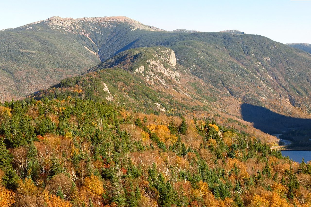
Above the slabs the trees shrink into stunted krummholz, the sky opens, and the trail tops out at the Lakes of the Clouds Hut, sitting in the high saddle between the summit cone and Mount Monroe at roughly 5,000 feet. The AMC counts the Ammonoosuc Ravine Trail from the lower hiker lot to the hut at about 3.1 miles with roughly 2,500 feet of climbing - which tells you almost all of that gain is packed into the steep upper mile. Reaching the hut is a real milestone, and it is where the character of the day changes completely, because you have just left the last of the shelter behind.
Lakes of the Clouds Hut and the col: your real decision point
The Lakes of the Clouds Hut is the highest and largest of the AMC's backcountry huts, sitting at about 5,030 feet in the open saddle just below the summit cone, next to the small alpine tarns it is named for and right under the rocky top of Mount Monroe. In its full-service season, roughly early June to mid-September, it is staffed by a crew, sleeps around 90 people in bunkrooms, and serves meals; day hikers can usually step inside to refill water, use the composting toilets, buy a snack or a bowl of soup, get out of the wind, and ask the crew what the weather is doing up top. That last part is worth the stop by itself - the people who work there are watching the mountain all day.
Treat the hut as the true go or no-go point of this hike, the same way the col is on the Southern Presidentials. Up to here you have climbed in the shelter of the ravine and the trees; step out of the hut door and you are in the full open alpine world, with the bare summit cone rising about 1,200 feet above you and nothing between you and the weather. This is the place to be clear-eyed with yourself. If you reached the hut later than you planned, or the wind is up, or cloud is pouring over the cone, or you are already colder and more tired than you expected, the summit is still well over a mile of exposed climbing away, and turning around at the hut costs you almost nothing but a summit photo.
Retreat from the hut is clean, which is what makes it such a good decision point. Drop back onto the Ammonoosuc Ravine Trail and within a short descent you are below the worst of the wind and back into scrub and trees. There is no better bail-out on Mount Washington than a warm building at 5,000 feet with a marked trail dropping straight back into shelter. Turning around at Lakes of the Clouds is not a failed hike - on this mountain it is the single most common piece of good judgment that keeps experienced people alive, and nobody who knows the range will think less of it.
The hut runs on a seasonal schedule that can change, and outside its full-service season the building is not an open shelter you can count on. The AMC has long kept a small stone-walled emergency refuge room at Lakes of the Clouds, known as The Dungeon, intended as a last-resort shelter, but you should not build a plan around it being available or comfortable - confirm current hut status and any off-season refuge arrangements with the AMC before you rely on them. In season, the hut is a genuine asset; out of season, plan as if there is nothing up there but rock and wind.
The final climb to the summit on the Crawford Path
From the hut the route joins the Crawford Path - the oldest continuously maintained hiking trail in the country, laid out in 1819 - for the last push up the summit cone. It is about 1.4 miles and roughly 1,200 feet of climbing from the hut to the top, all of it above treeline, all of it in the open, following cairns and painted blazes up a steepening slope of broken alpine rock. There is no scrambling in the technical sense, but the footing is rough and rocky the whole way, and the grade is real - this is the part of the climb where a long day starts to tell in your legs.
Because you are fully exposed for this entire section, it is where the weather stops being a background worry and becomes the only thing that matters. The wind that was a breeze at the hut can be a shove up here, the temperature drops as you climb, and cloud can close in around you in minutes so that you are navigating cairn to cairn in a gray blank. Put your wind and insulating layers on at the hut before you start up, not partway up when you are already chilled, and keep track of the cairns behind you as well as ahead so you know the way back down.
Near the top the Crawford Path meets a tangle of other trails and signs at the summit - the Gulfside Trail, the Trinity Heights Connector to the true summit, the Davis Path, and others all converge in the summit area, and it is easy to get turned around up there, especially in cloud, because so many marked routes meet in a small space full of buildings and rock. Slow down at the junctions, read the signs, and fix in your mind which trail you came up and which one you need for the descent, because the moment to sort that out is in good order at the top, not later in a whiteout.
Then you top out, and the summit is whatever it is that day - a crowd and a snack bar in the sun, or a wall of wind and cloud where you tag the sign and start down. Either way, do not linger past your weather window or your daylight: the summit is the halfway point of the work, not the finish, with the long Jewell descent still ahead.
The world's worst weather - read this section twice
Mount Washington bills itself as the home of the world's worst weather, and it has the record book to back the claim. The observatory measured a surface wind gust of 231 miles per hour on April 12, 1934, which stood as the world record for a straight-line surface wind for more than sixty years and is still the highest ever recorded by a person on land. The summit has seen a temperature of 50 below zero, a wind chill of 108 below in February 2023, and it averages the equivalent of more than 90 inches of precipitation a year with hurricane-force gusts logged in every month, July included. This is not marketing - it is where you are proposing to stand.
This mountain calls for care from every kind of hiker. When things do go wrong here, the causes are rarely exotic: hypothermia from being caught out in wind and wet without enough clothing, falls on steep or icy rock, and getting lost above treeline when the cloud comes down. The recurring pattern is heartbreakingly ordinary - a nice day at the bottom, a party that pushes on past the point where they should have turned around, and weather on top that they were not dressed or equipped for. You avoid being a statistic here mostly by making boring, conservative decisions early.
The single habit that protects you is to read the Mount Washington Observatory Higher Summits Forecast at mountwashington.org before you go, on top of an ordinary valley forecast. That forecast is written specifically for the above-treeline world you will step into at the hut, and it gives you the summit wind, the wind chill, the odds of the tops being in cloud, and whether a front is coming through. The observatory says it: mountain weather is subject to rapid changes and extreme conditions, and the forecast alone is not enough - you still have to carry the clothing and the judgment to turn back. A pleasant valley day and a violent summit day happen together here constantly. If the higher-summits forecast is bad - high wind, deep cold, storms, or the summits socked in - change the plan rather than hoping it lifts when you get up there.
Turnaround culture is the other half of surviving this mountain, and it is worth saying out loud as a rule you decide before you start. Set a turnaround time and a turnaround forecast, and honor them even when you feel strong and the summit looks close. The Lakes of the Clouds Hut is your decision point; a building thunderstorm or a wall of cloud coming over the cone is a reason to go down now, not after one more push; and the people who get in trouble here are almost never the ones who turned around early. On Mount Washington, turning back is the skilled call rather than a disappointing one, and everyone who hikes the range regularly has made it more than once.
The Jewell Trail down: the long exposed ridge and the navigation trap
Coming off the summit you do not retrace the Crawford Path - you follow the Gulfside Trail, which is also the route of the Appalachian Trail here, northwest across the upper mountain toward the top of the Jewell Trail. This connecting stretch is short but it is fully above treeline and fully exposed, crossing open alpine ground and the Cog Railway tracks, with the Great Gulf dropping away on your right. On a clear day it is a spectacular high traverse; in cloud it is the single most disorienting piece of the whole loop, because you are on open ground near the railway with few obvious landmarks and cairns as your main guide.
This is the navigation trap of the descent, and it deserves specific attention. More than one tired hiker has left the summit in deteriorating weather, missed the turn onto the Jewell, and ended up wandering the open plateau or starting down the wrong drainage. Before you leave the summit, be certain you know the sequence - Gulfside Trail to the marked top of the Jewell Trail - and follow the cairns deliberately, counting them and keeping the next one in sight before you leave the last. If the cloud is down and you cannot reliably follow the cairns, that is a reason to have not been up there, and a reason to be very careful now.
Once you are on the Jewell proper, the trail swings onto a ridge and drops back below treeline within a mile or so, and the character changes to a long, moderate, switchbacked descent through scrub and then forest. It is a relief after the exposure, but it is not short and it is not smooth - the Jewell is rocky and rooty in stretches and grinds on for roughly three and a half miles of downhill, and it is where knees and ankles get tired and careless. Keep eating and drinking, keep your feet under you on the rock, and do not mentally check out just because the hard part is behind you.
The Jewell delivers you back down near the Cog Base Station and the hiker parking, closing the loop. Because both trailheads are reached from the same lot off Base Road, you finish where you started with no road walk or car shuttle - a large part of why this loop is the standard one. Sort out in advance which connector leads back to your car, so you are not guessing at the end of a long day.
Water crossings, wet slab, and footing
The water on this loop is mostly a footing and timing story rather than a big-ford story. The Ammonoosuc Ravine Trail follows and crosses the Ammonoosuc River and its feeder brooks, and in normal summer conditions the crossings are rock-hops that barely register. The one caution is timing: after heavy rain, during spring snowmelt, or in a wet spell, the river runs hard and cold, the crossings get pushier, and - far more important - the steep granite slabs in the upper trail run with sheeting water and turn slick. The crossings are nothing like the big wilderness fords on the Pemigewasset routes, but wet slabs can make the steepest part of the climb slow, careful going.
The slabs are worth repeating because they are the real injury spot on the whole loop: wet, polished granite on a steep grade drops hikers, and it does not care how fit you are. That is why this guide sends you down the Jewell rather than back down the Ammonoosuc: you never descend that slab on tired legs, since wet rock is much riskier to come down than to climb, and saving a mile by reversing the loop is not worth it.
Higher up there is no reliable water and, once you leave the hut, no shelter except the summit buildings when they are open. Carry what you need from the car - two to three liters per person for a day this long, more in summer heat - and top off at the hut in season if you can. If you take water from the river low on the Ammonoosuc, filter, treat, or boil it as you would any backcountry water in the Whites. And remember the flip side of all that water on the way up: the same brooks and slabs you crossed dry in the morning can be running higher and slicker by afternoon if a storm has moved through, so factor the day's weather into your descent, not just your climb.
Can I just ride down? The Cog, the Auto Road stage, and why you plan to walk
Every season, hikers reach the summit wrecked and hope to buy a ride down instead of walking. It is worth understanding the real, current picture so you do not build a plan on it. The Cog Railway, whose tracks you cross on the descent, does sometimes sell a seat down the mountain, but only on a strictly space-available basis - as the railway itself puts it, if seats are available, down-mountain tickets are purchased in person at the summit, and because the train runs a set schedule and most riders have reserved round trips, seats are not guaranteed. The railway is blunt about it: you must always be physically and mentally prepared to hike back down. Confirm any current pricing and policy directly with the Cog, at the Base Station or by phone, and treat a ride as a lucky bonus, never a plan.
The Mount Washington Auto Road climbs the east side, and in past seasons its guided vans, the stages, have driven hikers down on a space-available basis for a fee, weather and space permitting. But there is a catch that makes it nearly useless for this loop: the Auto Road ends at Glen, on Route 16 on the far east side of the mountain, a long way around by road from the Cog Base Station where your car is parked. Riding the stage down leaves you on the wrong side of the range with no easy way back to your car short of a long hitch or a paid shuttle. As with the Cog, confirm the current policy rather than assuming it, and do not count on it.
The summary is the one the operators give themselves: plan to walk down. Build the whole day - your start time, your pace, your turnaround, your food and water and headlamp - around descending the Jewell Trail on your own two feet. If a ride happens to be available and it makes sense, fine, but a party that climbs Mount Washington counting on riding down is a party that has no plan for the most likely outcome, which is that they will be hiking. The mountain has a long history of rescuing people who ran out of daylight or legs on the descent because they assumed they would not have to make it.
The trailhead, Base Road, and parking
The loop starts from the hiker parking near the Cog Railway Base Station, at the end of Base Road (also called Base Station Road) in the town of Carroll, on the west side of the range. Both the Ammonoosuc Ravine Trail and the Jewell Trail are reached from the White Mountain National Forest hiker parking area off Base Road, which is the standard park-once setup for this loop - you leave the car once and both ends of the lollipop connect to it. Arrive early on any clear weekend; this is one of the most popular big-mountain hikes in the state, and the hiker lot fills.
On the fee, here is the short answer, with one practical wrinkle. The Forest Service hiker parking off Base Road sits in the White Mountain National Forest, so the safe move is to carry a WMNF recreation pass - about $5 for the day of purchase, $30 for an annual pass, $40 for an annual household pass, or the federal America the Beautiful pass at $80 covers it. The wrinkle is that the Cog Railway also operates its own paid parking at the Marshfield Base Station itself, which is a separate, privately run lot mainly for train passengers. Which lot you end up in changes what you owe, so read the signs when you arrive, park in the Forest Service hiker lot with a WMNF pass if that is where you are, and if you are unsure, confirm current parking and fees with the WMNF or the Cog before you rely on either.
Base Road is generally a maintained, drivable road, unlike some of the seasonal gravel roads elsewhere in the range - the Cog runs operations at the Base Station well into the cold months, so the road is usually kept open. Even so, conditions change, and in winter it can be snow-covered and icy even when open, so check the current status before you count on driving all the way in during the shoulder seasons and winter. One reassuring note on closures: the well-publicized 2026 Lincoln Woods and Franconia Falls closure, in effect roughly mid-June into November, is on the other side of the mountains and has no effect on this route at all - it matters for Pemigewasset Wilderness trips like Owl's Head and the Bonds, not for the Ammonoosuc and Jewell. Trail and road status can still change after storms, so a quick check of current WMNF alerts before you drive up is always worth it.
Winter: mountaineering, with the equipment to match
There is no gentle way to say this, so here it is: in winter, hiking Mount Washington is mountaineering, not hiking, and the gap between the summer loop and the winter one is enormous. The exposed miles that are a manageable novelty in July become a full-on alpine environment in January - wind that knocks you down, wind chills far below zero, spindrift and rime that ice everything, and a real chance of frostbite on exposed skin in minutes. Even climbers with serious winter experience and full equipment approach it with great care. This is not a place to find out whether you are ready.
If you are going to attempt it in winter, you need winter mountaineering gear and the skills to use it: full crampons and an ice axe, and the training to self-arrest and to move on hard-frozen, steep alpine slopes; snowshoes for the approach in deep snow; a serious layering system with a windproof shell, insulated parka, goggles, a warm hat and spare, mittens, and full face protection because bare skin freezes fast in that wind. You need real navigation ability for a whiteout on the exposed cone and the Gulfside link to the Jewell, where the cairns can be buried or plastered in rime and the summer track simply does not exist. And you need the fitness and the daylight discipline to do it all in the short winter day.
Two winter realities specific to this route are worth stating. First, the Lakes of the Clouds Hut is closed as a full-service refuge in winter, so the comforting mental picture of a warm building at 5,000 feet does not apply - plan as if there is no shelter above treeline at all. Second, avalanche and steep-snow hazards are real in the ravines and gullies of this mountain, and winter conditions can turn ordinary slopes dangerous; the summer trail corridor is not automatically safe. Winter Mount Washington is a fine objective for people who already have winter mountaineering skills, the gear, and ideally a partner who has done this exact climb - it is not the place to learn any of those things on a cold, clear Saturday because the forecast looked good.
Fees, the hikeSafe card, turnaround judgment, and what to carry
On fees, the short version is above: carry a White Mountain National Forest recreation pass for the Forest Service hiker parking - about $5 for the day, $30 annual, $40 annual household, or the $80 America the Beautiful pass - and note that the Cog runs its own separate paid lot at the Base Station. The posted signs where you park have the final word, and the WMNF or the Cog can confirm current parking and fees if you are unsure.
Separately, carry the New Hampshire hikeSafe card. It is a voluntary card sold by New Hampshire Fish and Game, and in 2026 it costs $25 for an individual and $35 for a family for the calendar year, the same price for residents and visitors. It matters because New Hampshire can bill hikers for their own rescue: under state law, RSA 206:26-bb, a hiker judged to have acted negligently can be charged for the cost of the search-and-rescue operation. The hikeSafe card removes that liability short of true recklessness and helps fund the rescue teams directly. On the deadliest mountain in the region, it is a sensible thing to have in your pocket; you can read about it at hikesafe.com.
The judgment that keeps you safe here comes down to a few hard rules. Let the higher-summits forecast set the plan; if it is bad up top, change the day. Make your real go or no-go decision at the Lakes of the Clouds Hut, where retreat into shelter is quick, and remember the summit is optional. Set a turnaround time before you start and honor it. Treat a building thunderstorm or a wall of cloud coming over the cone as a reason to go down now. Plan to walk down the Jewell rather than counting on a ride. And do not let your phone be your whole safety plan - coverage on the mountain is spotty, so download your map before you leave the driveway, carry map and compass and know how to use them, pack the ten essentials scaled to the season, and tell someone your route and your expected out-time. We ask our hiking guests to leave a plan with someone at home, and on this mountain we mean it more than on any other.
For gear, pack for the real alpine peak it is even in summer: sturdy footwear with grip for wet slab and rock, far more warm and windproof layers than the valley suggests because the top runs cold and windy, hat and gloves even in July, sun protection for the fully exposed miles, two to three liters of water and real food, a headlamp, and trekking poles for the long Jewell descent. In the cold season this becomes full winter mountaineering kit as described above, without exception. On Mount Washington the challenge is not a technical scramble or a big ford but exposure, weather, and distance on the highest, most weather-beaten summit in the East, so the layers, the forecast, and the discipline to turn around are the most important gear you carry.
Safety & conditions
- Read the Mount Washington Observatory Higher Summits Forecast at mountwashington.org before you go, on top of a valley forecast - it is written for the above-treeline world you step into at the hut and gives summit wind, wind chill, and whether the tops are in cloud. This summit recorded a 231 mph gust in April 1934, has seen 50 below and a 108-below wind chill, and logs hurricane-force wind in every month. A pleasant valley day and a violent summit day happen together here constantly; if the higher-summits forecast is bad, change the day.
- Treat the Lakes of the Clouds Hut, at about 5,000 feet, as your real go or no-go point. You climb to it in the shelter of the ravine; from there the summit is over a mile of fully exposed alpine climbing away with no shelter but the summit buildings when they are open. If you are behind on time, cold, or the wind is up and cloud is coming over the cone, turn around at the hut - retreat drops you quickly back into shelter, and turning back here is the most common good decision on this mountain, not a failure.
- The weather turns in minutes above treeline. Put your wind and insulating layers on at the hut before you start up the cone, not partway up when you are already chilled, and carry far more warmth than the valley suggests - hat and gloves even in July. Treat a building thunderstorm or a wall of cloud coming over the summit as a reason to get down now, not after one more push; roughly two miles of this loop have no cover at all.
- The steep wet granite slabs on the upper Ammonoosuc Ravine Trail, above Gem Pool, are the real injury spot on this loop - polished rock with water sheeting across it after rain or snowmelt drops hikers, and a fall there has consequences. Take the slabs slowly going up, use your hands, and do this loop in the right direction, Ammonoosuc up and Jewell down, so you never descend those slabs on tired legs. If they are running with water and you are unsure, that is real information about whether the day is on.
- Navigation on the descent is the trap that catches tired hikers. From the summit you follow the Gulfside Trail across open, exposed ground and the Cog tracks to the top of the Jewell Trail, and in cloud that stretch is disorienting with cairns as your main guide. Before you leave the summit, be certain of the sequence, keep the next cairn in sight before leaving the last, and know which trail you came up - the tangle of trails and signs at the summit is where people take the wrong one.
- Do not count on riding down. The Cog sells down-mountain seats only space-available, in person at the summit, and says you must be prepared to hike down; the Auto Road vans, when they run, leave you at Glen on the wrong side of the mountain from your car. Build the whole day around descending the Jewell on your own two feet, with the time, food, water, and headlamp to do it - the mountain has a long history of rescuing people who assumed they would not have to walk down.
- Set a turnaround time before you start and honor it even when you feel strong, and start early enough to be on the summit by early afternoon with real daylight left for the long Jewell descent. Carry map and compass and know how to use them, because cell coverage on the mountain is spotty and your phone may not work when you need it; download the forecast and your map before you leave, and leave your route and out-time with someone.
- Winter is mountaineering - not a hike with a jacket. You need crampons and an ice axe with the skills to self-arrest, snowshoes, a full windproof insulated layering system with goggles and face protection, and real whiteout navigation for the exposed cone and the Gulfside link. The Lakes of the Clouds Hut is closed as a refuge, avalanche and steep-snow hazards are real, and even skilled, well-equipped climbers give the mountain a wide margin. Go only with winter mountaineering skills, the gear, and ideally a partner who has done this climb.
- Carry the New Hampshire hikeSafe card ($25 individual, $35 family for 2026 from NH Fish and Game). The state can bill a hiker judged negligent for a rescue under RSA 206:26-bb, and the card waives that cost, short of recklessness, while helping fund the rescue teams. Most trouble in the Presidential Range comes from ordinary causes like hypothermia, falls, and getting lost above treeline, so make conservative decisions early and pack the ten essentials scaled to the season.
Where to stay for it
The drive is a straightforward run up the west side of the mountains toward Bretton Woods. From 191 Pollard Road you get on I-93 North through Franconia Notch, then follow US Route 3 north about ten miles to the village of Twin Mountain. There you turn right, east, onto US Route 302 and follow it through Bretton Woods, past the big Mount Washington Hotel, and watch for Base Road (Base Station Road) on the left; follow it in toward the Cog Railway Base Station and the hiker parking. It is about 40 miles and roughly 55 min. The single most useful tip is to arrive early on any clear weekend, because the hiker lot fills fast for a hike this popular - and because on this mountain you want every hour of daylight for the descent.
Provision before you leave Lincoln, because options thin out fast as you head north. The stores and gas stations in Lincoln and North Woodstock - the Price Chopper supermarket is the easy one-stop - are your best bet for sandwiches, extra water, and a full tank. Along the way, Twin Mountain has a small store and gas at the Route 3 and Route 302 junction, and Bretton Woods has resort services, but there is nothing at the trailhead itself beyond the Cog Base Station's seasonal facilities during its hours. Fill your water bottles before you go, download the higher-summits forecast and your map while you still have a signal, and leave your route and expected out-time with someone at home - on Mount Washington that matters more than on any other hike.
Sources & official info: 4000footers.com · mountwashington.org · thecog.com · outdoors.org
— Launchpoint Lodge, From the lodge