South of Crawford Notch, where Route 302 runs beside the Saco past the Notchland Inn, a small pull-off on the west side of the road marks the Nancy Pond Trail. Few of the cars streaming toward Arethusa Falls stop here, which is a gift to those who do. The trail follows an old logging road up the valley of Nancy Brook and then climbs to the foot of the Nancy Cascades, a waterfall that drops about three hundred feet in a series of tiers down a mountainside, hidden inside one of the largest stands of never-cut red spruce and balsam fir left in the Northeast.
The cascades are the destination for most people, about 2.4 miles and a real climb from the road. For the strong, the trail keeps going, steeply, for another mile to Nancy Pond and then Norcross Pond, two high, dark tarns on the shoulder of the Pemigewasset Wilderness. The ledge at the outlet of Norcross Pond looks west over the entire wilderness to Franconia Ridge, and on a clear day it is one of the great quiet viewpoints of the range, reached by almost no one.
The place is named for Nancy Barton, who in the winter of 1778 set out from Jefferson through the notch on foot after the man who had taken her savings, and froze to death beside this brook. This guide covers the trail, the waterfall, the ponds and the view, the protected old-growth forest you walk through, the legend as it has been told for two centuries, the tiny trailhead and how to find it, and how to do the hike safely. The drive from the lodge is about 45 min.
The numbers
The Nancy Cascades are about 2.4 miles from the trailhead, so roughly five miles round trip. Elevation gain to the base of the falls is listed anywhere from about 1,100 feet to a little over 1,500 feet depending on how the source counts the rolling middle section; call it a solid 1,200 to 1,500 feet, with the steepest part in the last mile before the falls. Allow three to three and a half hours for the cascades and back.
Nancy Pond is another 1.1 miles beyond the cascades, and that mile is steep, rough and rocky as the trail climbs beside the falls and above them. The round trip to the pond is about 6.9 miles with roughly 2,200 feet of gain, four and a half to five hours. Norcross Pond and its outlet ledge sit a few hundred yards past Nancy Pond on nearly level ground. The trailhead is around 1,300 feet; the ponds are a little over 3,100.
Finding the trailhead
The trailhead is easy to miss. It is a small pull-off on the west side of US Route 302 in Hart's Location, marked with a Forest Service trail sign, across the road from a clearing beside the railroad tracks. Heading east, that is toward Bartlett, it is on your right about 0.9 mile after you pass the entrance to the Notchland Inn and the Davis Path lot. Heading west from Bartlett, it is on your left before the inn. The pull-off holds only a handful of cars; park fully off the pavement and do not block the trail sign.
There is no kiosk, no toilet and no water at the trailhead. Carry a White Mountain National Forest recreation pass in case the signs ask for one, and use the facilities at the Willey House site or the Crawford Depot on the way in.
The trail to the cascades
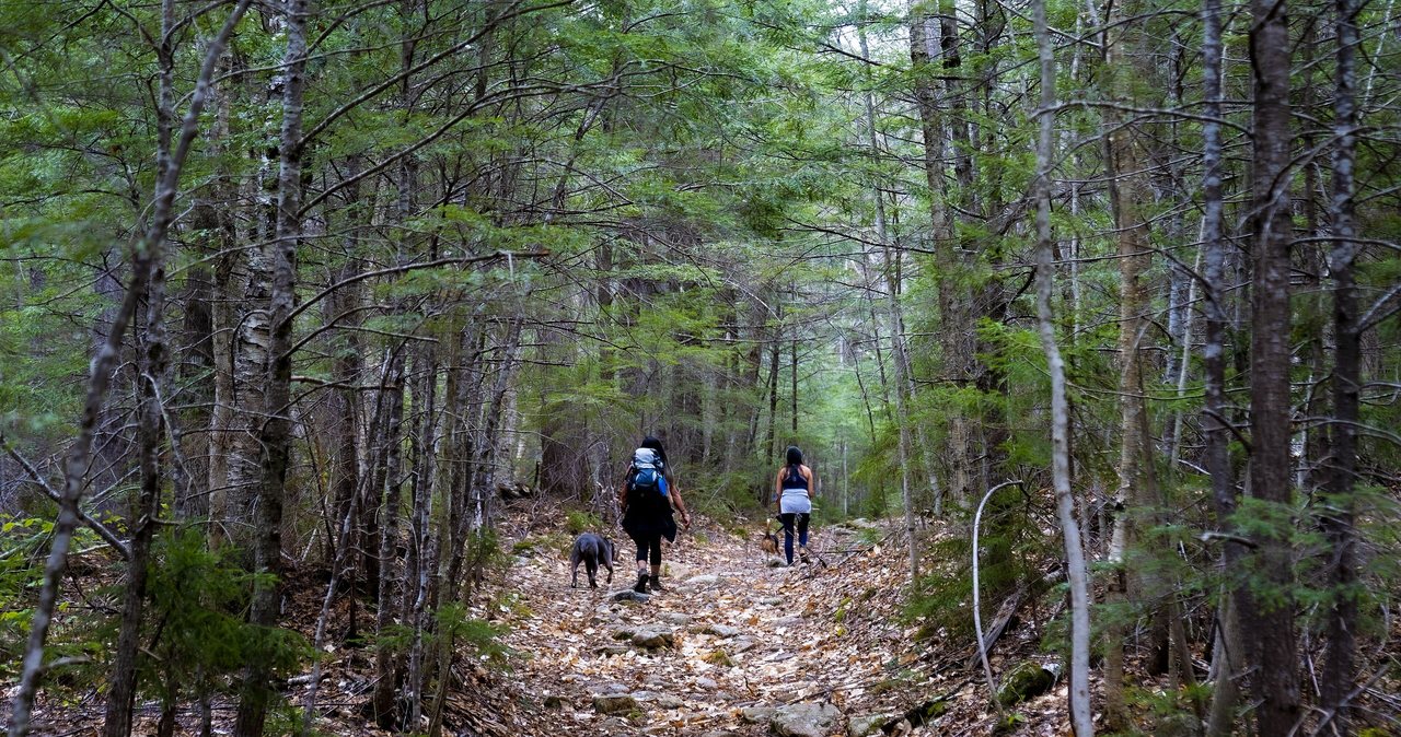
The Nancy Pond Trail begins as a gentle walk on an old logging road through hardwoods, crossing Halfway Brook and later working over toward Nancy Brook. It rolls more than it climbs for the first mile and a half, with some wet and rooty footing and a couple of brook crossings on rocks that are simple in normal water and worth care after rain. The forest changes as you go, the hardwoods giving way to big spruce, and the brook grows louder.
In the last mile the trail leaves the road grade and climbs in earnest, steep and rocky, until it arrives at the foot of the lowest cascade. The falls come down the mountain in a long staircase of ledges and slides rather than one plunge, with the lowest tier the showpiece: a broad fan of white water over dark rock into a shallow pool, in a spruce amphitheater that stays cool and dim even at midday. This is the natural turnaround for most people, and the best place for lunch.
The old-growth forest of Nancy Brook
The spruce around and above the cascades is the point as much as the water. The Nancy Brook Research Natural Area protects 1,385 acres of old-growth red spruce and balsam fir on the slopes above the brook, the largest virgin mountain spruce forest in New Hampshire and one of the few big remnants in the northeastern United States. It survived because the terrain was too steep and remote for the logging railroads, and the Forest Service now manages it for research, not timber. The wider area is a National Natural Landmark.
You notice it above the falls: trees far larger than the second growth you have walked through everywhere else in these mountains, deep moss, dead giants left to rot where they fell. Stay on the trail here; the ground is fragile and the point of the place is that nobody has disturbed it.
Above the falls: Nancy Pond and Norcross Pond
From the base of the cascades the trail climbs very steeply beside and above the falls for about 1.1 miles, with rough rock steps, roots and, in spring, running water on the tread. It is the hardest mile of the day and it earns its reward: the grade eases into a high, boggy plateau and the trail arrives at Nancy Pond, a dark tarn ringed with spruce at a little over 3,100 feet, utterly quiet.
Keep going a few hundred yards on nearly flat trail and you reach Norcross Pond, and at its western outlet an open ledge where the pond spills off the plateau. From that ledge the view opens west across the whole Pemigewasset Wilderness: the Bonds and Mount Carrigain close by, the Twins, and on a clear day the long line of Franconia Ridge on the far horizon, with not a road or a building in sight. It is one of the finest wilderness views in the White Mountains and one of the least visited. The trail continues beyond into the wilderness toward Carrigain Notch; that is a different, much longer day.
The legend of Nancy Barton
The brook, the cascades, the pond and the mountain above them are all named for Nancy Barton, and her story has been told in the notch since it happened. In the winter of 1778 Nancy was a young woman working as a servant on Colonel Joseph Whipple's farm in Jefferson, north of the notch. She had fallen for one of the farmhands, Jim Swindell, given him her savings and expected to marry him. He left for Portsmouth without her, taking the money, while she was away.
When she learned of it she set out after him on foot through Crawford Notch in a snowstorm, some thirty miles, and was found frozen to death beside the brook that now carries her name, having stopped to rest near a camp he had already left. The details vary with the teller, and the AMC and local historians have written the story down in several versions; the outline is consistent, and the place has kept her name for two and a half centuries. Walking up the brook in November, with the light going early, it is not hard to understand why.
Seasons and water levels
Late May through June is the biggest water, when snowmelt off the plateau turns the tiers into a continuous roar and the trail above the falls runs like a stream. July and August are the most pleasant walking, the spruce shade keeping the climb cool and the falls thinned to their elegant staircase. Foliage reaches the lower trail in the first two weeks of October, but this is a spruce valley; the color show is on the drive, not the hike.
In winter the cascades freeze into a wall of blue ice climbed by ice climbers, and the trail to the base is a good snowshoe for experienced winter hikers with traction. The steep mile above the falls is a serious winter climb and the plateau is remote and cold; most winter parties turn around at the cascades.
Who this hike is for
Hikers who have done the notch's famous waterfalls and want a wilder one, with a real climb, old forest and almost no one else on the trail. Couples who like a long, quiet day. Photographers, especially in June. Strong hikers who want the Norcross Pond ledge, one of the best views in the White Mountains that nobody has heard of.
It is not a first hike or a family stroll: the last mile to the falls is steep and the mile above them is steeper still. For a gentler waterfall on the same road, Arethusa Falls is a few minutes north; for the easy roadside cascades, drive on up into the notch.
What to carry
Water for a five- to seven-mile day with a real climb; the brook is there but needs treating. Food for a long lunch at the falls. A layer for the cool, damp amphitheater at the cascades and a windproof layer for the Norcross ledge. Boots for the rough, wet footing above the falls, and poles for the steep descent. Bug protection from late May through July, when the brook and the boggy plateau breed black flies and mosquitoes. From October on, microspikes for the icy steep section.
There is no cell service on this side of the notch. Download the map before leaving Lincoln, leave your plan with someone, and consider the $25 hikeSafe card; New Hampshire can bill for a rescue caused by negligence under RSA 206:26-bb, and the Nancy Pond plateau is remote.
Safety & conditions
- Wet rock around the base of the cascades and beside the trail above them is slick year round. Look at the falls from the trail and the dry rocks; do not climb the tiers or scramble on the wet ledges for a photograph.
- The mile between the cascades and Nancy Pond is very steep, rough and often wet, with running water on the tread in spring and ice from October into May. It is the most likely place for a fall on this hike; go slowly, use poles, and turn around at the cascades if the rock is running or icy and you are not equipped for it.
- The brook crossings on the lower trail are simple in normal water and can be difficult after heavy rain or in snowmelt. If a crossing looks fast and deep, the falls are not worth a swim.
- The Norcross Pond ledge is an open cliff edge above a big drop. Enjoy the view from well back, stay off the ledge in wind, and move carefully, since the plateau is a long way from help.
- Black flies and mosquitoes are fierce along the brook and on the boggy plateau from late May into July. Bring repellent and a head net.
- There is no cell service on this side of the notch and no kiosk or help at the tiny trailhead. Download a map before leaving Lincoln, leave your plan with someone, and consider the $25 hikeSafe card; New Hampshire can bill for a rescue caused by negligence under RSA 206:26-bb.
- Stay on the trail in the Research Natural Area above the falls. The old-growth forest floor is fragile and the area is protected for research; wandering off-trail damages it and is the easiest way to get lost on the plateau.
- Bears and moose use the Nancy Brook valley. Keep food packed away at lunch and give any moose a wide berth, especially a cow with a calf in early summer.
Where to stay for it
The drive follows the same run through the notch as our Arethusa Falls and Mount Crawford guides, a few minutes farther south. From 191 Pollard Road take I-93 North through the Franconia Notch Parkway to Exit 35, US Route 3 north about ten miles to Twin Mountain, and US Route 302 east past Bretton Woods and over the height of Crawford Notch at the Depot. Descend the whole notch past the Willey House and the Arethusa Falls road, pass the Notchland Inn and the Davis Path lot, and watch for the small trail-sign pull-off on the right about 0.9 mile later. Allow 45 to 50 min.
Because the trailhead is tiny and unstaffed, this is a good hike to pair with a stop at the Willey House site on the way in, for the restrooms and the history, and a look at the roadside Silver and Flume Cascades at the top of the notch on the way home. Our guests who want a two-waterfall day do Arethusa in the morning and the Nancy Cascades after lunch, though the second climb tells on the legs.
Leave early in October: not for this trailhead, which never fills, but for Route 302, which slows to a crawl through the notch by late morning on foliage weekends.
Useful links
- Forest Service: Nancy Brook Research Natural Area
What the old-growth forest above the falls is and why it is protected. - AMC: The Haunting Tale of Nancy Barton
The legend behind the name, as the Appalachian Mountain Club tells it. - Mount Washington Observatory higher-summits forecast
The Norcross Pond plateau sits above 3,000 feet; read the forecast before going past the falls. - White Mountain National Forest: alerts and recreation passes
Current trail alerts for the Saco District and the pass prices. - hikeSafe: the code and the card
The six-point hiker responsibility code and the $25 / $35 voluntary card. - Our Arethusa Falls guide
New Hampshire's tallest single waterfall, a few minutes up the same road and a gentler climb.
Sources & official info: research.fs.usda.gov · outdoors.org · nps.gov · alltrails.com · nhfamilyhikes.com · fs.usda.gov
— Launchpoint Lodge, From the lodge