Across Route 113 from the crowded ledges of West Rattlesnake, the Squam Range rises another thousand feet to a pair of summits that most visitors never climb. Mount Morgan and Mount Percival, both a little over 2,200 feet, stand a short ridge apart above the north shore of Squam Lake, and the loop that links them is the best hike in the Lakes Region: about 5.2 miles and 1,500 feet of climbing, with wooden ladders bolted to Morgan's summit cliffs, a squeeze through a rock slot, a ridge walk, and a descent off Percival through a jumble of house-sized boulders with a cave in the middle of them.
What makes it a hike for nearly everyone rather than only for scramblers is that every one of those features is optional. The ladders and the slot have a plain trail around them; the boulder cave has a marked bypass. You can do the loop as an adventure or as a walk, decide at each junction, and either way you get two open summits with the lake below and the Sandwich Range behind. The Squam Lakes Association keeps the trails in excellent shape.
This guide covers the loop in the right direction, the trailheads on Route 113 and how they connect, the ladders and caves and their bypasses, the views, the association's mud-season closure, and how to make a Lakes Region day of it. It is the harder companion to our West Rattlesnake guide, from the same corner of the same road.
The numbers
The full loop runs about 5.2 miles with roughly 1,500 feet of elevation gain, and most people take three to four hours with time on both summits and the optional scrambles. Mount Morgan is about 2,220 feet and Mount Percival about 2,200; the trailheads on Route 113 sit near 800 feet. The Mount Morgan Trail climbs about two miles to its summit, the Crawford-Ridgepole Trail runs a little under a mile along the crest to Percival, and the Mount Percival Trail descends about two miles back to the road, where a short connector path returns you to your car.
It is rated moderate as a walk and moderate-plus with the scrambles. The ladders are short and solid, the slot is a body-width squeeze, and the Percival boulder cave involves a few moves on hands and knees in the dark. None of it is technical climbing, and none of it is compulsory.
The trailheads on Route 113 and the connector
Both trailheads are on NH Route 113 between Holderness and Center Sandwich, about 5.5 miles from Holderness village, in the same stretch of road as the Old Bridle Path lot for West Rattlesnake. The Mount Morgan trailhead and its parking are on the north side of the road, and the Mount Percival trailhead is a short distance farther along toward Sandwich; a signed connector path links the two through the woods so the loop closes without walking the highway. Park at the Morgan trailhead to start the loop clockwise.
The lots are modest and fill on fine weekends, though later than the Rattlesnake lot. There is no fee, no toilet and no water. The Squam Lakes Association closes its Squam Range trails during mud season, usually for much of April, to stop boots from eroding the soft trail; check the association's site before an early-spring visit.
Up Mount Morgan: the ladders and the slot
The Mount Morgan Trail climbs gently at first through hardwoods and then more steadily through hemlock and oak as it works up the mountain's south face. Near the top the trail splits at a signed junction. Left is the adventure: a short scramble to the base of Morgan's summit cliffs, where a series of wooden ladders climbs the rock face, followed by a squeeze through a narrow slot between boulders that pops you out just below the summit. Right is the ordinary trail, which reaches the same summit a few minutes later without touching a ladder.
The ladders are sturdy and well maintained, and climbing them is straightforward for anyone comfortable on a ladder; the slot is tight enough that a large pack goes through ahead of you. The rule is to climb them, never descend them, which is why the loop goes this direction. In wet weather or with a nervous companion, take the bypass; the summit is the same rock.
The two summits and the view
Morgan's summit is open ledge on its south side with a fine, unobstructed view over Squam Lake: the whole lake with its islands and long arms, Little Squam to the west, and on a clear day Lake Winnipesaukee beyond the hills to the southeast. The Crawford-Ridgepole Trail then runs east along the wooded crest, dipping and rising, for a little under a mile to Mount Percival, whose open summit ledges give a slightly different angle on the lake and, to the north, a good look at the Sandwich Range and the higher White Mountains beyond.
Both summits are ledge with real drops on the lake side. They are also where people spend the most time, so on a fine weekend you will share them; Percival is usually the quieter of the two.
Down Mount Percival: the boulder cave or the cliffs bypass
Just below Percival's summit the descent splits again. The marked caves route drops steeply into a field of enormous boulders and threads through a cave beneath them, a short passage that involves crawling on hands and knees, a couple of body-width squeezes and a moment of real dark before you emerge on the far side. The bypass, signed for the cliffs route, avoids the cave with a steep but ordinary trail beside the boulders. The two rejoin below and the Mount Percival Trail descends steadily through the woods for about two miles to Route 113.
The cave is the memorable part of the loop and children of all ages love it, but a headlamp is worth carrying even at noon, it is impassable with a big pack on your back, and it is not the place for anyone who dislikes tight spaces or has bad knees. In rain the rock inside is slick; take the bypass.
The Squam Range and who looks after it
Morgan and Percival are the high points of the Squam Range, the long ridge that walls the north side of Squam Lake. The trails here are maintained by the Squam Lakes Association, a member-supported nonprofit based in Holderness that also rents boats, runs a campground on the lake and keeps the Rattlesnake trails across the road. Much of the ridge is protected by conservation easements. The association's trail work is why the ladders are sound and the junctions are signed; its mud-season closure is the price of that care, and worth respecting.
Seasons
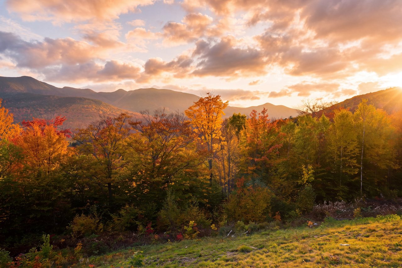
May, after the mud-season closure lifts, through October is the season, and the loop is at its best in early summer mornings and in the first two weeks of October, when the oak and maple slopes turn and the lake below is ringed with color. Summer weekends are busy but never as crowded as Rattlesnake. The ledges are hot and open by midday in July.
Winter is possible for experienced hikers with microspikes and snowshoes; the ladders ice, the slot fills with snow and the boulder cave is out, so the bypasses become the route and the loop turns into a woods walk with two cold summits. Most winter parties do Morgan alone.
Who this hike is for
Anyone who wants a real climb with a sense of play in it: couples who like a scramble, hikers who found Rattlesnake too tame, anyone who has done the notch's big trails and wants something different. It is a fine choice on a day the high peaks are in cloud, because these summits sit under the weather at 2,200 feet.
It is not for anyone who cannot take a bypass gracefully; the whole loop works only if the group agrees at each junction. And it is not the hike for a big pack, which will not fit the slot or the cave.
What to carry
Water for a half day, food for a summit lunch, a layer for the breezy ledges, sun protection, and a small pack that fits through a slot. A headlamp for the cave, even at midday. Boots or grippy shoes for the ledge and the boulder scramble. Poles are a nuisance on the ladders and in the cave; strap them to the pack for those stretches. From October on, microspikes.
Cell service is fair on the ridge. Leave your plan with someone anyway, and consider the $25 hikeSafe card; New Hampshire can bill for a rescue caused by negligence under RSA 206:26-bb.
Safety & conditions
- Climb the ladders, never descend them: do the loop clockwise, up Morgan and down Percival. Descending the ladders and the slot with a drop below you is how people get hurt here.
- The Percival boulder cave is a crawl through the dark with tight squeezes. Carry a headlamp, take packs off and pass them through, save it for a dry day since the rock inside is slick in rain, and take the cliffs bypass if anyone in the group is uneasy in tight spaces.
- Both summits are open ledge with real drops on the lake side. Keep back from the edges, especially when the rock is wet or when the summit is crowded.
- Respect the Squam Lakes Association's mud-season closure, usually in April. The trails are soft then and boots do lasting damage.
- Ticks are common in the oak and grass of this lower, warmer country. Check yourself after the hike; New Hampshire has one of the highest rates of Lyme disease in the nation.
- In winter the ladders and the slot ice over and the cave is out; the bypasses are the route, microspikes are essential, and the ledges are exposed and cold.
- Consider the $25 hikeSafe card; New Hampshire can bill for a rescue caused by negligence under RSA 206:26-bb, and the card waives that cost short of recklessness.
Where to stay for it
The drive is the same one our guests take for West Rattlesnake. From 191 Pollard Road take I-93 South about 25 min to Exit 24 for Ashland and Holderness, follow US Route 3 east into Holderness village at the bridge between the two Squam lakes, and turn onto NH Route 113 north. After about 5.5 miles of lake and woods you reach the Old Bridle Path lot on the right and the Mount Morgan trailhead near it on the left. Allow 40 min.
Because the loop is a half day, it fills the morning of a Lakes Region day. Our guests come down off Percival for a late lunch in Holderness, rent a kayak from the association's dock or take the science center's cruise on Squam in the afternoon, and drive home up the interstate in the evening light. Strong hikers who want both sides of the road add West Rattlesnake as a short sunset walk, though the crowd on those ledges is a shock after the quiet of the Squam Range.
Useful links
- Squam Lakes Association: trails, maps and mud-season closures
The trail maintainers; check here for the April closure before an early-season visit. - Squam Lakes Association: boat rentals
Canoes, kayaks and paddleboards from the Holderness headquarters for the afternoon after the loop. - hikeSafe: the code and the card
The six-point hiker responsibility code and the $25 / $35 voluntary card. - Our West Rattlesnake guide
The easy ledge walk across the road, for the same view in a fraction of the effort. - Our Squam Lake guide
The lake, the science center and Holderness for the rest of the day.
Sources & official info: stavislost.com · squamlakes.org · alltrails.com · peakery.com · laconiadailysun.com · hikesafe.com
— Launchpoint Lodge, From the lodge