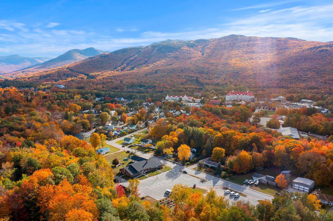
Ask a New Hampshire hiker what they are working on and the answer is often a number: thirty-one, or forty-two, or finished. They mean the 48, the four-thousand-footers, the list of every summit in the state that rises at least 4,000 feet above sea level and at least 200 feet above the ridge connecting it to its neighbor. The Appalachian Mountain Club's Four Thousand Footer Club has kept the list since 1957 and awards a patch and a certificate to anyone who climbs them all on foot. Thousands have. Most take years.
Lincoln is the best base in the state for the project, and not by a little. Of the 48, thirty-two can be reached from a trailhead within about 45 min of the lodge, and eight of those trailheads are inside 15 min. The Franconia Range, the Kinsmans, the Pemigewasset Wilderness peaks, the Hancocks, the Osceolas, the Waterville Valley mountains, the Twin Range, Zealand, the Willey Range and the southern Presidentials all radiate from this valley. Only the northern Presidentials, the Carters, the Wildcats and the far northern peaks need a longer drive.
This guide is the planning companion to our thirty individual summit guides. It explains the list and its rules, groups the reachable peaks by the trailhead they share so you can see which pair or triple make a day, suggests the first peaks for a new peakbagger and the ones to leave for last, notes what the 2026 Lincoln Woods closure does to the Pemigewasset peaks, and covers the winter list and the Grid for people who finish and want more. Every trail figure below comes from our own guides, which were researched and checked one mountain at a time.
The list and its rules
The AMC's White Mountain Four Thousand Footer list dates from 1957 and today holds 48 New Hampshire peaks. Two criteria decide membership: the summit must be at least 4,000 feet above sea level, and it must rise at least 200 feet above the lowest point on the ridge connecting it to any higher neighbor, which is why prominent bumps like Mount Clay and Mount Guyot, both over 4,000 feet, are not on the list. The list has changed twice: Galehead Mountain was added in 1967 after a new survey, and Bondcliff in 1980, which brought the total to 48.
The rule that matters to a hiker is simple. You must reach each summit on foot. The route does not matter, the direction does not matter, a hike from a hut or a campsite counts, and there is no time limit; what does not count is riding the Cog Railway or driving the Auto Road to the top of Mount Washington, or taking a ski lift to Cannon's summit. Finishers send the club a list of peaks and dates and receive a certificate and a patch. The club also recognizes a winter list, for ascents made between the December solstice and the March equinox, and a New England list of 67 peaks, established in 1964, that adds Vermont's five and Maine's fourteen.
One footnote hikers enjoy: Mount Tecumseh, the lowest peak on the list at a listed 4,003 feet, was resurveyed in July 2019 at 3,997 feet. The club kept it. If you stand on top, it counts.
Why Lincoln is the base: 32 peaks inside 45 min
Draw a 45 min driving circle around the lodge and thirty-two of the 48 fall inside it, most of them sharing trailheads so that they come in pairs and triples. Inside 15 min: Lafayette, Lincoln, Liberty, Flume and Cannon in Franconia Notch, and North and South Kinsman on its west side. Inside thirty: Moosilauke, Osceola and East Osceola, Tecumseh, North and Middle Tripyramid, North and South Hancock, Garfield, Galehead and the Twins. Inside forty-five: Carrigain, Bondcliff, Bond and West Bond, Zealand, Hale, Tom, Field and Willey, Jackson, Pierce and Eisenhower, and Owl's Head. Monroe and Washington, from the Cog's base road, are a few minutes past the line.
That geography changes how the project feels. A peakbagger based an hour away spends the best light of the morning on the interstate and arrives to a full lot; from Lincoln you are on the Old Bridle Path at six-thirty and back in town for a late breakfast. It also means a bad forecast on the ridge is not a lost day: there is always a wooded summit or a waterfall under the weather within 20 min.

The Franconia Notch peaks: seven summits, three trailheads
Lafayette and Lincoln are the famous pair, climbed together on the Franconia Ridge Loop from Lafayette Place, about nine miles and 3,900 feet, with Little Haystack thrown in for nothing (it is not on the list; it lacks the 200 feet of rise). Our Franconia Ridge, Lafayette and Lincoln guides cover the loop and its very real weather exposure. Liberty and Flume are the southern pair, usually done together from the Flume hiker lot by the Liberty Spring Trail and the ridge, about ten miles; Flume alone by the Flume Slide Trail is a serious scramble.
Cannon Mountain is climbed on foot from the tramway lot or Lafayette Place by the Kinsman Ridge or Hi-Cannon trails, since the tramway is retired for a multi-year replacement and would not have counted anyway. North and South Kinsman are the long day up the west side of the notch from Lafayette Place by way of Lonesome Lake, about ten miles, with the hut for a lemonade on the way down. Lafayette Place fills by eight on any fine weekend; the state's five-dollar shuttle from the Cannon lot runs weekends from late May to mid-October.
The Pemigewasset Wilderness peaks, and the 2026 Lincoln Woods closure
The Bonds, Owl's Head and Garfield's neighbor Galehead are normally approached from the Lincoln Woods trailhead on the Kancamagus, 9 min from the lodge, along the flat old railroad grade into the wilderness. Not in 2026: the Lincoln Woods Trail is closed from June to November between the highway and the Osseo Trail junction for riverbank repairs, with heavy equipment on the trail and stiff penalties for walking through. Bondcliff, Bond and West Bond become a long day or an overnight from Zealand Road by way of the Zealand Trail, Zeacliff and Guyot; Owl's Head, the list's most remote and least loved summit, is best left for 2027 unless you relish a very long approach from the north. Our Bonds and Owl's Head guides, and the Forest Service alerts page, carry the detours.
The Pemi Loop itself, the thirty-one-mile circuit that collects eight of the 48 in one enormous day or a two-night trip, is also rerouted this season. It is the crown of a Lincoln-based list and the reason many finishers come back.
The Kancamagus and Waterville Valley peaks
North and South Hancock are the pair from the Hancock Notch trailhead at the Kancamagus hairpin, about 25 min up the road: a flat approach, then two steep climbs and a ridge, about ten miles. Osceola and East Osceola are climbed together from Tripoli Road behind Loon, with the notorious chimney between them, or East Osceola alone from the Greeley Ponds trailhead on the Kancamagus. Tecumseh, the shortest of the 48, is a five-mile climb from the Waterville Valley ski area lot and the classic first four-thousand-footer. North and Middle Tripyramid are the Waterville Valley loop by the Livermore Trail and the slides, which are steep, exposed slabs and not for a wet day.
Mount Carrigain, at the head of Sawyer River Road off Route 302, is farther east, about 40 min, and its Signal Ridge Trail and summit tower give the finest single view of the whole list. Our Kancamagus-side guides cover each of these.
The Twin Range, Zealand and the Willey Range
From the Gale River Loop Road off Route 3 in Bethlehem, Garfield is a steady out-and-back of about ten miles, and Galehead, South Twin and North Twin make a long day by the Gale River Trail with the hut for water; North Twin has its own trail from Haystack Road with river crossings that fail in high water. From Zealand Road, Hale is the easiest four-thousand-footer on this side of the state, about 4.6 miles by the Hale Brook Trail, and Zealand Mountain is reached past the hut and Zeacliff. Zealand Road is gated from mid-November to mid-May.
From the Crawford Depot at the top of Crawford Notch, Tom, Field and Willey are the Willey Range, collected in one loop of about ten miles by the Avalon and A-Z trails and the Willey Range Trail, with Avalon's ledges as a bonus. Our Mounts Tom, Field and Willey guide covers the traverse; our Elephant Head and Avalon guide covers the gentler day from the same depot.
The southern Presidentials and Moosilauke
Jackson is a five-mile climb from the Webster-Jackson trailhead beside Saco Lake, and Pierce a six-mile one on the Crawford Path, the oldest continuously used footpath in America; both are gentle by Presidential standards and both have open summits. Eisenhower is usually added to Pierce along the Crawford Path for a ten-mile day above treeline, and the strong add Monroe. Washington itself, from the Ammonoosuc Ravine Trail at the Cog's base road, is the hardest day on this list to do well and the one that most rewards careful planning; our Mount Washington guide is the most safety-minded page on this site for that reason, and it is worth reading in full.
Moosilauke stands alone to the southwest, the westernmost of the 48, 30 min from the lodge by Route 112 over Kinsman Notch. Its Gorge Brook Trail from the Dartmouth ravine lodge is a fine, moderate seven and a half miles to a bald, broad alpine summit, and one of the best first big peaks for anyone who wants to know what treeline feels like.
The far peaks: the ones that need a longer drive
Sixteen of the 48 lie beyond the 45 min circle. The northern Presidentials, Adams, Jefferson and Madison, are climbed from Appalachia on Route 2 in Randolph, about an hour and a quarter away, and are the most serious mountains in the East; Isolation is a long, wet walk from the Rocky Branch trailhead on Route 16; the Carters, the Wildcats and Moriah line the east side of Pinkham Notch and Route 16 near Gorham; Waumbek in Jefferson and Cabot in the Kilkenny range are the quiet northern pair; Passaconaway and Whiteface are the Sandwich Range loop from Ferncroft in Wonalancet, about 50 min south. None of these is a bad day from Lincoln; they are the days that start earliest.
Which peaks to climb first
Start where the trails are kind and the summits forgive mistakes. Tecumseh is the classic first, short and wooded. Hale from Zealand Road is gentle and close. Pierce and Jackson give a first taste of open Presidential rock on moderate trails. Moosilauke by Gorge Brook is the first real alpine summit. Osceola from Tripoli Road is a steady climb with a big view. Cannon by the Kinsman Ridge Trail is steep but short. Garfield is a longer day, rewarded with one of the best summits on the list.
Leave for later: the Franconia Ridge, until you have watched the higher-summits forecast for a week and understand what above-treeline weather does; the Bonds, Carrigain and the Twins, which are long; the Tripyramid slides and the Flume Slide, which are steep rock; Owl's Head, which is a slog with a bushwhack; and Washington, Adams and Jefferson, which are a different sport in any weather that is not perfect. The list rewards patience, and it is not going anywhere.
The winter list and the Grid
Finishers who want more turn to the winter 48, the same peaks climbed between the December solstice and the March equinox, which the club recognizes separately. Winter four-thousand-footers demand snowshoes, traction, real insulation, an alarm clock and a willingness to turn around; the Franconia Ridge and the Presidentials in winter are mountaineering, not hiking. Lincoln is a fine winter base because the Kancamagus and the notch are plowed and several trailheads, including Tecumseh, Cannon and the Franconia Notch lots, are open all year.
Beyond that lies the Grid: every one of the 48 in every calendar month, 576 summits in all, a project measured in years and completed by only a few dozen people. We have hosted a couple of them. They were not in a hurry.
Planning the project from the lodge
Come for three or four nights at a time and stack trailheads by geography: a Franconia Notch day, a Kancamagus day, a Zealand or Crawford day, with a short walk or a waterfall on the fourth morning before the drive home. Read the higher-summits forecast the night before and keep a wooded peak in reserve for the windy days. Carry the annual national forest parking pass, cash for the kiosks, and the hikeSafe card. Keep a log of peaks and dates from the first day; the club asks for it at the end, and it is a pleasure to read back.
Our thirty summit guides are written for this: each carries the route, the trailhead and its parking reality, the elevation and distance, the exposure, and the season-by-season truth. Start with the hikes hub, pick a mountain, and check the dates. The list is a good excuse to come back to the same valley for years, which is how the people who finish it tend to describe it.
Where to stay
The lodge sits at Exit 32, 5 min from the Kancamagus and 10 min from Franconia Notch, which is why peakbaggers keep coming back to it. Our six suites take the early starts in stride: there's coffee in the lounge before first light, check-in is keyless for late arrivals off a long drive, and the back deck is where boots dry and lists get updated in the evening.
We keep the higher-summits forecast, the Forest Service alerts and the parking notes in the digital guidebook every guest receives, and we are glad to talk through a plan for the week. Tell us which peaks you are chasing when you book and we will point you at the trailheads that pair.
Useful links
- AMC Four Thousand Footer Club: the lists and the rules
The official list, the on-foot rule, the winter list and how to apply for the patch. - AMC: a history of the New Hampshire 4,000-footers list
How the list was born in 1957 and why Galehead and Bondcliff were added later. - Mount Washington Observatory higher-summits forecast
Read it every morning of a peakbagging trip; it decides which peak you climb. - White Mountain National Forest: alerts and the Lincoln Woods closure
Closures, seasonal road gates and the detours for the Pemigewasset peaks in 2026. - hikeSafe: the code and the card
The six-point hiker responsibility code and the $25 / $35 voluntary card. - Our hiking guides hub
All thirty summit guides plus the waterfalls and easy walks, each with its trailhead and parking reality. - Our Mount Tecumseh guide
The shortest of the 48 and the usual first peak. - Our Mount Washington guide
The hardest day on the list to do well; read it whole before you go.
Sources & official info: amc4000footer.org · outdoors.org · outdoors.org · mountwashington.org · hikesafe.com
— Launchpoint Lodge, From the lodge