New Hampshire has fifty-eight historic covered bridges standing, each with an official state number and most of them still carrying traffic, and the country around Lincoln holds a good share of them. Two are inside Franconia Notch at the Flume. The Kancamagus crosses the Swift River through one. The Pemigewasset valley south of town has three within 25 min, including a modern replica built to the old design after the original burned. 40 min west, the village of Bath keeps the longest and the oldest bridges in the state within a few miles of each other. And the Saco valley to the east has the honeymoon bridge in Jackson and the pair at Conway.
Most are Paddleford trusses, the design a Littleton builder perfected in the 1840s and the region's signature: a long-panel truss with counterbraces that let a single span cross a wide mountain river. The roofs were never decoration; they kept the rain and snow off the timber deck and trusses so the bridge lasted a century instead of a decade. The ones that survive are the ones somebody kept repairing.
This guide lists every covered bridge a guest can reasonably reach from the lodge, with its year, its length, the river under it and whether cars still cross, then arranges them into four drives: the notch, the Pemi valley, the Kancamagus and the Saco, and the western road to Bath. Foliage season is the obvious time, and the bridges are the reason half the cars on Route 302 stop.
In Franconia Notch: the Flume and Sentinel Pine bridges
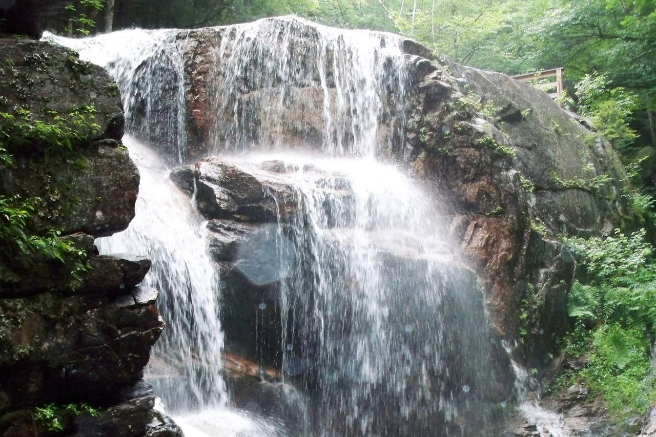
The Flume Covered Bridge crosses the Pemigewasset River at the start of the Flume Gorge walk in Franconia Notch State Park, 12 min from the lodge. It is a 50-foot Paddleford truss, one of the oldest in the state, dated 1886 by the state; it carries the park's service vehicles and the walkers headed into the gorge. A few hundred yards up the loop, the Sentinel Pine Bridge, built in 1939, is a 61-foot footbridge over the Pool, resting on the trunk of the Sentinel Pine, a giant that stood above the Pool until the hurricane of 1938 brought it down; the park used the fallen tree as the bridge's base.
Both bridges are inside the ticketed Flume Gorge attraction, open from May to late October; our Flume Gorge guide has the 2026 dates and prices. They are the only covered bridges on this list you pay to see, and the only ones with a waterfall walk attached.
In and around town: Clark's and the Jack O'Lantern bridge
Clark's Bears, the family attraction on Route 3 in Lincoln, owns a real covered bridge: a 116-foot railroad-era span built in 1904 that the Clark family brought to the property, now crossing the Pemigewasset for the park's steam train. It is on private land inside the attraction and seen from the train or the grounds. 10 min south at Exit 30 in Woodstock, the Jack O'Lantern Resort's 76-foot bridge, built in 1986, carries the resort's golf traffic over the river and is visible from Route 3; it is new, but it is built the old way.
The Pemi valley: Blair, Bump and the Smith Millennium Bridge
South of Lincoln the Pemigewasset valley holds three bridges within 25 min. The Blair Bridge in Campton, built in 1869, is the showpiece: a 293-foot two-span Paddleford truss over the Pemigewasset on Blair Road, east of Route 3 about two miles north of Livermore Falls, still carrying one lane of cars under a long, dim roof. It is the longest covered bridge you can drive through on this list and the most photographed in the valley. A few miles east in Campton Hollow, the Bump Bridge on Bump Road is a 68-foot bridge over the Beebe River, rebuilt in 1972 on the site of an 1877 original, small and quiet. Campton also has the short Turkey Jim's Bridge, dating from 1958, on private land.
Farther south, west of Plymouth off Route 3A on Smith Bridge Road, the Smith Millennium Bridge crosses the Baker River: 171 feet, completed in 2001 to replace the 1850 Smith Bridge that burned in 1993, built as a faithful Paddleford truss to modern load standards and open to traffic. Purists argue about whether a 2001 bridge counts; it looks the part, it works, and the town rebuilt it because it could not imagine the road without one.
On the Kancamagus: the Albany Covered Bridge
The Albany Covered Bridge is the one most of our guests see first, because they drive through it. It crosses the Swift River on Passaconaway Road, the side road off the Kancamagus about six miles west of Conway, a 120-foot Paddleford truss built in 1858 and still carrying one lane of cars at a time. It leads to the Boulder Loop trail, the Covered Bridge campground and the river's swimming rocks, and on a foliage weekend it is the busiest bridge in the mountains. Photograph it from the campground side or the riverbank, not from the road, which has no shoulder. Our Boulder Loop guide covers the hike that starts beside it.
The Saco valley: Jackson, Conway and Bartlett
Continue past the Kancamagus to the Saco valley and there are four more within an hour or so of the lodge. The Honeymoon Covered Bridge in Jackson, 121 feet over the Ellis River at the junction of Routes 16 and 16A, was built in 1876 and is the gateway to the village; it earned its name from the couples who drove through it and still carries cars. In Conway, the Saco River Bridge, a 225-foot two-span crossing from 1890, carries traffic just north of Route 16, and the Swift River Bridge, 129 feet and dating from 1869 or 1870, stands nearby as a pedestrian bridge. West of Conway on Route 302, the Bartlett Bridge of 1851, 167 feet, was bypassed years ago and houses a gift shop.
West to Bath: the longest and the oldest in the state
The best single covered-bridge drive from Lincoln goes west, over Kinsman Notch on Route 112 and down the Wild Ammonoosuc valley to the village of Bath, about 40 min. Bath holds three. The Swiftwater Bridge, 158 feet, built in 1849, crosses the Wild Ammonoosuc on Valley Road just north of Route 112 in the hamlet of Swiftwater, with a swimming hole below it. The Bath Bridge in the village center, on Pettyboro Road west of Route 302, is a four-span 375-foot crossing of the Ammonoosuc built in 1832, the longest covered bridge in New Hampshire, with the Brick Store, a general store trading since the 1790s, at its end. And at Woodsville, on Route 135 a quarter mile north of Route 302, the Bath-Haverhill Bridge of 1829, 256 feet over the Ammonoosuc, is the oldest covered bridge in the state, now closed to vehicles and kept as a footbridge.
Add the Littleton Riverwalk Bridge, a roughly 300-foot pedestrian covered bridge over the Ammonoosuc built in 2004 beside the Schilling brewery in downtown Littleton, and the western loop becomes a full day: out over Kinsman Notch to Bath and Woodsville, north along the river to Littleton for lunch, and home down I-93 through Franconia Notch, with the Flume bridges to finish. Our Littleton guide covers the town.
Two more inside attractions
The Lost River Gorge on Route 112 at Kinsman Notch has a 41-foot covered bridge of its own, the Allen Hollis Bridge, built in 1981 on the boardwalk route through the gorge; it is inside the ticketed attraction, which our Lost River guide covers. Clark's 1904 bridge, above, is the other private one. Neither is historic in the way the town bridges are, but both are real timber bridges under roofs and both are on the way to something.
How to see them: four drives
The notch, half a day: the Flume and Sentinel Pine bridges with the gorge walk, then Clark's from Route 3, then the Jack O'Lantern bridge at Exit 30 on the way home. The Pemi valley, half a day: Blair, then Bump in Campton Hollow, then the Smith Millennium Bridge west of Plymouth, with lunch in Plymouth. The Kancamagus and the Saco, a full day: Albany on the way east, the two Conway bridges, the Bartlett Bridge shop and the Honeymoon Bridge in Jackson, back over Crawford Notch or the Kancamagus. The western road, a full day: Swiftwater, Bath and the Bath-Haverhill Bridge, then Littleton's Riverwalk and lunch, home through Franconia Notch.
Every one of these is at its best in the first two weeks of October, which is also when every one of them has a car stopped on the approach with a photographer standing in the road. Pull fully off, walk back, and let the traffic through the bridge; the one-lane spans work on courtesy.
Why they are covered, and who built them
The roof was never for the traveler. An uncovered timber bridge rots in a decade or two; a covered one, with its trusses and deck kept dry, lasts a century and more, which is why the Bath-Haverhill Bridge is coming up on two hundred years. Most of the bridges here are Paddleford trusses, the design Peter Paddleford of Littleton refined in the 1840s from the older Long truss, adding counterbraces so a single long panel could carry the load; it became the standard for northern New England's mountain rivers, and Littleton's builders put up many of these spans. The state's covered bridges carry official numbers, are listed by the Department of Transportation, and are repaired with public money as historic structures, which is the only reason they are still here to drive through.
Where to stay
The Flume bridges are 12 min up the notch and Clark's is 4 min down Route 3, so the closest pair is an easy addition to any notch morning. The Pemi valley trio is a half day south on I-93; the Albany bridge is the natural stop on any Kancamagus day; and the western road to Bath is the drive we suggest to guests who have done the Kanc and want a quieter foliage loop with the oldest bridges in the state at the end of it.
In October, leave early for any of these. The bridges are one-lane and the roads beside them are narrow, and by mid-morning the approaches are lined with cars. We keep the state's covered-bridge list and a marked map in the digital guidebook for anyone who wants to collect them.
Useful links
- Visit New Hampshire: covered bridges
The state tourism office's roster of the covered bridges and how to find them. - White Mountains covered bridges roster
Every bridge in the region with its length, year and location. - Our Flume Gorge guide
The 2026 season, tickets and the walk past both notch bridges. - Our Boulder Loop Trail guide
The hike that starts beside the Albany Covered Bridge. - Our Kancamagus Highway guide
The drive that carries you to the Albany bridge and on to Conway. - Our Littleton guide
The town at the end of the western bridge loop, with the Riverwalk bridge and lunch.
Sources & official info: visitwhitemountains.com · visitnh.gov · fs.usda.gov · nhstateparks.org
— Launchpoint Lodge, From the lodge