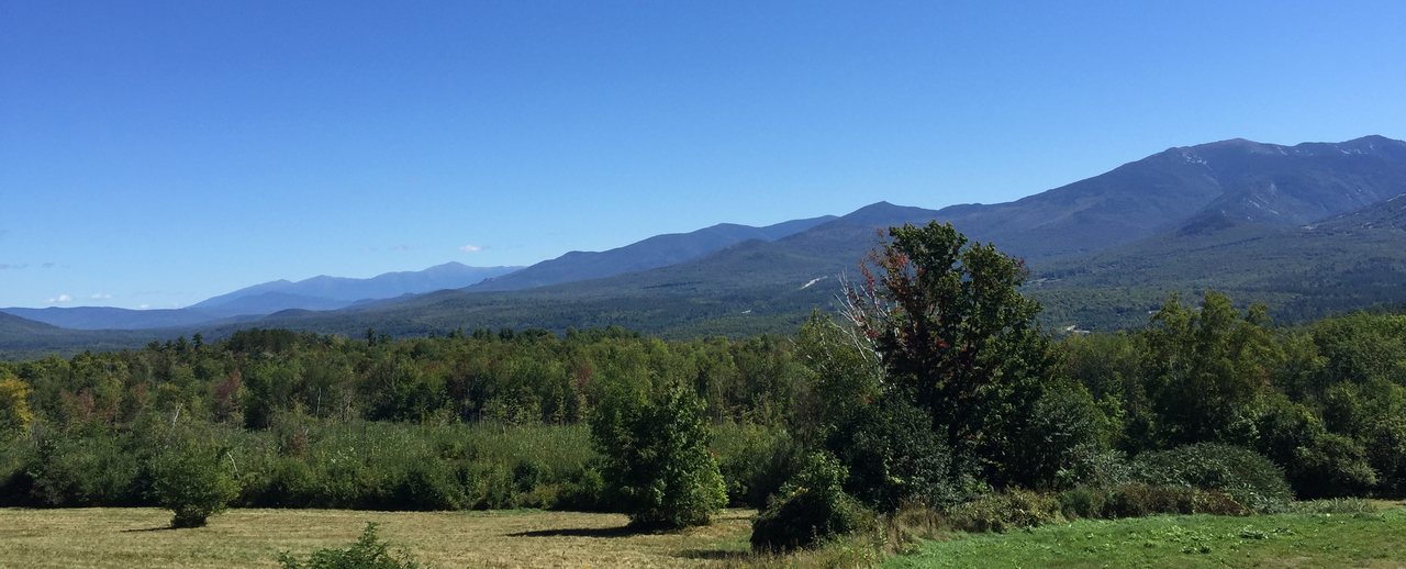
The Tripyramids are a loop people come to for the slides, not for the summits. North Tripyramid and Middle Tripyramid are two of New Hampshire's forty-eight four-thousand-footers, and both true tops are wooded, so if you came for an open summit view you will be a little let down. What you came for, whether you knew it or not, is the North Slide: a broad sheet of bare, water-polished granite slab across the mountain's northwest face, one of the most striking and most demanding pieces of maintained trail in the White Mountains. The standard trip is a loop of about 11 miles with roughly 3,000 feet of climbing out of Waterville Valley, up the North Slide and down the looser South Slide, and it is a hike that hurts more than those numbers make it sound.
The North Slide is the decision that shapes your whole day, so we will be blunt about it up front. It is open slab - smooth, steep rock that you climb on the friction of your boot soles more than on handholds - and it is safe enough to enjoy only when it is bone dry. Wet, iced, or slick with wet leaves, it gives your boots very little to hold, and a slip there does not stop where you fall; it can turn into a long slide down bare rock. The universal rule, in the AMC guide and from everyone who knows the mountain, is that you climb the North Slide and you never descend it. When it is wet, or when you are not comfortable on steep smooth rock, there is a graded footpath alternative - the Scaur Ridge Trail - and taking it is a smart call, not a soft one.
We wrote this to be straighter with you than the app on your phone. Below is the real drive out to the Depot Camp lot, the trap in the long flat approach, exactly what the North Slide asks of you, when to switch to Scaur Ridge, the loose South Slide that wrecks tired knees, and when to turn around. None of it is meant to scare you off - on a dry, settled day, by a fit hiker who starts early, this is one of the best and wildest loops in the Whites. It is meant to get you back to the parking lot in one piece, about 35 min from our door, having done it the way the mountain rewards rather than the way it punishes.
The short version, and who this hike suits
The route is a lollipop loop out of Waterville Valley. From the Depot Camp lot you walk the Livermore Trail, an old logging and carriage road that climbs so gently it barely feels like a mountain, for roughly three and a half miles to the foot of the North Slide. There you turn up the Mount Tripyramid Trail and climb the slide - a steep sheet of open rock - to North Tripyramid. From the wooded top you follow the ridge south to Middle Tripyramid, then drop off the far side down the South Slide, a loose, gravelly cousin of the one you came up. The Mount Tripyramid Trail delivers you back to the Livermore Trail, and you walk the easy miles out. Add it up and it is about 11 miles for the pair, though published segment mileages wander source to source, so treat the pieces as approximate and the 11-mile total as your working figure.
Be clear-eyed about the character of the day. This is not a view walk in the way Franconia Ridge or Mount Chocorua is. Both true summits sit in the trees; Middle Tripyramid has a good outlook ledge a step off the top, and North has only limited glimpses. The real scenery is on the slides themselves - the open North Slide gives a widening view west and north as you climb, out toward the Osceolas and the Sandwich Range and the Pemigewasset country, and the South Slide opens south toward Sandwich Dome and the Waterville valley. So the views come in the middle of the hike, on the steep rock, rather than as a reward at the top. If that sounds backward, it is part of what makes the Tripyramids their own thing.
This suits a fit hiker who is steady and calm on steep ground, and who owns the judgment to read a rock surface and back off if it is wet. It is a poor choice for a first four-thousand-footer, for anyone shaky about heights or exposure, and for a group moving at very different speeds, because the slide is a bad place to be strung out or rushed. Most parties are out here seven to nine hours car to car. The AMC book time for the loop is around seven hours, and almost everyone runs over that once you factor in the slow, careful slab climbing and the tedious loose descent. Come with the day, the legs, and the weather all lined up, or come back another time when they are.
The numbers, and why this loop hurts more than the stats
On paper the loop reads moderate: about 11 miles round trip and roughly 3,000 feet of elevation gain. Do not let that fool you, and here is why. The Livermore Trail approach and exit are close to flat and take up a good seven of those miles between them while barely climbing, which means nearly all of the 3,000 feet is packed into the short, steep middle - the North Slide up and the South Slide down. A GPS watch will often read the gain higher, commonly 3,200 to 3,400 feet, because the ridge between the summits rolls and watches count every little rise. Either way, the climbing is front-loaded into terrain steep enough that you move at a crawl, and that is what blows up people's time estimates.
The North Slide is the single number that tells the story. From the base to the top of the open rock it throws something on the order of 1,200 feet of climbing at you in roughly half a mile of trail - a pitch steep enough that you will often have your hands on the rock in front of you. That is one of the steepest sustained stretches of any maintained trail on the 48, and it is the reason a modest-sounding 11-mile day earns a strenuous rating. When you look at the mileage and think this looks easy, remember that a twentieth of the distance holds close to half the climb.
The summit elevations are worth a word, because you will see two sets of numbers. The Appalachian Mountain Club's four-thousand-footer list, which is the one hikers use, puts North Tripyramid at 4,180 feet and Middle Tripyramid at 4,140 feet. Both clear 4,000 feet comfortably, and North is the higher of the two by about forty feet. South Tripyramid, at roughly 4,100 feet, sits right there on the same ridge but is not counted among the 48, because it does not rise far enough above the ridge that joins it to Middle to qualify as a separate peak.
One more thing about time. The flat Livermore Trail miles that feel like nothing on fresh legs feel much longer walking out on tired ones, and both slides demand slow, deliberate movement - the North for the friction, the South for the loose footing. Budget your energy and daylight for a loop with two very steep, slow sections in the middle, not for a breezy 11-mile walk, and keep a real cushion for the descent, where tired hikers on this mountain get hurt.
Getting there: Waterville Valley and the Depot Camp lot
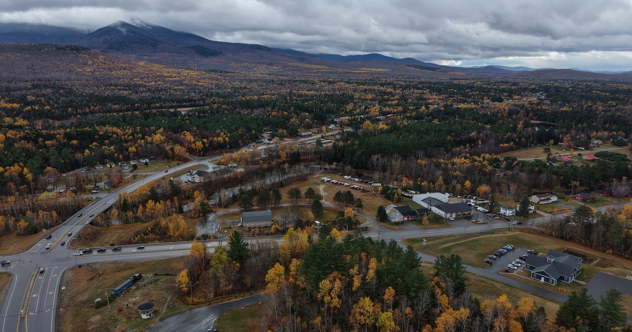
The hike starts at Depot Camp, the trailhead lot for the Livermore Trail at the western edge of Waterville Valley. From the lodge that is about a 35 min drive: down onto Interstate 93, south to Exit 28 for Campton and Waterville Valley, then east on New Hampshire Route 49 for roughly 11 miles up the valley to the town of Waterville Valley, and finally a short run onto Tripoli Road and West Branch Road to the Depot Camp parking area, where the gated old road that is the Livermore Trail begins. There is a good-sized gravel lot here, and it is the same trailhead that feeds a web of hiking and cross-country ski trails, so it can be busy.
Here is a distinction that matters and that trips people up. The short stretch of Tripoli Road you use inside Waterville Valley to reach Depot Camp is paved and maintained year-round - it is plowed in winter because the town's Nordic center grooms the Livermore Trail for skiing. That is a different road from the seasonal, gated gravel section of Tripoli Road farther west, the one that crosses over toward Interstate 93 Exit 31 and closes every winter. The Osceola trailhead sits on that seasonal gated section; Depot Camp does not. So unlike a lot of trailheads around here, you can reach the start of this hike in any season - which does not mean the hike itself is a winter walk, as you will see below.
You need a White Mountain National Forest recreation pass to park at the Livermore Trail trailhead. For 2026 that is about $5 for the day, good the day of purchase, or $30 for an annual pass, $40 for an annual household pass, and the federal America the Beautiful interagency pass at $80 a year covers it too if you already carry one. A self-service pass is usually available at the lot, but it is simpler to buy one ahead in Lincoln, and these lots do get checked. Because Depot Camp also serves the Nordic ski network, parking arrangements there can differ in ski season, so if you are coming in winter confirm the current setup with the White Mountain National Forest and with Waterville Valley, and confirm the current fee, since prices change over time.
The Livermore Trail: the easy miles that set the trap
The Livermore Trail is the easiest walking of your whole day, and that is exactly the trap. It follows the bed of an old logging road up the valley of the Mad River's west branch, wide and smooth and almost level, and on fresh legs in the morning you will cover it fast and feel like you are having a relaxed day out. Enjoy it, but do not spend yourself on it. The mountain has not started yet. Hikers who race the flat miles arrive at the base of the North Slide with less in their legs and less on the clock than they planned, and the slide is not a place you want to meet tired.
It is roughly three and a half miles of this gentle grade to the north end of the Mount Tripyramid Trail, where the North Slide begins. Watch the junction signs rather than trusting your odometer, because the exact tenths on these old roads and connectors vary from map to map. Along the way you pass junctions with the valley's ski and hiking network, and the surroundings are pleasant, quiet second-growth forest with the brook off to the side. There is water down here in the low ground, but there is none up on the ridge or the slides, so this is the country where you would filter and top off if you needed to, not up high.
Note the time when you reach the foot of the slide. That number is the one you will measure your turnaround against later, and it is the moment to eat something, drink, and take a real look up at the rock. If the slab in front of you is wet, dark, seeping, or holding any ice, this is your decision point: switch to the Scaur Ridge Trail, which we cover in a moment, or turn the day around. The flat approach also has to be walked back at the tired end of the day, so respect that these easy miles are easy only once.
The North Slide: the crux, and why you climb it and never descend it
The North Slide is the reason to do this loop and the reason to respect it. It is a bare landslide scar - rock swept clean when the mountainside let go in storms generations ago, well over a century back - and what is left is a broad face of open, water-smoothed granite slab tilted up at a steep angle. You climb it on friction: the grip of your soles pressed against the rock, with occasional edges and cracks for your hands. On the order of 1,200 feet of climbing in about half a mile makes it one of the steepest sustained pitches on any of the 48, and the open exposure means the view behind you falls away and opens up magnificently as you gain height. On a dry day it is a genuine thrill, and thousands of people climb it safely every season.
The thing to watch is water, in any form. Dry, the slab holds your boots well. Wet from rain, morning dew, seepage, or fog, that same rock turns to something close to greased glass, and the smoothness that makes it beautiful is the same thing that takes away your grip. A slip on wet slab does not end where you lose your footing - you slide, and a steep open face has nothing to catch you, so a small misstep can become a serious fall. Wet leaves in fall and any ice in the cold months are just as bad or worse. The slab also dries slowly, so it can be treacherous well into a fine morning after an overnight shower even when the sky is blue.
Two rules come out of that, and they are not optional. First, this is an ascent-only route. You climb the North Slide; you do not descend it. Coming down steep friction slab is far harder and riskier than going up, which is the whole reason the standard loop sends you up the North Slide and down the looser South Slide rather than the other way around. Second, if the slab is anything but dry, do not set foot on it - take the Scaur Ridge Trail instead, or turn around. There is no version of this hike where forcing a wet North Slide is the smart move.
Climb it deliberately when you do climb it. Pick a line, keep three points of contact where it steepens, test your footing before you trust it, and keep your group close together rather than strung out, so nobody is climbing directly below someone who might dislodge a foothold or slip. Take your time and let faster parties pass. Near the top the open rock gives way to a short, steep, wooded pitch up to the North Tripyramid summit sign - a quiet spot in the trees, more a place to catch your breath than to sit and gaze, since the real views were the ones you just climbed through.
The Scaur Ridge Trail: the sane way up when the slab is wet
You are not stuck with the North Slide, and knowing the alternative is part of hiking this mountain well. A little past the North Slide junction, the Livermore Trail meets the Scaur Ridge Trail, a graded, switchbacked footpath that climbs to the ridge crest and joins the Pine Bend Brook Trail, which then runs to the North Tripyramid summit. It is an ordinary steep mountain trail - roots, rocks, dirt, a normal hard climb - with none of the open friction slab. It adds roughly a mile to the round trip compared with the slide, and in return it bypasses the most demanding piece of the day.
This is the route to take, without any sense that you are cheating, in several situations: when the North Slide is wet, iced, or leaf-slick; when the forecast is shaky and you want a safety margin; when anyone in your party is uneasy on steep smooth rock; and in winter, when the slide is effectively an ice climb. Plenty of strong, experienced hikers choose Scaur Ridge on a given day simply because conditions do not favor the slab. You can still make a full loop by going up Scaur Ridge and Pine Bend Brook to North, traversing to Middle, and descending the South Slide - or, if you would rather avoid loose steep rock on both ends, go up and back down Scaur Ridge for an out-and-back over the peaks with no slide at all.
The practical takeaway is to decide at the base, with the rock in front of you, not from your couch the night before. Weather in these mountains changes the surface of the North Slide hour to hour. If you walk up to a dry slab under a settled sky, the slide is a wonderful climb. If you walk up to anything wet or icy, the Scaur Ridge Trail is right there, and it is the reason nobody has to gamble on this mountain.
The ridge, and the South Tripyramid question
Between North and Middle Tripyramid the Mount Tripyramid Trail runs along a wooded crest for a bit under a mile, and after the North Slide it feels like a reprieve. It dips to a shallow col and climbs again, nothing like the pitch you just did, through the kind of quiet, mossy, high-woods forest that is a big part of why people love the Sandwich Range. Middle Tripyramid, the high point of this stretch, has a genuine outlook a couple of steps off the trail - an open ledge with a real view east and south over the Sandwich Range, Sandwich Dome, and the Waterville valley. It is the best sit-down view of the day, so take your break here if the weather allows.
Past Middle, the ridge continues south toward South Tripyramid, and this is where the South Slide peels off to drop you back toward the valley. South Tripyramid itself, at roughly 4,100 feet, is only a short distance farther along the crest, and some hikers step over to tag it. Know two things before you bother. It is a wooded bump with essentially no view, and it is not one of the official 48, so it earns you nothing on the list. If you are a completist who wants to stand on all three named Tripyramid peaks, it is a quick side trip; if you are tired, or the weather is turning, or the clock is tight, let it go without a second thought and start down the South Slide.
Whatever you do at the south end, this is another good place to check your watch and your legs. You have done the hardest climbing, but the loose South Slide descent below you asks for concentration and eats time, and the long flat walk out is still to come. If you are behind where you wanted to be, the fix is to stop lingering and move - not to hurry the descent, which is the one part of the day where rushing gets people hurt.
The South Slide: the loose, knee-punishing way down
The South Slide is the other half of why this loop is famous, and it is a different animal from the North. Where the North Slide is smooth, water-polished slab, the South Slide is loose - gravel, sand, small scree, and shifting rock over steep, open ground. It is the standard descent, and it opens a fine view south as you pick your way down, but it is steep enough and loose enough that it punishes tired knees and rolls ankles, and every year it is where people on this hike take their falls. It is not technical, but it demands your full attention from the top of it to the bottom.
Go down it slow and deliberate. Short steps, poles planted below you, weight kept back over your feet, and a willingness to face into the hill and downclimb the worst bits rather than trusting momentum. The loose surface will slide a little under each step - that is normal, and it is exactly why the loop is built to descend this looser slide rather than the friction slab of the North. Expect the descent to take longer than the distance suggests, and do not let the fact that you are almost off the steep ground make you careless near the bottom, which is precisely where a lapse in focus meets tired legs.
When it is wet, the South Slide is still slick, but the hazard is loose footing and sliding rather than the North Slide's long friction slide, so it is descendable with care in conditions that would make the North Slide a hard no. In ice or old snow it becomes serious again, and traction is essential. At the bottom the Mount Tripyramid Trail eases back into the woods and returns you to the Livermore Trail, where the last flat miles out begin.
Weather, the slabs, and the higher-summits forecast
The Tripyramids do not put you on a bare alpine ridge the way Franconia Ridge or Mount Washington does - the summits and the connecting crest are wooded, and you are not walking a long treeless spine in the wind. But do not file this under sheltered and relax, because the two slides are wide open, and on this hike the weather does its damage on the rock rather than on an exposed summit. Rain, dew, fog, and cold all land directly on the North Slide and turn its friction from grippy to lethal, and both slides are exposed enough to catch wind and, in a thunderstorm, lightning. The condition of the slab is the weather story here.
So even though you are mostly below treeline, check the Mount Washington Observatory's Higher Summits Forecast before you drive out. It is written by the crew on top of Mount Washington for the high country of the Whites, and it is the best quick read on wind, temperature, and whether a front or shower is moving through the region that day - which is precisely what determines whether the North Slide will be dry and climbable or wet and off-limits. Pair it with an ordinary valley forecast for the Waterville Valley and Lincoln area to understand the spread between the trailhead and the tops, and pay special attention to overnight and early-morning rain, since the slab dries slowly and can stay greasy under a clear sky.
In summer the specific thing to beat is the afternoon thunderstorm. You want to be up and over the slabs before the day builds - both because wet rock on those grades is treacherous and because open slide is a terrible place to be caught in lightning. Start early, watch the western sky, and be willing to switch to Scaur Ridge or turn around if the day is going wrong. On these mountains good timing counts for more than effort, and the Tripyramids are at their best on a dry, settled day.
Water crossings and the Sabbaday Brook back door
The standard loop out of Waterville Valley is not a wet-feet nightmare - the Livermore Trail keeps to old road grade and the crossings on the loop are generally modest - but water still deserves a mention, because after heavy rain or during the spring snowmelt from roughly April into May the small brooks along the route and at the feet of the slides run higher and faster than in high summer. A crossing that is a dry rock-hop in August can be a slick, pushy step in a wet spring. The rule everywhere in these mountains applies here too: never cross fast water above your knees, use poles for balance, and if a crossing looks too strong to walk comfortably, turn back - the peaks will keep.
There is a second way onto Middle Tripyramid worth knowing about, if only so you understand what it is and why we are not sending you up it. The Sabbaday Brook Trail climbs from the Kancamagus Highway, near the Sabbaday Falls parking, up the long eastern valley to Middle Tripyramid. It is a beautiful, wild, quiet route, but it is also long, remote, and it crosses Sabbaday Brook many times without bridges. In normal flow those crossings are manageable; after rain or in snowmelt they can turn the trail into a series of serious fords, and the length and isolation make it a poor bail-out and a committing day. For almost everyone, almost always, the Livermore Trail loop from Waterville Valley is the right way to hike the Tripyramids, and the Sabbaday approach is a back door for people who specifically want it and have checked the water.
Check recent weather and recent trip reports before you commit either way. A big rain a day or two earlier can leave brooks running high under a blue sky, and the surface of the North Slide will tell the same story - if the country is wet, plan on Scaur Ridge or another day.
Winter and the shoulder seasons
Because Depot Camp is plowed for the Nordic center, the trailhead is reachable all winter - and that is exactly the thing that gets people into trouble here, because easy access does not mean an easy hike. In winter the North Slide becomes an ice slope, a genuine mountaineering objective that is out of bounds for ordinary hikers without technical tools and the skills to use them. Do not attempt to climb the North Slide in snow and ice as a hiking route. A winter Tripyramid is done by fit, experienced parties who go up the Scaur Ridge Trail and Pine Bend Brook Trail, avoiding the slab entirely, with full winter gear, and who often descend the same way rather than trusting the icy South Slide.
For any cold-season attempt, traction and flotation are not optional. Microspikes are a floor, crampons are commonly needed on the steep ridge trails and are essential anywhere near the slides, and snowshoes are needed to float on and after fresh snow and to avoid postholing and ruining the trail. Days are short, the loop is long, and breaking trail is slow, so start very early, carry and expect to use a headlamp, and keep a hard turnaround time. Confirm winter parking at Depot Camp with the forest and the town, since it doubles as the ski-network trailhead.
The shoulder seasons have their own catches. Spring is snowmelt season, which means higher water, lingering rotten snow and ice in the shaded woods and on the north-facing slide long after the valley is bare, and a slab that may still be wet or icy when the parking lot feels like spring. Late fall brings wet leaves that make the North Slide as slick as rain does, plus early ice and shorter days. In both seasons the slide can be off-limits when the calendar says it should be fine, so plan for Scaur Ridge as your default and treat a dry North Slide as a bonus.
The hikeSafe card and turnaround judgment
Two New Hampshire specifics belong in your pocket on this hike. First, this state can bill hikers for their own rescues: under state law (RSA 206:26-bb), a hiker whom Fish and Game judges to have acted negligently can be charged for the search-and-rescue operation, and a carry-out from the Tripyramid ridge or the base of a slide is a long and costly job. The voluntary hikeSafe card removes that liability short of true recklessness and helps fund the rescue teams directly. For 2026 it is about $25 for an individual or $35 for a family, sold through New Hampshire Fish and Game, valid for the calendar year, and the same price for residents and visitors. Confirm the current price when you buy it, and think of it as cheap insurance the night before any hike in these mountains.
The Tripyramids are a good example of why the card and the law exist: the North Slide is just the kind of terrain where a hurried party pushes onto wet slab, slips, and needs help getting down. The way to never test the law is to hike inside your limits - dry slab or Scaur Ridge, an ascent-only North Slide, a real turnaround time - and to hike so the volunteers never have to come for you at all.
Which brings us to judgment, the most important thing you carry out here. Turning around is free, and the mountain is 35 min from our porch - you can always come back. The decision points on this loop are clear and worth naming out loud before you go: at the base of the North Slide, if the rock is wet or icy, you take Scaur Ridge or you go home; on the slide, if it feels beyond you, you back off carefully while you still can; at Middle Tripyramid, if the weather is building or the clock is against you, you skip South and get moving; and anywhere, if a brook is too high, you do not force it. None of those are failures. The failure is pushing on wet slab or into the dark because you drove all this way.
Do not let your phone be your safety plan, either. Cell coverage is patchy to nonexistent in this country, so download your maps before you leave the driveway, carry a real map and compass or a GPS you know how to use, and leave your route and your expected out-time with someone who will notice if you do not come back. We ask our hiking guests to leave their plan with someone at home, and to update that person if they decide on a shorter day, so nobody raises an alarm over a hiker who simply made a smart call.
A realistic day plan, gear, and who this hike is for
Here is roughly how the day breaks down so you can plan backward from daylight. Figure about 35 min to drive from the lodge to Depot Camp. Give the flat Livermore Trail approach to the base of the North Slide around an hour and a half to two hours at a steady pace. The North Slide up to North Tripyramid is a slow climb - budget an hour or more for that half mile, and add a bit if it is busy and you are waiting for parties ahead. The ridge to Middle is another 45 min to an hour. The South Slide descent and the long flat walk out together run in the neighborhood of two and a half to three and a half hours, more if your knees are cooked. Add breaks and you land in the seven-to-nine-hour range car to car, and longer in winter or high water. Start early - it buys you margin against weather, against the slabs staying wet, and against your own slower-than-expected pace.
For gear, wear sturdy boots with real, unworn tread, because tread is exactly what keeps you on the North Slide's friction and off your backside on the South Slide's gravel. Trekking poles are close to essential on both slides and on the long descent, though you will want to stow them and use your hands on the steepest slab pitches. Carry two to three liters of water in summer, since there is none on the ridge or the slides and the only reliable water is down low on the approach; a small filter lets you top off early if you run short. Bring salty, easy food and eat before you are hungry. Pack a wind-and-rain shell and an insulating layer, a headlamp even on a day hike, a small first-aid kit, and the map and compass already mentioned. In the cold months add traction and snowshoes as conditions demand, and default to the Scaur Ridge Trail.
So who is this hike for? A fit, sure-footed hiker who is calm on steep rock, watches the weather, and wants one of the wildest and most distinctive loops in the White Mountains will have a tremendous day here on dry, settled conditions - it is less crowded than the Franconia and Presidential classics and it has a rough, real character all its own. It is the wrong pick for a first four-thousand-footer, for anyone nervous about heights or exposure, or for any day when the slab is wet. Get the big things right - dry slab or Scaur Ridge, an ascent-only North Slide, a plain turnaround time, and no forced brook crossings - and the Tripyramids give you two real summits, two remarkable slides, and a walk out with your knees and your nerve intact.
Safety & conditions
- The North Slide is the crux hazard and it is only safe dry. It is open, water-polished granite slab climbed on boot friction, roughly 1,200 feet of climbing in about half a mile. Climb it only when it is dry, keep three points of contact where it steepens, keep your party close rather than strung out so nobody is directly below a slip, and never descend it - downclimbing friction slab is how falls happen. Wet, iced, or leaf-slick, do not set foot on it: take the Scaur Ridge Trail instead.
- Weather does its damage on the rock here, not on an open summit. Rain, dew, fog, and cold all land on the slabs and turn the North Slide from grippy to lethal, and the slab dries slowly, so it can stay greasy under a clear sky after an overnight shower. Check the Mount Washington Observatory Higher Summits Forecast plus a Waterville Valley valley forecast before you go, be off the slabs before summer afternoon thunderstorms, and treat any wet or icy slab as an automatic switch to Scaur Ridge or a turnaround.
- The South Slide is a loose, steep descent that hurts tired hikers. Gravel, sand, and shifting rock over open ground make it slip-prone and knee-punishing, and it is where falls happen on the way down. Go slow and deliberate, plant poles below you, keep your weight back, face into the hill on the worst pitches, and hold your focus all the way to the bottom rather than relaxing as the steep ground ends. In ice or old snow it needs traction.
- Have your alternative decided before you start up. Just past the North Slide junction, the Scaur Ridge Trail and Pine Bend Brook Trail reach North Tripyramid on a graded footpath with no slab, adding about a mile. Decide at the base of the slide, with the rock in front of you: dry slab, climb it; anything wet or icy, or any doubt, take Scaur Ridge or go home. That one habit is what turns a bad-conditions day on this mountain into nothing more than a change of route.
- Respect how much the stats undersell the day. About 11 miles and 3,000 feet sounds moderate, but the flat approach hides two very steep, very slow slides, and most parties need 7 to 9 hours. Note your time at the base of the North Slide and set a hard turnaround, start early for dry slab and long daylight, keep energy in reserve for the loose descent and the long flat walk out, and do not let the easy first miles fool you into spending your legs.
- Take water and cold-season conditions seriously. Brooks along the route and at the feet of the slides rise after rain and in spring snowmelt (roughly April into May) - never cross fast water above your knees, and turn back rather than force a crossing. The shaded woods and the north-facing slide can hold ice long after the valley is bare, and late fall wet leaves make the North Slide as slick as rain. Carry two to three liters of water; there is none on the ridge or slides.
- Winter is a mountaineering-grade outing, not a snow walk. Depot Camp is plowed so the trailhead is reachable, which lures people in, but the North Slide is an ice slope out of bounds for ordinary hikers. Go via Scaur Ridge and Pine Bend Brook only, with full winter gear - microspikes or crampons plus snowshoes as conditions demand - a headlamp, an early start, and a firm turnaround time. Confirm winter parking at Depot Camp, and if this is beyond your experience, save the mountain for dry summer conditions.
- Carry the voluntary hikeSafe card, and plan your day so you never need it. Under NH RSA 206:26-bb the state can bill hikers judged negligent for the cost of a search and rescue; the card (about $25 individual or $35 family for 2026, from NH Fish and Game) waives that cost, short of true recklessness, and helps fund the rescue teams. Cell service is patchy to none, so download maps, carry map and compass, and leave your route and out-time with someone who will notice if you do not return.
Where to stay for it
From 191 Pollard Road the Tripyramids are an easy drive, though it runs south on the interstate rather than up the Kancamagus. Get onto Interstate 93 South at Lincoln and take it to Exit 28 for Campton and Waterville Valley, then follow New Hampshire Route 49 east about 11 miles up the valley to the town of Waterville Valley, and from there a short run onto Tripoli Road and West Branch Road brings you to the Depot Camp lot where the Livermore Trail starts. Call it about 23 miles and roughly 35 min. One reassurance and one caution: the access to Depot Camp is paved and plowed year-round for the Nordic ski trails, so there is no seasonal gate to worry about here - but that is a different road from the seasonal gated gravel stretch of Tripoli Road farther west, so do not let a map or a GPS route you over the closed section in the cold months.
Provision before you head up the valley. Lincoln is your best stop - the Price Chopper plaza on South Mountain Road and the shops and gas stations along Main Street will sort you out for sandwiches, extra water, snacks, and a full tank, and it is the easiest place to buy your White Mountain National Forest parking pass so you are not depending on the self-service machine at the lot. There is also a small market in the Waterville Valley town square near the end of Route 49 if you need a last-minute item. Do the real shopping the evening before if you want an early start, which on this hike matters: you want the slabs dry, the daylight long, and a parking spot before the lot fills. Download your maps while you still have a signal, and leave your route and your out-time with someone at home.
Sources & official info: fs.usda.gov · outdoors.org · mountwashington.org · hikesafe.com · 4000footers.com
— Launchpoint Lodge, From the lodge