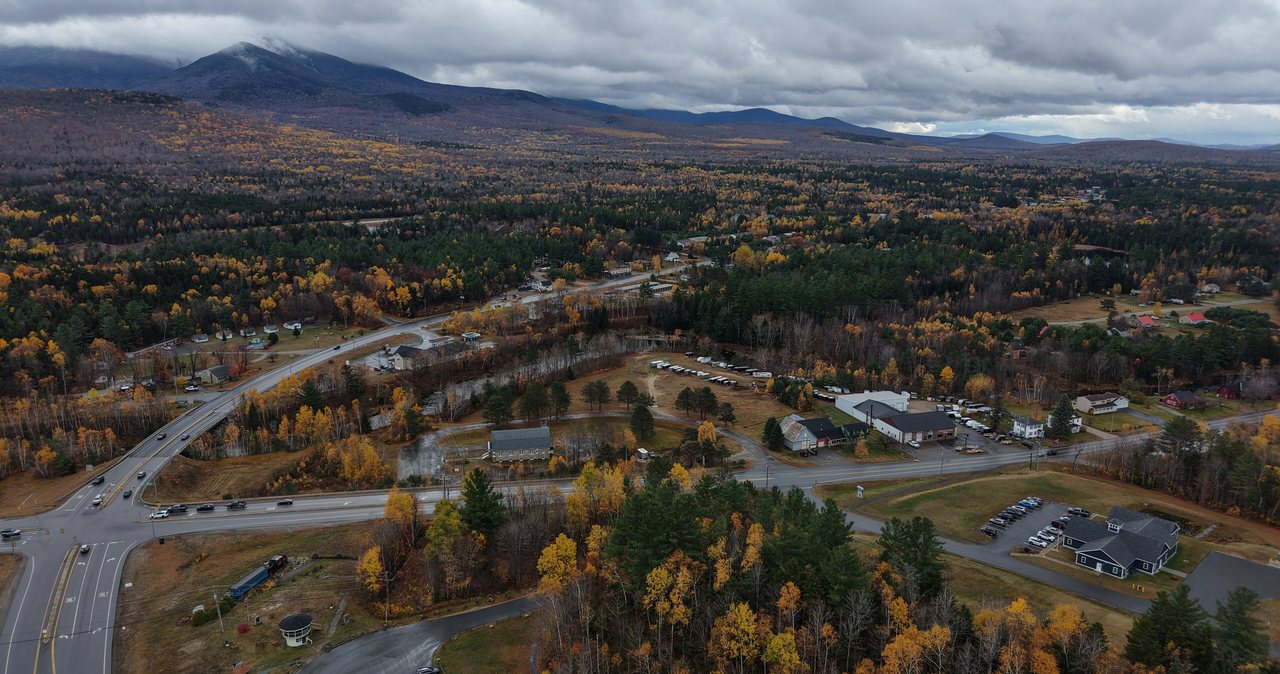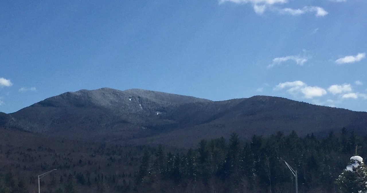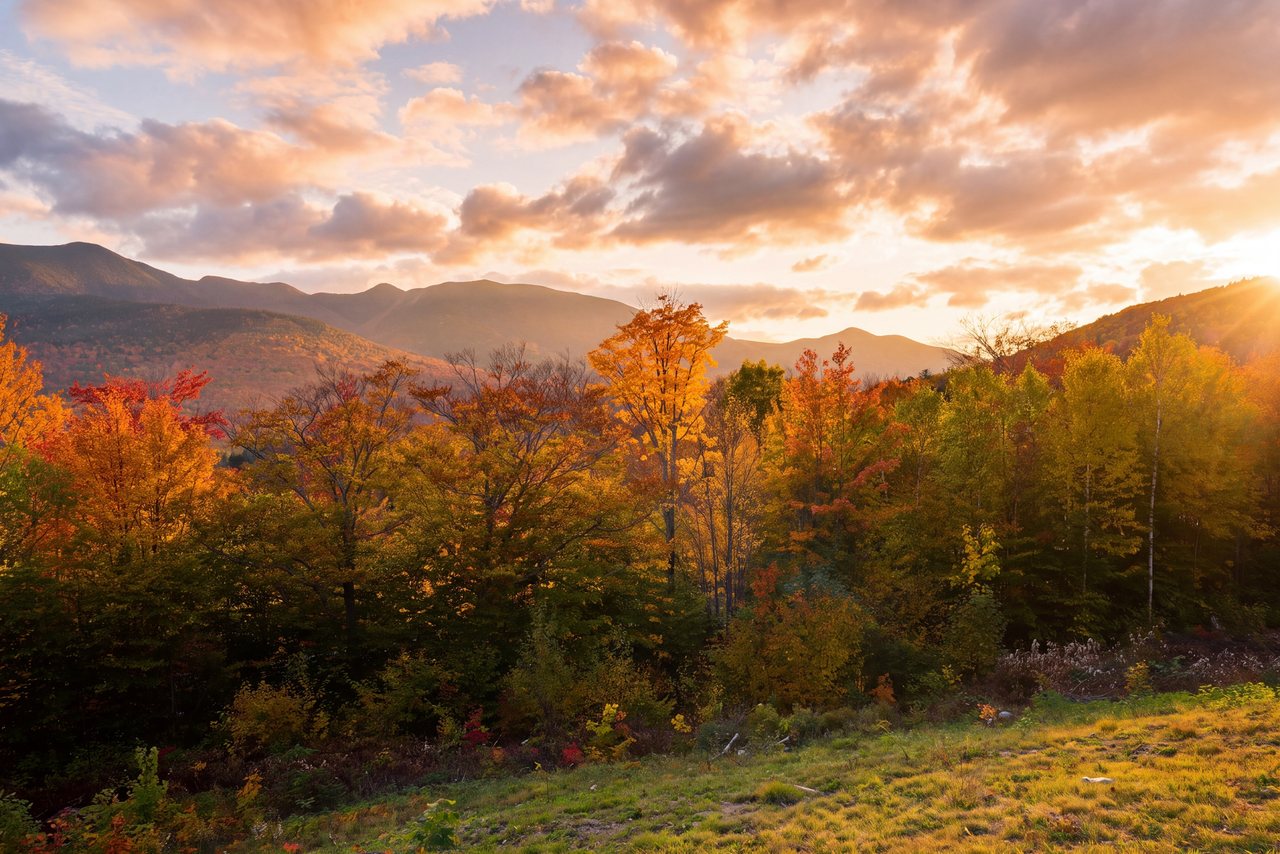
Galehead Mountain is 4,024 feet, and it is one of the quieter names on New Hampshire's list of 48 four-thousand-footers - a wooded hump in the Twin Range that sits between South Twin to the east and Mount Garfield to the west, back in the heart of the Pemigewasset Wilderness. It makes the list by the thinnest margin of almost any peak on it: its prominence, the drop to the col that separates it from higher ground, is just 264 feet, a hair over the 200-foot cutoff the list requires. That geography tells you most of what you need to know before you go. Galehead is not a bold peak with a bald summit and a big view. It is a long walk into remote country to a low rise in the forest, and the reason people make the trip is not the summit at all.
The reason is the hut. Galehead Hut sits at about 3,780 feet in the col just below the summit, and the Appalachian Mountain Club calls it the most remote of its eight high-mountain huts - the one that takes the longest to reach on foot, with no road anywhere near it. On a clear day its front porch is one of the finest seats in the White Mountains, looking straight out over the Pemigewasset Wilderness with Franconia Ridge, Owl's Head, and the Bonds spread across the view. In the full-service season the croo bakes daily, and passing hikers can usually buy something warm out of the kitchen. The summit itself, a half mile past the hut on the Frost Trail, is a flat wooded top with no view - there is one decent outlook along the way, and that is your look at the world up here. We want you to know that before you drive out, not after.
Here is the framing. This is about a 10.2-mile round trip on the Gale River Trail and the Garfield Ridge Trail, in country with spotty cell service and no quick way out, and the two things that shape the day are the North Branch of the Gale River, which you cross low down with no reliable bridge, and the steep pitch at the top of the Gale River Trail that hauls you up to the hut. It is not a technical climb and it is not above treeline for most of its length, but it is long, it is remote, and it asks for a full day and strong legs. We are about 35 min away at the lodge, up through Franconia Notch, and this is the version we would share with a guest before they left.
The case for Galehead
Let us be straight about why people climb Galehead, because it is not the usual reason. Most four-thousand-footers sell themselves on the summit - a view, a bare rocky top, a payoff you can see. Galehead does not have that. The true summit is a flat, wooded, viewless high point in the spruce, and if peak views were all you wanted, this would be a strange choice. People come here for two other things: to check a box on the list of New Hampshire's 48 four-thousand-footers, and to reach Galehead Hut, which is a genuine destination in its own right. If you understand that going in, you will have a good day. If you drive out expecting a grand summit, you will be let down.
Galehead makes the four-thousand-footer list on a technicality, and it is worth knowing why. To count as a separate peak, a summit has to rise at least 200 feet above the ridge connecting it to its nearest higher neighbor. Galehead clears that bar by only 64 feet - its prominence is 264 feet - which makes it one of the least prominent peaks on the whole list. It stands in the shadow of South Twin, which is nearly 900 feet higher right next door. None of that changes the fact that it counts, and for people working through the 48 it is simply a peak that has to be collected, usually on a big day that also grabs South Twin.
The saving grace, and the real reason to make the walk, is that the destination is remote and beautiful even if the summit is not. This is deep-wilderness hiking - you are walking into the middle of the Pemigewasset Wilderness, one of the largest roadless areas in the Northeast, to a hut that the AMC itself calls its most remote. The forest is quiet, the trail sees fewer people than the marquee ridges, and the hut and its porch give you a wilderness panorama that the summit withholds. Think of Galehead as a hike to a place rather than a hike to a peak, and it lands right.
The real destination: Galehead Hut
Galehead Hut sits at about 3,780 feet in the col between Galehead and South Twin, and it is the reason most people are up here. It is one of eight backcountry huts the Appalachian Mountain Club runs across the White Mountains, spaced a day's walk apart along the high country, staffed in season by a young crew - the croo - who pack in supplies on their backs and cook for overnight guests. What sets Galehead apart from its seven siblings is distance: it is the farthest from any road, the one the AMC calls its most remote, which is exactly why reaching it feels like an accomplishment and why you should not treat it as a casual stop.
For 2026 the AMC lists Galehead as full-service from June 4 through October 17. In that window overnight guests get a bunk and two meals - dinner served family-style at six sharp, with fresh bread, soup, salad, a hearty entree, and dessert, and breakfast with eggs, pancakes or a baked good, oatmeal, and a breakfast meat. The hut holds up to 38 people in four bunkrooms, and summer weekends book up well ahead, so a stay is something you plan, not something you wander into. Reservations go through the AMC, and the current way to book is on their website or by phone at (603) 466-2727. The AMC has not listed a self-service season here for 2026, so outside the full-service dates, treat the hut as closed and plan a day hike.
For a day hiker, the hut is a landmark and a small luxury, not a lifeline. In the full-service season the croo bakes daily, and they usually sell fresh baked goods, soup, hot drinks, or lemonade to hikers passing through for a few dollars in cash. It is a lovely thing to walk into on a cool day - but treat it as nice-if-it-happens, not your lunch plan, because it depends on the day, the croo, and what is left in the kitchen. Bring your own food and water regardless. There are composting toilets at the hut and a water source, but the smart move on a remote hike is to carry what you need and count on nothing.
The porch is the payoff the summit does not give you. Galehead Hut faces out over the Pemigewasset Wilderness, and from a seat on the front porch on a clear day you look across a vast basin of unbroken forest toward Franconia Ridge, with Owl's Head sitting low in the middle distance and the Bonds off to the south. It is one of the great sit-down views in the range, and it is a big part of why the long walk is worth it. If the day is socked in, you lose most of it - which is one more reason to save Galehead for clear weather.
The numbers
The standard hike is an out-and-back of about 10.2 miles, and it comes in three pieces. From the trailhead you follow the Gale River Trail for roughly four miles up the valley of the North Branch of the Gale River. It ends at a junction with the Garfield Ridge Trail, which carries the Appalachian Trail across this part of the range, and you turn and follow that for about six tenths of a mile to Galehead Hut. From the hut, the Frost Trail climbs half a mile to the true summit. Add it up and it is about 5.1 miles each way, right around 10.2 miles round trip.
The elevation gain depends a little on how you count it. The trailhead sits low, the hut is at about 3,780 feet, and the summit at 4,024, so the straightforward climb is roughly 2,300 to 2,400 feet. But the Frost Trail dips and rises between the hut and the summit, and you climb back over those bumps on the way out, so the total gain counted over the whole round trip runs closer to 2,500 feet. You will see figures from about 2,350 up toward 2,650 depending on whose track you read and how the ups and downs get counted. For the number your map uses, check the current AMC White Mountain Guide, and treat any single figure as a close approximation rather than gospel.
The summit elevation is the one clean number: 4,024 feet, confirmed the same way across the sources, with a prominence of 264 feet that places Galehead near the bottom of the 48 for prominence. Carry that 4,024 in your head - it is the figure on the signs and the patches, and it is not in dispute.
For timing, plan a full day. Most fit parties are looking at roughly six to eight hours car to car for the 10.2 miles, including breaks, time at the hut, and the short walk out to the summit. Strong hikers move faster; a careful group or a first big remote day runs longer, especially if you add South Twin, which turns a moderate day into a hard one. File Galehead as long and remote rather than steep or technical - the difficulty is the distance, the crossings, and the one steep pitch, not scrambling.
Gale River Loop Road: the access that sets your day
The Gale River Trail starts from a Forest Service trailhead on Gale River Loop Road, a gravel road that leaves US Route 3 in the Bethlehem and Twin Mountain area north of Franconia Notch - the standard directions have you drive a few miles up Route 3 and turn onto Gale River Loop Road, then follow it and the final gravel spur to the trailhead lot. In a normal summer the road is open and any passenger car can reach the lot with a little care over the gravel and washboard. That is the good scenario and the one most people get from late spring through fall.
Winter changes the day. Gale River Loop Road is a seasonal road - it is not maintained or plowed in the cold months, and it is gated - so when the gate is down you park at the plowed end and walk the road to the trailhead before the trail even begins. That adds roughly a mile of road walking each way to an already long hike. The exact winter parking spot and distance can shift from year to year, so confirm the current setup with the White Mountain National Forest before you go rather than guessing at a gate in the cold.
Here is the plain limit of what this page can promise. Seasonal Forest Service roads like this one open in late spring and close in fall on dates that shift with the year and the weather, so no page or trail app can promise the road's status on your exact date. Before you commit, check the current status with the White Mountain National Forest and look at recent trip reports on a conditions feed for the latest firsthand word. If you cannot confirm the road is open and drivable, plan for the longer winter version or pick another peak. Finding out at a locked gate wastes the daylight you needed. If you are staying with us, ask before you leave and we will help you make the call with whatever the current word is.
One piece of good news for 2026: the well-publicized Lincoln Woods closure - the bank-stabilization work that shut the Franconia Falls area and the main Lincoln Woods approach from June into November - does not touch this hike. That closure affects peaks reached from the Lincoln Woods trailhead on the Kancamagus, like Bondcliff and Owl's Head and the Pemi Loop. Galehead by the Gale River Trail comes in from the north, off Route 3, and is unaffected. If you have read about that closure and worried it blocks Galehead, it does not.
The route, mile by mile
The first two-plus miles of the Gale River Trail are the gentlest of the day. The trail follows old logging grades up the valley of the North Branch of the Gale River, climbing so mildly that it feels like a warmup, through hardwoods with the river never far off. It lulls you - people cover this opening stretch fast and feel great doing it. Read the river as you go, though, because this easy lower section is where you cross the North Branch, and those crossings get their own section below for good reason.
The middle of the trail keeps working up the valley at an easy-to-moderate grade, gaining height but without a fight, as the hardwoods give way to spruce and fir. Then, in the last half mile or so before the Garfield Ridge Trail, the character flips. The trail leaves the valley floor and climbs steeply and roughly up onto the ridge - a rocky, rooty pitch that is the real work of the day, gaining a few hundred feet in a hurry after miles of gentle walking. It catches people who spent themselves on the flat opening. Pace the lower trail so you have legs for this pitch.
At the top of that climb, about four miles in, the Gale River Trail ends at the Garfield Ridge Trail, which is the Appalachian Trail here. Turn left, toward the hut, and follow it about six tenths of a mile - it is high, rough, and up-and-down in the way the Garfield Ridge Trail is known for - to Galehead Hut, sitting in the col with its porch and its view. This is where most people stop, rest, and eat, and it is the natural turnaround for anyone who has had enough. But the summit is not here.
To bag the actual peak you take the Frost Trail, which leaves from right by the hut and climbs about half a mile to the wooded summit. Partway along it passes the one real outlook of the trip, a break in the trees with a view out toward Owl's Head, the Bonds, and the wilderness - stop here, because the true summit just ahead has nothing. The high point is a flat spot in the woods with a small sign and no view at all. Tag it, turn around, and retrace the whole route to the car, which means the steep pitch becomes a steep descent and the river crossings come around again - possibly higher than they were in the morning if the day warmed or a storm passed through while you were up top.
The water crossings of the North Branch
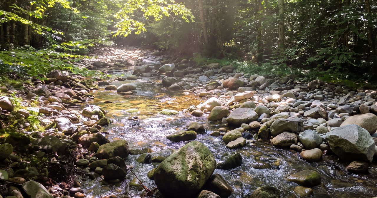
The Gale River Trail crosses the North Branch of the Gale River, and these crossings are the single most important thing to get right on this hike. In normal summer flow they are rock-hops - you pick your way across on stones and clear them without much drama, which is why in dry conditions people barely mention them. That is the version most hikers meet, and if that is your day, note the water level and move on. But do not assume it, because the same crossings behave like a different hazard entirely under different water.
Take a hard look at the bridge situation, because it has a history. Footbridges on this trail have come and gone with the storms over the years - the Gale River Trail has been relocated and re-bridged more than once after floods tore out crossings and eroded the bank, and at times the crossings have been plain fords with no bridge at all. We are not going to tell you exactly what structure is or is not standing on the day you go, because that changes, and the right move is to have you check recent trip reports for the current state of the crossings before you drive out. Plan for a ford, and be pleasantly surprised if there is a bridge.
After heavy rain, during spring snowmelt, or when the high snowpack is letting go, the North Branch runs fast, cold, and higher than you would expect. Moving water at that level is a real hazard - it does not take much depth or current to put you off your feet, and this is frigid mountain water, not a warm wade. Treat the first crossing as a test of the whole day: if you are uneasy getting across dry in the morning, remember it will likely be higher on your tired return after a day of melt or afternoon rain, and the far side is exactly where you will be worn out and tempted to be careless. Getting stranded on the wrong side of a risen river, miles from the car, is one of the classic ways a White Mountain day goes wrong.
So we will say it, because this decision saves people: if the water is high, this is not the day for Galehead, and the peak will be there next month. Do not cross fast water you are unsure of, and never cross where a slip would sweep you into a rapid or a jam of downed wood. Check recent conditions before you leave, and if thunderstorms are in the forecast, plan for the fact that an easy rock-hop at eight in the morning can run too fast to cross safely by four in the afternoon.
The summit, the Frost Trail, and the one outlook
This is the part guidebooks tend to soft-pedal, so we will not: the summit of Galehead is a viewless wooded knob. After 10 miles of walking, the reward at the actual high point is a flat clearing in the spruce and fir with a modest sign and trees in every direction. There is no ledge, no panorama, no rocky perch. If you are a peak-view person, the summit itself will feel like an anticlimax, and it is better to know that at the trailhead than to feel cheated at the top.
The view you do get is one outlook along the Frost Trail, the half-mile spur that runs from the hut to the summit. Somewhere along it the trees open to a genuine look out over the Pemigewasset Wilderness - Owl's Head down in the basin, the Bonds and Bondcliff off across the valley, and the wild green sprawl of the wilderness in between. That outlook, plus the hut porch, is the scenery of this trip. Stop at both, take your time, and do not walk the last stretch to the wooded summit expecting the outlook to get better - it does not, it ends in trees.
The practical upshot is about weather and expectations. Because the reward here is the hut porch and that one outlook rather than a bare summit, Galehead is a hike to save for a clear day, when the porch view and the outlook are there. On a socked-in day you get the walk, the crossings, and a viewless top, with the scenery erased. If your whole plan is the wilderness panorama, watch the forecast and be willing to swap the day. The mountain rewards patience more than persistence here.
Pairing with South Twin: the steep 0.8 mile next door
Almost everyone who bags Galehead does it together with South Twin, and there is a good reason. South Twin's summit is right above the hut, it is open and rocky and above treeline, and it hands you the big 360-degree view that Galehead withholds. On the four-thousand-footer list the two are natural partners, and if you have driven all this way and the weather is good, South Twin is what turns a viewless day into a view day. It is also what turns a moderate hike into a hard one - go in with your eyes open.
The climb from Galehead Hut up to South Twin is short and savage. It runs about eight tenths of a mile on the Twinway, and it is one of the steepest sustained pitches in the White Mountains for its length. The hut sits at about 3,780 feet and South Twin's summit is 4,902, so you gain roughly 1,100 feet in that eight tenths of a mile - straight up a rocky, relentless staircase with almost no let-up. It is a lung-burner on the way up and, candidly, worse on the way down, where the steep loose rock is hard on tired knees and easy to slip on. People underestimate this half mile constantly.
If you do the pair, the usual play is to climb Galehead first from the hut - out to the wooded summit and back on the Frost Trail while your legs are fresh - then grind up South Twin, take in the open summit and its full view of Franconia Ridge, the Bonds, the Presidentials, and the whole Pemi, and come back down to the hut before descending the Gale River Trail. That itinerary pushes the day to roughly 11 to 12 miles with a lot more climbing, and it moves the whole hike from moderate into strenuous. Budget the extra time and the extra food, start earlier, and be realistic: if the crossings, the weather, or your legs are marginal, take Galehead alone and leave South Twin for another trip.
Weather, exposure, and the higher-summits forecast
Most trouble in the White Mountains starts when the weather turns and hikers are dressed for the parking lot. Galehead on its own is mostly a sheltered, wooded hike - the summit is in the trees and you are not exposed the way you are on the big open ridges, which makes it a comparatively forgiving pick when the tops are getting hammered. But that changes the moment you add South Twin, whose summit is open, rocky, and fully above treeline, exposed to whatever wind and weather are moving through. The col and the Garfield Ridge Trail high up are exposed enough to matter too. Do not let the wooded reputation lull you into skipping the forecast.
Before you go, read the Mount Washington Observatory Higher Summits Forecast. It is the go-to read for the White Mountains up high - wind, temperature, cloud, and incoming weather at the elevations you will be standing at - and it is the right tool for deciding whether South Twin's open summit is a good idea on a given day. Pair it with an ordinary valley forecast for the Twin Mountain or Franconia area so you know what you are driving into as well as what you are climbing into. If that higher-summits forecast is calling for high wind, thunderstorms, or freezing levels dropping onto the peaks, that is your answer - do Galehead alone in the trees, or save the day.
Two timing rules earn their keep. First, thunderstorms in the Whites build in the afternoon, and South Twin's open summit is a bad place to be with lightning around - so if you are adding it, get up and over early and do not linger up top if storms are building. Second, this is a 10-mile day, more with South Twin, in remote country with a cold river crossing at the bottom, so start at first light and you will not be making decisions in fading light with tired legs and rising water still ahead of you. Carry a headlamp on every trip regardless; the descent is long and the light goes fast. The forecast is one tool, not a guarantee - be ready to read what the mountain is doing and turn around if it turns on you.
Winter and mud season - a different mountain
In winter Galehead becomes a much bigger undertaking, starting with the road. Gale River Loop Road is gated and unplowed, so you add roughly a mile of road walking each way before you even reach the trailhead, on top of the 10.2 trail miles. The steep pitch up to the Garfield Ridge Trail turns into a real climb on snow and ice, the high traverse to the hut is committing, and if you are adding South Twin, its 0.8-mile pitch becomes a serious winter climb that often wants crampons and an ice axe in the wrong conditions. Note too that the hut is not in full service in winter, so there is no warm kitchen to duck into - you are on your own out there.
There is a quiet winter trap on this particular route: the river crossings. In deep winter the North Branch may be frozen or bridged over with snow, which looks convenient, but snow bridges over moving water can be weak and give way, and thin ice over a cold river is best avoided this far from the car. In early winter and again in the thaw, the crossings may be open, high, and iced along the banks. Treat the crossings in winter with more suspicion, not less, and do not trust a snow bridge you cannot see under.
The other season to respect is spring. Mud season - roughly April into May - is often the worst time to be here. The road may still be gated, the trail is a soft, saturated mess that boots chew up, and the North Branch runs its highest of the year on snowmelt, when its crossings are at their hardest. The Forest Service asks hikers to stay off high-elevation trails during mud season to protect them from erosion, and the crossings alone are reason enough to wait. For most visitors, summer through mid-fall is the sensible window for Galehead - and if you want the hut open and baking, that lines up with the June-to-mid-October full-service season anyway.
Difficulty and turnaround judgment
On paper Galehead alone is moderate - a long, mostly graded walk with one steep pitch and no exposed scrambling. What makes it a real day is distance and remoteness: 10.2 miles, deep in the Pemigewasset Wilderness, with spotty-to-nonexistent cell service and no fast way out if something goes wrong. This is not the hike for your first big day in the Whites. It is a good pick for someone with a few solid mountain days already in their legs who wants a long, quiet walk to a remote place - and it becomes strenuous the moment you add South Twin's climb.
A useful rule for the Whites is to plan on roughly a mile every half hour on the easier grades and slower on the climbs and the crossings - most fit parties are looking at six to eight hours car to car for Galehead alone, and nine to eleven if they add South Twin. Set a turnaround time before you start: pick the hour by which you must be heading down regardless of how close the summit feels, based on your daylight, your fitness, the state of the crossings, and the weather. Then honor it. The summit is optional. Getting back across that river and to the car in one piece is not.
Remember what the hut is and is not. It is a welcome landmark and, in season, a place to buy a hot drink and a baked good, but it sits deep in the backcountry and is not staffed as a rescue station, so carry your own food, water, layers, and navigation. Cell coverage back here is unreliable, so do not plan around calling for help. Be self-sufficient, keep something in reserve for the walk out, and when in doubt, turn around. We would rather you came back for a clear day and got the porch view you drove for than gutted out a viewless slog with a sketchy crossing and called it a win.
What to carry, dogs, hikeSafe, and the rescue law
Carry the ten essentials every time, even in good weather: navigation - a paper map and compass plus a downloaded offline map on your phone, because cell service out here is spotty at best - a headlamp, sun protection, insulation beyond what you are wearing, a first-aid kit, a knife or repair kit, fire-starting means, extra food, extra water or a way to treat it, and emergency shelter. For a 10-plus-mile remote day, lean toward more water and more food than you think you need, two to three liters to start, more in heat, and pack a warm layer even in summer for the hut porch and, if you add it, South Twin's open, windy summit.
Dogs are allowed on the Gale River Trail, as on most White Mountain National Forest trails - there is no forest-wide leash law, but keeping a dog leashed or under tight voice control is the courteous and safe choice, especially at the river crossings and around the hut and other hikers. Think about your dog's stamina on this route, though: 10-plus miles, cold fords with no reliable bridge, a steep rocky pitch, and South Twin's steep, loose descent if you add it. Bring water and food for the dog, watch their paws on the steep rock, and turn around for their sake in high water exactly as you would for your own. One note for our guests, since people ask: the lodge is adults-only and pet-free, so hiking with a dog means other overnight arrangements.
New Hampshire has two things worth keeping in your pocket. The hikeSafe card, sold through New Hampshire Fish and Game, is a voluntary card that generally means you will not be billed for the cost of a search or rescue if you need one, a small, smart purchase for anyone who hikes here regularly. And the reason it matters: New Hampshire can bill a hiker for the cost of a rescue when the person was found negligent, under state law RSA 206:26-bb. The card protects you from the ordinary case, but not from reckless choices like fording a raging river you were warned about or pushing onto South Twin's exposed summit into a lightning forecast. The law and the card point the same way - prepare, check conditions, and turn around when the mountain tells you to.
One low-tech habit does more for your safety than any gadget: tell someone your plan and your expected return time before you leave, and check in when you are down. Leave it with a friend or someone at home - who is going, which trail, if you are adding South Twin, and when to worry, which matters more than usual on a hike this remote. Pack out everything you pack in, stay on the footway, respect the hut and its croo, and leave the wilderness in the shape you would want to find it. If your legs have anything left on the drive home, the Basin, a short flat roadside stop right off the parkway in Franconia Notch, makes an easy coda, and Lonesome Lake - a shorter uphill hike to another AMC hut on a mountain pond - is a fine rest-day plan for the day after.
Safety & conditions
- Treat the North Branch of the Gale River crossings as the crux of the day and a go/no-go. They are easy rock-hops in summer but run fast and cold in high water or snowmelt, and since footbridges here have washed out and been rebuilt more than once, plan to ford. If the water is high in the morning it will likely be higher on your tired return, and getting stranded on the far side is a classic way this hike goes wrong. Never cross fast water you are unsure of, and check recent trip reports before you drive out.
- Read the Mount Washington Observatory Higher Summits Forecast the morning you go, alongside a valley forecast for the Twin Mountain or Franconia area. Galehead itself is mostly sheltered woods, but South Twin's summit is open and fully above treeline - if you are adding it, high wind, thunderstorms, or dropping freezing levels on that forecast are a no. Do Galehead in the trees or save the day.
- Know that the summit is wooded with no view, so the payoff is the hut porch and one outlook on the Frost Trail - both of which vanish in cloud. Save this hike for a clear day, and do not push deeper into bad weather chasing a summit view that is not there anyway.
- Respect the one steep pitch near the top of the Gale River Trail and, if you add it, South Twin's steep 0.8-mile climb of roughly 1,100 feet, where the loose rock is more slippery on the descent, on tired legs, than on the way up. Slow down on the way down and watch your footing.
- Plan for a long, remote day with spotty-to-nonexistent cell service and no quick way out. Set a turnaround time before you start and honor it regardless of how close the summit feels, and start at first light so you are not finishing in the dark on a long descent with a cold crossing still ahead. Carry a headlamp on every trip.
- Do not count on Galehead Hut as a lifeline. It is remote and not staffed as a rescue station; in season it can sell you a snack, and outside June to mid-October it is effectively closed. Carry your own food, at least two to three liters of water or a way to treat it, warm layers, a paper map and compass, and an offline map on your phone.
- In winter, Gale River Loop Road is gated and unplowed, adding about a mile of road walking each way, and the river crossings become their own trap - snow bridges over moving water can be rotten and thin ice can give way. Treat the crossings with more suspicion in winter, not less, and know the hut is not in full service to warm up in.
- Save this one for after spring mud season, roughly April into May, when the North Branch runs its highest of the year on snowmelt and the Forest Service asks hikers to stay off the soft trail to prevent erosion. For most people, summer through mid-fall is the realistic window.
- Consider the hikeSafe card from New Hampshire Fish and Game. It generally spares you rescue costs, though New Hampshire can still bill a negligent hiker under RSA 206:26-bb, so the card pairs best with good calls, like skipping a high-water ford or South Twin in a lightning forecast. Tell someone your route, including any South Twin add-on, and your expected return time before you leave, and check in when you are down.
Where to stay for it
From the lodge at 191 Pollard Road, Galehead is one of our closer big-mountain trailheads - about 35 min. You head north on I-93, the Franconia Notch Parkway, straight through the Notch past Lafayette Place and Cannon, out the north end, and continue to Exit 35 for US Route 3 toward Twin Mountain. A few miles up Route 3 you turn onto Gale River Loop Road, a gravel Forest Service road, and follow it and its final spur to the Gale River Trail lot. The last turns are small and easy to miss, so watch your map, and remember that Gale River Loop Road is gated in winter - when it is, you park at the plowed end and walk the road, which adds about a mile each way to your day.
Gas up and grab food in Lincoln before you leave. There is a supermarket and convenience stores near Exit 32, right by us, and once you are north of the Notch the services thin out fast - do not count on anything at the trailhead, which has none. For a day this long and remote, we would point you toward an early breakfast and a packed lunch rather than counting on the hut, which may or may not have baked goods to spare when you pass through. If you want an easy add-on on the drive back, the Basin is a short, flat roadside stop right off the parkway in Franconia Notch, and Lonesome Lake - a shorter uphill walk to another AMC hut on a mountain pond - is a good lighter day if you want a taste of the hut system without the big miles.
Sources & official info: 4000footers.com · outdoors.org · outdoors.org · mountwashington.org · fs.usda.gov
— Launchpoint Lodge, From the lodge