The Kinsmans are the two high points on the long wooded ridge west of Franconia Notch - North Kinsman at 4,293 feet and South Kinsman at 4,358 feet, the highest ground in the Kinsman Range. The standard way up is a full day: about ten miles round trip from Lafayette Place, roughly 3,600 feet of climbing, on the Lonesome Lake Trail past the Appalachian Mountain Club's Lonesome Lake Hut and up the Fishin' Jimmy Trail - a trail famous, and a little infamous, for the wooden steps and rungs bolted to its steep, wet slabs. It is not the single hardest 4,000-footer day in the Whites, but it is a long one, and Fishin' Jimmy is the kind of trail that hurts tired people on the way down.
Two things make this hike worth a careful guide. The first is that you are really climbing two summits, and they are very different. North Kinsman is a wooded top with one superb open ledge a few steps off the trail - the best view of the day, straight across at the whole Franconia Ridge with Lonesome Lake and Kinsman Pond shining below. South Kinsman is higher, wilder, and far more open: a broad, semi-alpine dome with a true summit cairn set about a hundred yards past the first ledge you reach, easy to walk right past in cloud. Getting the second summit costs you an extra couple of miles and a real re-climb on the way back, and plenty of people sensibly turn around at North.
The second is that this is real White Mountain terrain - part of the Appalachian Trail, with a hut, a backcountry shelter, brook crossings, and genuine consequences if the weather turns or you run out of daylight on the far summit. The trailhead is about 12 min from our door in Lincoln, which is the single biggest advantage you have: you can be in the Lafayette Place lot early, before it fills, and moving while the crowd from Boston is still on the highway. Our Kinsman suite is named for these two peaks. What follows is the plain version of the day.
The numbers, and the two ways to count them
The full hike, both summits, out and back from Lafayette Place, runs about ten miles round trip with roughly 3,550 to 3,650 feet of climbing. Published figures wander a little - some sources read it at 9.8 miles, some at 10.6 - and the spread comes from exactly how you route the short stretch around Lonesome Lake and how your GPS handles the ledges up top. Call it ten miles and 3,600 feet and you will not be far off. Plan on a real seven to nine hours car to car for most hikers, more if you are slow on rough ground or stopping for the views, which you should.
Here is the number that changes your day, though: you can turn this into a shorter hike by stopping at North Kinsman. North is the lower of the two but has the better view, and reaching it is roughly eight and a half to nine miles round trip with something like 2,700 to 2,900 feet of gain - a big day, but a noticeably smaller one than tagging South as well. The last stretch, North Kinsman to South Kinsman and back, adds about 1.6 miles and a genuine re-climb: you drop around 250 feet from North into the col between them and climb back up, then do it again in reverse on the way home. Deciding in advance that North is an acceptable turnaround takes the pressure off the whole day.
The summit elevations are settled and worth carrying in your head: North Kinsman 4,293 feet, South Kinsman 4,358 feet, with 0.8 mile of Kinsman Ridge Trail between them. Both are on the Appalachian Mountain Club Four Thousand Footer list, which is why peak-baggers climb them together - it is the efficient way to collect two of the forty-eight in one trip, and it is a large part of why the trailhead is busy.
Overall, this is a long, strenuous day rather than a technical one, and the effort is spread across distance and one persistently awkward trail rather than packed into a short, steep climb. There is no long knife-edge ridge and no exposed ladder over a cliff. What there is: miles of rough, rooty, rocky footing, a steep middle section on wet wooden steps and slabs that is the crux of the day, and a high open summit on South Kinsman where weather and navigation matter. It is not a beginner's first 4,000-footer. It rewards strong legs, patient footwork, and a practical early start.
The route, trail by trail, from Lafayette Place
You start at the Lafayette Place trailhead on the Franconia Notch Parkway and pick up the Lonesome Lake Trail, which climbs steadily but reasonably for about a mile and a half - gaining roughly a thousand feet on switchbacks and a well-worn, well-graded path - to the eastern shore of Lonesome Lake. This first stretch is the busy part, shared with families and day-walkers heading up just to see the lake, and it is lovely: the lake sits in a shallow basin with the Franconia Ridge standing up behind it. Our separate guide to Lonesome Lake covers this lower section and the lake itself in full, so treat that as the companion piece to this one.
At the lake you follow the shoreline trails around toward the southwest corner, a short level walk of under half a mile on the Cascade Brook Trail and the loop path around the water, to the Appalachian Mountain Club's Lonesome Lake Hut. The junctions here are well signed; you are aiming for the hut and for the start of the Fishin' Jimmy Trail, which leaves from right beside it. This is the natural place to top off water, eat something, and make a real decision about the weather and the time before you commit to the real climb, because everything above the hut is harder and slower than everything below it.
From the hut the Fishin' Jimmy Trail climbs about two miles to Kinsman Junction, and this is the working heart of the hike - rough, rooty, and steep, with the notorious wooden steps and rungs on wet slabs that get their own section below. Fishin' Jimmy is part of the Appalachian Trail here, blazed white, and it does the bulk of the day's remaining climbing in a hurry. At Kinsman Junction, near Kinsman Pond and its shelter, you meet the Kinsman Ridge Trail.
Turn south (left) on the Kinsman Ridge Trail and it is about 0.4 mile of climbing to the wooded summit of North Kinsman and its open ledge. To continue to South Kinsman, stay on the Kinsman Ridge Trail as it drops into the col and climbs the broad dome of South - another 0.8 mile, with the descent-then-climb that makes the round trip between the two peaks feel longer than the mileage suggests. Then you reverse the entire thing: South to North, back down Fishin' Jimmy, around the lake, and down the Lonesome Lake Trail to the car. The descent of Fishin' Jimmy is the part to respect, and we come back to it.
Fishin' Jimmy: the wooden steps, the wet slabs, and the name
The Fishin' Jimmy Trail is the reason people remember this hike, for better and worse. It runs about two miles from Lonesome Lake Hut up to Kinsman Junction, and it is rough, rooty, and steep, with the last stretch below the ridge climbing hard. Its signature feature is a series of wooden steps and rungs - short ladders and boards bolted and pinned to the rock - built to get you up otherwise slick, steep granite slabs. On the ground this means long passages where you are stepping up on wet wood and wet rock, using your hands, and picking your feet up over roots and stone the whole way.
The problem is water. The trail is sheltered under dense trees and gets little sun, so it holds moisture and is wet far more often than it is dry - the wooden steps are frequently slick with damp and moss even on a fair day, and downright greasy after rain or in the dew of early morning. Going up, this is tiring but manageable. Coming down is where it bites: descending wet, angled wood and slab with tired legs is exactly the situation that produces the slips, the bruised tailbones, and the turned ankles that make up most of this hike's minor injuries. Trekking poles help. So does slowing down, facing in and downclimbing the steepest wooden bits like a ladder rather than walking down them, and accepting that the descent will be slow.
None of this puts Fishin' Jimmy out of reach in dry summer conditions for a fit hiker who takes it carefully - thousands of people climb it every season. It makes it slow, and it makes it treacherous in the wet, in frost, and above all in ice, when the wooden steps become the crux that decides if you should be on this trail at all. If heavy rain is in the forecast or the temperature is near freezing, this is the specific reason to pick a different mountain that day.
The name is one of the pleasant bits of White Mountain history. The trail was cut in 1929 and 1930 and takes its name from Fishin' Jimmy Brook, and from Fishin' Jimmy himself - the title character of a short, once-widely-read 1889 story by Annie Trumbull Slosson, set in the Franconia area, about a gentle old backwoods fisherman. Local lore has long tied the character to a real Franconia fisherman, and you will see that claim repeated, but the solid, documented thread is the Slosson story and the brook. It is a good thing to know as you haul yourself up the steps named for a fictional angler who, as far as anyone can tell, never climbed them.
Lonesome Lake Hut: your water stop and your decision point
The Appalachian Mountain Club's Lonesome Lake Hut sits on the southwest shore of the lake, roughly a third of the way up your climb, and for a Kinsman day hiker it plays two roles: it is your reliable water stop and it is the natural place to make your go or no-go call. The hut has water available on site, and stopping to fill up here matters, because above the hut the reliable water thins out fast. Our fuller write-up of Lonesome Lake and the hut lives in the Lonesome Lake guide; the short version for this hike is that it is a real building with a crew, not a shelter, and it is a comfortable place to regroup.
In 2026 the hut runs full-service with a resident crew serving breakfast and dinner from roughly early June to mid-October, and shifts to a caretaker and self-service mode for much of the rest of the year - the exact dates move a little year to year, so check the current schedule with the AMC before you count on meals or an overnight. Overnight stays require a reservation made in advance; you cannot simply show up expecting a bunk. For a day hiker none of that is required - you can stop, rest, refill water, use the composting privy, and buy a snack or a bowl of soup during the staffed season - but it is worth knowing what is and is not open when you pass through.
Use the hut as a decision point on purpose. This is the last easy place to bail with a short, gentle walk back to the car. If the weather is turning, if someone in your group is already tired, if you are behind your planned time, or if you looked at the higher-summits forecast that morning and did not love it, the hut is where you decide whether to commit to Fishin' Jimmy and the summits or to enjoy the lake and turn around. Above here, bailing is a long, rough retreat rather than a quick one.
One practical note: the hut and lake area are a destination in their own right and draw a crowd, so it can be surprisingly social down here even when the summits above are empty. Do not let the busy, easy feel of the lakeshore fool you into underestimating what is above it. The character of the day changes completely the moment you start up Fishin' Jimmy.
North Kinsman: the ledge and the best view of the day
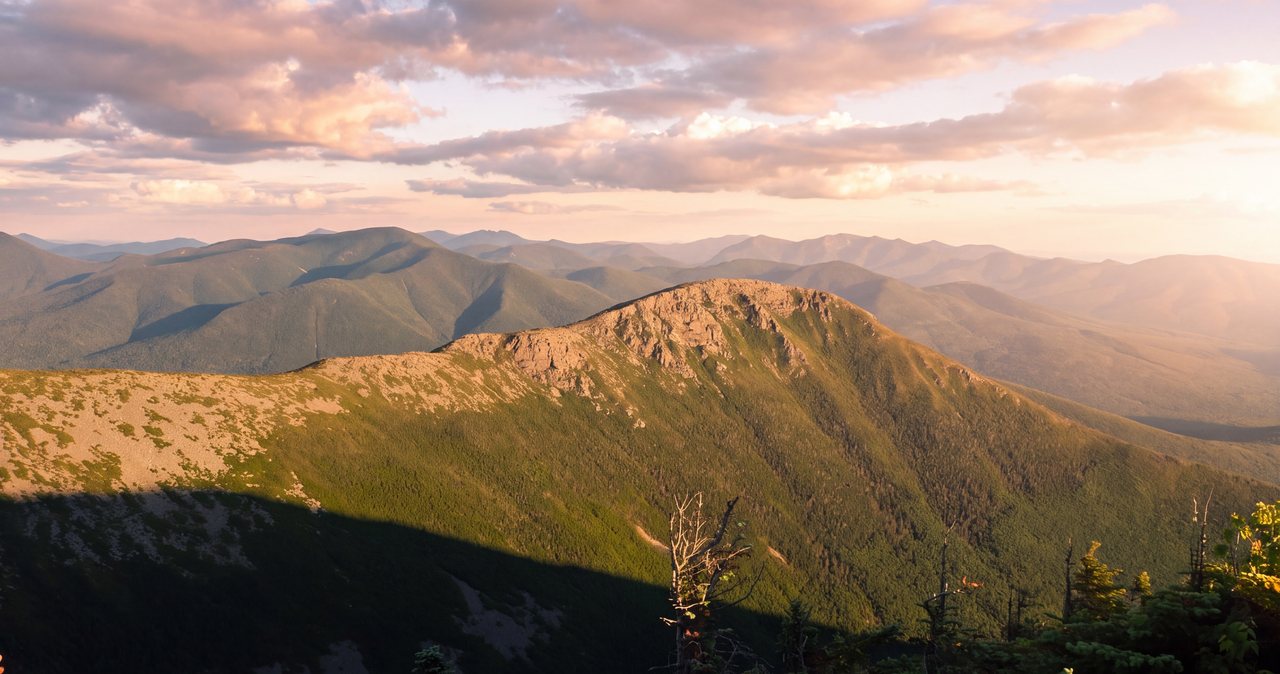
From Kinsman Junction it is a short 0.4-mile climb south on the Kinsman Ridge Trail to the summit of North Kinsman, and the summit itself is a bit of a trick: the true high point at 4,293 feet is in the trees, with no view. The payoff is a few steps away. Just off the trail, an open ledge - a broad tilted outcrop - opens up one of the finest close-range views in the Franconia region, a roughly 180-degree sweep east and northeast across the notch. You are looking straight at the wall of the Franconia Ridge, Lafayette and Lincoln and the summits down to Liberty and Flume, with Cannon Mountain off to the north and, directly below you, the dark little tarn of Kinsman Pond and the shine of Lonesome Lake beyond it.
That ledge is the reason many people rate North Kinsman's view above South Kinsman's, even though South is the taller peak. It frames the Franconia Ridge better than almost anywhere, and it is a natural spot to sit, eat, and decide if you have the legs and the daylight for South. Mind your footing at the edge - it is an open, tilted slab, not a fenced overlook, and it can be slick when wet - but there is no cliff-scramble required to get the view. You take it from solid, obvious ground.
For a lot of hikers, squarely, North Kinsman is a complete and satisfying day, and there is no shame in making it the turnaround. You have climbed a 4,000-footer, you have the best view on the ridge, and you have saved yourself the extra 1.6 miles and the re-climb that South demands. If you are moving slowly, if the wooden steps chewed up more time than you expected, or if the weather is building, take the view from North and start down. The mountain will still be here.
If you are going on to South, this is where you commit. Note the time, look hard at the sky, and make sure everyone in the group is up for another out-and-back with a real climb in the middle of it. From the North Kinsman ledge, South looks close. It is farther and more work than it looks.
South Kinsman: the higher, wilder top, and whether to go for it
South Kinsman is the taller of the two at 4,358 feet - the highest point in the Kinsman Range - and it feels like a different, wilder mountain than its neighbor. The 0.8 mile from North drops you into a wooded col and then climbs onto a broad, semi-open summit dome, higher and more exposed than anything else on the route, with stretches of low scrub and open ledge that give a real sense of standing on top of something. On a clear day the views are wide and all-around, out over the Pemigewasset Wilderness to the east and off toward Vermont in the west, a more expansive if less dramatic outlook than North's framed view of the ridge.
The summit has a quirk worth knowing before you are up there in the weather. As you come up onto the top, you reach an open ledge that looks and feels like the summit - but the true high point, marked by a cairn, sits about a hundred yards farther along the trail. In good visibility this is a non-issue; you just keep walking to the cairn. In cloud or fog it is a genuine navigation problem: people stop at the first opening thinking they have summited, and people also lose the trail on the open, cairned dome where the treadway is faint. If you care about standing on the high point, look for the cairn beyond the first ledge, and if the top is socked in, move carefully from cairn to cairn and keep track of the way you came.
Going for South is a real commitment, not a victory lap. It adds roughly 1.6 miles round trip and, more to the point, a climb out of the col in each direction, so it lands squarely at the tired, far end of your day. Budget an extra hour and a half to two hours for the North-to-South-and-back leg, and add that to the time you will still need to descend Fishin' Jimmy carefully. The real rule is to set a turnaround time at North Kinsman: if you are not standing on North with comfortable daylight and good weather in hand, South is the piece to skip.
For all that, on a clear day with time in the bank, South Kinsman is a fine summit and the natural completion of the pair - the higher top, the bigger sky, and the reason people climb the two together. Just make the decision with your eyes open, at North, rather than drifting onto it and finding yourself a long way from the car with the light going and wet wood still to climb down.
Kinsman Pond, the shelter, and the loop-back temptation
Just below the ridge near Kinsman Junction sits Kinsman Pond, a small, dark, high tarn at about 3,750 feet, and on its north shore is the Kinsman Pond Shelter and tentsite, a backcountry campsite in the White Mountain National Forest. It is an Adirondack-style lean-to that sleeps around a dozen, with a group tent platform and a few single platforms, a composting privy, and a metal bear box for food. There is a seasonal caretaker in the busy months and a fee - reported at about 15 dollars per person per night for 2026, collected year-round with a self-service box when no caretaker is present. Confirm the current fee and status with the Forest Service or AMC if you plan to stay; for a day hiker it is simply a landmark and, in a pinch, an emergency shelter.
The pond is a worthwhile few-minute detour and a good spot to filter water on a long day, though like all backcountry water it should be treated. It also marks the junction where a tempting idea presents itself: instead of retracing Fishin' Jimmy, you can descend on the Kinsman Pond Trail to make a loop. Resist that temptation unless you know what you are getting into.
The Kinsman Pond Trail is notoriously rough - a rocky, root-choked, often flooded descent that crosses and follows brooks for much of its length and is, by wide agreement, slower and more punishing than the Fishin' Jimmy it would replace. It is frequently wet to the point of being a streambed, and after heavy rain or in snowmelt its crossings can be a real nuisance. Making the loop turns an already-long day into a longer, harder one, and it is not the scenic upgrade the word loop suggests. For nearly everyone, the smart, faster, safer descent is back down Fishin' Jimmy the way you came up, wet steps and all.
If you are a strong, experienced hiker specifically wanting the loop and the different scenery of the pond and Cascade Brook, do it with eyes open, plenty of daylight, and the expectation of a slow, rough descent. Otherwise, tag the pond as a side trip and go back the way you came.
The Easton alternative: the Mount Kinsman Trail and Bald Peak
There is a second, much quieter way at these peaks that most guidebooks bury, and it is worth knowing about: the Mount Kinsman Trail, which climbs the range from the Easton side on Route 116, west of the notch. It is a blue-blazed, older, gentler-graded path that climbs through woods and past a couple of small cascades to meet the Kinsman Ridge Trail up near North Kinsman, close to four miles of climbing to reach the ridge. It trades away Lonesome Lake, the hut, and the Fishin' Jimmy steps for solitude and a steadier grade - you will see a fraction of the people - but it is a longer haul to reach the summits and it does not tidily string the two peaks and a lake together the way the Lafayette Place route does.
The bonus on this side is Bald Peak, a small open granite dome reached by a short, roughly 0.2-mile yellow-blazed spur off the Mount Kinsman Trail at about the 2.1-mile mark. Bald Peak tops out around 2,470 feet and gives an easy, open view for modest effort, and it makes a fine short hike in its own right if you do not want the full Kinsman day - a good bad-weather or half-day option when the high summits are socked in.
There is a real catch here to flag candidly, because it changed recently. The Easton trailhead was relocated in 2025 back to a spot near the Franconia and Easton town line on Route 116, and the landowner built a new parking area that now charges a fee - reported in 2025 at about 10 dollars for New Hampshire residents and 20 dollars for out-of-state hikers, with a discount for veterans and a season pass available. This is a private arrangement, not a Forest Service lot, and private arrangements change; confirm the current location, fee, and access before you drive out there, and do not park where you are not clearly permitted. Do not assume the old roadside spot still works.
Who should take the Easton side? Someone who has already done the Lafayette Place route and wants a quieter repeat, someone chasing solitude, or someone who wants Bald Peak as a shorter objective. For a first trip up the Kinsmans, the Lonesome Lake and Fishin' Jimmy route from Lafayette Place is the classic and the better introduction - more varied, more scenic, and closer to us - which is why it is the main event of this guide.
Parking, fees, and the Lafayette Place reality
The good news on the primary route is that parking is free. The Lafayette Place trailhead sits on Franconia Notch State Park land, so there is no day-use parking fee and no White Mountain National Forest recreation pass required to leave a car - the same deal as the Flume and the other notch trailheads, and different from the Forest Service lots out on the Kancamagus, where a pass is needed. For reference, that Forest Service pass runs about 5 dollars a day, 30 dollars for an annual pass or 40 dollars for a household, or 80 dollars for the America the Beautiful pass, but you do not need it here.
What matters here is space and timing. Lafayette Place is one of the busiest trailheads in the state - it serves Lonesome Lake and the Kinsmans on the west side and the enormously popular Falling Waters and Old Bridle Path routes up Franconia Ridge on the east side - and the lots fill early, often by seven in the morning on a fair-weather summer or foliage weekend. The Lonesome Lake Trail begins on the west side of the parkway by the campground; there is a hikers' lot on the east side as well, and a pedestrian underpass links the two beneath the road. When the lots are full, they are full.
This is where being 15 min away in Lincoln pays off in a way visitors from farther out cannot match. You can leave our driveway before dawn and be parked and moving while the highway crowd is still an hour south. Midweek and outside the foliage rush the pressure comes off and you will usually find a spot at a civilized hour, but on any fair weekend, treat an early start as mandatory - it is as much about the parking as the weather.
Do not solve a full lot by parking on the Franconia Notch Parkway shoulder. The Parkway is a fast, narrow, two-lane road with poor sightlines, roadside parking through the notch is prohibited and enforced by ticket and tow, and a car half on the pavement is a genuine hazard there. If both Lafayette Place lots are full, have a real backup - a different trailhead, the Easton side, or another day - rather than an illegal park.
Weather, exposure, and the higher-summits forecast
The forecast that matters for any high peak in this area is the Mount Washington Observatory Higher Summits Forecast at mountwashington.org, written by meteorologists who live in this weather and issued twice a day. It speaks for the exposed tops in the terms that decide your day - summit temperature, sustained wind and gusts, and whether the peaks will be in cloud - and it is far more candid for a summit like South Kinsman than the valley forecast for Lincoln, which describes conditions thousands of feet lower and much calmer. Read it the night before to choose your day, and again in the morning to confirm it.
Be clear-eyed about the kind of exposure the Kinsmans have, because it is different from their famous neighbors. This is not a long above-treeline traverse like the Franconia Ridge, where you are committed to a mile or more of open crest with nowhere to hide. The Kinsmans are mostly a wooded, sheltered climb, and the real open ground is concentrated in two places: the ledge on North and, more seriously, the broad open summit dome of South Kinsman. That is good news for a marginal-weather day - you spend most of the hike under trees - but South Kinsman's top is exposed enough to catch real wind and weather, and it is the highest, most committing point of your day, at the far end of it.
So the exposure rules apply, focused on South and on the far end of the hike. Thunderstorms are the hard no: the open dome of South Kinsman is bare high ground and a lightning target, so on a day with afternoon storms forecast, be up and turning around early, and treat the first distant rumble as the immediate end of your push for the far summit. Wind that staggers you when you step out of the scrub on South is a reason to skip the cairn and get back into the trees. Cloud costs you the view and, on South's faint summit paths, makes navigation harder - a fair reason to make North your turnaround on a socked-in day.
The pattern to internalize is simple: you climb sheltered, you are most exposed and most committed at the highest and farthest point, and the safe move when the top is throwing weather is to bank North Kinsman and go down rather than chase South. There is no ranger, no lift, and no shelter beyond the distant Kinsman Pond lean-to up there - just you, your gear, and your judgment.
Water, brook crossings, and the wet-rock reality
Plan this as a carry-your-water climb with one reliable refill. Fill up at the car and top off again at Lonesome Lake Hut, which is your best dependable water on the route. Above the hut, water thins out - there are brooks low on Fishin' Jimmy and the option of Kinsman Pond near the top, but you should treat anything you draw from them and you should not plan your day around finding water high on the mountain. Two to three liters per person from the car in summer is a sensible minimum, more on a hot day, because the climb is long and sweaty and dehydration sneaks up on the way up.
Brook crossings on this route are usually straightforward but deserve respect after weather. The Lonesome Lake and Cascade Brook drainages and the small streams on Fishin' Jimmy are simple rock-hops in normal conditions, but heavy rain or spring snowmelt can turn an easy step into a real crossing, and the Kinsman Pond Trail - the loop-back option - is notorious for flooded, streambed-like sections and multiple crossings that get awkward when the water is up. The rule is the standard one: never force a crossing that looks too fast or too deep, take the extra minutes to find a safer spot upstream or down, and if the water has turned a normally trivial brook into a problem, that is information about turning around.
The wet-rock reality is the through-line of the whole day, and it is worth saying once more. Fishin' Jimmy's wooden steps and slabs are wet far more often than dry, roots and rock are slick in the morning dew and after any rain, and the open ledges on both summits get greasy in the wet. This is not a reason to avoid the mountain in summer; it is a reason to bring trekking poles, to check the recent weather and the day's forecast, and above all to plan a slow, deliberate descent. Most of what goes wrong on the Kinsmans is a slip on wet wood or rock, going down, on tired legs. Everything you can do to slow that descent down is worth doing.
Winter and the shoulder seasons
The Kinsmans are a serious winter and shoulder-season undertaking, and the two things that make them a moderate summer hike - Fishin' Jimmy's wooden steps and South Kinsman's open dome - are exactly what make them hard in the cold. Iced-over, the bolted steps and steep slabs of Fishin' Jimmy go from awkward to hazardous, and this becomes traction terrain where microspikes are the minimum and, on hard days, full crampons and an ice axe with the skills to use them are the right call. South Kinsman's exposed top gets true alpine treatment - hard wind, rime ice, and cold that the valley gives no hint of - and the faint summit paths that are a navigation puzzle in summer fog become far worse under snow.
Snow also lengthens everything. The Kinsman Pond Trail, already the rough option, can sit under deep, unbroken snow well into spring, and even the main route breaks trail slow when it is fresh. Short winter daylight turns a ten-mile day with 3,600 feet of climbing into a race against dark that many parties lose; a pre-dawn start and a hard turnaround time are not optional. Snowshoes are often needed as well as traction, and the whole day asks for real winter layering, wind protection, goggles, and the experience to manage all of it. This is not a beginner's winter hike, and it is not a casual one.
The shoulder seasons are their own specific trap. In April and May the trailhead can look like spring while Fishin' Jimmy's sheltered, shaded pitch is still glazed with ice and the col and South's dome hold rotten, postholing snow. In late fall a mild parking lot can sit under a rimed, frozen summit. As a default, carry traction from roughly Columbus Day through late spring and let the mountain, not the calendar, tell you what season it is up high. When in doubt, check recent trail conditions - the Forest Service, the AMC, and current trip reports are all better than an old guidebook or an optimistic app.
None of this is meant to scare you off a winter Kinsman day if you are equipped and experienced - it can be a superb one. It is meant to make clear that from about November into spring this is a full-on winter mountaineering objective, not the same hike with colder air, and that the wet-slab trail you climbed in August asks for much more care under ice.
The hikeSafe card and turnaround judgment
Two New Hampshire specifics belong in your pocket on any 4,000-footer day, the Kinsmans included. First, this state can bill hikers for their own rescues: under state law - RSA 206:26-bb - a hiker whom Fish and Game judges to have acted negligently can be handed the cost of the search-and-rescue operation. The voluntary hikeSafe card removes that liability short of true recklessness and helps fund the rescue teams directly. It runs 25 dollars for an individual or 35 dollars for a family for 2026, sold through New Hampshire Fish and Game, valid January through December, the same price for residents and visitors. On a long day where a slip on wet wood is the most likely way to need help, it is a sensible thing to buy the night before.
Second, do not let your phone be your safety plan. Cell service in the notch and on the trail is patchy at best, so download your maps before you leave the driveway, carry a real map and compass or a GPS you know how to use - which matters specifically on South Kinsman's faint, cairned summit dome in cloud - and leave your route and your expected out-time with someone who will notice if you do not come back. We ask our hiking guests to do exactly this, and we mean it: someone at home who knows you went up Fishin' Jimmy planning to tag both Kinsmans and be down by late afternoon is worth more than anything in your pack if something goes wrong.
Turnaround judgment on this hike is mostly about the far summit and the descent, not about a committing traverse. Set a turnaround time at North Kinsman, worked backward from dark and from the practical knowledge that descending Fishin' Jimmy is slow. If you are not standing on North with comfortable daylight and decent weather in hand, skip South - it is the piece the whole plan should be built to shed. Set a first-rumble rule that ends your push for South immediately. And be willing to bank the North Kinsman view and turn around if the wooden steps ate more time than you expected, because the descent still has to be climbed down carefully no matter how tired you are.
Leashed dogs are allowed on these trails, which are National Forest and Appalachian Trail, and you will see plenty of them - but think hard about Fishin' Jimmy. The wooden steps, rungs, and steep wet slabs are hard for dogs, some of which have to be coaxed, lifted, or turned around, and the long day and rough footing are a lot to ask of a dog's paws and stamina. Carry water for the dog and be prepared to turn around for the dog's sake. One housekeeping note, since guests ask: our lodge is adults-only and pet-free, so if you are traveling with a dog you will need other overnight arrangements for it - the trail welcomes a leashed dog, but our rooms cannot. None of this is meant to talk you out of the Kinsmans. It is a long, real, rewarding day to two fine summits 15 min from our door - it just asks for an early start, careful feet on the way down, and the discipline to turn around when the mountain says so.
Safety & conditions
- Fishin' Jimmy's wet wooden steps and slabs are the signature hazard, and the descent is where they bite. The trail is sheltered and almost always damp, so the bolted wooden rungs and steep rock are frequently slick, and most of this hike's slips and turned ankles happen coming down on tired legs. Bring trekking poles, face in and downclimb the steepest wooden sections like a ladder, slow the whole descent down, and if heavy rain or freezing temperatures are forecast, pick a different mountain that day - iced wooden steps are the condition to avoid on this trail.
- This is a long day - about 10 miles and 3,600 feet for both summits, 7 to 9 hours - so plan your daylight and energy for the far, high end. Start early, set a hard turnaround time at North Kinsman worked backward from dark and from the fact that descending Fishin' Jimmy is slow, and treat South Kinsman as the piece to shed if you are behind. Reaching only North is a complete, satisfying, and safer day with the better view.
- South Kinsman's open summit dome is the most exposed and most committing point of the hike, and the true summit cairn sits about 100 yards past the first ledge on faint, cairned ground. In cloud or fog people stop short of the real summit and lose the trail up there; carry a map and compass or a GPS you know how to use, move cairn to cairn, keep track of your return route, and be willing to make North your turnaround if the top is socked in.
- Read the Mount Washington Observatory Higher Summits Forecast at mountwashington.org (issued twice daily) the night before and the morning of - it is far more realistic for South Kinsman's top than the Lincoln valley forecast. Thunderstorms are a hard no on the open dome, which is a lightning target: on stormy-forecast days be up and turning around early and treat the first distant rumble as the immediate end of your push for the far summit. Staggering wind on South is a reason to skip the cairn and drop back into the trees.
- Carry your own water and refill at Lonesome Lake Hut; above the hut reliable water thins out. Bring 2 to 3 liters per person from the car in summer, more on hot days, and treat anything you draw from brooks or Kinsman Pond. This is a sweaty, sustained climb and dehydration sneaks up on the way up.
- Respect brook crossings after weather. The crossings on the main route are usually simple rock-hops, but heavy rain and spring snowmelt can turn them into real crossings, and the Kinsman Pond Trail loop-back option is notoriously flooded with multiple awkward crossings. Never force a crossing that looks too fast or deep - find a safer spot or turn around.
- The Kinsman Pond Trail is not a shortcut. It is rougher, rockier, wetter, and slower than the Fishin' Jimmy you climbed, and looping out on it turns a long day into a longer, harder one. Unless you are experienced with time to spare, descend the way you came.
- From roughly November into spring, treat this as a full winter mountaineering objective: iced wooden steps and slabs on Fishin' Jimmy, alpine wind and rime and hard navigation on South Kinsman, deep snow on the approaches, and short daylight. Carry traction (microspikes and often crampons), frequently snowshoes, wind protection, and the skills to match, and check recent trail conditions rather than trusting an old guidebook. Shoulder seasons hide ice on the sheltered Fishin' Jimmy pitch while the trailhead looks like spring.
- New Hampshire can bill negligent hikers for rescue costs under RSA 206:26-bb. Buy the voluntary hikeSafe card from New Hampshire Fish and Game ($25 individual, $35 family for 2026) - it removes that liability short of recklessness and funds the rescue teams. Cell coverage in the notch is patchy, so download your maps in advance, carry a map and compass or GPS, and leave your route and out-time with someone who will notice if you do not return - and say if you are going for one summit or both, because it changes where a search would look.
Where to stay for it
This is one of the closest big climbs to the lodge. From 191 Pollard Road you are on Main Street in a minute, onto I-93 North at Exit 32 a minute after that, and heading up through Franconia Notch. Stay on the Franconia Notch Parkway to the Lafayette Place trailhead - about 9 to 10 miles and roughly 12 min from our door. The Lonesome Lake Trail, your start, leaves from the west side of the Parkway by the Lafayette Place campground; there is a second hikers' lot on the east side connected by a pedestrian underpass, but for the Kinsmans and Lonesome Lake you want the west side. The exits through the notch come up fast on a two-lane road, so know you are aiming for Lafayette Place before you are on top of it.
Provision in Lincoln before you go, because there is nothing for sale at the trailhead and nothing on the mountain except, during its staffed season, a snack or bowl of soup at Lonesome Lake Hut about a third of the way up. The Price Chopper plaza on Paper Mill Drive and the gas stations along Main Street are your last stop for sandwiches, extra water, and fuel - do it the evening before if you are chasing an early parking spot, which on a summer or foliage weekend matters at Lafayette Place. Download your maps before you leave the driveway, since cell coverage in the notch and on the trail is patchy, and leave your route and your out-time with someone at home.
Sources & official info: hikingproject.com · nh48.info · fs.usda.gov · outdoors.org · nhstateparks.org · mountwashington.org
— Launchpoint Lodge, From the lodge