The Pemi Loop is the biggest single hiking objective in the White Mountains, and it starts about 9 min from our front door. It is a roughly 31-to-32-mile ring around the Pemigewasset Wilderness - the largest designated wilderness in the White Mountains - with something close to 9,000 feet of climbing spread over ten of New Hampshire's forty-eight four-thousand-footers: Flume, Liberty, Lincoln, Lafayette, Garfield, Galehead, South Twin, Bondcliff, Bond, and West Bond, plus the exposed crossings of Little Haystack and Mount Guyot in between. Most of the loop runs high on open ridges with miles of above-treeline walking, which is exactly what makes it magnificent and why it rewards a close eye on the weather. Backpacker magazine has called it one of the hardest hikes in America, and that is a fair description.
There is no soft way to write this guide, so here is the frame. People do the Pemi in three ways: as a single enormous day that is elite, ultra-runner territory, sixteen to twenty-plus hours moving; as a two-day backpack with one night high on the ridge; or as a more humane three-day trip that lets you look around. All three are real and respectable. What none of them is, is casual: being slow, or being caught by weather, means being benighted on an exposed crest miles from any road, and the mountains here do not hand out second chances for that. If you have never done a White Mountain four-thousand-footer, the Pemi Loop is not where you start.
Two things about 2026 change how you plan this hike, and both are covered in full below because the usual apps and guidebooks are slow to catch them. First, the Lincoln Woods Trail - the classic start and finish - has a 1.4-mile section closed from June 15 into November 2026 for riverbank work, which breaks the traditional loop and pushes you to a different trailhead for the summer. Second, as of May 1, 2026 you are required by law to carry an approved hard-sided bear canister for any overnight in the Pemigewasset Wilderness. There is a bright side to being based in Lincoln for both: the closest of the free Forest Service canister-loan sites is the Lincoln Woods Trailhead Cabin, about 9 min from us, and we can point you straight at it. Our Pemi suite is named for this wilderness. What follows is the day - or the two or three days - laid out.
The numbers - and the three ways to count them
The standard Pemi Loop, measured the classic way from the Lincoln Woods trailhead, runs about 31 to 32 miles with roughly 9,000 feet of climbing. Precise figures vary because everyone's GPS counts the ups and downs differently and because there are small route choices along the way; a commonly cited careful measurement is 31.7 miles and about 9,200 feet of gain. Add the short spur to West Bond and the little climb of Galehead and you tag ten ranked four-thousand-footers; skip the spurs and you still cross eight of them right on the line. Either way, the practical one-number summary is this: it is longer than a marathon, with roughly the vertical of climbing from the valley floor to the top of Half Dome twice over, on rough mountain footing, much of it in the open.
The elevations are worth carrying in your head, because knowing where the high, exposed ground sits is a safety matter. Mount Lafayette is the roof of the loop at 5,249 feet - the AMC 4,000-footer list prints 5,260, and either way it is the tallest peak in New Hampshire outside the Presidential Range. Then Mount Lincoln at 5,089, South Twin at 4,902, Mount Bond at 4,698, West Bond at 4,540, Mount Garfield at 4,500, Mount Liberty at 4,459, Mount Flume at 4,328, Bondcliff at 4,265, and Galehead at 4,024. You also walk over Little Haystack (about 4,780 feet) and Mount Guyot (about 4,580), neither of which is a ranked four-thousand-footer but both of which are open, weather-exposed, and easy to lose the trail on in cloud.
Now the three ways to count the effort. Done in a single day, the Pemi is an all-day, often pre-dawn-to-after-dark effort - the American Mountain Guides and AMC book-time math lands somewhere around sixteen to twenty-five hours of walking, and even very fit hikers usually take fourteen to twenty. That is a hike you finish by headlamp, and a fair number of people who set out to do it in a day do not. Done as a two-day backpack, you carry a full pack over most of that same terrain and sleep once at a high campsite or the hut - hard, but the standard way strong backpackers do it. Done in three days, you cover roughly ten to twelve miles a day, sleep twice, and get to enjoy the ridges instead of grinding through them. Pick the version, against your real fitness and experience, not your ambition.
Difficulty: this is expert terrain by accumulation. No single move on the standard route is technical - there is no rock climbing, no fixed rope, no move harder than a stiff hands-on scramble - but the sheer distance, the vertical, the rough White Mountain footing, and above all the many hours committed to open, above-treeline ridge stack up into one of the most serious non-technical hikes in the East. The challenge is not a cliff. It is time, weather, water, and your own legs giving out a long way from help.
The 2026 access reality: the Lincoln Woods closure
Here is the single most important planning fact for this hike in 2026, and it is one the apps are still catching up to. A 1.4-mile section of the Lincoln Woods Trail - from the Kancamagus Highway (Route 112) at the trailhead up to the Osseo Trail junction - is closed from June 15 into November 2026 while the Forest Service stabilizes and rebuilds an eroded, undercut section of riverbank that was damaged back in Hurricane Irene and has kept washing out since. Heavy earth-moving equipment is on site, so it is a hard closure, not a step-around. That 1.4 miles is exactly the start and finish of the classic Pemi Loop, which means the traditional Lincoln-Woods-to-Lincoln-Woods loop cannot be done as a through-route for the summer and fall of 2026.
The natural question is whether the East Side Trail gets you around it, and the real answer is no. The Lincoln Woods trailhead parking, the restrooms, the suspension bridge over the East Branch, and the East Side Trail all remain open - but the East Side Trail runs up the far, eastern bank of the river, and there is no safe, maintained bridge crossing back to the Wilderness and Bondcliff trails on the western side. The old Thoreau Falls bridge that used to link the two banks deep in the wilderness was removed in 2019, and the East Branch is a wide, cold ford best left alone in anything but low late-summer water. So the East Side Trail lets you reach a few things on the east bank, but it does not close the loop. Do not drive to Lincoln Woods in the summer of 2026 expecting to start the classic Pemi from the parking lot - you will get to the closed sign and have nowhere to go.
What the Forest Service and the Appalachian Mountain Club recommend instead is starting the loop from a northern trailhead, which reaches the high ridge without touching the closed section. The main options, with their approximate approach distances and resulting total loop lengths, are: the Greenleaf Trail from the Cannon Mountain parking lot (about 3.5 to 3.8 miles up to Lafayette, roughly 36 miles total - the shortest of the detour options); the Skookumchuck Trail at the north end of Franconia Notch (about 4.3 miles, roughly 37 total); the Gale River Trail (about 4.2 miles, roughly 36.8 total, and one of several of these trailheads served by the AMC hiker shuttle); the Garfield Trail (about 4.8 miles, roughly 38 total); and the North Twin Trail off Route 3 (about 5.6 miles, roughly 39.6 total). In plain terms, the 2026 detour adds roughly four to eight miles to an already-enormous day. Some parties spot a second car or use the AMC hiker shuttle that serves the Gale River trailhead to run the loop as a point-to-point and trim the approach - check the current shuttle schedule and stops with the AMC first. Confirm all of these numbers and the current road and trail status on the Forest Service and AMC websites before you commit, because approaches, lots, and the closure timeline can all shift.
A note on the Greenleaf approach, since it touches something people ask about: the Greenleaf Trail starts from the Cannon Mountain ski area parking lot, and Cannon's aerial tramway is retired - it closed in October 2025 for a multi-year replacement and is not running. Do not plan on riding anything up. The parking lot itself and the in-season notch hiker shuttle are still there, and you climb the Greenleaf Trail on your own two feet to Greenleaf Hut and up to Lafayette, entering the loop at its high point. The Forest Service expects to reopen the Lincoln Woods section after the November 2026 work window, which would restore the classic start for 2027, but treat that as a target and not a promise, and check before you build a plan around it.
The route, peak by peak
Described the classic way - clockwise from Lincoln Woods, which is how you will do it in a normal year and roughly how the northern-approach versions still flow - the loop goes like this. From the trailhead you cross the suspension bridge and walk the Lincoln Woods Trail on the old railroad grade to the Osseo Trail, which turns up and climbs the long southern nose of the ridge to Mount Flume, the sharp southernmost four-thousand-footer, sitting above its cliffs. From Flume you follow the Franconia Ridge Trail north over Mount Liberty's open crag, then along the ridge and up over the wooded hump of Little Haystack, where the trees quit for good and the famous open section begins.
From Little Haystack you are on the exposed spine of Franconia Ridge - about a mile and a half of continuous above-treeline walking over Mount Lincoln to Mount Lafayette, the roof of the loop and one of the great ridge walks in the East when the sky is clear. From Lafayette's summit you leave the crowds behind and drop north and east onto the Garfield Ridge Trail, a long, rough, up-and-down stretch to Mount Garfield's old-fire-tower summit. This is the part of the loop that tests your patience, and it gets its own section below so you know what to expect.
Past Garfield the Garfield Ridge Trail continues to Galehead Hut, tucked at about 3,800 feet, where a short spur bags the viewless wooded summit of Galehead Mountain. Then comes the single steepest sustained pitch of the whole loop: the Twinway up the abrupt west face of South Twin Mountain at 4,902 feet, a real lung-and-thigh burner, rewarded with one of the best summit panoramas on the route. From South Twin the Twinway rolls southeast over the open dome of Mount Guyot to the spur for Guyot Campsite and the junction with the Bondcliff Trail.
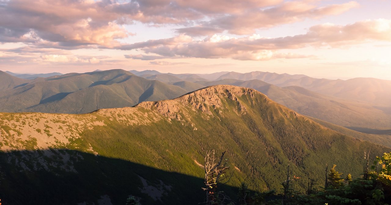
The Bondcliff Trail is the finale and, for many, the best part. It runs out to Mount Bond, then the short spur to West Bond's superb perch over the wilderness, then down over Bondcliff itself - the most photographed summit in the range, an open shelf of rock hung above the Pemi with the whole loop you just walked laid out behind you. From Bondcliff the trail descends the long ridge and drops to the Wilderness Trail on the old railroad bed, which becomes the Lincoln Woods Trail and carries you the last flat miles back to the bridge and the car. In 2026, that final stretch is the closed section - which is the whole reason the summer route starts from the north instead.
Clockwise or counterclockwise - which way to go
For the traditional Lincoln Woods loop, clockwise is the popular default, and the reasoning is sound. Going clockwise you climb the Osseo Trail first and get the exposed Franconia Ridge - the most weather-critical mile and a half of the whole route - done relatively early in the day, ideally before the afternoon thunderstorms that build over these mountains in summer and before the Falling Waters crowds flood the ridge from the notch. You also save the gentlest grade for last: the descent off Bondcliff and the long, flat railroad-grade walk out on the Wilderness and Lincoln Woods trails is the kindest possible way to finish thirty miles on wrecked legs.
The trade is that clockwise front-loads the hardest climbing. The stretch from Lafayette across the Garfield Ridge Trail to Galehead and up South Twin is the crux of the loop, and going clockwise you hit it in the middle of the day with a lot of miles already behind you. Counterclockwise flips all of this: you get the long flat miles first while fresh, climb the steep pitches rather than descending them (easier on the knees and arguably safer on the loose, steep bits), and finish over Franconia Ridge. The cost is that you reach that most exposed ridge at the end of a very long day, which is the worst time to be caught high if the weather has turned - and you descend the Osseo ladders tired, in the dark for many one-day hikers.
There is no single right answer, and strong hikers do it both ways. The rule that matters is this: whichever direction you choose, plan to be on the open Franconia Ridge with good weather and enough daylight in hand, because that is the section where being caught out has the highest consequences. If a one-day clockwise plan has you hitting Franconia Ridge at first light and Bondcliff in the afternoon, that is a good plan. If a counterclockwise plan has you reaching Lafayette at six in the evening with clouds building, that is a plan to change.
For the 2026 northern approaches, the direction question reshuffles around where you enter. Come up the Gale River Trail and you top out near Galehead and South Twin, roughly the midpoint, and can swing either way. Come up the Greenleaf or Old Bridle Path side and you enter at Lafayette, right at the exposed high point, which argues for getting the ridge done first and looping away from it. Whatever the entry, apply the same test - ridge first, weather-critical ground while you are fresh and the day is young.
One day, two days, or three - and where to sleep
The single-day Pemi is a genuine feat, not a stunt to take lightly. It is the province of very fit, very experienced mountain hikers and trail runners, and it typically means starting well before dawn and finishing after dark, moving efficiently for the better part of a day with minimal stopping. If you are considering it, the plain gut-check is your recent long-day pace on rough terrain: if you have not comfortably done, say, a Franconia Ridge Loop plus more in a day, the full Pemi in one push is a bigger jump than it looks. Carry a headlamp with fresh batteries and a backup no matter how fast you think you are, because the last miles by headlamp are the norm, not the exception.
The two-day trip is the classic backpacker's Pemi. You carry a full pack over the ridges and sleep once, most commonly at Guyot Campsite near the Bonds - which puts the remote, spectacular Bonds at your doorstep for sunset and sunrise and roughly splits the mileage - or at Garfield Ridge Campsite if your split runs the other way. Doing it in two days means big-mile days with a heavy pack over hard terrain, but it is well within reach for fit, experienced backpackers, and a night high on the ridge under some of the darkest skies in the Northeast is the reason many people choose the Pemi at all.
The three-day version is the one we quietly recommend for most people who want to enjoy it rather than endure it. Ten-to-twelve-mile days let you take the summits at a human pace, sit through a weather delay without blowing the whole trip, and see the wilderness you are walking around. A common rhythm is to sleep at Liberty Spring or Garfield Ridge the first night and Guyot the second, though the exact split depends on your direction and pace. More nights out also means more time under a changing forecast, so a longer trip asks for more, not less, attention to the weather windows.
For all overnight versions you have a real choice between the backcountry campsites and Galehead Hut. The campsites - Liberty Spring, Garfield Ridge, Guyot, and Thirteen Falls - are Appalachian Mountain Club tent-platform sites with spring water, a privy, and a caretaker in season, at a modest per-person fee. Galehead Hut is a full-service AMC mountain hut with bunks, blankets, and prepared meals by advance reservation, sitting right on the loop. The next section covers both, along with the 2026 rule that reshapes how everyone camps out here.
Campsites, Galehead Hut, and the 2026 bear-canister law
Start with the rule that changes everything for 2026, because it is the law and the penalty is real. Effective May 1, 2026, every overnight camper in the Pemigewasset Wilderness must store all food, trash, and scented items - that includes toothpaste, sunscreen, lip balm, and soap - in a cylindrical, hard-sided, IGBC-certified bear-resistant canister. Bear hangs are no longer allowed; the Forest Service found they simply were not working as the bears got smarter, and bear incidents in the Pemi had climbed sharply. The only exception is the fixed bear-resistant food boxes at the Thirteen Falls Tentsite. Violating the food-storage order is a Class B misdemeanor that can carry a fine up to 5,000 dollars and up to six months in jail, and it applies to the whole wilderness, which is most of this loop.
The good news, and it is good news for anyone based here, is that the Forest Service runs a free canister-loan program, and the closest pickup is the Lincoln Woods Trailhead Cabin right here in Lincoln - about 9 min from the lodge - along with the Pemigewasset Ranger Station in Campton and the Saco and Androscoggin ranger stations further out. You can borrow a canister at no cost, which means you do not have to buy one for a single trip. Plan to swing by during their open hours before you head to the trailhead, since in 2026 you may be driving to a northern trailhead well away from Lincoln, and you do not want to discover the requirement at the register.
Now the places to sleep, all AMC sites with a caretaker in the warm months and a fee reported at about 15 dollars per person per night for recent seasons - confirm the current figure with the AMC. Liberty Spring Tentsite sits just below Franconia Ridge on the Liberty Spring Trail, with tent platforms and a reliable spring, a good first-night stop on a three-day trip. Garfield Ridge Campsite, below Garfield's summit, has a shelter and seven tent platforms and a spring. Guyot Campsite, on a spur off the Bondcliff Trail near Mount Guyot, is the prize for the Bonds - a shelter that sleeps around sixteen plus about ten tent platforms and a spring, though that spring can run thin in a dry late summer, so ask the caretaker and treat everything you draw. Thirteen Falls Tentsite anchors the wilderness's north end near the Franconia Brook drainage, with the only sanctioned bear boxes on the route.
Galehead Hut is the other option and a comfortable one - a full-service AMC hut at about 3,800 feet, the most remote of the chain, sitting right on the loop between Garfield and South Twin. In the full-service season it offers bunks with blankets and a pillow, and breakfast and dinner cooked by the crew, all by advance reservation, which the AMC strongly recommends because it fills; their reservation line is 603-466-2727. Greenleaf Hut, the other hut in this neighborhood, sits about 1.1 miles off the loop below Lafayette on the Greenleaf Trail - not on the route, but a useful water stop, weather refuge, and bailout point, which is why it comes up again in the bailout section. Day hikers can stop at either hut to buy a snack or refill water during the staffed season without a reservation.
Franconia Ridge: the exposed crux
If one part of the Pemi Loop is going to hurt you, it is the Franconia Ridge traverse, and it deserves to be treated as the crux even though it is not the steepest climbing. From the moment the trees quit at Little Haystack until you drop off Lafayette toward Garfield, you are on roughly a mile and a half of continuous open, above-treeline crest with nowhere to shelter - over Mount Lincoln at 5,089 feet and Mount Lafayette at 5,249. On a clear, calm day it is the finest ridge walk in New Hampshire, a narrow rooftop with the world falling away on both sides. On a bad day it is a wind tunnel and a lightning rod, which is why this is the stretch to cross in your best weather window.
The numbers that matter up there are not the mileage; they are the wind, the temperature, and whether the ridge is in cloud, and none of those are described by the pleasant forecast for the town of Lincoln thousands of feet below. This is why the Mount Washington Observatory Higher Summits Forecast, covered in its own section, is not optional reading for the Pemi. The exposure here is unrelenting and total - you cannot duck into the trees, because there are no trees, and once you are committed to the traverse the fastest way off is to keep going to the far end. Treat any threat of thunderstorms as a hard no for this section, and mean it: afternoon lightning on this ridge is a well-documented killer, and the first distant rumble is the signal to have already been getting low.
Beyond Franconia Ridge, the loop keeps handing you exposure in smaller but real doses. The open dome of Mount Guyot, the shelf of Bondcliff, and the perch of West Bond are all above treeline, all scoured by the same weather, and all easy to lose the trail on in fog, where the path across bare rock is marked by cairns that vanish in thick cloud. The Pemi is not a hike where you get above the trees once and are done with it - you are exposed, off and on, for a large share of the whole loop, which is why weather governs this route more than any other single factor, and why the planning rule is simply to cross this ridge and the Bonds in the best window you can get.
The trail underfoot: the Osseo ladders, the Garfield grind, and the Bondcliff step
Three stretches of trail define the Pemi underfoot. Climbing the Osseo Trail toward Flume, the lower miles are pleasantly graded - and then, as you near treeline on the steep nose of the ridge, the trail hits a series of wooden ladders and staircases bolted to the slope, commonly counted at around eleven. Going up they are a well-engineered help. Going down them tired, wet, or by headlamp on a one-day counterclockwise finish, they demand real care, because wooden rungs get slick and a fall here is a long way from the road.
The stretch that breaks people is the Garfield Ridge Trail - the long connector from Mount Lafayette to Galehead Hut. On paper it is a low point tucked between the big summits, so hikers file it as a rest. It is the opposite: a relentless sequence of steep, rough, rooty, muddy little ups and downs - the classic White Mountain 'pointless ups and downs' - that gives back none of the elevation easily and seems to go on forever. One section below Garfield descends like a streambed, steep wet rock and rooted mud that is slow and slippery either way and miserable in the rain. None of it is cliff-edge terrain, but all of it is tiring and time-eating, and it lands in the middle of your day with your legs already taxed from Franconia Ridge.
So plan for the Garfield grind rather than be ambushed by it. Budget more time for the Lafayette-to-Galehead stretch than the mileage suggests, and if you are going clockwise, treat Galehead Hut at the end of it as your regroup - a place to refill water, eat, and candidly reassess your time and the weather before the steep haul up South Twin and out to the remote Bonds. Knowing it is coming, and that it is worse than the elevation profile looks, is half the battle.
At the far end waits the loop's most famous move: the short rock step just below the summit of Bondcliff, a chest-high ledge you hoist yourself up (or drop down) that has launched a thousand photographs of a hiker on the open shelf with the wilderness behind. It is a genuine hands-on scramble, short and not technically hard for an able hiker on dry rock, but exposed and consequential enough to respect - especially wet, iced, or with a heavy pack throwing off your balance. Beyond it, the Bond and Bondcliff ridge is some of the most beautiful open walking in the East, a broad alpine promenade with enormous views, earned by steady, deliberate footwork over many rough hours.
Water: the dry ridge and where to refill
Water is one of the two or three things to plan most carefully on a Pemi, because much of this loop is high, dry ridgeline where there is simply nothing to drink for hours. The long open traverse of Franconia Ridge is the worst of it - from the water sources near Liberty Spring, up over Little Haystack, Lincoln, and Lafayette, and along the Garfield Ridge Trail, you are on high ground with no reliable water for a long, sweaty, exposed stretch. On a hot, sunny day this is where people run dry, and dehydration on an exposed ridge with more miles to go is how a manageable day slides toward an emergency.
So plan the loop around its reliable water points and top off completely at every one. The dependable sources are the springs at the campsites - Liberty Spring, Garfield Ridge Campsite, Guyot Campsite, and Thirteen Falls - plus the potable spigot outside Galehead Hut and, off-loop, Greenleaf Hut near Eagle Lake below Lafayette. Between those, you are carrying what you drink. A sensible baseline is to start each stretch with three or more liters in hot weather and to treat everything you draw from a spring or brook, since backcountry water carries what backcountry water always carries. In cooler weather you can carry a bit less, but the ridge does not get less dry.
The specific trap to internalize is the gap across the high ridge. In either direction, there is a long carry over the most exposed ground with no refill, and the smart move is to tank up right before you commit to it - a full load leaving Liberty Spring or Greenleaf on the way onto the ridge, and again at Galehead or Guyot on the way to the Bonds. Late in a dry summer, ask the caretakers about the springs before you count on them; Guyot's in particular has a reputation for running thin in August, and a spring you were banking on being dry changes the math for the whole rest of your day.
Bailout routes: knowing your exits before you need them
A route this long and committing demands that you know your escape options cold, before you are on a ridge in bad weather with a decision to make. The Pemi's bailouts are real but not quick - most drop you to a road on the far side of the mountains from where you started, but a long walk to the wrong trailhead beats being caught high in a storm every time. Study these on the map at home, not on your phone in the wind.
From Franconia Ridge, your exits are toward Franconia Notch: the Falling Waters Trail and the Old Bridle Path both drop from the ridge to Lafayette Place on the parkway, and Greenleaf Hut sits just below Lafayette via the Greenleaf Trail as a weather refuge and a route down to the Cannon lot. These put you out in the notch, roughly 15 to 20 min from the lodge by car - the friendliest bailouts on the loop, and a reason the Franconia Ridge end is the safer end to be caught on. From the Garfield area, the Garfield Trail descends to the Gale River Loop Road on the Route 3 side of the mountains, and from Galehead the Gale River Trail does the same - both long, both dropping you far to the north.
From the Twin-Guyot-Bonds region, the main sanctioned exit is the Twinway east over to Zealand Falls Hut and out the Zealand Trail to Zealand Road, again a long way north and reliant on a seasonal road being open. The one bailout that looks tempting on the map and is not is dropping into the wilderness interior - the Lincoln Brook and Franconia Brook trails through the middle of the Pemi are long, wet, rough, and cross rivers you should not ford in high water, and in 2026 they connect back to the closed Lincoln Woods section anyway. The interior is not a shortcut home; it is a way to get more lost and more wet.
The short summary is that once you are committed to the Bonds - past South Twin, out toward Guyot and Bondcliff - you are about as far from a road as it is possible to be in the White Mountains, and there is no quick way off. That is exactly why the weather and turnaround decisions have to be made earlier, back at Galehead or on Franconia Ridge, while you still have good exits. Do not walk out to Bondcliff on a doubtful forecast telling yourself you will bail if it gets bad, because from Bondcliff, bailing and finishing are nearly the same distance.
Weather, the higher-summits forecast, and turnaround judgment
Every safe Pemi starts with the Mount Washington Observatory Higher Summits Forecast at mountwashington.org - written twice a day by meteorologists who live in this weather, and the only forecast that describes the ground you will be walking on. It gives you summit temperature, sustained wind and gusts, and whether the peaks will be socked in cloud, all of which are wildly different from the valley forecast for Lincoln. Read it the night before to decide whether to go at all, and again in the morning to confirm. For a route with this many exposed miles and this little shelter, a bad higher-summits forecast is a reason to do a different hike, not to start and hope.
The weather here changes fast and hard, even in summer - a clear dawn can become an afternoon thunderstorm, wind can climb from a breeze to something that knocks you down, and cloud can drop over Guyot and Bondcliff and turn easy cairn-to-cairn walking into a navigation problem. Because the Pemi commits you to the high ground for so long, you have to make weather calls on a forecast and a margin, not on what you can see: what Lafayette looks like at nine in the morning tells you little about what Bondcliff will be doing at three in the afternoon, five hours of walking away.
Turnaround judgment on the Pemi is mostly about honoring decisions you made in advance. Set a hard turnaround time worked backward from dark and from your actual pace, and set weather rules - a wind speed, a storm threat, a cloud ceiling - that end the push regardless of how much you want the summits. The words to be wary of on this loop are 'we are so close.' On the Bonds especially, close to the far summit can still be a very long way from the car. A first-rumble rule that gets you off the exposed ridge immediately is not caution, it is survival, and the hikers who get hurt out here are overwhelmingly the ones who talked themselves past their own limits.
Two New Hampshire specifics belong in your pack. First, under RSA 206:26-bb, New Hampshire can bill a hiker whom Fish and Game judges to have acted negligently for the cost of their own search and rescue, which adds up quickly on a route this remote. The voluntary hikeSafe card waives that cost, short of true recklessness, and helps fund the rescue teams; it runs 25 dollars for an individual or 35 for a family for 2026, sold through New Hampshire Fish and Game. On the Pemi, where a turned ankle in the wrong place means a serious carry-out, it is a sensible thing to buy the night before. Second, do not let your phone be your safety plan - cell coverage across most of this loop is nonexistent, so download your maps, carry a real map and compass or a GPS you know how to use, and leave your route and expected out-time with someone who will notice if you do not come back. We ask our hiking guests to do exactly that, and on a hike this size we mean it more than usual.
Winter and the shoulder seasons
The Pemi Loop in winter is not the summer hike with colder air; it is a full mountaineering expedition, and it belongs only to experienced, properly equipped winter hikers and parties. Everything that makes the summer loop serious is amplified: the many above-treeline miles become a fight against genuine alpine wind and cold, the open domes turn to wind-scoured ice, the Osseo ladders and the Bondcliff step ice over, and the short days turn an already-huge route into a race against a very early dark. Deep, unbroken snow can make the Garfield Ridge Trail and the wilderness approaches punishingly slow, and breaking trail across the Pemi after a storm is a monumental effort. A single-day winter Pemi is an elite feat; a multi-day winter Pemi is a serious expedition with a full winter kit and the skills to match.
The shoulder seasons are their own specific trap, and they fool people every year. In April, May, and even into June the trailheads and lower woods can look like full spring while the high ridge still carries rotten, collapsing snow, the sheltered north-facing pitches hold ice, and the brooks and river crossings run high and cold with snowmelt - exactly when the East Branch runs at its fullest. In late fall a mild parking lot can sit below a rimed, frozen, wind-blasted summit that got its first real winter blast weeks before the calendar says winter. As a default, from roughly Columbus Day through late spring, treat the high parts of this loop as winter and carry the traction, insulation, and navigation to prove it.
There is also a hard seasonal-access layer specific to the northern approaches you may be forced onto in 2026. The Gale River Loop Road, which serves the Gale River and Garfield trailheads, and Zealand Road, which serves the Zealand bailout, are seasonal roads that close and gate in the colder months - and when they are gated, your approach and your escape both get miles longer. Before any late-season or early-season Pemi attempt, confirm the current status of whatever road your trailhead depends on with the Forest Service, because a gate you did not know about can add hours to your day at both ends.
None of this is meant to talk a capable, experienced winter mountaineer out of a winter Pemi, which can be one of the great days in the Northeast. It is meant to be clear that the season changes what this route is, completely, and that the margin for error - already thin in summer - becomes razor-thin in the cold. If you have to ask whether a winter Pemi is within your skills, it almost certainly is not, and there is no shame in that. Very few people are.
Safety & conditions
- The Franconia Ridge traverse - about a mile and a half continuously above treeline over Lincoln and Lafayette - is the crux of the loop and the part to time most carefully. There is no shelter up there and no fast way off once you are committed. Read the Mount Washington Observatory Higher Summits Forecast (mountwashington.org, issued twice daily) the night before and the morning of, plan to cross this ridge and the Bonds in the best weather window you can get, and treat any threat of thunderstorms as a hard no. On the open ridge, the first distant rumble means you should already be getting low.
- This is a 31-to-32-mile, roughly 9,000-foot objective, and the single-day version is elite endurance territory (16 to 25 hours of walking). The most common way it goes wrong is misjudging your own pace and getting benighted on exposed ground. Carry a headlamp with spare batteries even if you plan to finish in daylight, set a hard turnaround time worked backward from dark, and accept that many one-day attempts do not finish in a day. If you have not done a Franconia Ridge Loop or similar comfortably, the full Pemi in one push is too big a jump.
- Water is a real hazard here, not a convenience. Long stretches of high, dry ridge - especially the Franconia Ridge traverse - have no water for hours, and running dry on exposed ground with miles to go wears you down fast. Refill completely at every reliable source (Liberty Spring, Garfield Ridge, Galehead Hut, Guyot, Thirteen Falls, and off-loop Greenleaf Hut), carry three or more liters across the dry sections in heat, treat everything, and ask caretakers whether the springs are flowing in a dry late summer.
- For 2026, do not drive to Lincoln Woods expecting to start the classic loop - a 1.4-mile section of the Lincoln Woods Trail (Route 112 to the Osseo junction) is closed June 15 into November 2026 for riverbank stabilization, and the East Side Trail is not a bypass because there is no safe bridge back across the East Branch. Start from a northern trailhead (Greenleaf, Skookumchuck, Gale River, Garfield, or North Twin), which adds several miles. Confirm the current closure and road status on the Forest Service and AMC websites the week before you go.
- If you camp, an IGBC-certified hard-sided bear canister is required by law for any overnight in the Pemigewasset Wilderness as of May 1, 2026 - bear hangs are banned, and violating the food-storage order is a Class B misdemeanor (up to $5,000 or six months). Store all food and scented items in it. Canisters are free to borrow from the Lincoln Woods Trailhead Cabin in Lincoln and area ranger stations; pick one up before you drive to the trailhead.
- Know your bailouts before you need them. Franconia Ridge exits toward the notch (Falling Waters, Old Bridle Path, Greenleaf Hut) are the friendliest and closest to the lodge; the Garfield and Gale River trails drop to the Route 3 side; the Twinway leads to Zealand Falls Hut. But once you are out on the Bonds you are about as far from a road as anywhere in the Whites, with no quick escape - so make the go-or-turn decision back at Galehead or on Franconia Ridge while you still have good exits. The wilderness interior (Lincoln Brook / Franconia Brook) is not a shortcut; it is long and wet, its river crossings are best avoided in high water, and in 2026 it leads back to the closed section.
- Much of the loop is bare, cairn-marked alpine ground - Franconia Ridge, Mount Guyot, Bondcliff, West Bond - where the trail can vanish in cloud and fog. Carry a real map and compass or a GPS you know how to use, download your maps in advance (cell coverage on the loop is essentially nonexistent), and move deliberately cairn to cairn when the tops are socked in. Respect the Osseo Trail's wooden ladders and the short rock step below Bondcliff, both of which are slick when wet and consequential with a heavy pack.
- From roughly Columbus Day through late spring, treat the high parts of this loop as full winter mountaineering: alpine wind and cold on the exposed miles, iced ladders and scrambles, deep snow that makes trail-breaking slow and tiring, and very short daylight. The seasonal Gale River Loop and Zealand roads gate in the cold months, lengthening both approach and escape. Shoulder seasons are a specific trap - a spring-like trailhead below a frozen, rimed summit, and snowmelt-swollen crossings. This is not a season for anyone without winter experience and a full winter kit.
- New Hampshire can bill negligent hikers for the cost of their rescue under RSA 206:26-bb, and on a route this remote a rescue is a long, costly effort. Buy the voluntary hikeSafe card from New Hampshire Fish and Game ($25 individual, $35 family for 2026) - it removes that liability short of recklessness and funds the rescue teams. Leave your exact route and expected out-time with a person who will notice if you do not return, and consider carrying a satellite messenger, because your phone will not be your safety plan out here.
Where to stay for it
In a normal year this is the closest big objective in the Whites to our door: from 191 Pollard Road you are on Main Street in a minute, and the Lincoln Woods Trailhead is about 9 min east on the Kancamagus Highway (Route 112) from Exit 32 - you can be standing at the trailhead before most day-trippers have left their driveways. For the summer and fall of 2026, though, the Lincoln Woods start is closed, so the practical trailheads are elsewhere: the Franconia Notch entries (Lafayette Place and the Cannon Mountain lot, about 12 to 16 min up I-93 through the notch) put you onto the loop at Lafayette, while the Gale River and Garfield trailheads on the Route 3 side are roughly 40 to 45 min via I-93 to Exit 35 and Route 3. Confirm the closure status and your trailhead's road before you drive.
Two errands in Lincoln before you go, and they matter more on this hike than any other. First, provision fully - the Price Chopper plaza on Paper Mill Drive and the gas stations along Main Street are your last stop for food, extra water bladders, and fuel, and there is nothing to buy at any of these trailheads. Do it the evening before if you are chasing a pre-dawn start, which on a one-day Pemi you almost certainly are. Second, if you are camping, swing by the Lincoln Woods Trailhead Cabin during its open hours to borrow a free bear canister, which the law now requires for any overnight in the wilderness - it is about 9 min from us and saves you buying one for a single trip. Download your maps before you leave, since cell coverage on the loop is essentially nonexistent, and leave your route and out-time with someone at home. On a hike this size, that last one is not a formality.
Sources & official info: outdoors.org · fs.usda.gov · fs.usda.gov · outdoors.org · outdoors.org · mountwashington.org
— Launchpoint Lodge, From the lodge