Owl's Head is the hike most people save for late in their round of the 48, and they do it for exactly one reason: it is on the list. It is a 4,025-foot wooded lump in the middle of the Pemigewasset Wilderness with a summit that has no view, no officially maintained trail to the top, and an approach that runs to about 18 miles round trip with something like 3,000 to 3,400 feet of climbing. In a normal year the trailhead is about 9 min from our front door, straight east on the Kancamagus Highway. We are not going to sell you a mountain that does not sell itself, so here is the plain version of what you are signing up for and how to do it as safely as a hike this long and remote can be done.
The character of Owl's Head is a long, flat, pretty walk that turns nasty at both ends of the trip. Most of the mileage is easy grade along an old logging railroad bed and then a rougher riverside trail, which is why people tend to underestimate it - then the last mile up the Owl's Head Slide packs roughly 1,500 feet of gain onto loose, wet, steep rock, and the several unbridged brook crossings on the way in can turn from a knee-deep rock hop into fast, deep water after one afternoon of rain. The climbing is not the main concern here. It is the water, the length, the remoteness, and the fact that once you are in there is no quick way out.
There is also a 2026 problem you have to plan around, and it is the first thing in this guide because the apps are slow to catch it. The Lincoln Woods Trail - the standard start for Owl's Head - is closed from June 15 into November 2026 for riverbank work, and the Forest Service specifically names Owl's Head as a hike that needs an alternate route this season. The workarounds are real but none of them is easy: a huge multi-day northern approach, or a do-it-yourself detour that adds a river ford to a hike that already has too many. Our Pemi suite is named for this wilderness, and we are happy to help you plan the trip - but read the access section below before you point the car at the trailhead.
The case for Owl's Head
Let us be straight about why this hike exists on anyone's calendar. Owl's Head is one of the forty-eight peaks in New Hampshire that top 4,000 feet with enough rise to count as separate mountains, and the 4,000-footer list is the single biggest reason people hike in the White Mountains. If you are working through the 48, you have to do Owl's Head. If you are not, there is very little on this particular mountain to draw you fourteen-plus miles into the woods, because the summit is a flat wooded spot with the trees closed in on every side and nothing to see.
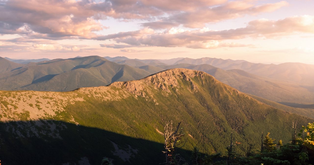
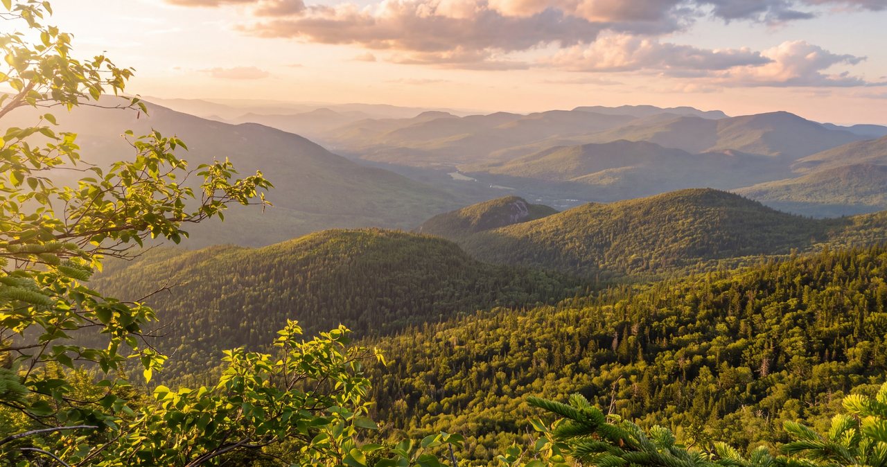
That is not us being sour about it. It is the mountain's own reputation. Owl's Head is routinely called the least rewarding of the 48 and the one peakbaggers dread, precisely because you invest a very long, committing day and the summit itself gives you nothing back. The reward, such as it is, comes on the way up the slide, where the trees open and you get a good look across the valley at the back side of Franconia Ridge, Mount Garfield, and Galehead. Many people say that view from the slide is the real summit of the trip, and the wooded top is just the place you tag to make it official.
It is also the most wilderness-feeling hike of the 48, and for some people that is the point. Owl's Head sits in the heart of the Pemigewasset Wilderness, the largest designated wilderness in the White Mountains, hemmed in by the Franconia Branch on its east side and Lincoln Brook on its west and south. There are no roads anywhere near it, no shortcuts, no cell service, and by design very little signage. You earn every foot of it on your own, and you spend most of the day a long way from anyone who could help you. If you like the idea of a full day of walking into big, quiet, roadless country, Owl's Head delivers that in a way the roadside summits never will.
So set your expectations correctly and the day works. Come expecting a scenic mountaintop and you will spend eight hours feeling cheated. Come expecting a long, real walk into deep woods, a hard scramble up a loose slide, a checkmark on the list, and a couple of good views along the way, and Owl's Head is a satisfying, character-building day. It is a rite of passage for the 48, and most people are glad they did it once and in no hurry to do it again.
The 2026 access problem: the Lincoln Woods closure
This is the single most important planning fact for Owl's Head in 2026, so it goes first. The Lincoln Woods Trail - the flat railroad-grade path that every standard Owl's Head route uses to get started - has a 1.4-mile section closed from June 15 into November 2026. The closed stretch runs from the Kancamagus Highway (Route 112) at the trailhead up to the Osseo Trail junction, and the Forest Service is stabilizing an undercut, eroded section of riverbank there that was damaged back in Hurricane Irene and has kept washing out since. The White Mountain National Forest specifically lists Owl's Head, along with 13 Falls, the Bonds, Guyot, and the Pemi Loop, as destinations that need an alternate route while the work is going on.
One wrinkle worth knowing so you are not confused by older reports: this same section was closed through the winter, reopened for a short window on March 11, 2026, and then closed again on June 15 for the main summer construction season. In other words, it has already flipped once, which is exactly why you cannot trust a trip report from earlier in the year or a stale app. The Forest Service is targeting a reopening after the November 2026 work window, but treat that as a goal, not a promise, and check the current status before you commit to anything.
What stays open at Lincoln Woods is the parking lot, the restrooms, the big suspension bridge over the East Branch, and the East Side Trail on the far bank. What does not exist is a clean, signed detour to Owl's Head. Here are your practical options during the 2026 closure. Option one, and the simplest: wait until the trail reopens, which is targeted for after November 2026 - check the Forest Service Lincoln Woods alert before you decide it is off the table. Option two: come at Owl's Head from the north, which is a serious undertaking - the researched route runs Gale River Trail to Garfield Ridge Trail to Twin Brook Trail to Lincoln Brook Trail to the Owl's Head Path, roughly 11.9 miles one way, which realistically means a backpacking trip with a night at the 13 Falls Tentsite or a stay at Galehead Hut rather than a day hike.
Option three is the one experienced parties are using, and it calls for careful judgment. During the closure, hikers have been taking the open East Side Trail up the east bank from the trailhead - it shares the parking area and does not cross the suspension bridge - then fording the East Branch of the Pemigewasset at a chosen spot and bushwhacking over to the Lincoln Woods Trail on the west bank above the closed section, where they rejoin the normal route to Black Pond and Lincoln Brook. The key thing to know is that this workaround adds a full river crossing of the East Branch itself - the biggest water on the whole trip - to a hike already known for its brook crossings. In low late-summer water that ford might be knee-deep and manageable; in high water it can be impassable, and it requires solid off-trail navigation on top of everything else. This is a route for very experienced, confident navigators in low water only, and it is not sanctioned or marked.
The bottom line for 2026: do not drive to Lincoln Woods assuming you can start the standard Owl's Head hike and figure it out at the trailhead, because you will reach a hard closure with heavy equipment and nowhere legal to walk. Decide your plan at home, confirm the closure and any road status on the Forest Service and AMC websites the week before you go, and leave your plan with someone at home. We are 9 min from the trailhead and we follow this closure closely - ask us before you go.
The numbers
Owl's Head is one of those hikes where the published figures disagree, so here is the real range rather than a single tidy number. Measured the standard way from Lincoln Woods, out and back, the trip runs right around 18 miles - one careful GPS track comes in at about 18.04 miles with no bushwhacking, and using the Black Pond bushwhack trims roughly a mile off that. Elevation gain is where the sources spread out: you will see everything from about 2,970 feet to about 3,368 feet depending on whose GPS did the counting and how it handled the slide. Call it roughly 3,000 to 3,400 feet, and know that the exact figure matters far less than where it sits.
Because here is the shape of the day that the raw totals hide: Owl's Head is almost flat until it is suddenly very steep. The first six or seven miles gain very little - it is old railroad grade and gentle riverside trail - and then the Owl's Head Slide packs something like 1,500 feet of climbing into less than a mile at the very end. So you walk for hours feeling like the mountain forgot to show up, and then it hands you the whole climb at once, on loose rock, with tired legs. Plan your energy for that, not for an even grind.
Time is the other number that fools people. The Appalachian Mountain Club book-time formula, which is a decent baseline, works out to roughly 10 hours and 45 min of moving for the standard route. In practice, strong and efficient parties finish in eight to ten hours, plenty of people take twelve to fourteen, and in winter this is a seventeen-hour day for a fit group breaking trail. The distance is what gets you: 18 miles is a long way to walk even on easy ground, and Owl's Head is not all easy ground.
So file Owl's Head as very strenuous, and not because any single move is hard - there is no exposed ridge, no cliff, no technical climbing. It is strenuous by accumulation and by remoteness: the sheer mileage, the unbridged crossings, the loose slide, the unmaintained and unblazed path, and the fact that you are deep in roadless country the whole time. It is not a beginner's 4,000-footer, and it is a poor choice for a first big White Mountain day. If you have not comfortably done a shorter, closer 4,000-footer first, do that before you take on Owl's Head.
The route, start to summit, in a normal year
In a normal year - and for reference when the trail reopens - the standard Owl's Head hike goes like this. From the Lincoln Woods Trailhead on the Kancamagus you cross the suspension bridge over the East Branch and walk the Lincoln Woods Trail north up the west bank on the old logging railroad grade. It is flat, wide, and easy, and it lulls you: you cover close to three miles before the character of the hike changes at all. You pass the Osseo Trail junction at about 1.4 miles - that is the far end of the 2026 closure - and continue to the edge of the Pemigewasset Wilderness at about 2.9 miles, where the Lincoln Woods Trail ends near Franconia Brook and the Franconia Brook Trail carries on north.
From there you follow the Franconia Brook Trail for about 1.7 miles and then turn onto the Lincoln Brook Trail, and this is where the flat walk becomes a wilderness trail: rougher underfoot, wetter, rooty, and punctuated by the brook crossings that give Owl's Head its reputation. The trail wades the Franconia Branch - the biggest and hardest crossing of the day, difficult even in a dry spell because it is wide - and then works up alongside Lincoln Brook, crossing it as it goes. This middle stretch is long and mostly gently graded, a few miles of streamside walking that is pleasant in low water and frightening in high water. Most people either take the two big crossings head-on here or avoid them with the Black Pond bushwhack, covered in its own section below.
Somewhere around seven miles in, the Owl's Head Path leaves the Lincoln Brook Trail and heads up the slide - the steep band of loose, often wet rock on the mountain's west side that carries you the last mile and the bulk of the climbing to the ridge. This is the crux of the hike and the part that demands care. The path is an unofficial, unmaintained herd track; there is no sign marking the turn, so people watch their GPS for it. Up the slide you finally get the views the summit will not give you, back across the valley to Franconia Ridge.
At the top of the slide the grade eases and you follow the herd path along the wooded ridge to the summit. The traditional summit, the one the 4,000-footer list has always used, is a flat spot in the trees; the true high point sits about 0.2 mile farther north and is marked by a cairn. Then you turn around and walk all of it back - the slide down, the crossings again, the long railroad grade out. Owl's Head is an out-and-back with no loop and no bailout worth the name, which is why the decisions you make on the way in matter so much: everything you walk past, you have to walk back.
How to handle the water crossings
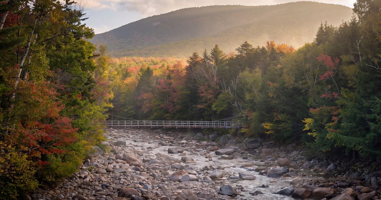
If Owl's Head hurts someone, it will almost certainly be at a water crossing, so treat this section as the heart of the safety plan. The standard route crosses the Franconia Branch once - the biggest and hardest crossing, difficult even in a dry spell because it is wide - and then crosses Lincoln Brook two more times, along with a couple of smaller crossings, so a full trip can tally around half a dozen in all. None of these crossings has a bridge. In normal summer flow they are a careful rock hop or a knee-deep wade. After rain, or during spring snowmelt, they turn into fast, cold, thigh-to-waist-deep water over slick rock, and those are the days to leave Owl's Head for another trip.
The specific trap that catches people on Owl's Head is not the crossing you can see - it is the one that changes while you are on the far side. Hikers cross a brook easily in the calm of a morning, spend hours on the summit side, and come back to find that an afternoon thunderstorm miles upstream has swollen the same brook into something they cannot safely recross. That is how people end up stranded out here overnight, on the wrong side of moving water, waiting for it to drop. Build your plan around it: if the forecast has any real rain in it, this is not the day, because the brooks respond fast and you may not be able to get back.
You can and should check the water before you go. Experienced Owl's Head hikers watch the USGS river gauge on the East Branch of the Pemigewasset at Lincoln - monitoring location 01074520 - as a proxy for the crossings. As a rule of thumb, a reading around 500 cubic feet per second or lower in summer usually means the crossings are a manageable rock hop or a shallow wade; well above that, pick a different hike. Treat that as a guideline, not a guarantee - it is a proxy, not a reading of the exact brook you are standing in - but it is far better than showing up blind, and it will talk you out of the worst days.
At the crossing itself, the rules are simple and they save lives. Unbuckle your pack's hip belt so you can shed it if you go in. Face upstream, keep three points of contact, and use trekking poles or a stick to brace against the current. Do not cross moving water that is above your knees and pushing hard, and never cross on a slick log over fast water when a wade is available lower down. And follow the most important rule without ego: if a crossing looks too high, it is, and the right move is to turn around, even at mile seven, even with the summit an hour away. The mountain will still be there. The 4,000-footer list is not worth a drowning.
This is also the strongest argument for the Black Pond bushwhack, which skips the two biggest crossings entirely - see the next section. In 2026, remember that the closure workaround adds the East Branch ford on top of all of this, which is why we push people so hard toward low-water days and real river-crossing experience before attempting Owl's Head this year.
The Black Pond bushwhack: what it skips
The Black Pond bushwhack has quietly become the most common way people do Owl's Head, and the reason is simple: it avoids the two worst water crossings. Instead of taking the Lincoln Brook Trail across the Franconia Branch and the first Lincoln Brook crossing, you follow the Black Pond Trail about 0.8 mile to Black Pond, continue past the pond, and then bushwhack through the woods for roughly half a mile to rejoin the Lincoln Brook Trail above those two crossings. It saves close to a mile of walking and, more importantly, skips the two crossings that are hardest in high water.
Level with yourself about what it is, though. It is not an official trail. There is no sign, no blaze, and the Forest Service does not maintain it - it exists because so many people have walked it that it is now beaten into a fairly obvious herd path, and it shows up on the mapping apps. In good conditions people describe it as essentially a trail and easy to follow. In fresh snow, under fallen leaves, or in fog, that same herd path gets much harder to hold, and you are navigating off-trail in designated wilderness with no markers. Carry a GPS track and a map, and do not assume you will simply see the way.
It is also wet. Expect mud and squelchy ground through the bushwhack, and know that it does not remove every crossing - it removes the two big ones, and you will still cross Lincoln Brook higher up. Used with judgment and a downloaded track, the Black Pond bushwhack is the sensible way to do Owl's Head for most people, and in higher water it can be what makes the day doable at all. Just go in understanding that you are choosing a rougher, unmarked shortcut over a maintained trail, and navigate accordingly.
The slide, and the Brutus bushwhack
The Owl's Head Slide is the crux and the character of the hike. It is an old landslide scar on the mountain's west face, and the herd path climbs straight up it, gaining something like 1,500 feet in under a mile. The footing is loose - rock and gravel that shifts under you - and it is usually a little wet, which makes the loose rock worse. It is steep enough that you will use your hands in places, narrow in sections, and the standard advice is to work more to the right as you climb. None of it is technical rock climbing, but all of it demands attention, and a slip on loose rock here, seven miles from the road, is a bad place to get hurt.
The one gift the slide gives you is the view. After an initial climb through dense evergreens the trees fall away and the valley opens up behind you - the back side of Franconia Ridge with Lincoln and Lafayette, Mount Garfield, Galehead. On a clear day it is a fine outlook, and since the summit has none, this is the scenery of the trip. Stop, turn around, and take it in on the way up, because you have earned it and the top will not offer anything.
A word on rockfall and spacing: on loose slide rock, the party above you can knock stones down onto the party below. Keep your group close together or well spread out - not stacked one directly above another - and call out if you dislodge anything. On a busy day with several groups on the slide, be patient and give people room. This is basic loose-terrain manners, and on a pitch this steep and loose it matters.
In winter the slide changes completely: it becomes avalanche terrain, and it is not a place to be after loading snow. That is where the Brutus bushwhack comes in. It is a wooded herd route - named, as the story goes, for a big dog who could not manage the loose slide - that slabs and switchbacks up through the trees alongside the slide instead of climbing the open scar. It is not a shortcut; the distance is about the same. What it offers is easier, more secure footing than the loose rock in its lower section and, crucially, an alternative to the avalanche-prone slide in winter. Plenty of people use it year-round to avoid the loose rock, and most winter parties use it as a matter of course. Like everything else out here it is unmarked, so carry the track.
The summit: viewless, and the true-summit question
Here is the part nobody softens: the summit of Owl's Head has no view. It is a flat, wooded spot, and the trees close in on all sides. Except in deep winter when snow has bent the branches down, you will stand at 4,025 feet and see forest and nothing else. This is not a mountain where you eat lunch on a rock in the sun and admire the range; it is a mountain where you touch the high point, note that you did it, and start the long walk back. Go in expecting that and the summit is easy to enjoy, because the good views already happened on the slide.
There is also a genuine quirk about which spot is the summit. For decades the accepted top was the flat clearing at the end of the traditional herd path. Then in the fall of 2005 careful surveying found that the true high point is about 0.2 mile farther north along the wooded ridge, marked now by a cairn. The Appalachian Mountain Club's Four Thousand Footer Committee still accepts the traditional summit for list purposes, so you do not strictly have to walk to the true summit to count the peak - but many hikers now continue the extra fifth of a mile to the cairn to be sure they have stood on the actual highest ground. It costs you a flat 10 min round trip through the trees. Given how far you have already walked, most people do it.
One practical note for the top: the wooded ridge up there has several beaten herd paths crisscrossing it, a sign of how much traffic this peak gets, and in flat light or snow it is surprisingly easy to get turned around on featureless wooded ground with no view to orient by. Note where you came up, keep your GPS handy, and pay attention on the ridge so that you start down the correct path. Coming off the wrong side of Owl's Head is a real way to turn a long day into an epic.
Navigation in the Pemigewasset Wilderness
Owl's Head sits in designated wilderness, and that changes how the trails are managed in ways that matter for your safety. Under the rules that govern the Pemigewasset Wilderness, the Forest Service deliberately keeps things primitive: trails are not blazed, signage is minimal or absent, and the herd paths that get you up the slide and across the Black Pond bushwhack are not official trails at all. You will not find the reassuring painted blazes and frequent junction signs you may be used to on other White Mountain hikes. That is by design, and it means you cannot outsource your navigation to trail markers.
So carry real navigation and know how to use it. Bring a paper map and compass and a GPS or phone app with the route and the herd paths downloaded for offline use, because there is essentially no cell service anywhere on this hike - you cannot count on your phone for a live map or for a call if something goes wrong. A dedicated GPS track for the Black Pond bushwhack, the slide, and the summit ridge is close to essential; the unofficial paths are obvious in good conditions and easy to lose in snow, leaf litter, or fog.
The places you are most likely to go wrong are predictable, so watch for them: the unsigned turn from the Lincoln Brook Trail onto the Owl's Head Path at the base of the slide, the Black Pond bushwhack in both directions, and the tangle of herd paths on the wooded summit ridge. Move deliberately at each of these, confirm your position, and if you lose the path, stop and re-find it rather than pushing on and compounding the error. Deep in the Pemi, a navigation mistake is not a minor inconvenience - it is hours of extra walking in roadless country with the light running out.
Weather, the higher-summits forecast, and turnaround judgment
Owl's Head spends most of its day in the trees, so it is not the exposed, above-treeline weather problem that Franconia Ridge or Washington is. But weather still governs this hike in two specific ways, and both are easy to underestimate. First, the open slide is exposed - loose, steep, west-facing rock that you do not want to be climbing or descending in a thunderstorm or on ice. Second, and more important, rain anywhere in the drainage swells the brook crossings, and on Owl's Head the water is the hazard. A forecast that looks merely unpleasant for a ridge hike can be a hard no for Owl's Head because of what it does to the crossings.
So read the mountain weather before you go. The Mount Washington Observatory Higher Summits Forecast at mountwashington.org, written twice a day by meteorologists who live in this weather, is the best read on what the high country will do - summit temperatures, wind, and whether storms are in the cards. Pair it with a close look at the rain in the forecast for the whole area, not just the trailhead, because it is upstream rain that floods the crossings you have to recross to get home. If the day carries a real chance of afternoon thunderstorms or steady rain, pick a different hike.
Turnaround judgment on Owl's Head is mostly about honoring decisions you made in advance, because this is a long day with no good bailout. Set a hard turnaround time worked backward from sunset and your real pace, and carry a headlamp with spare batteries even if you plan to be out by dark - a great many Owl's Head trips finish later than intended, and finishing the last flat miles by headlamp is common. The words to watch for out here are we are so close, spoken at a crossing that has come up since morning or with two hours of daylight left and four hours of walking to do.
And keep the crossings in the front of your mind as your real turnaround trigger. Because Owl's Head is an out-and-back, every crossing you make on the way in is one you must make again on the way out. If a brook is marginal on the way in, it may be worse on the way out, and there is no other way home. When a crossing looks too high, turning around - even short of the summit - is not a failure, it is the whole skill. The people who get in trouble here are almost always the ones who talked themselves past a crossing they should have respected.
Winter and the shoulder seasons
Owl's Head in winter is widely considered one of the two hardest of the winter 48, along with the Bonds, and it is a full expedition rather than a longer version of the summer hike. The distance stays around 18 miles but everything about it gets harder: the days are short, so you are starting and often finishing in the dark; deep, unbroken snow can make trail-breaking across the flat approach and the bushwhacks punishingly slow; and the whole thing routinely runs to seventeen hours for a fit, experienced group. This is terrain for people with real winter mountaineering experience, the full kit, and the fitness to move all day in the cold - not a place to learn.
Winter does change the water situation, and sometimes for the better. In a solid cold snap the brook crossings can freeze over or bridge with snow, and the first crossings in particular can go solid, which removes the summer hazard - but it replaces it with the need to judge ice and snow bridges correctly, which is its own skill, and in a thaw or early in the season those bridges are a trap. The slide, meanwhile, becomes avalanche terrain in winter, which is exactly why winter parties use the Brutus bushwhack through the trees rather than climbing the open, loaded slope. Snowshoes and often traction are mandatory, and breaking trail in fresh powder will exhaust you faster than you expect.
The shoulder seasons are their own specific trap, and on Owl's Head they center on the water. Spring, roughly April into June, is the hardest time for the crossings, because that is when snowmelt sends cold, high, fast water through the Franconia Branch and Lincoln Brook - enough to leave a hiker on the wrong side of a brook. A trailhead that looks like pleasant spring can sit below brooks running at their highest of the year. Late fall brings early cold and ice to the slide before the calendar says winter, and short days that shrink your margin. As a default, from roughly mid-fall through late spring, treat Owl's Head as a winter-grade objective and carry the traction, insulation, and navigation to match.
The 2026 closure overlaps all of this. The Lincoln Woods work runs June 15 into November, with a reopening only targeted afterward, so the practical window for Owl's Head in 2026 is either a winter-grade attempt via the workarounds or waiting for the trail to reopen - and if you are eyeing a northern approach or a late-season trip, confirm the status of the seasonal access roads on the Route 3 side, such as the Gale River Loop Road, which gate in the colder months and can lengthen both your approach and your escape.
Day hike or backpack, and where to sleep
Most people do Owl's Head as a single very long day, and in a normal year that is the sensible way: an early start, the long flat walk in, the slide, the summit, and the long flat walk out, finishing in twelve to fourteen hours for many parties. Start before dawn, carry more food and water than you think you need, and plan squarely for the trip to run long. There is nothing to buy anywhere out there, and the last miles are the ones where people run out of daylight and energy at the same time.
Some hikers break it into a backpacking trip instead, camping partway in to shorten the summit day, and the natural base in a normal year is the Franconia Brook Tentsite near the start of the wilderness, or the 13 Falls Tentsite deeper in. In 2026 this becomes more than a preference: the researched northern workaround - Gale River to Garfield Ridge to Twin Brook to Lincoln Brook - is long enough at roughly 11.9 miles one way that a night at 13 Falls or a stay at Galehead Hut is the realistic way to do it. If you camp overnight anywhere in the Pemigewasset Wilderness, note that as of May 1, 2026 you are required by law to store all food and scented items in an approved hard-sided bear canister; you can borrow one for free from the Lincoln Woods Trailhead Cabin here in Lincoln before you head out.
Whichever version you choose, provision and stage the trip from town. Fill up on food, water, and gas in Lincoln, download your maps while you still have signal, and leave your route and expected out-time with someone who will notice if you do not come back. On a hike this long, this remote, and this dependent on the weather and the water, that last step is not a formality - it is the single most useful thing you can do for yourself before you walk into the woods.
Safety & conditions
- The unbridged brook crossings are the primary hazard on this hike, not the climbing. The Franconia Branch and Lincoln Brook are a rock hop or knee-deep wade in low water but run fast, cold, and deep after rain or during snowmelt, and the thing to plan around is a brook that rises while you are on the summit side and cannot be safely recrossed - the usual cause of an unplanned night out here. Check the USGS East Branch Pemigewasset gauge at Lincoln (station 01074520; roughly 500 cfs or less in summer is usually manageable), save the trip for another day if significant rain is in the forecast, unbuckle your hip belt at each crossing, and turn around at any crossing that looks too high, even near the summit.
- For 2026, do not drive to Lincoln Woods expecting to start the standard Owl's Head hike. A 1.4-mile section of the Lincoln Woods Trail (Route 112 to the Osseo junction) is closed June 15 into November 2026, and the Forest Service names Owl's Head as needing an alternate route. The workarounds are serious - a long northern approach that is really a backpack, or a do-it-yourself East Side Trail detour that adds a full ford of the East Branch and demands off-trail navigation and low water. Confirm the current closure and road status on the Forest Service and AMC websites the week before you go, because the closure has already flipped once this year.
- The Owl's Head Slide gains about 1,500 feet in under a mile on loose, wet, steep rock. Take it deliberately, use your hands where needed, and manage rockfall - do not stack your group directly above one another on the loose scar, and call out anything you dislodge. In winter the slide is avalanche terrain and should be avoided in favor of the Brutus bushwhack through the trees. Descending the loose rock at the end of a long day, tired, is where footing goes wrong, so slow down for it.
- This is an 18-mile out-and-back deep in the Pemigewasset Wilderness with no meaningful bailout and no cell service. Benightment is a real risk, so start before dawn, carry a headlamp with spare batteries even if you plan to finish in daylight, set a hard turnaround time worked backward from sunset and your true pace, and carry more food and water than you think you need. You are a long way from help the entire day; act like it.
- Navigation is on you, because this is designated wilderness: trails are unblazed, signage is minimal, and the Owl's Head Path, the Black Pond bushwhack, and the summit herd paths are all unofficial and unmarked. Carry a paper map and compass plus a downloaded GPS track for offline use, and pay special attention at the unsigned turn onto the slide, at the Black Pond bushwhack in both directions, and on the tangle of herd paths at the wooded summit, where it is easy to start down the wrong side.
- Weather governs this hike through the water even though it is mostly below treeline. Rain anywhere in the drainage swells the crossings you must recross to get home, and the open slide is exposed rock you do not want to be on in a storm or on ice. Read the Mount Washington Observatory Higher Summits Forecast at mountwashington.org along with the area rain forecast, and treat any real chance of thunderstorms or steady rain as a reason to pick a different hike.
- From roughly mid-fall through late spring, treat Owl's Head as a winter-grade objective. Winter here is one of the two hardest of the winter 48 - about a seventeen-hour day with deep trail-breaking, short daylight, an avalanche-prone slide, and crossings that may be frozen, bridged with snow, or treacherously in between. Spring snowmelt brings the highest water of the year to the crossings. Carry full winter gear, snowshoes, and traction, and confirm that seasonal access roads like the Gale River Loop Road are open before a late- or early-season attempt.
- New Hampshire can bill hikers judged negligent for the cost of their rescue under RSA 206:26-bb, and on a route this remote, help takes a long time to arrive. Buy the voluntary hikeSafe card from New Hampshire Fish and Game ($25 individual, $35 family for 2026) - it removes that liability short of recklessness and funds the rescue teams. Leave your exact route and expected out-time with someone who will notice if you do not return, consider carrying a satellite messenger, and do not let your phone be your safety plan, because there is no signal out here.
Where to stay for it
In a normal year Owl's Head is the closest of the big White Mountain objectives to our door: from 191 Pollard Road you are on Main Street in a minute, then east on the Kancamagus Highway (Route 112) from Exit 32, and the Lincoln Woods lot is about 9 min out on the right. For summer and fall 2026, though, the Lincoln Woods Trail is closed, so read the access section and decide your plan before you drive - the closest thing to a straight shot is gone until the trail reopens, and the northern-approach alternative starts roughly 40 to 45 min away on the Route 3 side via I-93 to Exit 35 and Route 3. Confirm the closure and any road status on the Forest Service and AMC websites the week before you go.
Provision fully in Lincoln before you leave, because there is nothing to buy at the trailhead and this is a dawn-to-dusk day: food, plenty of water, and gas at the Price Chopper plaza on Paper Mill Drive and the stations along Main Street. Download your maps and a GPS track before you leave - there is essentially no cell service on this hike, and you will want the track for the Black Pond bushwhack, the slide, and the summit ridge. If you are backpacking the northern route, swing by the Lincoln Woods Trailhead Cabin during its open hours to borrow a free bear canister, which the law now requires for any overnight in the wilderness. And leave your route and expected out-time with someone at home - on a hike this long and remote, that matters more than anything in your pack.
Sources & official info: fs.usda.gov · outdoors.org · fs.usda.gov · trailtosummit.com · waterdata.usgs.gov
— Launchpoint Lodge, From the lodge