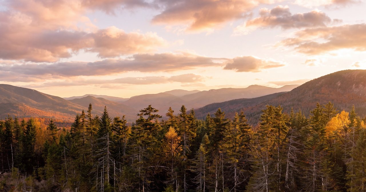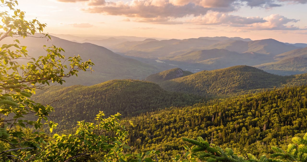
Hedgehog Mountain is the hike we send guests on when they want a real White Mountain summit with real views and none of the circus. It is a 2,532-foot peak in the Sandwich Range off the Kancamagus Highway, one of the more modest summits on the popular New Hampshire 52 With a View list, and it earns its place on that list by handing you three distinct open viewpoints on a single loop of about 4.8 miles. You get Allen's Ledge low down, the long bare granite of the East Ledges up high, and the summit ledges sitting right under the great steep wall of Mount Passaconaway. For the effort - call it a fit hiker's half-day, roughly 1,400 to 1,450 feet of climbing - that is an unusually good return, and you will often share it with only a handful of other people.
That quiet is the whole point. Five miles west of here the Franconia Ridge trailheads overflow by eight in the morning and the ridge itself can feel like a parade. Hedgehog, tucked on the eastern half of the Kancamagus near Sabbaday Falls, draws a fraction of that traffic. The lot is a Forest Service fee lot shared with hikers headed up Downes Brook and Mount Potash, so it does fill on a bluebird foliage Saturday, but on most days you will find room and, up on the ledges, room to spread out. This is a mountain for people who would rather work a little for a big view than stand in line for a famous one.
This guide walks you through Hedgehog: the numbers and how they feel underfoot, the trail junction by junction with the mileage splits, a clear recommendation on which way to walk the loop and why it changes with conditions, the trailhead and the Kancamagus drive that gets you there, and the one thing to watch on this hike - acres of open slab that are a joy when dry and slick when wet or iced. The trailhead is about 22 miles and 35 min east of our door, and there is nothing on that road, so read the drive section before you leave Lincoln.
The numbers, and what they feel like underfoot
Start with the stats, because Hedgehog punches above its modest height and the numbers explain why. The standard trip is the UNH Trail loop, and the well-kept trail guides put it at about 4.8 miles round - Hike New England, NH Family Hikes and several trip reports all list 4.8, while onX and AllTrails call it about 4.7. Either way you are looking at a loop of roughly 4.7 to 5.0 miles, not an out-and-back, which is part of the appeal: you climb one way and descend another and see new ground the whole time. The elevation gain lands around 1,400 to 1,450 feet cumulative - Hike New England lists 1,450 and AllTrails 1,407 - and the summit is 2,532 feet, low enough that a couple of sources round it to 2,520 or list 2,542.
What those numbers feel like on the ground is a rolling, three-part climb rather than one long grind. The loop starts nearly flat on an old railroad grade, then gives you a genuine pitch of steep, rooty forest climbing, eases across open granite, and pushes up again to the top. There is no exposed alpine ridge to cross, no scramble that needs both hands and a cool head, and nothing to fret about in good dry conditions. But there is real elevation, some steep rocky steps, and long stretches of bare slab where the footing is grip-on-rock rather than dirt. That mix is why some family-hike sites rate it hard - not for exposure, but for the distance and the steep, ledgy sections.
On time, most people walk the full loop in about three and a half to five hours, plus however long you sit at the three viewpoints, and you should plan to sit - this is a mountain to eat lunch on, not to speed-march. Strong, steady hikers do the loop in about three hours moving time. A slower group, or anyone stopping to take in each ledge, should give it the better part of a day and be fine with that. It makes an excellent full outing when you want more than a waterfall walk but less than a 4,000-footer, and it is a smart choice on a day when the high summits are socked in but the lower Sandwich Range is clear.
One frame before you go: low is not the same as easy. People read 2,532 feet, picture a stroll, and show up in smooth-soled sneakers with no water and no layer, and those are the folks who slip on the slab or run out of gas on the second climb. Hedgehog is moderate, not trivial. Treat it as the real mountain hike it is - proper footwear, water, a layer, a map - and it rewards you with three views most 4,000-footers cannot match for the money.
Three viewpoints on one modest loop
The reason to climb Hedgehog instead of a taller neighbor is that the one loop strings together three separate open viewpoints, each looking a different direction, so you are not walking to a single payoff and back. It is a lot of scenery packed into a short day, and each spot has its own character.
Allen's Ledge is the first and smallest, a low outlook reached by a short, steep, signed spur off the loop. It faces roughly north and west over the Swift River valley and the Kancamagus, toward Mount Potash right across the drainage, Mount Huntington, Mount Kancamagus, and Green's Cliff, with the highway itself somewhere down in the trees. It is a modest view, not the grand one, but it is a fine excuse to stop early and get your first look out of the forest.
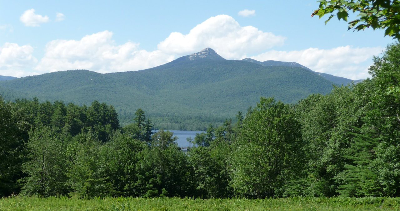
The East Ledges are the standout: acres of open, gently tilted granite slab high on the mountain's eastern shoulder, with a wide panorama that takes in the distinctive rocky horn of Mount Chocorua to the east and southeast, the Moat Range beyond it, the Swift River valley below, and Mount Carrigain with its Signal Ridge to the north. This is where you want to spend your time and eat your lunch. On a clear day it is one of the better open-ledge perches in the Sandwich Range, and because Hedgehog is quiet you often get it nearly to yourself.
The summit ledges at 2,532 feet are the third, and the view that defines the mountain: Mount Passaconaway rising steeply and hugely to the south and southwest, so close it fills the sky, with Mount Whiteface and the Tripyramids stacked along the Sandwich Range beside it. The top is partly wooded, so you move between openings rather than standing on a bald peak, but the Passaconaway wall is the picture everyone climbs Hedgehog for. On the clearest days you can pick out Mount Washington and the southern Presidentials off to the north.

The trail, junction by junction
The loop begins a little oddly, on a different trail: from the Kancamagus lot you start south on the Downes Brook Trail for only about 60 yards, then turn onto the signed UNH Trail. Do not blow past that turn - the Downes Brook Trail keeps going toward Mount Potash and the long Downes Brook drainage, and you want the UNH Trail. From there you walk an easy, nearly level old railroad grade for about a fifth of a mile to the loop junction, where the UNH Trail splits into its two branches. This is the one decision point on the hike, and the next section covers which way to take it.
Taking the branch that heads for the East Ledges first, you soon reach the crossing of White Brook at about 0.9 mile. In normal flow it is an easy rock-hop; after heavy rain or during spring melt it runs higher and deserves respect, and it is a useful early read on how wet the slabs above will be. Beyond the brook the trail climbs in earnest through the woods, then breaks out onto the open East Ledges at roughly 2.0 miles from the lot. You walk up and across the slab - watch for cairns and blazes on the bare rock - with the views opening as you climb, and continue to the wooded summit at about 2.9 miles.
From the summit the loop comes down the other branch, steeper and more direct, dropping back into forest. At about 3.7 miles a short, steep signed spur climbs 60 yards to Allen's Ledge for that last north-and-west view, and then the trail continues down to close the loop back at the junction and out to the car at about 4.8 miles. Those splits - White Brook 0.9, East Ledges 2.0, summit 2.9, Allen's Ledge 3.7 - are for walking the loop up the East Ledges side and down the Allen's Ledge side; reverse them if you go the other way around.
None of the junctions are confusing in good visibility - the UNH Trail is well signed and, apart from the open slab, well worn. The two places to pay attention are the initial turn off Downes Brook onto the UNH Trail, and the East Ledges themselves, where the footway crosses bare granite with no dirt tread to follow and it is easy to wander off the line, especially in fog or on the way down. On the rock, keep finding the next cairn or blaze before you move, and note where the trail leaves the slab back into the trees.
Which way around the loop - and why it matters
Because it is a loop, you can climb the East Ledges and descend past Allen's Ledge, or reverse it and climb past Allen's Ledge to descend the East Ledges. The standard trail guides describe it clockwise - up the East Ledges and down past Allen's Ledge - and in most conditions that is the safer way to walk it, because you climb the open slab rather than descend it. Some hikers prefer the reverse, saving the East Ledges for the descent so the big view toward Chocorua and the Swift River valley opens in front of you as you come down the open slab; that means going up the shorter, steeper Allen's Ledge branch to the summit, then down the longer, more gradual East Ledges branch. In dry summer conditions with a settled forecast that reverse is a fine, scenic choice - but only when the rock is reliably dry, for the reason the next paragraph explains.
But the direction is not just about scenery, and this is the important part the trail apps skip: the East Ledges are open granite, and open granite is treacherous when it is wet, frosted, or iced. Climbing up a slick slab is awkward but manageable - you are moving into the hill and your hands are near the rock. Descending a slick slab is how people fall, because a slip on angled granite slides you downhill toward a drop, not just onto your backside. So the rule that should override the scenery preference is simple: if the slab could be wet or icy - after rain, on a cold morning, in spring, in late fall - do not descend it. Go up the East Ledges and come down the sheltered, wooded Allen's Ledge side instead.
Put together, that gives you an easy decision at the trailhead. Dry rock and a settled forecast: walk it so you descend the East Ledges and enjoy the unfolding view. Any chance of wet or iced slab: walk it the other way, climbing the East Ledges and descending the woods. When in doubt, climb the ledges rather than descend them - you give up a little of the scenic-descent effect and gain a lot of margin. Either direction is the same 4.8-mile loop with the same three viewpoints; you are only choosing which hazard you take uphill.
One more practical note: whichever way you go, the East Ledges are where you will want to linger, so plan your food and your longest sit for there rather than the partly-wooded summit. If you are chasing morning light and dry rock, an early start up the East Ledges also gets you across the slab before any afternoon weather, which is never a bad habit on open rock.
The East Ledges: the best granite on the hike
The East Ledges are what lift Hedgehog from a pleasant woods walk to a hike worth driving for. After the climb above White Brook the forest thins and you step out onto a broad apron of tilted granite that runs up the mountain's eastern side, and the whole eastern White Mountains open up. The clear landmark is Mount Chocorua, whose bare rock summit is one of the most recognizable shapes in the range, sitting to the east and southeast; beyond it are the Moats over toward Conway, and swinging north you look up the Swift River valley to Mount Carrigain and the long Signal Ridge. It is a big, open, sit-down-and-stare kind of view.
The slab itself is part of the pleasure and part of the caution. When it is dry it is superb walking - grippy, sun-warmed rock at a friendly angle, the kind of surface that makes you feel surefooted. When it is wet with rain or dew, glazed with morning frost, or holding a skin of ice in the cold months, the same rock turns slick and unforgiving, and there are pitches steep enough that a slide would carry you. That split personality is why the direction-of-travel advice matters so much here and why this is the single feature to respect on the mountain.
Navigation is the other thing the ledges ask of you. Out on bare granite there is no boot-worn path to follow, so the trail is marked by cairns - small stacked-rock piles - and paint blazes, and it is easy to drift off the line if you stop watching for them, particularly in cloud or low light, and particularly on the descent when you are tired and moving faster. Before you take each stretch of rock, find the next marker. And fix in your mind the spot where the trail leaves the slab back into the woods, because an open ledge in fog is exactly where people lose the route.
Give yourself time here. This is the lunch spot, the photo spot, the place the whole loop is built around. On a quiet weekday you may have the entire East Ledges to yourself, which is not something you can say about the marquee ridges a few miles west, and it is the best argument for choosing a humble 2,532-foot peak over a crowded taller one.
The summit and the wall of Passaconaway
The true summit of Hedgehog, at 2,532 feet, is a short way on from the top of the East Ledges, and it trades the wide eastern panorama for one dominant, dramatic view: Mount Passaconaway. Passaconaway is a 4,000-footer that rises immediately to the south and southwest, and from Hedgehog's summit ledges it looms enormous and close, a steep forested wall that fills that side of the sky. Alongside it the Sandwich Range marches off - Mount Whiteface, the twin humps of the Tripyramids - so the summit view is really a portrait of the range Hedgehog belongs to, seen from its feet.
The top is not a bare bald; it is partly wooded, with openings and ledges rather than a single open crown, so you move a few steps between viewpoints to see out. Think of the views as a set rather than a single 360-degree panorama - the East Ledges give you the big open sweep, and the summit gives you the Passaconaway wall. On the clearest days you can also look north and pick out Mount Washington and the southern Presidentials on the horizon, which is a lot of mountain to see from a peak this modest.
Because the summit is treed and the East Ledges are open, most people find the ledges the better place to stop and the summit the better place to simply stand, take in Passaconaway, and turn around to continue the loop. If the day is cool or breezy, the summit's tree cover can be the more comfortable spot for a snack, while the exposed ledges are where you go for sun and the long view. Either way the summit is the hinge of the loop - the point where you have climbed all your elevation and everything ahead is downhill.
Allen's Ledge and the quiet north view
Allen's Ledge is the third viewpoint and the one most likely to be skipped, which would be a small shame. It sits low on the loop, reached by a short but steep signed spur that climbs about 60 yards off the main trail, and it looks out roughly north and west - the opposite direction from the East Ledges - over the Kancamagus corridor and the Swift River valley. From here Mount Potash stands almost directly across the drainage, with Mount Huntington, Mount Kancamagus, and the wooded hump of Green's Cliff filling out the view, and the highway you drove in on hidden somewhere in the trees below.
It is squarely the least dramatic of the three - a modest outlook rather than a grand one - but it faces a direction the other two do not, so it rounds out the day, and its low position makes it a natural place to pause early if you are climbing that side, or a last look before the final descent if you are coming down that way. The steep little spur is worth the 2 min it takes.
Where Allen's Ledge falls in your hike depends on your direction of travel. Climb the East Ledges side and you meet Allen's Ledge near the end, at about 3.7 miles, on the way down. Climb the Allen's Ledge side and you get it early, as your first view of the day, before the summit and the East Ledges. There is no wrong answer; it is simply one more reason the loop feels like it packs a lot of scenery into a short distance.
The trailhead, the fee, and the empty Kancamagus
The hike starts from the Downes Brook Trail parking lot on the south side of the Kancamagus Highway, NH Route 112, across the road from the WMNF Passaconaway Campground and about a mile east of the Sabbaday Falls parking area. It is an easy trailhead to find if you know it is the Downes Brook lot - the UNH Trail is not signed from the road as its own trailhead, so you are looking for Downes Brook, then you start on that trail for 60 yards before the UNH Trail branches off. The lot serves hikers headed for Downes Brook, Mount Potash, and Hedgehog, so on a peak foliage weekend it can fill, but it is a world quieter than the Franconia Notch trailheads and you will usually find a spot.
This is a White Mountain National Forest fee area, so you need a recreation pass on your dashboard to park. For 2026 that is about $5 for the day of purchase, $30 for an annual pass, or $40 for an annual household pass, and the federal America the Beautiful pass at $80 covers it too if you already carry one. You can buy the day pass on site; if you are hiking here more than once, the annual pays for itself fast. Fees do change, so if you want it confirmed to the dollar, check the current rate with the White Mountain National Forest before you go. The voluntary hikeSafe card is a separate thing, covered in the safety notes.
Now the part that catches people out: there is nothing on the Kancamagus. The highway runs about 34 miles between Lincoln and Conway with no gas station, no store, no restaurant, and no reliable cell signal for essentially its entire length - it crosses a high, wild stretch of national forest, not a town. Whatever you need for the day, you buy in Lincoln on the way out. That means a full tank of gas, water, food, and a downloaded map before you leave pavement you know. The trailhead has, at best, a vault toilet at the nearby campground in season and nothing else.
A nice bit of context for the drive: just east of the trailhead is the Russell-Colbath Historic Site, a preserved 19th-century homestead, and the whole area carries the name of the old Passaconaway settlement, named for Passaconaway, the 17th-century Pennacook leader whose name the big mountain over the summit also carries. You are hiking in a corner of the Kancamagus with a lot of quiet history to it, even if the loop itself keeps you in the woods and on the rock.
Ice on the ledges: the shoulder-season trap
If there is one thing to take away from this guide, it is that Hedgehog's open ledges hold ice long after the calendar and the valley say the coast is clear. From roughly October into spring, and on any cold, clear morning even at the edges of that window, the granite slabs of the East Ledges can carry black ice and verglas - a thin, hard, nearly invisible glaze - while the parking lot looks bare and the air down at the car feels mild. Hikers get lulled by a warm valley and a dry approach trail, step out onto the slab, and find themselves on skating-rink rock at an angle, which is a bad place to be.
The defense is straightforward. Carry microspikes from about Columbus Day onward and well into spring, and do not wait to put them on until after you have slipped - get them on before the first stretch of open rock. Treat a cold clear morning with suspicion even in the fringe seasons. And lean hard on the direction-of-travel rule from earlier: when the slab might be iced, climb the East Ledges and descend the wooded Allen's Ledge side, because down-climbing iced granite is exactly the move that ends in an ambulance. If you reach the ledges and the ice is beyond your traction and your comfort, turning around is the right call, not a failure - the view will be there on a warmer, drier day.
Wet rock, short of ice, is the same hazard in a milder form. After rain, in heavy dew, or when a cloud is dragging across the summit, the slab goes slick and the angled sections get sketchy underfoot. The same rules apply: prefer to climb the ledges rather than descend them, slow down, test your footing, and keep off the steepest pitches of wet rock if you can route around them. Dry granite is grippy and forgiving; wet or iced granite is neither, and the mountain does not care that it is only 2,532 feet.
Winter on Hedgehog
Hedgehog is a popular and rewarding winter hike, and the good news is that the Kancamagus Highway is a state road that is plowed and kept open year-round, so unlike the seasonally gated forest roads elsewhere in the Whites - Tripoli, Zealand, Sawyer River - you can reach this trailhead in winter. That said, the Kancamagus is high, exposed near its pass, and drives slick and snowy in a storm, and it can close temporarily in severe weather; check road conditions before you commit to the drive, and do not count on the trailhead lot being fully plowed out.
On the mountain, winter turns the whole loop into a traction problem. The steep forest pitches pack down into firm, slick tread, and the open ledges become the real event: they can be scoured to bulletproof ice or loaded with snow that hides the rock and the route. Microspikes are the minimum, full crampons and an ice axe may be warranted on hard days, and snowshoes earn their place after fresh snow. The cairns and blazes that guide you across the East Ledges in summer can be buried or plastered with rime, so winter navigation on the open rock is harder, not easier, and a whiteout up there is disorienting.
Add the ordinary winter factors and plan accordingly: short daylight, so start early and carry a headlamp; real cold and wind on the exposed ledges, far colder than the sheltered woods, so bring more insulation than the climb seems to need and put a layer on before you stop; and the fact that a mild valley can be a raw, blowing summit. Hedgehog is a reasonable winter objective for prepared hikers, and its modest height and short loop make it more forgiving than a big peak, but it is a full winter hike with winter gear, winter traction, and winter judgment - not a summer walk in the snow.
Weather, the higher-summits forecast, and turnaround judgment
Hedgehog is low and mostly wooded, so it does not carry the life-threatening alpine exposure of the Presidentials, and you should not go in braced for a Mount Washington epic. But it is still a mountain, its three viewpoints are all open and exposed, and its slabs are weather-sensitive, so a couple of habits pay off. Before you drive out, check a valley forecast for the Albany and Kancamagus area, and glance at the Mount Washington Observatory Higher Summits Forecast at mountwashington.org. That forecast is written for the big peaks and Hedgehog is far tamer, but it is the best single read on what the weather moving through the region is going to do, and it is free.
The reason the sky matters here is twofold. First, this is largely a view hike; if the Sandwich Range is buried in cloud you will do the loop and see gray, so it is worth saving Hedgehog for a clear or clearing day and being willing to swap it out when the forecast is murk. Second, and more seriously, the open ledges are exposed to lightning, and summer thunderstorms build fast and mean over these mountains on hot afternoons. A bare granite slab is a poor place to be when one arrives. The discipline is the usual one: be up and across the ledges early, watch the sky to the west, and treat the first distant thunder as your cue to get off the open rock and down into the trees, not as a reason to grab one more photo.
Turnaround judgment on Hedgehog comes down to conditions more than fitness, because the walking itself is moderate. If the ledges are iced beyond your traction, if a storm is building, if the cloud has dropped and you cannot follow the cairns across the slab, or if White Brook is a genuine ford telling you everything above is wet - those are all reasons to shorten the day or turn back, and none of them is a defeat. The loop runs on the same schedule every year. A modest, quiet peak is precisely the kind of place where it is easy to get casual and push on when you should not, so give yourself firm permission to bail. The mountain is not going anywhere.
It is also worth saying that quiet cuts both ways. The light traffic that makes Hedgehog so pleasant also means that if something goes wrong out here, there may be no one along to help and no cell signal to call for it. That is not a reason to avoid the hike - it is a reason to bring the judgment and the gear that let you handle small problems yourself before they become big ones.
Water, dogs, footing, and what to carry
Plan Hedgehog as a carry-your-own-water hike. You cross White Brook low on the loop, but the ridge, the ledges, and the summit are dry, so bring what you will drink from the car - figure a liter and a half to two liters per person on a warm summer day, less when it is cool. If you do dip from the brook, treat it by filter, purifier, or boiling like any backcountry water in the Whites, but for a loop this short it is easier to just carry your supply and not think about it. Fill up in Lincoln, where the water is easy, since there is nothing on the drive.
On footwear and gear, treat this as the real mountain hike it is. Wear boots or trail shoes with genuine grip and some ankle support for the steep rooty pitches and the slab, not smooth-soled sneakers; the same rock that is fine going up gets slick and ankle-turning coming down on tired legs. Carry a wind or rain layer even on a fair forecast, because the open ledges run cooler and breezier than the sheltered woods. Add sun protection for the exposed slabs, a map you have downloaded, a headlamp, and enough food for a half-day. In the cold months, microspikes are not optional - see the ice and winter notes above.
On dogs, since guests always ask: leashed dogs are allowed on the UNH Trail, as on most White Mountain National Forest trails, and plenty of people bring them. Just know the terrain going in - the open slabs and short steep ledges are hard on paws and slippery for a dog when the rock is wet or iced, the same as for you, and the ridge is dry, so carry the dog's water too. Keep the dog leashed and close on the exposed rock. The one note for our guests is the standing one: the lodge is adults-only and pet-free, so hiking with a dog means arranging for it somewhere other than here.
hikeSafe and hiking a quiet peak
Two New Hampshire specifics belong in your pack on any hike in these mountains, and a low, lonely peak like Hedgehog is exactly where they matter most. First, this state can bill hikers for their own rescues. Under RSA 206:26-bb, a hiker whom New Hampshire Fish and Game judges to have acted negligently can be charged for the search-and-rescue operation, which can run to thousands of dollars. The voluntary hikeSafe card removes that liability short of true recklessness and helps fund the rescue teams directly. It is $25 for an individual or $35 for a family for 2026, sold through New Hampshire Fish and Game, valid the calendar year, the same price for residents and visitors, and you can read about it at hikesafe.com.
Second, do not let your phone be your safety plan. There is little to no cell coverage on the Kancamagus or on Hedgehog, so anything that depends on a signal - a live map, a weather check, a call for help - may simply not work when you need it. Download your map before you leave the lodge, carry the ten essentials scaled to the day, and tell someone your plan: which trailhead, which loop, and when you expect to be back. We ask hiking guests to leave a route and an out-time with someone at home, and we mean it as much on a quiet 2,532-footer as on a big peak, because quiet is where help is farthest away.
That is really the whole safety story of this mountain, and it is a fair one: Hedgehog is a moderate, friendly hike with one serious hazard, the open ledges when they are wet or iced, and one quiet-country reality, that you are more on your own out here than on the famous trails. Respect the slab, carry traction in the shoulder and winter seasons, read the weather, choose your direction of travel for the conditions, tell someone your plan, and give yourself permission to turn around. Do those simple things and Hedgehog gives you three big views and a quiet day for a modest amount of work - which is exactly why it is one of our favorites to send people to.
Safety & conditions
- The open East Ledges are the signature hazard on this hike: acres of bare granite slab that are grippy when dry and treacherous when wet, frosted, or iced. Never descend wet or icy slab if you can climb it instead - in spring, late fall, or after rain, go up the East Ledges and come down the wooded Allen's Ledge side. A slip on angled slab slides you toward a drop, not just onto your backside.
- Shoulder-season ice is what catches people here. From roughly October into spring, and on any cold clear morning at the edges of that window, the ledges can hold black ice and verglas long after the parking lot looks bare and the valley feels mild. Carry microspikes from about Columbus Day on, put them on before you reach the slab, and turn around if the ice is beyond your traction and nerve.
- White Brook, crossed about 0.9 mile in on the East Ledges branch, is normally an easy rock-hop but runs high and pushy after heavy rain or during spring snowmelt. If it is a real ford, take that as a signal the ledges above will be wet too, and reconsider the day or your direction of travel.
- This is a view hike with three exposed viewpoints, so let the weather decide. Check a valley forecast for the Albany and Kancamagus area and the Mount Washington Observatory Higher Summits Forecast at mountwashington.org before you go. The open slabs are no place to be in a thunderstorm, and summer storms build fast on hot afternoons - be up and across the ledges early and get off the rock at the first thunder.
- It is easy to lose the trail on the open rock. On the East Ledges the footway crosses bare granite with no worn tread to follow, so watch for cairns and paint blazes, and fix in your mind where the trail leaves the slab back into the woods - especially in fog or fading light, and especially on the descent, when most people wander off-route.
- The Kancamagus has no services and little to no cell coverage for its whole 34-mile length. Download your map before you leave Lincoln, carry the ten essentials and a headlamp, plan to navigate without a phone signal, and tell someone your route and expected return time. On a quiet peak, help is farther away than on the famous trails.
- Do not underestimate the descent. The steeper Allen's Ledge side is rooty and rocky, and tired legs coming down are how ankles and knees get hurt on a modest mountain. Wear real footwear with grip and support, use poles if your knees like them, and slow down rather than hurrying because the peak felt small.
- Carry the New Hampshire hikeSafe card ($25 individual, $35 family for 2026 from NH Fish and Game). New Hampshire can bill a hiker judged negligent for a rescue under RSA 206:26-bb, and the card waives that cost, short of recklessness, while helping fund the volunteer rescue teams. It is worth having on a low, quiet peak precisely because quiet peaks are where help is farthest away.
Where to stay for it
The drive is simple but longer and emptier than it looks on a map, so read this before you set out. From 191 Pollard Road you make your way to the Kancamagus Highway, NH Route 112, in Lincoln, and head east - away from I-93 and up over the height of land. From there it is about 22 miles of winding, scenic two-lane to the Downes Brook Trail parking lot, which is on the right, the south side, across from the Passaconaway Campground and about a mile past the Sabbaday Falls lot. Figure roughly 35 min with a clear road, and closer to 45 min or more on a busy summer or foliage day, when the Kancamagus fills with sightseers driving slowly, pulling into overlooks, and occasionally stopping for wildlife. It is a beautiful drive, one of the best in the state, so leave time to enjoy it rather than fighting it.
Provision completely in Lincoln, because once you turn onto the Kancamagus there is nothing - no gas, no store, no coffee, and no reliable cell signal - for the entire 34-mile run to Conway. Fill the gas tank, and pick up sandwiches, snacks, and plenty of water in town; the supermarket in Lincoln is the easy one-stop, and there are gas stations and coffee in Lincoln and North Woodstock. Download your trail map while you still have a signal, since you will lose it on the highway, and leave your route and your expected out-time with someone at home. On the way you pass Sabbaday Falls just before the trailhead, an easy, worthwhile half-mile stop, and Rocky Gorge is a few miles farther east if you want to add a short scenic walk to the day.
Sources & official info: hikenewengland.com · nhfamilyhikes.com · alltrails.com · onxmaps.com · fs.usda.gov · outdoors.org
— Launchpoint Lodge, From the lodge