Mount Tecumseh is 4,003 feet, and that number is the whole story of the mountain in two ways. It is the lowest of New Hampshire's forty-eight 4,000-footers, the shortest peak on the list that thousands of hikers work to finish, which makes it a natural first climb and, for a lot of people, the very last one they tick off. It is also a number that has been argued over, because a newer survey marker on the summit reads a few feet under 4,000, and for a while it looked like the smallest of the 48 might not technically be a 4,000-footer at all. The list did not change - Tecumseh is still peak number 48, and climbing it still counts - but the debate tells you something true about this mountain: it is a modest, unshowy little summit that has to be taken on its own terms, not oversold.
The standard way up is the Mount Tecumseh Trail from the Waterville Valley ski area parking lot, and it is about 5 miles round trip with roughly 2,200 feet of climbing. That is short by the standards of the 48, and the grade is friendly enough that Tecumseh gets recommended constantly as a first 4,000-footer and a first winter 4,000-footer. What the tidy numbers do not tell you is the character of the climb - a steady, staircase-like ascent with very little flat to catch your breath on - or what the top is like: a wooded summit with a single cut opening rather than the wide-open panorama some people expect from a 4,000-footer. This guide is going to be straight with you about both, because a good day on Tecumseh starts with the right expectations.
Two things set Tecumseh apart from the bigger peaks around it, and both are good news. First, it is one of the least exposed summits on the whole list - the top is in the trees, there is almost no above-treeline alpine terrain, and that changes the entire safety picture from the giants to the north. Second, the trailhead sits in the Waterville Valley ski area lot, on the plowed, year-round end of the access road, which is exactly why Tecumseh works as a first winter peak when higher, more exposed mountains do not. The trailhead is about 30 min from our door. Here is the real 2026 rundown - the numbers, the parking, the view, the winter version, and the elevation story that makes this little mountain more interesting than its height suggests.
The numbers
Start with the standard hike, because it is the one almost every guest should plan for: Mount Tecumseh by the Mount Tecumseh Trail, out and back from the Waterville Valley ski area lot. Round trip it runs right around 5 miles. Waterville Valley's own trail page puts the out-and-back at about 4.9 miles; the AMC and the four-thousand-footer references list the popular loop version - up the Mount Tecumseh Trail, down the Sosman Trail and the ski slopes - at about 5.2 miles. Either way, call it a solid five-mile day, give or take, which is short for a 4,000-footer and part of why this one gets recommended to beginners.
The climbing is where the numbers matter. Waterville Valley lists the elevation gain at 2,283 feet, and most other sources land in the same neighborhood, roughly 2,200 to 2,300 feet. That is a real amount of up packed into a fairly short distance, which is the first clue to the trail's character: there is not much flat here. You gain your two-thousand-plus feet steadily, more or less the whole way, in a staircase-like grind rather than a gentle stroll with a steep bit at the end. It is not hard in the sense of scrambling or exposure - there is essentially none of that - but it is plain, sustained work, and newcomers are sometimes surprised by how continuously uphill it feels.
On time, most fit parties spend three to four and a half hours on Tecumseh car to car, and a strong hiker moving well can do it in under three. A first-time 4,000-footer taking a careful pace, or a group having a relaxed day with a long summit break, can easily be out for four to five hours. In winter, add time - broken trail, traction changes, and short daylight all slow you down. Whatever your pace, this is a mountain you can decide on over breakfast, climb in a morning, and be back from with the afternoon still ahead of you in Lincoln, which is a big part of its appeal.
One planning note before you commit. The plainest way to do Tecumseh is the straight out-and-back on the Mount Tecumseh Trail, up and down the same way, and that is what most of this guide describes. There is also a well-known loop that adds a little variety near the top - descending the Sosman Trail for a stretch and then following the ski trails back down to the lot - which gets you the best views of the day and only adds a few tenths of a mile. It also adds a couple of junctions you have to get right, which matters more in snow or fog than on a clear summer day. Both are covered below; for a first trip, the out-and-back is the simplest, and there is no shame in keeping it simple.
The 4,003-foot story: the shortest 4,000-footer that almost wasn't one
Here is the piece of trivia that makes this modest mountain worth a paragraph of its own, and it is worth getting right rather than repeating the tidy version. For decades the mapped summit elevation of Mount Tecumseh was 4,003 feet. That figure put it dead last on the Appalachian Mountain Club's list of New Hampshire 4,000-footers - the shortest of the 48, clearing the 4,000-foot bar by a scant three feet. It has always been the mountain with the least margin, the one whose place on the list depended on a rounding of a few feet on an old survey.
Then more precise measurement caught up with it. By July 2019, a survey marker on the summit showed an elevation of 3,997 feet - about three feet under the 4,000-foot line, and roughly six feet lower than the long-published 4,003. Modern high-resolution mapping of New Hampshire, the kind flown with laser instruments from aircraft, has generally supported a figure a touch below the old number. In other words, by the newest measurements, the smallest of the 48 may not stand 4,000 feet tall. That is a strange thing to be able to say about a peak that thousands of people have climbed specifically because it is a 4,000-footer.
So does it still count? Yes - and this is the part that matters if you are here to climb it. The AMC Four Thousand Footer Committee, which owns and maintains the list, did not remove Tecumseh. It remains the official shortest peak on the New Hampshire 48, still published at 4,003 feet, and finishing hikers still climb this summit to complete their round of the list. The committee's list is a defined standard set on the historical surveys, and it was not reshuffled over a handful of feet from a newer benchmark. Practically speaking, if you stand on top of Mount Tecumseh, you have climbed a 4,000-footer for list purposes.
The real bottom line is that exactly how tall Tecumseh really is depends on which survey you trust, and reasonable sources cite anywhere from about 3,997 to 4,003 feet. It is a fun bit of White Mountains trivia and nothing more - not a reason to skip the mountain, and not a reason to feel cheated if you climb it. If you care about the official record, the AMC Four Thousand Footer Committee is the authority to check, and their answer has not changed: Tecumseh is on the list, it is the shortest of the 48, and it counts.
The Mount Tecumseh Trail: a steady staircase through the woods
The Mount Tecumseh Trail leaves from the north end of the Waterville Valley ski area parking lot and climbs the mountain's east side through the woods the whole way. Its defining feature is the grade: steady and staircase-like, with very little flat and very few real breaks in the uphill. This is not a trail that lulls you along a river for a mile before it gets down to business - it starts climbing early and keeps climbing, and the work is fairly evenly spread from bottom to top. That is a virtue for a first 4,000-footer, because you settle into a rhythm and make consistent progress rather than facing one steep headwall.
Low down, the trail crosses a branch of Tecumseh Brook - normally an easy rock-hop, worth a note mostly because it is about the only water on the route and because it can run higher in spring melt or after heavy rain. Above the crossing the trail works up the slope, at times on a rougher, rockier tread with built-up steps and water bars, at times swinging into switchbacks as it gains the ridge. There are a couple of steeper pitches, but nothing that requires hands on rock in normal conditions; it is walking, uphill, the whole way. The footing is typical White Mountains - roots, embedded rock, some loose stone - so decent boots and a little care on the descent go a long way.
Higher up, the forest closes in to spruce and fir and the trail nears the junctions that matter near the top - the spur toward the ski area's upper slopes and the Sosman Trail along the ridge. This is the zone where the loop option and the summit come together, and where, in snow, you want to be paying attention to which way you are going. On a clear day it is straightforward and well-trodden. The last stretch to the actual high point is a short, modest push through the trees to a small wooded summit, and if you were expecting the trail to suddenly break out onto open rock, it does not - the top is in the woods, which brings us to the practical truth about the view.
The trailhead: the Waterville Valley ski area lot, and free parking
This is one of the friendlier trailheads we send guests to, and the parking situation is part of why. The Mount Tecumseh Trail starts right in the Waterville Valley ski area parking lot, off the plowed east end of Tripoli Road at the ski resort. Because you are parking in the resort's own lot rather than a Forest Service trailhead pull-off, a White Mountain National Forest parking pass is not required here - parking for the hike is free. That is a genuine and unusual perk; most 4,000-footer trailheads in these mountains want a $5 self-service pass or an annual sticker, and this one does not.
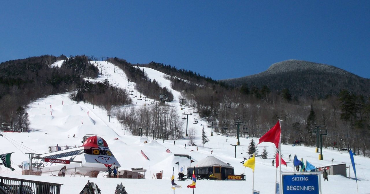
A couple of clear caveats on that. First, this is a working ski resort, and in ski season the lot is there for skiers, not hikers. If you are climbing Tecumseh in winter, park well out of the way, do not take prime spots near the base lodge, and expect a busy, plowed, actively used lot rather than a quiet trailhead - and if in any doubt about where hikers should park, ask at the resort or check Waterville Valley's website before you go, because a resort can change its parking rules season to season. Second, do not confuse this end of Tripoli Road with the gated part. The ski-area access is the paved, year-round east end; the seasonal gravel section of Tripoli Road, gated shut through the snow months, is farther west, and it matters here for one specific reason covered in the trail and winter sections - the far side of Tecumseh comes down to that gated road.
For general planning it is still worth knowing the White Mountain National Forest pass system, because you will use it at plenty of other trailheads around here even if not at this one. In 2026 the WMNF recreation pass runs about $5 for a day (good the day of purchase), $30 for an annual pass, $40 for an annual household pass, or the federal America the Beautiful pass at $80 covers it if you already carry one. None of that is required to park for Tecumseh at the ski area as things stand, but carry or know it for the rest of your hiking here.
The lot is your last piece of civilization on the hike itself. There is no water on the trail to count on beyond the low brook, no restroom you should rely on once you leave the base area, and cell coverage up on the mountain is patchy. Treat the car as your base station: fill your bottles, sort your layers, note your start time, and download your map before you walk in. The Waterville Valley town square, a couple of minutes away, has a small market if you need to top up on provisions before you start.
The summit and the real truth about the view
Here is what to expect at the top, so the summit feels like a reward rather than a surprise. Mount Tecumseh's true summit is wooded. It is not a bare rock dome with a sweeping panorama; it is a modest high point in the spruce and fir, and the main view from at or near the top is a single cut opening - a vista cleared through the trees - looking out toward Mount Osceola and the Tripyramids across the valley. On a clear day that cut view is a nice reward, a clean look at the peaks that wall off the far side of Waterville Valley. But it is one window, not a 360, and if you arrive expecting the kind of endless horizon you get on the bald summits to the north, you will feel shortchanged.
The better views on this hike are not from the true summit at all - they are from the Sosman Trail ridge just west of the top and, best of all, from the tops of the ski slopes. Take the short detour along the ridge or out to where the trail meets the upper ski trails and the country opens up: down into Waterville Valley, across to the Tripyramids and Osceola, and out over a good sweep of the southern Whites. Many people who know the mountain will tell you the ski-slope overlook is the real scenic payoff of a Tecumseh hike, and it is only a few minutes off the summit. If the view is what you came for, make the overlook part of your plan.
None of this is a knock on the mountain - it is just the plain character of it. Tecumseh is a woods walk to a woods summit with a couple of good outlooks you have to step slightly off the top to find, and taken that way it is a pleasant, worthwhile climb. Go in wanting a steady forest hike, a 4,000-footer in the bag, and one clean cut view of Osceola, with the option of a better look from the ski slopes, and the summit delivers exactly that. Go in expecting Franconia Ridge and you will be let down by a mountain that never promised it.
The Sosman Trail and the ski-slope loop option
The most popular way to add a little to the day and grab the best views is the loop: climb the Mount Tecumseh Trail to the summit, then descend the Sosman Trail along the ridge for a short stretch before dropping down the ski slopes back to the base lot. The whole loop runs about 5.2 miles, only a few tenths longer than the plain out-and-back, and it trades a bit of repetition for the open outlooks from the Sosman ridge and the top of the ski trails. On a clear summer or fall day it is a fine way to do the mountain and see more of it.
The difference is navigation. The out-and-back is dead simple - you go up and come down the same trail. The loop asks you to get a couple of junctions right near the top, find the Sosman Trail, follow it the correct distance, and then pick up the ski-trail descent, and the ski trails themselves can be a confusing braid of intersecting runs on the way down. In clear conditions with the ground bare, this is easy and obvious. In fog, or with everything under snow, it is exactly the kind of place where people take a wrong turn, wander onto the wrong ski trail, or start down the wrong side of the mountain. If you are doing the loop, have the map handy and know the sequence before you leave the summit.
For a first trip, or any day with weather or snow in play, the recommendation is to keep it simple and go out and back on the Mount Tecumseh Trail, then take the short there-and-back detour to the ski-slope overlook for the view before you descend. You get the best of both - the easy, unmistakable line of the main trail and the good open view from the slopes - without committing to a descent route that is harder to follow. Save the full Sosman-and-ski-trail loop for a clear day when you can see where you are going and the junctions are plain.
Winter: one of the better first winter 4,000-footers
Tecumseh has a real and deserved reputation as one of the best mountains in New Hampshire to climb for your first winter 4,000-footer, and the reasons are practical ones. It is short, about 5 miles round trip. The grade is steady and moderate with no scrambling. The summit and nearly the entire trail are in the trees, so you are largely sheltered from the wind and cold that make the exposed peaks so demanding in winter - there is very little of the open, alpine terrain you find on a mountain like Moosilauke or Lafayette. And the trailhead is at a plowed, year-round ski area lot, so you can reach the start when the seasonal gravel roads to other peaks are gated shut. Add it up and Tecumseh is about as forgiving an introduction to winter above 4,000 feet as the Whites offer.
Forgiving is not the same as easy, though, and winter is still winter here. The trail gets a lot of traffic, so it is usually packed out and easy to follow, but the packed tread also means the steady, staircase-like grade turns into a firm, often icy ramp that demands traction - microspikes at least, and sometimes more on the steeper upper pitches. Snowshoes earn their place after a fresh dump before the trail is broken. Daylight is short, so start early and carry a headlamp. And while the summit is sheltered, the ski-slope overlook that gives you the view is not - step out there and you are in the open wind, so save a warm layer for it.
The one winter-specific trap on this mountain is navigation near the top, and it is worth stating. Under snow, the junctions with the Sosman Trail and the ski slopes get confusing, the packed trail can braid, and it is entirely possible to start down the wrong way. In particular, the far (west) side of Tecumseh descends toward the gated, unplowed section of Tripoli Road - go down that side by mistake in winter and you will end up far from your car with no easy way back. The rule is simple: in winter, climb the Mount Tecumseh Trail and come back down the Mount Tecumseh Trail the way you came, unless you are certain of the loop. Follow your own tracks down. Carry a downloaded map and a GPS track of your ascent, because that packed-but-braided upper section is where a tired hiker takes a wrong turn.
Water, the brook crossing, and carrying enough
Plan Tecumseh as a carry-your-own-water hike. The Mount Tecumseh Trail crosses a branch of Tecumseh Brook low down, and above that the route is essentially dry - there is no water at the summit and nothing reliable on the upper mountain. That low brook can also run thin in a late-summer dry spell, so it is not something to count on. Bring what you need from the car: about 2 liters per person is sensible for this length in summer heat, a bit more on a hot day or for a slow group, and do not drink it all on the way up so hard that you are empty for the descent.
If you do draw from the brook, treat it - filter, purify, or boil - as you would any backcountry water in the Whites. But the best advice is not to plan around it at all; it is a short enough hike that carrying your full supply from the lot is easy and removes the question. The Waterville Valley town square market and the stores back in Lincoln are your last easy water stops, so fill up before you start.
The brook crossing is also a small conditions signal worth reading. In normal flow it is an easy rock-hop and a non-event. After heavy rain or during spring snowmelt it can run higher and the rocks get slick - still a manageable ford, but if you find the low crossing pushy and full, take it as a fair hint that the trail above will be wet, the built-up steps greasy, and the descent slower. It is a small thing on a small mountain, but reading the water is a good habit everywhere in these hills.
Weather, minimal exposure, and the higher-summits forecast
Here is where Tecumseh differs from most of the 48, and it is good news: this is one of the least exposed 4,000-footers in New Hampshire. The summit is wooded, the trail is in the trees almost the entire way, and there is next to no above-treeline alpine terrain where wind and cold can get an unobstructed run at you. The wide-open exposure of the ridges to the north - Franconia, the Presidentials, Moosilauke's bald dome - is simply not the main concern here. That is a real part of why Tecumseh is a sensible beginner and beginner-winter peak.
That said, it is still a 4,000-foot mountain in the White Mountains, and the tops of these hills run colder, windier, and wetter than the valley in Lincoln no matter how sheltered the trees are. A mild morning at the car can be a raw, damp summit, and the ski-slope overlook - the one open spot you will want to stand in for the view - catches the full wind. So it is still worth a look at the Mount Washington Observatory Higher Summits Forecast at mountwashington.org before you go, paired with a valley forecast for the Waterville Valley or Lincoln area. It is written for the highest peaks and Tecumseh is far tamer, but it will tell you candidly whether the high country is going to be cold, socked in, or blowing, and it costs nothing to check.
In summer, the one weather situation to respect on any of these mountains is thunderstorms, which build fast over the Whites on warm afternoons. Tecumseh's wooded summit is less of a lightning target than a bare ridge, but the open ski slopes are not, and getting caught out on them in a storm is a poor idea. The simple discipline is the same everywhere here: on a day with storms in the forecast, be up and down early, treat the first distant rumble as your cue to get off any open ground, and do not linger on the slopes for photos while a cell builds to the west. Take the friendly exposure as a margin of safety, not a license to ignore the sky.
Shoulder seasons, ice on the steep pitches, and turnaround judgment
The sneaky season on Tecumseh is the shoulder - the weeks in fall and spring when the trailhead looks like an easy day and the upper trail has other ideas. The mountain's whole character is a steady, staircase-like grade, and that steady grade is exactly what turns treacherous when a thin glaze of ice forms on the built-up steps and the packed tread up high. It does not take much - a cold night, a little melt-freeze - to make the upper trail slick well before there is enough snow to make anyone think winter. From roughly Columbus Day onward, carry microspikes in the pack even if the lot is bare and the sun is out, because a skim of ice on a continuous uphill is precisely where a tired hiker slips on the way down.
The descent is where most mishaps happen on a mountain like this, and it is worth saying out loud. You climb a steady grade feeling strong, tag the wooded summit, and then come down the same continuous slope on tired legs over roots, rock, and maybe ice. That is the moment to slow down, shorten your stride, use poles if you brought them, and pay attention, rather than hurrying because it is a small mountain and you are nearly done. Small mountains produce plenty of turned ankles and bruised tailbones for exactly this reason - people relax their guard on the way down because the numbers looked easy.
Turnaround judgment on Tecumseh is simpler than on the exposed peaks, but it still applies. Set a turnaround time worked back from dark, especially in the short days of late fall and winter. If you find real ice on the upper switchbacks and did not bring traction, turning back is a sound call, not a failure - the summit is not going anywhere and it will be there, unchanged, on the next good day. And if you are attempting the Sosman-and-ski-trail loop and the junctions are buried or the fog has come in, the only sensible move is to give up the loop and go back down the way you came. There is no view or list-tick on this mountain worth getting hurt or lost for.
The hikeSafe card and telling someone your plan
Two New Hampshire specifics belong in your pocket on any 4,000-footer, and Tecumseh is no exception even though it is the gentlest one on the list. First, under RSA 206:26-bb, New Hampshire can bill a hiker whom Fish and Game judges negligent for the cost of a search and rescue. The voluntary hikeSafe card waives that cost short of true recklessness and helps fund the rescue teams directly - it is $25 for an individual or $35 for a family for 2026, sold through New Hampshire Fish and Game, valid January through December, the same price for residents and visitors. It is a sensible thing to buy the night before any hike in these mountains, this one included, and you can read about it at hikesafe.com.
Second, do not let your phone be your safety plan. Cell coverage is patchy on the mountain, so anything that depends on a signal - live maps, a weather check, a call for help - may simply not work when you need it. Download your map before you leave the driveway, carry a real map and compass or a GPS unit you know how to use, and leave your route and your expected out-time with a person who will notice if you do not come back. We ask our hiking guests to do exactly this, and we mean it: someone at home who knows you went up the Mount Tecumseh Trail from the ski area and expected to be down by a certain hour is worth more than anything in your pack if something goes sideways. If you are doing the Sosman loop rather than the out-and-back, say so, because it changes where a search would begin.
The last piece is the one that keeps people out of trouble on every mountain around here, and it is easy to honor on one this close and this short: turning around is free, and the summit is not going anywhere. Skipping the loop because the fog rolled in, or turning back at the icy switchbacks because you left your spikes at the lodge, costs you nothing but a return trip on a drive that is half an hour from our porch. Tecumseh runs on the same schedule every year - the trail will be there, the cut view of Osceola will be there, and the good day you want will come around again. Buy the card, tell someone your plan, and give yourself full permission to turn around.
Who this hike is for, and how to make it a good day
Mount Tecumseh is for the hiker who wants a real 4,000-footer without a huge day - a first-timer building up to the list, a family of adults wanting a steady woods climb with a payoff at the top, or a 48 finisher coming to tag the shortest peak. It earns its reputation as a sound first 4,000-footer: the distance is short, the grade is steady rather than savage, there is no scrambling or exposure to speak of, and the round trip leaves plenty of margin for a slow, careful first outing. It is also, for all the same reasons plus the plowed ski-area trailhead, one of the best mountains in the state to climb for a first winter 4,000-footer. If either of those is your goal, this is a smart, plain choice.
To make it a good day, go in with the right expectations and a little preparation. Wear boots with decent support for the rooty, rocky footing, bring poles if your knees appreciate them on a continuous descent, carry your own water since the trail is dry, and pack a warm layer and a shell even on a fair forecast - the summit and especially the ski-slope overlook are cooler and windier than the lot. Plan to step off the true summit to the Sosman ridge or the top of the ski slopes for the real view, because the wooded top alone is modest. And in any cold-season condition, put microspikes in the pack; the steady grade that makes the climb pleasant is the same grade that ices up and bites on the way down.
A word on why we like sending guests here. Tecumseh is close - about 30 min up a pretty valley road - it is a genuine 4,000-footer you can climb in a morning, and it is forgiving enough to be a real introduction to the list without being trivial. It gives you a steady, satisfying climb, one clean look across at Osceola and the Tripyramids, a good story about the shortest 4,000-footer that a survey says might not be one, and an afternoon still free in Lincoln or Waterville Valley afterward. Confirm the parking situation at the resort if you are coming in ski season, start early, keep your expectations clear about the view, and it makes for one of the friendliest big-mountain days in this whole corner of the White Mountains.
Safety & conditions
- Reset your exposure expectations for this one, in a good way: Tecumseh is one of the least exposed 4,000-footers, with a wooded summit and almost no above-treeline terrain, so the open-ridge hazard of the big peaks is largely absent here. That changes where the real risks live - not alpine wind, but ice on the steady upper trail, short winter daylight, and navigation at the Sosman and ski-trail junctions. Plan for those, not for a Presidential-range epic.
- Ice on the steady, staircase-like grade is the main hazard in shoulder season and winter. It does not take much - a cold night and a little melt - to glaze the built-up steps and packed tread up high well before real snow arrives. From about Columbus Day onward, carry microspikes even if the lot is bare, and know that most slips on this mountain happen on the continuous descent, on tired legs. Slow down, shorten your stride, and use poles going down.
- Watch the navigation near the top, especially in snow or fog. The junctions with the Sosman Trail and the ski slopes get confusing under snow, and the packed trail can braid. Critically, the far (west) side of Tecumseh descends toward the gated, unplowed part of Tripoli Road - go down that side by mistake in winter and you end up far from your car with no easy way back. In any doubt, climb and descend the same Mount Tecumseh Trail, follow your own tracks, and carry a downloaded map and a GPS track of your ascent.
- Carry your own water - about 2 liters per person, more on a hot day. The one brook crossing low on the trail can run thin in late summer, and there is no water at the summit or on the upper mountain. The short length makes carrying your full supply easy, so fill up at the car or in town rather than planning around the brook. If you do use the brook, treat it.
- Read the water crossing as a conditions signal. The low Tecumseh Brook crossing is normally an easy rock-hop, but after heavy rain or in spring snowmelt it runs higher and the rocks get slick. Even then it is an easy enough ford, but if you find it pushy and full, take it as a sign that the trail above will be wet and the built-up steps greasy, and slow your footing accordingly.
- Still check the mountain weather, even though the summit is sheltered. Look at the Mount Washington Observatory Higher Summits Forecast at mountwashington.org and a valley forecast for Waterville Valley or Lincoln before you go. The top runs colder and windier than the trailhead, and the ski-slope overlook - the open spot you will want for the view - catches the full wind. In summer, afternoon thunderstorms build fast; be up and down early and get off the open ski slopes at the first distant rumble.
- In ski season, remember the trailhead is an active resort lot, not a quiet trailhead. Park well out of the way of skiers, do not take prime spots near the base lodge, and confirm current hiker-parking rules with Waterville Valley, since a resort can change them season to season. Start early for daylight and to be down before the weather or the crowds build.
- Pick up the voluntary hikeSafe card from New Hampshire Fish and Game ($25 individual, $35 family for 2026); New Hampshire can bill negligent hikers for rescue costs under RSA 206:26-bb, and the card waives that cost short of recklessness while funding the rescue teams. Cell coverage on the mountain is patchy, so download your map in advance, carry a map and compass, and leave your route and out-time with someone who will notice if you are late - and if you are doing the Sosman loop, say which way you went.
Where to stay for it
This is a short, pretty drive up a dead-end mountain valley, and one of the easier trailheads to reach from our door in any season. From 191 Pollard Road you get on I-93 South and take it from Exit 32 down to Exit 28, the Campton and Waterville Valley exit, then head east on NH Route 49 and follow it about 11 miles up the valley - a winding, scenic road along the Mad River - into Waterville Valley. From the town square, follow the signs to the ski area and park at the lot where the Mount Tecumseh Trail leaves the north end. It is roughly 22 miles and about 30 min all told. The one real advantage of the seasonal gravel roads being irrelevant here is that this access is plowed and open year-round, so unlike a lot of nearby peaks, Tecumseh is reachable in winter.
Provision before you go, though there is more available near this trailhead than most. The stores and gas stations back in Lincoln and North Woodstock - the Price Chopper supermarket in Lincoln is the big one - are your easiest one-stop for sandwiches, extra water, and a full tank, and there are services at Exit 28 in Campton as well. Waterville Valley's town square, a couple of minutes from the ski area, has a small market if you just need to top up. Buy your water in town since the trail is dry, download your trail map while you still have a signal, and leave your route and your out-time with someone at home. If you are planning the Sosman loop rather than the plain out-and-back, mention it, because it changes where anyone would look for you.
Sources & official info: waterville.com · 4000footers.com · outdoors.org · mountwashington.org · fs.usda.gov
— Launchpoint Lodge, From the lodge