Mount Osceola is 4,340 feet, the high point of the long Osceola ridge that walls off the north side of Waterville Valley, and for a great many people it is the first New Hampshire 4,000-footer they ever climb. There is a good reason for that. When Tripoli Road is open, the Mt Osceola Trail hands you a peak on the New Hampshire 48 list for about 6.4 miles of walking and a little over 2,000 feet of climbing, ending on a broad, flat, open ledge where a fire lookout tower stood until the late 1970s. On the scale of the 48, that is a modest, reasonable day, which is exactly why the small trailhead lot fills so early on summer weekends. It is a real mountain with a real summit view, reachable by ordinary fit hikers, and it earns its reputation as a sensible place to find out whether you like this sort of thing.
Just know that Osceola is easier to underrate than to climb. The trail is rougher and slower than its tidy mileage suggests - the lower half is a rocky, rooty, ankle-testing grind, and the upper half throws in sloping rock ledges that turn slick the moment they are wet. Most parties spend three and a half to five hours on the main summit alone, longer than the distance would lead you to expect, and they earn every foot of the 2,000-plus. It is easy by the standards of the 48, but it is not a stroll, and treating it like one is how a pleasant morning turns into a long, sore, headlamp-lit afternoon.
Two specific things make Osceola worth a careful guide rather than a cheerful one, and both get their own section below. The first is the road: Tripoli Road is a seasonal gravel road, gated shut for roughly half the year, so the whole easy version of this hike exists only from late spring into fall - confirm it is open before you point the car at it, because when it is closed the trailhead simply is not reachable and the mountain becomes a long, steep winter undertaking from the other side. The second is the Chimney: the natural add-on from Osceola is its neighbor East Osceola, and the trail between the two drops through a short, near-vertical rock step that turns a lot of hikers around. The trailhead is about 27 min from our door when the road is open. Here is the plain 2026 rundown.
The numbers - Osceola alone and with East Osceola
Take Mount Osceola by itself first, because that is the hike most people should plan for. The Mt Osceola Trail from Tripoli Road runs about 3.2 miles to the summit, so roughly 6.4 miles round trip, with a little over 2,000 feet of climbing. Published figures wander a bit depending on who measured and how a GPS reads the switchbacks - you will see numbers from about 6.1 to 6.4 miles and from 2,050 to 2,070 feet of gain - but 6.4 miles and a hair over 2,000 feet is the working figure. Most fit parties take three and a half to five hours car to car for the main summit, and slower than that if the rock is wet or the group is new to this. It is a moderate hike, not a hard one, but the footing keeps the pace down.
Now the add-on, because this is where the day gets bigger fast. From Osceola's summit the trail continues to East Osceola, a lower, wooded 4,156-foot top marked by a small cairn, and bagging both is the standard way to do this as a two-peak day on the 48. The out-and-back to East Osceola adds about two miles of walking on top of the main hike - roughly a mile each way - bringing the full round trip to about 8.4 miles, and the mileage badly understates the effort. Because you drop steeply into the col between the peaks and climb back out of it twice, the two-summit version stacks up to about 3,000 feet of cumulative climbing, not 2,000, and most parties spend five to seven hours on it. Plan the double as a full day, not a slightly longer morning.
The reason the extension costs so much more than its distance is the terrain between the summits, and it deserves saying before you commit to it. Leaving Osceola you descend a steep, rough half mile into the col, and the crux of that descent is the Chimney - a short, near-vertical rock pitch you either downclimb or skirt on a rough bypass path. Then you climb back up to East Osceola, turn around, and do the whole steep col in reverse to get home, re-climbing to Osceola on the way. None of it is long, but all of it is steep, and the Chimney in particular is the thing that turns a straightforward hike into something you should decide about candidly. Its own section is below.
So carry two plans in your head at the trailhead. Plan A is Mount Osceola alone: about 6.4 miles, a bit over 2,000 feet, a moderate half-day, the flat summit ledge as your turnaround, and no scrambling worth the name. Plan B adds East Osceola: about 8.4 miles, close to 3,000 feet, a real full day, and one genuine rock step in the middle. There is no shame in Plan A - plenty of people climb Osceola, enjoy the ledge, and come back for East Osceola another year - and the smart move is to leave the col decision until you are standing at the summit and can read your own legs, the clock, and the weather.
Tripoli Road: the seasonal gate that decides your whole day
Everything easy about Mount Osceola depends on Tripoli Road, so understand the road before you plan the hike. Tripoli Road is a Forest Service road that connects I-93 at Exit 31 on the west with Waterville Valley on the east, running about ten miles through the woods between the two. It is paved for a short stretch at each end and gravel through the long middle, and the Mt Osceola Trail trailhead sits on that gravel section, about 6.6 miles in from the Exit 31 end. In summer a normal car handles it fine at gravel-road speed - it is washboarded and potholed in places, so you go slow, but it is not a four-wheel-drive road. It is the trailhead access for one of the more popular 4,000-footers in the region, and it is busy.
The thing that catches people is that Tripoli Road is a seasonal road: it is gated shut through the snow season and only open for roughly half the year. As a rule it opens in the second half of May - often around May 21, sometimes as late as the end of the month, depending on how fast the mud dries - and closes again in November, usually in the second half of the month - often around the 17th to the 19th - though it can shut as early as the first if snow comes early. Those dates move every year with the weather, and the Forest Service does not promise a specific day. The road is open for the 2026 season, which is why this guide leads with the easy version, though in the shoulder months it is best not to assume. Confirm the current status on the White Mountain National Forest forest-roads page or the Trails NH gate tracker before you drive out, because a wrong guess here means a locked gate and a wasted morning.
When the gate is closed, the easy version of this hike does not exist. You cannot drive to the trailhead at all, and the 6.6 miles of road between Exit 31 and the trail become 6.6 miles you would have to walk, ski, or bike each way just to reach the start - about thirteen extra miles round trip added onto the hike, which nobody sensible does. That is why the winter route up Osceola comes at the mountain from a completely different direction, off the Kancamagus Highway, and why it is a much harder day than the summer walk. That winter approach has its own section below. The single most important planning fact for this mountain is simply this: is Tripoli Road open or gated. Answer that first, and the rest of the plan follows.
One more note on the road itself. Because it is gravel and lightly maintained, Tripoli Road can be rough after a wet spell, with washboard sections that rattle a low car and the occasional pothole worth slowing for. It is generally fine for a careful driver in an ordinary vehicle in summer, but take it easy, especially early and late in the season when frost heaves and washouts have not been graded out yet. There is no gas, no store, and no cell signal to speak of along it, so arrive with a full tank, your provisions bought in Lincoln, and your maps already downloaded.
The trailhead, the small lot, and the parking pass
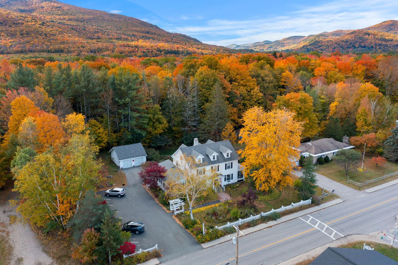
The Mt Osceola Trail leaves from a small parking area on the north side of Tripoli Road, about 6.6 miles east of I-93 Exit 31. It is a modest gravel lot at a popular trailhead, and that combination is the problem: on clear summer and foliage weekends it fills early, often well before mid-morning, and once it is full your options are poor. Do not improvise a spot by squeezing half onto the road - it is a narrow gravel road, sightlines are short, and a car sticking out is both a ticket risk and a genuine hazard. The real fix is the same one that works everywhere in these mountains: start early. Being 27 min away in Lincoln is a real advantage - you can be parked and lacing up while the crowd from farther south is still on the highway.
Parking here requires a White Mountain National Forest recreation pass. This is the standard Forest Service parking pass that covers the trailhead lots across the White Mountains, and Tripoli Road trailheads are included - a self-service pass is available at the trailhead, and passes are also sold at the ranger stations and many local shops. In 2026 the pass runs about 5 dollars for a day (good the day of purchase), 30 dollars for an annual pass, 40 dollars for an annual household pass, and the federal America the Beautiful pass at 80 dollars covers it as well if you already carry one. It is a small amount of money and it is worth getting right; display it as directed, because these lots do get checked. If the on-site machine is out or you are unsure, buy the pass in Lincoln before you drive out.
The lot is the last piece of civilization on this hike. There is no water, no restroom to count on, no store, and no reliable cell signal at the trailhead or on the mountain, so treat the car as your base station: fill your bottles, sort your layers, download your map, and note your start time before you walk in. If you are hiking with anyone who is not with you at the car, this is where you confirm the plan, because you will not be texting from the trail. The Greeley Ponds trailhead on the Kancamagus, which matters for winter, is a different trailhead entirely and a different drive - do not confuse the two.
The climb: a rough, rocky trail that is slower than its mileage
The Mt Osceola Trail is a steady, real climb, and its defining feature is the footing. From the lot it starts up through the woods on a notably rocky, rough tread - loose rock, embedded stone, roots, and stretches of rubble that demand you watch every step and that eat more time than the gentle early grade would suggest. This is the part first-timers underestimate: the trail is not steep at the bottom, but it is slow, and the effort is in placing your feet, not in gasping for breath. Trekking poles help here more than almost anywhere, and good boots with real ankle support earn their keep on the descent, when tired legs meet the same loose rock going down.
Partway up the trail crosses a small brook or spring - a minor, usually easy step-across that is worth noting mostly because it is the only water on the route and because it can be dry in a late-summer drought. Above it the trail gets down to business, climbing the ridge by a series of switchbacks that are steeper and steadier than the lower section. This is where you gain most of the 2,000-plus feet, on a reasonable grade with good rhythm, through changing woods that thin as you climb. It is a satisfying stretch of trail - the kind of steady uphill where you settle into a pace and watch the forest shift from hardwoods to spruce and fir.
The higher you go, the more the trail runs over open rock, and this is the second thing that slows plain parties down: sloping ledges and slabs near the top that are fine when dry and slick when wet. On a clear, dry day they are a pleasure, opening up the first views as you climb. After rain, in morning dew, or in the thin ice of a cold shoulder-season morning, they are a place to slow down and pick your line, because a sloping wet slab is exactly where an ankle turns or a tailbone finds the rock. Save some caution and some daylight for these on the way down - most Osceola mishaps are slips on the descent, not the ascent, when people are tired and hurrying on the same rough rock they climbed.
The summit: a broad flat ledge and the old fire-tower footings
Osceola's summit is one of the better payoffs for the effort on the easier half of the 48. It is a broad, flat, open ledge - a spacious slab of rock, unusual among these wooded summits for how much room there is to sit and spread out - with the view opening out to the east and south over Waterville Valley, the Sandwich Range, and the nearby Tripyramids, and farther peaks stacking up on a clear day. After a climb spent watching your feet on rough trail, the sudden openness of the top is the reward, and there is space enough that even on a busy weekend you can usually find your own patch of rock.
The flat rock at the top is not natural convenience alone - it is the old fire-tower site. A fire lookout tower stood here until it was taken down in the late 1970s, and the concrete footings that anchored its legs are still set into the ledge, low square blocks you will notice as you walk around the summit. They are a quiet bit of history and a useful landmark: when the tower stood, watchers scanned this whole quarter of the White Mountains for smoke, and the reason the summit is so open is partly that it was kept clear for the view. Standing among the footings gives you a sense of why they built up here.
Because it is a wide-open ledge on top of a real mountain, the summit rewards the same discipline every exposed White Mountains top does, even though Osceola is lower than the giants to the north. The ledge catches wind and weather with nothing to break it, so on a cold or blowy day you will want a layer the moment you stop moving, and there is no shelter up here beyond ducking back into the scrub just below the top. Watch your footing near the edges of the ledge, especially in wind or when the rock is wet, and pick a sheltered spot to eat rather than perching on the brink for a photo. Take the view, take the pictures, then decide - candidly and out loud - whether East Osceola is on for the day.
East Osceola and the Chimney
East Osceola is the natural second peak, and the Chimney is the reason it needs a straight-talking paragraph. From Osceola's summit the Mt Osceola Trail drops steeply toward the col between the two peaks, and the crux of that descent is a short, near-vertical rock face - the Chimney - roughly twenty to twenty-five feet of steep rock that you downclimb on the way to East Osceola and climb back up on the way home. In dry summer conditions it is a fair scramble with genuine handholds and footholds, more like climbing down a steep, chunky ladder than anything technical, and plenty of ordinary hikers manage it carefully and enjoy it. It is a short Class 3 move, not a rock-climbing pitch, but it is real, and a fall on it would hurt.
There is a bypass, and it is worth knowing about before you get there. A rough herd path skirts around the side of the Chimney, letting you avoid the steepest rock, but be realistic about what it is: it is still steep, loose, and eroded, a scramble in its own right rather than an easy stroll around the obstacle. It is a reasonable option for a careful hiker who does not want to downclimb the face directly, and it is the way many people take it, but it is not a shortcut that makes the col casual. Whether you take the Chimney itself or the bypass, the col between Osceola and East Osceola is the hardest ground on this hike, and it is where you should be most deliberate.
Here is the real turnaround guidance. It is completely fine to stand at the top of the Chimney, decide it is more than you want, and turn back to enjoy Osceola as a one-peak day - that is a sound decision, not a failure, and it is the right call if the rock is wet, if anyone in the party is uneasy on steep rock, if the weather is turning, or if the clock is against you. Wet or icy, the Chimney goes from a fair scramble to a genuine hazard, and it is the single spot on this route where a slip has real consequences. Do not talk a nervous hiker down it, and do not commit a tired party to the col late in the day just to tick a second summit. East Osceola itself, once you are up there, is an anticlimax - a flat, wooded top with a small cairn and limited views - so the peak is for the list, not the scenery, which makes the risk-reward on a bad day easy to read: turn around.
If the day is good and the party is solid, the double is a fine outing and the Chimney is part of the fun. Take the descent to the col slowly, face into the rock on the Chimney the way you would on a ladder, keep three points of contact, and keep the group close so nobody is alone on the hard bit. Then remember, standing on East Osceola, that you have to reverse all of it - back down to the col, back up the Chimney or the bypass, and back over Osceola - before you are truly headed home. Budget that return; the col is not done with you until you have climbed out of it twice.
Winter and the closed road: the Greeley Ponds approach from the Kancamagus
In winter Mount Osceola becomes a different, harder mountain, and the reason is the road. From roughly mid-November to late May Tripoli Road is gated shut, so the easy 3.2-mile trail from the south is out of reach unless you are willing to add about 6.6 miles of snow-covered road-walking or skiing each way just to reach the trailhead - which turns a moderate hike into a marathon nobody sensibly attempts. So winter hikers do not come at Osceola from Tripoli Road at all. They come from the north, off the Kancamagus Highway, which is plowed and open all winter.
The winter route uses the Greeley Ponds Trail from its trailhead on the Kancamagus Highway. You follow the Greeley Ponds Trail south for a bit over a mile - an easy, gentle stretch with several brook crossings, many of them bridged - and then turn onto the upper end of the Mt Osceola Trail and climb, hard, to East Osceola. From the highway it is only about 2.8 miles to East Osceola, but that short distance is deceptive: the climb to the ridge is steep, a relentless pull up the headwall that is one of the more demanding stretches of its length on the 48, and in winter it is often hard snow and ice. Reaching Osceola from there means continuing over the col - including the Chimney, which most winter parties bypass on the herd path rather than climb iced-over - so a full winter day takes in East Osceola first, then the col, then the main summit, and back, roughly eight miles with real steepness.
This is a serious winter hike, not a snowy version of the summer walk, and it should be treated that way. On the steep, north-facing pitches, full crampons are the right tool over microspikes - the grade and the ice are beyond what small traction handles safely - and an ice axe with the skill to use it belongs in the kit for the steepest sections. Daylight is short, the col and the Chimney are the most demanding stretches, and conditions change fast. Check current trail conditions before you go: the Trails NH and New England Trail Conditions reports, and the Mount Washington Observatory higher-summits forecast, will tell you what is up there. This is a route for hikers already comfortable with steep winter terrain, not a first winter 4,000-footer.
The practical takeaway for a lodge guest is simple. If you are here in summer or early fall and Tripoli Road is open, Osceola is a friendly, moderate day from the south - the hike this guide is mostly about. If you are here between late fall and late spring, the south route is closed, the mountain is a demanding winter climb from the Kancamagus, and it is a different drive from the lodge to a different trailhead. Know which season you are in before you plan, and if it is winter, go in with winter gear, winter skills, and a winter-length plan for the day.
Water, the brook crossing, and carrying enough
Plan Osceola as a carry-your-own-water hike. There is one small brook or spring partway up the Mt Osceola Trail, and that is the only water on the route - there is nothing on the summit ledge, nothing on the ridge to East Osceola, and nothing you should count on in a dry spell, because that lower brook can run thin or dry in late summer. Bring 2 to 3 liters per person for the main summit in summer heat, and add to that if you are taking on the full East Osceola double, which is a longer, sweatier day with the climbing concentrated in the col. Running out of water on the descent, on rough rock in the afternoon sun, is a common and avoidable misery here.
If you do draw from the brook, treat it - filter, purify, or boil - as you would any backcountry water in the Whites; it is a small mountain stream, not a tap. But the plain advice is not to rely on it at all. It is easier and safer to carry what you need from the car than to plan around a crossing that may be a trickle. The lot is your last water source, so fill up there, and if you forgot, buy water in Lincoln on the way rather than gambling on the brook.
The brook is also worth a glance as a conditions signal. In spring snowmelt or after heavy rain the lower trail can be wet and the rock slabs above slick, and a brook that is running fast and full is a fair hint that the ledges near the top will be wet and the col will be greasy. The crossing itself is an easy step-across, not a ford, but let it tell you what the rest of the mountain is likely doing underfoot, and dial your footing and your East Osceola ambitions accordingly.
The forecast, exposure, and why a low summit still needs the higher-summits report
Osceola is lower and more sheltered than the bare giants of the Presidential and Franconia ranges, and most of the climb is in the trees, so the exposure here is milder than on a high open ridge. That is true, and it is a fair reason to consider Osceola a friendlier objective. It is also not a license to skip the mountain weather. The summit ledge is open to the sky and the wind, the col to East Osceola sits high and cold, and the tops of these peaks run meaningfully colder and windier than the valley in Lincoln. A pleasant morning in town can be a raw, blowing summit, and the difference is bigger than newcomers expect.
So read the Mount Washington Observatory Higher Summits Forecast at mountwashington.org before you go. It is written by meteorologists who live in this weather and it speaks for the high country in the terms that decide your day - summit temperature, wind, and whether the tops will be socked in cloud. Osceola is not Mount Washington, but the higher-summits forecast is still the best single read on what the top of a 4,000-footer will feel like, and it will keep you from being surprised by a cold, cloudy ledge after a mild walk up. Pair it with the valley forecast for Lincoln to understand the spread between the two, and pack for the summit, not the parking lot.
Thunderstorms are the one weather situation to take as seriously here as anywhere. The open summit ledge and the high col are exposed enough to be poor places to be with lightning around, and afternoon storms build fast in these mountains in summer. On a day with storms in the forecast, be up and down early, treat the first distant rumble as the end of your time on the open ledge and out of the col, and do not linger for photos while a cell builds to the west. The same goes for the sloping summit slabs in a downpour - they turn slick, and the descent over wet rock is where the hazard lives on this particular mountain.
Shoulder seasons, ice on the ledge, and turnaround judgment
The shoulder seasons are the sneaky ones on Osceola, and they hinge on two things: the road and the ice. In spring, Tripoli Road stays gated until the mud dries and the road crew opens it, usually the second half of May, so an April or early-May plan to drive in will meet a locked gate even when the valley looks like spring. In late fall the road closes in November, sometimes early, and a warm brown week in town can sit under a summit ledge that a cold front glazed with ice overnight. The calendar is a poor guide here; the road status and the actual conditions up high are the real ones, so check both rather than assuming the season from the weather in Lincoln.
Ice is the shoulder-season hazard that catches people, and on this mountain it lives in two specific places: the sloping rock slabs near the summit, and the Chimney and steep col to East Osceola. Both can be bare and easy in the afternoon and glazed and treacherous in a cold morning, well before there is enough snow to make anyone think winter. From roughly Columbus Day onward, carry microspikes even if the trailhead looks like fall, because a thin skim of ice on a sloping ledge or in the Chimney is exactly the kind of thing that turns a routine hike into a fall. If you find real ice in the col, the smart move is to skip East Osceola and keep Osceola as your day.
Turnaround judgment is the whole discipline on a hike with an optional hard section and a seasonal road. Set your rules out loud at the car, where they cost nothing: a turnaround time worked back from dark and from the rough, slow descent; a clear condition for the East Osceola col - dry rock and daylight to spare, or you save it for another day; and a first-rumble rule that gets you off the open ledge. The good news is that Osceola gives you a clean, natural decision point built right in - the summit ledge, where you can read your legs, the sky, and the clock before you ever drop toward the col. Use it. The mountain makes the plain choice easy if you let the summit, not the parking-lot plan, decide the second peak.
The hikeSafe card and telling someone your plan
Two New Hampshire specifics belong in your pocket on any 4,000-footer, and Osceola is no exception even though it is one of the easier ones. First, under RSA 206:26-bb, New Hampshire can bill a hiker whom Fish and Game judges negligent for the cost of a search and rescue. The voluntary hikeSafe card waives that cost short of true recklessness and funds the rescue teams directly - it is 25 dollars for an individual or 35 dollars for a family for 2026, sold through New Hampshire Fish and Game, valid January through December, the same price for residents and visitors. It is a sensible thing to buy the night before any hike in these mountains, this one included.
Second, do not let your phone be your safety plan. Cell coverage is patchy to nonexistent along Tripoli Road, at the trailhead, and on the mountain, so anything that depends on a signal - live maps, a weather check, a call for help - may simply not work when you need it. Download your maps before you leave the driveway, carry a real map and compass or a GPS unit you know how to use, and leave your route and your expected out-time with a person who will notice if you do not come back. We ask our hiking guests to do exactly this, and we mean it: someone at home who knows you went up the Mt Osceola Trail from Tripoli Road and expected to be down by a certain hour is worth more than anything in your pack if something goes sideways. If you are attempting East Osceola and the col, say so, because it changes where a search would begin.
The last piece is the one that keeps people out of trouble on every mountain around here: turning around is free, and the summit is not going anywhere. Skipping East Osceola because the Chimney is wet, or turning back at the ledge because the sky is building, costs you nothing but a return trip on a road that is 27 min from our porch. There is no achievement in the col worth getting hurt for, and the mountain runs on the same schedule every year - open road, good rock, long summer light - so the good day you want will come around again. Buy the card, tell someone your plan, and give yourself full permission to turn around.
Who this hike is for, and how to make it a good first 4,000-footer
Mount Osceola earns its reputation as a good first New Hampshire 4,000-footer, and if that is what you are after, this is a sound choice - with a few clear caveats. It is moderate by the standards of the 48, the grade is reasonable, the summit is a rewarding open ledge, and the round trip is short enough to leave a margin for a slow, careful first outing. What makes it a good starter is exactly that margin: you can climb it at a beginner's pace, enjoy the top, and be down with daylight to spare, which is how a first big hike should feel. Just do not let the reputation talk you into treating it as trivial - the rough footing and the 2,000-plus feet are real work.
If it is your first, do it the easy way and do it right. Go up in summer or early fall with the road open, pick a clear, dry, stable day, start early for the parking and the weather, and plan on Osceola alone - leave East Osceola and the Chimney for a later trip when you know how your legs handle rough White Mountains rock. Carry more water than you think you need, wear boots with ankle support, bring poles for the loose footing, and pack a warm layer and a rain shell even on a fair forecast, because the summit ledge is colder and windier than the trailhead. That is the whole recipe: modest objective, good conditions, early start, practical pace.
For stronger hikers, Osceola is a satisfying half-day on its own and a fair full day with East Osceola thrown in, and the double is a legitimately good outing when the rock is dry and the light is long. The Chimney adds a genuine bit of hands-on scrambling that many people enjoy, and knocking off two of the 48 in one trip is efficient. The judgment is the same either way, just scaled up: read the summit before you commit to the col, respect the rough descent, and keep a turnaround time. Whether you take one peak or two, this is a mountain that rewards an early start and a little humility about the footing.
And a word on why we like sending guests here. Osceola is close - about 27 min from the door when the road is open - it is a real 4,000-footer with a real view, and it is forgiving enough to be a fine introduction and interesting enough to be worth a strong hiker's day. It is the kind of hike you can decide on over breakfast, be finished with by mid-afternoon, and still have the evening in Lincoln ahead of you. Confirm the road, buy the pass, start early, and it makes for one of the better easy-to-moderate days in this whole corner of the White Mountains.
Safety & conditions
- Confirm Tripoli Road is open before you drive out. It is a seasonal gravel road, gated shut roughly mid-November to late May, and the exact open and close dates move every year - check the White Mountain National Forest forest-roads page or the Trails NH gate tracker. When it is closed the trailhead is unreachable and Osceola becomes a long, steep winter climb from the Kancamagus (Greeley Ponds Trail), not the moderate walk this guide describes.
- The Chimney between Osceola and East Osceola is the crux and the place to make a clear call. It is a short, near-vertical rock step of about 20 to 25 feet - a fair Class 3 scramble when dry, a genuine hazard when wet or icy. Turning back at the top of it and keeping Osceola as a one-peak day is a sound decision, not a failure. If you do it, face into the rock, keep three points of contact, and keep the party together; the rough bypass path around it is still steep and loose, not an easy way around.
- Respect the footing - it is the real difficulty here. The lower trail is rocky, rooty, and slower than its mileage, and the sloping rock ledges near the summit turn slick when wet. Most mishaps on Osceola are slips on the descent, on tired legs over the same loose rock. Wear boots with ankle support, carry poles, slow down on wet slab, and keep daylight and energy in reserve for the way down, especially if you added East Osceola.
- Read the Mount Washington Observatory Higher Summits Forecast (mountwashington.org) before you go, even though Osceola is lower and more wooded than the big ridges. The open summit ledge and the high col run meaningfully colder and windier than the valley in Lincoln, and afternoon thunderstorms build fast in summer. On a day with storms forecast, be up and down early and treat the first distant rumble as the end of your time on the open ledge and in the col.
- Carry your own water - 2 to 3 liters per person, more for the East Osceola double. The one small brook partway up can run dry in late summer, and there is nothing on the summit or the ridge. The lot is your last reliable water. In spring melt or after rain, a fast-running brook is a fair sign the summit slabs and the col will be wet and slick, so let it inform your footing and your East Osceola decision.
- In the shoulder seasons, watch for ice before there is any snow. From about Columbus Day onward, carry microspikes even if the trailhead looks like fall - a thin glaze on the summit slabs or in the Chimney is exactly what causes a fall. If you find real ice in the col, skip East Osceola and keep Osceola as your day. In full winter, this is a crampons-and-skills route from the Kancamagus with short daylight; check Trails NH and New England Trail Conditions first.
- Set a turnaround time and real go/no-go rules at the car, and use Osceola's summit as your natural decision point for the col. Taking on East Osceola's extra climbing late in the day, or dropping into the Chimney on wet rock or with a tired party, is how a good hike goes wrong. The summit lets you read your legs, the sky, and the clock before you commit - let those, not your parking-lot plan, decide the second peak.
- Pick up the voluntary hikeSafe card from New Hampshire Fish and Game ($25 individual, $35 family for 2026); New Hampshire can bill negligent hikers for rescue costs under RSA 206:26-bb, and the card waives that cost short of recklessness while funding the rescue teams. Cell coverage is patchy to nonexistent on Tripoli Road and the mountain, so download maps in advance, carry a map and compass, and leave your route and out-time with someone - and if you are attempting East Osceola and the col, say so, because it changes where a search would begin.
Where to stay for it
This is one of the closer trailheads to the lodge when the road is open, and the drive is short but the last stretch is slow. From 191 Pollard Road you cross Lincoln to Main Street and I-93 in a few minutes, then take I-93 South one exit, from Exit 32 to Exit 31, and turn onto Tripoli Road. From there it is about 6.6 miles east on Tripoli Road - paved at first, then gravel - to the Mt Osceola Trail parking area on the left, roughly 11.5 miles and about 27 min from our door all told. Take the gravel at an easy pace; it is washboarded in spots and there is no reason to hurry it. This drive only works while the road is open, roughly the second half of May into November. If you are here outside that window, the gate is locked and Osceola is a different, harder hike from the Kancamagus side.
Provision in Lincoln before you go, because there is nothing for sale on Tripoli Road or the mountain and no cell signal to order anything up. The Price Chopper plaza on Paper Mill Drive and the gas stations along Main Street are your last stop for sandwiches, extra water, and a full tank - do it the evening before if you are chasing an early parking spot, which on a summer weekend matters at this small lot. Buy your White Mountain National Forest parking pass in town too if you would rather not fuss with the self-service machine at the trailhead, download your map while you still have signal, and leave your route and your out-time with someone at home. If you are planning to add East Osceola and the Chimney, say so, because it changes where anyone would look for you.
Sources & official info: waterville.com · northeasthikes.com · fs.usda.gov · trailsnh.com · outdoors.org · mountwashington.org
— Launchpoint Lodge, From the lodge