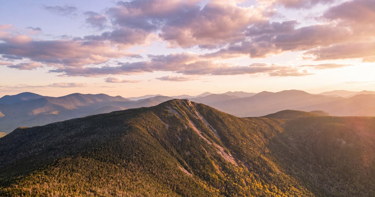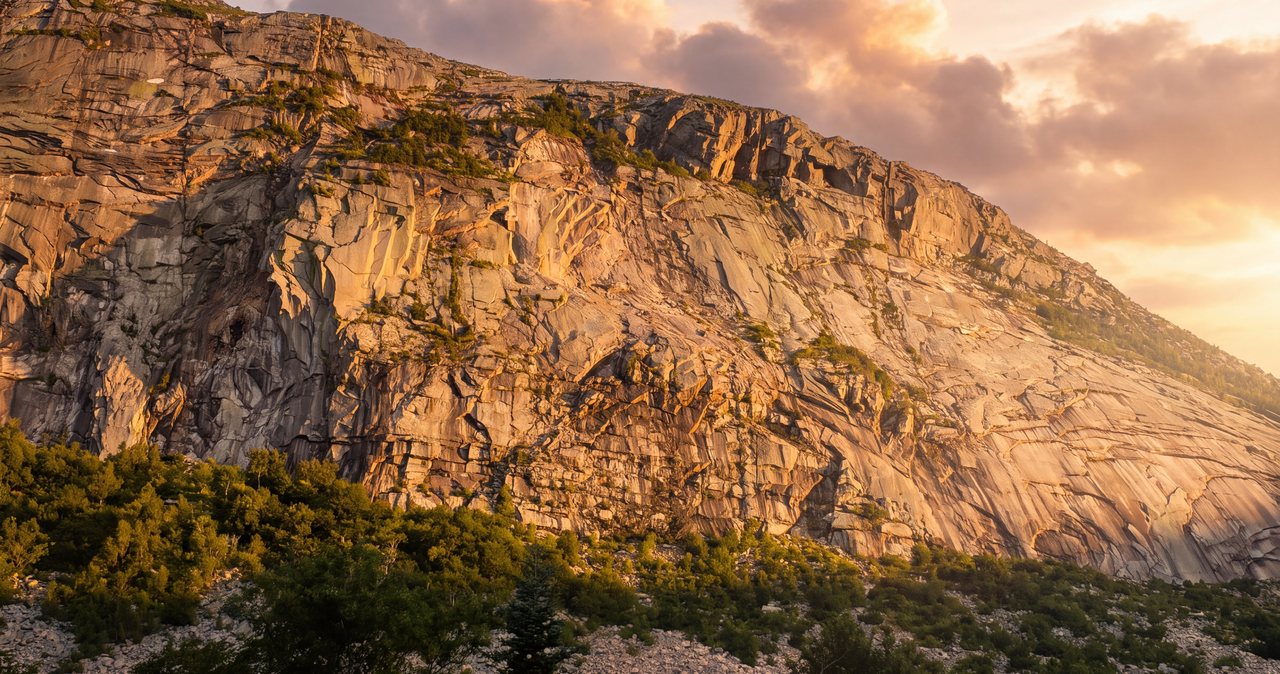
Mount Liberty is 4,459 feet, and it is the Franconia Ridge 4,000-footer you can climb almost entirely in the woods. That is the whole pitch, and it is a better one than it sounds. Lafayette, Lincoln, and Little Haystack put you on more than two miles of open alpine crest where the weather owns you from the moment you leave the trees. Liberty, at the quiet southern end of the same ridge, keeps you under a canopy of spruce and hardwood for something like ninety-five percent of the walk and only turns you loose at the very top, where a short scramble up open rock hands you a full 360-degree view of the notch. Same famous ridge, a completely different kind of day.
The standard route is the Liberty Spring Trail from the Whitehouse trailhead near the Flume, and by the numbers it is a big but plain hike: about 8 miles round trip with roughly 3,150 feet of climbing, no technical terrain, no exposure to speak of until the last hundred feet. What it asks of you is clear, sustained uphill work - the Liberty Spring Trail gains around 2,700 feet in three miles of rock steps - and a little judgment at two points where the day can grow. You can tag Liberty and turn around, or you can add Mount Flume as a dogleg south along the ridge and collect two 4,000-footers in one trip. The trailhead is about 14 min from our door.
One thing to settle up front, because it shapes the guide. Because you climb Liberty in the trees, it is the smart pick on a day when the higher summits are marginal - windy, or capped in cloud, but not stormy - since you can do almost the whole climb sheltered and make the exposure decision at the treeline right below the summit, with a cheap retreat if the top looks wrong. But do not mistake sheltered for safe. The summit itself is a bare rock perch fully open to wind, cold, and lightning, and if you continue to Flume you take on about a mile of half-open ridge. This is still a White Mountains 4,000-footer, and it still runs on the Mount Washington Observatory higher-summits forecast, not on how it looks from the parking lot.
The numbers
Round trip to Liberty and back, the real figure is about 8 miles. Published sources cluster between 7.8 and 8.2, and a GPS track usually reads a touch longer because it counts every switchback; nobody is lying, they are just measuring differently. The climbing is about 3,150 feet, with the same modest spread across sources - call it 3,100 to 3,200. Most parties take 5 to 7 hours car to car with a real stop on top. It is a shorter, lower day than the Franconia Ridge Loop, which is 8.9 miles and about 3,900 feet, and it feels easier than the raw numbers suggest precisely because you are climbing in the shelter of the woods rather than fighting a ridge.
Here is the route broken into its pieces, because the trailhead is not the trail. From the Whitehouse hiker lot you walk the Whitehouse Trail, about 0.8 mile of rolling connector, to reach the Franconia Notch bike path and cross the Pemigewasset River on a footbridge to the actual start of the Liberty Spring Trail. The Liberty Spring Trail then climbs roughly 3 miles and about 2,700 feet: the Flume Slide Trail branches off at 0.5 mile, a stream crossing comes around 1.1 miles, and Liberty Springs Tentsite sits at 2.6 miles. From the tentsite it is another 0.3 mile to the crest, where the Liberty Spring Trail ends at the Franconia Ridge Trail. Turn right, south, and it is about 0.3 mile of easy ridge and the final scramble to the summit. That is roughly 4.1 miles to the top, one way.
Difficulty: hard by effort, moderate by technique. There is no scrambling anywhere except the last short pull onto the summit rock, and that is a walk-up with your hands for balance, not a climb. The seriousness is not on the summit block and it is not exposure - it is the relentlessness of the middle. The Liberty Spring Trail simply goes up, steeply, on rock and root, for a long time, and it takes back every foot on the descent, which is where tired knees and wet rock combine into most of this route's minor injuries. A fit beginner can do this hike; they will just feel it in the legs the next morning.
Who is this hike for? It is a strong first Franconia 4,000-footer, because it delivers the full ridge view without the sustained alpine commitment of the loop, and it is a reliable fallback for a day when the open summits are too windy for comfort. It is also a favorite of people working the New Hampshire 48, since Liberty and Flume are both on that list and sit close enough to bag together. What it is not is a short walk to a view - the mileage is real and the climb is steady, so treat it as a full day out, pack accordingly, and start early enough that you are not rushing the descent in the dark.
The Whitehouse trailhead, and the Flume-lot confusion
Nearly everyone who gets this wrong gets it wrong at the parking lot, so start here. The hike leaves from the Whitehouse trailhead, a small dedicated hiker lot on the Franconia Notch Parkway (the two-lane stretch of I-93 through the notch), on the east side, a short distance north of the Flume Gorge Visitor Center near Exit 34A. It is not the big Flume Gorge lot, which is for people buying tickets to walk the gorge, and it is not Lafayette Place, which is three miles north and serves the Franconia Ridge Loop. If your map app sends you to Flume Gorge you are close but in the wrong lot; the hiker parking is signed separately, a bit farther north, and it is free.
Free, and small. Franconia Notch State Park does not charge to park at its hiking trailheads, so unlike the Forest Service lots out on the Kancamagus there is no five-dollar day pass to buy here. It is a modest lot at one of the most popular trailheads in the state, though, and on clear summer and foliage weekends it fills early, often before 8 a.m. Staying in Lincoln is the practical edge - you can be standing in the lot at 7 while the Boston crowd is still an hour south on the highway. Midweek, and any time outside foliage season, the pressure comes off and you will usually find a spot at a civilized hour.
When the lot is full, do not improvise a spot on the parkway shoulder; it is illegal, ticketed, and towed, and the notch is a fast road with poor sightlines. A weekend hiker shuttle runs in the notch in season - roughly late May through mid-October, weekends and holiday Mondays, a small per-person fare - based out of the Cannon Mountain lot at Exit 34B. One clear note so nobody plans around a ghost: Cannon's aerial tramway shut down in October 2025 for a multi-year rebuild and is not running, but the lot and the shuttle are, and no lift goes anywhere near this hike regardless. Check cannonmt.com for the current shuttle route and whether it is stopping at the Flume end of the notch this season before you count on it.

The half-mile you did not expect: Whitehouse Trail and the bike path
The first part of this hike is a piece of connective tissue, and it is worth knowing why it exists so you do not think you have gone wrong. The Liberty Spring Trail used to start at a roadside pullout. When the Franconia Notch Parkway was built through here, that parking went away, and the Whitehouse Trail is the replacement - a purpose-built connector that runs about 0.8 mile from today's hiker lot, over a couple of low rises roughly parallel to the road, to the Franconia Notch bike path. It is not scenic and it is not the point; it is the price of getting from the modern lot to the old trailhead. Treat it as an easy warm-up; the mountain begins soon enough.
Where the Whitehouse Trail meets the paved bike path - the Franconia Notch Recreation Path, an 8.8-mile route that threads the whole park - turn left and follow it a very short distance to a bridge over the Pemigewasset River. This is the one substantial water crossing on the route that is bridged, and in high water it is a genuine convenience; you cross the biggest flow of the day dry-shod on a footbridge. Just across the bridge, the Liberty Spring Trail leaves on the right and starts climbing. Note this junction on your way up. In the flat green tangle of the notch floor, tired hikers coming down at dusk have walked past it and continued along the bike path by mistake.
From here on, the hike is what you came for: a steady, wooded climb that does not touch a road, a view, or a bridge again until the summit rock. If you brought trekking poles, the bottom of the Liberty Spring Trail is where they start earning their place in your pack.
The Liberty Spring Trail: a long, steep, practical climb
The Liberty Spring Trail is the whole hike, and its character is consistency. It climbs about 2,700 feet in roughly three miles as a section of the Appalachian Trail, and it does it without drama or relief - no false summits, no flat stretches to catch your breath, just a sustained grade up the western flank of the ridge through spruce and fir that get shorter and thicker as you climb. The footing is classic White Mountains: rock steps, roots, and slabs that the trail crews have worked into a staircase in the steepest pitches. It is well-built and easy to follow. It is also tiring in the plain way a long stair climb is tiring, and it rewards a slow, steady pace over a fast, stopping one.
Low down, in the first mile and a bit, you pass two junctions worth clocking. At 0.5 mile the Flume Slide Trail splits off to the right - that is the notorious slab route to Mount Flume, covered on its own below, and for an out-and-back to Liberty you simply stay straight on the Liberty Spring Trail. Around 1.1 miles there is a stream crossing, the one unbridged crossing that can matter after weather; more on that in the water section. Above it the trail settles into its long middle grind, and the miles here are real work with little to look at but the forest, which is part of why Liberty is a good head-down, get-it-done climb on a day when the views up high are socked in anyway.
The upper trail tightens into short switchbacks as it approaches the tentsite and the crest, and this is where the descent deserves a word ahead of time. Everything you climbed, you down-climb, and the same rock steps that were a staircase going up are a slick, quad-burning obstacle course coming down, especially wet. This is where the route's small injuries happen - a rolled ankle, a hard sit-down on greasy rock - almost always in the last hour when people are tired and hurrying toward the car. Save something in the legs for the way down, keep the poles out, and take the wet slabs deliberately. The mountain does not care that you are almost done.
Because this is a stretch of the Appalachian Trail, you will likely share it in late summer with thru-hikers deep into their 2,000-mile walk, and with the trail crews and the tentsite caretaker who keep this heavily-used corridor from eroding. It is a well-loved, well-maintained trail, and it stays that way partly on hiker manners: stay on the treadway, walk through the mud rather than around it so the trail does not widen into the woods, and yield to uphill hikers on the narrow steep pitches. Small courtesies, but this trail carries a lot of boots in a season.
Water: the crossing low down and the spring up high
There is no water on the ridge and none on the summit, so plan the Liberty Spring Trail as a carry-it-with-you climb. Bring 2 to 3 liters per person from the car in summer; the wooded climb is sweaty even without sun, and the summit rock in full exposure dries you out fast. The last reliable water on the route is Liberty Spring itself, a good spring at the tentsite 0.3 mile below the crest - treat anything you draw from it, and know that above the tentsite there is nothing at all between you, the summit, and, if you continue, Mount Flume.
The crossing to know about is the unbridged stream at roughly 1.1 miles up the Liberty Spring Trail. In a normal dry summer it is a nothing rock-hop, ankle-deep and forgettable. After heavy rain, or during spring snowmelt when the high country is dumping water down these drainages, the same crossing runs faster and deeper and can mean wet feet or a careful pick across slick rocks. It is much gentler than the Dry Brook crossings on the Falling Waters Trail up the ridge - there is no waterfall below it, and a slip means a cold soaking rather than anything worse - but it is a good reason to check the forecast and the recent rain before you count on dry feet.
The useful water rule here is about the Pemigewasset footbridge you already crossed. Because the biggest flow of the day is bridged, this route stays open in wet conditions that can shut down the crossing-heavy hikes elsewhere in the notch. If a big rain has The Basin roaring and Falling Waters looking like a bad idea, Liberty is frequently the drier, saner choice from the same corner of the park - you take the one meaningful crossing dry on a bridge, and the little stream up the trail is a manageable step-across rather than a wade.
Liberty Springs Tentsite: the option to sleep near the top
A third of a mile below the crest, the Liberty Spring Trail passes Liberty Springs Tentsite, an Appalachian Mountain Club backcountry site that turns Liberty and Flume into an easy overnight for people carrying a pack. It has ten wood tent platforms - seven singles and three doubles - a spring for water, a composting privy, and a dishwashing station, strung up the slope in the trees. There is a seasonal AMC caretaker on site, roughly Memorial Day through Columbus Day, who collects the fee and keeps the place running; outside that window it is self-service. The fee is 15 dollars per person per night, collected year-round, and it is first-come, first-served with no reservations - on a busy summer Saturday the platforms can fill, so an early arrival or a weeknight is the safer bet.
For a day-hiker the tentsite is mostly a landmark and a water stop, but it is a good one: it is the last water, the last privy, and a sheltered place to add a layer before the final push to the exposed summit. Backpackers use it as a base to catch sunrise or sunset on Liberty - the summit is a 10 min walk above the platforms - or to stage a two-summit day over Flume without a long approach. It is also a fixed point of reassurance in bad visibility: if the crest is a mess of cloud, the tentsite is a known, sheltered spot to reassess rather than pushing into the open.
A note for our guests, since it comes up. The tentsite is a real option if you want to carry a pack and spend a night on the mountain, and it is entirely separate from the lodge. Our rooms are adults-only and pet-free, and nothing about a night at Liberty Springs changes that; if you are combining a backcountry night with lodge nights on either side, message us and we will time your booking around it. The tentsite is a backcountry campground with a privy and a spring, not a hut with beds and meals - carry everything you would for any night out, and treat the spring water.
The summit: an open rock crag with the whole notch below it
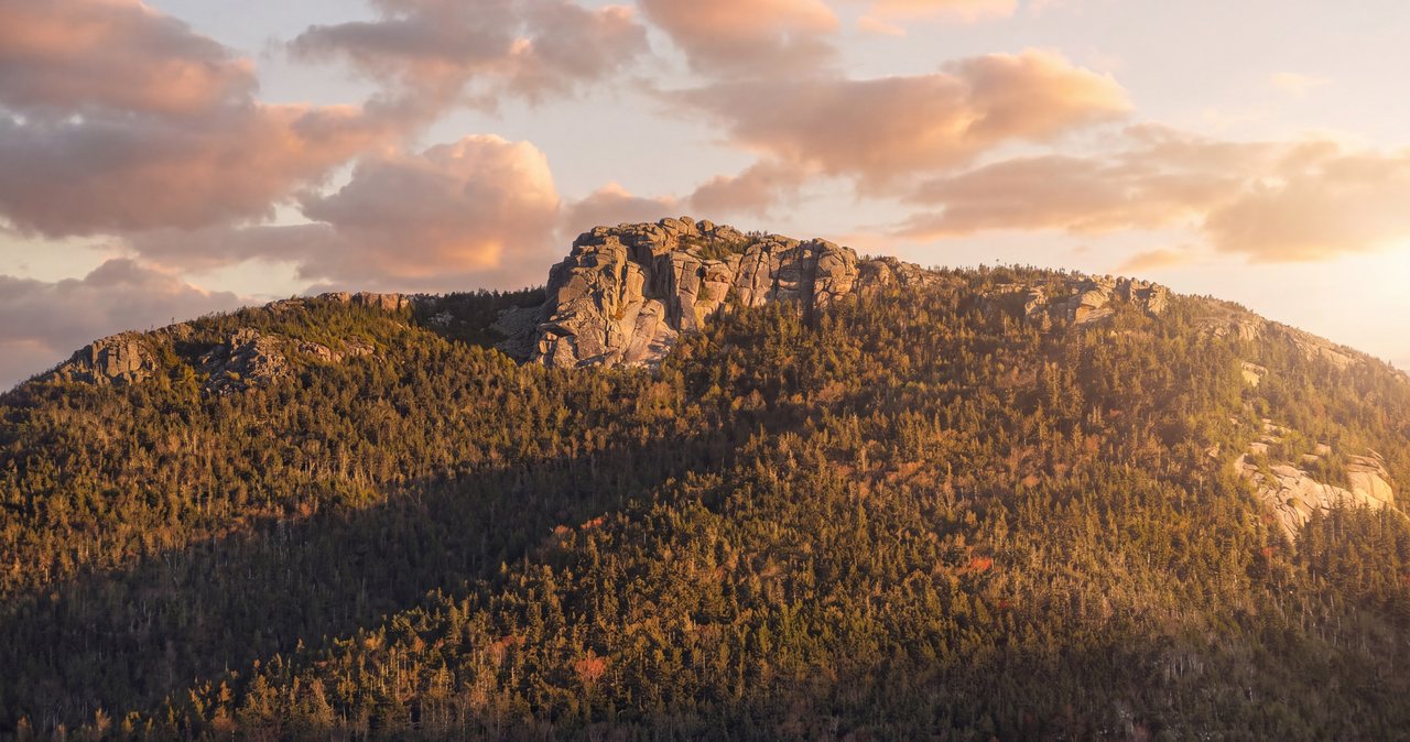
The last stretch is the payoff and the character change. From the top of the Liberty Spring Trail you turn south on the Franconia Ridge Trail, walk a few flat minutes through knee-high scrub, and then the trees quit and the summit reveals itself as a heap of open, ledgy rock - a genuine little crag, the trail scrambling up broken slabs to a pointed high place barely bigger than a living room. It is a short, easy hands-on move to the very top, nothing exposed enough to frighten anyone, and then you are standing on one of the best small summits in the range, fully in the open for the first time all day.
The view is the reason people rate this hike far above its modest stats. North, the whole spine of Franconia Ridge runs away from you - Little Haystack, Lincoln, and Lafayette stacked up in a line, the open alpine crest you did not have to walk laid out for inspection. Just south, close enough to feel like a neighbor, is the jagged cone of Mount Flume above its cliffs. West and below, the full trench of Franconia Notch: Cannon Mountain's cliff face across the gap, the Kinsman Range behind it, the parkway a thin line on the valley floor. East, the view falls away into the Pemigewasset Wilderness, a huge roadless bowl of forest with the remote Bonds and Owl's Head in it, and on a clear day the bulk of Mount Washington and the Presidentials stand up on the far horizon. For a peak you climbed in the trees, the top hides nothing.
Plan your summit stop for what the crag is: small, and fully exposed. There is no wind shadow up here and not much flat ground, so on a breezy day the smart move is to take your photos and your view, then drop back into the scrub or down to the tentsite to sit and eat where the wind cannot reach you. Watch your footing on the ledges, which are polished in places and slick when wet, and keep track of where the Franconia Ridge Trail re-enters the trees, both the way you came up from the Liberty Spring Trail junction and, if you are continuing, the way south toward Flume.
Adding Mount Flume: the dogleg south
Because Liberty and Flume are only 1.2 miles apart along the Franconia Ridge Trail, most people climbing one seriously consider both, and doing them as an out-and-back from Liberty is the straightforward way. From Liberty's summit you drop south along the ridge, losing and regaining a few hundred feet, to Mount Flume at 4,328 feet - the southernmost 4,000-footer on the ridge, an open, ledgy summit perched above steep cliffs with its own fine view north along the whole range. Tagging both adds roughly 2.4 miles round trip between the peaks and brings the day to about 10.5 miles and something closer to 4,100 feet of total climb, since you re-cross the ground between them on the way back. Figure 7 to 9 hours for the pair.
The ridge between Liberty and Flume is a different animal than the flat woods below. It is partly open and partly in scrubby trees, narrower and rougher than the Liberty Spring Trail, with a couple of short, steep, ledgy pitches - including the section along the very top of the Flume Slide, where the trail runs near the lip of that long slab and the drop to your side is real. In good conditions it is pleasant walking, with superb views from the open stretches, but it is more exposed, more committing, and less forgiving of bad weather than the climb to Liberty. Taking on Flume means taking on about a mile of half-open ridge in each direction, and the weather decision that follows.
So make Liberty the anchor and Flume the bonus, and decide at the top of Liberty, not in the parking lot. If the summit of Liberty is calm and clear and you have the legs and the daylight, the walk to Flume and back is one of the nicer ridge miles in the notch, and two 4,000-footers for one climb is an efficient day. If Liberty is windy, socked in, or later than you planned, keep Flume for another trip; it is not going anywhere, and the return over Liberty at the end of a long day is more climbing than tired hikers expect. There is no shame and no lost effort in a Liberty-only day - it is a complete hike on its own.
For peak-baggers the pairing is efficient in a way the list rewards. Flume is the southernmost 4,000-footer on Franconia Ridge and Liberty is next in line, so climbing both in a day clears the two quiet ends of the ridge in one trip and leaves Lincoln, Lafayette, and the loop for another. Seen from the west, the Liberty and Flume summits together make the sharp, tilted pair of crags you notice from the parkway on the drive up, at the tail of the ridge. Standing on them is the close-up version of that view, and on a clear day it is worth the extra ridge miles to have both under your boots.
The Flume Slide Trail, and why we do not send you down it
You will see the Flume Slide Trail listed as the other way to make a Liberty-Flume loop, and you should understand exactly what it is before you consider it. The Flume Slide Trail climbs the mountain up a long, water-scoured granite slab, gaining something like 1,500 feet in under a mile of steep, polished rock that is almost always wet from seeps and runoff. It is one of the hardest regularly-hiked trails in the White Mountains, a hands-and-feet scramble where a slip on the slick rock can mean a serious fall, and it is best left to careful, experienced scramblers. The Appalachian Mountain Club and essentially every plain source say the same thing: this trail is for ascending only, and it should not be climbed at all in wet weather.
Which means the standard loop - up the Flume Slide to Flume, over to Liberty, down the Liberty Spring Trail - is a committing route that puts the hardest piece early, on rock that is wet more often than not. Strong, experienced parties do it in good dry conditions and love it. It is no place for a first scramble or a wet day, and the Flume Slide is only ever a way up, never a way down - reversing the loop or bailing down the slide is exactly how hikers get into trouble. If you want both peaks and you are not certain the slab is dry and you are solid on steep scrambling, the out-and-back over the ridge from the Liberty Spring Trail is the sane version of the same two summits.
One 2026 access note that closes off the other loop option. The classic eastern approach to Flume and Liberty runs up the Osseo Trail from the Lincoln Woods trailhead, but a 1.4-mile stretch of the Lincoln Woods Trail - from the Kancamagus Highway to the Osseo Trail junction - is closed for riverbank stabilization from June 15 through November 2026, which breaks that approach for the season. So for 2026 the practical ways onto these peaks are the Liberty Spring Trail from the Whitehouse trailhead, described in this guide, and the Flume Slide only as an experienced-hikers ascent. Confirm the current status on the Forest Service and AMC pages before you build a plan around any Lincoln Woods route this year.
The forecast, the exposure, and how Liberty differs from the ridge
The forecast that matters for any Franconia summit is the Mount Washington Observatory Higher Summits Forecast at mountwashington.org, written by meteorologists who live in this weather and published twice a day. It speaks for the high peaks in the units that decide your day - summit temperature, sustained wind and gusts, and whether the tops will be in the clear - and it is far more useful than the valley forecast for the town of Lincoln, which describes conditions 3,000 feet below the crag. Read it the night before to pick the day, and again in the morning to keep or fold. Figure the summit runs well colder than town, and let the wind govern.
Here is where Liberty is different from Lincoln and Lafayette, and where a guide earns its keep. Because you climb Liberty in the trees and only step into the open for the final scramble, you are exposed to the wind for minutes, not hours. That makes Liberty the intelligent choice on a marginal day - one with strong wind or cloud on the summits but no storms - because you can do almost the whole climb sheltered and make the go-or-turn decision at the treeline just below the top, looking at the actual summit rock, with the trees at your back and a cheap retreat behind you. On the open ridge you commit to the weather the instant you leave the woods; on Liberty you get to keep asking the question almost to the summit.
Now the flip side, because sheltered is not the same as safe. The summit itself is a fully exposed rock perch, and it is a textbook lightning target - a bare high point above the trees. Thunderstorms are the hard no here, as everywhere in the Whites: on a day with afternoon storms in the forecast, be up and down off the summit early, and treat the first distant rumble as the immediate end of your time on the rock, from wherever you are. And if you continue to Flume you give up the sheltered advantage entirely for the ridge miles between the peaks. Cloud on the tops is a softer call on Liberty than on the open ridge - you can climb in the woods and simply skip a viewless, windy summit block - but wind that staggers you at the treeline and lightning anywhere are reasons to turn, whatever the parking lot looked like.
Winter and the shoulder seasons
Liberty in winter is a popular objective and a serious one, and it is a good example of how the tree cover cuts both ways. The Liberty Spring Trail, sheltered and moderately graded, holds a packed snow track most of the winter and is a friendlier winter climb than the wind-scoured open ridge - one reason Liberty and Flume are common early-winter peaks for people building toward the harder summits. But the summit block is fully exposed, the same lightning-target crag now glazed in rime and wind, and the descent of those rock steps under snow and ice is where the winter day gets real. Parties do this all winter; the ones doing it well carry traction that matches the conditions - snowshoes for a soft or drifted track, and real crampons plus an axe when the upper trail and summit turn to ice - along with the layers, goggles, and face cover that a bare White Mountains summit demands.
The stream crossing low on the trail becomes ice architecture in deep winter, usually easy to cross on snow bridges but treacherous in the freeze-thaw of the shoulder seasons, when a rotten snow bridge or glazed rock over moving water is a genuine hazard. And plan to be self-sufficient: the tentsite platforms are open to the weather, there is no enclosed shelter anywhere on this route in any season, and a caretaker is there only in the warm months. From mid-October to late May, treat this as a winter hike - carry traction and insulation, read the higher-summits forecast as a winter forecast, and remember that the short days turn a leisurely summer pace into a headlamp finish faster than you expect.
The shoulder seasons fool people because the trailhead lies about the top. In April and May the notch floor can be bare and muddy while the upper Liberty Spring Trail still carries rotten snow and the crossing runs high with melt - the season of postholing and wet feet. In late October a mild, brown trailhead regularly sits under a summit crag iced by a cold front nobody in the valley noticed. From roughly Columbus Day to Memorial Day, carry microspikes at a minimum, expect the summit to be colder and icier than the climb, and let the mountain, not the calendar, tell you what to wear.
Turnaround judgment, the hikeSafe card, and telling someone your plan
Liberty gives you two clean decision points, and using them is the whole discipline. The first is the treeline just below the summit: this is where you step from shelter into the open, and it is the place to make a real call on wind and sky before you commit to the exposed rock. The second only exists if you are adding Flume - the summit of Liberty itself, where you decide whether to take on the ridge miles south or call it a complete day and head down. Say your rules out loud in the parking lot, where they cost nothing: a time by which you will turn regardless of how close the summit feels, worked backward from dark and from the long descent; a weather rule set from the morning forecast, not negotiated with the gusts at the top; and a first-rumble rule that ends the summit immediately.
Two New Hampshire specifics belong in the same pocket as those rules. First, this state can bill hikers for their own rescues: under RSA 206:26-bb, a hiker Fish and Game judges to have acted negligently can be handed the cost of the operation. The voluntary hikeSafe card - 25 dollars per person or 35 dollars per family for 2026, sold through New Hampshire Fish and Game - removes that liability short of recklessness, and the money funds the search-and-rescue work itself. It is a sensible thing to buy the night before any 4,000-footer, this one included. Second, cell service in the notch and on the ridge is patchy at best, so do not let your phone be your safety plan.
Leave your route and your expected out-time with a person, not a note on the dashboard. We ask our hiking guests to do exactly this, and we mean it: someone at home who knows you went up the Liberty Spring Trail for Liberty and expected to be down by four is worth more than anything in your pack if something goes sideways. Download your maps before you leave the driveway, since the notch has dead zones. And keep the last thing in mind that keeps people out of trouble on every mountain around here: turning around costs you a view, and the view will be here next week. The trailhead is 14 min from our porch. Liberty is not going anywhere.
Safety & conditions
- Read the Mount Washington Observatory Higher Summits Forecast (mountwashington.org, issued twice daily) the night before and the morning of. The valley forecast for Lincoln describes conditions 3,000 feet below the summit crag and is close to useless here. The summit runs much colder than town before wind chill - dress for the top, not the trailhead.
- Liberty's advantage is that you climb in the trees and only reach exposed ground at the summit, so it is a sensible marginal-weather pick - but the summit is a fully exposed rock perch and a lightning target. Make the go-or-turn call at the treeline just below the top, with a cheap retreat behind you, and on any day with afternoon storms forecast be off the summit early and treat the first rumble as the immediate end of your time on the rock.
- The Liberty Spring Trail gains about 2,700 feet in three miles of rock steps and slabs. The descent is where this route's injuries happen - the same steps are slick and quad-burning going down, especially wet. Save something in the legs, keep trekking poles out, and take the wet rock deliberately in the last tired hour toward the car.
- Carry 2 to 3 liters of water per person from the trailhead - more if you continue to Flume. The last reliable water is Liberty Spring at the tentsite, 0.3 mile below the crest; treat it. There is no water and no shade on the summit or the ridge.
- The one unbridged stream, about 1.1 miles up the Liberty Spring Trail, is a trivial rock-hop in dry weather but runs faster and deeper after heavy rain and during spring snowmelt. The big Pemigewasset crossing at the bottom is on a footbridge, which is why Liberty is often the drier, saner choice from this corner of the notch when other trails are flooded - but check the crossing and recent rain before you count on dry feet.
- Do not descend the Flume Slide Trail, ever, and do not ascend it in wet conditions. It is a steep, water-scoured slab that climbs roughly 1,500 feet in under a mile, one of the most demanding trails in the Whites and one where a slip can mean a serious fall. If you want both peaks and are not certain the slab is dry and you are solid on steep scrambling, take the Liberty Spring Trail up and out-and-back to Flume over the ridge instead.
- For 2026, the Osseo Trail approach from Lincoln Woods is broken by a Lincoln Woods Trail closure (June 15 through November, from the Kancamagus Highway to the Osseo junction) for riverbank stabilization. Use the Liberty Spring Trail from the Whitehouse trailhead, and confirm current status on the Forest Service and AMC websites before planning any Lincoln Woods route this year.
- From roughly mid-October to late May, treat this as a winter hike. The sheltered trail holds a good snow track, but the summit crag is iced and wind-blasted and the descent of the rock steps turns treacherous - carry traction matched to conditions (microspikes at a minimum; crampons and an axe when the upper trail ices up), plus snowshoes for soft snow, insulation, goggles, and face cover. The tentsite is open to the weather and is not an emergency shelter; there is no enclosed refuge anywhere on this route.
- New Hampshire can bill negligent hikers for rescue costs under RSA 206:26-bb. Buy the voluntary hikeSafe card from New Hampshire Fish and Game ($25 individual, $35 family for 2026) - it removes that liability short of recklessness and funds the rescue teams. Leave your route and expected out-time with a person who will notice you missing; cell coverage in the notch and on the ridge is too patchy to be your safety plan.
Where to stay for it
This is one of the easier trailheads to reach from the lodge, and one of the closest. From 191 Pollard Road you are on Main Street in a minute, onto I-93 North at Exit 32 a minute after that, and you head north into Franconia Notch. Stay on I-93 to Exit 34A for the Flume; the hiker parking is signed a short distance north of the Flume Gorge Visitor Center, on the right - about 6 miles and roughly 14 min from our door. If your map app is pointed at Flume Gorge itself you are in the right neighborhood but the wrong lot; the free Whitehouse hiker lot is a little farther north and separately marked.
Provision in Lincoln before you go, because there is nothing for sale at the hiker lot and nothing on the mountain. The Price Chopper plaza on Paper Mill Drive and the gas stations along Main Street are your last stop for sandwiches, extra water, and fuel - do it the evening before if you are chasing an early parking spot. The Flume Gorge Visitor Center nearby has restrooms and a snack bar when it is open for the season (roughly May into late October), but do not count on it for an early start, and it is a paid attraction, not a hiker facility. Download your maps before you leave the driveway, since cell coverage in the notch is patchy, and leave your route and your out-time with someone at home.
Sources & official info: outdoors.org · outdoors.org · alltrails.com · mountwashington.org
— Launchpoint Lodge, From the lodge