Mount Flume is 4,328 feet, the southernmost 4,000-footer on Franconia Ridge and the lowest of the peaks on that ridge you can reach by an official trail. It is a fine summit - a narrow, ledgy top perched right on the edge of a line of cliffs, with the whole spine of the ridge running north from your feet - and on the New Hampshire 48 list it is almost always climbed together with its neighbor, Mount Liberty, a mile and a bit to the north. What makes Flume worth a careful guide is not the summit. It is the fact that the mountain has two completely different personalities depending on which trail you choose, and choosing wrong is how people get hurt here.
The sane way up Flume is the long way: climb the Liberty Spring Trail to the crest, walk over Mount Liberty, and drop south along the open ridge to Flume, then turn around and come back the way you came. It is roughly a ten-and-a-half-mile day with about 4,000 feet of climbing, all of it on good trail, and it hands you two 4,000-footers for one big walk. The other way is the Flume Slide Trail, a much steeper route that deserves a close look before you choose it. The Flume Slide climbs a long, water-scoured granite slab - a genuine hands-and-feet scramble that gains something like 1,450 to 1,500 feet in under a mile of steep, polished, usually wet rock. It is one of the most accident-prone trails in the White Mountains. It is for going up only, never down, and it is a bad idea at all in the wet, which it usually is.
So this guide is built around the choice. If you are a strong, experienced scrambler and the rock is bone dry, the classic loop - up the Flume Slide, over Flume and Liberty, down the Liberty Spring Trail - is a legitimately great and hard day. If you are not certain the slab is dry, or you are not solid on steep exposed rock, or you just want the two summits without the risk, the out-and-back over Liberty is the answer, and there is no shame in it. The trailhead for both is about 14 min from our door. What you cannot do this year is the old eastern approach up the Osseo Trail, because the Lincoln Woods Trail that reaches it is closed for 2026 - more on that below.
The numbers - all three routes
Mount Flume has three named ways up, and they are not interchangeable, so here are the real figures for each. The Flume Slide loop - up the Flume Slide Trail to Flume, north over the ridge to Liberty, down the Liberty Spring Trail - runs about 9.8 to 9.9 miles with roughly 3,700 to 3,750 feet of climbing. Published numbers wander a little, from about 9.6 to 9.9 miles and 3,550 to 3,900 feet depending on where a given source starts counting and how a GPS reads the slide, but 9.9 and 3,750 is the middle. Figure 7 to 9 hours for the loop, and understand that the mileage is the least of it - the difficulty is concentrated in the slide.
The out-and-back over Liberty - the safe route, up the Liberty Spring Trail, over Mount Liberty, south to Flume and back the same way - is a little longer and a little more climbing, about 10.5 miles and something close to 4,000 to 4,100 feet, because you re-cross Liberty on the return. So the safe way to Flume is not the shortcut by the numbers; it asks for a little more distance and a bit more climbing. What it buys you is that every foot of it is on ordinary, well-built trail with no slab scramble anywhere, and you can turn around at any point without committing to something you cannot reverse. To Flume alone, one way, it is about 5.3 miles.
The third route, from the southeast, is the Osseo Trail from the Lincoln Woods trailhead - about 5.6 miles one way with 3,150 feet of gain, a gentler grade than the slide and a longer, quieter walk in. It is a good approach in a normal year. It is also broken for 2026, because the Lincoln Woods Trail that carries you to the foot of the Osseo Trail is closed for riverbank work from June 15 into November. That closure has its own section below; for now, just know that the Osseo option is off the table this season and plan on one of the two Franconia Notch routes.
Difficulty is best rated route by route, since an average blurs the difference. The out-and-back over Liberty is hard by effort and easy by technique - a long, steep, plain climb with one short easy scramble onto Liberty's summit rock and nothing worse. The Flume Slide loop is hard by both measures: the same long day plus a stretch of steep slab that demands four points of contact, real balance, and a cool head, on rock that is wet more often than it is dry. Treat them as two different hikes, because they are, and pick the one that matches the party you have and the conditions you got.
Two routes, one summit: how to choose before you leave the lot
The whole safety of a Flume day is decided in the parking lot, before you take a step, when you choose your route - so choose it. Ask three questions. Is the rock dry? The Flume Slide is a slab that sheds water; if it has rained in the last day or two, or if snowmelt is running, or if the forecast is iffy, the slide is out. Are you and everyone with you comfortable scrambling up steep exposed rock using your hands, where a slip has real consequences? If anyone in the group is not, the slide is out. Do you have the daylight and the legs for a hard 9-to-10-mile day either way? If the answer to all three is a clean yes, the loop is on the menu. If any answer is a maybe, take the ridge.
Here is the practical framing we give guests who ask. The Flume Slide loop is a wonderful hard hike for the right party on the right day, and plenty of experienced people do it every dry summer and come back grinning. It is not a beginner's loop, it is not a wet-weather loop, and it is not something to attempt because you drove all this way and do not want to waste the trip. The mountain does not care that you are already at the trailhead. The out-and-back over Liberty is the route that is almost always the right call: it gives you the same two summits, the same ridge views, and a day you can bail out of at any time, at the cost of a mile of extra walking and a few hundred more feet of climb.
One more piece of the decision, because it is the one people get backwards. You commit to the Flume Slide at the very bottom of the mountain, half a mile up the Liberty Spring Trail, and once you are on the slab the only sane direction is up - you cannot safely come back down it if the weather turns or someone is struggling. The out-and-back, by contrast, lets you keep asking the question the whole way up, all the way to the treeline below Liberty's summit, with a cheap retreat behind you the entire time. If you value being able to change your mind, and on a mountain in this range you should, that alone is a reason to take the ridge.
The Flume Slide Trail: read this before you even consider it
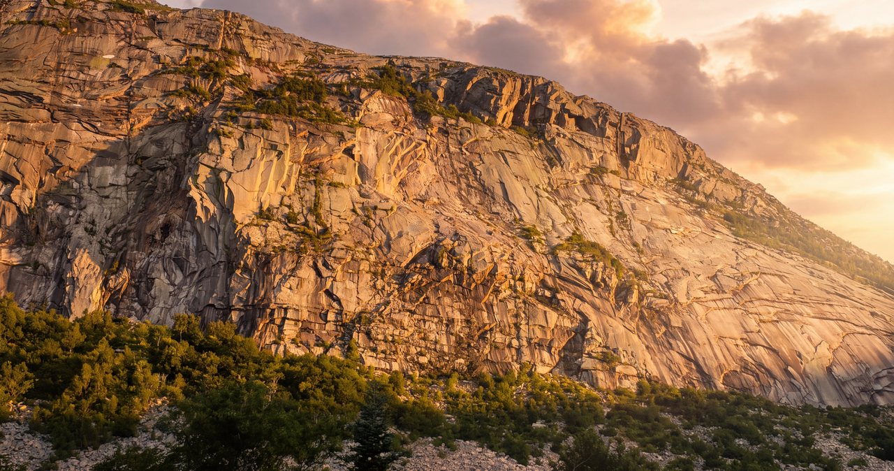
The Flume Slide Trail is the reason Mount Flume needs a blunt guide, so here is the blunt version. From its junction with the Liberty Spring Trail, the Flume Slide runs a moderate, unremarkable couple of miles through the woods with a few small stream crossings, and then it changes character completely. The last stretch to the ridge climbs the old slide itself - a long, open sheet of granite scoured bare by a landslide, gaining something like 1,450 to 1,500 feet in under a mile, on rock pitched at roughly 30 to 35 degrees over much of the slab and steepening toward 45 degrees in the worst sections. That is not a metaphor for steep. That is a slope where you are climbing with your hands as much as your feet, on smooth rock, often with water sheeting or seeping across it.
Water is the whole problem. The slab faces the weather and drains the slope above it, so it is wet far more often than it is dry - seeps, runoff, and a green film of algae on the polished rock even on days the sky is clear. Wet, that granite is slick, and the consequence of a slip on a steep slab is a slide or a fall, not a stumble. Every serious source says the same thing, and so does the official trail description: the Flume Slide is notably steep and slippery, its use is discouraged in wet weather or snow, and it is not recommended as a descending trail. The trail has a long record of injuries, which bears that description out. Take it at its word.
So the rules for the slide are simple and non-negotiable. Go up it, never down it - the people who get hurt worst are the ones who try to descend the slab or bail down it when something goes wrong. Do not set foot on it if the rock is wet, and assume it is wet unless you have real reason to believe otherwise. Put your trekking poles away and stow them before the slab starts, because you need your hands free and a pole caught between your body and the rock is a hazard. Climb it only with a party that is all comfortable on steep exposed scrambling, and keep the group close so a nervous climber is never alone on the hard rock. And know the psychology of the thing: you top out one steep section, turn the corner, and see more slide above you, again and again. That is normal. Pace yourself for it.
If any of that reads as more than you want to take on, you have not lost the mountain - you have simply chosen the other route, and it is the better choice for most people. The Liberty Spring out-and-back reaches the exact same summit with no slab at all. We steer the large majority of our guests to the ridge, and we tell the ones set on the slide to wait for a dry spell and to treat the descent plan - down the Liberty Spring Trail, never back down the slide - as fixed before they start.
The safe way: up the Liberty Spring Trail and over Mount Liberty
The route we point most people to reaches Flume without touching the slide at all, and it is a straightforward, if long, mountain day. From the Whitehouse trailhead you walk the Whitehouse Trail connector to the Franconia Notch bike path, cross the Pemigewasset River on a footbridge, and start up the Liberty Spring Trail - a steady, wooded climb of about three miles and 2,700 feet that is a section of the Appalachian Trail. It is steady, relentless uphill on rock steps and roots, with no exposure and no scrambling until the very top, where a short easy pull over open rock puts you on Mount Liberty at 4,459 feet.
From Liberty's summit you turn south on the Franconia Ridge Trail and follow the crest to Flume, a bit over a mile away, losing and regaining a few hundred feet along a narrower, rougher, partly open ridge. This stretch has its own character and a couple of short steep ledgy pitches - including the section that runs along the very top of the Flume Slide, where the trail skirts the lip of that long slab and the drop to one side is real - but it is ordinary careful walking in good conditions, not a scramble. Then you reach Flume's ledgy summit, take it in, and simply reverse the whole thing: back over Liberty, back down the Liberty Spring Trail to the bridge and the car.
The reason this is the sane route is not that it is short or gentle, because it is neither - at about 10.5 miles and close to 4,100 feet it is a bigger day than the slide loop on paper. The reason is that it is all reversible. There is no point on it where you are committed to something you cannot safely undo. If the weather sours at Liberty, you skip Flume and go down. If your legs are gone at the treeline, you turn around before the summit. You get the two-summit day, the full ridge view, and the whole time you keep the right to change your mind - which is exactly what the slide takes away from you.
A note on doing it as a loop the safe direction: people ask if you can go up the Liberty Spring Trail and down the Flume Slide to make a loop without the slab climb. You cannot. The Flume Slide is an up-only trail, whatever loop you have in mind - descending the slab is the one thing to avoid on this mountain. If you want a loop, the only defensible one is up the slide and down the Liberty Spring, done dry by an experienced party. Everyone else does the out-and-back.
The Osseo Trail, and why it is off the table for 2026
The third way up Flume is the Osseo Trail from the Lincoln Woods trailhead on the Kancamagus Highway, and in a normal year it is a lovely approach - about 5.6 miles to the summit with 3,150 feet of gain, a longer and gentler grade than anything on the Franconia Notch side, famous for a series of wooden ladders and staircases the trail crews built into its upper switchbacks. It reaches Flume from the southeast and connects to the same ridge. If you have read older guidebooks or trail apps, this is the route they may push you toward.
For 2026, it does not work, and this is not a soft suggestion. The Lincoln Woods Trail - the flat old railroad grade that everyone walks to reach the foot of the Osseo Trail - is closed for major riverbank stabilization from June 15 into November 2026. The closed segment is a 1.4-mile stretch from the Kancamagus Highway trailhead to the junction with the Osseo Trail, which is precisely the piece you would need to walk to get onto Osseo. The Forest Service has posted it as a legal closure, and violating it is a federal offense - a Class B misdemeanor carrying a fine of up to 5,000 dollars for an individual. This is not a rope you step over.
That closure breaks the standard eastern access not just to Flume but to Owl's Head, the Bonds, the Pemi Loop, and Franconia Falls for the season, and the Forest Service is telling hikers to plan other routes. Parking, the suspension bridge, and the East Side Trail at Lincoln Woods stay open, but none of that gets you legally onto the Osseo Trail while the closure is in effect. So for 2026, the two working ways up Mount Flume are the Liberty Spring out-and-back and, for experienced dry-weather parties, the Flume Slide loop - both from the Whitehouse trailhead in Franconia Notch. Before you build any plan around Lincoln Woods or Osseo this year, confirm the current status on the Forest Service and AMC websites; closures get extended, and dates move.
The Whitehouse trailhead, parking, and the Flume-lot confusion
Both Franconia Notch routes start at the Whitehouse trailhead, and almost everyone who gets confused gets confused here, so start with the parking. The hike leaves from a small, dedicated hiker lot on the Franconia Notch Parkway - the two-lane stretch of I-93 through the notch - on the east side, a short distance north of the Flume Gorge Visitor Center near Exit 34A. It is not the big Flume Gorge parking lot, which is for people buying tickets to walk through the gorge, and it is not Lafayette Place, which is three miles north and serves the Franconia Ridge Loop. If your map app sends you to Flume Gorge you are close but in the wrong lot; the hiker parking is signed separately, a bit farther north, and it is free.
Free and small, which shapes how you plan the morning. Franconia Notch State Park does not charge to park at its hiking trailheads, so unlike the Forest Service lots out on the Kancamagus there is no day pass to buy here. But it is a modest lot at one of the busiest trailheads in the state, and on clear summer and foliage weekends it fills early, often before 8 a.m. Being 14 min away in Lincoln is the real edge - you can be standing in the lot at 7 while the Boston crowd is still an hour south on the highway. Midweek and outside foliage season, the pressure comes off and you will usually find a spot at a civilized hour.
When the lot is full, do not improvise a spot on the parkway shoulder. It is illegal, ticketed, and towed, and the notch is a fast road with poor sightlines where a car half on the pavement is a genuine hazard. A weekend hiker shuttle runs in the notch in season, roughly late May through mid-October, based out of the Cannon Mountain lot at Exit 34B for a small per-person fare. One clear note so nobody plans around a ghost: Cannon's aerial tramway shut down in October 2025 for a multi-year rebuild and is not running, but the ski area, the lot, and the shuttle still operate, and no lift goes anywhere near this hike regardless. Check the current shuttle route and stops before you count on it.
The connector: the Whitehouse Trail and the Pemigewasset footbridge
The first part of the hike is a piece of connective tissue, and it helps to know why it exists so you do not think you have gone wrong. The trails up Flume and Liberty used to start at a roadside pullout. When the Franconia Notch Parkway was built, that parking went away, and the Whitehouse Trail is the replacement - a purpose-built connector of about 0.6 to 0.8 mile that runs from today's hiker lot, over a couple of low rises roughly parallel to the road, to the paved Franconia Notch bike path. It is not scenic and it is not the point. Treat it as an easy warm-up; the mountain begins soon enough.
Where the Whitehouse Trail meets the bike path, turn and follow the pavement a very short distance to a footbridge over the Pemigewasset River. This is the one substantial water crossing on either route that is bridged, and in high water it is a real convenience - you cross the biggest flow of the day dry, on a bridge. Just across it, the Liberty Spring Trail leaves and starts climbing. Note this junction on your way up, because in the flat green tangle of the notch floor, tired hikers coming down at dusk have walked past it and continued along the bike path by mistake.
From here the two routes share the Liberty Spring Trail for the first half mile, to the point where the Flume Slide Trail branches off to the right. That junction is your commitment point: straight ahead stays on the Liberty Spring Trail and the safe ridge route, right puts you on the road to the slab. If you are taking the out-and-back, simply stay straight and keep climbing. If you are set on the loop and the rock is dry, this is where you turn.
The ridge between Flume and Liberty
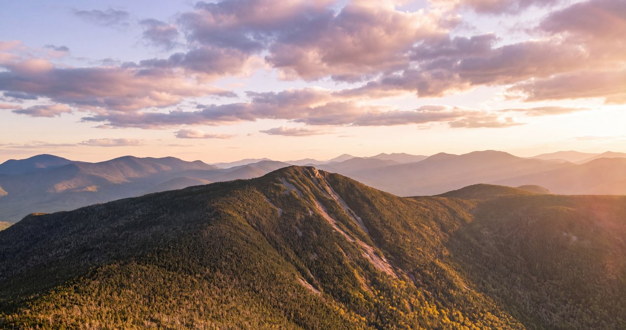
However you get up here, the mile-and-a-bit of Franconia Ridge Trail between Flume and Liberty is the connective spine of the day, and it is a different animal from the wooded climb below. It runs partly in the open and partly through scrubby, wind-stunted trees, narrower and rougher than the Liberty Spring Trail, with a couple of short steep ledgy pitches where you use your hands for balance. The views from the open stretches are the reason to be up here: the whole northern ridge - Little Haystack, Lincoln, and Lafayette - stacked up in a line, with Franconia Notch dropping away to the west.
One spot on this ridge deserves specific attention, because it is where the gentle route meets the steep one. Near Flume, the Franconia Ridge Trail runs right along the top edge of the Flume Slide - the same slab the Flume Slide Trail climbs - and for a short stretch the drop off one side of the trail is the head of that long slide. In good conditions it is ordinary careful ridge walking, but it is no place to be casual with your footing, and in wind or wet or poor visibility it is a spot to slow down and pay attention. Keep well to the trail, and keep children and any nervous walkers on the uphill side.
The ridge is also where your exposure lives on this hike. The climb up the Liberty Spring Trail is sheltered woods almost the whole way, but the moment you step onto the crest you are in the open and committed to the weather until you drop back into the trees. If you are doing the out-and-back, that means the exposed portion is the ridge between Liberty and Flume, in each direction - a mile or so of half-open walking where wind and cold and lightning are the real risks, not the footing. Time your ridge crossing for the calm part of the day, and treat any building weather as a reason to cut the ridge short and get back down.
The summit: a ledge on the edge of the cliffs
Flume's summit is small and dramatic in a way its modest elevation does not advertise. It is a narrow ledgy top sitting right on the lip of a line of cliffs that fall away to the east, so the view opens hard in that direction with nothing in front of you - a real edge, not a viewpoint behind a railing. The official description sums the panorama up squarely: outstanding views of Franconia Notch and the Kinsman Range to the west, the Franconia Range marching north, and more limited views east over the Pemigewasset Wilderness and the Twin Range. For the southern, lowest peak on the ridge, the top gives up a lot.
Because the summit is a narrow perch on the edge of a drop, it rewards a little discipline. There is not much flat ground, and the exposure to the east is genuine, so watch your footing near the edge, keep back from the lip in wind, and pick a sheltered spot just off the top to sit and eat rather than perching on the brink. On a busy dry summer day, when the slide loop is running, the small summit can get crowded; be patient about photos and give people room to move on the tight ground.
Flume shares its name with the Flume Gorge far below on the western side of the mountain, the deep 800-foot granite chasm that is one of the notch's paid attractions. You cannot see the gorge from the summit and the two are separate outings, but if the name rings a bell as you stand up here, that is the connection. From the top, the right move is the same as on any exposed White Mountains summit: take the view, take the photos, then get off the high point and put the trees between you and the wind to rest.
Water: the crossings, the bridge, and carrying enough
Plan both routes as carry-it-with-you climbs, because there is no water on the ridge and none on either summit. Bring 2 to 3 liters per person from the car in summer, more if you are taking on the full slide loop, which is a longer effort with a sweaty scramble in the middle. The last reliable water on the Liberty Spring side is Liberty Spring itself, a good spring at the Liberty Springs Tentsite about 0.3 mile below the crest - treat anything you draw from it. Above the tentsite there is nothing between you, the ridge, and Flume.
The crossings to know about are on the Flume Slide Trail. Its lower couple of miles include several small stream crossings that are trivial rock-hops in a normal dry summer and forgettable - but the same crossings, and the wetness of the slab above them, run faster and higher after heavy rain and during spring snowmelt. That is not just a wet-feet nuisance on this trail; it is the direct signal that the slab is running with water and the slide is off for the day. If the streams on the approach are up, turn the loop into an out-and-back over Liberty, or save it for a drier week.
The useful water rule here is the Pemigewasset footbridge. Because the biggest flow of the day is bridged at the bottom, the Liberty Spring route stays passable in wet conditions that shut down crossing-heavy hikes elsewhere in the notch. So on a damp day the ridge route is often the smart choice from this trailhead: you take the one meaningful crossing dry on a bridge, you avoid the water-slick slab entirely, and all it asks of you is a little extra care on the wet rock coming down.
The forecast, exposure, and the wet-rock rule that is special to Flume
The forecast that matters for any Franconia summit is the Mount Washington Observatory Higher Summits Forecast at mountwashington.org, written by meteorologists who live in this weather and published twice a day. It speaks for the high peaks in the terms that decide your day - summit temperature, sustained wind and gusts, and whether the tops will be in cloud - and it is far more useful than the valley forecast for Lincoln, which describes conditions 3,000 feet below the ridge. Read it the night before to pick the day and again in the morning to keep or fold. The summit runs much colder than town, and on the open ridge the wind governs everything.
Flume adds a second weather rule that most summits do not have, and it is the important one: the wet-rock rule for the slide. On any other 4,000-footer, a little rain mostly means a wet, careful walk. On the Flume Slide it means the crux of the route is running with water and slick as glass, and the right decision is to not be on it. Rain in the last day or two, snowmelt in spring, or a forecast that could turn - any of those takes the slide off the table and sends you to the ridge. Do not gamble the slab against the sky. The out-and-back over Liberty is your all-weather answer, within reason, precisely because it has no slab to be wet.
The exposure rule is the standard White Mountains one, and it applies to the ridge portion of either route. Thunderstorms are the hard no: the crest and both summits are bare high ground and textbook lightning targets, so on a day with afternoon storms in the forecast, be up and across the ridge early, and treat the first distant rumble as the immediate end of your time in the open, from wherever you are. Wind that staggers you at the treeline is a reason to skip the ridge and keep Flume for another day. Cloud on the tops costs you the view but not much else if the wind is calm - though it also means poor visibility on the one spot where the trail runs along the top of the slide, so navigate carefully.
Winter, the shoulder seasons, and turnaround judgment
In winter the Flume Slide Trail is effectively a mountaineering route, not a hiking trail, and for the large majority of people it is simply off. The slab turns to ice and hard snow, crampons and an ice axe and the skills to use them become the price of admission, and the consequences of a slip are worse than in summer. The winter way up Flume, for those equipped for a serious winter day, is the Liberty Spring Trail and the ridge - the same safe route, now a real winter undertaking with a wind-blasted, iced summit and a long exposed ridge crossing. From roughly mid-October to late May, treat any Flume attempt as a winter hike: carry traction matched to conditions, insulation, goggles, and face cover, and read the higher-summits forecast as a winter forecast.
The shoulder seasons are the sneaky ones. In April and May the notch floor can be bare and muddy while the Flume Slide is still glazed and the streams below it are roaring with melt - the worst possible time to be on the slab, and a season when the ridge holds rotten, postholing snow well after the trailhead looks like spring. In late October a mild brown trailhead can sit under a ridge that a cold front iced overnight. Let the mountain, not the calendar, tell you what you are dealing with, carry microspikes from Columbus Day onward as a minimum, and expect the tops to be colder and icier than the walk in.
Turnaround judgment is the whole discipline on a mountain with a route this committing. Say your rules out loud in the parking lot, where they cost nothing: which route you are taking and the real conditions that would send you to the ridge instead of the slide; a turnaround time worked backward from dark and from the long descent; and a first-rumble rule that ends the ridge immediately. The Liberty Spring route gives you clean decision points the whole way up. The slide gives you exactly one, at the bottom, before you commit - which is the strongest reason of all to make that decision carefully and to default to the ridge whenever the answer is anything but a confident yes.
The hikeSafe card and telling someone your plan
Two New Hampshire specifics belong in your pocket on any 4,000-footer, and doubly on one with a route as consequential as the Flume Slide. First, under RSA 206:26-bb, New Hampshire can bill a hiker whom Fish and Game judges negligent for the cost of a search and rescue. Choosing to climb a wet slab that every source warns against, or trying to descend the slide, is exactly the kind of decision that conversation turns on. The voluntary hikeSafe card waives that cost, short of recklessness, and helps fund the rescue teams - it is 25 dollars for an individual or 35 dollars for a family for 2026, sold through New Hampshire Fish and Game, valid January through December, same price for residents and visitors. It is a sensible thing to buy the night before.
Second, cell service in the notch and along the ridge is patchy at best, so do not let your phone be your safety plan. Download your maps before you leave the driveway, carry a real map and compass or a GPS unit you know how to use, and leave your route and your expected out-time with a person who will notice if you do not come back. We ask our hiking guests to do exactly this, and we mean it - someone at home who knows you went up the Liberty Spring Trail for Flume and expected to be down by five is worth more than anything in your pack if something goes sideways. If you are on the slide loop, say so specifically, because it changes where a search would look.
The last thing is the thing that keeps people out of trouble on every mountain around here, and it is worth more on Flume than most: turning around, or trading the slide for the ridge, costs you a view or a harder route, and the view and the route will both be here next week. There is no achievement on the Flume Slide worth getting hurt for, and the same two summits are waiting on the safe side of the ridge. The trailhead is 14 min from our porch. Mount Flume is not going anywhere.
Safety & conditions
- Choose your route in the parking lot, frankly. The Flume Slide is only for experienced scramblers on a dry day; if the rock is not certainly dry, or anyone in the party is uneasy on steep exposed rock, or the weather could turn, take the Liberty Spring out-and-back over Mount Liberty instead. You commit to the slide at the very bottom and cannot safely reverse it - the ridge route lets you change your mind the whole way up.
- Never descend the Flume Slide Trail, and do not ascend it wet. It climbs a smooth, water-scoured granite slab - roughly 1,450 to 1,500 feet in under a mile, pitched around 30 to 35 degrees and steepening toward 45 degrees in the worst sections - that is wet far more often than dry and slick when wet. It is one of the most accident-prone trails in the Whites, a place for slow, deliberate moves. The official description calls it notably steep and slippery and warns against it in wet weather or snow. Stow your trekking poles before the slab so your hands are free, and keep the party together.
- Read the Mount Washington Observatory Higher Summits Forecast (mountwashington.org, issued twice daily) the night before and the morning of. The valley forecast for Lincoln describes conditions 3,000 feet below the ridge. Recent rain or spring snowmelt means the slide is running with water - use the small stream crossings low on the Flume Slide as your tell, and if they are up, switch to the ridge route or save the loop for a drier week.
- The ridge between Flume and Liberty is your exposure. Once you leave the trees you are committed to the weather across about a mile of half-open crest each way. Thunderstorms are a hard no - both summits are bare lightning targets, so be across the ridge early on any day with afternoon storms and treat the first distant rumble as the immediate end of your time in the open. Near Flume, the Franconia Ridge Trail runs along the top edge of the slide, with a real drop off one side - slow down there in wind, wet, or poor visibility.
- Carry 2 to 3 liters of water per person from the trailhead, more for the full loop. There is no water and no shade on the ridge or either summit. The last reliable water is Liberty Spring at the tentsite, 0.3 mile below the crest on the Liberty Spring side - treat it. The big Pemigewasset crossing at the bottom is bridged, which is why the ridge route stays passable on damp days that would flood crossing-heavy hikes elsewhere in the notch.
- For 2026, the Osseo Trail approach is broken by a Lincoln Woods Trail closure (June 15 into November, a 1.4-mile stretch from the Kancamagus Highway to the Osseo junction) for riverbank stabilization. It is a legal closure - violating it is a federal Class B misdemeanor with a fine up to $5,000. Use the Franconia Notch routes from the Whitehouse trailhead, and confirm current status on the Forest Service and AMC websites before planning any Lincoln Woods or Osseo route this year.
- From roughly mid-October to late May, treat any Flume attempt as a winter hike, and treat the Flume Slide as a mountaineering route that most people should skip entirely - the slab ices over and demands crampons, an axe, and the skills to use them. The winter way up Flume is the Liberty Spring Trail and the ridge, itself a serious day with an iced, wind-blasted summit and a long exposed crossing. Carry traction matched to conditions, insulation, goggles, and face cover, and read the higher-summits forecast as a winter forecast.
- New Hampshire can bill hikers judged negligent for a rescue under RSA 206:26-bb, and taking on the slab when it is wet is the kind of choice that question turns on. Buy the voluntary hikeSafe card from New Hampshire Fish and Game ($25 individual, $35 family for 2026) - it removes that liability short of recklessness and funds the rescue teams. Cell coverage in the notch and on the ridge is too patchy to be your safety plan; download maps in advance, carry a map and compass, and leave your route and out-time with a person - and if you are on the slide loop, say so, because it changes where a search would look.
Where to stay for it
This is one of the closest trailheads to the lodge and one of the simplest to reach. From 191 Pollard Road you are on Main Street in a minute, onto I-93 North at Exit 32 a minute after that, and heading north into Franconia Notch. Stay on I-93 to Exit 34A for the Flume; the Whitehouse hiker parking is signed a short distance north of the Flume Gorge Visitor Center, on the right - about 6 miles and roughly 14 min from our door. If your map app is pointed at Flume Gorge itself you are in the right neighborhood but the wrong lot; the free hiker lot is a little farther north and separately marked.
Provision in Lincoln before you go, because there is nothing for sale at the hiker lot and nothing on the mountain. The Price Chopper plaza on Paper Mill Drive and the gas stations along Main Street are your last stop for sandwiches, extra water, and fuel - do it the evening before if you are chasing an early parking spot, and this is a hike where an early start matters, both for the small lot and for getting across the ridge before any afternoon weather. Download your maps before you leave the driveway, since cell coverage in the notch and on the ridge is patchy, and leave your route and your out-time with someone at home - and if you are attempting the Flume Slide, say so, because it changes where anyone would look for you.
Sources & official info: outdoors.org · fs.usda.gov · alltrails.com · mountwashington.org
— Launchpoint Lodge, From the lodge