Cannon Mountain is a strange one among the notch peaks. It is a real 4,000-footer with an observation tower on top and a wide-open view, and the practical truth is that for forty-five years most of the people who stood up there had ridden a cable car to do it. That changed in October 2025, when the state retired the aerial tramway to build its replacement - and no reopening date has been announced. So in 2026 the summit belongs to hikers. If you want to stand on Cannon, you walk up, and the walk is nothing like the easy ride the tram made it look like.
There are two ways up worth your time, and they are very different. The direct one is the Kinsman Ridge Trail straight up from the tramway base lot: about four and a half miles round trip, and one of the steepest, roughest, most relentlessly uphill 4,000-footer climbs in the state - it gains roughly two thousand feet in a little over two miles, on loose, eroded, often wet rock, and it barely lets up. The longer one starts from Lafayette Place and links the Lonesome Lake Trail, the Hi-Cannon Trail, and the Kinsman Ridge Trail into a loop of about six miles, with a exposed wooden ladder bolted to a small cliff as its crux. Neither is long by mountain standards. Both are harder than the mileage suggests, because on Cannon the difficulty is packed into a short, steep climb rather than spread over a long ridge.
What makes Cannon worth a careful guide right now is partly the tram closure and partly the mountain itself. This is the peak the Old Man of the Mountain hung from until he fell in 2003, and its east face - Cannon Cliff - is one of the biggest, most rockfall-prone cliffs in the East. It is a working ski area in winter, so the hiking trail crosses ski terrain near the top. And the summit, while nothing like the long open ridge on Lafayette, is a bald, breezy, rime-caked spot where a lot of underdressed people used to step off a warm cable car straight into weather they were not ready for. The trailheads are about 15 min from our door. This guide is the plain version of what you are signing up for.
The numbers - both real routes
Start with the direct route, because it is the one most people take now that the tram is down: the Kinsman Ridge Trail from the aerial tramway base lot to the summit and back. Figure about 4.4 miles round trip - roughly 2.1 to 2.3 miles each way, depending on how much of the little summit loop you walk and how your GPS reads the steep bits - with something like 2,000 to 2,200 feet of climbing. Published numbers wander a bit, from about 4.0 to 4.6 miles, but 4.4 and 2,100 feet is the real middle. That does not sound like much, and it is not, in distance. Nearly all of that climbing is packed into the two miles up, which makes this one of the steeper 4,000-footer climbs in New Hampshire. Plan on 3.5 to 5 hours car to car, most of it spent going up slowly.
The longer route is the loop from Lafayette Place: up the Lonesome Lake Trail a short way, right onto the Hi-Cannon Trail and up its steep switchbacks and ladder to the Kinsman Ridge Trail, then north on the Kinsman Ridge Trail to the summit, and back down the way that suits you. Depending on exactly how you close the loop, that runs about 6 miles - some maps put versions of it anywhere from 6.0 to 7.3 - with roughly 2,100 to 2,500 feet of gain. The Hi-Cannon Trail alone climbs close to 2,000 feet in about a mile and a half, so this route trades a little extra distance and a lake for a crux ladder and, candidly, a more interesting climb. Plan on 4.5 to 6 hours.
A word on the summit elevation, because the signs and the apps do not agree and it throws people. Cannon is listed at 4,100 feet on the Appalachian Mountain Club Four Thousand Footer list, which is the number hikers and the peak-bagging lists use. The modern USGS survey elevation is 4,080 feet. The difference is about twenty feet - the length of a school bus - and it changes nothing about the climb. We mention it only so that when one source says 4,100 and another says 4,080, you know they are talking about the same mountain and nobody is wrong.
Difficulty: both routes are short and hard, not long and hard. The Kinsman Ridge direct is a steep, rough, eroded grind with poor footing and stretches of loose gravel and slick rock, and its difficulty is pure steepness and traction, not scrambling or exposure. The Hi-Cannon loop adds one real obstacle - an exposed wooden ladder up a small cliff, with a drop beside it - that is the single most intimidating move on either route and a genuine problem for anyone uneasy with heights, for dogs, and for winter. Neither route is a beginner's first mountain. Both reward strong legs and clear footwork over speed.
The tram is retired - on foot is the only way up now
Here is the fact that reroutes every plan for this mountain: the Cannon Mountain aerial tramway closed on October 26, 2025, and no reopening date has been announced. The state retired the forty-five-year-old cable cars to build a next-generation replacement, a project running somewhere in the range of 25 to 33 million dollars. Bids from lift builders were due in the summer of 2026 and the old foundations and towers are being reused where they can be, but the short version for a hiker in 2026 is simple: there is no ride to the top. Do not plan around the tram, do not tell anyone to ride it up or down, and be skeptical of any older guidebook, app, or blog that treats the tram as a shortcut or a bail-out. It is gone.
The good news, and the reason this guide exists, is that the summit is public land in Franconia Notch State Park and the trails to it are open. The state's own park page says walking trails to the summit observation tower leave from the tram station, and the tower itself is a walk-up structure on the true summit, not something you needed the tram to reach. So on foot you can still stand on Cannon and climb the tower for the view. What you lose with the tram is every convenience that came with it: no ride, no summit cafeteria, no flush restrooms, no water fountain, and no easy way down if your legs give out. Whatever you carry up, you carry down under your own power.
The construction work is on the tramway line - the base and summit terminals and the towers between them - and that is right next to the summit station where the trails top out. The summit and its observation tower are open to hikers in 2026, and because the rebuild runs for several years right where you arrive, you may find fencing, equipment, staging, or a temporary reroute of the little summit paths in any given week. Before you count on tagging the tower, take 2 min to check the current status with Cannon Mountain or New Hampshire State Parks. If a section is fenced for construction, respect it - the view from the open ledges a few steps away is nearly the same.
Last thing on the tram: the ski area is a separate operation and it still runs. Cannon is a state-owned ski mountain, open for skiing and riding in winter using its other lifts, and the base lodge, the parking, and a seasonal hiker shuttle all still operate. So the base area will look busy and alive even with the tram dark. That matters for two reasons covered later in this guide - the hiking trail crosses ski terrain near the top, which is a real issue once the mountain is operating in winter, and the base lot doubles as ski parking, which changes when and where you can leave a car.
Route one: the Kinsman Ridge Trail straight up from the tram base
The direct route is the Kinsman Ridge Trail, and it starts from the aerial tramway base parking lot off Exit 34B, to the left of the base buildings where hiker parking is signed. It is the shortest way to the summit and, by a wide margin, the steepest. From the lot the trail climbs almost immediately and does not really stop - the standard description is that it gains around two thousand feet in about two miles, which on the ground means long stretches of steep, rough, rocky trail with switchbacks, eroded gullies, and pitches of loose gravel and slick rock where you are watching every step. There is very little flat and very little relief. It is a steady, unglamorous grind, and strong hikers still find it tiring on the way up and awkward on the way down.
About nine-tenths of a mile up, the trail crosses a ski run - the Kinsman Glade, a long black-diamond glade cut into this side of the mountain. In summer it is just a swath of open slope you cross, sometimes rocky and washed out, and the crossing is unremarkable except that it opens up a bit of a view and a bit of sun. In winter it is a different and more serious matter, which we cover in the winter section, because a hiking trail that crosses live ski terrain is a place you have to pay attention. Watch for the trail markers on both sides of the opening; the eroded, braided ground here is one of the spots where people briefly lose the treadway.
Roughly three-quarters of the way up, a short spur to the left leads out to a viewpoint over the lip of Cannon Cliff, with a big look down into Franconia Notch and across at the whole Franconia Ridge - Lafayette, Lincoln, Little Haystack, Liberty, and Flume stacked up across the valley. It is the best view of the climb and a natural place to catch your breath. Stay back from the edge here: this is the top of a nearly thousand-foot cliff, the rock can be loose, and there is no railing. Take the view from solid ground a step or two back, not from the brink.
Near the top the Kinsman Ridge Trail passes close to but not exactly over the true summit - it is a through-trail that keeps going southwest over the Cannon Balls toward the Kinsmans - so to stand on the high point and reach the observation tower you turn onto the Rim Trail, the short loop of gravel paths near the summit station that ties the viewpoints and the tower together. Follow the signs for the summit and the tower; it is a few minutes of easy walking after all that climbing. Then you reverse the whole thing back down the Kinsman Ridge Trail, which on this route is the crux of the day for most people - steep, loose, and hard on the knees, and slow going if it is wet.
Route two: the Hi-Cannon and Lonesome Lake loop
The other route is a loop out of Lafayette Place, and it is the one to take if you want more than a straight up-and-down grind. From the Lafayette Place parking you pick up the Lonesome Lake Trail, a popular, well-graded path that climbs toward Lonesome Lake. A short way up, before the lake, the Hi-Cannon Trail branches off to the right and starts climbing in earnest - steep switchbacks up a rocky ridge, with the grade stiffening the higher you go. This is a rougher, quieter trail than the Lonesome Lake path it left, and it does the bulk of the day's climbing in a hurry, close to two thousand feet in about a mile and a half.
The Hi-Cannon Trail has one feature that earns it a place on local lists of the more frightening trails in the state: a wooden ladder bolted to a small cliff, with a real drop beside it, that you climb to get past an otherwise impassable step. It is short, it is solid, and plenty of ordinary hikers go up it without drama - but it is exposed, and if anyone in your party is uneasy on ladders or heights, this is the deciding factor, and the direct Kinsman Ridge route is the better pick for them. Just above and around the ladder the trail traverses under a rocky overhang and past an open ledge with a striking look straight down at Lonesome Lake, one of the best views on either route. In the wet, or with a heavy pack, take the ladder and the ledges slowly and deliberately.
Higher up, the Hi-Cannon Trail meets the Kinsman Ridge Trail, and you turn north (right) to climb the last stretch to Cannon's summit and the Rim Trail, same as the direct route. To close the loop, most people come back down the Kinsman Ridge Trail toward Lonesome Lake, a steep, rough stretch where you will use your hands in places on the way down, then rejoin the Lonesome Lake Trail and follow it down to the car. Done as a loop it runs about six miles. It is longer and a bit more climbing than the direct route, and it is the more rewarding day: a lake, a ladder, a cliff-edge view of the lake from above, and the summit, instead of one long staircase up and back.
Which one to pick? If you want the shortest possible way to the top and do not mind a punishing grade, and especially if ladders or heights are a problem for anyone in your group or you have a dog, take the Kinsman Ridge Trail straight up from the tram base. If you want a more varied, more interesting hike and everyone is comfortable on an exposed ladder, take the Hi-Cannon and Lonesome Lake loop from Lafayette Place. Both put you on the exact same summit. Neither is easy.
The summit: the observation tower, the Rim Trail, and what is running
Cannon's summit is a broad, mostly scrubby top with an observation tower planted on the high point, and the tower is the payoff - a few steps up onto a platform that clears the trees and hands you a full circle of the White Mountains. The state park calls the view panoramic and it earns it: Franconia Ridge fills the eastern sky across the notch, the Kinsman Range runs south, the Pemigewasset Wilderness rolls off to the east, and on a clear day you can pick out Vermont's Green Mountains to the west and, sometimes, the Presidentials and Mount Washington to the northeast. For a mountain you climb in a couple of miles, the top gives up an enormous amount.
The Rim Trail is the short network of easy gravel walkways up here that used to shuttle tram riders between the summit station, the tower, and the viewpoints. As a hiker you use it to reach the true summit and the tower from wherever the Kinsman Ridge Trail tops out, and to wander between the open ledges for different angles on the view. It is flat, simple walking, a relief after the climb - just follow the signs for the summit and the observation tower.
Set your expectations about services, because with the tram down there effectively are none. In the tram era the summit had a cafeteria, restrooms, and water; right now, assume all of that is closed and that the summit station is an active construction zone rather than a warm place to wait out weather. There is no reliable shelter, no food, no water, and no bail-out ride. If the wind is up or the cloud is in - and both happen fast on this exposed top - you take your look, you climb down off the tower, and you get back below treeline under your own steam. Treat the summit as a place to visit briefly and leave, not a place to linger and count on comfort.
Because a project this size is ongoing right at the top, do the sensible thing and verify tower and summit access with Cannon Mountain or New Hampshire State Parks close to your hike date. The summit and tower are open to hikers in 2026, though fencing and staging around the worksite can shift from week to week, and that quick check saves you a surprise turnaround just short of the top.
The Old Man of the Mountain: you are standing on his mountain
If Cannon Mountain rings a bell even for people who have never hiked, this is why: the Old Man of the Mountain, the granite profile that was New Hampshire's state emblem, hung from Cannon's east face until it collapsed. Five stacked granite ledges, seen from the right angle down in the notch, formed the shape of a stern human face in profile, forty-odd feet tall, and for generations it was the symbol of the state - it is still the shape on the New Hampshire quarter and the road signs. It let go in the early hours of May 3, 2003, sometime between about midnight and two in the morning, after countless winters of freeze and thaw finally worked the blocks loose. People woke up, drove into the notch, and the face was simply gone.
The profile lived on Cannon Cliff, the mountain's dramatic east wall above Profile Lake, so when you climb Cannon you are climbing the very mountain the Old Man was part of. You cannot really see where he was from the summit - the cliff falls away below and out of sight - but from the Cannon Cliff viewpoint spur off the Kinsman Ridge Trail you are looking out over the top of that same wall and down into the notch he watched. It is a quiet thing to know as you stand up there: this is his mountain, and the climb is your version of visiting.
Down at road level in the notch there is a formal memorial worth a stop on the way out, the Old Man of the Mountain Profile Plaza by Profile Lake, dedicated in 2011. It is a set of steel profiler rods planted so that, when you line them up from a marked spot, they trace the outline of the face back onto the empty cliff where it used to be. It is a short, flat, free walk from a parkway pullout, not part of the hike, and it is a moving little piece of design - the closest anyone can get now to seeing the Old Man again. If you are at all curious about the state symbol, that is where to satisfy it.
Cannon Cliff, rockfall, and staying where you belong
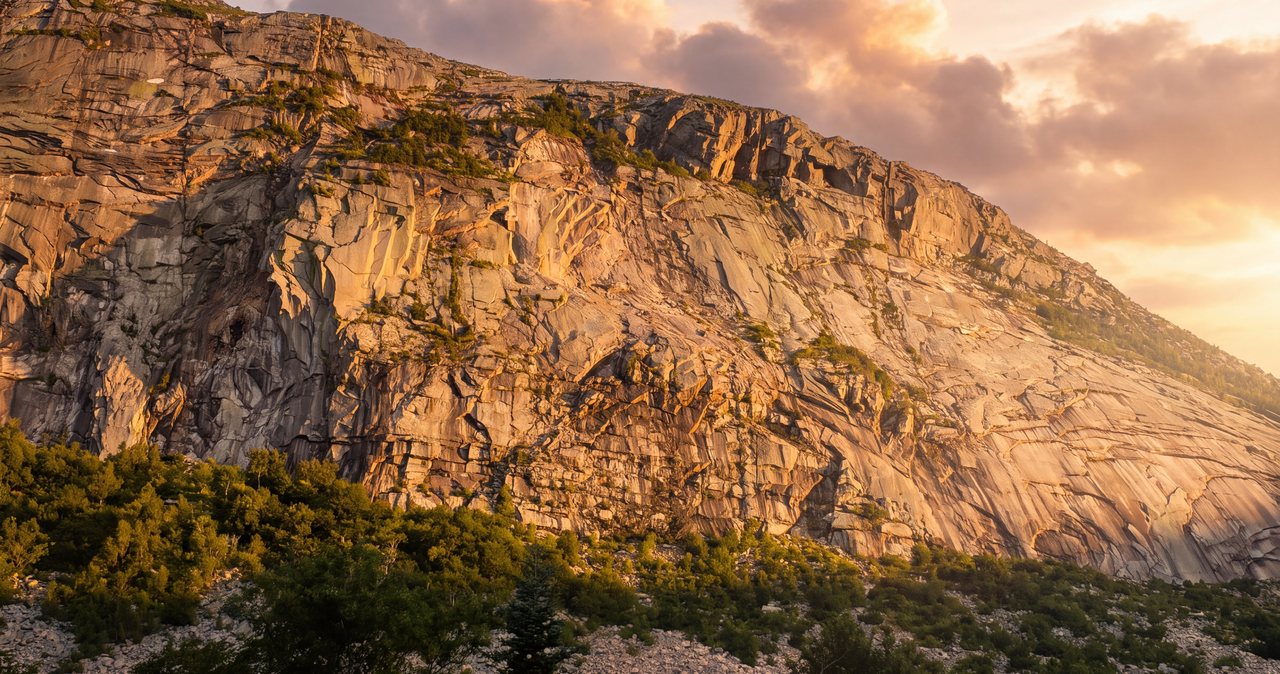
Cannon Cliff is a serious piece of mountain, and it is worth understanding even though the hiking trails do not go on it. The cliff is a nearly thousand-foot sweep of granite on Cannon's east face, one of the largest cliffs in the eastern United States and a famous, committing technical rock-climbing wall. It is also actively falling apart, in the geological sense: rockfall is a normal, ongoing event here. The Old Man was the most famous piece to go, but he was not the only one - a large section called the Whaleback Crack peeled off in the 1990s and left a fresh field of talus at the base. The mountain is quite literally shedding itself, slowly, all the time.
For a hiker on the Kinsman Ridge or Hi-Cannon trails, this is context rather than a direct threat - you are on top of and behind the cliff, not on its face or directly under it. The one place you brush up against it is the Cannon Cliff viewpoint spur near the top of the Kinsman Ridge Trail, which looks out over the lip. The rule there is simple: stay on the marked ground, keep well back from the edge, do not scramble out onto the cliff-top slabs for a better photo, and keep any children on the trail side. Loose rock and a thousand-foot drop are a bad combination, and there is no barrier.
The people who contend with the rockfall are the technical climbers on the face and, historically, anyone who wandered onto the talus and the closed area directly below the old profile. As a hiker, your job is just to respect the trail markings and any posted closures, and to resist the urge to explore off-trail on the cliff side of the summit. The view is fully available from the safe, obvious spots. There is nothing to gain and a lot to lose by getting closer to the edge than the trail takes you.
Parking, the free lots, and the seasonal shuttle
Both routes park on Franconia Notch State Park land, and the useful headline is that hiker parking here is free - there is no day-use fee to leave a car and there is no White Mountain National Forest pass required, because this is state park ground, not national forest. That is the same deal as the Flume and Lafayette Place trailheads and it is different from the Forest Service lots out on the Kancamagus, where you do need a pass. The direct route parks at the aerial tramway base lot at Exit 34B, in the signed hiker parking to the left of the base buildings. The loop route parks at the Lafayette Place trailhead lots on the Parkway a short distance south, the same lots that serve Lonesome Lake and the Falling Waters and Old Bridle Path trails.
At both lots, the key is space and timing. Lafayette Place is one of the busiest trailheads in the state and its lots fill early - often before eight on a fair-weather summer or foliage weekend - and when they are full, they are full. The tramway lot is larger, but remember it is also the ski-area lot, so in winter and on event days it fills with skiers and the hiker section can get squeezed. Being 15 min away in Lincoln is the real advantage here: you can be standing at the trailhead early while the crowd from Boston is still an hour down the highway. Midweek and outside foliage season, the pressure comes off and you will usually find a spot at a civilized hour.
Do not solve a full lot by parking on the Franconia Notch Parkway shoulder. The Parkway is a fast, narrow, two-lane road with poor sightlines through the notch, roadside parking is prohibited and ticketed and towed, and a car half on the pavement is a genuine hazard on that stretch. If both lots are full, have a backup plan - a different trailhead, a later start another day, or the shuttle.
On that: Cannon runs a seasonal hiker shuttle. In 2026 it runs Saturdays, Sundays, and holidays from May 23 through October 18, roughly 8 a.m. to 7 p.m., for 5 dollars per person round trip, connecting the aerial tramway lot with the Lafayette Place and Falling Waters trailheads. That is handy if you want to hike Cannon as a traverse or if one lot is full and the other is not, but confirm the current schedule and route before you build a plan on it, because seasonal services change dates and stops from year to year.
The forecast, exposure, and how Cannon is different from the ridge
The forecast that matters for any high peak in this area is the Mount Washington Observatory Higher Summits Forecast at mountwashington.org, written by meteorologists who live in this weather and issued twice a day. It speaks for the exposed tops in the terms that decide your day - summit temperature, sustained wind and gusts, and whether the peaks will be socked in cloud - and it is far more accurate for the summit than the valley forecast for Lincoln, which describes conditions thousands of feet lower and much calmer. Read it the night before to choose your day and again in the morning to confirm it.
Cannon is different from its neighbors across the notch, and it helps to be clear about how. This is not a long above-treeline ridge walk like Lafayette, Lincoln, or Flume, where you are committed to a mile or more of open crest. Cannon is mostly a steep climb through the trees, and the real exposure is concentrated in a small area at the very top - the open summit ledges and the observation tower, and the cliff-edge viewpoint. That is both good news and a specific trap. Good, because you are sheltered for most of the climb and your exposure to wind and weather is short. A trap, because Cannon's summit sits right at the edge of serious weather, and for forty-five years people rode a warm tram straight up into it dressed for the parking lot. On foot you feel the mountain the whole way, which is safer, though the top is still a bald, wind-scoured spot that can be much colder than the base.
So the exposure rules still apply, just concentrated at the summit. Thunderstorms are the hard no: the open top and the tower are bare high ground and textbook lightning targets, so on a day with afternoon storms in the forecast be up and back down early, and treat the first distant rumble as the immediate end of your time on the summit. Wind that staggers you as you step out of the trees is a reason to take a quick look and get back down rather than lingering on the tower. Cloud on the top costs you the view but little else if the wind is calm. The pattern to internalize: climb sheltered, top out exposed, and do not dawdle up high if the weather is anything but kind.
Water, footing, and the wet-rock reality
Plan both routes as carry-it-with-you climbs. There is no water on the summit and none you should count on high on either trail - and with the tram down, the old summit water is not an option either. Bring 2 to 3 liters per person from the car in summer, more on a hot day, because the direct Kinsman Ridge climb is a sweaty, sustained grind with almost no letup. On the loop, the Lonesome Lake side has small brooks low down, but treat anything you draw and do not plan your day around finding water on the mountain. Carry what you need.
Footing is the real story on Cannon, more than water and more than exposure. The Kinsman Ridge Trail is steep, rough, eroded, and in many places loose - gravel over hardpack, slick roots, and rock that holds water. It is tiring going up and tricky going down, and it is the kind of trail where most of the day's small slips and turned ankles happen on the descent when your legs are tired. Poles help a lot here. So does slowing down. When the rock is wet - after rain, in morning dew, in the shoulder seasons - every bit of that steep ground gets more slippery, and the smart move is to shorten your stride, test your feet, and accept that down will be slow.
The two spots that deserve extra care in the wet are specific. The Kinsman Glade ski-trail crossing and the eroded pitches near it can be washed out and greasy. And on the loop, the Hi-Cannon ladder and the ledges around it are exposed and unforgiving if you slip - wet wood and wet rock with a drop beside them. None of this is a reason to skip the mountain in summer. It is a reason to check the recent weather, to bring poles, and to plan a slow, careful descent rather than a fast one.
Winter, the ski area, rime, and the buried ladder
Cannon in winter is a real winter mountain, and the fact that it is a ski area makes it its own particular puzzle. The summit turns fierce: hikers routinely report rime ice and verglas plastering the rocks and the tower, temperatures near zero, and wind whipping across the open top at forty miles an hour and more. The Kinsman Ridge Trail becomes a firm, often icy staircase where microspikes are the minimum and crampons are frequently the right call, and the short exposed summit is a place to cover your face, not to stand around admiring the view. From roughly November into April, treat any Cannon attempt as a winter hike and carry traction, insulation, goggles, and wind protection to match.
The ski-area piece is the part people forget. The Kinsman Ridge Trail crosses live ski terrain - the Kinsman Glade - and other routes brush ski trails, and once Cannon is operating for the season those pistes carry skiers moving fast, plus snowmaking and grooming. The rule is firm and it is for your safety and theirs: do not hike up or down the ski trails, cross ski terrain only where your hiking trail crosses it and do so quickly and alert, and never treat a groomed run as a convenient path. Walking uphill on an operating ski mountain is against the rules and puts you in the path of skiers. If you are hiking Cannon in ski season, know where your trail goes, stay on it, and stay off the slopes.
The Hi-Cannon ladder is effectively off the table in real winter. Buried, iced, or plastered in rime, that exposed wooden ladder and the ledges around it turn from an interesting obstacle into a serious hazard, and the standard winter approach is the Kinsman Ridge Trail rather than the Hi-Cannon loop. The shoulder seasons are their own trap: in April and May the base can look like spring while the upper trail is still glazed and postholing, and in late October a mild trailhead can sit under a rimed, iced summit. Let the mountain, not the calendar, tell you what season it is up high, and carry traction from Columbus Day onward as a default.
The hikeSafe card, the rescue law, turnaround judgment, and telling someone your plan
Two New Hampshire specifics belong in your pocket on any 4,000-footer, Cannon included. First, under RSA 206:26-bb, New Hampshire can bill a hiker whom Fish and Game judges negligent for the cost of a search and rescue. The voluntary hikeSafe card removes that liability short of true recklessness and funds the rescue teams directly - it runs 25 dollars for an individual or 35 dollars for a family for 2026, sold through New Hampshire Fish and Game, valid January through December, the same price for residents and visitors. On a steep mountain where a turned ankle on the descent is the most likely way to need help, it is a sensible thing to buy the night before.
Second, do not let your phone be your safety plan. Cell service in the notch and on the trail is patchy, so download your maps before you leave the driveway, carry a real map and compass or a GPS you know how to use, and leave your route and your expected out-time with a person who will notice if you do not come back. We ask our hiking guests to do exactly this, and we mean it - someone at home who knows you went up the Kinsman Ridge Trail on Cannon and expected to be down by mid-afternoon is worth more than anything in your pack if something goes wrong. If you are doing the loop, say so, because it changes where a search would look.
Turnaround judgment on Cannon is mostly about the descent and the weather, not about a long committing traverse. Set a turnaround time worked backward from dark, remembering that the down-climb on the Kinsman Ridge Trail is slow and hard on tired legs. Set a first-rumble rule that gets you off the exposed summit immediately. And be willing to skip the tower and turn around at the treeline if the wind or cloud at the top is worse than you bargained for - the view will be here next week. There is no ride waiting at the top anymore and no shelter to hide in, which is exactly why the plain move on a bad-weather day is to climb a different, sheltered peak or wait for a better one.
None of this is meant to talk you out of Cannon. It is a terrific short-and-steep climb to a big view, on a mountain wrapped up in the state's own history, and it is 15 min from our porch. It just asks for respect in a way the tram used to hide: you earn this summit now, and the way you keep it a good day is real gear, an early start, careful footing on the way down, and the discipline to turn around if the top is throwing weather you did not come dressed for.
Safety & conditions
- The tram is retired and there is no ride and no shelter at the top. In 2026 the only way up or down Cannon is on foot, and with the tramway closed the summit has no cafeteria, restrooms, or water, so pack everything you need and save some energy for the walk down. Do not plan around the tram or trust older guides that treat it as a shortcut. Major construction is at the summit station, so verify tower and summit access with Cannon Mountain or NH State Parks before you go.
- This is a short, very steep climb, and footing is the thing to watch, especially going down. The Kinsman Ridge Trail gains about 2,000 feet in two miles on rough, eroded, often loose and wet rock; most slips and turned ankles happen on the tired-legged descent. Bring trekking poles, shorten your stride on wet or loose ground, and plan a slow, deliberate way down rather than a fast one.
- On the loop, the Hi-Cannon Trail's wooden ladder is exposed, with a drop beside it. It is solid but intimidating - if anyone in your party is uneasy on ladders or heights, take the direct Kinsman Ridge route instead, and skip the ladder entirely in wet weather or winter, when it is iced or buried. Keep dogs off the Hi-Cannon loop; most cannot manage the ladder.
- The summit is short but exposed, and it can be far colder and windier than the base. Read the Mount Washington Observatory Higher Summits Forecast at mountwashington.org (issued twice daily) the night before and the morning of - it is far more realistic for the top than the Lincoln valley forecast. Thunderstorms are a hard no on the open summit and tower, which are lightning targets: be up and down early on stormy-forecast days and treat the first distant rumble as the immediate end of your time on top. If wind or cloud at the summit is worse than you expected, take a quick look and get back below treeline.
- Stay back from the edge at the Cannon Cliff viewpoint. The spur near the top of the Kinsman Ridge Trail overlooks a nearly thousand-foot cliff with no railing and loose rock, the same wall the Old Man fell from, and rockfall here is a normal, ongoing event. Keep to the marked ground, do not scramble out onto the cliff-top slabs for a photo, and keep children on the trail side. Do not explore off-trail on the cliff side of the summit.
- In winter Cannon is a serious mountain and an operating ski area at once. Expect rime ice, verglas, near-zero cold, and wind over forty miles an hour on the exposed top; carry microspikes or crampons, insulation, goggles, and wind protection, and read the higher-summits forecast as a winter forecast. Stay off the ski trails themselves, and cross ski terrain only where your hiking trail does, quickly and alert; walking on open runs is against the rules and puts you in the skiers' path.
- Carry your own water and food; there is none on the mountain and none at the summit now. Bring 2 to 3 liters per person from the car in summer, more on hot days, and do not count on the small brooks on the Lonesome Lake side - treat anything you draw. This is a sweaty, sustained climb and dehydration sneaks up on the way up.
- New Hampshire can bill negligent hikers for rescue costs under RSA 206:26-bb. Buy the voluntary hikeSafe card from New Hampshire Fish and Game ($25 individual, $35 family for 2026) - it removes that liability short of recklessness and funds the rescue teams. Cell coverage in the notch is patchy, so download your maps in advance, carry a map and compass or a GPS you know how to use, and leave your route and out-time with a person who will notice if you do not return - and if you are on the loop, say so, because it changes where a search would look.
Where to stay for it
This is one of the closest big climbs to the lodge. From 191 Pollard Road you are on Main Street in a minute, onto I-93 North at Exit 32 a minute after that, and heading up through Franconia Notch. For the direct route, stay on the Parkway to Exit 34B and follow signs for the aerial tramway and Cannon Mountain; the hiker parking is signed to the left of the base buildings - about 10 miles and roughly 16 min from our door. For the loop, get off a little sooner at the Lafayette Place trailhead lots on the Parkway. The exits through the notch are close together and quickly signed on a fast two-lane road, so know which one you want before you are on top of it.
Provision in Lincoln before you go, because there is nothing for sale at either trailhead, nothing on the mountain, and with the tram closed there is no summit cafeteria or water the way there used to be. The Price Chopper plaza on Paper Mill Drive and the gas stations along Main Street are your last stop for sandwiches, extra water, and fuel - do it the evening before if you are chasing an early parking spot, which on a summer or foliage weekend matters at these lots. Download your maps before you leave the driveway, since cell coverage in the notch is patchy, and leave your route and your out-time with someone at home.
Sources & official info: nhstateparks.org · cannonmt.com · cannonmt.com · trailfinder.info
— Launchpoint Lodge, From the lodge