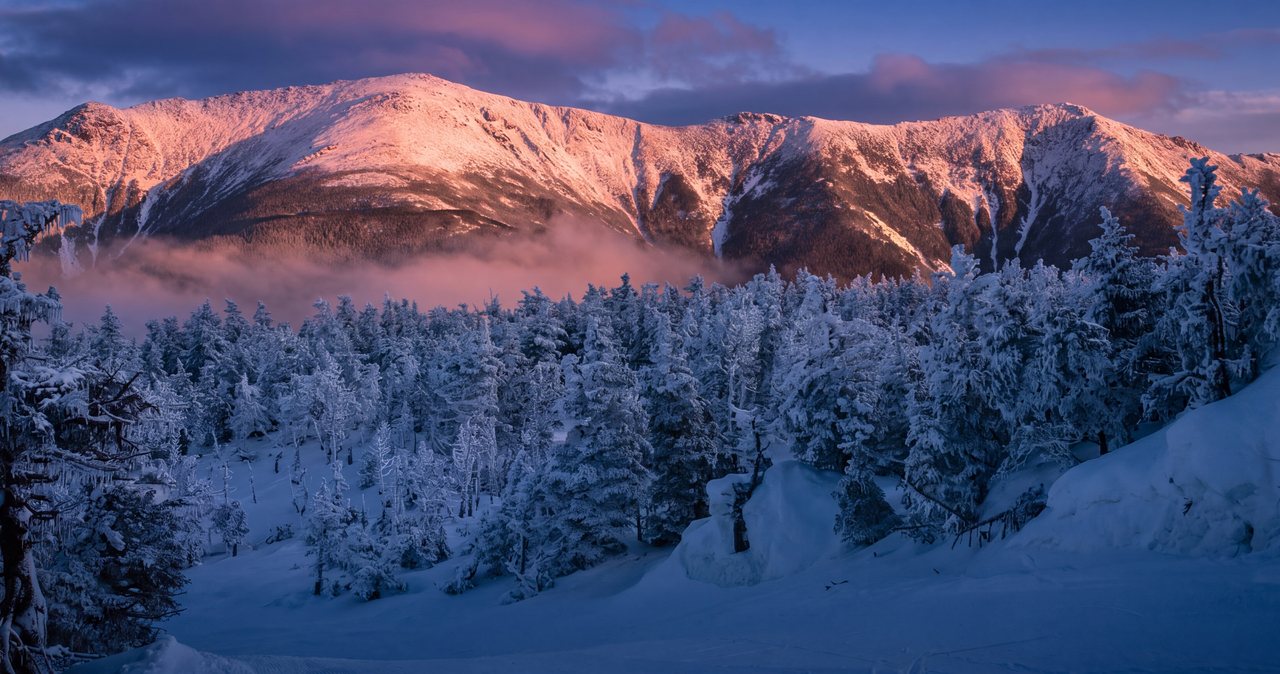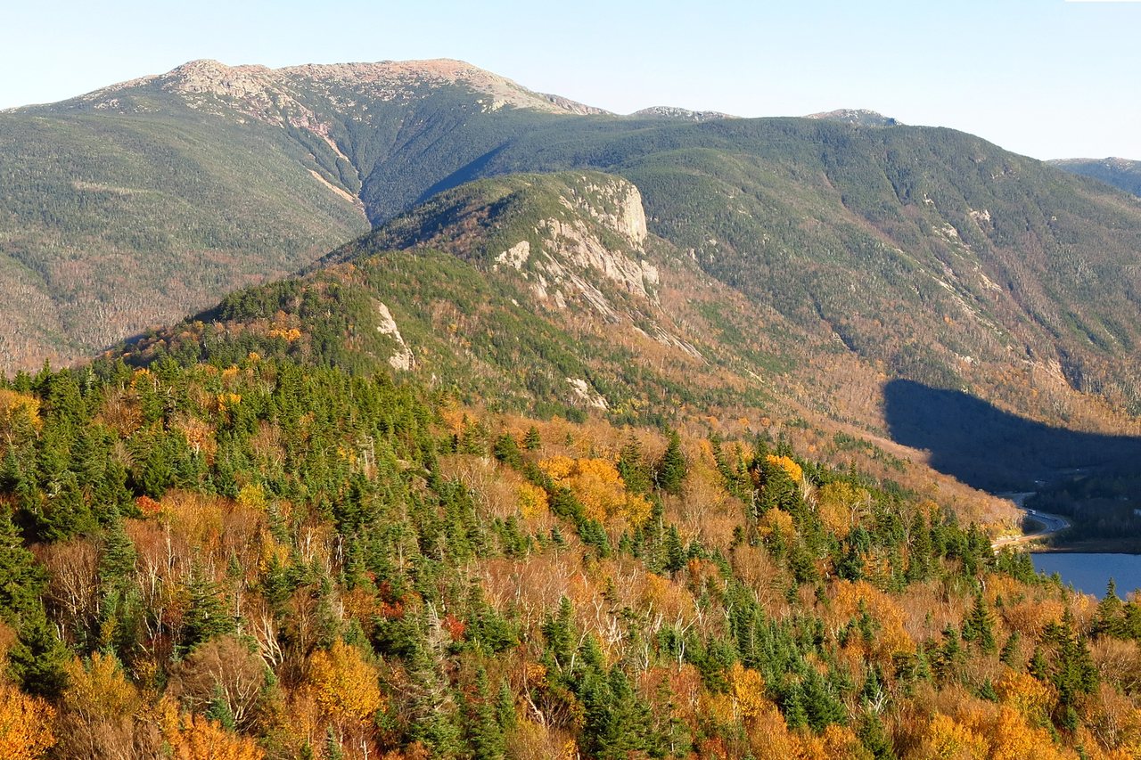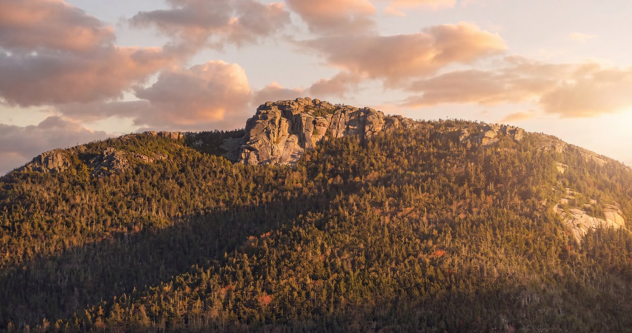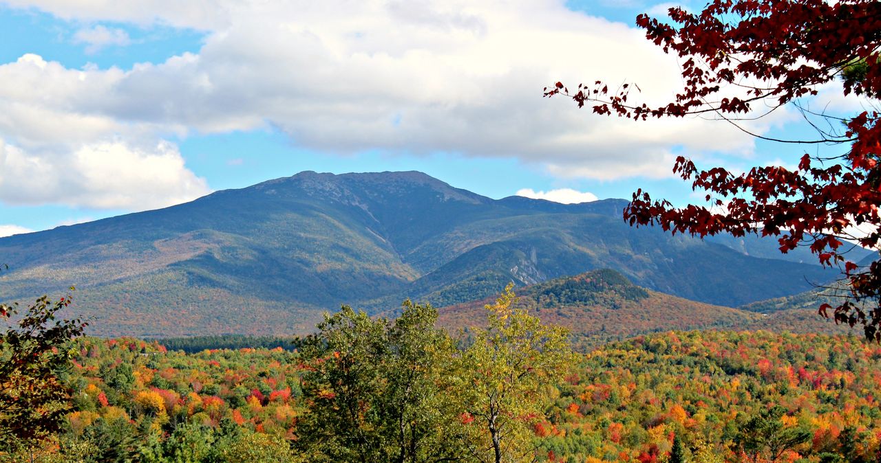
Mount Lafayette is 5,249 feet, the sixth-highest of New Hampshire's 4,000-footers and the tallest thing in the state outside the Presidential Range. It forms the entire east wall of Franconia Notch, and from the lodge it is a 16 min drive to the bottom of it. The classic way up is the Old Bridle Path to Greenleaf Hut, then the top section of the Greenleaf Trail to the summit - about 4 miles each way, roughly 3,500 feet of gain, with the last three-quarters of a mile fully above treeline. Most people know this trail as half of the famous Franconia Ridge Loop. Fewer people know it works beautifully on its own.
That is what this guide covers: Lafayette as a straight out-and-back. We wrote a separate guide to the full 8.9-mile loop over Little Haystack, Lincoln, and Lafayette, and if the forecast is perfect and your legs are good, the loop is one of the best day hikes in the country. But the out-and-back is the smarter call more often than people admit - in iffy weather, in high water, in winter, for sunrise, or any day you want a big summit with a built-in bailout at every stage. You climb the same mountain, you stand on the same summit, and you keep a staffed hut and a familiar trail between you and the parking lot the whole way.
We send guests up this trail all season, and the two things that decide how the day goes are settled before you leave Lincoln: where you park and what the wind is doing up high. So this guide spends real time on both. The trailhead lots at Lafayette Place fill before sunrise on good weekends, shoulder parking on the parkway is illegal and enforced, and the summit runs its own weather program that has nothing to do with the blue sky over Main Street. Get those two right and Lafayette is a long, fair, completely manageable day. Get them wrong and you are either driving in circles at 8 a.m. or crawling on the summit cone wishing you had turned at the hut.
Why the out-and-back instead of the loop
The Franconia Ridge Loop gets the glory, and on a clear, calm day it deserves it. But the loop commits you: once you are strung out along the ridge past Little Haystack, the fastest way off is usually forward, over Lincoln to Lafayette and down past the hut. That is nearly 2 miles above treeline with no shelter, no water, and no shortcut. The Old Bridle Path out-and-back flips that math. Your exposed distance drops to about a mile and a half total - up and back on the summit cone - and every step of it is optional right up until you take it. If the clouds are sitting on the ridge when you reach Greenleaf Hut, you have soup and a decision, not a problem.
There are quieter, practical reasons too. The Falling Waters Trail, the loop's other leg, crosses Dry Brook several times, and those crossings get pushy after heavy rain or during snowmelt - people turn around there in June more often than you would think. The Old Bridle Path has nothing beyond step-over seeps, which makes it the reliable choice the day after a storm. Descending is also simply easier on a trail you climbed that morning: you know where the ledges are, you know where the footing is loose, and years of rebuilt stone staircase (more on that below) beats the steep, wet rock steps of Falling Waters when your knees are tired.
On the out-and-back you repeat 4 miles instead of seeing 9 new ones, and you miss the ridge walk between Lafayette and Little Haystack, the most photographed stretch in the White Mountains. If that ridge walk is the whole point of your trip, read our Franconia Ridge Loop guide and wait for a real weather window. But do not treat the out-and-back as the consolation prize. Summit-wise you give up nothing - Lafayette is the high point of the loop anyway - and you gain control of the day. Guidebook writers have been calling the Old Bridle Path the finest way up Lafayette since people rode horses on it, and they were not wrong.
The numbers
Call it 8 miles round trip. The AMC segment math is 2.9 miles from Lafayette Place to Greenleaf Hut on the Old Bridle Path, then 1.1 miles from the hut to the summit on the Greenleaf Trail - 4.0 each way. AllTrails logs the same route at 7.9 miles with 3,523 feet of gain. Published gain figures run from about 3,450 to 3,600 feet depending on the map, because the trail rolls a little on Agony Ridge and dips slightly past the hut. Plan on 3,500 and you will not feel lied to. The trailhead sits just under 1,800 feet; the summit is 5,249.
Time: the old AMC book formula (half an hour per mile plus half an hour per thousand feet) puts the ascent around 3 hours 45 min. In the real world, fit hikers reach the hut in about 2 hours and the summit in 3, most parties summit in 3 to 4, and the round trip with a real summit stop lands between 6 and 8 hours car to car. Nobody has ever regretted starting this hike early. The descent is faster but not fast - the same rocks that slowed you going up demand attention going down, and most twisted ankles happen in the last 2 downhill miles when people stop paying attention.
Difficulty: hard, but a civilized kind of hard. There are no ladders, no scrambles where you need your hands for more than balance, and no exposure below treeline. What it is, relentlessly, is up - the grade barely relents from the moment you leave the lot - and the footing is White Mountains standard, meaning rock, roots, and stone steps almost the entire way. If your hiking resume is flat rail trails, this is not the place to discover what 3,500 feet feels like; do Lonesome Lake or the hut out-and-back first. If you have done any 4,000-footer before, Lafayette by this route is a step up in scale, not in technique - right until you leave the trees, where the difficulty stops being about your legs at all.
Parking at Lafayette Place: the part people get wrong
There are two small lots at Lafayette Place, one on each side of the Franconia Notch Parkway. The trailhead itself - shared by the Old Bridle Path and Falling Waters Trail - is on the east side, which is the northbound side, the direction you approach from Lincoln. The second lot is across the highway at Lafayette Place Campground, reachable only from the southbound lanes; a paved path and underpass connect it to the trailhead, adding a few minutes of walking. Parking at both lots is free - the notch trailheads are state park land, so the Forest Service parking pass system does not apply here. What neither lot is, is big.
On clear summer and foliage weekends these lots are routinely full before sunrise. Not by 8 a.m. - before sunrise. This is one of the most heavily hiked trailheads in New England, and it is 2 hours from Boston. Staying in Lincoln is the cheat code: you can be standing in the lot at 5:30 having left the lodge at 5:15, while the Massachusetts crowd is still crossing the border. Midweek is a different world; outside of peak foliage you can arrive at a reasonable hour on a Tuesday and park without drama.
When the lots fill, do not improvise. Parking on the parkway shoulder is illegal at all times - the state posts it, and state police ticket and tow along I-93 through the notch. Beyond the fine, you would be walking a live interstate shoulder in trail runners, which is a worse idea than anything on the mountain. The sanctioned overflow is the big Cannon Mountain Tramway lot at Exit 34B, one exit north, where a hiker shuttle runs on Saturdays, Sundays, and holidays from May 23 to October 18, 2026, 8 a.m. to 7 p.m., $5 per person round trip, cash or card, dogs ride free. It stops at the trailhead lot on the northbound side and the campground lot on the southbound side; keep your ticket for the ride back. (The tramway itself shut down October 26, 2025, and no reopening date has been announced - the lot is open, the lift is not.)
Two more wrinkles worth knowing. First, if you sail past a full northbound lot, do not stop - continue to Exit 34B, and either join the shuttle or loop back southbound and try the campground-side lot. Second, hikers are not allowed to park at campsites or block the campground loop; use the marked day-use spaces. On a July Saturday, our plain advice in order: be there before 6, take the shuttle, or hike midweek. There is no fourth option that ends well.
The lower miles: Walker Brook to the ledges
From the trailhead kiosk, the Old Bridle Path and Falling Waters Trail leave together. About 0.2 miles in, Falling Waters ducks right to cross Walker Brook; you keep left and start up. This junction is signed and obvious in daylight, and worth a deliberate look if you are starting by headlamp - every season a few sunrise hikers end up on the wrong trail for a mile before checking a map.
The first stretch climbs steadily through hardwoods - yellow birch, beech, maple - on a trail that has carried foot traffic for the better part of two centuries. It was graded in the 1800s as a bridle path, so tourists could ride horses to a small stone summit house at the top, which explains the name and the mostly reasonable grade. The brook falls away below you on the right, the woods do the quiet green-tunnel thing New Hampshire does, and there is not much to see for the first hour and a half. That is the deal on Lafayette: the views are all in the second half, and they are worth the wait.
You will notice the trail itself is in remarkable shape, and that is recent. The Old Bridle Path is in the middle of a multi-year, multimillion-dollar rebuild - the Forest Service, New Hampshire State Parks, and the AMC working together with professional trail crews - that has installed hundreds of granite steps, rebuilt drainage, and rerouted several badly eroded sections onto fresh tread. In 2026 the crews are still at it, typically Monday through Thursday. If you meet them, follow their flagging, stay on the marked line, and say thank you; they are moving rocks the size of washing machines by hand winch so this trail survives another century of us.
Around the 2-mile mark, at roughly 3,200 feet, the hardwoods give way to spruce and the trail pops out on the first open ledges. This is where the hike changes. Franconia Notch drops away to your left, Cannon's cliff face stands across it, and ahead and above you get your first real look at the upper mountain and the ravine between you and it. It is also your first clear weather report: if the summits are in cloud from here, believe what you see over what your phone said in Lincoln.
Agony Ridge and the three Agonies
From the ledges, the trail follows the crest of a narrow spur called Agony Ridge, and the name is not decorative. The hut crews who packed loads of food and propane up this section on wooden pack boards named its three steep pitches the Agonies, and hikers have kept the name because it is accurate. Each one is a short, blunt, hands-on-knees grind; each false top reveals the next. This is the steepest sustained climbing of the day, and it comes in the middle third of the ascent, which is exactly where people misjudge how much mountain is left. When you finish the third Agony you are near the hut - but the hut is at 4,220 feet, and the summit is still more than 1,000 feet above it.
The compensation is that Agony Ridge is beautiful. The ledges keep coming - perches with clean views into Walker Ravine, whose old slide scars streak the headwall below the summit cone, and straight across the notch to Cannon and the Kinsmans. On a summer morning you will likely climb through the last of the valley haze here and come out into different, thinner light. Take the breaks at the views; they arrive at sensible intervals, and there is no prize for doing the Agonies without stopping.
Treat this section as your pacing gut-check. If the Agonies wrecked you - if you are at the hut having taken 3 hours-plus and feeling emptied - the summit does not get easier from there, it gets harder, and the environment gets less forgiving. There is no shame in making Greenleaf Hut the destination; 5.8 miles round trip with 2,500 feet of gain is a legitimate day out with one of the best hut settings in the Whites. The mountain does not care that you drove up planning a summit, and it will still be here. This matters double in shoulder seasons, when the last mile can hold ice the Agonies did not.
Greenleaf Hut: soup, water, and a decision
Greenleaf Hut sits at 4,220 feet on a shoulder just below treeline, facing Lafayette across the shallow tarns of Eagle Lakes. It is one of the AMC's eight staffed high huts, sleeps 48 overnight guests, and has been catching hikers in exactly your position for close to a century. For a day hiker its value is simple: real bathrooms, potable water to refill your bottles, and a crew selling snacks, baked goods, and usually soup and bread at lunch. Day sales run 10 a.m. to 5 p.m. during the staffed season.
Dates matter here, so mark them: in 2026 the hut is self-service (bunks and kitchen access for overnight guests, minimal services) May 8 to May 31, and full service June 4 to October 17. Outside those windows it is closed and locked - and the AMC is explicit that the closed hut cannot be used as an emergency shelter in winter. Do not build a cold-season plan around a building you cannot enter. If a hut night is part of your plan, book well ahead through the AMC; summer weekends sell out months out. And leave the dog tied up outside sadly but firmly - dogs are welcome on the trail but not inside any AMC hut.
More than a snack bar, the hut is the natural decision point of this hike, and we would encourage you to use it that way. You are two-thirds of the way up by distance but not by seriousness: everything above you is a different mountain. Sit on the porch for 10 min. Eat something. Look at Lafayette - the whole summit cone is visible across Eagle Lakes, and so is its weather. Watch what the clouds are doing to the top, watch how hikers descending are dressed, ask the croo what the morning radio forecast said. 5 unhurried min of looking will tell you more than any app in your pocket. Then decide, on purpose, whether the top half of this guide applies to your day.
The last mile: Eagle Lakes to the summit
From the hut, the Greenleaf Trail dips briefly past Eagle Lakes - shallow alpine ponds, more marsh than lake by late summer - and then gets down to business, climbing about 1,000 feet in 1.1 miles. The scrub shrinks with every switchback, and within roughly a quarter mile of the hut you run out of trees entirely. The last three-quarters of a mile is open alpine terrain: rock-hop footing over broken talus, marked by cairns and paint blazes, with nothing between you and whatever the sky is doing. Budget close to an hour for this mile going up. That is normal, not slow.
Two things about this stretch surprise people. First, the skyline you see from the hut is not the summit - the cone humps up in stages, and there is at least one moment where you will be certain you are nearly there and be wrong by 20 min. Second, the wind. Franconia Notch is a natural funnel: the prevailing northwest flow squeezes between the Cannon-Kinsman wall and the Franconia Range and accelerates over the west face you are climbing - exactly the slope this trail ascends. It is routinely twice the wind of the trailhead, and it usually arrives all at once at treeline, like walking out from behind a building. What felt like a breeze over lunch at the hut can be a lean-into-it push on the cone.
The upside of climbing the funnel: views the loop hikers get late, you get the whole way. Cannon's cliff and the tramway-less tram line, Lonesome Lake sitting in its bowl on the far wall, Vermont stacked behind the Kinsmans. Stay on the trail as you climb - the alpine plants up here survive Lafayette winters but not Lafayette boot traffic, and the restoration crews have rebuilt cairns and laid a scree wall along stretches of this trail specifically to keep people on the rock. Walking on the vegetation to shortcut a switchback undoes their work in a season.
In descent, this mile deserves the same respect. Tired legs and irregular rock are a bad pairing, and if cloud has moved in, the cairns matter in reverse: from the summit, the Greenleaf Trail leaves the west side of the summit area, and in fog people have followed the ridgeline cairns south along the Franconia Ridge Trail or north onto the Garfield Ridge Trail by mistake. Note your entry line when you arrive, or drop a GPS point at the summit sign. It feels like overkill on a clear day. It is not overkill in a whiteout, and Lafayette manufactures whiteouts in every month of the year.
On top of Lafayette
The summit is a broad, rocky crown at 5,249 feet, and the first thing most people do is turn a slow circle, because the view goes all the way around. East, the land drops into the Pemigewasset Wilderness - thousands of acres of roadless forest, with Owl's Head in the foreground trench, the Bonds and the Twins walling the far side, and Mount Washington's summit towers beyond them on a clear day. South, the ridge you did not walk today runs dead straight to Lincoln and Little Haystack, usually with a line of hikers strung along it like beads. West, the notch, Cannon, and Vermont. North, Garfield's cone and the long green hump of the Kilkenny beyond. It is the best summit panorama in New Hampshire outside the Presidentials, and unlike Washington, you cannot drive to it - everyone standing up there walked.
You will also be standing in history. The low stone walls just below the summit are the foundation of a small summit house built around 1860, back when the Old Bridle Path carried tourists up on horseback. The building is long gone; its foundation now serves as the summit's only windbreak, and on a raw day you will find hikers hunched inside it eating sandwiches exactly where Victorian tourists once did roughly the same thing. It is the only shelter of any kind above the hut, and it is a wall, not a roof - useful for a lunch out of the wind, useless in a storm.
The summit is also a junction, which matters for more than navigation trivia. The Greenleaf Trail ends here, meeting the Franconia Ridge Trail - which is the Appalachian Trail - running south along the ridge and the Garfield Ridge Trail departing north toward, eventually, everything else in the Pemi. In August you may share the top with thru-hikers 1,800 miles into their walk from Georgia; they are usually happy to talk and hungrier than they admit. When you have had your fill, find your cairn line west and head down the way you came - with one more note for clear days: the descent to the hut faces the full afternoon view of Eagle Lakes and the notch, and it is the stretch where people walk off the trail edge while staring. Stop to look. Then walk.
The forecast that matters (it is not your phone's)
The weather app on your phone forecasts Franconia village or Lincoln - valley towns more than 4,000 feet below where you are going. The forecast that matters is the Mount Washington Observatory's Higher Summits Forecast, written by meteorologists on top of Washington and published twice daily at mountwashington.org. It covers all the high peaks of the Whites, Lafayette included, and it speaks in the units that decide your day: summit temperatures, wind speed ranges with gusts, and whether the summits will be in the clear or in the clouds. Read it the night before to plan and again the morning of to decide. It is free and it takes 2 min.
How to translate it for this route: figure the summit runs 15 to 25 degrees colder than Lincoln before wind, and then let the wind numbers do the real talking. Sustained winds to 30 mph are annoying but workable for most adults with a shell and warm layers. Sustained 40 with higher gusts will stagger you on the cone and turn the last half mile into genuine work; that is a day for strong parties with full gear and low pride about turning around. Sustained 50-plus is not a hiking day on Lafayette, whatever the sun is doing. And cloud cover matters as much as wind: summits in the clouds means navigating cairn to cairn in fog with the wet cold that soaks insulation. Wind and fog together are what bring on summer hypothermia in the Whites, often in July and August, even in rain gear, above treeline.
Thunderstorms get their own paragraph because Lafayette gives you nowhere to hide. On a summer day with storms forecast to build in the afternoon, the play is arithmetic: be off the summit cone by early afternoon, earlier if the forecast says so. From the summit, the fastest shelter is below treeline on the Greenleaf Trail - 20 to 30 min of hard downhill - and a bolt does not wait while you pick through talus. First distant rumble, you descend, immediately, even if the sky above you is still blue. The hut porch is a fine place to watch a storm. The summit house foundation is not.
For the 2026 season this route is fully open - the Old Bridle Path, Greenleaf Trail, and Greenleaf Hut are all operating normally, with restoration crews working weekdays. (The big 2026 closure in this part of the forest is on the Lincoln Woods Trail across the range, which does not touch this hike.) Conditions change, though: check the Forest Service's White Mountain National Forest alerts page and the hut's status before you commit, especially in spring and late fall.
Turnaround judgment: deciding like you'll get to do it again
Most trouble on this range has little to do with falls, and it follows one simple, predictable pattern. It is a continuation error - someone kept going, in deteriorating weather or fading light or growing exhaustion, because the summit was close and the car was far and turning around felt like losing. So decide your turnaround rules in the parking lot, out loud, before the mountain starts negotiating with you. They cost nothing to say and everything to skip.
Ours, for what they are worth. A time rule: pick a turnaround hour - if you are not on the summit by then, you turn, wherever you are; work backward from dark, remembering the descent takes most people 3 hours from the top. A treeline rule: the scrub above the hut is the commitment line, and you do not cross it unless you can see the summit weather and like it; if the wind at the hut already makes conversation loud, the cone will be double that. A visibility rule: if you cannot see the next cairn, you have no business walking toward where you think it is. A thunder rule: first rumble ends the climb, no discussion. And a group rule: any party member can call the turn, nobody argues, and the party stays together - most of the range's worst outcomes involve a group that split up.
What makes the out-and-back such a good format is that turning around costs so little. Turn at the ledges and you got a view. Turn at the hut and you got soup and one of the finest porches in the mountains. Turn halfway up the cone and you stood in the alpine zone on a 5,000-footer. The summit does not expire - we are 16 min away, the mountain is not going anywhere, and an early turnaround today just means a second try on a clearer day. Fish and Game answers rescue calls on this range in every month of the year. The hikers they carry out planned to be back at the car by dinner too.
Winter and the shoulder seasons
Lafayette by the Old Bridle Path is a classic winter climb, and winter here means full mountaineering conditions, not a snowy walk. Above the hut you are on an exposed alpine cone in wind that regularly exceeds anything most people have stood in, at temperatures where exposed skin freezes in minutes. The standard winter kit is real: snowshoes for the drifted lower trail, full crampons for the wind-packed and iced upper mountain (the steep stretch between the hut and treeline is usually where they go on), an insulated shell system, goggles, and full face coverage. Microspikes alone are a common and sometimes serious mistake up high - they are for icy trails, not for hard alpine snow above treeline.
Winter logistics: the trailhead parking at Lafayette Place is plowed and the trail sees traffic all season, so you will usually find a packed track to the hut within a day or two of a storm - but confirm parking before a trip right after a big storm cycle, and remember the hut is closed and locked all winter with no emergency access. Days are short; a December summit means headlamps at one or both ends. The broken-out track can also lie to you: it ends wherever the last party turned around, which was not necessarily the summit, and above treeline blowing snow erases tracks in minutes. Navigation is on you, not on the footprints.
The shoulder seasons fool more people than winter does, because the trailhead lies. In May and early June the lot is bare and the lower trail is muddy spring hiking, while the upper mountain still holds rotten snow drifts and ice; the hut does not even open full service until June 4 in 2026. In October, a bare brown trailhead can sit under a summit already glazed in rime from a passing cold front - and after the hut closes on October 17, the safety margin of the whole route quietly shrinks. From roughly Columbus Day to Memorial Day, carry traction (at minimum spikes) and treat every forecast as a winter forecast above 4,000 feet. The month on the calendar means nothing at 5,249 feet; Lafayette has delivered midwinter conditions in every month of the year.
One more seasonal note, going the pleasant direction: late September through early October, the hardwood miles of the Old Bridle Path run through peak foliage while the summit stands above it all, and it is as good as this trail gets. It is also when the parking pressure is at its absolute worst - foliage weekends are the one time we would say flatly: shuttle, midweek, or pre-dawn, choose one before you leave the lodge.
What to carry, and the two New Hampshire-specific things
The gear list for a summer Lafayette day is not exotic, but the above-treeline mile makes a few items non-negotiable even in July: a real wind and rain shell, a warm insulating layer (not cotton), a hat and gloves - yes, in August - 2 to 3 liters of water plus the ability to refill at the hut, more food than feels necessary, a headlamp regardless of your planned finish time, and a map you do not need a phone signal to read. Poles earn their keep on the descent. Footwear with actual tread; the rock up high is grippy when dry and soap when wet. Cell coverage in the notch and on the mountain is patchy and directional - treat your phone as a camera that might make a call, and never as the plan.
New Hampshire thing number one: the hikeSafe card. New Hampshire is one of the few states that can bill hikers for their own rescue - under RSA 206:26-bb, if Fish and Game determines you were negligent, you can be handed the bill for the operation, which can be sizable. The voluntary hikeSafe card ($25 individual, $35 family for calendar-year 2026, sold online through NH Fish and Game) exempts you from that liability except in cases of recklessness or intentionally creating the emergency, and the proceeds go into Fish and Game's search and rescue fund. 10 min and $25 the night before your hike. We think everyone hiking a 4,000-footer should carry one, and not mainly for the liability shield - it is the cheapest way there is to pay the people who will come get you.
New Hampshire thing number two: leave your plan with a person, not a trailhead register. Tell someone who will notice your absence which trail, which summit, and when to worry, and text them when you are out. We ask our hiking guests to do exactly this, and we mean it - someone who knows you took the Old Bridle Path and expected to be back by 5 is worth more than every gadget in your pack, because help in the Whites starts with someone raising a hand early. Between a filed plan, a checked forecast, a turnaround time, and a hikeSafe card, you have done more for your odds than any single piece of gear ever will.
Safety & conditions
- Check the Mount Washington Observatory Higher Summits Forecast (mountwashington.org, issued twice daily) the morning of your hike - it covers Lafayette, and it is the only forecast that speaks for the summit. Figure the top 15 to 25 degrees colder than Lincoln before wind chill, and treat summits-in-the-clouds as a different, harder hike.
- Treeline is the commitment line. The last shelter of any kind is the scrub a quarter mile above Greenleaf Hut; beyond it you are exposed for the rest of the climb. If wind at the hut already makes conversation loud, expect roughly double on the cone - the notch funnels and accelerates northwest wind directly up the slope this trail climbs. Sustained 40 mph staggers adults; sustained 50-plus is not a hiking day here.
- Thunderstorms leave you nowhere to hide above the hut, and shelter is 20 to 30 hard downhill min from the summit. On days with afternoon storms forecast, be off the cone by early afternoon; at the first rumble, descend immediately. The summit house foundation is a windbreak, not lightning protection.
- In fog, the summit's three-way junction catches people: the Greenleaf Trail leaves the west side of the summit, and descending hikers have wrongly followed cairns south along Franconia Ridge or north onto the Garfield Ridge Trail. Note your arrival line or drop a GPS point at the summit, and never move above treeline without sight of the next cairn.
- Summer hypothermia does happen in the Whites, even in July and August, when wind, fog, and rain-soaked clothing combine above treeline. Carry a wind/rain shell, a warm non-cotton layer, hat, and gloves on every summit attempt, all season. Wet cotton stays cold.
- Water: carry 2 to 3 liters and refill at Greenleaf Hut (staffed June 4-October 17, 2026). There is no reliable water above the hut, Eagle Lakes need treatment, and the Agonies in full summer sun dehydrate people faster than the map suggests. The good news in wet weather: this route has no serious brook crossings, unlike the Falling Waters side of the loop.
- In winter and shoulder seasons, the hut is locked - the AMC states flatly it cannot serve as an emergency shelter - so nothing on this route provides refuge from October 18, 2026 until spring. Full crampons and snowshoes for winter (microspikes are not enough up high), goggles and face coverage above the hut, and carry traction any trip between mid-October and Memorial Day: the summit holds winter conditions in every month of the year.
- Set a turnaround time in the parking lot and honor it; work backward from darkness knowing the descent takes most people about 3 hours from the summit. Any member of your party can call the turn, and the party stays together - the range's worst outcomes disproportionately involve groups that split up.
- New Hampshire can bill negligent hikers for rescue costs under RSA 206:26-bb. Buy the voluntary hikeSafe card from NH Fish and Game ($25 individual / $35 family for 2026) - it removes that liability except for recklessness and funds Fish and Game's search and rescue work. Leave your route and return time with a person who will notice you missing; cell coverage on this mountain is too patchy to be a plan.
Where to stay for it
This is one of the closest big summits to the lodge, and the drive is simple: from 191 Pollard Road, you are on Main Street in under a minute and onto I-93 North at Exit 32 a minute after that. The interstate narrows into the two-lane Franconia Notch Parkway, passes the Flume Gorge exit and the Basin pull-offs, and about 12 min and 9 miles from our door the trailhead parking appears on the right at Lafayette Place - a signed pull-off directly from the parkway, no exit number. If you reach Exit 34B and the tramway lot, you overshot it (or, on a busy Saturday, you are exactly where the shuttle wants you).
Do all your provisioning in Lincoln, because there is nothing for sale between Exit 32 and the far end of the notch, and nothing at the trailhead. The Price Chopper plaza and the gas stations on Main Street are the last stop for sandwiches, extra water, and fuel - hit them the evening before if you are chasing a pre-dawn start, and leave your plan with someone at home. Trailhead cell service is unreliable, so download your map before you leave the driveway.
Sources & official info: outdoors.org · cannonmt.com · nhstateparks.org · cannonmt.com · outdoors.org · mountwashington.org
— Launchpoint Lodge, From the lodge