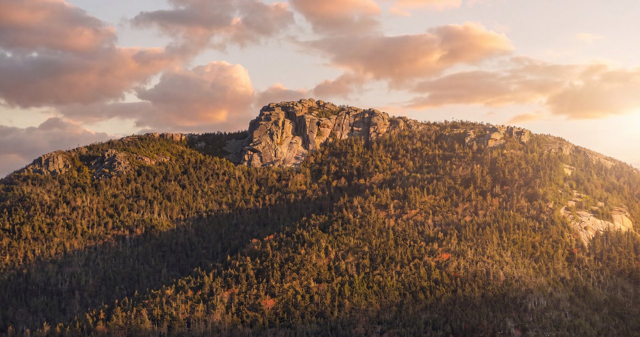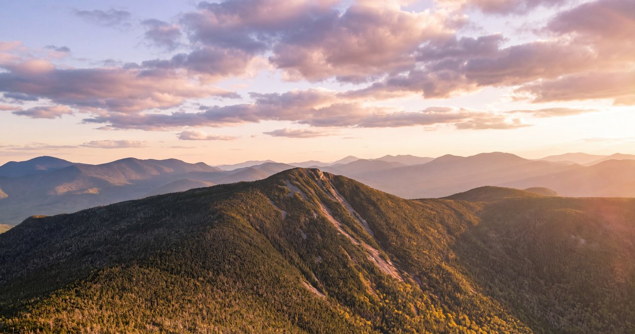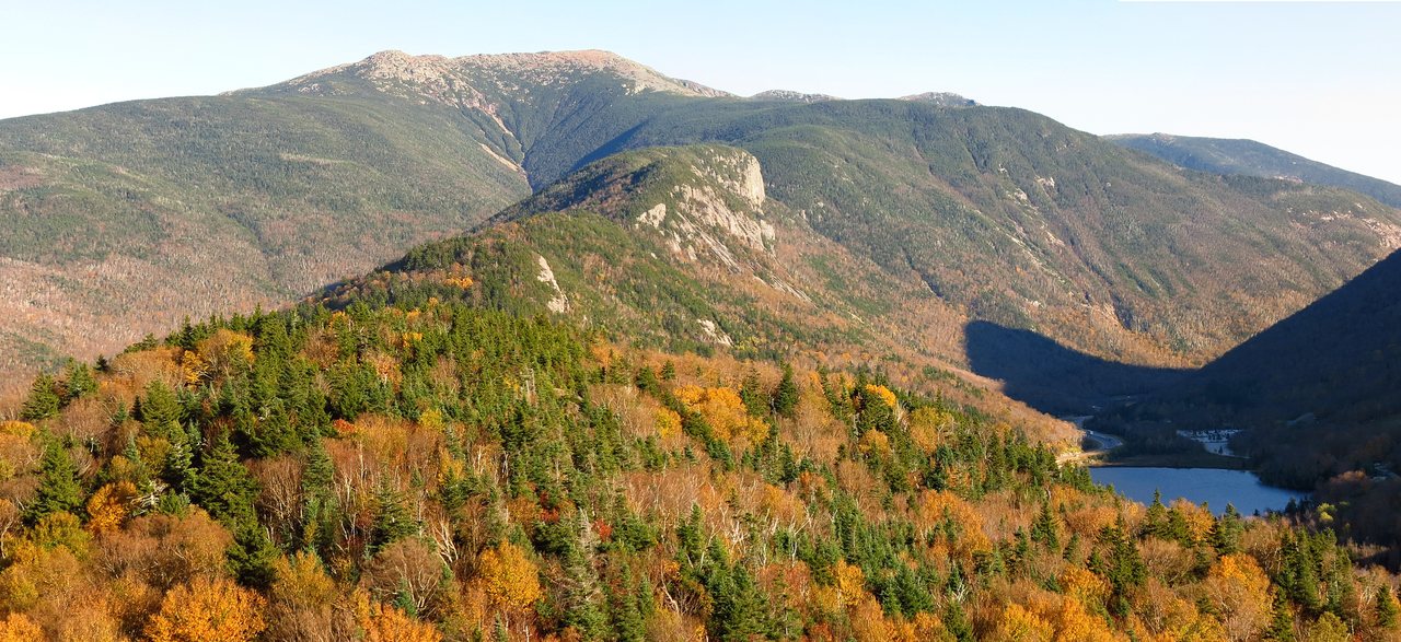
Little Haystack Mountain is the summit at the south end of the open crest of Franconia Ridge, 4,760 feet up on the east wall of the notch, and the Falling Waters Trail goes straight to it from the Lafayette Place parking lot: 3.2 miles, about 3,000 feet of climbing, three named waterfalls in the first mile and a half, then a long steep pull through the spruce to a rocky knob above the trees. Almost everyone who walks that trail is on the way to something bigger - the 8.9-mile Franconia Ridge Loop over Lincoln and Lafayette, which we cover in its own guide. This page is for the hike most people never consider on purpose: up Falling Waters to Little Haystack, and back down the same way. Call it 6.4 miles round trip. It is the shortest walk to the open alpine crest of Franconia Ridge.
It is a better hike than its reputation as the loop's warm-up act. It has the best waterfalls of any summit trail in the notch, including 80-foot Cloudland Falls. It has a top that is alpine, with the whole ridge laid out to the north and the notch dropping away under your boots. And it fits days the full loop does not: a morning with afternoon storms in the forecast, legs with one climb in them, a foliage Saturday when you want to be back at the car before the crowd piles onto the crest. What it does not have is a place on the official list of New Hampshire's forty-eight 4,000-footers - it fails the club's col rule despite standing 760 feet over the line - and we will get to why.
It also has teeth, and they are not where the calendar photos put them. The above-treeline exposure on this hike is short. The five unbridged crossings of Dry Brook and the wet ledges beside the falls ask for more care, and New Hampshire Fish and Game noted in 2025 that a 200-foot stretch of this trail sees more injuries than any other piece of trail in the state. Most of those injuries happen on the way down. So this guide spends its time where the trouble is: the crossings after rain, the ledges in the afternoon, the decision at treeline, and the winter version of all three. The trailhead is 16 min from our porch. Read the whole thing before you go.
The front porch of Franconia Ridge
Look at the map and Little Haystack's job is obvious. The Franconia Range runs north to south along the east side of the notch: Lafayette at 5,249 feet, Lincoln at 5,089, then Little Haystack at 4,760, and south of that the ridge drops back into the trees before rising again to Liberty and Flume. The 1.7 miles from Little Haystack north to Lafayette is the famous open crest, the biggest piece of alpine ground in the state outside the Presidential Range, and Little Haystack is where it begins. Stand on top and the treeless ridge runs north; turn around and the trail south dives back into scrub within a few hundred yards. The Falling Waters Trail meets the ridge trail right at the summit, and the ridge trail here is also the Appalachian Trail, so in August you will share the top with people who started walking in Georgia.
The trail is one of four that make up the Franconia Ridge Loop system - Falling Waters, the Franconia Ridge Trail, the Greenleaf Trail, and the Old Bridle Path - which together carry up to 1,000 hikers a day in peak season and have been under a five-year, multi-agency restoration since 2022, led by the White Mountain National Forest and the Appalachian Mountain Club with New Hampshire State Parks and conservation-corps crews, and funded in large part by a federal appropriation that carries the work through 2026. Crews have been setting stone steps and relocating eroded sections on both the Old Bridle Path and Falling Waters. The trails stay open while the work goes on, crews are usually out Monday through Thursday, and all they ask is that you take care through work zones and follow the crew's directions.
Why climb Falling Waters as an out-and-back instead of folding it into the loop? Because it buys you a summit above the trees for a little more than half the loop's mileage, and it keeps you all day within reach of a cheap exit - the trail you came up is always under your feet, with no 1.7-mile crest between you and shelter. The price is that you descend the steepest, wettest trail in the neighborhood and cross Dry Brook a second time, when the water may be higher and your legs are certainly more tired. On the right day it is a bargain. On the wrong one, the loop's crossing-free descent of the Old Bridle Path is worth every extra mile, and we will tell you how to spot which day you have.
The numbers
Distance: 3.2 miles from the trailhead kiosk to the summit by the AMC's measurement, which includes the first 0.2 mile shared with the Old Bridle Path - so 6.4 miles round trip. GPS apps read this hike anywhere from about 5.9 to 6.6 miles. Plan on 6.4 and treat any shorter number on your wrist as a pleasant surprise.
Elevation gain: about 3,000 feet. Lafayette Place sits near 1,780 feet, the summit is 4,760, and guidebook figures for the climb run from 2,900 to 3,000; phones read a bit more. The topographic map shows a 4,760-foot contour with no spot height, so most maps print 4,760-plus, and some guidebooks round it to 4,780.
Time: the old AMC book formula - half an hour per mile plus half an hour per 1,000 feet - gives just over three hours to the top and about an hour and a half down, but nobody hikes book time here. The falls stop you going up, the ledges slow you coming down, and the summit is hard to leave. Most parties run 5 to 7 hours car to car with a real lunch on top; fit hikers moving steadily do it in 4. Anybody starting after noon in the shoulder seasons should be carrying a headlamp and expecting to use it.
Difficulty: hard, but not for the reasons people assume. There is no scrambling that needs your hands beyond a few ledgy steps beside the falls, no ladders, no exposure to a fall on the summit. The hardness is an average grade near 18 percent that pitches steeper in the middle, crossings that change character with the water, and wet rock - the mist off the falls keeps the ledges damp on dry days. Footwear matters more here than on any other summit trail in the notch.

Parking at Lafayette Place: the part that decides your morning
The Falling Waters Trail leaves from Lafayette Place on the Franconia Notch Parkway - the two-lane stretch of I-93 through the notch - between Exits 34A and 34B. There are two lots. The trailhead lot proper is on the northbound side, the side you arrive on from the lodge: a signed pull-off directly from the parkway, no exit number, with restrooms and a kiosk where a paved path leads up to the split for the Old Bridle Path and Falling Waters. The second lot is across the highway at Lafayette Place Campground, reachable only from the southbound lanes and connected to the trailhead by a paved path through an underpass. Both are free in 2026 - this is Franconia Notch State Park land, so you won't need the Forest Service's $5 parking pass. Neither lot is large, and this is one of the busiest trailheads in New England.
On clear summer and foliage weekends, both lots are routinely full before sunrise. This is where staying in Lincoln pays: leave our driveway at 5:15 and you are parked at 5:35 while the Boston traffic is still an hour south. Midweek outside foliage season is calmer and you can usually roll in at 8. When the lots do fill, do not improvise. The parkway shoulder is ticketed and towed at all hours, and an interstate shoulder in the half-dark is no place for a walk, so if both lots are full, save this one for another morning.
The sanctioned overflow is the big lot at Cannon Mountain's tramway base at Exit 34B, one exit north, where a hiker shuttle runs Saturdays, Sundays, and holidays from May 23 through October 18, 2026, 8 a.m. to 7 p.m., $5 per person round trip, cash or card, dogs free. It drops at the campground lot southbound and picks up at the Falling Waters and Old Bridle Path trailhead northbound; keep your ticket for the ride back. One clarification so nobody plans around a ghost: the Cannon aerial tramway itself closed on October 26, 2025, for a multi-year replacement and is not running in 2026 - the lot and the shuttle are open, the lift is not. On a July or foliage weekend the options are exactly three: be parked by 6, ride the shuttle, or come back on a Tuesday.
Mile by mile: the bridge, Dry Brook, and the three waterfalls
From the kiosk, the paved path climbs past the restrooms and the two trails leave together on easy grades. At 0.2 mile they split - Old Bridle Path left, Falling Waters right - and Falling Waters immediately crosses Walker Brook on a footbridge - the only bridge of the day. The trail climbs gently for about half a mile through hardwoods, swings left, and drops slightly to Dry Brook, the stream that gives the trail its name and its problems. Around 0.7 mile it crosses Dry Brook for the first time, on rocks, no bridge, and turns sharply uphill along the brook to Stairs Falls, just upstream of the crossing - a short, wide plunge of 15 to 20 feet down a set of granite steps, the least dramatic of the three.
A few hundred feet higher the trail reaches the foot of Swiftwater Falls, 60 feet of cascades and small plunges down a slanted rock face, and recrosses the brook right there. Swiftwater is the one people walk past: thin in an August dry spell, it only really performs after rain or in spring snowmelt - which is exactly when the crossings are at their worst, so the days it looks best are the days to think hardest about the water. Above Swiftwater the trail climbs steeply beside the brook on wet, ledgy rock - hold that thought, it gets its own section - and at about 1.3 to 1.4 miles arrives at Cloudland Falls, the main event: 80 feet of water fanning from a couple of feet wide at the lip to 25 or so at the base, in a rock amphitheater that stays misty all summer. We wrote a separate Cloudland Falls guide for the walk to it and back.
Just above Cloudland the trail crosses the brook twice in quick succession, and the fifth and final crossing comes at about 1.5 miles. That is the end of the water. From here to the summit and back there is nothing to drink, and Dry Brook itself should be treated - this is a heavily used trail. Fill up here if you are low, and note the time and the water level as you cross, because the same brook is your only obstacle on the way home, and it will not necessarily be the same brook. In normal summer flow the crossings are rock-hops, some barely worth the name; do not let that lull you. Every one sits above, between, or below a waterfall, the rocks are rounded and slick, and the trail on the far bank is not always obvious - find the blaze before you commit to a line across, not after.
One 2026 note on this stretch. In October 2024 the Forest Service approved a relocation of roughly a mile of the Falling Waters Trail - about 5,100 feet of new tread built by AMC crews on a more sustainable line, plus a new spur of about 1,900 feet to Cloudland Falls - to get the trail off the eroded ground where it crosses and recrosses Dry Brook around the falls. The work is still underway in 2026 and the new section has not opened yet, so the trail still follows the route described here. When it does open, expect signs, fresh blazes, and possibly fewer crossings on the main line, with Cloudland Falls reached by the spur. Follow the signs on the ground over anything printed here, and never take a closed or unfinished section as a shortcut.
The ledges beside the falls: where people get hurt
On June 25, 2025, a 65-year-old hiker descending the Falling Waters Trail slipped and slid over a steep ledge, suffering lacerations and other upper-body injuries. A passing hiker stayed with him until New Hampshire Fish and Game and Pemigewasset Valley Search and Emergencies volunteers arrived, and he walked out with their support - one of two calls in the notch that afternoon, which brought out 23 Pemi Valley SAR volunteers between them. The department's write-up contained a sentence that ought to be posted at the kiosk: "This 200-foot section of trail accounts for more injuries than any other section of trail in the State of New Hampshire." The release did not name a landmark, but the ledgy pitch beside the falls - where the trail climbs wet rock steps within arm's reach of moving water - is the obvious candidate.
One year to the day later, on June 25, 2026, a solo hiker who had done the loop up the Old Bridle Path and was coming down Falling Waters slipped on wet rocks near Cloudland Falls at about 4:20 in the afternoon and ended up in the water with upper-body injuries. A passing hiker heard it happen and pulled him out. Fish and Game and Pemi Valley SAR reached him around 5:40, had him in a litter by 6, and took nearly an hour to carry him the last mile to the trailhead and an ambulance. Both came down to the same four things: late in the day, tired legs, wet rock, and the descent. That is the pattern.
So here is what to do about it. Accept that the descent of the falls section is the crux of this hike and budget for it - a mile that takes as long going down as it did going up. Go slowly on any rock that slopes toward the brook; the mist keeps it wet all summer regardless of the weather. Face into the steepest steps and use your hands, poles stowed for those few moves and out again after to spare your knees on the rest of the descent. Wear boots or trail shoes with real lugs; sneakers and worn-smooth soles are overrepresented in the carry-outs. And stay on the built trail. The shortcuts through the ledges next to the falls are exactly the wet, sloping rock the trail crew is trying to keep you off. Remember, too, that Falling Waters is the evacuation route for much of the southern ridge - a hiker who hurt a leg between Lincoln and Lafayette in March 2025 started down this trail on foot and had to be brought the rest of the way out by Pemi Valley SAR volunteers - so move like a person who intends to walk out under their own power.
Above the falls: the long grind and Shining Rock
After the last crossing at about 1.5 miles the trail leaves the brook, and the character of the hike changes completely. What follows is roughly a mile and a half of steep, rocky, sustained climbing - switchbacks up the west face of the ridge, hardwoods giving way to birch and then to spruce and fir, no views to speak of, and no water. This is where the 3,000 feet happens; the falls section is scenery, the middle is work. Set a pace you can hold, eat before you feel you need to, and expect a solid hour or more before anything opens up. In 2026 you may find fresh stone staircase and rerouted sections in here from the restoration crews; follow the new blazes.
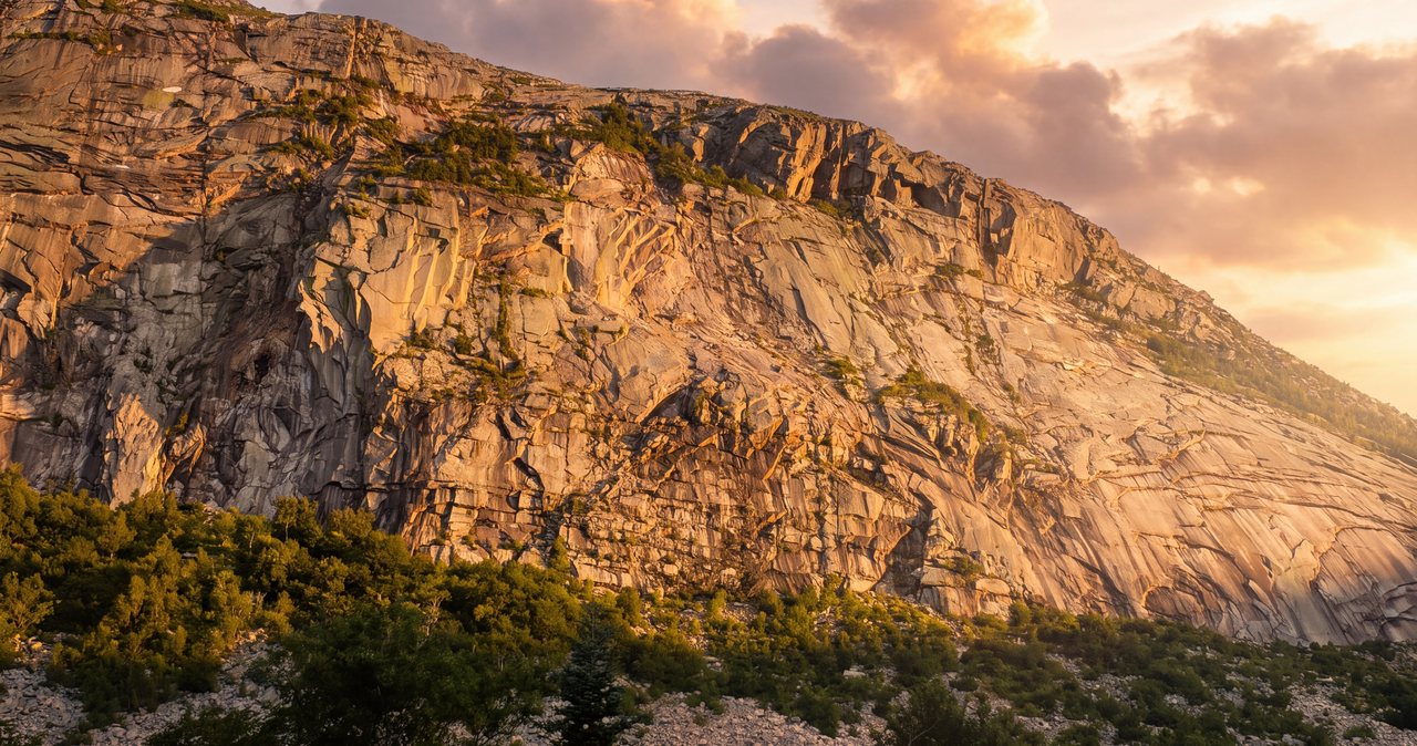
At about 2.8 miles, roughly half a mile below the summit, a signed side path drops about a tenth of a mile to Shining Rock - the enormous slab of open granite you can see glinting from the parkway on any sunny day, commonly described as about 200 feet high and 800 feet wide. It shines because water runs over it. Go down and look: Cannon's cliff dead ahead across the notch, the Kinsmans behind it, the parkway a thread below. Then come back up. Do not climb the slab. It is steep, it is wet even in dry weather, and guidebooks have warned against climbing it for decades because people got hurt trying. The view improves a few hundred vertical feet higher anyway, on rock you can stand on.
Back on the trail, the last 0.4 mile is the steepest sustained pitch of the day and also the best, because you can feel it ending. The spruce shrinks to chest height, then knee height, the rock steps get bigger, and the wind - which you have not felt since the parking lot - starts finding gaps in the trees. Put your shell on here, in the last of the shelter, not on top. Then the scrub gives out all at once and you step onto the summit knob of Little Haystack, at the junction sign for the Franconia Ridge Trail, with the whole crest in front of you. Green tunnel to open sky in about the time it takes to read this paragraph.
The summit: what 4,760 feet buys you
Little Haystack's top is a modest knob of broken rock and low alpine scrub, and it is a real summit in every way that matters to a person standing on it. West, the notch falls away at your feet with the parkway in the bottom, Cannon's cliff face across the gap and the Kinsman ridge behind. North, the open crest runs 0.7 mile to Lincoln and another mile to Lafayette. East, the Pemigewasset Wilderness - thousands of roadless acres, the Bonds walling its far side and, on a clear day, Mount Washington over their shoulders. South, the ridge dips back into scrub and rises to Liberty and Flume. You have paid 3.2 miles for the view rather than nine.
Two habits on top. Stay on the rock and inside the low scree walls - the green plants up here are alpine vegetation that handles the toughest weather in the East but not a season of boots, and the walls show you exactly where the trail runs. And respect that this is the first place all day with no wind shadow: on a breezy day the summit is for photos and lunch happens fifty feet back down in the trees, on a still clear day it is the best picnic spot in the notch, and either way you sort your layers before you step out of the trees, not after your hands are cold.
And now the decision the whole hike is built around, because it presents itself the moment you arrive: Lincoln is right there, and on a calm clear day it is what it looks like - 0.7 mile of open path, roughly 400 feet of climbing out of the shallow col, a fine extension that our Mount Lincoln guide covers. But going north puts you on a crest with no shelter, no water, and only two ways down; it turns a hike with a cheap exit into one without. On October 19, 2025, Fish and Game got a call at 6:03 p.m. for a 23-year-old near this summit, still above treeline as a storm moved in and temperatures dropped, with no water, no food, and no headlamp. A conservation officer reached him just below the summit at 8:14 p.m., shared food, water, and a light, and walked him down to the lot by 9:50; he was unhurt, and the department said he would be charged for the cost of the rescue. Do the arithmetic before you step onto the crest - time, daylight, water, weather, and whether you have a light. If any of it argues, Little Haystack was the summit today. It is a good one.
If you do go north, look back at the Falling Waters junction from the ridge side first and mark it in your head or your phone. It is signed, but coming back south in cloud it is the exit you must not miss - the ridge trail keeps going south toward Liberty, and in fog it is easy to walk straight past a junction sign you are not looking for.
Why it is not on the 4,000-footer list
Here is the fine print that surprises people at the top every week. The Appalachian Mountain Club's Four Thousand Footer Club, which drew up New Hampshire's list in 1957 (46 peaks then, 48 today), does not count a summit by height alone. To be a separate peak, a summit has to rise at least 200 feet above the low point of the ridge connecting it to a higher neighbor - the col rule. Little Haystack is 4,760 feet, comfortably over the line, with its own name and its own trail, and it fails that test: the ridge between it and Lincoln dips less than 80 feet. So it is not on the list, and never has been. For peak-bagging purposes it counts for nothing but the view.
The comparison next door is what makes it feel arbitrary: Mount Lincoln sits close to the same line on its own col with Lafayette, and Lincoln is on the list and has been from the beginning. Lists run on rules and measurements, not fairness. If you are working the forty-eight, the upshot is cheerful enough: Little Haystack alone gets you nothing official, Little Haystack plus the 0.7-mile walk to Lincoln gets you one, and the full loop gets you two. Choose your day accordingly, and do not let a list talk you onto the crest in weather that says no.
For everyone not carrying a checklist, the status is a gift: because it is not on the list, Little Haystack is nobody's goal - people arrive, take a photo, and hurry north. Sit at the edge of the scrub on a weekday morning and you will have a piece of Franconia Ridge nearly to yourself while the crest a mile north carries a parade.
The crossings after rain, and the trap of a dry morning
Dry Brook is a joke of a name for about half the year. It drains a steep, rocky slice of the west face, so it responds fast: a night of hard rain, a summer thunderstorm, or a warm June day working on the last of the high snow can raise it from a rock-hop to a knee-deep push in hours. And the five crossings sit above, between, and below waterfalls - a slip in fast, cold water above Cloudland Falls is one of the lethal scenarios in the Whites, less famous than ridge weather and just as final.
The trap on an out-and-back is specific: you cross in the morning at the day's low water, climb three thousand feet, sit on a summit while a storm builds or the sun works on the snowfields, and come down to a brook that is not the one you crossed. Read the water going up. If the stepping stones are already awash and the brook is loud, the afternoon will be worse, and this is the day to turn the hike into a waterfall walk that stops at the first crossing, with Stairs Falls in view just upstream - or to walk the 10 min back to the kiosk and climb the Old Bridle Path to Greenleaf Hut and Lafayette instead, which has no crossings at all. Our Mount Lafayette guide covers it, and on a wet week it is simply the better summit.
If you are on the way down and the brook has come up on you, the rules are these. Water pushing white over the tops of the stepping stones means do not cross there. Do not go around by way of the ledges beside the falls; that trades a bad crossing for the most injury-prone rock in the state. Look for a wider, shallower spot where you can see the bottom. If you must wade: unbuckle the hip belt and sternum strap so you can shed the pack, face upstream, use poles for a third point of contact, move one foot at a time, and keep it short. Thunderstorm floods on a stream this small usually drop as fast as they rose; an hour on a rock above the high-water line beats a bad wade every time. In settled weather there is one more option - north over Lincoln to Lafayette and down the crossing-free Old Bridle Path, about two and a half miles longer than retracing your steps, with roughly 900 more feet of climbing and 1.7 miles of open crest - and it is only an answer if the sky is one.
Weather at treeline: reading the higher-summits forecast for a short exposure
The forecast for the town of Lincoln is a forecast for a valley three thousand feet below the summit, and above the falls it is close to useless. The one that matters is the Mount Washington Observatory's Higher Summits Forecast at mountwashington.org, published twice a day. It covers the high summits of the Whites, Franconia Ridge included, with summit temperature, sustained wind and gusts, and whether the summits will be in the clear. Read it the night before to choose the hike, and again in the morning to keep it or fold. Figure the summit runs 15 to 25 degrees colder than town before you add wind, and let the wind number govern.
What makes Little Haystack different from Lincoln or Lafayette is that the exposure on the direct hike is short - the last couple hundred yards and the summit knob. On a day with wind in the 40s and summits in the clouds, the loop is a bad idea and the crest is off the table, but Falling Waters to treeline is still a fine, safe day, with a turnaround from the scrub that costs nothing. What the short exposure does not do is make the summit itself safe. Sustained 40 with higher gusts staggers adults on the open knob and makes the last rocky steps a place to fall; sustained 50-plus is not a summit day here regardless of sunshine at the trailhead; and summits-in-the-clouds means the top gives you a wet wind chill and nothing else.
Thunderstorms deserve their own rule. On the summit knob you are the highest object around, but shelter is 5 min down the trail. On days with afternoon convection forecast, be off the top by early afternoon and treat the first distant rumble as the end of your summit stop, immediately. Then remember what a downpour does to the bottom of this trail: the ledges beside the falls run with water and the crossings rise. A storm that chases you off the summit at 1 p.m. is one you would rather not meet at Cloudland Falls at 2:30 - move promptly, or wait out the worst of it in the trees above Shining Rock rather than hurry down wet ledges in the middle of it.
The other thing to plan for up here is quieter: summer hypothermia. Wind, fog, and wet clothing on an exposed knob at 4,700 feet can take a healthy adult down in a July afternoon. In November 2022 a 19-year-old set out from this trailhead planning a solo traverse of Lafayette, Little Haystack, and Flume, in sneakers and light pants, into 30-to-40-mile-an-hour winds and a wind chill around 30 below. She did not survive the exposure, and was found three days later on the northwest side of Lafayette, near the headwaters of Lafayette Brook. The calendar said November, the trailhead looked like November, and the ridge was in winter. Carry a wind and rain shell, a warm non-cotton layer, a hat, and gloves on every attempt at this summit, all season - especially for the short exposure, since it is the one people talk themselves out of preparing for.
Winter and the shoulder seasons
Falling Waters in winter is a popular, beautiful climb and a completely different proposition from the summer trail. The falls freeze into blue ice, the ledges beside them become ice bulges under a skin of snow, and the crossings turn into snow bridges over moving water that may or may not hold you - test each with a pole, and remember that a bridge that held ten people at 8 a.m. can be sun-rotted by 2. Microspikes handle the packed trail on many days, but the icy steeps beside the falls - the same pitch Fish and Game called the most injury-prone in the state - and the wind-packed rock of the summit knob are crampon terrain when they are hard. Carry both, plus snowshoes when the upper trail is unbroken or drifted. There is no shelter of any kind on this route in any season, and the summit in a January northwest wind is Presidential-grade.
Two winter-specific traps. First, the trail is popular enough that you will usually find a packed trench to follow, and the trench is a liar above the falls: it ends wherever the last party turned around, and above treeline the wind erases it in minutes. Navigate with the map, the blazes, and the cairns, not the footprints. Second, the days are short and the walking is slow. A party that tops out at 2 p.m. in December is descending the falls ledges by headlamp by arithmetic, not bad luck. Set a turnaround time before you leave the car and hold to it.
The shoulder seasons fool more people than winter does, because the trailhead lies about the summit. In May and early June the lot is green and buggy, the falls are roaring, and the upper trail is still a trough of rotten snow you posthole through to the knees while the brook runs at full melt - the season of pushy crossings and slow miles. In October, a brown, mild parking lot regularly sits under a summit glazed with rime from a cold front nobody in the valley noticed. From roughly Columbus Day to Memorial Day, carry traction at minimum and read the higher-summits forecast as a winter forecast. The calendar is a valley document. At 4,760 feet it has no authority.
Turnaround plans, the hikeSafe card, and New Hampshire's rescue law
Say your rules out loud in the parking lot, where they cost nothing. A time rule, worked backward from dark and generous, because the descent of the falls section takes as long as the climb. A crossing rule: white water over the stepping stones going up means the hike becomes a waterfall walk today, no negotiation at the brook. A ledge rule: on the descent, nobody hurries, nobody shortcuts, and poles come out. A treeline rule: you step onto the summit knob only if the wind and visibility are what the morning forecast promised, and you go north onto the crest only with the time, water, weather, and light to come back through the Falling Waters junction with margin. And a group rule: anyone can call the turn, nobody argues, and the party stays together.
Two New Hampshire specifics belong in the same pocket. First, New Hampshire can bill a hiker judged negligent for a rescue under RSA 206:26-bb, and it does - the hiker walked off Little Haystack in October 2025 without water, food, or a headlamp was told he would be charged for the cost. The voluntary hikeSafe card - $25 for an individual or $35 for a family for 2026, from New Hampshire Fish and Game at wildnh.com/safe - waives that cost short of recklessness, and the money goes straight to the search and rescue work itself. Second, Fish and Game's own list of what to carry is a packing list, not a slogan: warm clothing, extra food and water, headlamp, fire starter, first aid kit, whistle, rain and wind jacket and pants, knife, map and compass. Pack every item on it, even on a clear summer morning.
Leave your route and your worry-time with a person, not a windshield note; cell service in the notch is not something to plan around. We ask our hiking guests to do exactly this, and we mean it: someone at home who knows you went up Falling Waters for Little Haystack and expected to be out by 4 is worth more than most of what is in your pack. Turning around costs a view. The mountain is 16 min from our porch, and it does not expire.
Making a day of it: variations that make sense
The falls-only walk. If the forecast is grim up high, if it rained all night, or if you simply want a short morning, walk to the first crossing of Dry Brook and back - about a mile and a half round trip, one footbridge and no unbridged crossings if you stop on the near bank, with Stairs Falls just upstream of the crossing - or continue to Cloudland Falls, about 2.8 miles round trip with two rock-hop crossings and the ledgy stretch in between. The falls are at their best in exactly the water that makes the summit a poor idea. See our Cloudland Falls guide.
Little Haystack plus Lincoln. On a calm, clear day with a good forecast, the 0.7-mile crest walk north to Lincoln is one of the finest short stretches of trail in New England, and it turns the day into about 7.8 miles round trip with roughly 3,500 feet of gain - and, if you are counting, an official 4,000-footer. Our Mount Lincoln guide covers it; the short version is that you leave the cheap-exit zone the moment you leave Haystack, and you still come back down Falling Waters, crossings and all. The full 8.9-mile Franconia Ridge Loop, up Falling Waters and down the Old Bridle Path past Greenleaf Hut, is the classic and has its own guide too - and it is the only one of the three that never descends the falls section, a fair argument for the loop on any day the crest is friendly.
Sunrise. People climb Falling Waters in the dark for sunrise on Little Haystack, but you are signing up for the wet ledges beside the falls by headlamp on cold legs - a good plan for people who already know the trail's line and have real traction underfoot, a poor first date with this mountain. Sunset asks more, because it brings you down those ledges tired and in the dark, the same pairing the rescue reports describe.
Dogs. Leashed dogs are allowed on the Falling Waters Trail and the ridge and ride the hiker shuttle free, but the rock-hop crossings and the ledges beside the falls are hard on paws and harder on a dog pulling on a leash on wet rock, and the summit has no water and no shade. Plenty of dogs do this hike happily; a fair number get carried down. And a lodging note so nobody is surprised at check-in: our lodge is pet-free, so hikers traveling with a dog will need other arrangements for the night.
Safety & conditions
- The five unbridged crossings of Dry Brook (roughly miles 0.7 to 1.5) sit above, between, and below waterfalls and rise fast in rain and snowmelt. If water is running white over the stepping stones on the way up, do not cross - and assume it will be higher when you come back down. Never bypass a crossing by way of the ledges beside the falls, and never cross above a waterfall lip. On a wet week, choose the crossing-free Old Bridle Path to Lafayette instead.
- The wet ledges beside the falls are where people get hurt on this trail. New Hampshire Fish and Game noted after a June 2025 rescue that a 200-foot section here sees more injuries than any other stretch of trail in the state, and a June 2026 slip near Cloudland Falls also came on wet rock during the descent. Descend that mile slowly, face in on the steepest steps, use poles, wear real lugged footwear, and stay on the built trail.
- Check the Mount Washington Observatory Higher Summits Forecast (mountwashington.org, published twice daily) the night before and the morning of; it covers Franconia Ridge and the town forecast does not. Figure the summit runs 15 to 25 degrees colder than Lincoln before wind. The exposed stretch on this route is short, but the summit knob is fully open: sustained 40 mph with gusts makes it a place to fall, and 50-plus is not a summit day regardless of sunshine at the trailhead.
- Thunderstorms: on the summit you are the highest object around; shelter is 5 min down the trail. On days with afternoon storms forecast, be off the top by early afternoon and treat the first distant rumble as the end of your summit stop, immediately. Then remember the storm will also raise Dry Brook and wet the ledges you have to descend - move promptly, or wait it out in the trees above Shining Rock rather than hurry down onto wet rock in the middle of it.
- Do not continue north onto the crest toward Lincoln unless you have the time, water, weather, and a headlamp to come back through the Falling Waters junction with margin. Beyond Little Haystack there is no shelter, no water, and only two ways down. A hiker caught near this summit at dusk on October 19, 2025, with a storm moving in and no water, food, or light, was walked down by Fish and Game and told he would be charged for the rescue. Mark the Falling Waters junction before you leave it; in fog from the north it is easy to miss.
- Summer hypothermia is the one to plan for on this ridge: wind, fog, and wet clothing above treeline can wear down a healthy adult in a single July afternoon. Carry a wind and rain shell, a warm non-cotton layer, hat, and gloves on every attempt, all season, and put the shell on in the last of the trees rather than on the open knob with cold hands.
- Water: the last crossing at about 1.5 miles is the last water on the route, and there is none on the summit. Carry 2 to 3 liters per person from the car and treat anything from Dry Brook.
- Shining Rock: look at it from the spur, do not climb it. The slab is steep, runs with water even in dry weather, and has a long record of injuries. The view is better a few hundred feet higher on the trail.
- From mid-October to Memorial Day, treat this as a winter climb: the ledges beside the falls become ice, the crossings become snow bridges over moving water that must be tested, and the summit knob is wind-packed and exposed. Carry crampons as well as microspikes, snowshoes when the upper trail is unbroken, and a headlamp always; the trench you follow ends where the last party turned around, and there is no shelter of any kind on this route in any season.
- New Hampshire can bill negligent hikers for rescue costs under RSA 206:26-bb. The voluntary hikeSafe card from NH Fish and Game ($25 individual, $35 family for 2026) waives that cost short of recklessness and helps fund the search and rescue teams that work this trail. Leave your route and return time with a person who will notice you missing - cell coverage in the notch is too patchy to be the plan.
Where to stay for it
From 191 Pollard Road you are on Main Street inside a minute, onto I-93 North at Exit 32 a minute after that, and the interstate narrows into the two-lane Franconia Notch Parkway almost immediately. Past the Flume Gorge exit and the Basin pull-offs, the Lafayette Place trailhead parking appears on the right about 9 miles and 12 min from our door - a signed pull-off directly from the parkway, no exit number. If you reach Exit 34B and the big Cannon tramway lot, you have overshot it, though on a busy Saturday that lot is exactly where the hiker shuttle wants you anyway.
Provision in town, because there is nothing for sale at the trailhead and nothing above it. The Price Chopper plaza and the gas stations on Main Street are the last stop for sandwiches, extra water, and fuel - hit them the evening before if you are chasing a pre-dawn parking spot. Download your maps before you leave the driveway, since cell service in the notch is patchy, and leave your route and your out-time with someone at home.
Sources & official info: cannonmt.com · cannonmt.com · nhfishgame.com · nhfishgame.com · nhfishgame.com
— Launchpoint Lodge, From the lodge