Cloudland Falls is the payoff at the top of a good climb, and the first thing a guide should tell you is that it is a climb. This is not the Basin, and it is not Sabbaday Falls, where you park and stroll a few hundred yards on a gravel path. To reach Cloudland you walk roughly a mile and a third uphill on the Falling Waters Trail, gaining close to 900 feet, crossing a mountain brook several times on bare rock with no bridges. In exchange you get three waterfalls in a row — little Stairs Falls, the tall slide of Swiftwater Falls, and finally the 80-foot fan of Cloudland itself, spilling straight down the trail beside you. On a good day it is one of the best short-ish hikes in Franconia Notch.
We wrote this guide because most of what you will read online treats Cloudland as a casual family waterfall walk, and it is not. It shares its entire lower mile with the Franconia Ridge Loop, one of the most demanding and most rescued-upon day hikes in New England, and the same wet rock that makes the falls beautiful is what puts hikers in the back of a Fish and Game truck every summer. We would rather you turn back at a flooded crossing than trust a stranger's trip report. So this covers the real parking situation at Lafayette Place, the three falls in the order you meet them, the footing, high water, winter, and how this hike connects to the full ridge.
The short orientation: the trailhead is at Lafayette Place, about 12 min north of the lodge on I-93, right in the heart of Franconia Notch State Park. From the parking lot you follow the Falling Waters Trail up the mountainside, meet all three waterfalls in the first mile-plus, and Cloudland Falls is where most sensible people turn around and head back down. Everything above Cloudland is the serious ridge climb, and that is a different day and a different guide.
The short version: what you are signing up for
Here is the summary in one breath. From the Lafayette Place trailhead you climb the Falling Waters Trail for about a mile and a third to Cloudland Falls, gaining somewhere near 900 feet. Round trip to the falls and back is roughly 2.6 to 2.8 miles. Most reasonably fit people take somewhere between two and three and a half hours for the round trip, depending on how long you linger at the water and how careful the footing forces you to be. That is not a huge day by White Mountains standards, but the grade is steady and the last stretch up to Cloudland is steep, rocky, and often wet.
Difficulty is where the internet gets sloppy. AllTrails and a lot of blogs will file the falls under short, easy waterfall hikes because they are comparing it to the full 8-to-9-mile ridge loop. Compared to that, yes, going only to Cloudland is short. Compared to what most people picture when they hear the word waterfall walk, it is a real hike. Call it moderate to strenuous. You will use your hands on a couple of rock steps near the top. Trail runners fly up it; families with young kids grind up it slowly and turn some of them around before the top. Both are normal.
The good news is that Cloudland is a natural, obvious turnaround. The waterfalls are all packed into the first mile-plus, so you get essentially the entire scenic reward of this trail without committing to the ridge above. You do not need to summit anything to see all three falls. That makes it one of the better bang-for-effort hikes in the notch — as long as you respect the parts that hurt people, which we get to below.
Getting there and the Lafayette Place parking reality
The trailhead is at Lafayette Place, in the middle of Franconia Notch State Park, reached from the Franconia Notch Parkway — the stretch where I-93 narrows to a two-lane parkway through the notch. From the lodge it is about 12 min: north on I-93 out of Lincoln, into the notch, and off at the Lafayette Place parking area. The Falling Waters Trail and the Old Bridle Path both leave from here, which is exactly why this lot is one of the busiest trailheads in the state.
There are two lots. The main lot is on the northbound side by the Lafayette Place Campground; a smaller lot sits on the southbound side, and the two are joined by a pedestrian tunnel under the highway so you never have to cross the parkway on foot. It sounds like plenty of parking. It is not. On summer and fall weekends this lot fills by roughly 7 to 8 in the morning, sometimes earlier on a bluebird foliage Saturday, and once it is full there is no legal roadside parking on the parkway. People get turned around and sent all the way back out of the notch. On a Saturday in October, plan to be parked well before 10am, because a later arrival rarely finds a space.
The move is simple: arrive early. Aim to be pulling in before 7:30 on any weekend from July through mid-October, and a weekday is better in every way. Midweek in shoulder season you can often roll in mid-morning and still find a spot. There is also a seasonal hiker shuttle that serves the Franconia Notch trailheads on weekends and holidays through the warm season for a small per-person fee, which is worth knowing about if the lot is full — but do not count on it as your plan A.
Parking here is free: the Lafayette Place trailhead lots charge no day-use fee in 2026, because this is New Hampshire state-park land rather than a Forest Service fee site. You do not need the White Mountain National Forest pass or the America the Beautiful pass to park here. That is different from the Forest Service trailheads out on the Kancamagus, like Sabbaday Falls and Lincoln Woods, where you do need a roughly $5 daily pass or the roughly $80 annual America the Beautiful pass on your dash. Paid parking at these popular notch lots has been floated in the past, so glance at the signage when you arrive in case that ever changes.
The trail, step by step
From the trailhead, the Falling Waters Trail and the Old Bridle Path start out together for a very short distance before splitting. Stay right for Falling Waters. Almost immediately you cross Walker Brook on a footbridge — an easy, dry start that lulls people into thinking the whole thing will be like this. It will not.
The trail then climbs to meet Dry Brook, which despite its name is the whole show. From here up to Cloudland the trail essentially follows this brook up the mountainside, and you cross it several times on bare rock. In normal summer flow these are straightforward rock-hops, ankle to shin deep at most, the kind of thing you can usually do without soaking your boots if you pick your line and take your time. There are no bridges or boardwalks at these upper crossings. That is by design, and it is the single most important thing to understand about this trail: your safety here depends on the water level, not the calendar.
Above the first crossings the grade tips up in earnest and the footing turns to rock, roots, and stone steps. This is steady climbing, not scrambling, but it is relentless enough that you will feel it in your legs. You will start to hear water off to your right, and then you meet the falls one after another. The trail literally runs alongside and across the cascades near the top, which is what makes it so scenic — and, again, so slick. Cloudland is the last and largest, at roughly the mile-and-a-third mark, and the trail climbs right up beside it.
Above Cloudland the character changes completely. The trail leaves the water, steepens further, and grinds up through the forest toward Shining Rock and the open ridge at Little Haystack. Most people going to see the waterfalls turn around at Cloudland. If you keep going you are committing to the ridge, which is a bigger, more exposed, more serious undertaking — see the section below and our full Franconia Ridge Loop hike guide for that.
The three falls, in the order you meet them
The falls come in ascending order of size as you climb, which is a lovely bit of trail design by nature. First is Stairs Falls, the smallest at around 20 feet — a tidy staircase of ledges the brook steps down. It is easy to walk right past it if you are head-down and grinding, so look up. It is a pretty little warm-up and a good spot to check how much water is moving before you commit to the steeper crossings above.
Next is Swiftwater Falls, roughly 60 feet — a long, angled slide of water down a broad rock face. This is the one a lot of people underrate. It is tall and, in good flow, impressive, and the trail crosses the brook right around here, so it is also where footing and water level start to matter. Take a beat, look at the crossing, and be realistic about the flow.
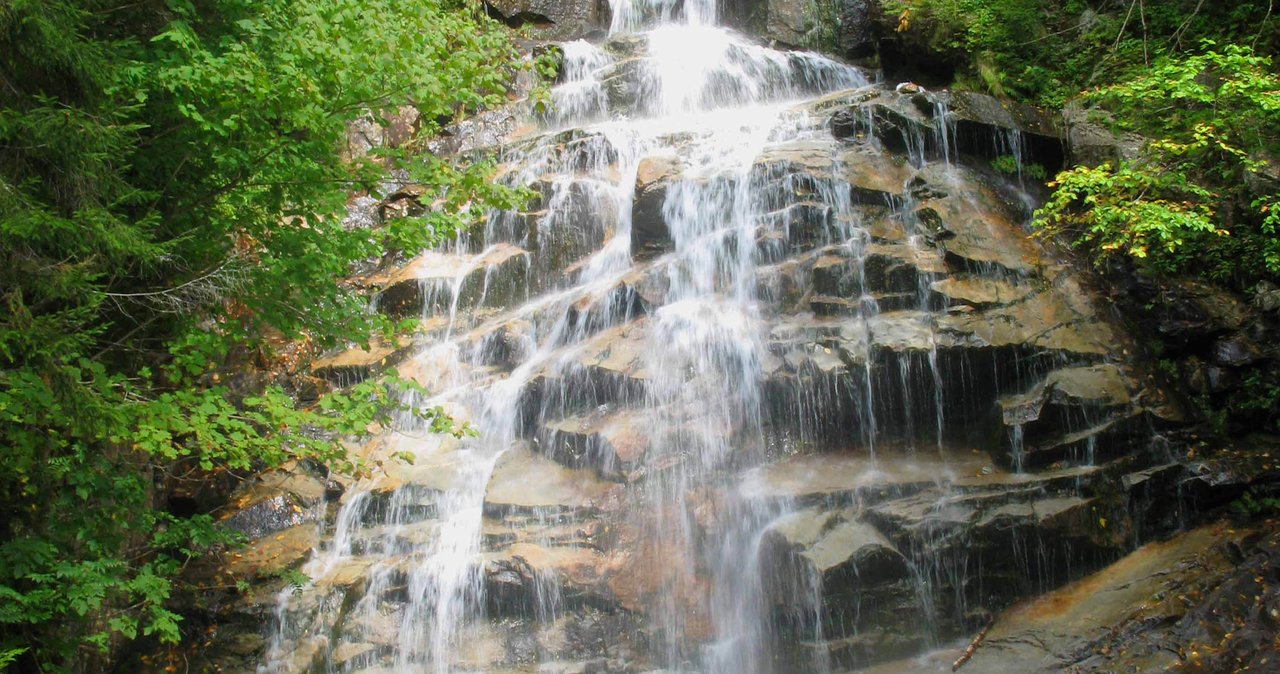
Finally, at about 1.3 miles, you reach Cloudland Falls, the headliner at roughly 80 feet. It is a fan-shaped horsetail that spreads as it drops, and the trail climbs steeply right beside it, so you get the full height of it up close rather than as a distant view. In high spring flow it roars; in a dry late-summer spell it can thin to a lacy trickle. In hard winter it can freeze into a curtain of ice that ice-climbers come to play on. There is a small pool and rock area at the base where people rest, eat a snack, and turn around. It is the emotional and practical top of the waterfall hike.
One note on the numbers: you will see the heights quoted a little differently across sources, and some lump the whole chain together as a single 80-foot-plus system. The figures here — roughly 20, 60, and 80 feet — are the commonly cited individual heights and are close enough for planning. What matters more than the exact footage is that all three are stacked into the same steep, wet mile, which makes for a spectacular climb and a good reason to take it slowly.
Why people get hurt here: the footing
The number-one hazard on this trail is not exposure or getting lost. It is slipping on wet rock. The same spray that makes Cloudland gorgeous keeps the ledges, slabs, and stone steps beside it permanently damp, and wet granite with a film of algae or grit is slick — the kind of slick that puts a foot out from under you before you register it. This is not a theoretical risk. In June of 2026 a 42-year-old hiker had to be carried off the Falling Waters Trail near Cloudland Falls after he slipped and fell on the wet, slippery rock while descending from the ridge. That is a completely typical incident here, not a freak one.
That story points at the second footing truth: descending is worse than climbing. Going up, you can see your holds and your weight is going into the hill. Coming down the same wet steps, gravity is working against you and it is far easier to skate out. If you do the waterfall hike, save some care and some caution for the way back down, when your legs are tired and you are mentally already back at the car. Most falls happen on the descent.
Footwear matters more here than on a flat trail. Real hiking shoes or boots with lugged soles, not sneakers and definitely not sandals. Trekking poles help a lot, both on the climb and especially for balance at the crossings and on the wet descent. Take the rock steps beside the falls deliberately, test a foot before you commit your weight, and keep three points of contact on the steeper bits. Slow is fine. Slow is the whole strategy.
Keep well back from the lips and edges of the falls when you stop for photos. The rock right at the water's edge is the slickest rock on the mountain, the drop-offs are unfenced, and every year somebody edges out for a better angle and regrets it. The good photo is from the trail, not from the wet edge above an 80-foot drop.
High water is the real killer
If the wet rock is the everyday hazard, high water is the serious one. Dry Brook is a mountain stream with a big drainage above it, and it responds fast. After heavy rain, during a thaw, or in the spring snowmelt, those tidy summer rock-hops turn into fast, cold, thigh-deep crossings with slick submerged rock and real force behind the water. Moving water only needs to be knee-deep to knock an adult off their feet, so when the brook is running high, save the crossings for a calmer day.
The rule is simple and it is not negotiable: if you cannot cross with dry or near-dry feet by rock-hopping, the crossing is too high, and that is your signal to turn around. Do not wade a flooded brook to save a hike. Do not cross above a waterfall lip, ever — a slip there does not end in a wet boot. If the brook is clearly up and roaring and you are hesitating at the first crossing, you already have your answer. The falls will be there next week.
Timing feeds directly into this. The falls are at their most powerful and beautiful in spring snowmelt, roughly late April into May — which is also when the crossings run highest and the trail is often a mix of ice, mud, and soft snow. There is a real tension between the best-looking water and the safest crossings. Our practical steer for most guests is to come in summer or early fall, when the water is lower and the footing is manageable, and accept a slightly gentler flow in exchange for a safer, more enjoyable hike.
Watch the sky and the forecast, too. A thunderstorm upstream can raise the brook while you are up at the falls in sunshine. If serious rain is forecast, pick a different day, or at minimum keep an eye on the water and be ready to head down before it comes up behind you. Turning around is not failure. In these mountains, good turnaround judgment is the whole skill.
How Cloudland fits into the Franconia Ridge Loop
The Falling Waters Trail is not just a waterfall trail — it is the standard ascent route for the Franconia Ridge Loop, one of the most famous and most demanding day hikes in the Northeast. The classic loop goes up Falling Waters (right past all three of these falls) to Little Haystack, north along the open, above-treeline crest over Mount Lincoln to Mount Lafayette, then back down the Old Bridle Path past Greenleaf Hut to the same Lafayette Place lot. It is roughly 8 to 9 miles with about 3,900 feet of climbing, and a big chunk of it is on an exposed ridge with nowhere to hide from weather. It is a spectacular hike and a serious one.
So when you are standing at Cloudland Falls, you are standing at the point where the casual waterfall hike and the epic ridge hike part ways. Everyone descending Falling Waters late in the day — often tired, often on tired legs on that wet rock — is coming off the full loop. That is why you will see a steady stream of hikers passing you, and why loop hikers do well to save some energy and care for this wet descent at the end of their day.
If the loop is what you are after, our Franconia Ridge Loop hike guide (/hikes/franconia-ridge-loop) is the better plan — it covers the full route, the weather above treeline, the turnaround times, and the gear you need. The ridge is a different animal: real exposure, fast-changing weather even in summer, and no shelter for miles. Plenty of strong hikers get above treeline and get caught out.
But you do not have to do the loop to have a great morning here, and you should not feel like turning around at Cloudland is settling. The three falls are the highlight of the lower trail, they are the reason people call it Falling Waters in the first place, and stopping at Cloudland gives you the best of this trail without committing to the exposure above. Know which hike you came to do before you leave the car.
Swimming, wading, and the pools — the practical take
Let us be clear, because people ask: Cloudland Falls is not a swimming hole, and you should not treat it like one. The pool at the base of Cloudland is small, shaded, and cold, and there is real force and turbulence where 80 feet of water lands. The hydraulics under a fall like this are exactly the kind of thing that holds a person down, and nobody is coming quickly if something goes wrong up here. There is no swimming, jumping, or diving at Cloudland.
The little pools and shallows along Dry Brook are a different, gentler thing. On a hot day it is fine to sit on a rock and soak your feet, or splash in a shin-deep eddy well away from the falls, when the water is low and calm. Even then the water is cold — it is snowmelt and spring water off the high ridge — and cold-water shock is real, so ease in and do not plunge. This is a foot-cooling stop, not a swim.
If swimming is what you want on a warm day, this is the wrong destination and there are better, safer, legal options nearby. Wading and swimming are far more suited to the calm, shallow, sun-warmed spots elsewhere in the area than to a steep, cold cascade. We are happy to point you toward the ones that suit the conditions that day — and away from spots where swimming is prohibited and enforced, like Rocky Gorge on the Kancamagus, a place to admire from the footbridge.
The through-line here is the same as with the crossings: the water in these mountains is colder, faster, and less forgiving than it looks in a photo. Admire Cloudland, cool your feet in the shallows if it is calm and low, and save the actual swimming for a place built for it.
Winter and shoulder season
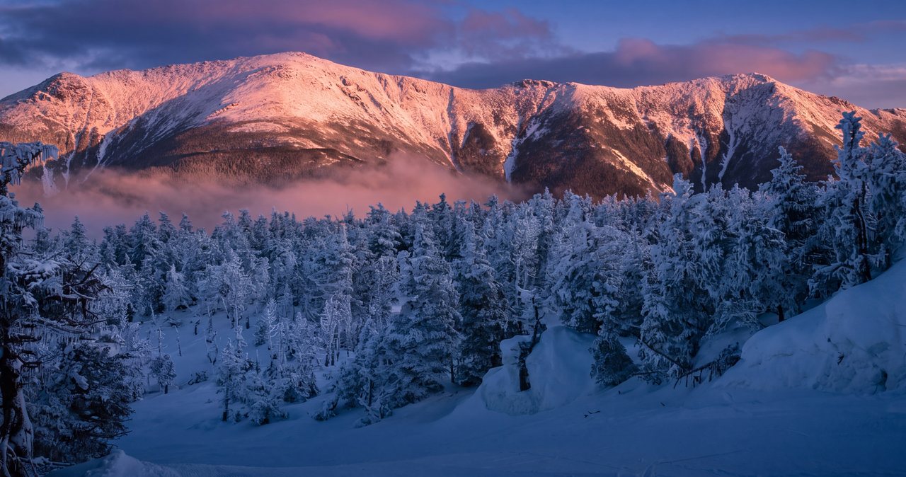
Cloudland in winter is beautiful — the falls partly freeze into ribbons and curtains of ice, the forest is quiet, and the crowds vanish. It is also a different and more serious hike, and it is not a good pick for a casual visitor without winter experience and gear. If you are not sure whether you are ready for it, you are not, and that is fine.
The core problem in winter and the icy shoulder seasons is exactly the same as in summer, only worse: the footing and the crossings. The trail ices over, especially in the steep sections beside the falls, and the descent in particular gets treacherous — coming down icy rock steps beside a frozen cascade is a good way to get seriously hurt. At a minimum you want microspikes and trekking poles, and squarely the ability to read conditions and turn around. The brook crossings hide a special hazard in winter: a thin skin of ice and snow can bridge over cold running water, so what looks like solid ground gives way. Poles let you test the ground ahead before you trust it.
Early spring is the trickiest window of all — the trail can hold ice, mud, and deep soft snow at the same time the brook runs its highest of the year. Late fall can ice up early after the first hard freezes. In these shoulder windows the safe, real move for most guests is to admire the falls in a warmer season and save winter for people equipped for it.
If you do go in the cold, treat it as a real winter hike: traction, poles, insulating layers, extra warmth in the pack, food and water that will not freeze, an early start, and a hard turnaround time given the short daylight. And tell someone your plan. The notch is stunning in winter and completely unforgiving of a twisted ankle two hours from the car in the cold.
Best time to go, crowds, and light
For the best all-around experience — good water, manageable footing, and a fair shot at parking — aim for summer through early fall, roughly late June into mid-October. That is when the crossings are usually easy rock-hops, the trail is dry-ish, and the falls still have respectable flow. Peak foliage, generally the first couple of weeks of October near Lincoln, is gorgeous here and also the single busiest window, so the early-arrival rule matters most then.
If you want the falls at maximum power, spring snowmelt (roughly late April into May) is when they roar. Just plan for what comes with it: the crossings run high, the footing is slick, and the trail is often still snowbound up high. Beautiful water and safe hiking do not peak at the same moment on this trail.
Crowds are heaviest on summer and fall weekends and holidays, driven mostly by the ridge-loop hikers sharing the lower trail. Beat them by going early or, better, going midweek. An early weekday in September is close to ideal: cooler air, thinner crowds, good color starting, and a real chance at a relaxed parking situation.
For light and photos, the falls sit in a steep, forested cleft, so the sweet spot is overcast days or the softer light of morning and later afternoon, when you avoid harsh midday sun and blown-out spray. An early start does double duty here: better parking, better light, and cooler climbing. There is a lot to like about being the first party at Cloudland with the falls to yourself.
What to bring and how to hike it smart
This is a short hike, not a wilderness expedition, but it is enough of a climb — and enough of a hands-on, wet-rock trail — that a little preparation pays off. Footwear first: hiking shoes or boots with real tread. Trekking poles are useful here for the crossings and the wet descent. Carry more water than you think you need for a mile-and-a-third climb, plus a snack for the top; the pool at Cloudland is a perfect spot to sit and eat before heading down.
Layer for the notch, not for the parking lot. It can be warm and buggy at the trailhead and noticeably cooler and breezier up at the falls, and weather in Franconia Notch changes fast. A light rain or wind shell in the pack is smart even on a nice-looking morning. Bug spray in early summer is not optional. And bring a small first-aid kit — the most common injury here is exactly the kind of scrape, twist, or knock you get from slipping on rock.
Cell service is spotty to nonexistent in parts of the notch, so think of your phone as a backup rather than your guide. Download a map offline or carry a paper one, tell someone at the lodge your plan and your expected return, and give yourself a hard turnaround time so you are not descending wet rock in the dark. The trail is well-worn and easy to follow to the falls, though phone batteries run low and clouds can roll in.
Finally, hike the descent like it matters, because it does. Save some caution and some snacks for the way down, take the wet steps slowly, use your poles, and do not let being almost back at the car make you sloppy on the last slick pitch. Cloudland rewards a patient hiker and punishes a hurried one.
Is it family-friendly? A real answer
Yes and no, and it mostly depends on the kids. Plenty of families do hike to Cloudland Falls and love it — active kids who are comfortable on uneven trails and used to a bit of a climb can absolutely make it, and the three-falls payoff is a genuine thrill for them. It is a great first real mountain hike for the right kid. So we will not pretend it is off-limits to families; it is not.
But it is not a stroller hike or a toddler hike, and it is not the flat, railed, few-hundred-yard waterfall walk that Sabbaday Falls or the Basin offer. The climb is steady, the rock steps near the top need hands and balance, the drop-offs beside the falls are unfenced, and the brook crossings demand real attention — all things that are harder to manage with small children in tow. If you have little ones or anyone unsteady on rough ground, the gentler waterfalls elsewhere in the area are the better call, and we are glad to point you to them.
A fair rule of thumb: if everyone in the group can comfortably handle a steady mile-and-a-third uphill on rough, sometimes-wet rock and can be trusted to keep back from the edges, Cloudland is a wonderful family hike. If not, save it for another year and pick an easier waterfall for this trip. There is no shame in matching the hike to the group.
As for us — the lodge itself is adults-only, so most of our guests are hiking Cloudland as couples or friends rather than with kids. That tends to suit the trail well: it is a fantastic morning for two people who want a real hike and a real waterfall without committing to the whole ridge, back in time for a late, unhurried lunch.
Safety & conditions
- Wet rock is the number-one hazard. The slabs, roots, and stone steps beside the falls stay slick even in dry weather, and descending is worse than climbing. A hiker was seriously injured and had to be carried off the Falling Waters Trail near Cloudland Falls in June 2026 after slipping on the wet rock — a completely typical incident here. Wear lugged hiking shoes, use poles, and take the wet steps slowly, especially on the way down.
- High water is the serious killer. Dry Brook rises fast after rain, during thaws, and in spring snowmelt, turning easy rock-hops into fast, cold, thigh-deep crossings. Moving water only needs to be knee-deep to knock you off your feet. If you cannot cross with dry or near-dry feet, the water is too high — turn around. Never wade a flooded brook and never cross above a waterfall lip.
- Watch the sky. A thunderstorm upstream can raise the brook while you are up at the falls in sunshine. If heavy rain is forecast, pick another day, and if the water starts rising, head down before it comes up behind you.
- No swimming or jumping at Cloudland. The plunge pool churns hard beneath an 80-foot fall, and the water is cold enough to startle even a wader. Feet-only, in calm, shin-deep shallows well away from the falls, and only when the water is low.
- Keep well back from the edges. The rock right at the lip of the falls is the slickest on the mountain, the drop-offs are unfenced, and people are injured every year edging out for a photo. Shoot from the trail, not the wet edge.
- Winter and early spring are treacherous. The trail ices over, the descent gets sketchy on the steep pitches beside the frozen falls, and thin ice can hide cold running water at crossings. Bring microspikes and poles at a minimum, go only with winter experience, and prioritize turnaround judgment over reaching the top.
- Cloudland is the smart turnaround for most hikers. Above it the trail steepens toward the exposed ridge with no water and full weather exposure — a much more serious hike. Set a turnaround time and keep it; do not drift onto the ridge without the gear, weather window, and plan for it.
- Cell service is spotty in the notch. Carry a map you can use offline or on paper, the Ten Essentials, and tell someone at the lodge your plan and expected return. Treat your phone as a backup for directions and calls.
Where to stay for it
Cloudland is about 12 min from our door — north on I-93 straight into Franconia Notch to the Lafayette Place lot. Because that lot fills by 7 to 8 on summer and fall weekends, this is a hike that rewards an early start, and we are set up for exactly that. The coffee lounge is open whenever you are up, so you can grab a coffee and a snack and be pulling into the trailhead while the lot is still half empty and the falls are still quiet.
It also makes a near-perfect half-day. Most guests are up to Cloudland, back down, and returning to the lodge by early afternoon with the whole rest of the day open — a shower, a slow lunch in Lincoln, and your feet up on the deck. If you would rather turn it into the full Franconia Ridge Loop, that is a bigger, longer day and we will help you plan the early alarm, the parking, and the weather window for it.
Sources & official info: nhstateparks.org · fs.usda.gov · cannonmt.com · visitwhitemountains.com · worldwaterfalldatabase.com · 4000footers.com
— Launchpoint Lodge, From the lodge