Franconia Falls is the hike we send people on when they want the White Mountains without the suffering. It is a nearly flat walk on a converted railroad grade along the East Branch of the Pemigewasset, out to a wide sheet of granite where the water fans and slides into pools you can swim in on a hot afternoon. There is very little climbing. A reasonably fit six-year-old can do it, and so can a grandparent, and the payoff at the end holds up well against hikes that cost you a few thousand feet of climbing on Franconia Ridge a few miles west.
That said, there is one important note for the 2026 season, and we are sharing it up front because the trailhead area and many apps still describe the hike as if nothing has changed. As of June 15, 2026, the lower Lincoln Woods Trail — the stretch from the Kancamagus Highway trailhead to the Osseo Trail junction, about 1.4 miles — is closed for riverbank reconstruction, and the White Mountain National Forest expects it to stay closed through November 2026. Because that closed stretch is the only way onto the trail, the standard route to Franconia Falls is not walkable this season. We explain exactly what that means, and what to do instead, in the section below. The rest of this guide describes the hike as it is the other 360 days a year, because it is worth knowing for the season it reopens, and because the falls are not going anywhere.
We have hiked this one in most months it is walkable, pushed a stroller most of the way, swum in the pools in August, and turned around at the bridge in April when the river was a brown freight train. What follows is the guide we would give a friend — where it is easy, the one short stretch that is not, where to take extra care, and how to have the place nearly to yourself. The trailhead is about 9 min from the front door of the lodge, which matters more than it sounds like it should. On this hike, the first hour of the morning is much of the game.
The 2026 closure — read this before you plan anything
Here is the situation in plain terms. The White Mountain National Forest closed the lower Lincoln Woods Trail on June 15, 2026, and the closure is scheduled to run through November 2026. The closed section runs from the Kancamagus Highway (NH Route 112) trailhead to the junction with the Osseo Trail — a distance of about 1.4 miles. The corridor was first damaged during Hurricane Irene in 2011 and the riverbank has kept eroding through repeated flood events since. Forest Service staff and contractors are carrying out an engineered plan to stabilize and rebuild the undercut section of bank. This is real construction, not a token closure, and it is backed by a Forest Order. Violating a federal closure order is a petty offense that can carry a fine and, in principle, jail time, so treat the closure as firm rather than advisory.
What that means for Franconia Falls is simple, and it is a pause rather than a goodbye. The falls sit about 2.8 miles up the Lincoln Woods Trail, plus a short spur. To reach them you have to walk through the closed 1.4-mile section first. There is no legal, safe, easy detour to the falls this season. The East Side Trail, which runs up the opposite bank, stays open, but it runs on the far side of the river from the falls spur with no bridge across, so it does not get you there. We would not send a guest up the East Side Trail expecting to reach the falls, and we would not encourage anyone to ford the East Branch to try, because that river is exactly where people get into trouble.
What does stay open at the trailhead: the parking lot, the visitor cabin when staffed, and the long suspension bridge, which is worth walking out onto for the view up the river even if you go no farther. Note that the seasonal restrooms out at the falls themselves have been closed in recent years over sanitation problems, so this was never a place to count on facilities. If your heart is set on falling water this season, we send guests to The Basin and the Cascade Brook area in Franconia Notch, to Flume Gorge, or over to Zealand Falls, all a short drive from the lodge and covered elsewhere in our guides. And if you are reading this in a future season, ignore the closure notes above and read on — the hike below is the real thing, and it comes back.
The suspension bridge and the rail grade — the first mile and a half
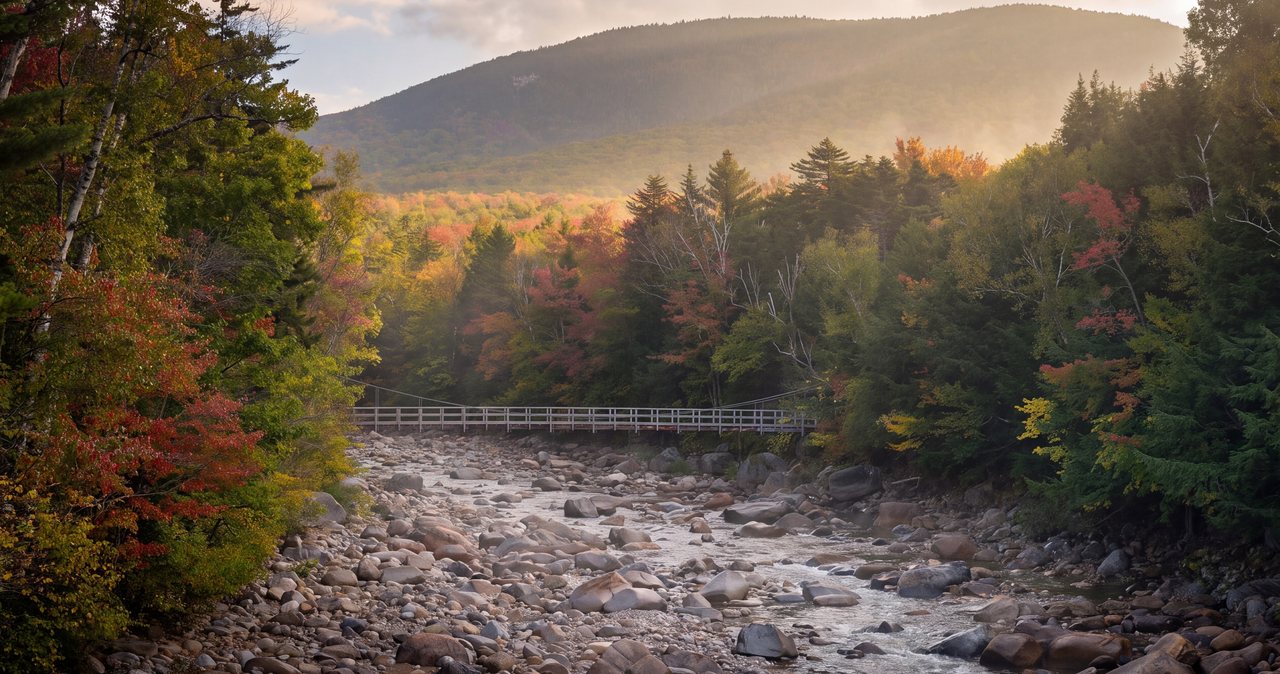
The hike starts by walking out of the far end of the parking lot and onto the suspension bridge, a long span over the East Branch of the Pemigewasset. It bounces a little, which delights children and mildly unnerves everyone else, and it gives you a straight look up the river into the valley you are about to walk. Take the minute to stop in the middle. In low water the East Branch is a clear, boulder-strewn stream; in spring runoff it is an intimidating volume of cold water, and seeing that from the bridge is the single best gut-check you will get about whether today is a swimming day at the far end.
On the far side, turn right and the Lincoln Woods Trail settles into what it is for almost its entire length: a nearly flat, arrow-straight corridor following the old East Branch & Lincoln Railroad grade. This was a logging railroad a century ago, and the proof is under your boots. Original wooden crossties are still embedded in the tread at intervals — you can walk them like a metronome. They are also the one trip hazard on an otherwise forgiving trail; they get slick when wet and they are spaced just wrong for a comfortable stride, so watch your feet rather than the scenery when the ground is damp. The forest here is second-growth hardwood and hemlock, and the river is off to your right, sometimes right beside you, sometimes screened by trees.
At about 1.4 miles you reach the junction with the Osseo Trail, which leaves to the left and climbs — steeply, eventually — toward Mount Flume and the Franconia Ridge. This junction is the boundary of the 2026 closure, and in a normal season it is your first real decision point: continue nearly flat to the falls, or turn uphill into a completely different and far more serious day. For the falls, you stay straight. The grade barely changes. If you have a stroller or a hesitant walker, this whole section is the good news — it is as close to a graded path as a mountain trail gets.
To the Wilderness boundary and the falls spur — miles 1.4 to 3.2
Past the Osseo junction the trail keeps the same easy character. The river swings closer and the corridor feels a little wilder, though you are still on the old rail bed. At roughly 2.6 miles the Black Pond Trail branches left; it is a worthwhile short detour on its own to a quiet pond with a view toward the Bond range, and it is a good escape valve if the falls are mobbed, which in July and August they can be.
At about 2.8 miles the Lincoln Woods Trail reaches the boundary of the Pemigewasset Wilderness. This is where the trail names get confusing on maps, so here is the clean version: right around the boundary, the Franconia Brook Trail continues ahead into the Wilderness, and the short Franconia Falls Trail spur branches left toward the falls. Follow the spur. It runs roughly 0.4 mile and it is the one stretch of this hike that feels like hiking — rockier, rootier, with a little up and down as it works over to the ledges. It is nothing a normal hiker will find hard, but it is emphatically not stroller terrain, so this is where you park the wheels, carry the little one, or take turns.
Total distance to the falls works out to about 3.2 miles each way, call it roughly 6.4 to 6.9 miles round trip depending on how far onto the ledges you wander and which measurement you trust. Total elevation gain for the whole thing is modest — most sources put it somewhere between 300 and 460 feet, and almost all of it is so gradual you will not notice it. This is about the flattest 6.5-mile walk to serious moving water we know of in the Whites, and that combination is exactly why it draws the crowds it does.
The falls themselves — and the swimming
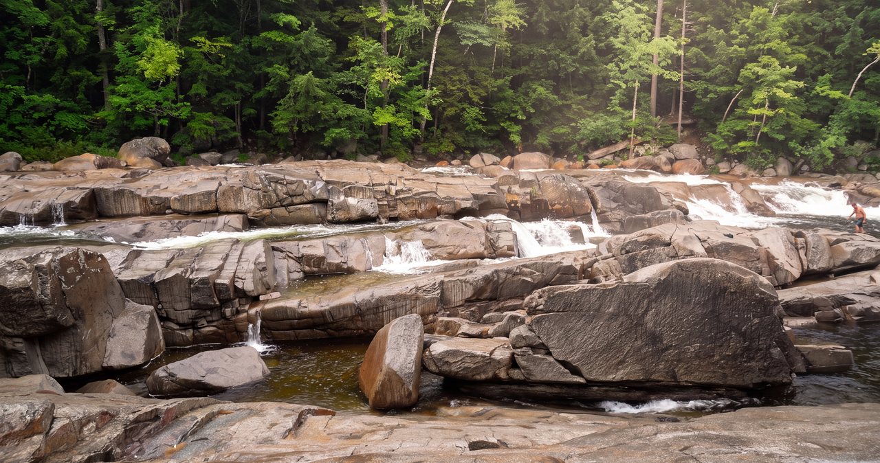
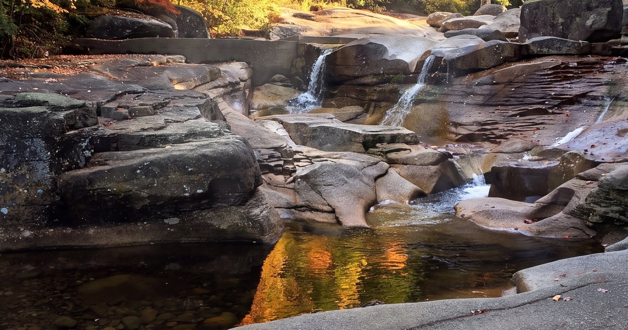
Franconia Falls is not a single plunge. It is a broad apron of open granite where the brook comes down in a series of chutes, slides, and stepped cascades into a string of pools. On a warm, low-water August day it is close to ideal: you can sit on sun-warmed rock, slide down the natural chutes into deeper pools, and cool off in water that has come straight off the high country. People bring lunch and make an afternoon of it. This is a swimming destination as much as a hiking one, and most of the crowd treats it that way.
Now the plain part, because the granite here has hurt people. Wet rock at the falls is far more slippery than it looks — polished by a century of water, and treacherous when a film of spray covers it. Every year someone slips on a slope they thought was fine and slides into a pool or against rock. Second, water that looks calm can be moving hard underneath; the chutes create strong pull, and the pools have currents that are not obvious from the bank. Do not judge a pool by its surface. Third, and most important: this is a snowmelt-fed stream, and in spring and after heavy rain the whole place turns from a swimming hole into fast, cold, powerful water you have no business near. There is no swimming in May and often into June. If the East Branch looked angry from the suspension bridge, the falls will be worse.
Our rules, and the ones we give guests, are boring and they work. Do not swim alone. Keep children within arm's reach on any wet rock, not just in the water. Do not walk out onto sloping wet granite to get a photo. Wear footwear you can grip and swim in. And if the water is high, treat the falls as a place to look at, eat lunch beside, and photograph — not a place to get into. The falls will be there on a better day.
Difficulty, and who it suits
By White Mountain standards this hike is easy, and we mean that in the specific way it matters here. There is no exposure, no scrambling, no route-finding, and no real climbing to the falls turnoff. The footing on the rail grade is generally excellent apart from the old ties. If you can comfortably walk six to seven nearly level miles, you can do this hike, and you can do it in sneakers if you have to, though we would not.
Who it is good for: first-time White Mountain hikers, families with kids who can walk a few miles, anyone easing back after an injury, and people who want a big natural payoff without a big effort. To the falls turnoff at 2.8 miles it is stroller-friendly — a real rarity — provided you accept that the final 0.4-mile spur is not. It is also a fine trail-running and mountain-biking corridor on the flat sections.
Who it is not for, or at least who should reset expectations: anyone hoping for a summit view or a sense of remoteness on a summer weekend. This is a popular, well-trafficked trail, and in high season you will share it. And it is emphatically not a shortcut to the ridge — the Osseo Trail that branches off it is a serious, steep climb into the alpine zone, an entirely different undertaking that we cover below. On time: at a steady pace the walking runs about an hour and a half each way, so figure roughly three to three and a half hours of actual walking round trip, more with young children or long stops. Nobody spends only a few minutes at the falls, so plan a real half-day. An hour and a half out, an hour or two at the water, and an hour and a half back is a realistic and pleasant rhythm.
The trailhead and parking reality
The Lincoln Woods Trailhead sits on the south side of the Kancamagus Highway (NH Route 112), about five miles east of Interstate 93 in Lincoln. It is one of the largest and best-equipped trailheads in the White Mountain National Forest: a big paved lot, a visitor information cabin that is staffed in the busy season, restrooms, potable water when the cabin is open, and the suspension bridge. If you are new to hiking here, it is a reassuring place to start, and staff at the cabin can give you current trail and water conditions, which are worth 10 min of anyone's time.
The lot is large but it fills, and on peak summer and foliage weekends it fills early and completely. When it is full, it is full — there is no good overflow, and cars parked along the highway shoulder can be ticketed and towed. The practical answer is time of day. Arrive before 9 a.m. on a summer weekend and you will usually park easily and have the first stretch of trail nearly to yourself; arrive at 11 and you may be circling or turned away, and you will be sharing the falls with a crowd. This is where staying central pays off: from the lodge it is roughly a 9 min drive, so a 7:30 breakfast can put you on the bridge before the day-trippers coming up from the coast have finished their coffee.
You need a recreation pass to park. The standard option is the White Mountain National Forest day pass at $5 per vehicle, paid at the self-service station or the cabin. If you hike here more than a few times a year, the WMNF annual pass pays for itself quickly, and a federal America the Beautiful / Interagency pass is honored here too, so bring it if you have one. None of these is a hiking permit — it is strictly for parking — which brings us to the permit question people always ask.
Permits and Wilderness rules — what you need
Guests routinely arrive believing they need a special permit to visit Franconia Falls. For individuals and normal-size groups today, that is not the case: there is no day-use permit or reservation required to hike to the falls. Franconia Falls has had crowd-management measures over the years, so it is a fair question to ask at the cabin whether any day-use limits are in effect during your visit, but for a party of a few people you simply pay to park and walk. The only recreation pass you must have is the parking pass described above.
The rule that does apply is the Wilderness group-size limit. Franconia Falls sits at the gateway to the Pemigewasset Wilderness — the largest Forest Service Wilderness in the Northeast — and in Wilderness the maximum group size is ten people, whether you are hiking or camping. Organized groups at that size, and any outfitter, guided, or commercial trip, need to arrange the appropriate Forest Service permit in advance; a family or a couple of friends does not.
If you are planning to camp rather than day-hike, know that things have changed here. The old Franconia Brook Campsite is now a closed Forest Protection Area; the designated camping in this corner has shifted to an interim fee site reached via the East Side Trail. On top of that, as of May 1, 2026, everyone camping overnight in the Pemigewasset Wilderness must store all food and scented items in a certified bear-resistant canister. That is a different trip from the day hike, but plan for it if you intend to stay out. Because this is Wilderness, Leave No Trace is not a suggestion: pack out everything, including food scraps and fruit peels, do not build fires or move rocks to dam pools, and do not camp right at the falls. The reason this place still looks the way it does, despite the numbers who visit, is that most people treat the granite and the water with some care. Be one of them.
When exposure matters — the Osseo extension and the ridge above
The walk to the falls itself is a gentle one in almost any weather. It is low, sheltered, and nearly flat, and the worst the sky can do to you on the rail grade is get you wet and cold.
The Osseo Trail that branches off at 1.4 miles is a different animal entirely. It climbs to Mount Flume and connects to the Franconia Ridge — Liberty, Little Haystack, Lincoln, Lafayette — one of the most beautiful and most exposed stretches of trail in the East. The ridge is above treeline, fully exposed, and the weather up there can turn from calm to wind, cold, and whiteout in under an hour, even for experienced, well-equipped hikers. If you use Lincoln Woods as an approach to the ridge, you are committing to a long, strenuous, exposed day, not extending an easy one. Do not wander uphill on Osseo on a whim.
For anything that touches the alpine zone, build two habits. First, check the Mount Washington Observatory Higher Summits Forecast the morning of — it is the forecast that tells you what the exposed high country is going to do, and it routinely reads nothing like the valley forecast. Second, learn and follow the hikeSafe Hiker Responsibility Code: be prepared with the knowledge and gear to turn around, leave your plans with someone, stay together, and know that turning back is the strong choice. New Hampshire sees roughly 150 to 200 search-and-rescue missions a year, and the great majority are avoidable, which is the whole point of the code. Message us if you would like to talk through a ridge day before you commit to one.
Seasons — what changes and what to bring
Summer is the postcard season and the reason most people come: warm rock, swimmable pools, and long days. It is also the crowded season, so the early-start advice above matters most from late June through August. Bugs can be present near the water in June and early July — blackflies earlier, mosquitoes after — so carry repellent if you are sensitive.
Foliage, roughly late September into the first half of October in this part of the Whites, is the other peak. The hardwoods along the corridor turn hard, the river reflects it, and the trailhead lot fills earlier than at any other time of year. If you hike here on a color-season Saturday, treat it like a dawn mission or accept that you may not park. Swimming is over by then — the water is cold — but the walk is at its best.
Winter and spring each ask for specific preparation. In winter the rail grade is a lovely, gentle snowshoe or microspike walk, flat and forgiving, and often quiet; the falls freeze into something else entirely, beautiful and absolutely not to be walked out onto. Bring traction and layers and know that the road access and lot are plowed but the trail is not groomed. Spring is the season to respect most: snowmelt turns the East Branch and the falls into high, fast, frigid water through May and often into June, and the trail itself can be a mud-season mess. Spring is a look-only season at the falls, since the current runs strong in high water. Save the swimming trip for a settled stretch of summer.
Gear, water, and footwear
This is a forgiving hike, but a few specifics make the difference between a good day and a soggy one. On your feet, trail runners or light hiking shoes with real grip beat sneakers, mostly because of those slick railroad ties and the rockier falls spur. If swimming is the plan, bring a second pair of footwear you can grip wet rock in and get into the water with — flip-flops are how people slip. A quick-dry towel and a swimsuit worn under your clothes save you the awkward changing shuffle at the falls, where there is no reliable facility.
Water: there is no potable water out on the trail, though you can usually fill up at the trailhead cabin when it is open. The East Branch and Franconia Brook run right beside you, but that is untreated Wilderness water — do not drink it without a filter or treatment. For a summer round trip, carry at least a liter or two per person; more if it is hot and you plan to linger. Pack lunch or snacks, because the falls are made for sitting and eating, and pack it all back out.
Otherwise, standard White Mountain sense applies even on an easy trail. A light rain layer, because valley weather here changes fast. Sun protection for the open granite at the falls, which throws a surprising amount of glare. A small first-aid kit. And your phone in a dry bag if you are swimming — cell service is spotty in the corridor, another reason to leave your route and expected return time with someone before you go.
Common mistakes and the smarter play
The single most common mistake is arriving mid-morning on a summer or foliage weekend and finding the lot full. The fix is largely within your control: start early. From the lodge that is roughly a 9 min drive, so an early breakfast and you are on the bridge before the crowd forms, with easier parking and a quieter trail both ways if you keep your falls stop reasonable.
The second mistake is misreading the water. People see photos of the swimming holes and arrive in late May expecting them, only to find the water still high, cold, and fast. Match the trip to the season — swimming is a settled-summer activity, not a spring one — and use the suspension bridge as your first read on conditions.
A few smaller ones. Do not treat the Osseo junction as a casual side trip; going uphill there turns an easy hike into a committing ridge day. Do not skip the Black Pond Trail if the falls are packed — it is a quiet, pretty alternative right off the main route. Do not push a stroller past the falls turnoff; the spur will beat both the stroller and your patience. And do not assume the trail is open without checking, especially in the 2026 season and any future season with flood-repair work; the Forest Service posts closures at the trailhead and on its website, and a 5 min check saves a wasted drive.
Nearby add-ons and how it connects
Franconia Falls sits at the hub of a lot of terrain, which is part of what makes it a good base hike to build a trip around. Right off the route, the Black Pond Trail adds a quiet pond with a view toward the Bond range for little extra effort. For strong hikers, the Lincoln Woods corridor is the classic approach to the deep Pemigewasset Wilderness — Owl's Head, Thirteen Falls, the Bonds and Bondcliff, and the full Pemi Loop all start from this trailhead in a normal season, though every one of those is a serious, long day and several are overnights.
For an easier pairing that stays close to the lodge, this hike combines naturally with the water features of Franconia Notch just up the highway — The Basin, Flume Gorge, and Lonesome Lake — none of which demand a big effort and all of which we cover in their own guides. A common and satisfying plan is Franconia Falls in the cool of the morning, lunch back in Lincoln, and a short notch walk in the afternoon. The trailhead is on the Kancamagus Highway itself, so a drive over the Kanc for the overlooks and the smaller roadside falls slots in easily on the way back east.
If you want to graduate from the falls to something with a summit, the Osseo Trail from this very trailhead is your ladder up to Franconia Ridge — but read the exposure section above first and pick your weather window. That is the appeal of using this corner of Lincoln as a base: the easiest walk in the region and one of its most serious ridge traverses share the same parking lot, and you can choose your day accordingly.
Safety & conditions
- Check the trail status before you drive. The lower Lincoln Woods Trail is closed June 15–November 2026 for reconstruction, and the standard route to Franconia Falls is not walkable during the closure. The closure is backed by a federal Forest Order and is enforceable.
- The granite at the falls is dangerously slick when wet, and some calm-looking pools hide strong currents. Do not walk out onto sloping wet rock, keep children within arm's reach, and never swim alone.
- Match the trip to the water. In spring snowmelt and after heavy rain the East Branch and the falls run high, cold, and fast — no swimming, and treat the falls as look-only. Use the view from the suspension bridge as your first read on conditions.
- If you extend onto the Osseo Trail toward Franconia Ridge, you enter exposed alpine terrain where the weather sets the plan. Check the Mount Washington Observatory Higher Summits Forecast and follow the hikeSafe Hiker Responsibility Code; consider a NH Hike Safe card ($25/person, $35/family).
- There is no potable water and cell service is spotty out on the trail. Carry your own water, leave your plans and expected return time with someone, and pack out everything in this Wilderness area.
Where to stay for it
The whole case for hiking Franconia Falls from the lodge comes down to one number: about 9 min to the trailhead. This is a hike where the first hour of the day decides a lot, because the Lincoln Woods lot fills early and completely on summer and foliage weekends. Guests who grab a coffee in the lounge and roll out by 7:30 are on the suspension bridge with easier parking and a quiet trail while day-trippers from away are still an hour down the interstate. You cannot buy that advantage; you can only be close enough to use it.
It is also a restorative hike to come back from, and a couple of our suites suit that especially well. After an afternoon on wet granite and in cold pools, the Basin suite's spa tub is exactly the reward tired legs are asking for. And there is a nice symmetry in staying in the Pemi suite before walking the length of the East Branch of the Pemigewasset out to the falls — it is the river the whole hike is named for and follows.
Because the walk to the falls turnoff is nearly flat and stroller-friendly, it is one of the few White Mountain outings that works for a wide range of abilities, and you can message us for a realistic read on whether it is a swimming day or a look-only day. In the 2026 season, while the standard route is closed for repairs, we will point you to the notch waterfalls instead — so the day starts with water and woods, not a closure sign.
Sources & official info: fs.usda.gov · fs.usda.gov · fs.usda.gov · outdoors.org · nhpr.org · mainepublic.org
— Launchpoint Lodge, From the lodge