Potash Mountain is one of the best value-for-effort hikes we point guests toward on the eastern half of the Kancamagus. It is only 2,700 feet, and the trip is a modest 4.4 miles round, but the summit is largely open granite with a wide, generous view across the Sandwich Range - the great steep wall of Mount Passaconaway close by, Whiteface and the Tripyramids stacked beside it, the rocky horn of Mount Chocorua to the southeast, and Mount Carrigain and the Presidential Range off to the north. For a hike you can finish in a morning, that is a lot of mountain to see, and because Potash sits away from the Franconia Notch crowds you will often have the top nearly to yourself.
It is also the hike with the real asterisk, and we would rather you hear it from us than find out at the water. The Mt Potash Trail crosses Downes Brook near the very start, and there is no bridge. In normal summer and fall flow it is a straightforward rock-hop; in spring snowmelt, after heavy rain, or when the remains of a tropical storm have come through, Downes Brook runs high, cold and pushy, and the crossing is best left for another day. The saving grace is that it comes so early that turning back costs you almost nothing - which is exactly the right move when the brook is up. This guide treats that crossing as the main event it deserves to be.
What follows is the current, plainspoken version of Potash for 2026: the real numbers and how the climb feels, the Downes Brook crossing and how to judge it, the trail step by step to the lower ledges and the open summit, exactly what you are looking at from the top, how to pair Potash with neighboring Hedgehog for a full day from one parking lot, the drive out from the lodge on the empty Kancamagus, and a safety section built around this route rather than a generic mountain. The trailhead is about 21 miles and roughly 35 min east of our door, and there is nothing on that road, so read the drive and provisioning notes before you leave Lincoln.
The numbers, and what they feel like underfoot
Start with the stats, because Potash is short and the numbers are friendly, with one wildcard. The standard trip is an out-and-back of about 4.4 miles round - roughly 0.3 mile in on the Downes Brook Trail from the Kancamagus, then about 1.9 miles on the Mt Potash Trail to the summit, so 2.2 miles each way. Trip reports and the trail guides consistently put it at 2.2 miles one way to the top, which is where the 4.4-mile round figure comes from, and it is a real number: this is a genuine there-and-back climb, not a long ramble.
The climbing is modest but real. The trailhead sits low, around 1,250 feet, and the summit is 2,700 feet, so the net gain is roughly 1,450 feet; counting the little dip down to Downes Brook at the start and a bit of undulation, most sources put the total gain right around 1,400 feet, with GPS trip reports ranging from about 1,385 to 1,425. A few references round the summit to 2,680 feet rather than 2,700; the difference does not matter on the ground. If you want the gain confirmed to the foot, the AMC White Mountain Guide and the White Mountain National Forest are the sources to trust over any single trail app, and we would rather tell you the real range than pretend at a false precision.
What that adds up to is a climb of the middle sort: not a stroll, not a grind. The first stretch is nearly flat to the brook, then the Mt Potash Trail settles into a steady, moderate grade through hardwood forest, steepening on the upper mountain before it breaks out onto ledges and the open top. There is no hands-on scrambling, no alpine ridge to traverse, and nothing you would call exposed in the mountaineering sense. Most reasonably fit hikers are up in an hour and a half to a little over two hours, and the full round trip runs about two and a half to four hours depending on your pace and how long you sit at the summit - and you should sit, because the view is the whole point.
The one frame before you go: short is not the same as guaranteed. The wildcard is the Downes Brook crossing at the start, which can make the day harder than the mileage suggests or stop it entirely in high water, and the open summit turns slick and cold when the weather is wrong. Treat Potash as the real mountain hike it is - proper footwear, water, a layer, a map, and a look at the forecast - and it pays back a big-mountain view for a half-day's work.
The Downes Brook crossing: the make-or-break at the start
The single most important thing to understand about Potash is the water crossing, so we are putting it right up front the way the trail does. About 0.3 mile from the parking lot, where the Mt Potash Trail leaves the Downes Brook Trail, you cross Downes Brook. There is no footbridge. Downes Brook drains a large, steep basin below Whiteface and the Tripyramids, including old slide country, which means it gathers a lot of water fast and holds it for a while, so this is not a trickle you can ignore - it is a real mountain stream.
In ordinary summer and early-fall conditions the crossing is a manageable rock-hop or a shallow, ankle-to-shin wade, and most people barely think about it. The problem is the other conditions. During spring snowmelt - roughly April into May, and later in a big snow year - and after any heavy rain or the passing remains of a tropical system, Downes Brook comes up hard: fast, cold, knee-deep or more, with slick submerged rocks and enough push to take your feet out from under you. Trip reports and the guides are blunt that this crossing can be problematic at high water, and blunt is right. High, moving water is how people get hurt in these mountains, and no summit is worth being swept off your feet in a cold brook far from help.
Here is the plain advice, and it is good news: because the crossing sits at the very start, turning back costs you almost nothing. If you arrive and Downes Brook is running high and pushy - if the rocks you would use are underwater, if the flow is above your knees and shoving, if you cannot see the bottom - do not force it. Walk the 0.3 mile back to the car, and either go do Hedgehog Mountain from the same lot, which does not require a Downes Brook ford, or drive to a waterfall walk and save Potash for a dry spell. That is not a failed hike; that is the correct call, and it is the whole reason we tell you about the crossing before you drive out.
If you do cross, cross smart. Unbuckle your pack's hip belt and sternum strap first, so you could shed the pack if you went in. Face upstream, use trekking poles or a stout stick for a third and fourth point of contact, keep your boots on for grip rather than crossing barefoot, and move one foot at a time without rushing. If the water is above your knees and actively pushing, or you cannot keep your footing on the first couple of steps, back out and reconsider - that is your answer. And read the crossing as a forecast for the rest of the hike: a high, loud Downes Brook means the ledges and summit above will likely be wet and slick too.

The trail, step by step
From the Downes Brook lot on the Kancamagus, the walk begins on the Downes Brook Trail, heading south into the woods on easy, nearly level ground. Enjoy this part - it is the flat opening stretch before the real climbing. At about 0.3 mile you reach the point where the Mt Potash Trail diverges to the right, heading generally west, and this is where you cross Downes Brook and commit to the mountain. Do not blow past the junction; the Downes Brook Trail itself keeps going straight, up its long drainage toward Whiteface, and you want the signed Mt Potash Trail on the far side of the brook.
Once on the Mt Potash Trail the grade picks up into a steady, moderate climb through pleasant hardwood forest. You may step over a small brook or two in the first mile, nothing like the main Downes Brook crossing, and in a wet spring the lower trail can be muddy and running with snowmelt. The forest is quiet and shady, good climbing on a warm day, and the trail is generally well worn and blazed, so route-finding down here is simple. This is the grind-it-out middle of the hike, where you gain most of your elevation with your head down.
Partway up, the trail earns its first reward: it climbs onto open ledges on the mountain's south and southwest shoulder, where the trees fall back and you get your first real view out, south over the Swift River valley and toward the Sandwich Range. These lower ledges are a natural place to catch your breath, and on a warm day the south-facing granite is a fine spot to sit. From here the trail continues up, ducking back into scrub and low woods before a steeper final pitch pulls you out onto the summit ledges at about 2.2 miles.
The top is largely open, a bare granite crown rather than a viewpoint you peer out from, and the trail markings matter more up here than in the woods below. On the open rock the footway is marked by cairns and paint blazes rather than a worn dirt tread, so keep finding the next marker before you move, and fix in your mind where the trail leaves the ledges back into the trees for the descent. In good visibility none of this is difficult; in cloud or fading light, an open summit is exactly where people lose the line, so pay attention on the way up so the way down is obvious.
The lower ledges and the open summit
Potash gives you two doses of open rock, and it is worth knowing the difference so you pace the hike well. The lower ledges, partway up the south and southwest shoulder, are the appetizer: a set of open granite slabs facing generally south, with the Swift River valley below you and the bulk of Mount Passaconaway and the Sandwich Range filling the view ahead. They catch the sun, they are a good rest and snack stop, and on a hazy day they can be the better place to sit if the summit is in and out of cloud.
The summit itself, at 2,700 feet, is the main course: a largely bare, open top that opens up a wide sweep in most directions. It is a modest area, not a sprawling alpine plateau, so on a busy foliage weekend a few groups fill it, but on most days there is room to spread out, eat lunch and turn slowly through the whole view. This is the payoff the whole climb is built around, and it is an unusually big one for a peak this low and a hike this short.
Both stretches of open rock come with the same caution, in a milder form than nearby Hedgehog's famous slabs but real all the same: bare granite that is grippy and pleasant when dry becomes slick and unforgiving when it is wet with rain or dew, glazed with morning frost, or holding ice in the cold months. The summit ledges are not steeply pitched enough to send you sliding far, but a slip on wet rock is still how ankles and wrists get hurt a long way from the road. Move deliberately on the open rock when it is anything but dry, and see the ice and weather notes further down before you count on a cold-season summit.
The summit view: Passaconaway, Whiteface and the whole Sandwich Range
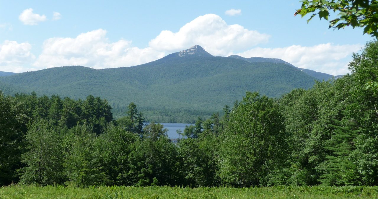
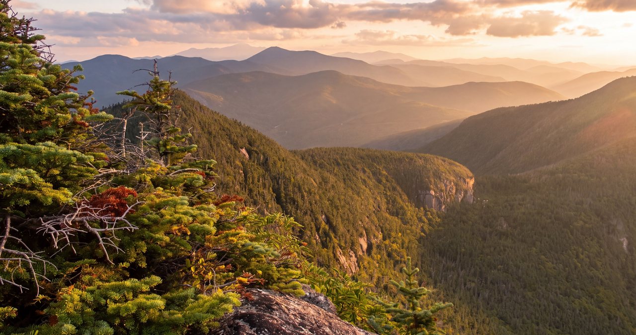
The reason to climb Potash is the view, and for a 2,700-foot peak it is a remarkably complete one. The dominant sight is to the east and southeast: Mount Passaconaway, a 4,000-footer, rises steep and close, a great forested wall that anchors the whole scene, with Mount Whiteface and the twin humps of the Tripyramids ranged along the Sandwich Range beside it. You are looking straight into the heart of the range from one of its lower outliers, and the peaks feel near enough to touch.
Swing your eye southeast and the unmistakable rocky horn of Mount Chocorua stands out on the skyline, one of the most recognizable summits in the White Mountains. To the north the view opens toward Mount Carrigain with its long Signal Ridge, the deep cleft of Carrigain Notch, and the wooded dome of Green's Cliff, while below and nearer you can pick out Church Pond and the slopes of Mount Tremont. On a clear day the Presidential Range lines the far northern horizon, so from this humble summit you can see all the way to Mount Washington and its neighbors - a lot of mountain for a morning's work.
Closer in, the view is a map of your own day. The Swift River valley and the ribbon of the Kancamagus Highway lie below, and directly across the drainage to the east sits Hedgehog Mountain, the peak that shares your parking lot - so from the top of Potash you can look straight at the other half of the double. It is a satisfying, all-around summit, and because it faces so many directions there is no bad seat.
A note on views, because we would rather set the expectation than oversell it: Potash is low, so the far peaks read best on a clear or clearing day, and on a soft, humid summer afternoon the distant Presidentials can fade into haze even when the near Sandwich Range is sharp. This is a hike to save for good visibility. If the valley is socked in or a cloud is dragging across the summits, the climb still goes, but you will spend it in the trees and the gray - so watch the forecast and pick your day, which the weather section covers in more detail.
Pairing Potash with Hedgehog for a full day
Potash and Hedgehog share the same Forest Service parking lot on the Kancamagus, which makes them the natural double in this corner of the range, and plenty of hikers climb both in a day. Do the pair and you are looking at roughly nine to ten miles total and something like 2,800 feet of combined climbing - a full but very reasonable day for fit hikers, with two very different summits and two different views for a single drive and a single parking fee.
The two peaks look at each other and at the range from opposite sides, so the double does not feel repetitive. From Potash you look east across the valley at Hedgehog and southeast into the Passaconaway wall; from Hedgehog's East Ledges and summit you look back west toward Potash and out over a broad eastern panorama toward Chocorua and Carrigain. It is the same neighborhood seen two ways, and the contrast is part of the appeal.
On order and strategy, let the water decide. If Downes Brook is running high, do Hedgehog only - the Hedgehog loop leaves the Downes Brook Trail within about 60 yards for the UNH Trail, with only a couple of small, easy brook crossings and no Downes Brook ford, so it stays in play on days when Potash does not. If the brook is low and the forecast is settled, a good plan is to climb Potash first, while your legs are fresh and the summit is quiet, get the crossing done early, then come back to the lot and do the Hedgehog loop. Either way it is a long day: carry enough water and food for both climbs, watch the clock and the sky, and be straight with yourself about your legs and the daylight before you start the second peak. There is no shame in doing one, driving down for a swim or a waterfall walk, and coming back for the other another day.
The trailhead, the fee, and the empty Kancamagus
The hike starts from the Downes Brook Trail parking lot on the south side of the Kancamagus Highway, NH Route 112, across the road from the WMNF Passaconaway Campground and about a mile east of the Sabbaday Falls parking area. It is the same lot used by hikers headed for Downes Brook, Mount Potash and Hedgehog, and the Mt Potash Trail is not signed as its own trailhead from the road - you park at the Downes Brook lot and start on the Downes Brook Trail. The lot is not large, so on a peak foliage weekend it can fill by mid-morning; it is still a world quieter than the Franconia Notch trailheads, and on most days you will find a spot. Park in the lot, not on the highway shoulder, and do not block the trail or the campground access.
This is a White Mountain National Forest fee area, so you need a recreation pass on your dashboard to park. For 2026 that is about $5 for the day of purchase, $30 for an annual pass, or $40 for an annual household pass, and the federal America the Beautiful pass at $80 covers it too if you already carry one. You can buy the day pass on site. Fees do change, so if you want it confirmed to the dollar, check the current rate with the White Mountain National Forest before you go. The voluntary hikeSafe card is a separate thing, and it is covered in the safety notes below.
Now the part that catches people out every season: there is nothing on the Kancamagus. The highway runs about 34 miles between Lincoln and Conway with no gas station, no store, no restaurant, and no reliable cell signal for essentially its entire length - it crosses a high, wild stretch of national forest, not a town. Whatever you need for the day, you buy in Lincoln before you leave. That means a full tank of gas, water, food, and a downloaded map before you turn onto the byway. At the trailhead itself there is, at best, a vault toilet at the campground across the road in season, and nothing else - no water, no snacks, no help desk.
A little context for the drive, since the area rewards it: just east of the trailhead is the Russell-Colbath Historic Site, a preserved nineteenth-century homestead, and the whole area carries the old Passaconaway settlement name, after the seventeenth-century Pennacook leader whose name the big mountain over your summit also bears. Sabbaday Falls, a short, easy walk to a photogenic gorge and falls, sits just west of the trailhead and makes a natural add-on before or after the climb. You are hiking a corner of the Kancamagus with a lot of quiet history, even if the trail itself keeps you in the woods and on the rock.
Water crossings and wet rock after rain and snowmelt
Potash is unusually weather-sensitive for such a short hike, and it comes down to water. The Downes Brook crossing near the start is fed by a big, steep basin, so it responds fast to rain and stays high for a day or two after a real storm, and in the spring melt it can run high for weeks. That is the single feature most likely to change your plans, and the planning rule is simple: if there has been heavy rain in the last day or two, or if it is peak snowmelt season, expect the crossing to be the deciding factor and have a backup in mind before you drive out.
The open rock is the second half of the water story. The lower ledges and the summit are granite, and wet granite is slick granite - after rain, in heavy dew, in morning frost, or when a cloud is dragging across the top, the footing on the open sections gets treacherous in a way the dry rock never hints at. Potash does not have the acres of steep slab that make Hedgehog a genuine slip hazard, but the principle is the same and the consequences of a fall are the same when you are hours from the road. Slow down on wet rock, test your footing, and use your hands on the steeper ledge steps.
Put the two together and the guidance writes itself. The best Potash days are dry ones in a settled stretch of weather, when the brook is low and the rock is grippy. In a wet spring, right after a storm, or during a rainy spell, either pick a different, bridged and lower-consequence hike, or drive out ready to turn around at the crossing and be fine with it. The mountain keeps the same hours every year; the water is what changes, and reading it squarely is most of the skill on this particular hike.
Winter and the shoulder seasons on Potash
Potash is a reasonable cold-season objective for prepared hikers, and it has one real advantage: the Kancamagus Highway is a state road that is plowed and kept open year-round, so unlike the seasonally gated forest roads elsewhere in the Whites - Tripoli, Zealand, Sawyer River, the Gale River loop - you can reach this trailhead in winter. That said, the Kancamagus is high and exposed near its height of land, it drives slick and snowy in a storm, and it can close temporarily in severe weather, so check road conditions before you commit to the drive and do not count on the trailhead lot being fully plowed out.
The Downes Brook crossing changes character in winter and demands respect either way. Early and late in the cold season it may still be open, moving water with icy rocks and ice shelves along the banks - a bad combination for footing. In deep winter it may be bridged by snow or frozen over, but a snow bridge over moving water can be thin and hollow, and breaking through into a cold brook is a genuine emergency. Do not trust a snow bridge you have not tested, probe before you commit your weight, and treat open black water with ice edges as a hazard, not a convenience.
On the mountain, winter turns the whole climb into a traction and navigation problem. The steady middle grade packs down into firm, slick tread, and the open ledges and bare summit can be scoured to hard, wind-blasted ice or drifted deep with snow that hides the rock and the trail markings. Microspikes are the minimum, snowshoes earn their place after fresh snow, and on a hard, icy day heavier traction is warranted. The cairns and blazes that guide you across the summit ledges in summer can be buried or plastered with rime, so an open top in a winter whiteout is disorienting - carry a map and compass or a downloaded GPS track and know how to use them. Add short daylight, so start early and carry a headlamp, and real cold and wind on the exposed summit, far colder than the sheltered woods, so bring more insulation than the climb seems to need. It is a full winter hike, with winter gear and winter judgment, not a summer walk in the snow.
Weather, the higher-summits forecast, and turnaround judgment
Potash is low and mostly wooded on the way up, so it does not carry the life-threatening alpine exposure of the Presidentials, and you should not go in braced for a Mount Washington epic. But it is still a mountain, its summit and ledges are open, and this is above all a view hike, so the weather deserves a look before you drive out. Check a valley forecast for the Albany and Kancamagus area, and glance at the Mount Washington Observatory Higher Summits Forecast at mountwashington.org. That forecast is written for the big peaks and Potash is far tamer, but it is the best single read on what the weather moving through the region is going to do, and it is free.
The sky matters here for two reasons. First, this is a hike you climb for the view; if the Sandwich Range is buried in cloud you will do the whole trip and see gray, so it is worth saving Potash for a clear or clearing day and being willing to swap it for something else when the forecast is murk. Second, and more seriously, the bare summit is exposed to lightning, and summer thunderstorms build fast and mean over these mountains on hot afternoons. An open granite top is a poor place to be when one arrives. The discipline is the usual one: start early, be up and back down off the open rock before the afternoon, watch the sky to the west, and treat the first distant thunder as your cue to get off the summit and into the trees, not as a reason to grab one more photo.
Turnaround judgment on Potash is refreshingly concrete, because the mountain gives you clear signals. If Downes Brook is running too high to cross safely, that is your answer at the start. If a storm is building, if the cloud has dropped onto the summit so you cannot read the view or the cairns, or if the ledges are iced beyond your traction and comfort, those are all reasons to shorten the day or turn back, and none of them is a defeat. A short, modest peak is exactly the kind of place where it is easy to get casual and push on when you should not, so give yourself firm permission to bail. The mountain runs on the same schedule every year, and it is a lot more fun on the right day than it is scary on the wrong one.
It is also worth saying that quiet cuts both ways. The light traffic that makes Potash so pleasant also means that if something goes wrong out here, there may be no one along to help and no cell signal to call for it. That is not a reason to avoid the hike - it is a reason to bring the judgment and the gear that let you handle small problems yourself before they become big ones.
Water, dogs, footing, and what to carry
Plan Potash as a carry-your-own-water hike. You cross Downes Brook low down, but the climb, the ledges and the summit are dry, so bring what you will drink from the car - figure a liter and a half to two liters per person on a warm summer day, less when it is cool. If you do dip from the brook, treat it by filter, purifier, or boiling like any backcountry water in the Whites, but for a hike this short it is easier to carry your supply and not think about it. Fill up in Lincoln, where the water and the gas are easy, since there is nothing on the drive.
On footwear and gear, treat this as the real mountain hike it is. Wear boots or trail shoes with genuine grip and some ankle support for the steady climb, the ledge steps, and especially the Downes Brook crossing, where you want traction on wet rock - not smooth-soled sneakers. Carry a wind or rain layer even on a fair forecast, because the open summit runs cooler and breezier than the sheltered woods. Trekking poles are useful here, both for the crossing and for the descent on tired legs. Add sun protection for the exposed rock, a map you have downloaded before you lost signal, a headlamp, and enough food for a half-day. In the cold months, microspikes are not optional - see the winter notes above.
On dogs, since guests always ask: leashed dogs are allowed on the Mt Potash Trail, as on most White Mountain National Forest trails, and plenty of people bring them. Go in with clear eyes about this route in particular, though. When the water is up, the Downes Brook crossing is no place for a dog - cold, fast current is as tough on a dog as on you, and a dog should never have to swim a pushy ford - and the open ledges are hard on paws and slick when wet or iced. Carry water for the dog since the climb is dry, keep it leashed and close on the rock, and turn around at the crossing if it is too high for the dog as readily as for you. The standing note for our guests is the practical one: the lodge is adults-only and pet-free, so hiking with a dog means arranging for it somewhere other than here.
hikeSafe and hiking a quiet peak
Two New Hampshire specifics belong in your pack on any hike in these mountains, and a short, quiet peak like Potash is exactly where they matter most, because quiet is where help is farthest away. First, this state can bill hikers for their own rescues. Under RSA 206:26-bb, a hiker whom New Hampshire Fish and Game judges to have acted negligently can be charged for the search-and-rescue operation, which can run to thousands of dollars. The voluntary hikeSafe card removes that liability short of true recklessness and helps fund the rescue teams directly. It is $25 for an individual or $35 for a family for 2026, sold through New Hampshire Fish and Game, valid the calendar year, the same price for residents and visitors, and you can read about it at hikesafe.com.
Second, do not let your phone be your safety plan. There is little to no cell coverage on the Kancamagus or on Potash, so anything that depends on a signal - a live map, a weather check, a call for help - may simply not work when you need it. Download your map before you leave the lodge, carry the ten essentials scaled to the day, and tell someone your plan: which trailhead, which trail, and when you expect to be back. We ask hiking guests to leave a route and an out-time with someone at home, and we mean it as much on a modest 2,700-footer as on a big peak, because the mountain does not know how tall it is when something goes wrong.
That is the whole safety story of this hike, and it is a fair one: Potash is a short, rewarding, big-view climb with one serious gate - the Downes Brook crossing when the water is high - plus the ordinary open-rock and weather sense any summit asks for, and one quiet-country reality, that you are more on your own out here than on the famous trails. Judge the crossing candidly and be willing to turn back at it, respect the rock when it is wet or iced, read the weather and save it for a clear day, carry traction in the cold seasons, tell someone your plan, and give yourself permission to bail. Do those simple things and Potash hands you one of the best summit views per mile in this part of the Whites for a half-day's work - which is exactly why it is one of our favorites to send people to.
Safety & conditions
- The Downes Brook crossing near the start is the signature hazard on this hike. There is no bridge, and in spring snowmelt or after heavy rain the brook runs high, cold and fast enough to take your feet out from under you. Because the crossing comes only about 0.3 mile in, turning back costs you almost nothing - so if the water is above your knees and pushing, or you cannot see the bottom, do not force it. Cross with trekking poles, boots on for grip, and your pack hip belt and sternum strap unbuckled so you could shed the pack if you went in, and back out at the first sign you cannot keep your footing.
- Read the crossing as a forecast for the whole hike. A high, loud Downes Brook means the ledges and summit above will likely be wet and slick too, and it is a strong signal to switch to Hedgehog from the same lot, which needs no Downes Brook ford, or to save Potash for a drier day.
- The lower ledges and the open summit are granite, grippy when dry and slick when wet with rain or dew, frosted, or iced. The slopes are not steep enough to send you sliding far, but a fall on wet rock hours from the road still hurts. Move deliberately on the open rock whenever it is anything but dry, use your hands on the steeper ledge steps, and carry microspikes from about Columbus Day into spring.
- The bare summit is exposed to lightning, and summer thunderstorms build fast over these mountains on hot afternoons. Start early, be up and off the open top before the afternoon, watch the sky to the west, and treat the first distant thunder as your cue to get down into the trees rather than lingering for another photo.
- It is easy to lose the route on the open summit ledges, where the trail is marked by cairns and paint blazes rather than a worn tread. Watch for the next marker before you move, and fix in your mind where the trail leaves the rock back into the woods - especially in cloud or fading light, and especially on the descent, when most people wander off-line.
- The Kancamagus has no services and little to no cell coverage for its whole 34-mile length. Download your map before you leave Lincoln, carry the ten essentials and a headlamp, plan to navigate without a phone signal, and tell someone your route and expected return time. On a quiet peak, help is farther away than on the famous trails.
- In winter, do not trust a snow bridge over Downes Brook you have not tested - a thin bridge over moving water can break and drop you into a cold brook, which is a genuine emergency. Probe before you commit your weight, treat open black water with ice edges as a hazard, and be ready to turn around. The open summit can be wind-scoured ice or a drifted whiteout, so carry traction, a map and compass or GPS track, and warm layers.
- Carry the New Hampshire hikeSafe card ($25 individual, $35 family for 2026 from NH Fish and Game). New Hampshire can bill a hiker judged negligent for a rescue under RSA 206:26-bb, and the card waives that cost, short of recklessness, while helping fund the volunteer rescue teams. It is worth having on a short, quiet peak precisely because quiet peaks are where help is farthest away.
Where to stay for it
The drive is simple but longer and emptier than it looks on a map, so read this before you set out. From 191 Pollard Road you make your way to the Kancamagus Highway, NH Route 112, in Lincoln, and head east - away from I-93 and up over the height of land. From there it is about 21 miles of winding, scenic two-lane to the Downes Brook Trail parking lot, which is on the right, the south side, across from the Passaconaway Campground and about a mile past the Sabbaday Falls lot. Figure roughly 35 min with a clear road, and closer to 45 min or more on a busy summer or foliage day, when the Kancamagus fills with sightseers driving slowly, pulling into overlooks, and sometimes stopping for a moose. It is one of the best drives in the state, so leave time to enjoy it rather than fighting it. This is the same lot that serves the Hedgehog loop, so if you are planning the double you only make the drive once.
Provision completely in Lincoln, because once you turn onto the Kancamagus there is nothing - no gas, no store, no coffee, and no reliable cell signal - for the entire 34-mile run to Conway. Fill the gas tank, and pick up sandwiches, snacks, and plenty of water in town; the grocery store in Lincoln is the easy one-stop, and there are gas stations and coffee in Lincoln and North Woodstock. Download your trail map while you still have a signal, since you will lose it on the highway, and leave your route and your expected out-time with someone at home - and if the forecast has been wet, mention that you may turn around at the Downes Brook crossing, so no one worries if you are back early. On the way you pass Sabbaday Falls just before the trailhead, an easy, worthwhile half-mile stop, and Rocky Gorge is a few miles farther east if you want to add a short scenic walk to the day.
Sources & official info: fs.usda.gov · outdoors.org · 1happyhiker.blogspot.com · mountwashington.org · hikesafe.com
— Launchpoint Lodge, From the lodge