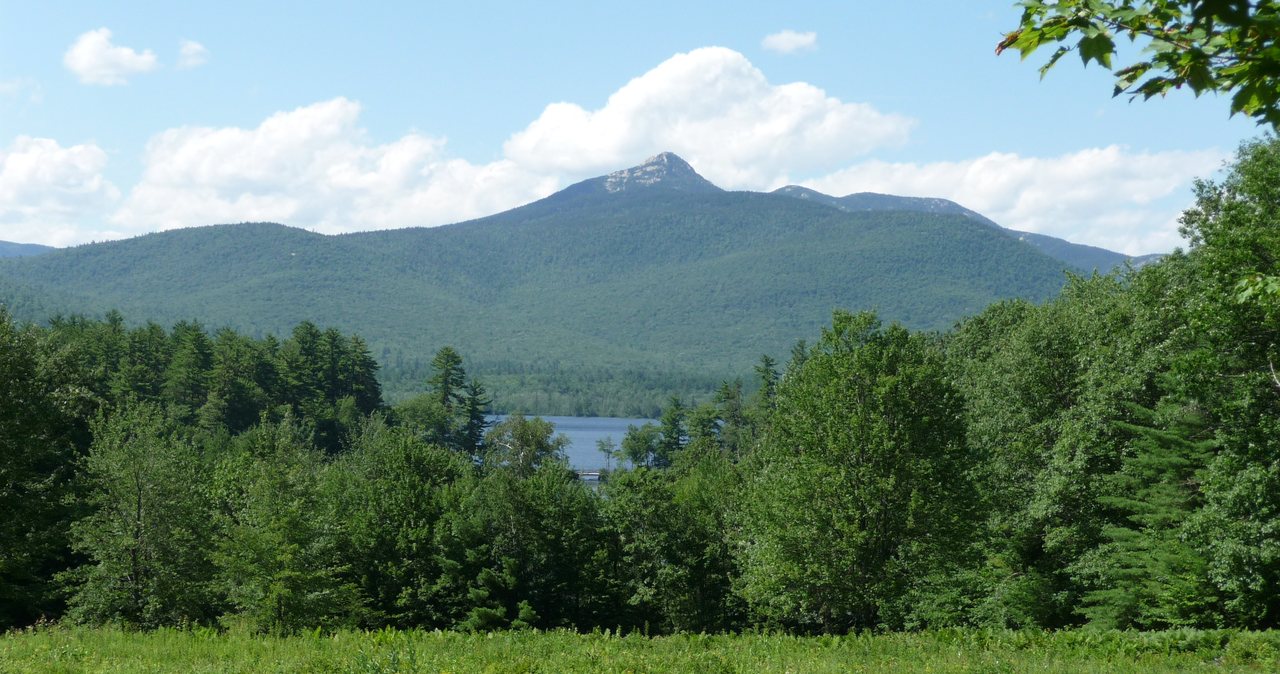
Mount Chocorua is 3,490 feet, the easternmost high point of the Sandwich Range, standing off by itself above the town of Albany at the quiet end of the White Mountains. It is almost certainly the mountain you have already seen in a photograph without knowing its name - a sharp, bare rock cone reflected in a pond, the postcard of New Hampshire. It is said to be one of the most photographed mountains in the world, and standing at the bottom looking up, you understand why. That open granite peak is the whole appeal, and it is also the whole problem, because getting to it means climbing out of the trees and onto exposed rock with no cover, and a great many people underestimate what that asks of them.
The number that fools people is the elevation. At 3,490 feet Chocorua falls just short of the 4,000-foot mark that defines New Hampshire's famous peak list, so hikers who chase the 48 pass it by and casual hikers assume that a mountain a few hundred feet shorter must be a few hundred feet easier. It is not. The standard route, the Champney Falls Trail from the Kancamagus Highway, runs about 7.5 to 7.6 miles round trip with somewhere around 2,250 to 2,500 feet of climbing, and the last part of the climb is open ledge that you scramble up on your hands as much as your feet. Plenty of people who have finished actual 4,000-footers come off Chocorua saying it felt harder. It earns that reputation squarely, and this guide is going to treat it as the real mountain it is.
Two things make Chocorua worth a careful guide rather than a cheerful one, and both get their own section below. The first is the exposure: the summit cone is bald rock, wide open to sun, wind, and weather, which is exactly why it is so photogenic and exactly why you want to be off it before a thunderstorm builds - and in these mountains, on a summer afternoon, they build fast. The second is the crowd, because a famous, close-in, moderate-height summit on the Kancamagus draws enormous traffic, especially on fall foliage weekends, and the fee lot fills early. The trailhead is about 38 min from our front door, the entire drive spent on the Kancamagus Highway. Here is the real 2026 rundown - the numbers, the lot, the waterfall, the ledges, and the judgment calls.
The numbers
Take the standard route first, because it is the one most lodge guests should plan for: Mount Chocorua by the Champney Falls Trail, starting from the large parking area on the Kancamagus Highway. From the trailhead the Champney Falls Trail climbs a bit over three miles to meet the Piper Trail just below the summit, and a short final push on rock brings you to the top - about 3.7 to 3.8 miles each way, so roughly 7.5 to 7.6 miles round trip. Add the short Champney Falls loop, the side path to the waterfall, and you are closer to 7.9 or 8 miles for the day. Call it a solid three-quarters of a day on your feet.
The climbing works out to somewhere around 2,250 to 2,500 feet of gain, depending on whose measurement you trust and how a GPS reads the ledges near the top. The practical working figure is that you start around 1,250 feet at the highway and finish at 3,490, so the base gain is a little over 2,200 feet, and the small ups and downs push the real number toward 2,300 or 2,400. Published sources wander in the 2,250-to-2,500 range, and the AMC White Mountain Guide and the White Mountain National Forest are the references to check if you want the figure their surveyors settled on. Do not let the modest total fool you; the last mile of it is the hard mile.
Time is where people get the biggest surprise. Most fit parties spend five to seven hours on Chocorua car to car, which is longer than 7.6 miles suggests, because the pace on the upper ledges is slow, careful, hands-on work and the descent over the same rock is slower still. A strong, experienced hiker moving well can do it in four and a half; a family or a first-timer having a good, careful day can easily be out for seven or eight. Plan for the long end, not the short one, and start early enough that a slow descent still leaves you daylight.
One thing to know about the mileage before you commit. The summit is 3,490 feet and there is no 2026 closure on this route, but the exact trail distance and gain vary a little source to source, as they always do in these mountains. The figures here match what AllTrails, the AMC guide, and the Forest Service publish within the usual margin. If you want the precise numbers your map uses, check the current AMC White Mountain Guide or the USFS White Mountain National Forest trail pages before you go, and treat any single decimal point as approximate.
Under 4,000 feet, and still one of the hardest-feeling summits in the Whites
Let us settle the elevation question, because it drives every bad decision made on this mountain. Chocorua is 3,490 feet. That is ten feet short of 3,500 and five hundred feet short of the 4,000-foot line that defines New Hampshire's celebrated peak list, so it is not one of the 48, and the peak-baggers working that list mostly drive right past it. What Chocorua is on is the 52 With a View list, a collection of lower summits chosen for exactly the reward Chocorua delivers - a huge, open view for a mountain of its height. It is famous, it is beautiful, and it is not a checkbox on the list most serious hikers are chasing.
None of that makes it easy, and here is the part to say out loud: Chocorua feels as hard as a 4,000-footer, and often harder, and the reason is the top. On most White Mountain peaks the trees run nearly to the summit and the open, exposed rock is a short crown at the very top. On Chocorua the forest gives out well below the summit and you finish the climb on bare granite - a long stretch of open ledge that you go up with your hands as well as your boots, in full sun and full wind, with the drop-offs in plain view. It is the kind of terrain that keeps your heart rate up not from the grade but from the concentration, and it wears people out in a way that a walk in the woods to a 4,000-foot summit does not.
The bald summit cone is unusual for a mountain this short. In the White Mountains the natural tree line sits up around 4,400 to 4,800 feet, so a 3,490-foot peak has no business being above the trees at all - and yet Chocorua's upper cone is open rock. The account usually given is that fires in the 1800s burned off the thin soil on the upper mountain and it never fully grew back, leaving the exposed granite that makes the peak so photogenic today. However it happened, the effect for a hiker is the same: you spend the hardest part of the day out in the open, which is glorious on a calm clear morning and no place to linger when the weather turns.
The Champney Falls trailhead, the fee lot, and the crowds
The Champney Falls Trail leaves from a large paved parking area on the south side of the Kancamagus Highway, roughly 11 and a half miles west of Conway and around 22 to 23 miles east of Lincoln - out near the quiet eastern end of the Kanc, past the height-of-land and well beyond the busier Lincoln-side overlooks. It is one of the bigger trailhead lots on the highway, with room for a lot of cars and a restroom, which tells you something about how popular this hike is. On an ordinary weekday in summer you will find a space without drama. On a clear weekend, and above all on a fall foliage weekend, that big lot fills and overflows, and cars end up strung along the highway shoulder.
Parking here requires a White Mountain National Forest recreation pass, the standard Forest Service parking pass that covers the trailhead lots across the Whites. A self-service pay station is at the lot, and passes are also sold at ranger stations and many shops in the area. In 2026 the pass runs about 5 dollars for a day (good the day of purchase), 30 dollars for an annual pass, 40 dollars for an annual household pass, and the federal America the Beautiful pass at 80 dollars covers it as well if you already carry one. It is a small sum and the lots do get checked, so display it as directed. If you would rather not deal with the machine, buy the pass in Lincoln before you drive out.
The crowd is not just a parking annoyance; it shapes the whole day, and the fix is the same one that works everywhere in these mountains. Start early. Being 38 min away in Lincoln is a genuine advantage - you can be parked and climbing while the day-trippers from the coast are still on the highway. An early start also puts you on the exposed summit in the calm of the morning and gets you off it before the afternoon, which is when both the crowds and the thunderstorms peak. On this particular mountain, beating the crowd and beating the weather are the same move, and both argue for being the first car in the lot rather than the twentieth.
The climb to the ledges: a long, steady grade
The good news about the Champney Falls Trail is that the first two-thirds of it is a pleasure to walk. From the highway the trail sets off on an easy grade through hardwood forest, following the valley of Champney Brook, and for a couple of miles it is a wide, well-worn, moderately climbing path - the kind of steady uphill where you settle into a rhythm and cover ground. This is the stretch that makes Chocorua feel approachable, and it is the easy part. Enjoy it, keep a sustainable pace, and do not burn your legs here, because you will want them later.
Around the middle of the hike the trail passes the junction for the short Champney Falls loop, the side path to the waterfall, which gets its own section below. Above that the main trail leaves the brook and begins to climb in earnest, working up the mountainside on a series of switchbacks that are steeper and more sustained than the gentle lower grade. The footing turns rockier and rootier as you gain height, the hardwoods give way to spruce and fir, and the trail settles into the plain business of climbing a mountain. It is a satisfying stretch, steady and rhythmic, and it is where you earn most of your elevation.
Higher up the Champney Falls Trail meets the Middle Sister Trail and then the Piper Trail near the top of the mountain, and the forest starts to open. This is the transition zone, where the trees shrink and thin and the first big views appear between them, and it is your signal that the character of the hike is about to change completely. The steady woods-walk is nearly over; the open rock is about to begin. It is a good place to stop, drink, add a layer if the wind has picked up, and check the sky squarely before you commit to the exposed summit cone. Everything above this point is a different kind of hiking.
Champney Falls and Pitcher Falls: the side loop, and when it has water
About halfway up, a short loop leaves the main trail, drops to the waterfall, and rejoins the Champney Falls Trail higher up, adding only a few tenths of a mile. The falls are named for Benjamin Champney, the nineteenth-century painter who did more than almost anyone to make these mountains famous on canvas, and in the right conditions they are the pretty centerpiece of the lower hike - a series of cascades and pools stepping down a rock gorge, with a narrower side falls, Pitcher Falls, tucked into a cleft just off the loop. On a good water day it is well worth the small detour, and many people who are not fit for the whole summit come up just to see it.
Here is the part, because the falls are the single most over-promised feature of this hike: they need water to be worth it, and for much of the summer they do not have it. Champney Brook is a modest stream that runs hard in spring snowmelt and after heavy rain, and thins to a trickle, or nearly nothing, through a dry stretch of July, August, or September. If you come after a dry spell expecting a roaring cascade, you will find a quiet rock gully with a little water sliding down it, and you will wonder what the fuss was about. The falls are a bonus when the brook is up, not a reliable attraction, and it is better to know that going in than to feel let down.
So time the loop by the weather, not by the calendar. The best water is in spring - late April into early June, as the snow comes off the mountains - and in the day or two after a real soaking rain any time of year. If the streams are running high, take the loop on the way up when your legs are fresh and the light is good in the gorge. If it has been dry for two weeks, skip the detour without regret, save the distance for the summit, and treat the falls as a maybe-on-the-way-down. On a wet day the loop is a highlight; on a dry one it is a footnote.
The upper cone: open ledge, painted blazes, and real scrambling
This is the part of Chocorua that people remember, for good reasons and bad. Above the last junction the trees release you onto open granite, and the final approach to the summit is a scramble up bare, sloping rock. It is not technical climbing and you do not need a rope, but it is genuine hands-on work - you will use your hands for balance and for hauling, you will look for footholds, and you will pick a line up the slabs rather than simply walking. The route across the open rock is marked by painted blazes and arrows daubed on the stone, and following them matters, because on bare ledge there is no worn path to keep you realistic.
Dry, in good weather, the scramble is the fun of the mountain - solid grippy granite, big holds, and the view expanding with every move until the whole world opens up. Wet, it is a different animal. Rain, morning dew, or a passing cloud can leave the sloping slabs slick, and wet granite on a steep pitch is exactly where an ankle turns or a hiker slides. If the rock is wet when you reach the open cone, slow down hard, test your footing before you weight it, and weigh carefully whether you should be up there at all. Coming down wet ledge is worse than going up it, because gravity is helping you fall, and most Chocorua mishaps happen on the descent.
The exposure is total and it is the point. On the open cone there is nothing above you and nothing beside you - no trees to break the wind, no cover from the sun, no shelter from the weather. On a calm clear day that is the glory of the place. On a windy day it is punishing, and cold sets in the moment you stop moving. In a storm it is a place to avoid, which is why lightning gets its own section below. Carry a warm layer and a wind shell and put them on before you are cold, because up here there is no ducking behind a tree to warm up, and the temperature and wind on the cone can be a different world from the parking lot.
Take the scramble deliberately and it is well within the reach of a fit, careful hiker with no climbing experience. Keep three points of contact on the steep bits, move one person at a time on the exposed pitches so nobody is climbing under anybody else, keep the group close together, and go at the pace of your least-steady member. Trekking poles that helped you on the trail below become a nuisance here - stow them so your hands are free for the rock. And fix in your mind, going up, that you have to reverse every move of this on the way down. If a pitch feels too much to descend, that is your answer before you climb above it.
The summit: the most-photographed rock in New Hampshire, and fully exposed
The top of Chocorua is a small, bare, rocky peak with one of the great 360-degree views in the White Mountains, and on a clear day it more than earns the climb. To the north and west the Sandwich Range rolls back toward the higher peaks; to the east and south the land drops away to lakes and the low country toward Maine, with Chocorua Lake set below the mountain, the exact view that made this the most-photographed peak in the state. There is room to sit and take it in, but not much of it, and on a busy day the summit rock gets crowded, which is one more argument for an early start.
Because it is a small bald summit, the top offers no shelter at all. There is nowhere to get out of the wind, nowhere to escape the sun, and nowhere to wait out weather - what you see is what you get, a knob of open rock in the sky. That makes it a spectacular place to be in good conditions and a place you do not want to linger in bad ones. Eat, drink, take your photographs, enjoy the view, and keep an eye on the western sky the whole time, because the summit is the worst possible place to be caught by a change in the weather and the first place you should leave when one is coming.
The mountain carries a name and a story worth knowing while you sit up there. Chocorua is named, in the tradition of this region, for a figure of the Pequawket people, and the legend of Chocorua's death on the mountain has been told many ways over two centuries - as history, as poem, as painting - with no single version that can be called the true one. The name itself is usually traced to an Algonquian root, likely meaning, in effect, the rocky home of the water serpent. Take the story for what it is, an old legend attached to a striking peak, and enjoy the fact that you are sitting on one of the most painted, photographed, and storied summits in New England.
Lightning, wind, and the higher-summits forecast
This is the most important section in the guide, so here it is without hedging: the bare summit cone of Mount Chocorua is one of the worst places in the region to be in a thunderstorm, and afternoon thunderstorms are common in these mountains all summer. An open rock peak with nothing taller around it is precisely what lightning finds, and there is no shelter up there - no trees, no building, nothing to duck behind. Chocorua's fame and easy access also mean more people are on that rock, in more weather, than the mountain's modest height would suggest. Treat the threat as real, because it is.
The defense is timing and information. Summer storms in the Whites tend to build in the afternoon, so the discipline is simple and it saves lives: be on the summit in the morning and off the exposed rock by early afternoon. Get an early start, set a firm turnaround time, and hold to it. If you can hear thunder, the storm is already close enough to strike you, so the first distant rumble is not a cue to hurry - it is the signal that your time on the open cone is over and you should already be getting down into the trees. Do not stop for one more photograph while a cell builds to the west.
Before you go, read the Mount Washington Observatory Higher Summits Forecast at mountwashington.org. It is written by meteorologists who live in this weather, and while it speaks for the highest peaks, it is the best single read on what the exposed tops of these mountains will feel like - wind, temperature, cloud, and the chance of storms. Chocorua is lower than the summits that forecast is written for, but its bare cone behaves like the high country, and the forecast will tell you whether today is a day to be on open rock. Pair it with an ordinary valley forecast for the Conway or Lincoln area and note the spread; the summit will be colder, windier, and more exposed than the number in town.
Wind alone, without a storm, is reason enough to change your plan. A stiff wind that is merely brisk in the parking lot can be hard to stand up in on the open cone, and combined with cold or wet it turns the scramble hazardous. If the higher-summits forecast is calling for high winds, the practical choice may be to enjoy the lower, sheltered parts of this hike and skip the exposed summit, or to pick a different, more wooded peak for the day. The mountain will be here next week. Being blown off balance on a wet slab will not wait for a good outcome.
Fall foliage weekends: crowds, the lot, and the early start
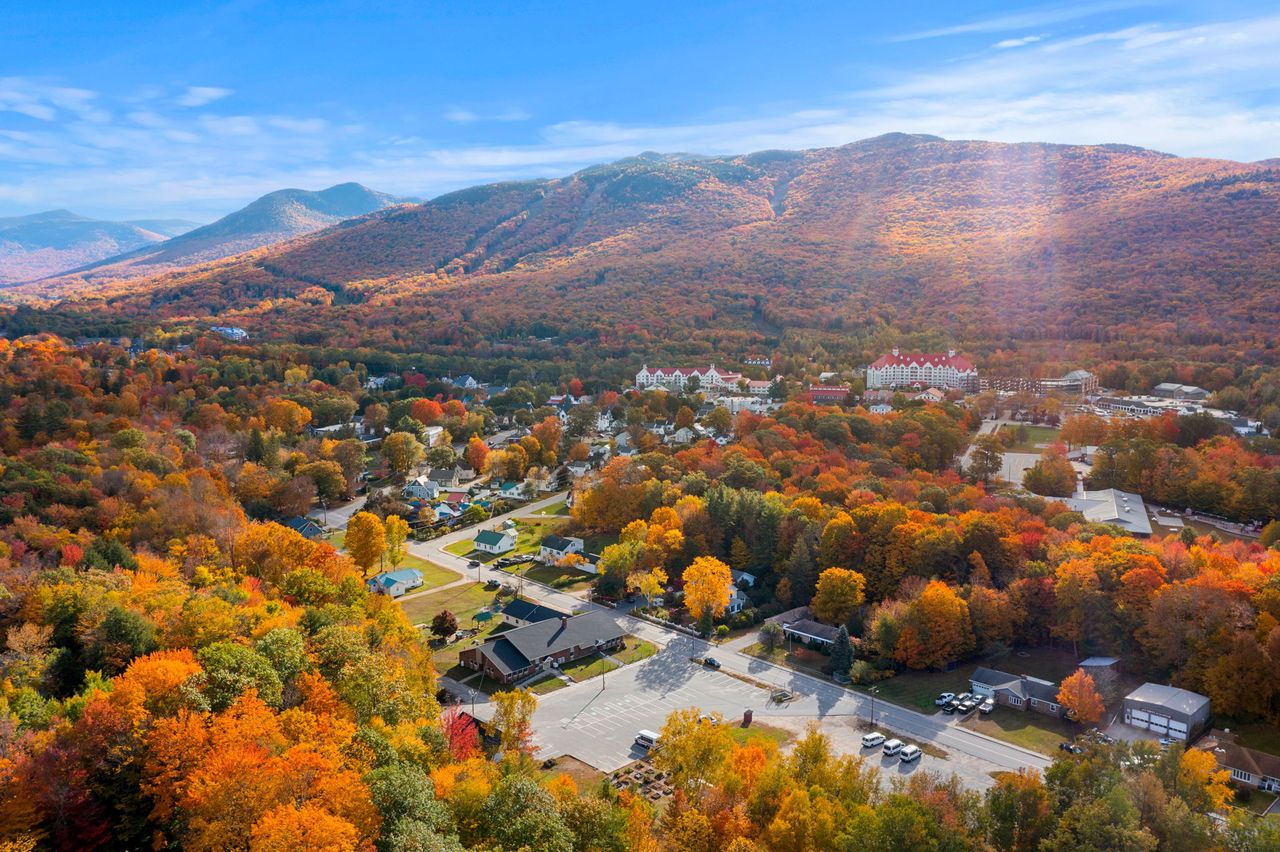
Chocorua in fall is spectacular and it is a madhouse, and you should know both halves before you plan a foliage-season hike. This is one of the signature autumn views in New Hampshire - a bare rock peak over a mirror lake, ringed by turning hardwoods - and it draws crowds to match on the peak weekends, which typically fall in the first half of October, though the exact timing shifts with the year. On those weekends the big Champney Falls lot fills early and stays full, the summit rock gets crowded, and the whole Kancamagus runs slow with leaf-peeping traffic. It is worth it if you plan for it and miserable if you do not.
The plan for a foliage weekend is the same as for any busy day, only more so: be the first car in the lot. Get up in the dark, be at the trailhead at first light, and you will have parking, a quiet climb, and the summit in the morning calm before the crowds and before any afternoon weather. Come at nine or ten on a peak Saturday and you will be circling a full lot and climbing in a line. The early start is not a nicety on a Chocorua foliage day; it is the difference between a great morning and a frustrating one.
There is a slower, gentler way to enjoy the fall view of Chocorua that does not involve the scramble at all, and it is worth mentioning outright. The classic photograph of the mountain is taken from below - from Chocorua Lake and the surrounding roads down in the valley toward Tamworth - not from the summit, and on a peak foliage day the view of Chocorua can be better than the view from it. If the goal is the postcard, or if the weather is wrong for the exposed cone, a drive to the lake overlooks and the lower trails is a fine day in its own right, without the crowds on the rock.
Winter and the shoulder seasons: ice on the cone
The Kancamagus Highway is plowed and open all winter, so unlike some White Mountain trailheads that sit behind a seasonal gate, the Champney Falls lot is reachable year-round. That makes Chocorua an available winter objective - but available is not the same as easy, and the exposed summit that is merely demanding in summer becomes a serious mountaineering proposition under snow and ice. Do not read year-round access as an invitation to treat this as a casual winter walk.
The hazard in winter, and in the long shoulder seasons around it, is the same open cone that defines the hike, now glazed. The sloping summit ledges that are grippy granite in July are sheets of ice in the cold months, and a scramble that a fit hiker manages easily in summer becomes a place where a slip means a long, fast, uncontrolled slide on rock. Full crampons and an ice axe, with the training to use them, are the right tools for the frozen cone, not the light traction that handles a packed snow trail. This is terrain for hikers who already have real winter mountain experience, not a first winter summit.
The shoulder seasons are the sneaky ones, because winter conditions arrive up high before the calendar says winter. From roughly Columbus Day onward, and again into April and even May, the summit ledges can be glazed with ice in a cold dawn while the parking lot still looks like fall - a thin, clear film on sloping rock that is nearly invisible and completely treacherous. Carry microspikes in the pack any time from mid-fall through late spring, even on a mild-looking day, and be prepared to turn around at the base of the cone if you find the ledges iced. A bare-looking trailhead is not a promise about the exposed rock 2,200 feet higher.
Whatever the season, check conditions before you go rather than trusting the season alone. The New England trail-conditions reports and the Mount Washington Observatory higher-summits forecast will tell you what is up on the exposed rock - ice, wind, cold - far better than the weather in town will. In the cold months, plan around short daylight, start earlier than you think you need to, and build your turnaround time around getting off the exposed cone with plenty of light to spare. Winter mistakes on an open summit have a much smaller margin than summer ones.
Water on the mountain, and provisioning on the Kancamagus
Plan Chocorua as a carry-your-own-water hike. The lower Champney Falls Trail follows Champney Brook, so there is water alongside you for the first part of the climb, but it is a modest stream that runs low or dry in a summer dry spell, and above the falls the trail leaves it behind - the whole upper mountain and the exposed summit are dry. You cannot count on filling up partway, especially in late summer, and the scramble on the open cone in full sun is thirsty work. Bring 2 to 3 liters per person in summer heat, and do not ration it so hard on the way up that you are empty on the hot ledges coming down.
If you do draw from Champney Brook, treat it - filter, purify, or boil - as you would any backcountry water in the Whites. But the better plan is not to rely on it. It is easier and safer to carry what you need from the car than to build your day around a brook that may be a trickle, and the parking lot is your last certain water. Fill your bottles before you start, and if you forgot, buy water in Lincoln on the way out rather than gambling on the stream.
That points to the single most important logistical fact about this trailhead, and it is one people from away consistently get wrong: the Kancamagus Highway has no services along its entire length. No gas, no store, no snack bar, no cell signal to speak of for most of it - once you leave Lincoln heading east, there is nothing until you come down into Conway on the far side, and the Champney Falls lot sits out in the middle of that empty stretch. Our Kancamagus Highway guide says the same thing, because it is the thing that strands the unprepared. Arrive with a full tank, your food and water bought, and your map downloaded.
Navigation on the open rock, and descending the right trail
Navigation on Chocorua is easy in the trees and tricky on the open rock, and it deserves its own attention because the mistakes here are both common and consequential. On the wooded lower trail you simply follow a well-worn path. On the bare summit cone there is no worn tread - the route runs over open ledge, marked only by painted blazes and arrows on the rock - and in clear weather that is fine. In cloud or fog, when the summit socks in, those painted marks can be hard to pick out on gray rock, and it becomes surprisingly easy to lose the line and wander on the ledges. If a cloud rolls over you up high, slow down, find the next blaze before you leave the last one, and do not freelance across the rock.
The bigger trap is choosing the wrong trail down. Because Chocorua is climbed from every side and the trails meet near the summit, the top is a junction of several routes that head to trailheads miles apart, on opposite sides of the mountain. Every year, hikers who came up the Champney Falls Trail from the Kancamagus start down the Piper Trail toward Route 16, or one of the southern trails toward Tamworth, and end up far from their car with a long, grim problem to solve. The map and a moment of attention prevent it entirely: before you take a single step off the summit, confirm you are on the Champney Falls Trail heading back the way you came, toward the north and the Kancamagus.
Carry the tools to do this and know how to use them. Download the trail map to your phone before you leave town, because there is no signal to load it at the trailhead, and carry a paper map and compass as a backup that does not run out of battery. A GPS track of your ascent is the simplest insurance of all - if you can see the line you climbed, you can follow it back down, blazes or no blazes. On a clear day none of this is hard. It is the foggy summit and the tired late-afternoon descent that catch people, and those are exactly the times the map earns its place in your pack.
Who this hike is for, the hikeSafe card, and turnaround judgment
Mount Chocorua is for a fit, careful hiker who wants a big, open, memorable summit and is plain about exposure and scrambling. It is not a beginner's first hike and it is not a casual family stroll to a waterfall, whatever the modest elevation suggests. But for someone in reasonable shape who is steady on their feet, comfortable using their hands on rock, and willing to respect the weather, it is one of the finest half-to-three-quarter days in the White Mountains - a real climb to a real summit with a view out of proportion to its height. If that is you, this is a mountain to say yes to.
Two New Hampshire specifics belong in your pocket on Chocorua, and they matter here as much as on any bigger peak. First, under RSA 206:26-bb, New Hampshire can bill a hiker whom Fish and Game judges negligent for the cost of a search and rescue. The voluntary hikeSafe card waives that cost short of true recklessness and helps fund the rescue teams directly - it is 25 dollars for an individual or 35 dollars for a family for 2026, sold through New Hampshire Fish and Game, valid January through December, the same price for residents and visitors. On an exposed, popular summit where weather changes fast, it is a sensible thing to buy the night before.
Second, do not let your phone be your safety plan. Cell coverage is patchy to nonexistent along the Kancamagus and on the mountain, so anything that depends on a signal - live maps, a weather check, a call for help - may simply not work when you need it. Download your maps before you leave the driveway, carry a real map and compass or a GPS unit you know how to use, and leave your route and your expected out-time with a person who will notice if you do not come back. We ask our hiking guests to do exactly this, and we mean it: someone at home who knows you went up the Champney Falls Trail and expected to be down by a certain hour is worth more than anything in your pack if something goes sideways.
Turnaround judgment is the whole discipline on this mountain, because Chocorua hands you a clean, natural decision point built right in - the edge of the trees, where the woods give way to the open cone. That is the spot to make the call before you commit to the exposed rock: is the weather holding, is the rock dry, is everyone steady and unhurried, and is there time to go up and get down with a margin? If the answer to any of those is no, stopping at the tree line and enjoying the near-summit view is a sound decision, not a failure. The scramble is the reward on a good day and the trap on a bad one, and the tree line is where you get to choose which.
The last piece is the one that keeps people out of trouble everywhere around here: turning around is free, and the summit is not going anywhere. Skipping the cone because a storm is building, or turning back on wet ledge, or coming down to the lake view instead of the summit view, costs you nothing but a return trip on a road that is 38 min from our porch. There is no photograph on that summit worth getting hurt for, and the mountain runs on the same schedule every year - good rock, long summer light, the best view in this corner of the Whites. Buy the card, tell someone your plan, and give yourself full permission to turn around.
Safety & conditions
- The exposed summit cone is the main hazard and it is a serious one: bare open rock with no shelter, in a region where thunderstorms build fast on summer afternoons. Lightning is what to plan around on an open summit like this one. Be on the summit in the morning and off the open rock by early afternoon, and treat the first distant rumble of thunder as the signal that your time on the cone is over - if you can hear it, it can strike you.
- Read the Mount Washington Observatory Higher Summits Forecast (mountwashington.org) before you go, not just the valley forecast. Chocorua's bald cone behaves like the high country - colder, windier, and more exposed than town - and the forecast is the best read on wind, cold, cloud, and storm risk up on the rock. High wind alone, without a storm, can make the exposed scramble hazardous; on a windy forecast, consider skipping the summit for the sheltered lower trails.
- The upper mountain is a hands-on scramble on open granite ledge, marked only by painted blazes on the rock. Dry it is fun; wet it is slick, and most slips happen on the way down rather than the way up. Slow down hard on wet slab, test footing before weighting it, keep three points of contact and one person on a pitch at a time, and remember you must down-climb everything you go up. If a pitch feels too much to reverse, do not climb above it.
- Do not descend the wrong trail. Several trails converge near Chocorua's summit and head to trailheads miles apart on opposite sides of the mountain - every year hikers who came up Champney Falls start down the Piper Trail toward Route 16 or a southern trail toward Tamworth and end up far from their car. Before you take a step off the summit, confirm you are on the Champney Falls Trail heading north toward the Kancamagus. Carry a downloaded map, a paper map and compass, and ideally a GPS track of your ascent.
- In fog or cloud the painted blazes on the bare summit rock get hard to follow and it is easy to wander off-route on the open ledge. If a cloud rolls over you up high, slow down and find the next blaze before you leave the last one - do not freelance across the rock. This is exactly when a downloaded map or GPS track earns its place in the pack; there is no worn path to keep you on course on open granite.
- Carry your own water - 2 to 3 liters per person in summer. Champney Brook is alongside the lower trail but runs low or dry in a dry spell, and the entire upper mountain and exposed summit are dry. The hot ledges in full sun are thirsty work; do not ration so hard going up that you are empty coming down. The parking lot is your last certain water, and the Kancamagus has no services to buy more - provision in Lincoln first.
- Near the waterfall, the rock is slick when wet and Champney Brook runs fast and cold in high water. The pretty ledges beside a swollen stream are where people slip - keep back from the edges when the water is up, and admire the falls from a stable spot, not the brink of a cascade.
- Pick up the voluntary hikeSafe card from New Hampshire Fish and Game ($25 individual, $35 family for 2026); New Hampshire can bill negligent hikers for rescue costs under RSA 206:26-bb, and the card waives that cost short of recklessness while funding the rescue teams. Cell coverage is patchy to nonexistent on the Kancamagus and the mountain, so download maps in advance, carry map and compass, and leave your route and out-time with someone who will notice if you are late.
Where to stay for it
This is an all-Kancamagus drive, and it is one of the prettier trailhead approaches we send guests on. From 191 Pollard Road you cross Lincoln to the start of the Kancamagus Highway (NH 112) in a few minutes, then simply follow the Kanc east - up over the height-of-land, past the overlooks, and down the eastern side toward Conway. The large Champney Falls parking area is on the right, roughly 22 to 24 miles and about 38 min from our door, out near the quiet eastern end of the highway. It is a straightforward drive with only one turn that matters, but it is a slow mountain road, so give it more time than the mileage suggests, especially on a foliage weekend when the whole highway crawls. Our Kancamagus Highway guide covers the overlooks and the timing if you want to make a morning of the drive itself.
Provision in Lincoln before you leave, because the Kancamagus famously has no services its whole length - no gas, no store, no snack bar, and little to no cell signal once you are on it. The grocery store and the gas stations in Lincoln are your last stop for sandwiches, extra water, and a full tank; do it the evening before if you are chasing a first-light start at the lot, which on a summer or fall weekend matters at this popular trailhead. Buy your White Mountain National Forest parking pass in town if you would rather skip the self-service machine, download your trail map while you still have a signal, and leave your route and your out-time with someone at home. On a mountain with an exposed summit and fast-changing weather, someone knowing your plan is worth more than anything you can carry.
Sources & official info: outdoors.org · fs.usda.gov · mountwashington.org · hikesafe.com · wildlife.nh.gov
— Launchpoint Lodge, From the lodge