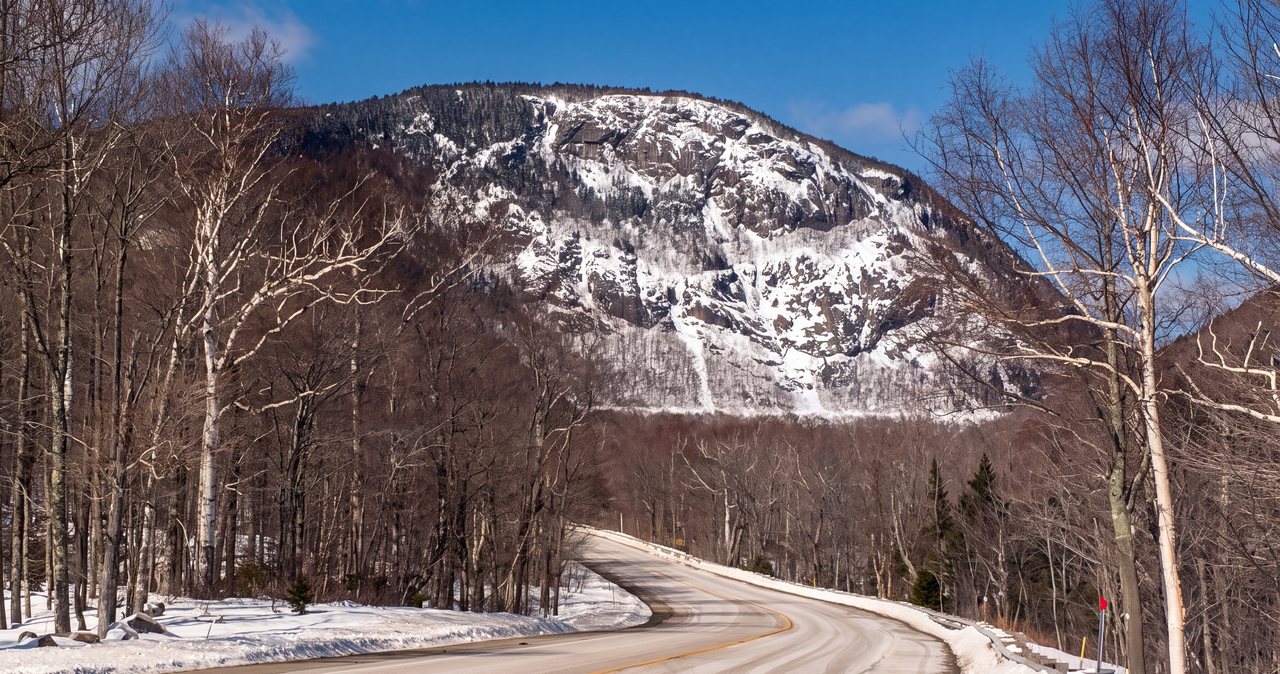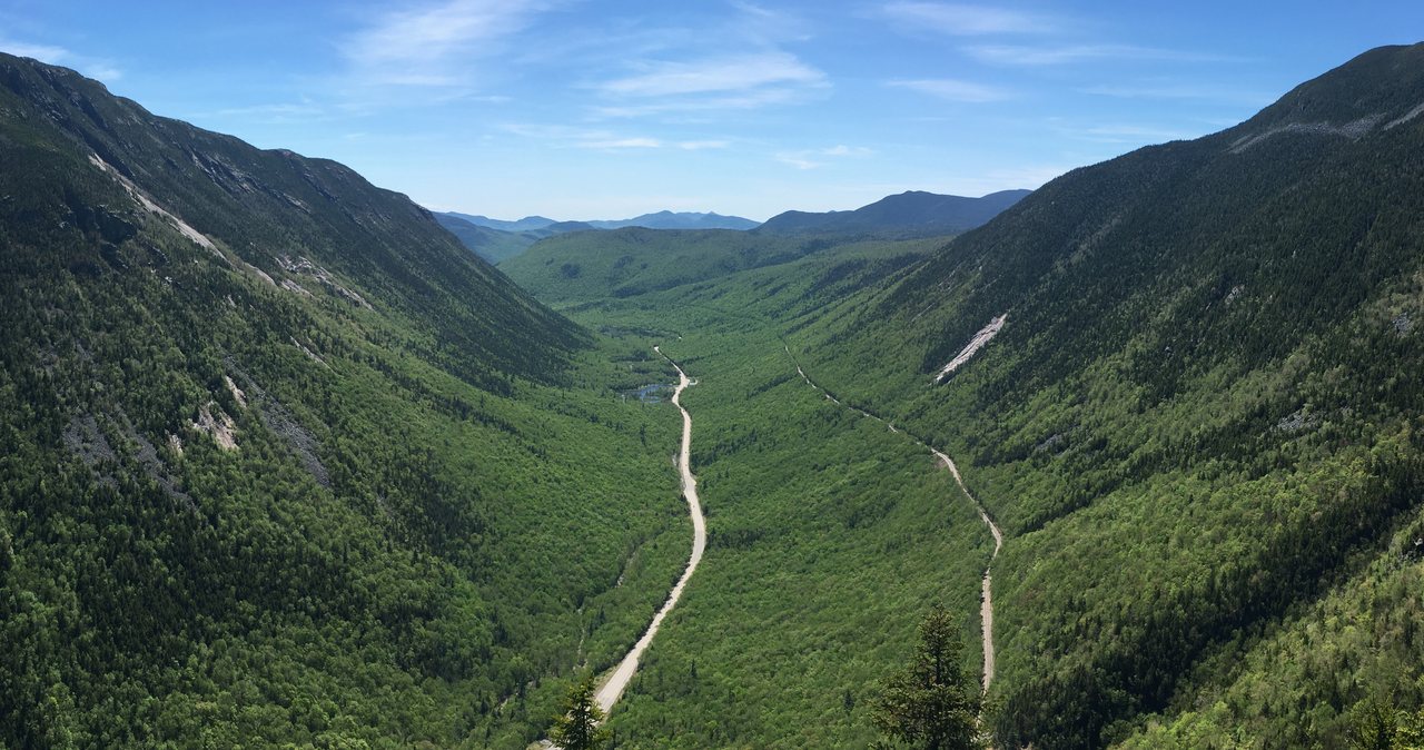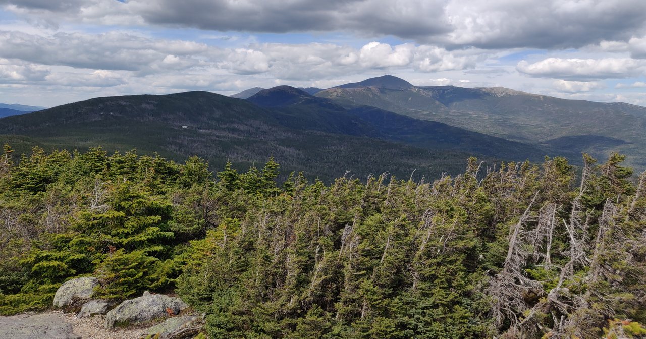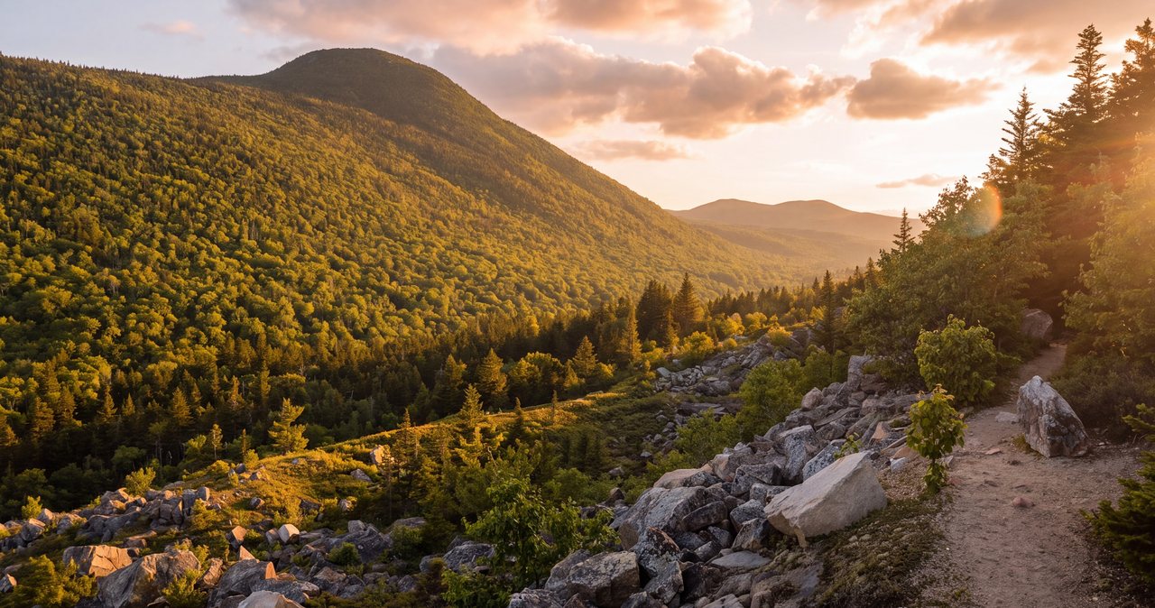
Middle Sugarloaf is the hike we send people to when they want a real summit without a real beating. It is short - about 3 miles round trip on the Sugarloaf Trail - and the climbing is modest, but the top is not a peek through the trees. It is a broad open crown of granite, tilted to the west and south, that hands you one of the best views-per-mile in this whole part of the White Mountains: the Twin Range rising across the Zealand valley, Mount Hale close by, the long Presidential Range off to the east with Mount Washington on the skyline on a clear day, and the wild green bowl of the Zealand valley right below your boots. For a hike most people finish in a morning, that is a lot of mountain to look at.
The asterisk here is a small one, which is exactly why we like this hike. By White Mountain standards Middle Sugarloaf is easy and low-consequence: it stays below treeline the whole way, the grade is friendly, the trail is well worn, and the only hands-on move on the whole route is a short, sturdy wooden ladder near the summit that gets you up a steep step of rock. That ladder is the signature of the hike and, for most people, the best part. The real thing to plan around is not the trail but the road. The Sugarloaf Trail leaves from Zealand Road, a gated Forest Service road that is only open in the warm months, so this is a spring-through-fall hike unless you are willing to walk the closed gate in winter.
What follows is the current, plainspoken version of Middle Sugarloaf for 2026: the real numbers and how the climb feels, the trailhead it shares with the Trestle Trail across the Zealand River, the ladder, the summit ledges and exactly what you are looking at from the top, how to add neighboring North Sugarloaf for a little more, the blueberries that cover the ledges in late summer, the drive up from the lodge on the quiet north side of the notch, and a safety section built for this route rather than a generic mountain. The trailhead is roughly 28 miles and about 40 min from our door, on the far side of Franconia Notch, so read the drive and provisioning notes before you leave Lincoln.
The numbers, and what they feel like underfoot
Start with the stats, because Middle Sugarloaf is the rare White Mountain hike where the numbers are as friendly as they sound. The standard trip is an out-and-back of about 3 miles round on the Sugarloaf Trail to the summit of Middle Sugarloaf, so roughly 1.5 miles each way. Add the short spur over to neighboring North Sugarloaf and you are looking at about 3.4 miles total. Trail apps and guidebooks vary by a few tenths - some put the Middle Sugarloaf round trip a little under three miles, some a little over - because they start measuring in slightly different places, so if you want the mileage to the tenth, trust the AMC White Mountain Guide or the White Mountain National Forest over any single app.
The climbing is gentle for the Whites. The Zealand Road trailhead sits down around 1,600 feet, and the summit is 2,539 feet, so the net gain to Middle Sugarloaf is only about 900 feet; count in a bit of up and down and the short climb over to North Sugarloaf and the day's total runs somewhere in the 900-to-1,100-foot range, depending on whose GPS you believe. Compared with the 3,500 and 4,000-foot days on the big peaks in these mountains, that is almost nothing, and it is the whole reason this hike works as a rest day. If you want the gain confirmed to the foot, again the AMC guide is the source to trust, and we would rather give you the true range than a false precision.
What that adds up to underfoot is a pleasant, steady climb rather than a grind. The first stretch from the road is easy, along and across the Zealand River, then the Sugarloaf Trail settles into a moderate grade through hardwood and birch forest, switchbacking up the shoulder of the mountain. There is no long scramble and nothing you would call exposed in the mountaineering sense - just one short wooden ladder near the top, which we give its own section below because it is the one genuine hands-on move and the thing people remember. Most reasonably fit hikers are on the summit in an hour to an hour and a half, and the full round trip to Middle Sugarloaf runs about two to three hours with time on the ledges.
The one thing to set straight before you go: easy is not the same as trivial. This is still a real mountain trail with roots, rock, a ladder, and a big open summit that catches real weather, not a paved nature path. Wear proper shoes, carry water and a layer, look at the forecast, and treat the ledges with the same respect you would give any open summit when the rock is wet or the sky is turning. Do that and Middle Sugarloaf gives you a big-mountain view for a small-mountain effort - which is exactly what a rest day wants.
Why this is the area's best rest-day hike
Every serious hiking trip needs an easy day, and Middle Sugarloaf is the one we recommend most for the leg between big climbs. The reasons stack up. It is short and low, so it does not cost you much and you can sleep in and still be home for lunch. It is a genuine summit with a genuine view, not a consolation walk, so it does not feel like a wasted day. And the payoff - a wide-open granite top with the Twin Range and the Presidentials laid out in front of you - is out of all proportion to the effort it takes to get there. Hikers who have just come off a hard ridge often say this is the hike they enjoyed most, precisely because they had the legs to enjoy the view.
It also sits in a quieter corner than the Franconia Notch trailheads that draw the crowds. The Sugarloaf Trail leaves from Zealand Road on the north side of the mountains, near Twin Mountain and Bretton Woods, and while it is popular and can fill its small lot on a foliage weekend, it is a world calmer than the parking chaos at Lafayette Place or the Flume. You get a real summit without a real fight for parking, and on most weekdays you will have long stretches of the trail and the ledges to yourself.
The ladder is part of the appeal too, in truth. There is something satisfying about a hike where the last move to the summit is climbing a wooden ladder up a step of rock and then walking straight out onto an open granite dome. It gives the hike a little sense of adventure without any real risk in good conditions, and it is the kind of thing people talk about afterward. Pair all that with blueberries on the ledges in late summer and the option to tick a second little summit next door, and Middle Sugarloaf earns its spot as our standing recommendation for a low-key day.

The trailhead, the Trestle Trail, and the Zealand River start
The hike starts from the Sugarloaf Trail trailhead on Zealand Road, a Forest Service road that leaves the south side of US Route 302 between the village of Twin Mountain and Bretton Woods. The trailhead is only about a mile up Zealand Road, near the Sugarloaf campgrounds, just after the road crosses the Zealand River - so unlike the Zealand Trail, which runs to the very end of the road about three and a half miles in, you do not drive the whole road to get here. There is a Forest Service parking area at the trailhead. It is not large, and on a peak foliage Saturday it can fill by mid-morning, so arrive early or have a backup in mind, and park in the lot rather than blocking the road or the campground.
The Sugarloaf Trail shares its start with the Trestle Trail, a short, flat riverside loop named for an old logging-railroad trestle that once crossed here - this whole valley was heavily logged a century ago, and the Zealand area is one of the classic stories of forest coming back. The two trails leave together and cross the Zealand River near the trailhead. In normal summer flow this crossing is easy and quick, and the bigger water is behind you within the first few minutes of walking. Pay attention at the junctions in the first stretch so you stay on the Sugarloaf Trail where it splits away from the Trestle loop and starts climbing; the signage is generally good, but the flat riverside braid of paths near the start is the one place people take a wrong turn.
One thing worth knowing before you drive up: because the trailhead is on a seasonal, gated road, its status is tied to the road's status, which we cover in its own section below. In the 2026 hiking season the road is open and you can drive right to the trailhead. In the winter months, when the gate is closed, the hike is still doable but it starts with about a mile of road walking each way, which changes the character of the day entirely. Confirm the current road status with the White Mountain National Forest before you count on driving to the trailhead, especially early or late in the season.
The trail, step by step
From the parking area the Sugarloaf Trail sets off with the Trestle Trail, easy and nearly level, and crosses the Zealand River near the start. Enjoy this opening - it is the flat warm-up before any real climbing, along a pretty stretch of river. Keep an eye on the signs where the Sugarloaf Trail leaves the Trestle loop and turns to climb; once you are on the climbing trail the route is obvious and well worn, so route-finding down low is simple.
The Sugarloaf Trail then settles into a steady, moderate grade up the shoulder of the mountain through hardwood and white-birch forest, with a few switchbacks to ease the pitch. This is the real middle of the hike, where you gain most of your elevation at a reasonable angle with your head down. The footing is ordinary White Mountain trail - roots, some rock steps, a few spots that hold mud after rain - nothing technical, but shoes with grip earn their keep. The forest is shady and quiet, good climbing on a warm day, and you will notice the trees thin and shrink as you gain height toward the ledges.
Near the top the trail reaches the col, or low point, between Middle and North Sugarloaf, where a junction lets you choose your summit. For Middle Sugarloaf you turn and climb the final steep step of the mountain, and this is where the wooden ladder comes in - it lifts you up a short pitch of rock that would otherwise be an awkward scramble, and it deposits you almost directly onto the open summit ledges. It is the one genuine hands-on move on the hike and it is short; more on it in the next section.
Above the ladder the trees fall away and you walk out onto the broad, open granite crown of Middle Sugarloaf. Up here the trail is a matter of following worn rock and any cairns rather than a dirt tread, so in good visibility it is trivial, but fix in your mind where you came up over the ladder so the way down is obvious - an open summit is exactly where people get briefly turned around in cloud or fading light. The summit is big enough to wander, so take a minute to find the west and south-facing edges, which is where the view opens up.
The wooden ladder near the top
The signature of this hike is the wooden ladder near the summit of Middle Sugarloaf, set on the final steep step of rock on the mountain's north side. It is a sturdy, purpose-built ladder bolted to the ledge, a handful of rungs tall, and it turns what would be an awkward little cliff into a quick, secure climb. For most people it is the highlight of the day and the thing they photograph - a proper wooden ladder in the woods, with the open summit waiting right at the top of it. Kids and nervous first-timers usually love it, and confident hikers barely break stride on it.
It is also the one place on the route where conditions matter, so treat it with a little respect rather than none. Dry, it is easy and safe. Wet, frosted, or iced, the rungs and the rock around them get slick, and a ladder is a bad place to slip. Take it one rung at a time, keep three points of contact, and face the ladder on the way down rather than trying to walk down it forward. In the shoulder seasons and winter, ice on and around the ladder is a real thing - one local hiker's account we read specifically flagged worrying about ice on it - and on a hard, icy day it can be treacherous or effectively impassable without traction and good judgment. That is a fair reason to turn around, and turning around on a hike this short costs you almost nothing.
If you are hiking with a dog, the ladder is the crux for them too, and we cover that candidly in the dogs section below - most dogs cannot climb a vertical ladder, so plan for it before you are standing at the bottom of it looking up.
The summit ledges and the view: Twins, Presidentials, and the Zealand valley
The reason to climb Middle Sugarloaf is the summit, and it is an unusually generous one for such a modest peak. The top is a broad, open dome of granite that tilts to the west and south, so instead of a viewpoint you peer out from, you get acres of bare rock to walk around on, with the view opening in a wide arc in front of you. There is room to spread out, find a flat spot, eat lunch, and turn slowly through the whole scene, and on most days there is space even when a few other groups are up there.
The dominant sight is the Twin Range across the Zealand valley to the south and southwest - the big wooded masses of North Twin and South Twin, with Mount Hale closer in and the long green ridge running back toward Zealand Notch and the Bonds beyond. Directly below you the Zealand valley spreads out, a wide, wild, reforested bowl that is one of the classic recovered-wilderness landscapes in the Whites. Swing your eye to the east and, on a clear day, the Presidential Range lines the horizon, with Mount Washington and its neighbors standing over the Bretton Woods valley - a lot of skyline for a 2,539-foot summit. To the north and northwest you look out over the Twin Mountain area toward Cherry Mountain and the country along US 302.
One thing to know about the view, because we would rather set the expectation than oversell it. Middle Sugarloaf is low, so the far peaks read best on a clear or clearing day; on a soft, humid summer afternoon the distant Presidentials can wash out into haze even when the near Twin Range is sharp. This is a hike to save for good visibility if the view is the point. If the valley is socked in, the climb still goes and the ledges are still a fine place to sit, but you will be looking at gray, so watch the forecast and pick your day - the weather section below has more on that.
The open granite is also the one place to mind your footing on the summit itself. Bare rock that is grippy and pleasant when dry turns slick when it is wet with rain or dew, glazed with frost, or holding ice, and the west and south edges of the dome drop away, so the spots people wander to for the best photo are exactly the spots to be careful near when the rock is anything but dry or the wind is up. Keep back from the lip, move deliberately on wet rock, and enjoy the view from a seat rather than from the edge.
Adding North Sugarloaf for a little more
If you have the time and the legs, North Sugarloaf is an easy add-on that most people tack on almost as an afterthought. From the col between the two peaks - the junction you passed on the way up to Middle Sugarloaf - a short trail climbs the other way to the summit of North Sugarloaf at 2,310 feet, a little lower than its neighbor. The extra distance is small, bringing the day to roughly 3.4 miles total, and the extra climb is modest, so it is a cheap second summit.
North Sugarloaf has its own open ledges and its own view, tilted more to the north and east, so it is not a repeat of what you just saw from Middle Sugarloaf. Between the two little summits you get the view in two directions for barely any added effort, which is a good deal on a day you are trying to keep easy. Plenty of hikers do both without really planning to, simply because the junction is right there and the second summit is so close.
There is no obligation, though, and that is part of what makes this a good rest-day hike. If the weather is turning, if your legs are done, or if you just want to sit on the Middle Sugarloaf ledges and then go home, skip North Sugarloaf with a clear conscience - the main event is Middle Sugarloaf, and you will not have missed the reason you came. Save North for next time, or for the day you bring someone who has not done it.
Blueberries and the open ledges in late summer
One of the quiet pleasures of Middle Sugarloaf is the blueberries. The open, sunny granite ledges near the summit grow low-bush wild blueberries, and in a good year, roughly late July into August, the plants around the edges of the summit dome carry ripe fruit. It is a nice thing to arrive on the top of a small mountain, take in the Twin Range, and then graze a handful of wild blueberries off the ledge while you sit. The timing shifts year to year with the spring and the weather, so treat late July through August as the window rather than a guarantee, and understand that a wet or cold season can thin the crop.
A few clear manners on the berries. This is national forest, and personal-use berry picking is fine, but pick lightly and leave plenty - you are not the only one who wants them, and you are not the only species, either. These mountains are black-bear country, and blueberry ledges are exactly the kind of place bears feed in late summer. That is not a reason for alarm - encounters are uncommon and bears here generally want nothing to do with you - but it is a reason to stay aware, make normal noise, keep any food packed, and not get so absorbed in picking that you stop paying attention to the ledge and the weather around you.
Even outside berry season the open ledges are the whole reward of the hike, so plan to linger. Bring a proper snack or lunch, something to sit on for the warm rock, and enough water, and give yourself time on top rather than treating the summit as a turnaround point. The climb is short enough that you can afford to sit for a while, and the view earns it.
Zealand Road, the seasonal gate, and the fee
The single logistical thing that governs this hike is Zealand Road. It is a gated, seasonal Forest Service road off US Route 302, not a year-round public road, and the Sugarloaf Trail trailhead sits about a mile up it. In the warm months the gate is open and you drive right to the trailhead; in winter the road is not plowed and the gate is closed, so the hike gains about a mile of road walking each way just to reach the trail. The road is open for the 2026 season. The exact opening and closing dates move year to year with the snow and with Forest Service scheduling - seasonal White Mountain roads like Zealand, Tripoli, Sawyer River, and the Gale River loop typically open in mid-to-late spring and close in the fall - so confirm the current status with the White Mountain National Forest before you drive up, especially in the shoulder seasons when the date is a coin flip.
This is a White Mountain National Forest fee area, so you need a recreation pass displayed at the trailhead to park. For 2026 that is about $5 for the day of purchase, $30 for an annual pass, or $40 for an annual household pass, and the federal America the Beautiful pass at $80 covers it too if you already carry one. There is usually a self-serve pay station at the trailhead where you can buy a day pass, so bring a few dollars. Fees do change, so if you want it confirmed to the dollar, check the current rate with the White Mountain National Forest before you go. The voluntary hikeSafe card is a separate thing and is covered in the safety notes below.
It is also worth saying that this hike is not affected by the 2026 Lincoln Woods closure that has been in the news. That closure - the Lincoln Woods Trail near the Kancamagus, in effect roughly June through November 2026 for riverbank repair - is on the other side of the region and touches deep Pemigewasset routes like Owl's Head, the Bonds, and 13 Falls, not the Sugarloaf Trail. Zealand Road and the Sugarloaf Trail are open and unaffected. So if you have read about a Pemi-area closure, rest easy: it does not touch Middle Sugarloaf.
Winter and the shoulder seasons
Middle Sugarloaf can be a lovely cold-season hike, but the gated road changes the math and you should plan for it. With Zealand Road closed and unplowed in winter, you park at the gate on US Route 302 and walk the road to the trailhead - about a mile each way - before you even start climbing. That extra couple of miles of flat road, often on packed snowmobile-hardened snow, is not hard, but it makes the day longer than the trail mileage suggests and it means starting earlier, especially given short winter daylight. Carry a headlamp as a matter of course.
On the mountain, winter turns the friendly summer grade into a traction problem, and the two features that make this hike fun in summer become the things to respect in winter. The wooden ladder near the summit ices up - rungs and the rock around them can be glazed, and a ladder is a poor place to slip - and the open summit ledges can be scoured to hard, wind-blasted ice or drifted deep with snow that hides the rock and any cairns. Microspikes are the practical minimum for the icy tread and the ledges, snowshoes earn their place after fresh snow on the road and the climb, and on a hard, icy day the ladder step calls for genuine care or a turnaround.
The shoulder seasons - late fall and early spring - are the sneaky ones, because the road may be gated but the ground is not yet in practical winter shape, and you can hit bare trail low down and ice up high, or open water at the Zealand River crossing with icy rocks along the banks. Carry traction even when the trailhead looks bare, expect the summit to be colder and windier than the parking area by a wide margin, and be willing to turn around at the ladder if it is iced beyond your comfort. None of this makes Middle Sugarloaf a hard winter peak - it is one of the gentler ones - but it is a winter hike in winter, with winter gear and winter judgment, not a summer walk in the snow.
Weather, the higher-summits forecast, and turnaround judgment
Middle Sugarloaf stays below treeline and is wooded almost to the top, so it does not carry the life-threatening alpine exposure of the Presidentials, and you should not go in braced for a Mount Washington epic. That is a big part of why it is such a good easy day. But it is still a mountain with an open summit, and this is above all a view hike, so the weather deserves a look before you drive up. Check a valley forecast for the Twin Mountain and Bretton Woods area, and glance at the Mount Washington Observatory Higher Summits Forecast at mountwashington.org. That forecast is written for the big peaks and this little summit is far tamer, but it is the best single read on what the weather moving through the region is going to do, and it is free.
The sky matters here for two reasons. First, this is a hike you climb for the view; if the Twin Range and the Presidentials are buried in cloud you will do the whole trip and see gray, so it is worth saving Middle Sugarloaf for a clear or clearing day and being willing to swap it for a valley walk or a waterfall when the forecast is murk. Second, and more seriously, the bare summit ledges are exposed to lightning, and summer thunderstorms build fast and mean over these mountains on hot afternoons. An open granite dome is a poor place to be when one arrives. The discipline is the usual one: start early, be up and back off the open rock before the afternoon, watch the sky to the west, and treat the first distant thunder as your cue to get off the summit and down into the trees, not as a reason to grab one more photo.
Turnaround judgment on a hike this short is refreshingly cheap, and that is a feature, not a failure. Because the whole climb is under two miles, bailing costs you almost nothing, so give yourself firm permission to do it. If the ladder is iced beyond your traction, if a storm is building, if the cloud has dropped onto the summit so there is nothing to see, or if the open rock is glazed and slick, those are all good reasons to shorten the day or turn back, and none of them is a defeat. An easy summit is exactly the kind of place where people get casual and push on when they should not, precisely because it feels small - so treat it like the real, if gentle, mountain it is.
Dogs, footing, what to carry, and the quiet-country reality
On dogs, since guests always ask: leashed dogs are allowed on the Sugarloaf Trail, as on most White Mountain National Forest trails, and plenty of people bring them. The practical catch on this particular hike is the wooden ladder near the summit. Most dogs cannot climb a vertical ladder, so you need a plan before you are standing at the bottom of it - a small dog you can lift or hand up and down, but a big dog often simply cannot make that step, and forcing it is how dogs and owners both get hurt. Some hikers find a rough scramble around the side, but it is steep and not a sure thing, so go in expecting the ladder to be the deciding obstacle. Carry water for the dog, since the ledges are dry, keep it leashed and close on the open rock and near the edges, and be ready to turn around at the ladder. The standing note for our guests is the plain one: the lodge is adults-only and pet-free, so hiking with a dog means arranging for it somewhere other than here, and this is an adults' outing from an adults-only house, not a hike to bring children back from to the lodge.
On footwear and gear, treat this as the real mountain hike it is even though it is easy. Wear boots or trail shoes with genuine grip for the roots, the rock steps, the ladder, and especially the open summit ledges, which are slick when wet - smooth-soled sneakers are the wrong tool. Carry a wind or rain layer even on a fair forecast, because the open top runs cooler and breezier than the sheltered woods. Bring more water than the short mileage suggests if it is warm, sun protection for the exposed rock, a map you have downloaded before you lost signal, a headlamp, and enough food to enjoy a long sit on the ledges. Trekking poles are nice on the descent but not essential. In the cold months, microspikes are not optional - see the winter notes above.
Two New Hampshire specifics belong in your pack on any hike in these mountains, and an easy, quiet peak is exactly where people forget them. First, carry the hikeSafe card. New Hampshire can bill a hiker judged negligent for a rescue under RSA 206:26-bb, and the voluntary hikeSafe card waives that cost, short of true recklessness, while helping fund the rescue teams. It runs $25 for an individual or $35 for a family in 2026, sold through New Hampshire Fish and Game, and you can read the details at hikesafe.com. Second, do not let your phone be your safety plan - cell coverage on Zealand Road and this stretch of US 302 is patchy at best, so download your map before you leave the lodge, carry the ten essentials scaled to the day, and tell someone your route and expected out-time. We ask hiking guests to leave a plan and an out-time with someone at home, and we mean it as much on a gentle 2,539-footer as on a big peak, because a small mountain does not know it is small when something goes wrong.
Safety & conditions
- This is a below-treeline hike, so it does not carry the sustained alpine exposure of the Presidentials - one of the reasons it makes such a good easy day. But do not read easy as nothing can go wrong: the summit is open rock that gets real wind, cold, and weather, and the whole route is a genuine mountain trail, so bring proper shoes, water, a layer, and a look at the forecast.
- The wooden ladder near the summit is the one genuine hands-on move and the one place conditions matter. Dry it is easy; wet, frosted, or iced the rungs and surrounding rock get slick, and a ladder is a bad place to slip. Take it one rung at a time, keep three points of contact, and face the ladder going down. In the cold seasons, ice on and around the ladder can make it treacherous or effectively impassable without traction - a fair reason to turn around on a hike this short.
- The open summit ledges are bare granite that ends in drops on the west and south sides. Grippy when dry, they turn slick when wet with rain or dew, glazed with frost, or holding ice, and the edges people wander to for the best photo are exactly where footing matters most. Keep back from the lip, move deliberately on wet rock, and take in the view from a seat rather than the edge, especially in wind.
- The open dome is exposed to lightning, and summer thunderstorms build fast over these mountains on hot afternoons. Start early, be up and back off the open rock before the afternoon, watch the sky to the west, and treat the first distant thunder as your cue to get off the summit and down into the trees rather than lingering for one more photo.
- The Zealand River crossing near the start is normally an easy step-across, but in spring snowmelt or after heavy rain it runs higher, faster, and colder - give it respect, and read high water as a signal that the ladder and ledges above will be wet and slick too. It is a low-consequence crossing compared with the big fords elsewhere in the Whites, but wet rock at the crossing still turns ankles.
- Navigation is simple in the woods but easy to muddle on the open summit, where the route is worn rock and cairns rather than a dirt tread. Fix in your mind where you came up over the ladder so the way down is obvious, find the next cairn before you move in poor visibility, and be extra deliberate in cloud or fading light and on the descent, when most people wander off-line.
- Zealand Road is gated and unplowed in winter, adding about a mile of road walking each way to the trailhead and making for a longer, earlier day - carry a headlamp and start early. In the cold months the ladder and ledges ice up; microspikes are the practical minimum, snowshoes earn their place after fresh snow, and the shoulder seasons can serve up bare trail low down and ice up high, so carry traction even when the trailhead looks clear.
- Carry the New Hampshire hikeSafe card ($25 individual, $35 family for 2026 from NH Fish and Game, at hikesafe.com). New Hampshire can bill a hiker judged negligent for a rescue under RSA 206:26-bb, and the card waives that cost, short of recklessness, while helping fund the rescue teams. Cell coverage up here is patchy, so do not lean on your phone - download your map before you leave, carry the ten essentials even on a short hike, and tell someone your route and out-time.
Where to stay for it
The drive takes you up and over the north end of the mountains, so it is a different route from the Kancamagus hikes, and it is a pretty one. From 191 Pollard Road you get onto I-93 North and run up through Franconia Notch - the parkway section is scenic and slower, with the Old Man site, the Basin, and the notch cliffs going by - to Exit 35. From there take US Route 3 North to the village of Twin Mountain, then turn east on US Route 302 toward Bretton Woods. Zealand Road is a Forest Service road on the right off US 302, a couple of miles past Twin Mountain, and the Sugarloaf Trail trailhead is about a mile up it, near the Sugarloaf campgrounds just after the road crosses the Zealand River. Figure roughly 40 min with a clear road, longer on a busy foliage day when the notch and US 302 fill with leaf-peepers. Remember that Zealand Road is gated and seasonal, so confirm it is open before you make the drive in the shoulder seasons.
Provision in Lincoln before you leave, where the grocery store, gas, and coffee are all easy - pick up water, snacks, and a lunch to eat on the ledges, and top off the gas tank. If you forget something, the village of Twin Mountain, right at the US 3 and US 302 junction just before the turn onto Zealand Road, has a gas station and a small general store that make a handy last stop, but do not count on much beyond that once you turn onto the forest road, and cell signal up here is patchy, so download your trail map while you still have one. Leave your plan and your expected out-time with someone at home. On the way home, this side of the mountains gives you easy options: the Franconia Notch attractions - the Basin, the Flume, Lonesome Lake - are strung right along the drive back, so an easy morning on Middle Sugarloaf pairs naturally with a short afternoon stop in the notch.
Sources & official info: outdoors.org · fs.usda.gov · 1happyhiker.blogspot.com · mountwashington.org · hikesafe.com
— Launchpoint Lodge, From the lodge