The Willey Range traverse is how a lot of people climb three New Hampshire 4,000-footers in one day, and on the map it looks tidy: Mount Tom at 4,051 feet, Mount Field at 4,340, and Mount Willey at 4,285, all strung along one wooded ridge on the west wall of Crawford Notch, all reachable from a single trailhead at the Crawford Depot. Do the full loop and you cover about 10 miles and climb somewhere in the range of 3,000 to 3,400 feet, ticking three summits off the list in a single outing. That efficiency is the whole appeal, and it is a real one - if you are working through the forty-eight, this is one of the better three-for-one deals in the mountains.
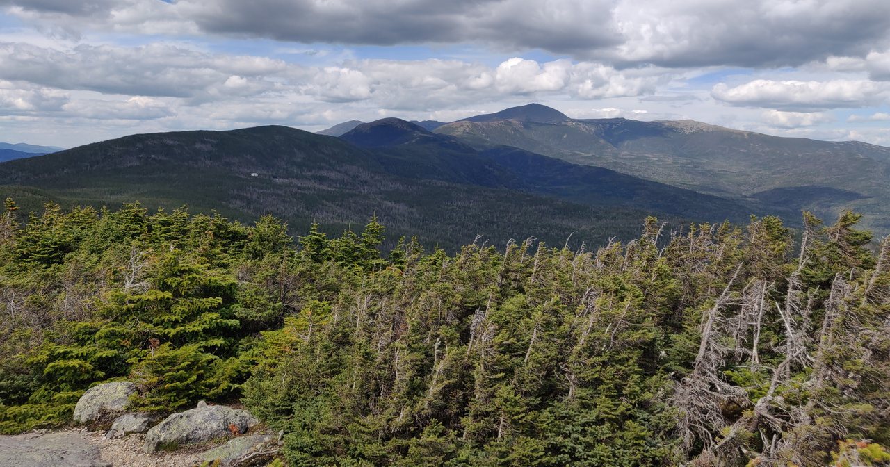
But it helps to know before you drive up that this range is a woods-walking day more than a view day. All three named summits are in the trees, and two of them give you almost nothing to look at. The best view of the entire day comes from Mount Avalon, a 3,400-foot bump you pass on the way up that is not even on the 4,000-footer list. The long push out to Willey and back adds real distance, a steep drop-and-reclimb, and a set of wooden ladders, which is exactly why a great many sensible hikers do Tom and Field only - about 7 miles - and go home satisfied. We will lay out both versions candidly so you can pick the right one for your legs and the forecast.
This is the current, 2026 version: the real numbers and how they stack up, the route junction by junction, Mount Avalon as the sleeper highlight, what you see from each wooded top, the ladders on Willey's south side and the shuttle trap of descending them, the gray jays that will land on your hand, what winter turns this range into, and the plain safety cautions for a below-treeline day that still tops out above 4,000 feet. It starts from the same Crawford Depot lot as our Mount Willard hike, about 45 min from our door, and the two make a natural pair of trips from the same parking area on the same stretch of Route 302.
The numbers
Start with the stats, because they decide which version of this hike you should do. The full Willey Range outing - Mount Tom, Mount Field, and Mount Willey from the Crawford Depot, out along the Avalon Trail and A-Z Trail and back over Field down the same way - runs about 10 miles round trip. Published figures wander a bit, from roughly 9.8 to 10.5 miles depending on who measured and exactly which spurs they counted, so call it a solid ten and plan your day around that, not around a hopeful nine. Cumulative climbing lands somewhere around 3,000 to 3,400 feet, which is more than you would guess from the summit heights alone, and there is a specific reason for that we will come back to.
The elevations themselves come with a clear footnote. The numbers hikers use - Field 4,340 feet, Willey 4,285, Tom 4,051 - are the figures on the Appalachian Mountain Club's Four Thousand Footer list, the list that governs whether a peak counts. The AMC list heights are the ones that matter for the peakbagging list and the ones you will see on other trip reports. Mount Field is the high point of the range either way.
What makes the cumulative gain higher than the raw heights suggest is the shape of the ridge. Between Mount Field and Mount Willey the trail drops hard into a deep col and then climbs back up the far side to Willey - and because Willey is a dead end on this route, you turn around and pay that drop back a second time, re-climbing toward Field on the way home. So the last three-ish miles out to Willey and back deliver a disproportionate share of the day's total climbing and a good chunk of its fatigue. That is the single biggest reason the two versions of this hike feel so different, and the reason the decision at Field is the real crux of the day.
On time, budget about 6 to 9 hours car to car for the full three at a normal pace, less if you are fit and moving steadily and not lingering to feed birds, more if the trail is rough, wet, or snowed in. The shorter Tom-and-Field version - about 7 miles - runs closer to 4.5 to 6 hours. Neither is a technical climb; there is no exposed scrambling and nothing you need a rope or real hands-and-feet moves for. What you are signing up for is a long walk on rooty, rocky, sometimes steep and laddered footpath, entirely in the woods, at elevations where the weather can still be raw. Treat it as the all-day 4,000-footer outing it is.
The route, junction by junction
The hike begins behind the Crawford Depot, the little Victorian railroad station right on US Route 302 at the top of Crawford Notch, and the first hundred yards are shared with our Mount Willard hike - see that guide for the full picture of this trailhead, because it is the same lot and the same start. You cross the active railroad tracks, used by the Conway Scenic Railroad's seasonal excursion trains, and pick up the Avalon Trail. In about a tenth of a mile the Mount Willard Trail branches left; you stay straight, or right, on the Avalon Trail, and that single junction is the fork between an easy afternoon on Willard and a full day on the Willey Range.
The Avalon Trail climbs steadily through the woods, crossing Crawford Brook a couple of times low down, and after roughly a mile and a third reaches the short spur to Mount Avalon. Take it - the tenth-of-a-mile scramble up to Avalon's open ledge is the best view of the day and we give it its own section below. Back on the main trail, a bit farther on you reach the junction with the A-Z Trail. This is where the loop's plumbing gets busy, so pay attention to the signs: you turn onto the A-Z Trail and follow it a short distance to the height of land, where the Mount Tom Spur splits off to the north.
The Mount Tom Spur runs about six tenths of a mile one way, gently, to the wooded summit of Mount Tom - an out-and-back you will retrace to get back to the junction. From there you pick up the Willey Range Trail heading south, climbing to Mount Field, the high point, about nine tenths of a mile along. Field is the natural decision point of the day: from here you either turn around and head home for the Tom-and-Field version, or commit to the long out-and-back to Willey.
If you go on, the Willey Range Trail drops steeply from Field into the col and climbs the far side to Mount Willey, roughly 1.4 miles each way from Field, with the steep steps and ladders that Willey is known for. Willey is the end of the line for the standard route: you turn around there and reverse the whole thing - back over the col, back over Field, back to the A-Z and Avalon Trails, and down to the Depot. It is not a true loop but an out-and-back with a couple of short spurs, and the re-climb over Field on the return is the part tired legs remember. Do not be tempted to descend Willey's steep south side to shortcut the day; that leads somewhere else entirely, which is the subject of its own section here.
Mount Avalon: the best view of the day is not a 4,000-footer
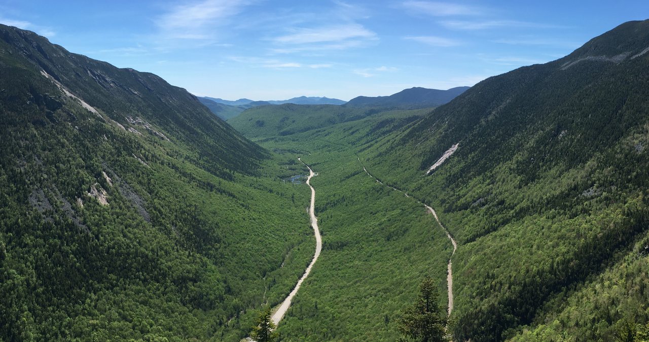
Here is the thing to know before you are up there: the finest view on this entire hike comes from a peak that does not count. Mount Avalon, about 3,400 feet - sources list it anywhere from 3,399 to 3,442 - sits right on the way up, a tenth of a mile off the Avalon Trail by a short, steep, rooty scramble to an open rock ledge. From that ledge you get a excellent panorama: straight across Crawford Notch to the cliffs of Mount Webster and the slopes of Mount Jackson, up the notch toward the southern Presidentials, and along the very ridge you are about to walk. It is the payoff the three big summits mostly withhold, handed to you for a 5 min detour.
Because it is so easy to reach and so much better than what waits above, Mount Avalon is worth building into your plan rather than treating as an afterthought. Many people who are not chasing the 4,000-footer list hike the Avalon Trail to this ledge and Mount Field and call it a day - a shorter, saner trip with the best view included. And if the weather is marginal or your legs are done, Avalon is the consolation that makes the drive worth it even when you bail on the summits. On the way down at the end of a long day, it is also a fine place to sit for the last good look before you drop back into the trees.
The one caution is the small one that comes with any open ledge: the top of the Avalon spur is exposed rock with a drop-off, it gets slick when wet or icy, and the scramble up to it uses your hands over a couple of steep steps. It is very manageable in dry conditions and plenty of people bring kids up it, but it is steeper than the woods-walking of the rest of the lower trail, so slow down for it, especially coming down and when the rock is wet. Take the view, keep back from the edge, and enjoy that you got the best of the day for the least of the effort.
Three wooded summits, and what you see
Manage your expectations up top, because this range does not do grand summit reveals. Mount Tom, first of the three, is a broad wooded dome with a small clearing at the top and a herd path leading a short way to a limited outlook - on a clear day you can pick out the northern Presidentials and the Bretton Woods valley through and over the trees, but it is a peek, not a panorama. Tom's real character at the top is the gray jays, which we give their own section; the summit clearing is one of the classic spots in the Whites to have a bird land on your hand. It is a pleasant, low-key place to stand, not a viewpoint you drove all this way for.
Mount Field, the high point at 4,340 feet, is the most thoroughly wooded of the three and the closest to a true viewless summit. There are one or two small outlooks near the top - a gap in the trees toward the Presidentials and Bretton Woods from just north of the summit, and another that looks off toward the Pemigewasset Wilderness and the Bonds - but you have to know to look for them, and on a gray day the summit gives you spruce and a sign and not much else. Field's reward is mostly the ticked box and the halfway feeling; it is the pivot of the day rather than a destination in itself.
Mount Willey, if you make the push, is quietly the best of the three actual summits. Just off the top are outlook ledges - one looking east and south across Crawford Notch to Webster and Jackson and out toward the southern Presidentials, another looking southwest down into the wild heart of the Pemigewasset Wilderness. On a clear day those Willey outlooks earn the extra miles, and they are the argument for doing all three rather than stopping at Field. On a socked-in day they give you the same white wall as everywhere else, which is worth remembering when you are deciding at Field whether the long trip out is worth it.
So the practical ranking of views on this hike, best to worst, is roughly Avalon, then Willey's outlooks, then a scrap at Tom, then Field. That is an odd shape for a day where the whole point is the three 4,000-footers, and it is the single most useful thing to internalize before you go: you are climbing this range for the summits themselves and the walk between them, not for a series of big vistas. Go on a clear day and you will still be well rewarded, mostly at Avalon and Willey. Go in cloud and you are hiking for the list alone, which is a fine reason, as long as you know that going in.
The ladders on Willey, and the shuttle trap of the south side
Mount Willey is the reason this hike has a reputation for being more work than its mileage suggests. The Willey Range Trail between Field and Willey drops steeply into the col and climbs the far side over ground that is rough, steep, and in places built up with wooden steps and short ladders bolted into the pitch. Going out to Willey you climb these; coming back you climb the re-ascent toward Field. None of it is technical mountaineering, but it is genuine steep-trail work - hands on wood and rock, careful foot placement - and it is slow, particularly on the descent when your legs are tired and the steps are polished or damp.
The steepest, most laddered ground of all is on Willey's south side, below the summit, where the Willey Range Trail drops off toward the Ethan Pond Trail. This is the stretch to understand clearly, because it sets up the single most important routefinding decision on the mountain. Those ladders and steep steps look like a way down, and they are - but they are a way down the wrong side of the range, away from your car. The Willey Range Trail south of the summit descends to the Ethan Pond Trail, which leads out to the Willey House area and the Ripley Falls trailhead on Route 302, well down Crawford Notch and a long way by road from the Crawford Depot where you parked.
So the rule is blunt: do not descend Willey's south side to shortcut or vary your day unless you have deliberately staged a second car at the Willey House or Ripley Falls trailhead. Hikers do run the range as a one-way traverse ending down there, and it is a fine trip - it adds up to something like 11 miles - but it is a shuttle hike, planned in advance with two vehicles. Wander down those inviting ladders on a whim at the end of a long day and you will end up miles down the road from your car with a hitchhike or a very long walk on Route 302 ahead of you. The standard, no-shuttle route turns around at Willey and goes back the way it came, over Field.
In the wet those ladders and steps are slick, and in the cold season they ice up and can disappear under snow entirely, which changes the calculus a lot - more on that in the winter section. Even in summer, this Field-to-Willey-and-back stretch is where the day earns its length and where a lot of people privately wish they had stopped at Field. That is not a knock on Willey, whose outlooks are the best summit views of the trip; it is just the real trade you are weighing when you stand on Field and decide.
The sane version: Tom and Field, and deciding at the top of Field
For a lot of hikers, the right call on this range is to skip Willey, and there is no shame in it - it is the smart, common choice, not a failure of nerve. Tom and Field from the Crawford Depot, out along the Avalon Trail and A-Z Trail and back the same way, runs about 7 miles with something in the range of 2,300 to 2,700 feet of climbing, and it still bags two 4,000-footers and includes the best view of the day at Mount Avalon. You cut out the steep laddered col to Willey and its double drop-and-reclimb, which is the hardest and slowest three miles of the full trip, and you shave a couple of hours off the day.
That makes Tom and Field the sensible pick in a whole set of common situations: a shorter weather window, a party of mixed fitness, tired legs from a bigger hike the day before, a late start, or simply a preference for a good half-to-most-of-a-day rather than a grind. It is also the more forgiving winter objective, when daylight is short and the Willey ladders are buried. If you are not specifically chasing all forty-eight in the fewest trips, Tom and Field plus the Avalon ledge is arguably the better hike, not the lesser one.
If you are going for all three, the place to make the final decision is the summit of Mount Field, and you should make it rather than by momentum. Look hard at three things: the clock, the sky, and your legs. Because the trip to Willey is an out-and-back that forces you to re-climb toward Field on the return, committing to it roughly doubles the remaining effort of your day from that point - it is not a little extra, it is a lot. If you are behind schedule, if the weather is turning, or if the group is already worn, turning around at Field for the 7-mile day is the strong, safe choice, and Willey will still be there another trip.
One practical note for peakbaggers weighing the whole thing: because Willey is the far, hard end, some people do this range as Willey-first on a different day paired with a Kedron Flume or Ethan Pond approach, and knock off Tom and Field together as the easier outing. There are several plain ways to slice it. But from the Crawford Depot, on a single-car day, the two clean options are the full three at about 10 miles or Tom and Field at about 7, and knowing both before you start is what keeps the decision at Field a calm one instead of a stubborn one.
The Crawford Depot trailhead and the parking reality
You park at the Crawford Depot, the restored Queen Anne railroad station on US Route 302 at the height of Crawford Notch, directly across the road from the AMC Highland Center and beside little Saco Lake. This is the very same lot our Mount Willard guide covers, so the two hikes share a trailhead - a handy thing to know if you want a big day and an easy day from the same base on the same road. The Avalon Trail leaves from behind the Depot, and the hike begins by crossing the active railroad tracks, so look both ways for the seasonal excursion train and cross promptly.
One genuine advantage of this trailhead over many in the Whites: Route 302 is a state highway, plowed and open all year, so unlike trailheads reached by Tripoli Road, Zealand Road, Sawyer River Road, or the Gale River Loop Road - all of which gate closed for the cold months - the Crawford Depot has no seasonal road closure to plan around. You can drive to this exact spot in January. That is a big part of why the Willey Range is such a popular winter objective, and it is worth knowing when other approaches are shut. It is also unaffected by the 2026 Lincoln Woods trail closure down in Lincoln, which touches the Pemi Loop and Osseo-area routes but not this side of the notch at all.
Now the plain parking part. The Depot lot is not huge and it serves several popular hikes at once - Willard, Avalon and the Willey Range, Mount Tom, and the through-hikers - so on a clear summer or foliage weekend it fills early, and on a bluebird winter Saturday it fills too. The fix is the usual one: arrive early, ideally before 9 a.m., and have a backup plan for a weekday if you can. There is additional parking associated with the Highland Center across the road, but respect the AMC's signs about who may use which spaces; do not assume the nearest open spot is fair game.
On fees, the easiest answer is to read the sign at the lot when you arrive, because the depot area mixes New Hampshire state park land and White Mountain National Forest, and the rules there can differ from a standard Forest Service pull-off and change season to season. The safe move is to carry a White Mountain National Forest recreation pass so you are covered either way - it runs about $5 for the day of purchase, $30 for an annual pass, $40 for an annual household pass, or the federal America the Beautiful pass at $80 covers it if you already have one. If in any doubt, check current parking and fee details with the WMNF or ask at the Highland Center front desk before you walk in.
Water, footing, and mud - what the trail is like underfoot
Water crossings are an easy part of this route, a nice change from the Whites hikes that hinge on a river ford after rain. The Avalon Trail crosses Crawford Brook a couple of times low down, on rocks, and there is reliable water up near the height of land around the A-Z junction, but above that the ridge is essentially dry - you walk the crest from Tom to Field to Willey without a real stream. So carry what you will drink for the whole day from the car, because you cannot count on filling up on the ridge. Two to three liters per person is a sensible starting point, more in summer heat.
The low crossings are usually a non-event, a hop across a rocky brook, but after heavy rain or during spring snowmelt Crawford Brook runs higher and the rocks around it get slick, and if you find the lower crossings full and pushy, take it as a sign that the whole trail above will be wet, slick, and slower than usual. It is not a route where you get cut off by an impassable river, but it is a route where a wet day means hours of slippery roots and rock, so factor that into your timing and your footwear.
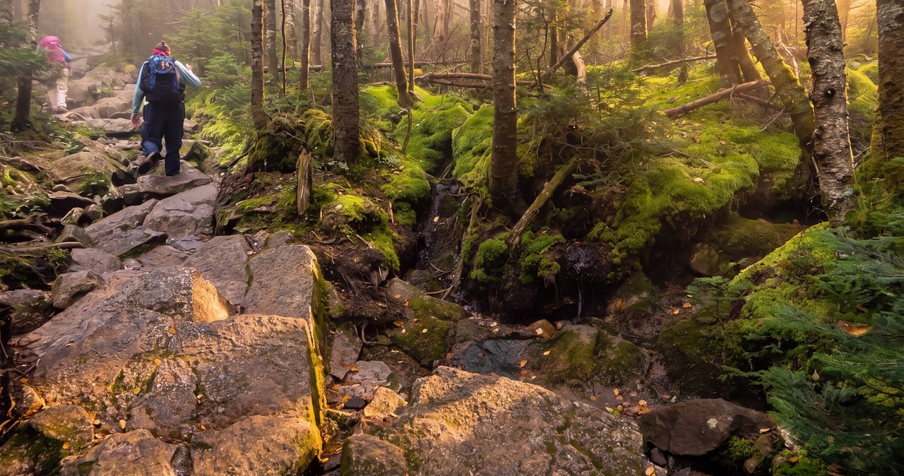
The footing itself is classic White Mountains: packed dirt and rock low on the Avalon Trail, roots and rubbly tread as you climb, and steeper rock steps and the built wooden ladders on the Field-to-Willey stretch. The wet, seepy sections between the summits stay muddy well after rain, and the col mud can be shoe-sucking in spring. Trekking poles help here, both on the steep laddered pitches and on the long rooty descent at the end, when tired legs and slick roots are how people roll an ankle. Wear real hiking footwear with grip and support, not smooth-soled sneakers, and plan to slow down on the way down rather than hurry because you are almost home.
None of this is meant to sound grim - in dry summer conditions the trail is simply a long, pleasant woods walk with a few steep bits. It is just that the same ground turns tedious and slippery in the wet, the descent is where most of the small injuries happen, and the ridge gives you no water, so a little planning around footwear, poles, and your full water supply makes the difference between a good long day and a miserable one.
Winter: a popular range, and a serious one
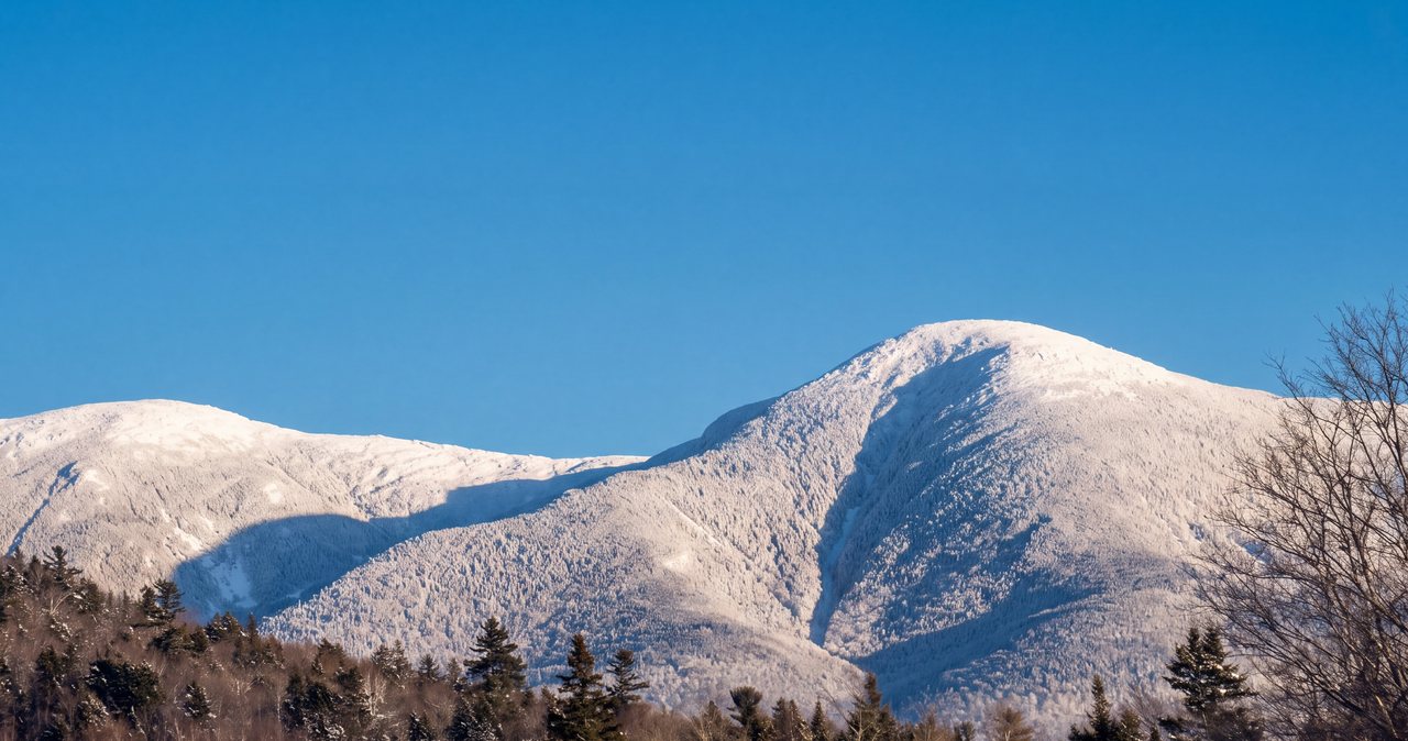
The Willey Range is one of the more popular winter 4,000-footer trips in the region, and the reasons are real: the Crawford Depot trailhead stays open all year on plowed Route 302, the route is entirely below treeline so you are spared the murderous wind of the high alpine ridges, and the packed winter trail is often easy to follow on a fair weekend. For someone building winter experience, Tom and Field in good conditions is a reasonable step up. But popular and below-treeline do not mean easy, and this range has specific winter teeth that catch people every season.
The first is the Field-to-Willey ground. Those steep steps and wooden ladders that slow you down in summer can be buried, glazed, or awkwardly half-filled with snow in winter, turning the col into a tricky descent and climb where microspikes may not be enough and full crampons and an ice axe sometimes come into play in hard conditions. Many winter parties sensibly do Tom and Field only and leave Willey for a summer trip, precisely because that laddered south end is the crux. If you go for Willey in winter, go with the traction, the skills, and the daylight for it, and be willing to turn around at the col if the steep pitches are bare ice.
The second is navigation, the quiet winter challenge on this range. The terrain up high is flat, wooded, and featureless in exactly the way that hides a trail under fresh snow, and the busy cluster of junctions - Avalon to A-Z, the height-of-land where the Mount Tom Spur and Willey Range Trail meet, and the broad wooded plateau around Field - is easy to get turned around in when signs are buried and spindrift is blowing. Carry a map, compass, and a GPS track you know how to use, do not rely on being able to follow yesterday's tracks, and remember that on this kind of flat spruce terrain people have walked off the wrong trail in a whiteout more than once.
Add the ordinary winter load: short daylight, so start early and carry a headlamp with fresh batteries; deep cold and real wind on any open spot even below treeline, so bring more insulation than the walk up seems to need and put it on before you stop; snowshoes for the trail-breaking after a fresh fall and spikes or crampons for the packed and icy stretches; and spruce traps waiting off the packed line. The Willey Range in winter is a rewarding, achievable trip for a prepared party, and a long cold ordeal for an unprepared one. Know which you are before you leave the Depot.
Weather, the higher-summits forecast, and why below-treeline is not the same as safe
The most important weather fact about this range is a reassuring one: you are below treeline the entire way. There is no long above-treeline traverse here, none of the exposed alpine ridge that makes the Franconia Ridge Loop or the Presidentials so unforgiving when the weather turns. The trees give you shelter, a windbreak, and a trail corridor to follow, and that makes the Willey Range a more forgiving foul-weather objective than the open ridges. On a marginal day when you would not dream of committing to Franconia Ridge, Tom and Field can still be a reasonable, sheltered walk in the woods.
That said, do not let below-treeline lull you into treating this as a fair-weather stroll, because the top of this range is still above 4,000 feet, and 4,000 feet in the White Mountains is cold, windy, and capable of rime ice and winter conditions well outside of what the calendar calls winter. Snow can fall here in September and linger into May; a raw wind can knife through the col; and the same storms that hammer the high summits pass right over this ridge. The single best read on what the high country is doing is the Mount Washington Observatory Higher Summits Forecast at mountwashington.org - it is written for the peaks above treeline and this ridge is tamer, but it will tell you when a day is turning rough up high, and it costs nothing to check the night before and the morning of.
Pair that with a valley forecast for the Crawford Notch, Bretton Woods, or Twin Mountain area for the conditions down low, and read them together. Because the good views on this hike - Avalon and the Willey outlooks - only pay off in the clear, there is a real argument for saving this range for a fair day if the views are what you want, and doing it in cloud only if you are hiking for the list. Mornings are generally the clearest window before afternoon haze and clouds build, which is one more reason, on top of parking, to start early.
In summer, watch for afternoon thunderstorms, which build fast over these mountains on warm days. You are mostly in the trees here, which is safer than an open ridge, but the Avalon ledge and the Willey outlooks are exposed spots you do not want to be standing on when lightning is close, and a long day means you can easily still be out when the afternoon cells fire. Be up and moving early, keep half an eye on the western sky, and treat the first close thunder as a cue to get off the open ledges and keep moving down, not as a reason to linger for one more photo.
The gray jays of Mount Tom, and feeding wildlife
One of the small pleasures of this range, and a highlight for a lot of hikers, is the gray jays - officially renamed Canada jays a few years back, still called gray jays by most everyone in these hills, and known to old-timers as camp robbers or whiskey jacks. They live in the high spruce forests of the Whites year-round, they are bold and curious, and around the summit clearings of this range, Mount Tom especially, they will fly right in and land on an outstretched hand looking for a handout. It is a charming few minutes and one of the things people remember from this hike more than the wooded summits.
Here is the part that the guidebooks tend to skip: feeding wildlife, however delightful, is discouraged under Leave No Trace principles, and for real reasons. Human food is not good for the birds, teaching them to depend on hikers changes their behavior and can hurt them over a winter when the crowds thin out, and the same boldness that lets a jay land on your hand also draws jays, and less welcome scavengers like squirrels, into a reliance on people. The birds have been fed on these summits for generations and they are not going to stop landing on hands tomorrow, but the responsible move, if you want to be upfront about it, is to enjoy watching them and skip the actual feeding, or at most keep it to a token and never make it a meal.
Whatever you decide about feeding, the jays are a reliable and cheerful company on the tops of Tom and along the ridge, and they are worth watching for. They are quiet fliers, so you often do not notice one until it is already perched a few feet away, sizing up your snack. Keep your pack zipped when you set it down, because a camp robber earns its name, and enjoy the company of a bird tough enough to live up here through a White Mountains winter.
hikeSafe, the rescue law, navigation, and turnaround judgment
Two New Hampshire specifics belong in your pack on any hike in these mountains, and a long below-treeline 4,000-footer day is no exception. First, New Hampshire can bill a hiker whom Fish and Game judges negligent for the cost of a search and rescue under RSA 206:26-bb, and those bills can run into the thousands. The voluntary hikeSafe card removes that liability short of true recklessness and helps fund the rescue teams directly. It is about $25 for an individual or $35 for a family for 2026, sold through New Hampshire Fish and Game, valid the calendar year, the same price for residents and visitors. Carry one, and read the Hiker Responsibility Code it is built around.
Second, do not let your phone be your whole safety plan. Cell coverage in Crawford Notch and along this wooded ridge is spotty at best, so anything that depends on a live signal may simply not work when you need it. Download your map and your GPS track before you leave the driveway, carry the ten essentials scaled to a long day even though the mileage looks moderate, and tell someone your plan - which trailhead, which peaks, and when you expect to be back. We ask our hiking guests to leave a route and an out-time with someone at home, and this is exactly the kind of long day where that matters.
Navigation-wise, the specific spots to be careful are the junctions and the flat wooded ground, not any dramatic cliff. Watch the Avalon-to-A-Z transition, the busy height-of-land cluster where the Mount Tom Spur and the Willey Range Trail come together, and the broad, featureless plateau around Field, all of which are easy to misread in fog, rain, or snow when the signs are hard to spot. Know which trail you want before each junction rather than working it out on the fly, and if visibility is bad, slow down and confirm with map and compass rather than guessing.
Turnaround judgment on this route comes down to a few clear rules. Make the real decision at Field: if the clock, the weather, or your legs are marginal, take Tom and Field and go home, because committing to Willey roughly doubles the effort left in your day. Never descend Willey's steep south side toward Ethan Pond and Ripley Falls unless you have a car staged down there - it leads away from your Depot parking. In the cold season, turn around at the col rather than fight bare-ice ladders you are not equipped for. And on any day, if the weather turns or someone in the group is done, the summits will still be here next trip. Turning around is free, and on a long day like this one it is often the smart, experienced call rather than the timid one.
Safety & conditions
- The steep steps and wooden ladders on the Willey Range Trail, especially on Willey's south side and in the Field-Willey col, are the technical crux of the day - slick when wet, worse when iced, and slow on tired legs coming down. Take them deliberately, use your hands, and use poles on the rooty descents where most ankle injuries happen.
- Do not descend Willey's steep south side toward the Ethan Pond Trail unless you have deliberately staged a second car at the Willey House or Ripley Falls trailhead. That trail leads away from the Crawford Depot and out to Route 302 miles down the notch. The standard, single-car route turns around at Willey and returns over Field the way you came.
- Navigation is the quiet hazard here, not exposure. The busy junctions - Avalon to A-Z, the height-of-land where the Mount Tom Spur and Willey Range Trail meet, and the flat, wooded plateau around Field - are easy to misread in fog, rain, or snow. Carry a map, compass, and a GPS track you know how to use, and know which trail you want before each junction rather than deciding on the fly.
- The route stays below treeline the whole way - a real advantage over open ridges like Franconia in bad weather - but the summits are above 4,000 feet, where cold, wind, and rime ice occur well outside winter. Check the Mount Washington Observatory Higher Summits Forecast at mountwashington.org and a valley forecast together, and save the Avalon and Willey views for a clear day.
- In winter this is a serious trip despite its popularity: the Willey ladders can be buried or bare ice, trail-breaking after fresh snow is slow, spruce traps wait off the packed line, and the flat wooded terrain is easy to lose in a whiteout. Carry microspikes at a minimum, snowshoes after snow, sometimes crampons and an axe for the steep col, and start early against the short daylight. Turn back at the col if you are not equipped for iced ladders.
- It is a dry ridge with no reliable water above the A-Z junction, so carry your full day's water from the car - two to three liters per person, more in heat. The lower Avalon Trail crossings of Crawford Brook run higher and slicker after heavy rain or spring snowmelt, which is also a reliable hint that the whole trail above will be wet, slick, and slower than usual.
- This is a long day - about 10 miles for the full three - so manage it actively. Make the real go/no-go decision at the summit of Mount Field, because committing to Willey roughly doubles the remaining effort with its drop-and-reclimb. If the clock, the weather, or your legs are marginal, take Tom and Field and go home; the summits will still be there.
- Carry the New Hampshire hikeSafe card (about $25 individual, $35 family for 2026 from NH Fish and Game). The state can bill negligent hikers for rescue costs under RSA 206:26-bb, and the card removes that liability short of recklessness. Cell coverage in the notch and on the wooded ridge is spotty, so download your map and track, carry the ten essentials for a long day, and leave your route and out-time with someone at home.
Where to stay for it
The drive is the same pretty run as our Mount Willard hike, since it is the same trailhead. From 191 Pollard Road you get on I-93 North and take it up through the Franconia Notch Parkway - scenic in its own right, past the Basin and the Old Man site - to Exit 35, then follow US Route 3 north about ten miles to the village of Twin Mountain. There you turn right, east, onto US Route 302 and follow it through Bretton Woods, past the big Mount Washington Hotel, and up to the top of Crawford Notch, where the Crawford Depot and the AMC Highland Center sit right by the road beside little Saco Lake. It is about 30 miles and, with no traffic, roughly 45 min. The trailhead parking is the lot at the Depot, and on any clear, foliage, or winter weekend the single most important tip is to arrive early, because it serves several popular hikes and fills fast.
Provision before you leave Lincoln, because the options thin out toward the notch and there is nothing at the trailhead itself beyond the seasonal Depot and the Highland Center front desk during its hours. The stores and gas stations in Lincoln and North Woodstock - the Price Chopper is the easy one-stop - are your best bet for sandwiches, plenty of water, and a full tank for a long day. Twin Mountain has a small store and gas at the Route 3 and Route 302 junction if you need a last stop, and Bretton Woods has resort services. Fill your bottles before you go, since the ridge is dry and there is no reliable water up high, download your map and track while you still have a signal, and leave your route and expected out-time with someone at home.
Sources & official info: 4000footers.com · outdoors.org · mountwashington.org
— Launchpoint Lodge, From the lodge