Mount Eisenhower is the mountain we point people to when they want the full above-treeline Presidential experience - a bald summit, a clean 360-degree view, and real alpine weather - without the long, punishing mileage of Mount Washington or the exposed knife-edge of Franconia Ridge. At 4,780 feet it sits in the middle of the range, and the standard climb up the Edmands Path is about 6.6 miles round trip with roughly 2,750 feet of climbing. What makes it worth the drive is the top: a rounded, perfectly bald dome with nothing on it but a big cairn and a ring of alpine rock, open in every direction, that you walk a short loop over rather than just touch and turn around.
The path you climb it on is a small piece of trail-building history. The Edmands Path was laid out and graded by J. Rayner Edmands, the Harvard astronomer and pathmaker who built a whole network of low-angle, stone-paved trails through the Presidential Range in the years around 1900, and it is generally dated to 1909. He built for a comfortable, even grade rather than the straight-up-the-fall-line brutality of most old White Mountain trails, and long stretches of his rock paving, cribbing, and stone culverts are still under your boots today. It is one of the more pleasant ways to climb 2,700 feet in New Hampshire, and the reason Eisenhower is such a good first fully-alpine summit.
This guide walks you through that hike: the numbers and how the graded path feels underfoot; the Edmands Path trailhead on Mount Clinton Road and when that seasonal road is open; where the trees give out and the wind arrives; the col at the Crawford Path junction where you make your go or no-go decision; the exposed loop over the bald crown; the option to skirt the summit entirely in bad wind; the Pierce-Eisenhower loop if you want a bigger day; the winter version, which is a serious alpine objective; and the safety heart of the whole thing, because an open Presidential dome is where the weather matters most. The trailhead is about 50 min from our door.
The numbers
The standard hike is an out-and-back on the Edmands Path from the trailhead lot on Mount Clinton Road, up to a junction with the Crawford Path in the col southwest of the summit, then a short loop over the top. Round trip it runs about 6.6 miles - the Edmands Path is roughly 2.9 miles to the Crawford Path, and the loop adds about 0.4 mile to reach the summit, so the reference 4000footers.com counts 3.3 miles each way. Figure 6.6 miles as the plain working number, give or take a tenth depending on which app you carry and how the loop shakes out.
The climb is roughly 2,750 feet. The trailhead sits near 2,000 feet and the summit is 4,780, so the net gain is a little under 2,800 feet; because the Edmands Path has a couple of small dips and the loop rolls a bit at the top, GPS tracks often read a hair higher, in the 2,800 to 2,900 range. Published figures vary, which is normal - if you want an exact number, check a current map or the AMC White Mountain Guide, but plan your legs and your water around roughly 2,750 feet of up.
On time, most people are up in two and a half to three and a half hours and down a bit quicker, so call it five to seven hours round trip with a good stop on top and a fair-weather pace. The Edmands Path grade feels easy on the way up, and the graded stone can be slow and awkward on the way down, so allow more time for the descent than the mileage suggests. Add real time, an hour or more, if you extend to Mount Pierce or push north on the Crawford Path.
A reality check before you go: the trail is gentle by White Mountain standards, but the summit is not a gentle place. You are climbing a real 4,000-footer to a fully bald alpine dome in the middle of the highest, most weather-beaten range in the Northeast. The grade and distance are moderate and friendly; the exposure at the top and the speed the weather turns are not, and the whole point of this guide is that the two things are true at the same time.
The bald dome: what makes Eisenhower Eisenhower
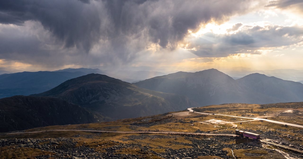
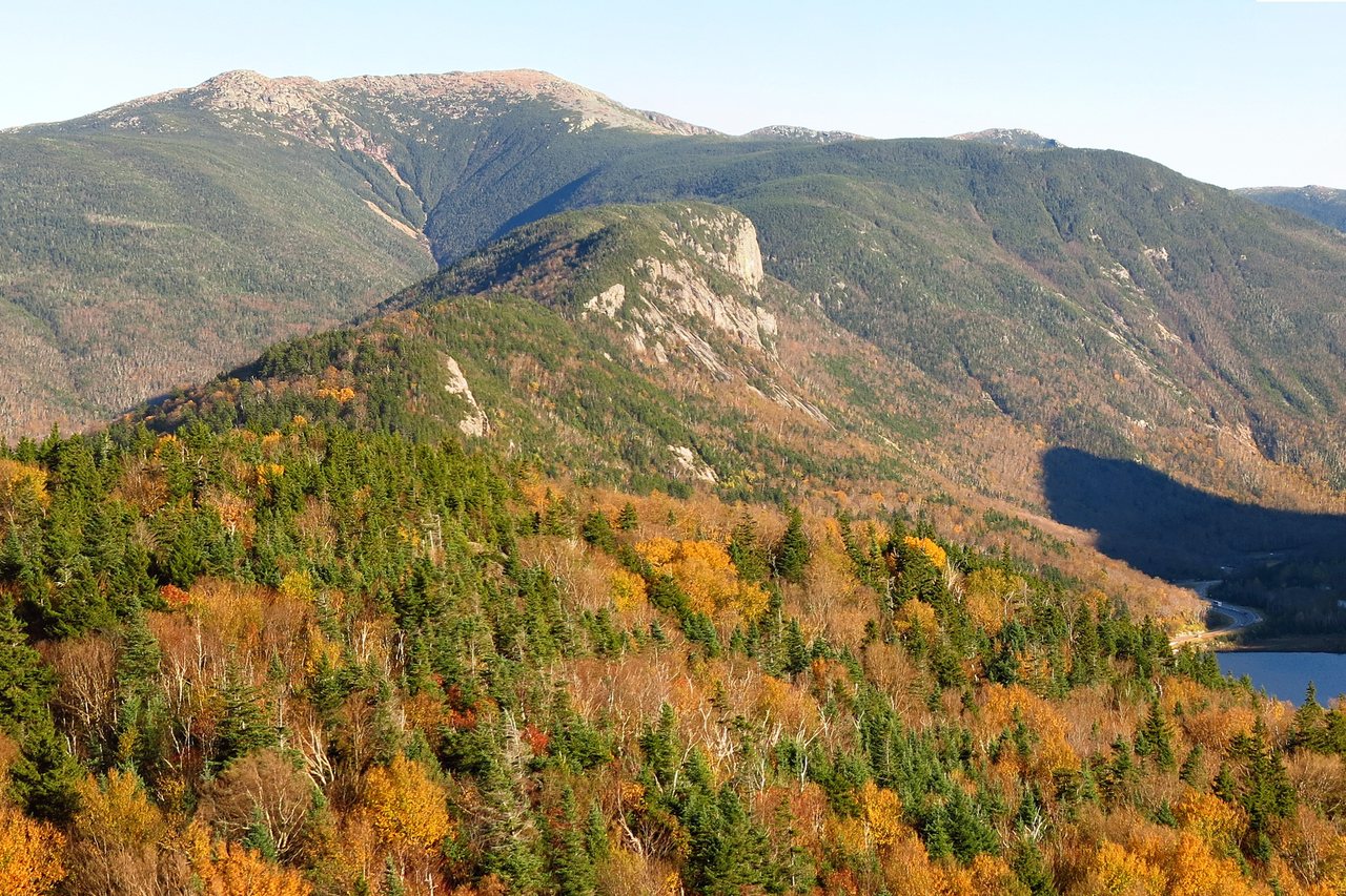
Most White Mountain 4,000-footers make you climb through woods to a small opening or a rock knob for a view. Eisenhower does the opposite - the top half-mile is completely open, and the summit itself is a broad, bald, rounded dome of alpine rock and low sedge with a clean, uninterrupted horizon in every direction. From the top you look straight up the Crawford Path at the roof of the range: Franklin and the rockpile of Monroe just north, Mount Washington and its summit buildings at the head of the line, the Southern Presidentials and Crawford Notch behind you, and on a clear day the Franconia Range, the Pemigewasset Wilderness, and a long reach into Vermont and Maine. It is a genuine big-summit panorama for a moderate half-day of work.
The crown has a distinctive look. The true summit is marked by a large cairn set in a cleared, flat ring of rocks and boulders, and from the middle of it the low stone rim can read almost like the edge of a shallow crater, though there is nothing volcanic about it - it is just the shape of a wind-scoured alpine dome that people have piled and cleared over the years. There is a little shelter to be found tucking down behind the rocks out of the wind, and that is about the only shelter on the whole open top, which is worth remembering when you plan your lunch stop.
The mountain was called Mount Pleasant for most of its history. The New Hampshire Legislature voted to rename it for President Dwight D. Eisenhower in 1969, and the U.S. Board on Geographic Names made it official in 1970. Its listed height is 4,780 feet on the AMC White Mountain 4,000-Footer Club list, which is the figure hikers use; the modern USGS survey reads 4,757 feet, or 1,450 meters, and its prominence is about 353 feet. The small gap between the two elevation figures is the usual old-survey-versus-new-survey difference, and it does not change anything about the hike.
Position matters too. Eisenhower stands between Mount Pierce to the southwest and Franklin, Monroe, and Washington to the north, right on the Crawford Path - the historic line that runs the spine of the Southern Presidentials. That central spot is why the view is so good and why the peak is such a natural building block toward the rest of the range. It is also why the summit is so exposed: there is nothing above you or beside you to break the weather that pours down the ridge from Washington.
The Edmands Path: a graded staircase through the woods
The Edmands Path is the reason Eisenhower climbs so kindly, and it is worth understanding what you are walking on. In the years around 1900, J. Rayner Edmands - an astronomer at Harvard and one of the Appalachian Mountain Club's great early trail builders - set out to build mountain paths the way a road engineer would, at a steady, walkable grade rather than straight up the slope. He and his crews cut sidehill benches into the mountain, paved long stretches with fitted stone, built rock cribbing to hold the tread on steep ground, and laid stone culverts to carry water across the trail. The Edmands Path, generally dated to 1909, is one of the finest surviving examples of that work in the Southern Presidentials.
What that means underfoot is a trail that gains its 2,700-odd feet at a remarkably even, moderate angle, with almost none of the knee-and-lung fall-line grinding that defines rougher White Mountain routes. Low down it is a pleasant woods walk through hardwoods; higher up it swings into a long graded traverse across the slope that barely seems to climb at all, before a final steeper pitch pulls you up to the ridge. It is one of the more comfortable ways to reach an alpine summit in the range, and the sense of walking a carefully engineered century-old line is a real part of the pleasure of it.
Age has its price, though, and the picture includes the rough parts. A hundred-plus years of frost, water, and big storms have torn at Edmands' stonework, and trail crews have rebuilt sections more than once. You will walk beautiful stretches of intact old paving and then hit eroded, rooty, washed-out ground where the mountain has reclaimed the grade, especially where brooks cross the trail. None of it is technical; think of it as a good old trail, mostly gentle and occasionally rough, rather than a manicured staircase, and watch your feet on the worn stone.
The path ends where it meets the Crawford Path in the col southwest of the summit, at roughly 4,450 feet. That junction is the hinge of the whole hike: it is where you leave Edmands' sheltered grade, where you decide whether to go over the top or around it, and where, if the weather has turned, you turn around and drop back into the trees the way you came.
The trail, step by step
From the Edmands Path lot on Mount Clinton Road, the trail starts as an easy woods walk on old logging-road grade, climbing gently through hardwood forest. Within the first mile or so you cross a couple of small brooks - usually simple rock-hops, but see the safety notes, because they can run high after rain or snowmelt - and the forest shifts from hardwoods to darker spruce and fir as you gain height. This lower section is the most straightforward part of the day, and a good place to settle into a steady rhythm rather than charging.
Higher up the trail commits to its signature feature: a long, graded traverse that cuts across the steep west face of the ridge at a low angle, much of it on Edmands' fitted stonework, gaining height so gradually that it feels almost flat. It is a beautiful, distinctive stretch of trail, and also a place to pay attention, because the stone tread is off-camber, tilts toward the drop, and turns greasy when wet and icy well into spring. Take the paved sidehill sections deliberately, especially coming down on tired legs.
The traverse ends with a short, steeper pitch that pulls you up onto the ridge, and this is where the mountain changes character. The spruce shrinks into stunted, wind-flagged krummholz, the sky opens ahead, and you break out of the trees into the open alpine world - the wind, the sun, and the exposure all arriving within a few minutes of walking. The Edmands Path tops out at a signed junction with the Crawford Path in the col at about 4,450 feet, with the bald dome of Eisenhower rising to the northeast.
From that junction you have two ways to the summit and back. The Eisenhower Loop climbs directly over the bald crown - about 0.4 mile up to the cairn and 0.4 mile down the far side, rejoining the Crawford Path north of the top - and this is the way you came for. The alternative is to follow the Crawford Path itself, which was relocated years ago to skirt around the west side of the dome, staying a little lower and marginally more sheltered; it lets you bypass the exposed summit entirely and still continue north or loop back. Note both junctions carefully, because in cloud this little tangle of trails is exactly where people get turned around.
Treeline, the col, and your real decision point
On this route the trees give out near the top of the Edmands Path, roughly in the 4,300 to 4,400-foot range, which means you get the last half-mile or so of the hike in the open - up the final pitch to the ridge, across the col, and over the summit. That is a short, manageable dose of above-treeline travel compared with Monroe or Washington, and it is a big part of why Eisenhower is such a good introduction to alpine hiking. It is also the exact moment the weather stops being a background detail and becomes the whole story.
The Crawford Path junction in the col is where you make your real go or no-go decision, and it is a good place to make it. For the entire climb you have been sheltered in the woods and on the lee of the ridge; here you step into whatever the Presidential Range is doing, and you can feel it before you commit to the open dome. If you break out into a hard wind, driving cloud, or cold that feels worse than you bargained for, this is the spot to level with yourself - the summit is only a half-mile of open walking away, but that half-mile has no shelter, and turning around here costs you almost nothing.
Retreat from the col is fast and clean, which is one of the best things about this hike as a learning peak. Drop back onto the Edmands Path and within a few minutes of downhill you are under the krummholz and back into real trees and calmer air. There is no better bail-out on an exposed Presidential objective than a short, sheltered, downhill escape into the woods, and Eisenhower hands it to you right at the decision point. Turning around at the col is not a failed hike; on this range it is the judgment that keeps experienced people alive.
The col also offers a middle option that AllTrails will not tell you about: you do not have to go over the top. If the wind is up but you still want to move, you can follow the Crawford Path as it skirts around the west flank of the dome, which stays a touch lower and gives a little more shelter, and either turn around there or continue - without ever standing on the fully exposed crown. Knowing that the summit is optional, and that there is a way around it, takes a lot of the all-or-nothing pressure out of a marginal day.
The exposed loop over the bald crown
When the weather is good, the loop over the summit is the whole reward, and it is a wonderful piece of walking. From the Crawford Path junction the Eisenhower Loop climbs about 0.4 mile up the open dome to the big summit cairn, following cairns across bald rock and low alpine turf, and drops about the same distance down the north side to rejoin the Crawford Path. You are completely in the open for the entire loop, which is the point - there is nothing between you and the sky, and the view swings a full 360 degrees as you go, with Washington filling the northern horizon and the whole Southern Presidential ridge laid out at your feet.
It is worth saying how exposed this ground is. Once you leave the col to go over the top, you are committed to roughly three-quarters of a mile of open, above-treeline walking with no cover of any kind - the summit cairn is the only feature, and the little cleared ring of rock around it is the only real windbreak. On a calm, clear day that is pure pleasure. On a windy or fast-changing day it is a place you do not want to be caught out on, because there is nowhere to hide and the way off is back the way you came.
You are standing in the alpine zone up here, above the natural treeline, and the ground is more fragile than it looks. The low mats of sedge, alpine flowers, and lichen between the rocks are slow-growing arctic-alpine plants living at the far southern edge of where they can survive, and a bootheel does damage that takes decades to heal. Stay on the rock and the worn cairned line, do not cut across the vegetation for a photo or a shortcut, and treat the summit like the rare habitat it is. In early summer the alpine bloom up here is a quiet, specific reward if you know to look down as well as out.
Because the top is fully open, it is cold and windy far more often than the sheltered climb suggests, and the temperature drop from the trailhead to the crown can be dramatic. A warm, still walk up through the woods can end on a summit with a hard wind and a serious wind-chill. Put a layer on before you leave the col or before you sit, not after you are already chilled, and be real about how long you want to linger up there if the wind is working - which brings us to the part of this guide that matters most.
How fast Presidential weather turns - the part that matters most
Read this section twice. Mount Eisenhower sits in the middle of the range that carries some of the most violent weather in the world. Mount Washington, a few miles up the Crawford Path from Eisenhower's summit, held the world record for a surface wind gust for more than sixty years - 231 miles per hour, measured on the observatory in April 1934 - and it still routinely sees hurricane-force winds, whiteouts, and bitter cold in every month of the year, summer included. Eisenhower is lower and its exposed stretch is shorter, but it shares that exact sky, and its bald open dome catches a full share of what the range dishes out. These mountains ask for the same care on their gentler summits as on the famous hard peaks.
The single habit that keeps you safe is to check the Mount Washington Observatory Higher Summits Forecast at mountwashington.org before you go, on top of an ordinary valley forecast. That forecast is written specifically for the above-treeline world you will step into at the col, and it will tell you the summit wind, the wind-chill, the odds of the tops being socked in cloud, and whether a front is coming through. A pleasant valley day and a violent summit day happen together here constantly. If the higher-summits forecast is bad - high wind, deep cold, storms, or the summits in the clouds - change the plan rather than hoping it clears when you get up there.
Summer thunderstorms deserve their own line. A bald 4,780-foot dome is a lightning-exposed high point with no cover, and Presidential-range storms can build fast on a warm afternoon. Start early so you are heading down, not up, by early afternoon, watch the sky to the west, and treat the first distant rumble or building tower of cloud as a reason to get off the open ground and back below treeline now - not after one more photo. The graded Edmands Path gets you down and into the trees quickly, which is a real asset when the weather is stacking up.
The plain summary is that Eisenhower gives you an unusually safe way to sample serious alpine terrain - short exposure, a fast retreat, an optional summit - but it does not lower the ceiling on how bad the weather can get. Bring the forecast into your plan, make your decision at the col, and remember that the mountain does not grade on a curve for people who came for an easy day. The gentle trail is the invitation; the exposed top is the mountain.
Water crossings, footing, and the graded stone
The Edmands Path crosses a couple of small brooks in its lower and middle sections, and in normal summer conditions they are simple rock-hops that barely register. The real caution is timing: after heavy rain, during spring snowmelt, or in a wet spell, those little crossings can run fast and cold, and the graded traverse above them collects and channels water in ways that make the tread slick. The crossings are small, nothing like the big fords on some Pemigewasset routes, but high water can turn a casual rock-hop into a wet, awkward one, so check the recent weather before you count on a dry-footed day.
The bigger footing story is the stonework itself. Edmands' fitted paving and sidehill benching are a joy to walk when they are dry, but the same stone is greasy when wet, and the traverse holds ice and snow late - well into spring, and again early in fall - because it sits on a shaded west face. Wet or iced stone that tilts toward the downhill side is exactly the surface that rolls an ankle or drops a hiker on the descent, when legs are tired and attention drifts. Slow down on the paved sections going down, use trekking poles if you carry them, and do not let the easy grade lull you into hurrying across slick rock.
There is no water source and no shelter high on this route, and that is worth planning around. Once you are on the ridge and the summit there is nothing to drink and nowhere to duck out of the weather except behind the summit rocks, and there is no hut on the Edmands Path route the way there is on some other Presidential trails. Carry what you need from the car - two to three liters per person for a full day, more in summer heat - and if you do take water from a brook low down, filter, treat, or boil it as you would any backcountry water in the Whites.
Extending it: the Pierce-Eisenhower loop and pushing north
If you want a bigger day, the classic variation ties Eisenhower to its neighbor Mount Pierce and makes a loop out of the two. The common version starts from the Crawford Path trailhead near the AMC Highland Center, climbs the Crawford Path over Pierce, runs the ridge north to Eisenhower, goes over the summit on the loop, and descends the Edmands Path back to Mount Clinton Road - the reference 4000footers.com puts this Pierce-Eisenhower outing at about 10.4 miles. It is a superb circuit that bags two Presidential 4,000-footers in a day, but it commits you to a good stretch of above-treeline ridge between the peaks, so it is a fair-weather objective and a real step up from the Eisenhower out-and-back.
Because the loop starts and ends at two different trailheads on Mount Clinton Road, you will either need to walk the short connecting stretch of road between them or spot a second car - worth sorting out before you start rather than at the end of a long day. Both lots are on the same seasonal road a couple of miles apart, so it is manageable, but plan the logistics with a current map. The Pierce end also passes near Mizpah Spring Hut, an AMC hut where you can refill water and get out of the wind, which is a genuine resource on that side that the Edmands Path route does not have.
From Eisenhower's summit the Crawford Path also runs invitingly north toward Franklin, Monroe, and ultimately Mount Washington, and strong parties on a good day sometimes push on. Be very clear-eyed about that: everything north of the col is fully above treeline with long, committing stretches and no quick escape into the woods, and it turns a friendly half-day into a serious full-day alpine undertaking. Make that call on the summit, based on the forecast and what you can see coming up the ridge, not on how good the sheltered climb felt - and when in doubt, be satisfied with the bald dome you came for and save the traverse for another day.
The trailhead, Mount Clinton Road, and parking
The hike starts at the Edmands Path trailhead lot on Mount Clinton Road, in Carroll, on the west side of the Southern Presidentials. Mount Clinton Road leaves US Route 302 near the top of Crawford Notch, close to the AMC Highland Center, and runs north to connect toward the Base Station area; the Edmands Path lot is a bit farther up the road than the Crawford Path lot, so watch for the signed trailhead on the right as you drive in. It is a small hiker lot for a popular peak, and on clear summer and fall weekends it fills early - the fix is the usual one in these mountains: come early, and have a plan B if it is full rather than inventing parking on a narrow shoulder.
The important catch is the road itself. Mount Clinton Road is a seasonal, largely unpaved connector, generally open from late spring through fall and not maintained or plowed in winter. That means the Edmands Path trailhead access changes completely in the cold months - the summer lot may be unreachable, and winter hikers commonly start from plowed parking down on Route 302 and walk the closed road in, adding real distance to an already serious day. Confirm the current road status with the White Mountain National Forest before you count on driving to the trailhead, in any season but especially at the shoulders.
One reassuring note on closures: the well-publicized 2026 Lincoln Woods and Franconia Falls area closure, in effect roughly mid-June into November, is on the other side of the mountains and does not affect the Edmands Path or this route at all. That closure matters for Pemigewasset Wilderness trips like Owl's Head and the Bonds; it has nothing to do with Eisenhower. Still, trail and road status can change on short notice after storms, so it is always worth a quick check of the current WMNF alerts before you drive up - and the Highland Center's front desk, right at the top of the notch, is a good place to sanity-check both the road and the weather on your way by.
Winter: a full alpine objective
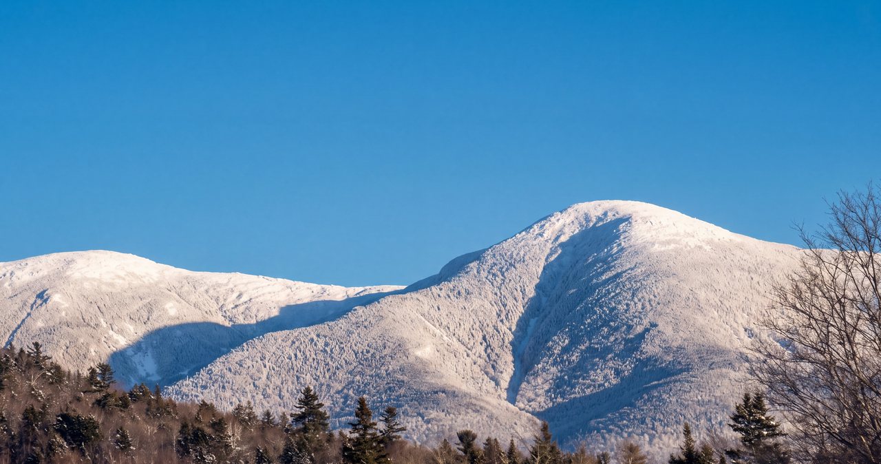
In winter Eisenhower stops being a friendly introduction and becomes a genuine alpine climb, and the gap in seriousness between the summer hike and the winter one is large. In good conditions the packed trail and the snow-plastered dome are spectacular, and Eisenhower is a well-loved winter peak - but it is not a summer hike with a jacket. The exposed top that is a short, pleasant novelty in July can be a full-on wall of wind, spindrift, and face-freezing cold in January, and the fast, clean summer retreat down the Edmands Path is a different proposition when the road to the trailhead is unplowed and buried.
The gear is real winter gear, not an afterthought. You want traction for packed and icy trail - microspikes at least, and full crampons for the steeper upper pitch and the hard-frozen open dome - plus snowshoes for fresh or deep snow so you are not postholing or wrecking the track. Above that, the summit calls for serious cold-weather protection: insulated layers, a windproof shell, a warm hat and a spare, mittens, goggles or eye protection, and something to cover your face, because exposed skin freezes fast in a Presidential wind. The graded traverse can carry hard-frozen snow tilted toward the drop, where a slip has consequences, so this is crampon-and-ice-axe-judgment terrain in the wrong conditions.
Two winter hazards deserve specific mention on this route. First, the treeline transition near the top is where winter hikers get caught out: you climb in relative calm in the trees and then step onto the open ridge into a full alpine wind almost at once, so layer up before you break out of the scrub, not after. Second, navigation on the bald dome gets hard fast when the summit is in cloud - the cairns can be buried or iced, the packed track drifts in, and a whiteout on that open crown is disorienting, with the tangle of Crawford Path and loop junctions easy to confuse. Carry map, compass, and a GPS you know how to use, and know your bearing back to the col and the top of the Edmands Path.
Add the ordinary winter realities and plan hard around them. Daylight is short, so start very early and carry a headlamp with fresh batteries. The trailhead access is different because Mount Clinton Road is not plowed, so confirm where you are parking and how far you will have to walk the road just to reach the trail. And the margin for a small mistake is far thinner in the cold, so turn-around discipline at the col matters even more than in summer. Winter Eisenhower is a fine objective for people with winter skills, winter gear, and someone along who has done it - it is not the place to learn all three at once on a cold clear Saturday.
Fees, the hikeSafe card, and turnaround judgment
For parking, the Edmands Path lot sits in the White Mountain National Forest, so the simple move is to carry a WMNF recreation pass - about $5 for the day of purchase, $30 for an annual pass, $40 for an annual household pass, or the federal America the Beautiful pass at $80 covers it if you already have one. Read the sign at the lot when you arrive, because the posted rule governs and details can change, and if you are in any doubt, confirm current parking and fee information with the WMNF or the AMC Highland Center before you go.
Separately, carry the New Hampshire hikeSafe card. It is a voluntary card sold by New Hampshire Fish and Game, and in 2026 it costs $25 for an individual and $35 for a family for the calendar year, the same price for residents and visitors. It matters because New Hampshire can bill hikers for their own rescue: under state law, RSA 206:26-bb, a hiker judged to have acted negligently can be charged for the cost of the search-and-rescue operation. The hikeSafe card removes that liability short of true recklessness and helps fund the rescue teams directly. On an exposed Presidential dome with fast-changing weather, it is a sensible thing to have in your pocket; you can read about it at hikesafe.com.
The other half of safety here is judgment, and on Eisenhower it comes down to a few clear rules. Let the higher-summits forecast set the plan - if it is bad up top, change the day. Make your go or no-go decision at the col, where retreat into the woods is quick and cheap, and remember the summit is optional: you can skirt it on the Crawford Path or turn around entirely. Decide about extending toward Pierce or north toward Washington before you leave the summit, based on the forecast and what you can see coming, not on how good the sheltered climb felt. And treat a building thunderstorm as a reason to get off the open dome and back below treeline, not a reason to grab one more shot.
Finally, do not let your phone be your whole safety plan. Cell coverage in Crawford Notch and on the mountain is spotty, so anything that needs a signal may simply not work when you need it. Download your map before you leave the driveway, carry the ten essentials scaled to the season, and tell someone at home your route and your expected out-time, on the moderate days as much as the hard ones. A mountain with a friendly trail and a savage summit is exactly the kind of place where people get casual, and casual is where small problems on an alpine dome become big ones.
Dogs, crowds, seasons, and what to carry
On dogs, since guests always ask: leashed dogs are allowed on the Edmands Path and the Crawford Path, as they are on most White Mountain National Forest trails, and plenty of people hike Eisenhower with a dog. Respect the alpine part, though - the summit rock can be very hot or very cold on paws, the wind and cold hit a dog hard on the fully open top, there is no water and no shelter up high, and a dog cannot tell you when the wind is getting to be too much. Carry water for the dog, keep it leashed near the fragile alpine plants and other hikers, and know it can handle the exposure before you commit to the loop. The one standing note for our guests: the lodge is adults-only and pet-free, so hiking with a dog means arranging for it somewhere other than here.
On crowds and timing, Eisenhower is popular but rarely a circus. It draws steady traffic as a scenic, approachable Presidential and a 4,000-footer-list peak, and the small Edmands Path lot fills on clear weekends, but the broad summit spreads people out and it never feels as packed as Franconia Ridge on a good day. Best season is late spring through fall for the easiest footing and the safest above-treeline conditions, with late September into early October adding foliage low on the trail and crisp, long-range views up high - and busier parking to match. Go on a clear, low-wind day for the view and the summit you came for, and go early for the parking and the calmer morning air.
For gear, pack it like the real alpine 4,000-footer it is even though the grade is friendly: sturdy footwear with grip for the stone and the roots; more warm and windproof layers than the sheltered climb seems to need, because the open dome runs cold and windy; sun protection for the fully exposed top; two to three liters of water and real food; and a map, compass, and headlamp. Trekking poles help a lot on the graded stone descent. In the cold season add traction and, in deep snow, snowshoes without exception. What to plan for on Eisenhower is not a big ford or a technical scramble but exposure and weather on a bald summit, so the layers, the forecast, and the discipline to turn around are your most important gear here.
Safety & conditions
- The summit is a fully exposed alpine dome that gets full Presidential Range weather, so let the Mount Washington Observatory Higher Summits Forecast at mountwashington.org set the plan on top of a valley forecast. Washington, just up the ridge, once recorded a 231 mph gust and sees hurricane-force wind, whiteout, and bitter cold in every month - Eisenhower shares that sky. A pleasant valley day and a violent summit day happen together here constantly; if the higher-summits forecast is bad, change the day.
- Make your go or no-go decision at the col, at the Crawford Path junction, where you step out of shelter and can feel the real conditions before committing to the open dome. If you break out into a hard wind, driving cloud, or cold worse than you expected, turn around there - retreat down the Edmands Path drops you back into the trees within minutes. Turning back at the col is sound judgment on this range, not failure.
- Remember the summit is optional. The Eisenhower Loop goes over the fully exposed crown - about three-quarters of a mile of open walking with no cover but the summit cairn's rocks - while the Crawford Path skirts around the west side of the dome, a little lower and more sheltered. In marginal wind you can go around instead of over the top, or skip the crown entirely, without abandoning the day.
- Carry more warmth and wind protection than the sheltered climb suggests. The open dome runs cold and windy even on warm valley days, and the temperature drop from trailhead to top can be large. Put a wind and insulating layer on before you leave the col or before you sit, not after you are chilled. In summer, treat a building thunderstorm as a cue to get off the bald, lightning-exposed summit and back below treeline immediately - the graded Edmands Path gets you down fast.
- Mind the footing and the water. The trail crosses a couple of small brooks that can run high and fast after heavy rain or spring snowmelt, and Edmands' graded stonework is greasy when wet and holds ice and snow on its shaded traverse well into spring and again in fall. Wet, off-camber stone tilted toward the drop is where ankles roll and hikers fall on tired legs - slow down on the descent, and use poles on the paved sidehill sections.
- Navigation matters when the summit is in cloud. The bald dome is disorienting in a whiteout, the cairns can be buried or iced, and the tangle of the Crawford Path and the Eisenhower Loop junctions on both sides of the summit is exactly where people take the wrong trail. Carry map, compass, and a GPS you can use, and fix your bearing back to the col and the top of the Edmands Path before you leave the summit. Stay on rock and the worn cairned line to protect the fragile, slow-growing alpine vegetation.
- Winter turns this into a serious alpine climb. Bring traction (microspikes and often crampons) plus snowshoes for deep snow, full insulated and windproof layers, goggles and face covering, and the skills for hard-frozen, tilted snow on the graded traverse. The treeline transition near the top is where winter hikers get caught out - layer up before you step into the open - and Mount Clinton Road is not plowed, so confirm parking and the extra road miles, and start early for the short daylight.
- Carry the New Hampshire hikeSafe card ($25 individual, $35 family for 2026 from NH Fish and Game). The state can bill negligent hikers for rescue costs under RSA 206:26-bb, and the card removes that liability short of recklessness while funding the rescue teams. Cell coverage in the notch and on the mountain is spotty, so download your map, carry the ten essentials, and leave your route and out-time with someone - a friendly trail with a savage summit is exactly where people get casual.
Where to stay for it
The drive is a straightforward run up the west side of the mountains and over to Crawford Notch. From 191 Pollard Road you get on I-93 North through Franconia Notch, take Exit 35, and follow US Route 3 north about ten miles to the village of Twin Mountain. There you turn right, east, onto US Route 302 and follow it through Bretton Woods, past the big Mount Washington Hotel, toward the top of Crawford Notch. Mount Clinton Road comes up on the left just before the AMC Highland Center; turn up it and watch for the signed Edmands Path lot, which sits a bit farther in than the Crawford Path lot. It is about 32 miles and, with no traffic, roughly 50 min, a few of which are slow going on the gravel of Mount Clinton Road. The single most useful tip is to arrive early on any clear weekend, because the trailhead lot is small and fills fast.
Provision before you leave Lincoln, because options thin out as you head toward the notch. The stores and gas stations in Lincoln and North Woodstock - the Price Chopper supermarket is the easy one-stop - are your best bet for sandwiches, water, and a full tank. Along the way, Twin Mountain has a small store and gas at the Route 3 and Route 302 junction, and Bretton Woods has resort services, but there is nothing at the trailhead itself beyond the Highland Center's front desk during its hours. Fill your water bottles before you go, since there is no water high on this trail, download your map while you still have a signal, and leave your route and expected out-time with someone at home.
Sources & official info: 4000footers.com · mountwashington.org · hikesafe.com · outdoors.org
— Launchpoint Lodge, From the lodge